Lancing Manor Park

Downs, Moorland in Sussex Adur

England

Lancing Manor Park

Grinstead Lane railway bridge The Bridge was built in the mid sixties for the new A2025 bypass road. The level crossing could be avoided.
Grinstead Lane railway bridge Credit: James Emmans

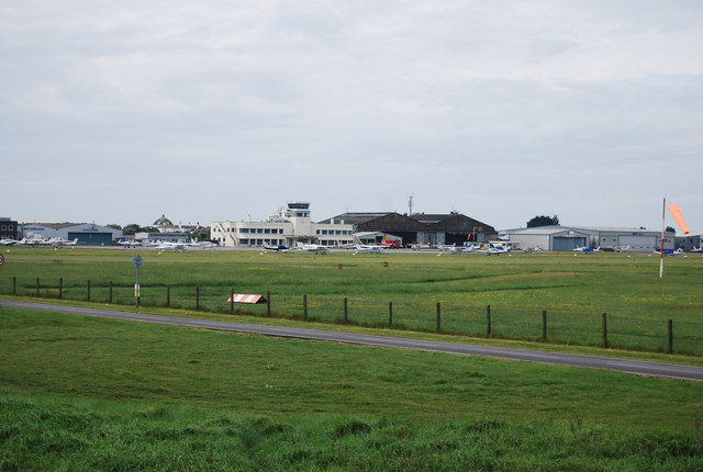
Lancing Manor Park, located in Sussex, is a picturesque recreational area that offers a delightful blend of natural beauty and leisure activities for visitors of all ages. Nestled amidst the stunning Sussex Downs and Moorland, the park spans across a vast expanse of open space and presents a wide array of attractions and amenities.

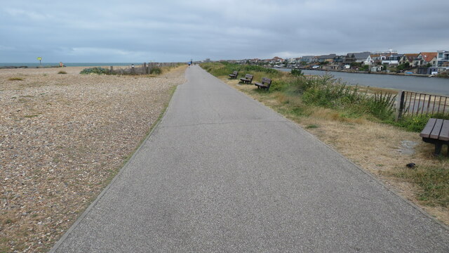
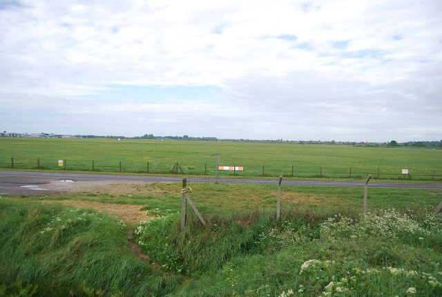
The park boasts expansive green fields, rolling hills, and breathtaking views of the surrounding countryside, making it a haven for nature enthusiasts and outdoor lovers. It provides ample opportunities for walking, jogging, and picnicking, as well as hosting various sporting events and games on its well-maintained grounds.

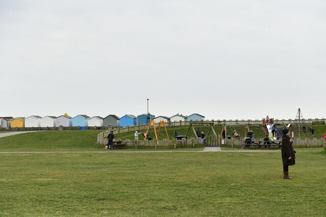
Lancing Manor Park is also home to a playground, featuring a range of play equipment suitable for children of different ages. From swings and slides to climbing frames and sandpits, the playground offers endless fun and entertainment for little ones.

Moreover, the park is equipped with a skate park, where skateboarders, BMX riders, and rollerbladers can showcase their skills and enjoy their favorite activities. The skate park includes ramps, rails, and other features to cater to different levels of expertise.

For those seeking a peaceful retreat, Lancing Manor Park boasts serene woodland areas, perfect for leisurely walks or simply unwinding amidst nature's tranquility. The park is also equipped with benches and picnic tables, allowing visitors to relax and soak in the idyllic surroundings.

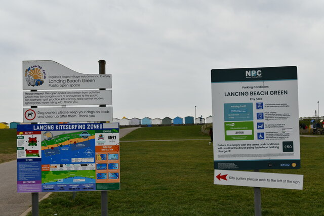
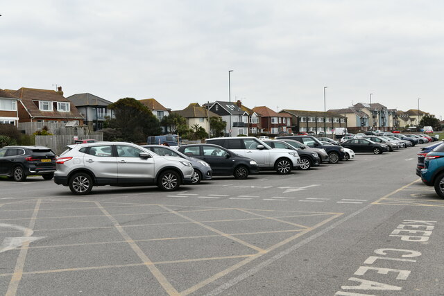
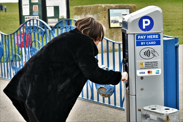
Lancing Manor Park is conveniently located near local amenities, including cafes, shops, and parking facilities, ensuring a pleasant and convenient experience for all who visit. With its stunning landscape, diverse recreational options, and easy accessibility, Lancing Manor Park is a true gem of Sussex, inviting both locals and tourists alike to enjoy its natural splendor and recreational offerings.

If you have any feedback on the listing, please let us know in the comments section below.

Lancing Manor Park Images

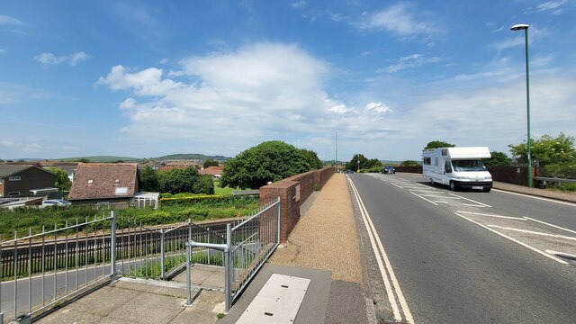
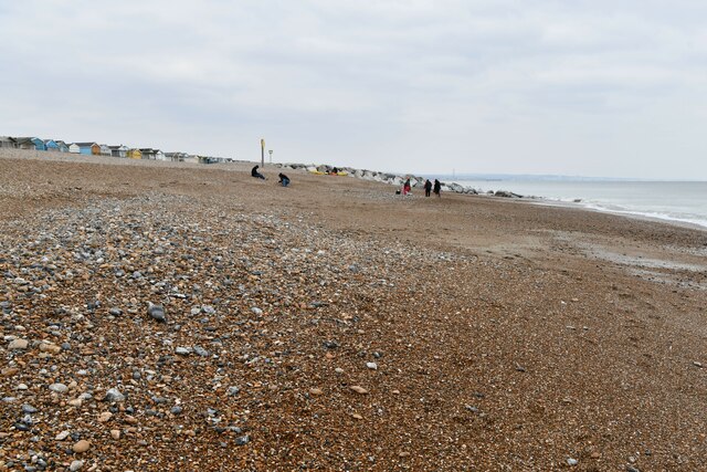
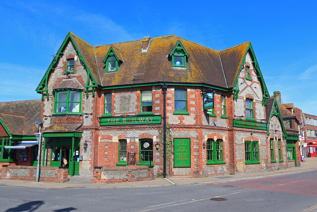
Images are sourced within 2km of 50.837787/-0.31708719 or Grid Reference TQ1805. Thanks to Geograph Open Source API. All images are credited.

Grinstead Lane railway bridge The Bridge was built in the mid sixties for the new A2025 bypass road. The level crossing could be avoided.
Grinstead Lane railway bridge
The Bridge was built in the mid sixties for the new A2025 bypass road. The level crossing could be avoided.
Path by Widewater Lagoon, lancing Widewater Lagoon is an area of brackish water landlocked by a man-made shingle bank. It lies between the beach and A259 coast road (Brighton Road) in Lancing; between the far east of Lancing Beach and the far west of Shoreham Beach.
This path runs between the beach and lagoon
Path by Widewater Lagoon, lancing
Widewater Lagoon is an area of brackish water landlocked by a man-made shingle bank. It lies between the beach and A259 coast road (Brighton Road) in Lancing; between the far east of Lancing Beach and the far west of Shoreham Beach. This path runs between the beach and lagoon
Lancing: Play area
Lancing: Play area
Lancing: Beach Green information boards
Lancing: Beach Green Car Park
Lancing: Beach Green Car Park, 'pay by card'
Lancing Beach: Huts
Lancing Beach: Huts
Lancing Beach Green: Path to the beach
Lancing Beach looking east
The Railway Public house in Lancing.
The Railway
Public house in Lancing.
Houses on Brighton Road
Path across Widewater Lagoon Widewater Lagoon is an area of brackish water landlocked by a man-made shingle bank. It lies between the beach and A259 coast road (Brighton Road) in Lancing; between the far east of Lancing Beach and the far west of Shoreham Beach.
The path crosses from the beach to the road
Path across Widewater Lagoon
Widewater Lagoon is an area of brackish water landlocked by a man-made shingle bank. It lies between the beach and A259 coast road (Brighton Road) in Lancing; between the far east of Lancing Beach and the far west of Shoreham Beach. The path crosses from the beach to the road
Shoreham Airport terminus
Shoreham Airport Shoreham Airport, also known as Shoreham (Brighton City) Airport was founded in 1910, it is the oldest licensed airfield in the UK. It was an RAF base during both World wars, but is now mainly used for private planes and flying instructions. The hangar at the airport is grade II listed. <span class="nowrap"><a title="http://www.britishlistedbuildings.co.uk/en-503030-municipal-hangar-at-shoreham-airport-sho" rel="nofollow ugc noopener" href="http://www.britishlistedbuildings.co.uk/en-503030-municipal-hangar-at-shoreham-airport-sho">Link</a><img style="margin-left:2px;" alt="External link" title="External link - shift click to open in new window" src="https://s1.geograph.org.uk/img/external.png" width="10" height="10"/></span> 
Wikipedia: <span class="nowrap"><a title="http://en.wikipedia.org/wiki/Shoreham_Airport" rel="nofollow ugc noopener" href="http://en.wikipedia.org/wiki/Shoreham_Airport">Link</a><img style="margin-left:2px;" alt="External link" title="External link - shift click to open in new window" src="https://s1.geograph.org.uk/img/external.png" width="10" height="10"/></span> 
Website: <span class="nowrap"><a title="http://www.shorehamairport.co.uk/" rel="nofollow ugc noopener" href="http://www.shorehamairport.co.uk/">Link</a><img style="margin-left:2px;" alt="External link" title="External link - shift click to open in new window" src="https://s1.geograph.org.uk/img/external.png" width="10" height="10"/></span>
Shoreham Airport
Shoreham Airport, also known as Shoreham (Brighton City) Airport was founded in 1910, it is the oldest licensed airfield in the UK. It was an RAF base during both World wars, but is now mainly used for private planes and flying instructions. The hangar at the airport is grade II listed. LinkExternal link Wikipedia: LinkExternal link Website: LinkExternal link
Wind sock, Shoreham Airport Shoreham Airport, also known as Shoreham (Brighton City) Airport was founded in 1910, it is the oldest licensed airfield in the UK. It was an RAF base during both World wars, but is now mainly used for private planes and flying instructions. The hangar at the airport is grade II listed. <span class="nowrap"><a title="http://www.britishlistedbuildings.co.uk/en-503030-municipal-hangar-at-shoreham-airport-sho" rel="nofollow ugc noopener" href="http://www.britishlistedbuildings.co.uk/en-503030-municipal-hangar-at-shoreham-airport-sho">Link</a><img style="margin-left:2px;" alt="External link" title="External link - shift click to open in new window" src="https://s1.geograph.org.uk/img/external.png" width="10" height="10"/></span> 
Wikipedia: <span class="nowrap"><a title="http://en.wikipedia.org/wiki/Shoreham_Airport" rel="nofollow ugc noopener" href="http://en.wikipedia.org/wiki/Shoreham_Airport">Link</a><img style="margin-left:2px;" alt="External link" title="External link - shift click to open in new window" src="https://s1.geograph.org.uk/img/external.png" width="10" height="10"/></span> 
Website: <span class="nowrap"><a title="http://www.shorehamairport.co.uk/" rel="nofollow ugc noopener" href="http://www.shorehamairport.co.uk/">Link</a><img style="margin-left:2px;" alt="External link" title="External link - shift click to open in new window" src="https://s1.geograph.org.uk/img/external.png" width="10" height="10"/></span>
Wind sock, Shoreham Airport
Shoreham Airport, also known as Shoreham (Brighton City) Airport was founded in 1910, it is the oldest licensed airfield in the UK. It was an RAF base during both World wars, but is now mainly used for private planes and flying instructions. The hangar at the airport is grade II listed. LinkExternal link Wikipedia: LinkExternal link Website: LinkExternal link
Shoreham Airport The Hangar is Grade II listed. <span class="nowrap"><a title="http://www.britishlistedbuildings.co.uk/en-503030-municipal-hangar-at-shoreham-airport-sho" rel="nofollow ugc noopener" href="http://www.britishlistedbuildings.co.uk/en-503030-municipal-hangar-at-shoreham-airport-sho">Link</a><img style="margin-left:2px;" alt="External link" title="External link - shift click to open in new window" src="https://s1.geograph.org.uk/img/external.png" width="10" height="10"/></span>
Shoreham Airport
The Hangar is Grade II listed. LinkExternal link
Shoreham Airport Shoreham Airport, also known as Shoreham (Brighton City) Airport was founded in 1910, it is the oldest licensed airfield in the UK. It was an RAF base during both World wars, but is now mainly used for private planes and flying instructions. The hangar at the airport is grade II listed. <span class="nowrap"><a title="http://www.britishlistedbuildings.co.uk/en-503030-municipal-hangar-at-shoreham-airport-sho" rel="nofollow ugc noopener" href="http://www.britishlistedbuildings.co.uk/en-503030-municipal-hangar-at-shoreham-airport-sho">Link</a><img style="margin-left:2px;" alt="External link" title="External link - shift click to open in new window" src="https://s1.geograph.org.uk/img/external.png" width="10" height="10"/></span> 
Wikipedia: <span class="nowrap"><a title="http://en.wikipedia.org/wiki/Shoreham_Airport" rel="nofollow ugc noopener" href="http://en.wikipedia.org/wiki/Shoreham_Airport">Link</a><img style="margin-left:2px;" alt="External link" title="External link - shift click to open in new window" src="https://s1.geograph.org.uk/img/external.png" width="10" height="10"/></span> 
Website: <span class="nowrap"><a title="http://www.shorehamairport.co.uk/" rel="nofollow ugc noopener" href="http://www.shorehamairport.co.uk/">Link</a><img style="margin-left:2px;" alt="External link" title="External link - shift click to open in new window" src="https://s1.geograph.org.uk/img/external.png" width="10" height="10"/></span>
Shoreham Airport
Shoreham Airport, also known as Shoreham (Brighton City) Airport was founded in 1910, it is the oldest licensed airfield in the UK. It was an RAF base during both World wars, but is now mainly used for private planes and flying instructions. The hangar at the airport is grade II listed. LinkExternal link Wikipedia: LinkExternal link Website: LinkExternal link
Show me another place!

Lancing Manor Park is located at Grid Ref: TQ1805 (Lat: 50.837787, Lng: -0.31708719)

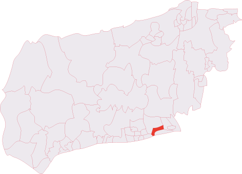
Administrative County: West Sussex

District: Adur

Police Authority: Sussex

What 3 Words

///workroom.ombudsman.smiling. Near Lancing, West Sussex

Nearby Locations

Lancing Manor Park

Related Wikis

St James the Less Church, Lancing

St James the Less Church is the Anglican parish church of Lancing, an ancient village which has been absorbed into the modern town of Lancing in the district...

Lancing (electoral division)

Lancing is an electoral division of West Sussex in the United Kingdom, and returns one member to sit on West Sussex County Council. == Extent == The division...

Lancing, West Sussex

Lancing is a large coastal village and civil parish in the Adur district of West Sussex, England, on the western edge of the Adur Valley. It occupies part...

Lancing Ring

Lancing Ring is a 29.4-hectare (73-acre) Local Nature Reserve in Lancing in West Sussex. It is owned and managed by Adur District Council.This chalk grassland...

Nearby Amenities

Located within 500m of 50.837787,-0.31708719
Traffic Calming: island
Lat/Long: 50.8364166/-0.3226767
Give Way
Direction: backward
Lat/Long: 50.8365181/-0.3197354
North Lancing
Is In: West Sussex, England, UK
Place: hamlet
Source: npe
Lat/Long: 50.8385772/-0.320336
Turning Circle
Lat/Long: 50.8352403/-0.3225561
Bus Stop
Leisure Centre
Bus: yes
Naptan AtcoCode: 4400AD0002
Naptan Bearing: W
Naptan CommonName: Leisure Centre
Naptan Indicator: opp Leisure Centre
Naptan Landmark: Manor Close
Naptan NaptanCode: wsxadadg
Naptan ShortCommonName: Leisure Centre
Naptan Street: A27 Old Shoreham Road
Naptan Verified: no
Public Transport: platform
Source: naptan_import
Lat/Long: 50.8372445/-0.3152649
Bus Stop
Leisure Centre
Bus: yes
Naptan AtcoCode: 4400AD0003
Naptan Bearing: E
Naptan CommonName: Leisure Centre
Naptan Indicator: o/s Leisure Centre
Naptan Landmark: opp. Manor Way
Naptan NaptanCode: wsxadadj
Naptan ShortCommonName: Leisure Centre
Naptan Street: A27 Old Shoreham Road
Naptan Verified: no
Public Transport: platform
Source: naptan_import
Lat/Long: 50.8373279/-0.3160572
Bus Stop
Miller & Carter
Naptan AtcoCode: 4400AD0008
Naptan Bearing: E
Naptan CommonName: Miller & Carter
Naptan Indicator: opp First Avenue
Naptan Landmark: Mill Road
Naptan NaptanCode: wsxadadw
Naptan ShortCommonName: Miller & Carter
Naptan Street: Manor Road
Naptan Verified: no
Source: naptan_import
Lat/Long: 50.8381852/-0.3193783
Bus Stop
Miller & Carter
Naptan AtcoCode: 4400AD0009
Naptan Bearing: W
Naptan CommonName: Miller & Carter
Naptan Indicator: adj First Ave
Naptan Landmark: Mill Road
Naptan NaptanCode: wsxadaga
Naptan ShortCommonName: Miller & Carter
Naptan Street: Manor Road
Naptan Verified: no
Source: naptan_import
Lat/Long: 50.8382115/-0.3199597
Bus Stop
Lancing Church
Naptan AtcoCode: 4400AD0010
Naptan Bearing: W
Naptan CommonName: Lancing Church
Naptan Indicator: adj Upper West Lane
Naptan Landmark: Upper West Lane
Naptan NaptanCode: wsxadagd
Naptan ShortCommonName: Lancing Church
Naptan Street: Manor Road
Naptan Verified: no
Source: naptan_import
Lat/Long: 50.8378544/-0.3232676
Bus Stop
Lancing Church
Naptan AtcoCode: 4400AD0011
Naptan Bearing: E
Naptan CommonName: Lancing Church
Naptan Indicator: adj Fircroft Avenue
Naptan Landmark: Fircroft Avenue
Naptan NaptanCode: wsxadagj
Naptan ShortCommonName: Lancing Church
Naptan Street: Manor Road
Naptan Verified: no
Source: naptan_import
Lat/Long: 50.8379798/-0.3232347
Bus Stop
Fairview Road East
Naptan AtcoCode: 4400AD0017
Naptan Bearing: E
Naptan CommonName: Fairview Road East
Naptan Indicator: o/s 6
Naptan Landmark: Mill Road
Naptan NaptanCode: wsxadajd
Naptan Street: Fairview Road
Naptan Verified: no
Source: naptan_import
Lat/Long: 50.8414657/-0.3211069
Bus Stop
Norbury Drive
Naptan AtcoCode: 4400AD0018
Naptan Bearing: S
Naptan CommonName: Norbury Drive
Naptan Indicator: adj Norbury Drive
Naptan Landmark: Norbury Drive
Naptan NaptanCode: wsxadajg
Naptan Street: Mill Road
Naptan Verified: no
Source: naptan_import
Lat/Long: 50.8402314/-0.3197025
Bus Stop
The Street
Naptan AtcoCode: 4400AD0019
Naptan Bearing: SW
Naptan CommonName: The Street
Naptan Indicator: opp 15
Naptan Landmark: The Street
Naptan NaptanCode: wsxadajm
Naptan Street: Mill Road
Naptan Verified: no
Source: naptan_import
Lat/Long: 50.838948/-0.3198906
Bus Stop
Upper Brighton Rd
Naptan AtcoCode: 4400AD0088
Naptan Bearing: S
Naptan CommonName: Upper Brighton Rd
Naptan Indicator: o/s 25
Naptan Landmark: Old Shoreham Road
Naptan NaptanCode: wsxadgtd
Naptan Street: Grinstead Lane
Naptan Verified: no
Public Transport: platform
Source: naptan_import
Lat/Long: 50.8356756/-0.3174801
Bus Stop
Upper Brighton Rd
Naptan AtcoCode: 4400AD0089
Naptan Bearing: N
Naptan CommonName: Upper Brighton Rd
Naptan Indicator: o/s 28
Naptan Landmark: Upper Brighton Road
Naptan NaptanCode: wsxadgtg
Naptan Street: Grinstead Road
Naptan Verified: no
Public Transport: platform
Source: naptan_import
Lat/Long: 50.8355164/-0.3176705
Bus Stop
Curvins Way
Naptan AtcoCode: 4400AD0090
Naptan Bearing: N
Naptan CommonName: Curvins Way
Naptan Indicator: o/s 54
Naptan Landmark: Curvins Way
Naptan NaptanCode: wsxadgtj
Naptan Street: Grinstead Lane
Naptan Verified: no
Public Transport: platform
Shelter: yes
Source: naptan_import
Lat/Long: 50.8341628/-0.3179748
Bus Stop
Curvins Way
Naptan AtcoCode: 4400AD0091
Naptan Bearing: S
Naptan CommonName: Curvins Way
Naptan Indicator: o/s 67
Naptan Landmark: Curvins Way
Naptan NaptanCode: wsxadgtm
Naptan Street: Grinstead Lane
Naptan Verified: no
Public Transport: platform
Source: naptan_import
Lat/Long: 50.8337671/-0.3179748
Woodard Road
Naptan AtcoCode: 4400AD0101
Naptan Bearing: NE
Naptan BusStopType: CUS
Naptan CommonName: Woodard Road
Naptan Indicator: adj Woodard Road
Naptan Landmark: Woodard Road
Naptan NaptanCode: wsxadjad
Naptan Street: Shadwells Road
Naptan Verified: no
Source: naptan_import
Lat/Long: 50.8344788/-0.313078
Bus Stop
Woodard Road
Bus: yes
Naptan AtcoCode: 4400AD0102
Naptan Bearing: SW
Naptan CommonName: Woodard Road
Naptan Indicator: opp Woodard Road
Naptan Landmark: Woodard Road
Naptan NaptanCode: wsxadjag
Naptan Street: Shadwells Road
Naptan Verified: no
Public Transport: platform
Source: naptan_import
Lat/Long: 50.834468/-0.3129505
Bus Stop
Shadwells Road
Naptan AtcoCode: 4400AD0104
Naptan Bearing: E
Naptan CommonName: Shadwells Road
Naptan Indicator: opp Shadwells Road
Naptan Landmark: Shadwells Road
Naptan NaptanCode: wsxadjaj
Naptan Street: Hayley Road
Naptan Verified: no
Public Transport: platform
Source: naptan_import
Lat/Long: 50.8360686/-0.3129354
Bus Stop
Shadwells Road
Naptan AtcoCode: 4400AD0105
Naptan Bearing: W
Naptan CommonName: Shadwells Road
Naptan Indicator: adj Shadwells Road
Naptan Landmark: Shadwells Road
Naptan NaptanCode: wsxadjam
Naptan Street: Hayley Road
Naptan Verified: no
Public Transport: platform
Source: naptan_import
Lat/Long: 50.8359908/-0.3131513
Bus Stop
Lisher Road
Naptan AtcoCode: 4400AD0106
Naptan Bearing: N
Naptan CommonName: Lisher Road
Naptan Indicator: opp. Lisher Road
Naptan Landmark: Lisher Road
Naptan NaptanCode: wsxadjap
Naptan Street: Hayley Road
Naptan Verified: no
Public Transport: platform
Source: naptan_import
Lat/Long: 50.8353403/-0.3160578
Bus Stop
Glebe Way
Naptan AtcoCode: 4400AD0129
Naptan Bearing: W
Naptan CommonName: Glebe Way
Naptan Indicator: Glebe Way
Naptan Landmark: Grand Avenue
Naptan NaptanCode: wsxadjmt
Naptan Street: Glebe Way
Naptan Verified: no
Source: naptan_import
Lat/Long: 50.835767/-0.3219506
Bus Stop
Fifth Avenue
Naptan AtcoCode: 4400AD0130
Naptan Bearing: S
Naptan CommonName: Fifth Avenue
Naptan Indicator: opp. Fifth Avenue
Naptan Landmark: Fifth Avenue
Naptan NaptanCode: wsxadjmw
Naptan Street: Grand Avenue
Naptan Verified: no
Source: naptan_import
Lat/Long: 50.8345657/-0.321596
Bus Stop
Sports Centre
Naptan AtcoCode: 4400AD0342
Naptan Bearing: SE
Naptan CommonName: Sports Centre
Naptan Indicator: nr roundabout
Naptan Landmark: Old Shoreham Road (A27)
Naptan NaptanCode: wsxdptmt
Naptan Street: Manor Road
Naptan Verified: no
Public Transport: platform
Source: naptan_import
Lat/Long: 50.8373594/-0.3182433
Fairview Road East
Naptan AtcoCode: 4400AD0362
Naptan Bearing: W
Naptan BusStopType: CUS
Naptan CommonName: Fairview Road East
Naptan Indicator: Nr Mill Rd
Naptan Landmark: Mill Rd
Naptan Street: Fairview Rd
Naptan Verified: no
Source: naptan_import
Lat/Long: 50.8413842/-0.3210673
Norbury Drive
Naptan AtcoCode: 4400AD0363
Naptan Bearing: N
Naptan BusStopType: CUS
Naptan CommonName: Norbury Drive
Naptan Indicator: Opp Norbury Dr
Naptan Landmark: Norbury Dr
Naptan Street: Mill Rd
Naptan Verified: no
Source: naptan_import
Lat/Long: 50.8402518/-0.3198722
The Street
Naptan AtcoCode: 4400AD0364
Naptan Bearing: N
Naptan BusStopType: CUS
Naptan CommonName: The Street
Naptan Indicator: opp The Street
Naptan Landmark: The Street
Naptan Street: Mill Rd
Naptan Verified: no
Source: naptan_import
Lat/Long: 50.8389682/-0.3200461
Bus Stop
Fifth Avenue
Naptan AtcoCode: 4400AD0368
Naptan Bearing: N
Naptan CommonName: Fifth Avenue
Naptan Landmark: Fifth Avenue
Naptan Street: Grand Avenue
Naptan Verified: no
Public Transport: platform
Source: naptan_import
Lat/Long: 50.8348278/-0.321686
Crossing
Bicycle: yes
Crossing: traffic_signals
Crossing Markings: yes
Crossing Signals: yes
Crossing Ref: toucan
Kerb: lowered
Tactile Paving: yes
Lat/Long: 50.8371842/-0.3162734
Crossing
Crossing: traffic_signals
Crossing Island: no
Crossing Ref: puffin
Kerb: lowered
Tactile Paving: yes
Lat/Long: 50.836457/-0.3202709
Crossing
Bicycle: yes
Crossing: traffic_signals
Crossing Markings: yes
Crossing Signals: yes
Crossing Ref: toucan
Kerb: lowered
Tactile Paving: yes
Lat/Long: 50.8371208/-0.3161251
Crossing
Crossing: unmarked
Crossing Island: yes
Tactile Paving: yes
Lat/Long: 50.8351656/-0.3176251
H&K Convenience Stores
Addr City: Lancing
Addr Street: Lisher Road
Shop: yes
Lat/Long: 50.8350392/-0.3144248
Atm
Fee: £1.50
Opening Hours: unknown
Operator: DC ATM
Lat/Long: 50.8349932/-0.3144486
Post Box
Brand: Royal Mail
Brand Wikidata: Q638098
Brand Wikipedia: en:Royal Mail
Collection Plate: CP7
Collection Times: Mo-Fr 16:45; Sa 11:30
Operator: Royal Mail
Operator Wikidata: Q638098
Post Box Type: lamp
Ref: BN15 1407
Royal Cypher: EIIR
Royal Cypher Wikidata: Q33102113
Lat/Long: 50.8346605/-0.3174826
Post Box
Brand: Royal Mail
Brand Wikidata: Q638098
Brand Wikipedia: en:Royal Mail
Collection Plate: CP7D
Collection Times: Mo-Fr 09:00; Sa 07:00
Operator: Royal Mail
Operator Wikidata: Q638098
Post Box Type: lamp
Ref: BN15 1384D
Royal Cypher: EIIR
Royal Cypher Wikidata: Q33102113
Lat/Long: 50.8349272/-0.3146591
Post Box
Brand: Royal Mail
Brand Wikidata: Q638098
Brand Wikipedia: en:Post Office Ltd
Operator: Royal Mail
Operator Wikidata: Q638098
Post Box Type: lamp
Source: survey
Lat/Long: 50.8381603/-0.3114115
Crossing
Crossing: unmarked
Crossing Island: yes
Crossing Markings: no
Kerb: lowered
Tactile Paving: yes
Lat/Long: 50.8364365/-0.3234172
Traffic Calming: island
Lat/Long: 50.8364618/-0.3212335
North Lancing Fairy Tree
Tourism: artwork
Lat/Long: 50.8404554/-0.3153008
Veterinary
Adur Valley Vets
Lat/Long: 50.8349736/-0.3144412
Post Box
Brand: Post Office
Brand Wikidata: Q1783168
Brand Wikipedia: en:Post Office Ltd
Disused: yes
Operator: Post Office
Operator Wikidata: Q1783168
Lat/Long: 50.8392373/-0.3196325
Crossing
Crossing: unmarked
Crossing Island: yes
Tactile Paving: yes
Lat/Long: 50.8344506/-0.3177813
Give Way
Direction: backward
Lat/Long: 50.8340577/-0.3160493
Give Way
Direction: forward
Lat/Long: 50.8346254/-0.3161452
Give Way
Direction: forward
Lat/Long: 50.835184/-0.3159564
Give Way
Direction: forward
Lat/Long: 50.837401/-0.3143099
Give Way
Direction: backward
Lat/Long: 50.8351182/-0.3125174
Post Box
Brand: Royal Mail
Brand Wikidata: Q638098
Operator: Royal Mail
Operator Wikidata: Q638098
Royal Cypher: GR
Royal Cypher Wikidata: Q33102273
Lat/Long: 50.8399441/-0.3196882
Crossing
Crossing: marked
Tactile Paving: no
Lat/Long: 50.8359709/-0.3116568
Bench
Backrest: yes
Lat/Long: 50.835719/-0.313214
Barrier: bollard
Bollard: fixed
Lat/Long: 50.8358651/-0.3151321
Barrier: bollard
Bollard: fixed
Lat/Long: 50.8356059/-0.3150523
Barrier: bollard
Bollard: fixed
Lat/Long: 50.8356066/-0.3150684
Barrier: bollard
Bollard: fixed
Lat/Long: 50.8356078/-0.3150888
Barrier: bollard
Bollard: fixed
Lat/Long: 50.8356087/-0.3151123
Barrier: bollard
Bollard: fixed
Lat/Long: 50.8356119/-0.3151311
Colour: #22AA22
Man Made: street_cabinet
Operator: Openreach
Operator Wikidata: Q7096543
Utility: telecom
Lat/Long: 50.836545/-0.3146295
Traffic Calming: island
Lat/Long: 50.8364376/-0.3219507
Give Way
Direction: backward
Lat/Long: 50.8364018/-0.3211576
Traffic Signals
Traffic Signals: pedestrian_crossing
Traffic Signals Direction: backward
Lat/Long: 50.8364583/-0.3203476
Traffic Signals
Traffic Signals: pedestrian_crossing
Traffic Signals Direction: forward
Lat/Long: 50.8364562/-0.3201946
Give Way
Direction: forward
Lat/Long: 50.8363854/-0.3197824
Traffic Calming: island
Lat/Long: 50.8364524/-0.3196743
Traffic Calming: island
Lat/Long: 50.8364788/-0.3188201
Traffic Signals
Traffic Signals: crossing
Traffic Signals Direction: forward
Lat/Long: 50.8371674/-0.3163392
Traffic Signals
Traffic Signals: crossing
Traffic Signals Direction: forward
Lat/Long: 50.8371355/-0.3160662
The data included in this document is from www.openstreetmap.org. The data is made available under ODbL.

Have you been to Lancing Manor Park?

Leave your review of Lancing Manor Park below (or comments, questions and feedback).