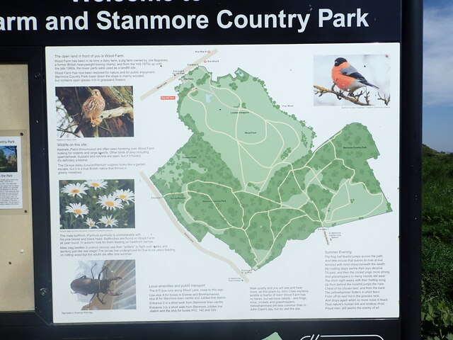
Centennial Park

Downs, Moorland in Middlesex Hertsmere

England

Centennial Park

Derelict restaurant on Watling Street, Elstree
Derelict restaurant on Watling Street, Elstree Credit: David Howard

Centennial Park, Middlesex, also known as Downs and Moorland, is a picturesque green space located in the heart of Middlesex County, England. Spanning over a vast area of land, the park offers a serene and tranquil environment for residents and visitors alike.

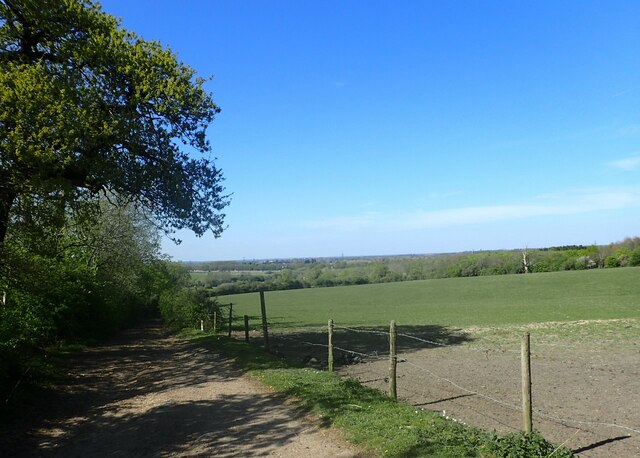
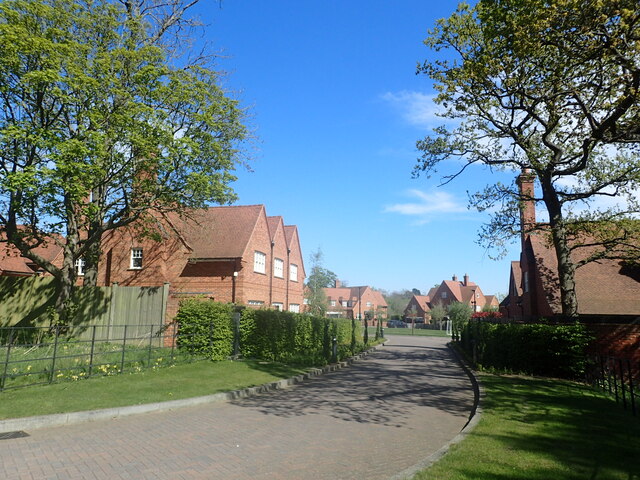
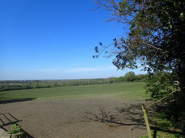
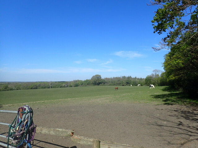
The park is renowned for its rolling hills, expansive meadows, and breathtaking views. It is a popular destination for nature enthusiasts and families seeking a peaceful retreat from the hustle and bustle of city life. The landscape is dotted with majestic ancient trees, providing ample shade and creating a soothing atmosphere.

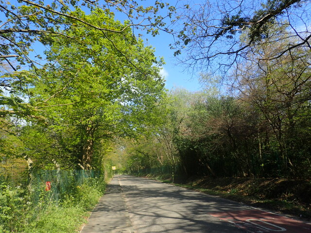
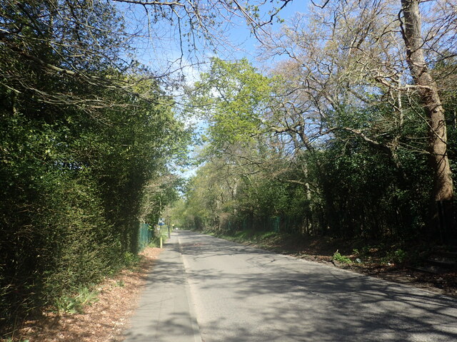
Centennial Park offers a range of recreational activities to cater to diverse interests. Walking and cycling trails are scattered throughout the park, allowing visitors to explore its vast expanse at their own pace. The park also features well-maintained sports fields, where locals can engage in various team sports or enjoy a friendly game of cricket or football.

For those looking to relax, there are plenty of picnic areas with well-manicured lawns, perfect for a leisurely afternoon with friends and family. Additionally, the park boasts a beautiful lake, providing opportunities for fishing and boating.

Centennial Park is home to a rich and diverse ecosystem, supporting a wide array of flora and fauna. Birdwatchers will delight in the park's abundance of bird species, making it an ideal spot for ornithological enthusiasts. The park also plays a vital role in conservation efforts, ensuring the preservation of the region's natural beauty.

Overall, Centennial Park, Middlesex, offers a delightful escape into nature, providing a perfect balance of recreational activities, breathtaking scenery, and a peaceful ambiance for all to enjoy.

If you have any feedback on the listing, please let us know in the comments section below.

Centennial Park Images

Images are sourced within 2km of 51.642133/-0.30542607 or Grid Reference TQ1795. Thanks to Geograph Open Source API. All images are credited.

Derelict restaurant on Watling Street, Elstree
The London Loop This is just after leaving a narrow footpath which runs alongside the Royal National Orthopaedic Hospital. The Loop drops down to pass under the M1 which can just be made out in the distance. It then heads on to Aldenham Reservoir.
The London Loop
This is just after leaving a narrow footpath which runs alongside the Royal National Orthopaedic Hospital. The Loop drops down to pass under the M1 which can just be made out in the distance. It then heads on to Aldenham Reservoir.
Wood Lane This is just after passing the entrance to the Royal National Orthopaedic Hospital.
Wood Lane
This is just after passing the entrance to the Royal National Orthopaedic Hospital.
Wood Lane This is approaching the entrance to the Royal National Orthopaedic Hospital.
Wood Lane
This is approaching the entrance to the Royal National Orthopaedic Hospital.
Wood Farm Close This gated group of new housing is off Wood Lane to the east of Wood Farm.
Wood Farm Close
This gated group of new housing is off Wood Lane to the east of Wood Farm.
The viewpoint at Wood Farm Wood Farm has in the past been a dairy farm, and a pig farm owned by Joe Bygraves, a former British heavyweight boxing champion. From the mid 1970s to the late 1980s, the lower parts were used as a landfill site. Wood Farm has now been restored for nature and for recreation.

As can be seen, there are fabulous views as far as the North Downs and including the Wembley Arch.
The viewpoint at Wood Farm
Wood Farm has in the past been a dairy farm, and a pig farm owned by Joe Bygraves, a former British heavyweight boxing champion. From the mid 1970s to the late 1980s, the lower parts were used as a landfill site. Wood Farm has now been restored for nature and for recreation. As can be seen, there are fabulous views as far as the North Downs and including the Wembley Arch.
View from Wood Farm Wood Farm has in the past been a dairy farm, and a pig farm owned by Joe Bygraves, a former British heavyweight boxing champion. From the mid 1970s to the late 1980s, the lower parts were used as a landfill site. Wood Farm has now been restored for nature and for recreation.

As can be seen, there are fabulous views as far as the North Downs, which are in the distance here, and including the Wembley Arch which can be seen towards the right of the pictures.
View from Wood Farm
Wood Farm has in the past been a dairy farm, and a pig farm owned by Joe Bygraves, a former British heavyweight boxing champion. From the mid 1970s to the late 1980s, the lower parts were used as a landfill site. Wood Farm has now been restored for nature and for recreation. As can be seen, there are fabulous views as far as the North Downs, which are in the distance here, and including the Wembley Arch which can be seen towards the right of the pictures.
Pond at Wood farm Wood Farm has in the past been a dairy farm, and a pig farm owned by Joe Bygraves, a former British heavyweight boxing champion. From the mid 1970s to the late 1980s, the lower parts were used as a landfill site. Wood Farm has now been restored for nature and for recreation.

As can be seen at <a title="https://www.geograph.org.uk/photo/7153529" href="https://www.geograph.org.uk/photo/7153529">Link</a> there are fabulous views as far as the North Downs and including the Wembley Arch.
Pond at Wood farm
Wood Farm has in the past been a dairy farm, and a pig farm owned by Joe Bygraves, a former British heavyweight boxing champion. From the mid 1970s to the late 1980s, the lower parts were used as a landfill site. Wood Farm has now been restored for nature and for recreation. As can be seen at Link there are fabulous views as far as the North Downs and including the Wembley Arch.
Pond at Wood Farm Wood Farm has in the past been a dairy farm, and a pig farm owned by Joe Bygraves, a former British heavyweight boxing champion. From the mid 1970s to the late 1980s, the lower parts were used as a landfill site. Wood Farm has now been restored for nature and for recreation.

As can be seen at <a title="https://www.geograph.org.uk/photo/7153529" href="https://www.geograph.org.uk/photo/7153529">Link</a> there are fabulous views as far as the North Downs and including the Wembley Arch.
Pond at Wood Farm
Wood Farm has in the past been a dairy farm, and a pig farm owned by Joe Bygraves, a former British heavyweight boxing champion. From the mid 1970s to the late 1980s, the lower parts were used as a landfill site. Wood Farm has now been restored for nature and for recreation. As can be seen at Link there are fabulous views as far as the North Downs and including the Wembley Arch.
Information board at Wood Farm As explained on the information board, Wood Farm has in the past been a dairy farm, and a pig farm owned by Joe Bygraves, a former British heavyweight boxing champion. From the mid 1970s to the late 1980s, the lower parts were used as a landfill site. Wood Farm has now been restored for nature and for recreation.

As can be seen at <a title="https://www.geograph.org.uk/photo/7153529" href="https://www.geograph.org.uk/photo/7153529">Link</a> there are fabulous views as far as the North Downs and including the Wembley Arch.
Information board at Wood Farm
As explained on the information board, Wood Farm has in the past been a dairy farm, and a pig farm owned by Joe Bygraves, a former British heavyweight boxing champion. From the mid 1970s to the late 1980s, the lower parts were used as a landfill site. Wood Farm has now been restored for nature and for recreation. As can be seen at Link there are fabulous views as far as the North Downs and including the Wembley Arch.
View from the London Loop This is just after leaving a narrow footpath which runs alongside the Royal National Orthopaedic Hospital. The Loop drops down to pass under the M1 which can just be made out in the far distance on the left. It then heads on to Aldenham Reservoir. An enclosed footpath leads off to the right at this point to pass under the M1 and reach the A41 Watford By-pass.
View from the London Loop
This is just after leaving a narrow footpath which runs alongside the Royal National Orthopaedic Hospital. The Loop drops down to pass under the M1 which can just be made out in the far distance on the left. It then heads on to Aldenham Reservoir. An enclosed footpath leads off to the right at this point to pass under the M1 and reach the A41 Watford By-pass.
View from the London loop This is just after leaving a narrow footpath which runs alongside the Royal National Orthopaedic Hospital. The Loop drops down to pass under the M1 and then heads on to Aldenham Reservoir. An enclosed footpath leads off here, beyond the edge of this field on the right, to pass under the M1 and reach the A41 Watford By-pass.
View from the London loop
This is just after leaving a narrow footpath which runs alongside the Royal National Orthopaedic Hospital. The Loop drops down to pass under the M1 and then heads on to Aldenham Reservoir. An enclosed footpath leads off here, beyond the edge of this field on the right, to pass under the M1 and reach the A41 Watford By-pass.
The London Loop passing Fish Pond Little Common is between Stanmore Hill and Wood Lane. There are a number of small areas of grassland with footpaths crossing them, including the London Loop seen here. There are also a couple of ponds and this is one of them.
The London Loop passing Fish Pond
Little Common is between Stanmore Hill and Wood Lane. There are a number of small areas of grassland with footpaths crossing them, including the London Loop seen here. There are also a couple of ponds and this is one of them.
Fish Pond on Little Common
Husaini Shia Islamic Centre and Madressa, Stanmore Formerly Springbok House.
Husaini Shia Islamic Centre and Madressa, Stanmore
Formerly Springbok House.
Grove Rugby Club
Grove Rugby Club
Show me another place!

Centennial Park is located at Grid Ref: TQ1795 (Lat: 51.642133, Lng: -0.30542607)

Administrative County: Hertfordshire

District: Hertsmere

Police Authority: Hertfordshire

What 3 Words

///smile.solved.those. Near Elstree, Hertfordshire

Nearby Locations

Centennial Park Elstree

Related Wikis

Aldenham Works

The Aldenham Works, or Aldenham Bus Overhaul Works, was the main London Transport bus overhaul works. It was located on the edge of the Hertfordshire village...
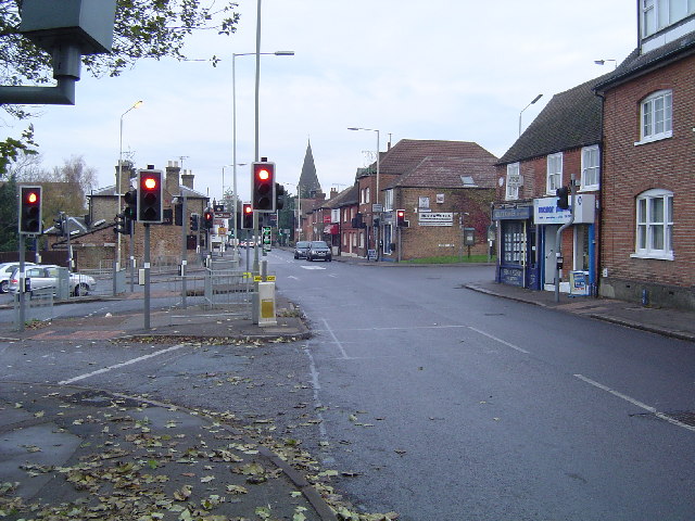
Elstree

Elstree is a large village in the Hertsmere borough of Hertfordshire, England. It is about 15 miles (24 kilometres) northwest of central London on the...

Elstree South tube station

Elstree South (usually just Elstree on Underground maps) was a proposed London Underground station in Elstree, Hertfordshire. It was designed by Charles...
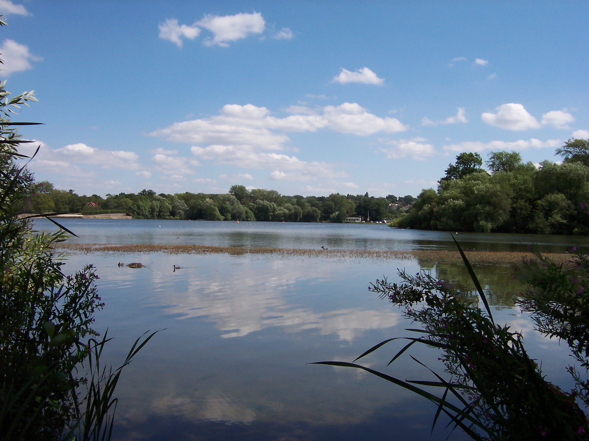
Aldenham Reservoir

Aldenham Reservoir is situated in the parish of Elstree and Borehamwood in Hertfordshire, England, about one mile (1.6 km) to the west of the village of...

New Elstree Studios

New Elstree Studios was a British film studio complex that was the main production centre for the Danziger Brothers from 1956 to 1962, and was one of several...

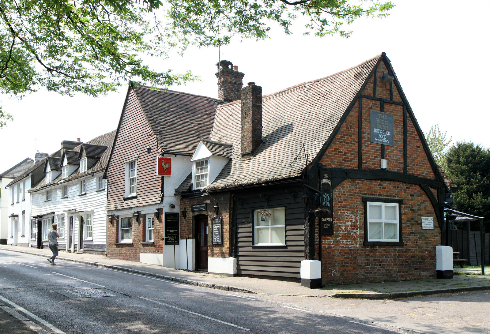
The Holly Bush, Elstree

The Holly Bush is a listed building, formerly a public house, on the High Street, Elstree, Hertfordshire, England. Elstree's High Street was formerly an...

Aldenham Country Park

Aldenham Country Park is a 175-acre (0.71 km2) parkland and woodland, including Aldenham Reservoir. It is now part of the Watling Chase Community Forest...

Bushey Heath tube station

Bushey Heath was a proposed, but unbuilt, London Underground station in Bushey Heath, Hertfordshire, England. The planned location of the station was at...

Nearby Amenities

Located within 500m of 51.642133,-0.30542607
Crossing
Crossing: traffic_signals
Crossing Island: no
Tactile Paving: yes
Traffic Signals Vibration: yes
Lat/Long: 51.6440942/-0.3023654
Turning Circle
Lat/Long: 51.6424684/-0.3028449
Give Way
Direction: forward
Lat/Long: 51.6417795/-0.3009938
Barrier: bollard
Lat/Long: 51.6439696/-0.3021957
Elstree
Place: village
Population: 5110
Wikidata: Q19931
Wikipedia: en:Elstree
Lat/Long: 51.6437729/-0.2989349
Power: tower
Lat/Long: 51.6419992/-0.3110072
Power: tower
Lat/Long: 51.6405983/-0.3057972
Power: tower
Lat/Long: 51.6387326/-0.3014333
Crossing
Crossing: unmarked
Lat/Long: 51.6437992/-0.300415
Crossing
Crossing: unmarked
Lat/Long: 51.6438288/-0.3080086
Bus Stop
Rodgers Close
Bench: yes
Bin: yes
Naptan AtcoCode: 210021002780
Naptan Bearing: N
Naptan CommonName: Rodgers Close
Naptan Indicator: adj
Naptan Landmark: Unknown
Naptan NaptanCode: hrtgpgwj
Naptan ShortCommonName: NA
Naptan Street: High Street South
Naptan Verified: yes
Public Transport: platform
Shelter: yes
Source: naptan_import
Lat/Long: 51.6423648/-0.3002145
Bus Stop
Sullivan Way
Bench: yes
Naptan AtcoCode: 210021004980
Naptan Bearing: N
Naptan CommonName: Sullivan Way
Naptan Indicator: adj
Naptan Landmark: Unknown
Naptan NaptanCode: hrtgmwmg
Naptan ShortCommonName: NA
Naptan Street: Elstree Hill South
Naptan Verified: yes
Public Transport: platform
Shelter: yes
Source: naptan_import
Lat/Long: 51.6403264/-0.3017016
Centennial Park
Naptan AtcoCode: 210021007805
Naptan Bearing: S
Naptan BusStopType: CUS
Naptan CommonName: Centennial Park
Naptan Crossing: opp Centennial Avenue
Naptan Indicator: opp
Naptan Landmark: opp Centennial Avenue
Naptan NaptanCode: hrtgmjpm
Naptan ShortCommonName: NA
Naptan Street: Elstree Hill South
Naptan Verified: no
Source: naptan_import
Lat/Long: 51.6378881/-0.3034312
Bus Stop
Aldenham Road
Bench: no
Bin: no
Naptan AtcoCode: 210021007810
Naptan Bearing: W
Naptan CommonName: Aldenham Road
Naptan Indicator: opp
Naptan Landmark: Unknown
Naptan NaptanCode: hrtgmjpt
Naptan PlusbusZoneRef: ELTR
Naptan ShortCommonName: NA
Naptan Street: Watford Road
Public Transport: platform
Shelter: no
Source: naptan_import
Lat/Long: 51.6441042/-0.3029403
Bus Stop
The Fishery Inn
Naptan AtcoCode: 210021007820
Naptan Bearing: W
Naptan CommonName: The Fishery Inn
Naptan Crossing: Aldenham Reservoir
Naptan Indicator: W-bound
Naptan Landmark: Aldenham Reservoir
Naptan NaptanCode: hrtgmjtd
Naptan PlusbusZoneRef: ELTR
Naptan ShortCommonName: NA
Naptan Street: Watford Road
Naptan Verified: no
Public Transport: platform
Source: naptan_import
Lat/Long: 51.6438973/-0.307134
Bus Stop
Aldenham Reservoir
Naptan AtcoCode: 210021007830
Naptan Bearing: SW
Naptan CommonName: Aldenham Reservoir
Naptan Indicator: opp
Naptan Landmark: Unknown
Naptan NaptanCode: hrtgmjtg
Naptan PlusbusZoneRef: ELTR
Naptan ShortCommonName: NA
Naptan Street: Watford Road
Naptan Verified: no
Public Transport: platform
Source: naptan_import
Lat/Long: 51.642856/-0.3105877
Bus Stop
Elstree Hill South / Centennial Park
Bench: no
Naptan AtcoCode: 210021008015
Naptan Bearing: N
Naptan CommonName: Centennial Park
Naptan Crossing: North Western Avenue
Naptan Indicator: nr
Naptan Landmark: North Western Avenue
Naptan NaptanCode: hrtgmjaw
Naptan ShortCommonName: NA
Naptan Street: Elstree Hill South
Naptan Verified: no
Public Transport: platform
Ref: 51816
Shelter: no
Source: naptan_import
Lat/Long: 51.637964/-0.3036726
Bus Stop
The Fishery Inn
Naptan AtcoCode: 210021008100
Naptan Bearing: E
Naptan CommonName: The Fishery Inn
Naptan Crossing: Reservoir
Naptan Indicator: nr
Naptan Landmark: Reservoir
Naptan NaptanCode: hrtgmgwd
Naptan PlusbusZoneRef: ELTR
Naptan ShortCommonName: NA
Naptan Street: Watford Road
Naptan Verified: no
Public Transport: platform
Source: naptan_import
Lat/Long: 51.6440495/-0.3066946
Bus Stop
Aldenham Road
Local Ref: NR
Naptan AtcoCode: 210021008110
Naptan Bearing: E
Naptan CommonName: Aldenham Road
Naptan Crossing: High Street
Naptan Indicator: nr
Naptan Landmark: High Street
Naptan NaptanCode: hrtgmgwg
Naptan PlusbusZoneRef: ELTR
Naptan ShortCommonName: NA
Naptan Street: Watford Road
Naptan Verified: no
Public Transport: platform
Source: naptan_import
Lat/Long: 51.6440883/-0.3018989
Bus Stop
Rodgers Close
Bench: yes
Bin: yes
Naptan AtcoCode: 210021008160
Naptan Bearing: S
Naptan CommonName: Rodgers Close
Naptan Indicator: opp
Naptan Landmark: Unknown
Naptan NaptanCode: hrtgmjad
Naptan ShortCommonName: NA
Naptan Street: Elstree Hill South
Naptan Verified: yes
Public Transport: platform
Shelter: no
Source: naptan_import
Lat/Long: 51.6425316/-0.2999337
Bus Stop
Sullivan Way
Bench: yes
Bin: yes
Naptan AtcoCode: 210021011800
Naptan Bearing: S
Naptan CommonName: Sullivan Way
Naptan Indicator: opp
Naptan Landmark: Unknown
Naptan NaptanCode: hrtgmgdj
Naptan ShortCommonName: NA
Naptan Street: Elstree
Naptan Verified: yes
Public Transport: platform
Shelter: yes
Source: naptan_import
Lat/Long: 51.6395525/-0.3020852
Post Box
Check Date: 2022-08-25
Ref: WD6 100
Lat/Long: 51.6432374/-0.2992884
Barrier: bollard
Lat/Long: 51.637907/-0.3037521
Crossing
Kerb: lowered
Lat/Long: 51.6386335/-0.3042301
Crossing
Kerb: lowered
Lat/Long: 51.6387702/-0.3042353
Restaurant
Buca di Beppo
Cuisine: italian
Wheelchair: limited
Lat/Long: 51.6393582/-0.3091969
Cafe
Starbucks
Brand: Starbucks
Brand Wikidata: Q37158
Website: https://www.starbucks.com/store-locator/store/2846/elstree-village-hotel-centennial-avenue-elstree-eng-wd-6-3-sy-gb
Wheelchair: yes
Lat/Long: 51.6392526/-0.3088006
Pub
the victory
Wheelchair: limited
Lat/Long: 51.6391832/-0.3085949
Man Made: surveillance
Surveillance: outdoor
Lat/Long: 51.638769/-0.3045696
Village Food and Wine
Old Name: Londis
Shop: convenience
Lat/Long: 51.6433727/-0.2991092
Restaurant
The Eastern Brasserie
Cuisine: indian
Lat/Long: 51.6433054/-0.2991282
Traffic Calming: bump
Lat/Long: 51.6390931/-0.3058886
Man Made: surveillance
Surveillance: outdoor
Lat/Long: 51.6396513/-0.3084495
Traffic Signals
Traffic Signals: signal
Traffic Signals Direction: forward
Lat/Long: 51.643625/-0.2991791
Give Way
Direction: forward
Lat/Long: 51.6436972/-0.2992741
Traffic Signals
Traffic Signals: signal
Traffic Signals Direction: forward
Lat/Long: 51.6438204/-0.2991212
Crossing
Button Operated: yes
Crossing: traffic_signals
Crossing Island: no
Tactile Paving: yes
Lat/Long: 51.6439185/-0.2988265
Addr Housenumber: 1
Lat/Long: 51.6396545/-0.3025777
Addr Housenumber: 11
Lat/Long: 51.639967/-0.3031541
Addr Housenumber: 2
Lat/Long: 51.6401313/-0.3024958
Bus Stop
Centennial Park
Bench: no
Naptan AtcoCode: 210021008017
Public Transport: platform
Shelter: no
Lat/Long: 51.6402644/-0.3106846
Bus Stop
Centennial Avenue
Bench: no
Naptan AtcoCode: 210021008016
Public Transport: platform
Shelter: no
Lat/Long: 51.6398788/-0.3092478
Bicycle Parking
Covered: yes
Lat/Long: 51.6383751/-0.3071645
Bicycle Parking
Lat/Long: 51.6387948/-0.3075063
Bicycle Parking
Lat/Long: 51.6398025/-0.3106886
Barrier: bollard
Lat/Long: 51.6403799/-0.3044109
Crossing
Lat/Long: 51.6404838/-0.3035708
Barrier: bollard
Lat/Long: 51.640518/-0.3040383
Crossing
Lat/Long: 51.6406218/-0.3037355
Post Box
Lat/Long: 51.6413726/-0.3041267
Bicycle Parking
Lat/Long: 51.6414451/-0.3123028
Barrier: bollard
Lat/Long: 51.6423404/-0.3050847
Barrier: bollard
Lat/Long: 51.6423722/-0.3044974
Barrier: swing_gate
Lat/Long: 51.6430597/-0.3088762
Barrier: kissing_gate
Lat/Long: 51.6431092/-0.3080277
Entrance: main
Lat/Long: 51.6432975/-0.3086749
London LOOP - Aldenham Country Park
Hiking: yes
Information: map
Map Size: site
Tourism: information
Lat/Long: 51.6439961/-0.3082573
Blitz a GES Company
Addr City: Borehamwood
Addr Housenumber: 100
Addr Postcode: WD6 3SA
Addr Street: Centennial Avenue
Addr Suburb: Elstree
Opening Hours: Mo-Fr 09:00-18:00
Phone: +44 20 8327 1000
Website: https://blitzges.com/
Lat/Long: 51.6395/-0.3054036
Crossing
Lat/Long: 51.6434701/-0.3084779
Direction: 125
Generator Method: photovoltaic
Generator Output Electricity: yes
Generator Solar Modules: 4
Generator Source: solar
Generator Type: solar_photovoltaic_panel
Location: roof
Power: generator
Lat/Long: 51.6400033/-0.3032515
Direction: 215
Generator Method: photovoltaic
Generator Output Electricity: yes
Generator Solar Modules: 4
Generator Source: solar
Generator Type: solar_photovoltaic_panel
Location: roof
Power: generator
Lat/Long: 51.6400061/-0.3033148
Direction: 150
Generator Method: photovoltaic
Generator Output Electricity: yes
Generator Solar Modules: 10
Generator Source: solar
Generator Type: solar_photovoltaic_panel
Location: roof
Power: generator
Lat/Long: 51.6424284/-0.3036484
Direction: 125
Generator Method: photovoltaic
Generator Output Electricity: yesg
Generator Solar Modules: 9
Generator Source: solar
Generator Type: solar_photovoltaic_panel
Location: roof
Power: generator
Lat/Long: 51.6432841/-0.3028127
Traffic Calming: island
Lat/Long: 51.6442964/-0.3032973
Crossing
Button Operated: yes
Crossing: traffic_signals
Crossing Island: no
Lat/Long: 51.643783/-0.2987195
Direction: 225
Generator Method: photovoltaic
Generator Output Electricity: yes
Generator Solar Modules: 9
Generator Source: solar
Generator Type: solar_photovoltaic_panel
Location: roof
Power: generator
Lat/Long: 51.6450586/-0.3026176
Direction: 135
Generator Method: photovoltaic
Generator Output Electricity: yes
Generator Solar Modules: 25
Generator Source: solar
Generator Type: solar_photovoltaic_panel
Location: roof
Power: generator
Lat/Long: 51.6450159/-0.3024964
Direction: 210
Fixme: survey for panel count
Generator Method: photovoltaic
Generator Output Electricity: yes
Generator Solar Modules: 14
Generator Source: solar
Generator Type: solar_photovoltaic_panel
Location: roof
Power: generator
Lat/Long: 51.6427511/-0.2993126
Direction: 30
Fixme: survey for panel count
Generator Method: photovoltaic
Generator Output Electricity: yes
Generator Solar Modules: 6
Generator Source: solar
Generator Type: solar_photovoltaic_panel
Location: roof
Power: generator
Lat/Long: 51.6427649/-0.2992741
Bus Stop
Centennial Avenue
Naptan AtcoCode: 210021008018
Public Transport: platform
Shelter: no
Lat/Long: 51.6400514/-0.3094175
Barrier: bollard
Lat/Long: 51.6419439/-0.3008566
Traffic Signals
Traffic Signals: signal
Traffic Signals Direction: forward
Lat/Long: 51.643611/-0.2990704
Traffic Signals
Traffic Signals: signal
Traffic Signals Direction: forward
Lat/Long: 51.6438767/-0.2991196
Traffic Signals
Traffic Signals: signal
Traffic Signals Direction: forward
Lat/Long: 51.6437087/-0.2987077
Crossing
Crossing: traffic_signals
Crossing Island: no
Lat/Long: 51.6437251/-0.2987646
Crossing
Button Operated: yes
Crossing: traffic_signals
Crossing Island: no
Lat/Long: 51.6438834/-0.2990596
Crossing
Button Operated: yes
Crossing: traffic_signals
Crossing Island: no
Lat/Long: 51.6438208/-0.2990646
Crossing
Crossing: traffic_signals
Crossing Island: no
Lat/Long: 51.6437304/-0.2991119
Crossing
Crossing: traffic_signals
Crossing Island: no
Lat/Long: 51.643659/-0.2992055
Crossing
Button Operated: yes
Crossing: traffic_signals
Crossing Island: no
Lat/Long: 51.6436462/-0.2990415
Tactile Paving: yes
Lat/Long: 51.6436381/-0.2992452
Tactile Paving: yes
Lat/Long: 51.6437557/-0.299086
Barrier: kerb
Kerb: lowered
Tactile Paving: yes
Lat/Long: 51.6436209/-0.2989701
Barrier: kerb
Kerb: lowered
Tactile Paving: yes
Lat/Long: 51.6439455/-0.298933
Barrier: kerb
Kerb: lowered
Tactile Paving: yes
Lat/Long: 51.643693/-0.2987897
Barrier: kerb
Kerb: lowered
Tactile Paving: yes
Lat/Long: 51.6438083/-0.2986997
Give Way
Direction: backward
Lat/Long: 51.6418742/-0.3005154
Barrier: cycle_barrier
Cycle Barrier: double
Cycle Barrier Installation: fixed
Lat/Long: 51.6438472/-0.3003864
Crossing
Crossing: unmarked
Crossing Island: yes
Tactile Paving: yes
Lat/Long: 51.6424187/-0.3000683
Tactile Paving: yes
Lat/Long: 51.6437888/-0.2990696
Tactile Paving: yes
Lat/Long: 51.6437502/-0.2987451
Tactile Paving: yes
Lat/Long: 51.6437643/-0.2987341
Tactile Paving: yes
Lat/Long: 51.643707/-0.2991336
Tactile Paving: yes
Lat/Long: 51.6436712/-0.2991816
Tactile Paving: yes
Lat/Long: 51.6436714/-0.2991141
Tactile Paving: yes
Lat/Long: 51.6438535/-0.2990608
Tactile Paving: yes
Lat/Long: 51.6438645/-0.2990612
Tactile Paving: yes
Lat/Long: 51.6439037/-0.299058
Traffic Signals
Traffic Signals Direction: backward
Lat/Long: 51.6440828/-0.3023033
Traffic Signals
Traffic Signals Direction: forward
Lat/Long: 51.6441024/-0.3024184
Turning Circle
Lat/Long: 51.6445396/-0.3031705
Turning Circle
Lat/Long: 51.6445996/-0.3025368
Bench
Lat/Long: 51.6416362/-0.3011765
The data included in this document is from www.openstreetmap.org. The data is made available under ODbL.

Have you been to Centennial Park?

Leave your review of Centennial Park below (or comments, questions and feedback).