Bartonhill Cutting

Downs, Moorland in Bedfordshire

England

Bartonhill Cutting

Cafe Goa Restaurant, Barton-le-Clay
Cafe Goa Restaurant, Barton-le-Clay Credit: Mark Anderson

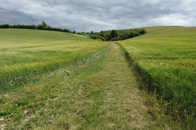
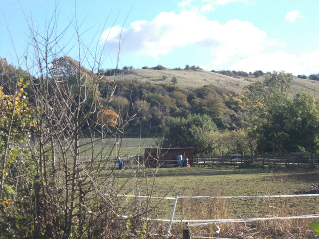
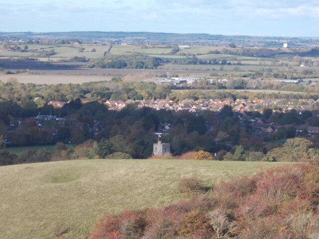
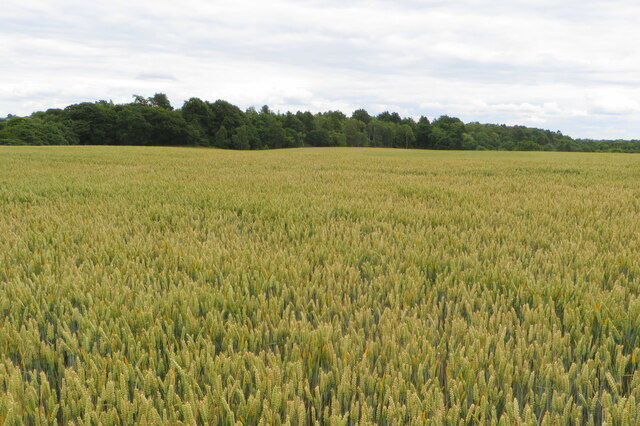
Bartonhill Cutting is a picturesque natural landscape located in Bedfordshire, England. Situated in the Downs region, this area is characterized by its rolling hills and vast moorland. The cutting itself is a deep, narrow valley that has been formed by years of erosion from various natural forces.

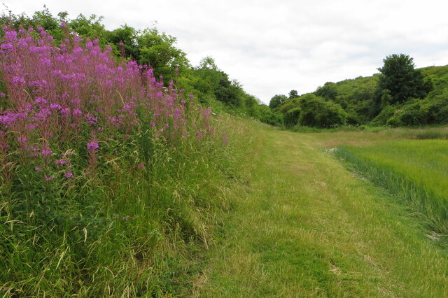
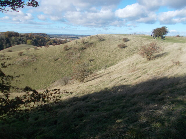
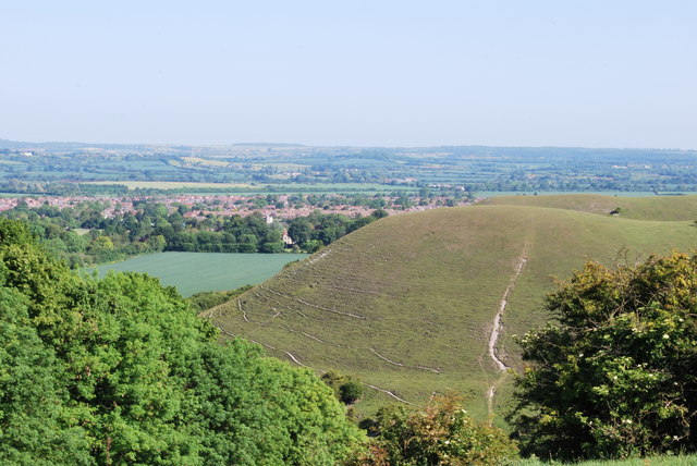
The landscape of Bartonhill Cutting is diverse and offers a unique blend of natural features. The area is covered in lush green grasses, wildflowers, and heather, creating a colorful and vibrant scene. The cutting is flanked by steep slopes on both sides, which are covered in dense woodland, further adding to the beauty of the location.

A small stream meanders through the bottom of the cutting, providing a serene and peaceful atmosphere. The stream is home to various species of freshwater fish and is often frequented by local wildlife, including birds, rabbits, and deer. This makes Bartonhill Cutting a popular spot for nature enthusiasts, birdwatchers, and photographers.

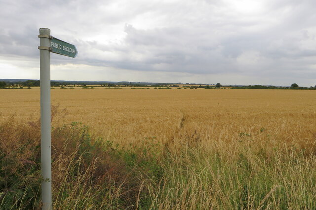
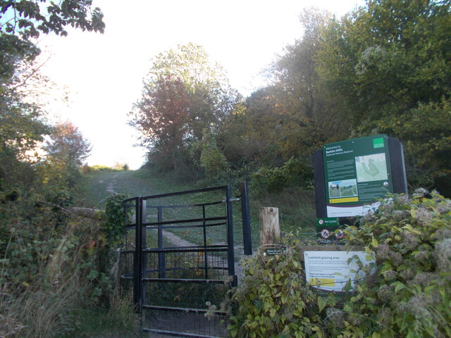
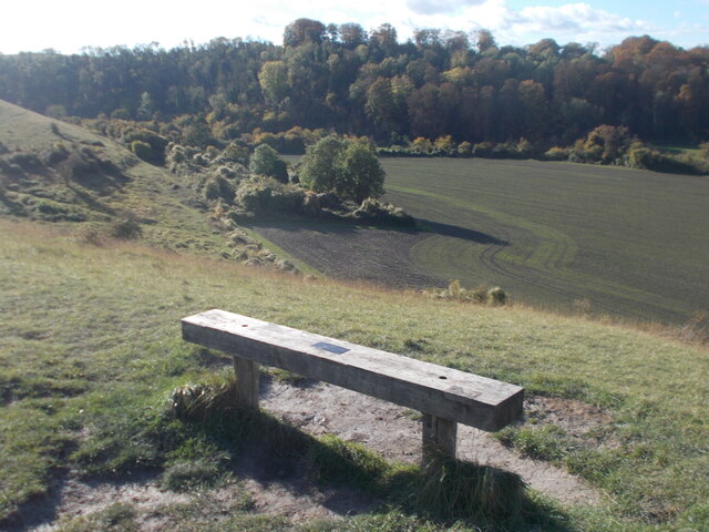
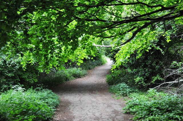
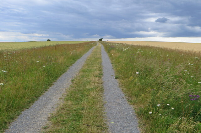
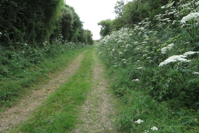
The cutting itself offers a network of walking trails and footpaths, allowing visitors to explore the area and enjoy the stunning vistas. The trails wind through the moorland and take visitors to viewpoints that offer panoramic views of the surrounding countryside.

Bartonhill Cutting is a true hidden gem in Bedfordshire, offering a peaceful retreat from the hustle and bustle of daily life. With its diverse landscape, abundance of wildlife, and tranquil ambiance, it is a must-visit destination for anyone seeking to connect with nature and enjoy the beauty of the English countryside.

If you have any feedback on the listing, please let us know in the comments section below.

Bartonhill Cutting Images

Images are sourced within 2km of 51.95948/-0.42888512 or Grid Reference TL0830. Thanks to Geograph Open Source API. All images are credited.

Cafe Goa Restaurant, Barton-le-Clay
The Bull public house, Barton-le-Clay
Houses on Mill Lane
Houses on Mill Lane
Houses on Brookend Drive
Bridleway going up the hill
Path through the barley At least on the map it is
Path through the barley
At least on the map it is
Wild flowers by the side of the bridleway
Barton-le-Clay village sign Barton-le-Clay is a village in Bedfordshire. More details on this link including a photo of the village sign ! <span class="nowrap"><a title="https://en.wikipedia.org/wiki/Barton-le-Clay" rel="nofollow ugc noopener" href="https://en.wikipedia.org/wiki/Barton-le-Clay">Link</a><img style="margin-left:2px;" alt="External link" title="External link - shift click to open in new window" src="https://s1.geograph.org.uk/img/external.png" width="10" height="10"/></span>
Barton-le-Clay village sign
Barton-le-Clay is a village in Bedfordshire. More details on this link including a photo of the village sign ! LinkExternal link
Church at Barton-le-Clay Chequer-board stonework is seen on the outer facade of the building.
Church at Barton-le-Clay
Chequer-board stonework is seen on the outer facade of the building.
Barton Hills in view from Barton-le-Clay A steady climb uphill leads away from the village which is soon seen below in retrospect.
Barton Hills in view from Barton-le-Clay
A steady climb uphill leads away from the village which is soon seen below in retrospect.
Gate and sign for Barton Hills Nature Reserve
Bench view with Sharpenhoe Clapper in the background Across the road divide of the Bartonhill cutting, the wooded hillfort of Sharpenhoe Clapper is seen on the distant horizon.
Bench view with Sharpenhoe Clapper in the background
Across the road divide of the Bartonhill cutting, the wooded hillfort of Sharpenhoe Clapper is seen on the distant horizon.
Church in sunshine among the trees A distant glimpse of the church at Barton-le-Clay from the Barton Hills.
Church in sunshine among the trees
A distant glimpse of the church at Barton-le-Clay from the Barton Hills.
Sharpenhoe Clappers The pathway through the woods at Sharpenhoe Clappers
Sharpenhoe Clappers
The pathway through the woods at Sharpenhoe Clappers
Bridleway to Barton Hills
Climbing up the bridleway
Looking over the wheat towards Ravensburgh Castle (fort)
Walkers on the Barton Hills
Show me another place!

Bartonhill Cutting is located at Grid Ref: TL0830 (Lat: 51.95948, Lng: -0.42888512)

Unitary Authority: Central Bedfordshire

Police Authority: Bedfordshire

What 3 Words

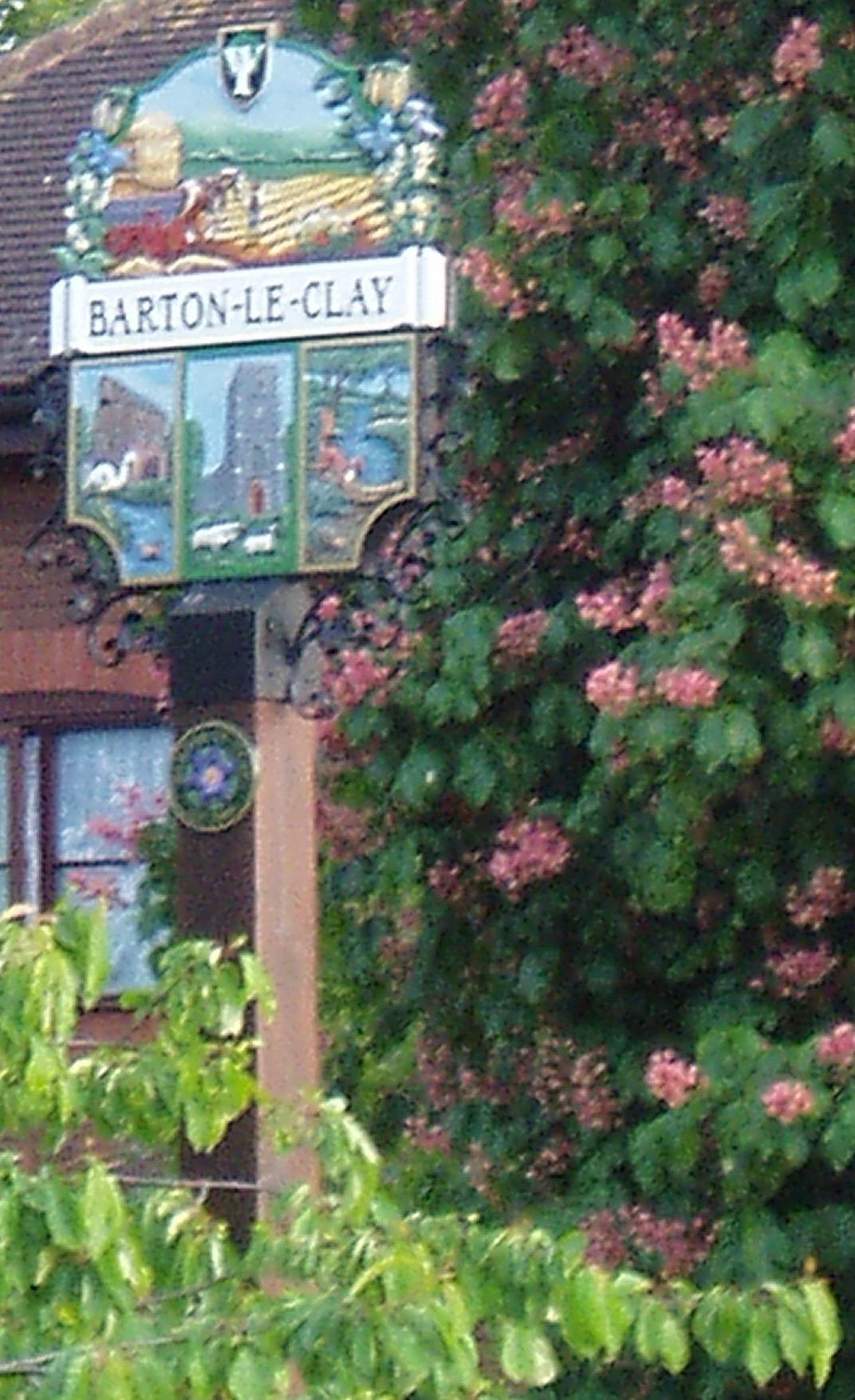
///nipped.dull.essay. Near Barton-le-Clay, Bedfordshire

Related Wikis

Barton Rovers F.C.

Barton Rovers Football Club is a semi-professional football club based in Barton-le-Clay, Bedfordshire, England. The club are currently members of the...

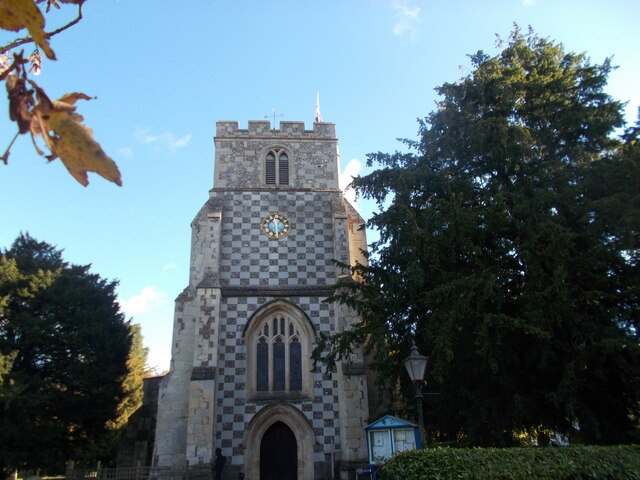
Church of St Nicholas, Barton le Clay

Church of St Nicholas is a Grade I listed church in Barton le Clay, Bedfordshire, England. It became a listed building on 3 February 1967. == History... ==

Barton Hills, Bedfordshire

Barton Hills are situated southeast of the village of Barton-le-Clay in the English county of Bedfordshire. They are part of the Chilterns and hiking...

Barton-le-Clay

Barton-le-Clay is a large village and a civil parish in the Central Bedfordshire Borough in Bedfordshire, England, bordering Hertfordshire. The village...

Nearby Amenities

Located within 500m of 51.95948,-0.42888512
Access: designated
Barrier: chicane
Bicycle: no
Foot: yes
Horse: no
Motor Vehicle: no
Source: GPS;survey
Lat/Long: 51.9613489/-0.4234604
Turning Circle
Turning Circle: knuckle
Lat/Long: 51.9607031/-0.4279523
Turning Circle
Turning Circle: hammer
Lat/Long: 51.9622704/-0.4266414
Communication Mobile Phone: yes
Man Made: mast
Tower Type: communication
Lat/Long: 51.9637567/-0.4290315
Parking
Lat/Long: 51.962554/-0.4340247
Post Box
Brand: Royal Mail
Brand Wikidata: Q638098
Brand Wikipedia: en:Royal Mail
Collection Times: Mo-Fr 16:15; Sa 10:00
Operator: Royal Mail
Operator Wikidata: Q638098
Post Box Type: lamp
Ref: MK45 207
Royal Cypher: EIIR
Royal Cypher Wikidata: Q33102113
Source: survey
Lat/Long: 51.9633216/-0.4260458
Access: yes
Barrier: kissing_gate
Bicycle: no
Foot: yes
Horse: no
Motor Vehicle: no
Note: RADAR gate
Source: GPS
Lat/Long: 51.9604882/-0.4219548
Barton Hills NNR
Tourism: information
Lat/Long: 51.9591116/-0.421926
Parking
Access: yes
Capacity: 20
Fee: no
Operator: Roadside, free parking
Surface: grass
Lat/Long: 51.9621258/-0.4254328
Barton Hills NNR Entrance
Information: board
Tourism: information
Lat/Long: 51.9591875/-0.4241008
Barton Hills Entrance
Leisure: park
Lat/Long: 51.9595802/-0.4261433
Turning Circle
Turning Circle: y-head
Lat/Long: 51.9605674/-0.4275477
Direction: 155
Generator Method: photovoltaic
Generator Output Electricity: yes
Generator Solar Modules: 40
Generator Source: solar
Generator Type: solar_photovoltaic_panel
Location: roof
Power: generator
Lat/Long: 51.9575986/-0.4299369
Direction: 185
Generator Method: photovoltaic
Generator Output Electricity: yes
Generator Solar Modules: 20
Generator Source: solar
Generator Type: solar_photovoltaic_panel
Location: roof
Power: generator
Lat/Long: 51.9602889/-0.4274641
Direction: 185
Generator Method: photovoltaic
Generator Output Electricity: yes
Generator Solar Modules: 19
Generator Source: solar
Generator Type: solar_photovoltaic_panel
Location: roof
Power: generator
Lat/Long: 51.9602666/-0.4272977
Direction: 200
Generator Method: photovoltaic
Generator Output Electricity: yes
Generator Solar Modules: 16
Generator Source: solar
Generator Type: solar_photovoltaic_panel
Location: roof
Power: generator
Lat/Long: 51.9604549/-0.4269631
Turning Circle
Turning Circle: knuckle
Lat/Long: 51.9614146/-0.4285703
Direction: forward
Traffic Calming: chicane
Lat/Long: 51.9615004/-0.429534
Traffic Calming: cushion
Lat/Long: 51.9615084/-0.4295268
Direction: backward
Traffic Calming: chicane
Lat/Long: 51.9616486/-0.4294012
Traffic Calming: cushion
Lat/Long: 51.9616355/-0.4294129
Give Way
Direction: forward
Lat/Long: 51.9614384/-0.4295895
Turning Circle
Turning Circle: knuckle
Lat/Long: 51.9619832/-0.4274238
Give Way
Direction: forward
Lat/Long: 51.9633028/-0.4258316
Direction: 210
Generator Method: photovoltaic
Generator Output Electricity: yes
Generator Solar Modules: 10
Generator Source: solar
Generator Type: solar_photovoltaic_panel
Location: roof
Power: generator
Lat/Long: 51.9625997/-0.4281908
Traffic Calming: table
Lat/Long: 51.9634449/-0.4277931
Colour: yellow
Marker: post
Material: concrete
Utility: gas
Lat/Long: 51.9577182/-0.4330435
Colour: yellow
Marker: post
Material: plastic
Utility: gas
Lat/Long: 51.9576424/-0.4331122
Colour: red and white
Marker: aerial
Material: plastic
Utility: gas
Lat/Long: 51.9576469/-0.4331231
Colour: red and white
Marker: aerial
Material: plastic
Utility: gas
Lat/Long: 51.9575938/-0.4329747
Colour: red and white
Marker: aerial
Material: plastic
Utility: gas
Lat/Long: 51.9578688/-0.4356745
Give Way
Lat/Long: 51.9593519/-0.4317594
Give Way
Lat/Long: 51.9589416/-0.4319112
The data included in this document is from www.openstreetmap.org. The data is made available under ODbL.

Have you been to Bartonhill Cutting?

Leave your review of Bartonhill Cutting below (or comments, questions and feedback).