Oldhill Wood

Downs, Moorland in Bedfordshire

England

Oldhill Wood

Footpath through Whipsnade Heath Woods The path goes uphill through the woods towards Kensworth.
Footpath through Whipsnade Heath Woods Credit: Bob Walters

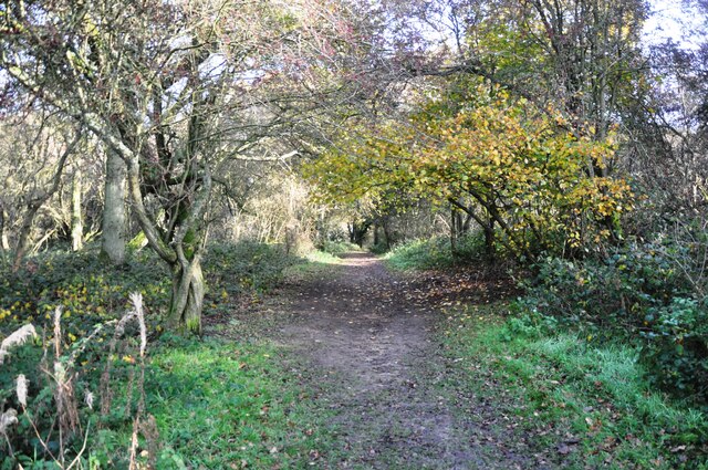
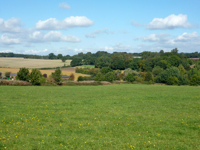
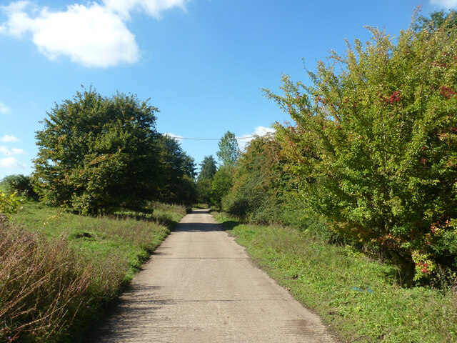
Oldhill Wood is a picturesque woodland located in the county of Bedfordshire, England. Situated on the outskirts of the village of Downs, this woodland covers an area of approximately 50 hectares. The wood is characterized by its diverse range of plant and animal species, making it a popular destination for nature lovers and wildlife enthusiasts.

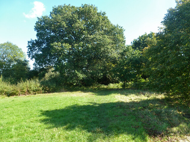
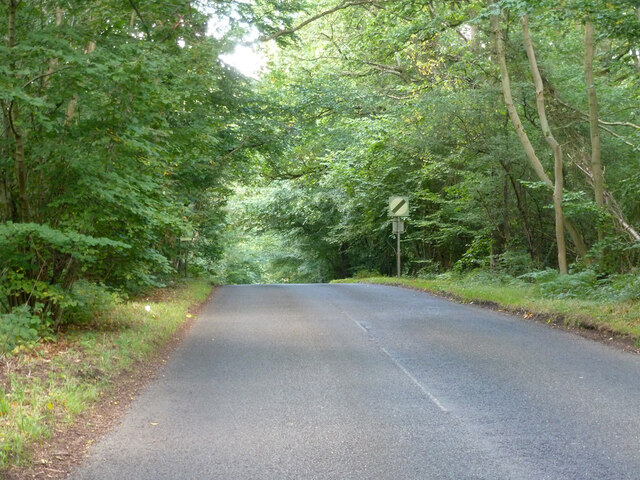
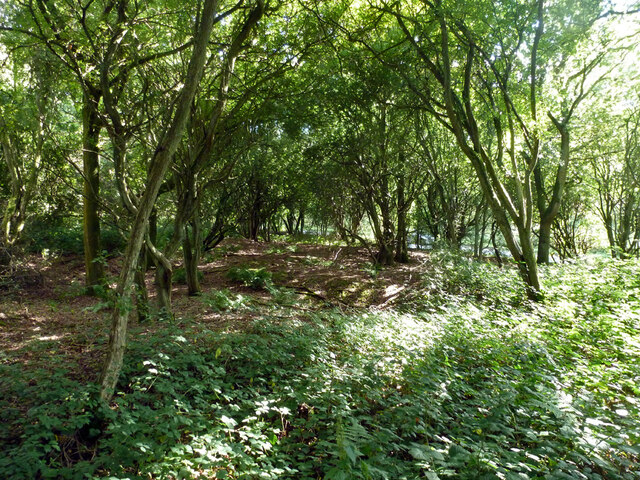
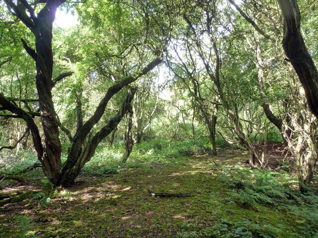
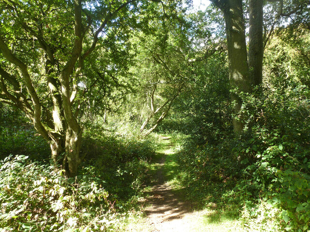
The wood is predominantly composed of oak and beech trees, with some areas also featuring birch, hazel, and holly. The dense canopy of the trees creates a shaded and tranquil atmosphere, providing a perfect escape from the hustle and bustle of urban life.

Oldhill Wood is known for its rich biodiversity, with various species of birds, mammals, and insects inhabiting the area. Birdwatchers can spot species such as woodpeckers, tits, and thrushes, while small mammals like squirrels, foxes, and badgers can be observed foraging among the undergrowth. The wood is also home to a variety of butterflies, bees, and other insects, contributing to the overall ecological value of the area.

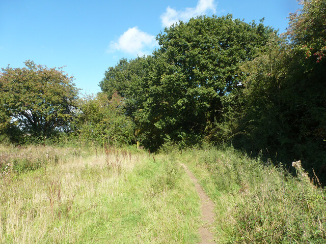
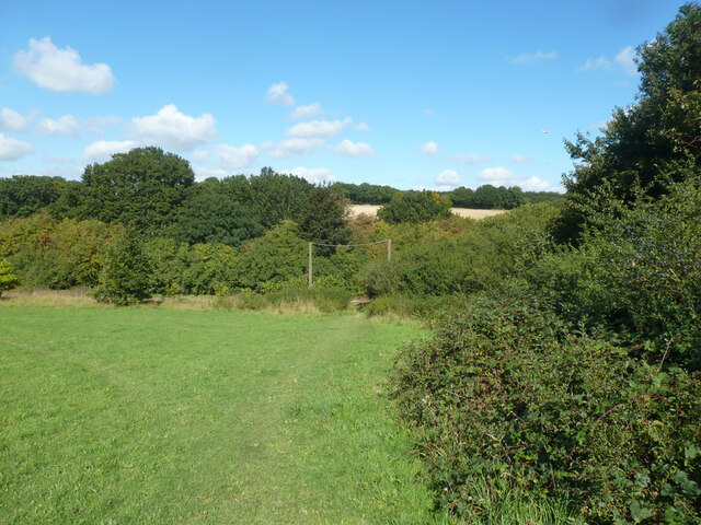
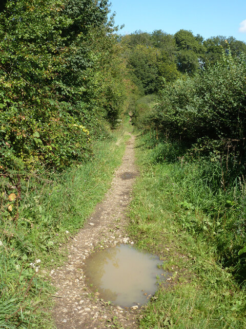
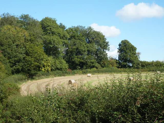
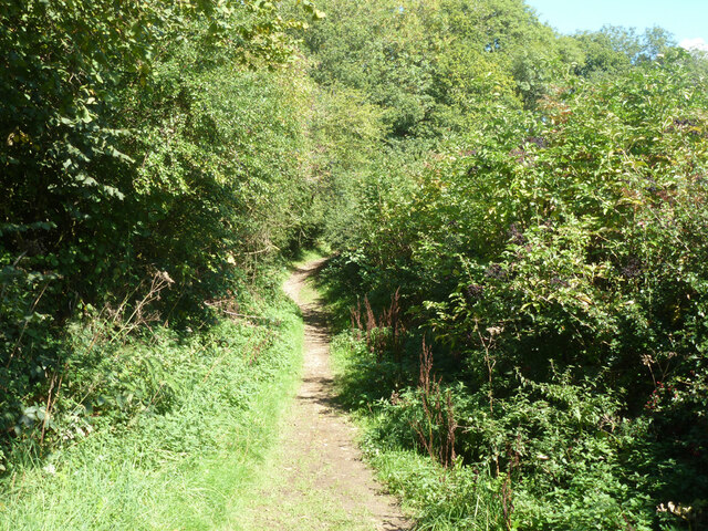
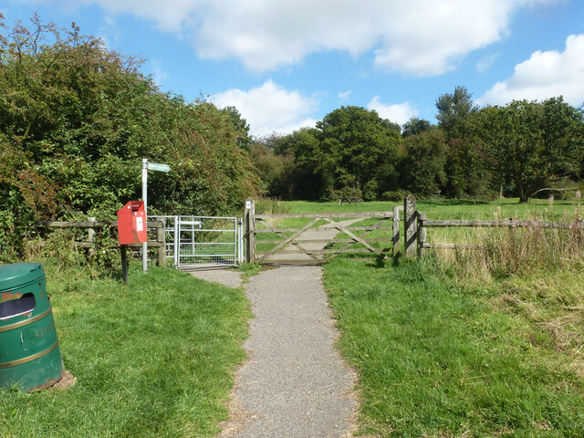
Visitors to Oldhill Wood can enjoy a network of well-maintained walking trails that wind their way through the woodlands. These trails offer stunning views of the surrounding countryside and provide an opportunity to explore the different habitats within the wood, including areas of moorland and open grassland.

Overall, Oldhill Wood in Bedfordshire offers a unique natural experience, combining the beauty of ancient woodlands with the charm of moorland and grassland habitats. It is a haven for wildlife and a place of tranquility for those seeking to immerse themselves in nature.

If you have any feedback on the listing, please let us know in the comments section below.
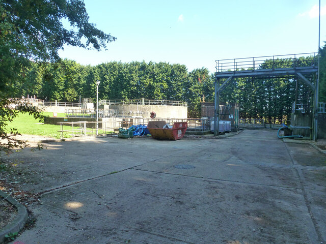
Oldhill Wood Images

Images are sourced within 2km of 51.840286/-0.5125257 or Grid Reference TL0216. Thanks to Geograph Open Source API. All images are credited.

Footpath through Whipsnade Heath Woods The path goes uphill through the woods towards Kensworth.
Footpath through Whipsnade Heath Woods
The path goes uphill through the woods towards Kensworth.
Whipsnade - St Mary Magdalene Church
Clements End Road Towards Studham.
Clements End Road
Towards Studham.
Byslips Road Towards Dunstable.
Byslips Road
Towards Dunstable.
Studham Common and view north Most of the common is a large area of grassland.
Studham Common and view north
Most of the common is a large area of grassland.
SE corner of Studham Common Public footpaths follow both margins of the common, which has public access anyway.
SE corner of Studham Common
Public footpaths follow both margins of the common, which has public access anyway.
Footpath towards Studham Common The SE corner of the common is beyond the hedge ahead.
Footpath towards Studham Common
The SE corner of the common is beyond the hedge ahead.
NE corner of Studham Common Public footpaths follow both margins of the open common, which has public access anyway.
NE corner of Studham Common
Public footpaths follow both margins of the open common, which has public access anyway.
Studham sewage works Plated on the gate as 'Studham STW  STUDS1ZZ' by Thames Water.
Studham sewage works
Plated on the gate as 'Studham STW STUDS1ZZ' by Thames Water.
Roe End Lane Technically a full public highway of some sort, but in practice a footpath.
Roe End Lane
Technically a full public highway of some sort, but in practice a footpath.
Harvested field corner by Roe End Lane
Roe End Lane Technically a full public highway of some sort, but in practice a footpath.
Roe End Lane
Technically a full public highway of some sort, but in practice a footpath.
Studham sewage works road The access route to Studham sewage works runs along the northern edge of the open part of Studham Common. To the right is a belt of densely wooded common land.
Studham sewage works road
The access route to Studham sewage works runs along the northern edge of the open part of Studham Common. To the right is a belt of densely wooded common land.
Byslips Road heading north Deadmansey Wood on the right.
Byslips Road heading north
Deadmansey Wood on the right.
Path onto Whipsnade Heath Although mostly secondary woodland, there is a pleasant open area with a picnic table.
Path onto Whipsnade Heath
Although mostly secondary woodland, there is a pleasant open area with a picnic table.
Woodland, Whipsnade Heath Most of the heath is now this sort of woodland.
Woodland, Whipsnade Heath
Most of the heath is now this sort of woodland.
Woodland, Whipsnade Heath Most of the heath is now this sort of woodland.
Woodland, Whipsnade Heath
Most of the heath is now this sort of woodland.
Woodland, Whipsnade Heath
Show me another place!

Oldhill Wood is located at Grid Ref: TL0216 (Lat: 51.840286, Lng: -0.5125257)

Unitary Authority: Central Bedfordshire

Police Authority: Bedfordshire

What 3 Words

///among.oldest.moved. Near Kensworth, Bedfordshire

Related Wikis

Studham

Studham is a village and civil parish in the county of Bedfordshire. It has a population of 1,182. The parish bounds to the south of the Buckinghamshire...

Holywell, Bedfordshire

Holywell is a hamlet located in the Central Bedfordshire district of Bedfordshire, England. The settlement is close to Whipsnade and Studham, and Holywell...

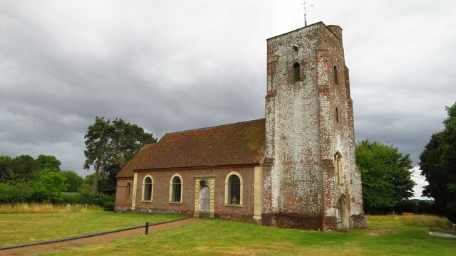
Church of St Mary, Studham

Church of St Mary is a Grade I listed church in Studham, Bedfordshire, England. It became a listed building on 3 February 1967. == See also == Grade...

Kensworth

Kensworth is a village and civil parish located in the Central Bedfordshire district of Bedfordshire, England. The parish is located on the edge of Dunstable...

Nearby Amenities

Located within 500m of 51.840286,-0.5125257
The data included in this document is from www.openstreetmap.org. The data is made available under ODbL.

Have you been to Oldhill Wood?

Leave your review of Oldhill Wood below (or comments, questions and feedback).