Bagmoor Common

Downs, Moorland in Surrey Waverley

England

Bagmoor Common

Barn at Oxenford Grange It was built in 1843 by Augustus Welby Northmore Pugin in Medieval Gothic style of sandstone rubble with ashlar dressings. It has a plain tiled roof, part restored, with ridge cresting and gable end pinnacles. It is rectangular, with pentice roofed aisle extensions to side. There are five bays with gabled, opposing, entrances to centre, offset flanking buttresses and octagonal gable finial. There are rectangular breathers to both and sides, three to either side alternating with buttresses. There are double doors to centre on both sides with stable doors to side. Interior - main roof trusses on corbels with cross braced roof <span class="nowrap"><a title="https://www.britishlistedbuildings.co.uk/101334359" rel="nofollow ugc noopener" href="https://www.britishlistedbuildings.co.uk/101334359">Link</a><img style="margin-left:2px;" alt="External link" title="External link - shift click to open in new window" src="https://s1.geograph.org.uk/img/external.png" width="10" height="10"/></span>
Barn at Oxenford Grange Credit: John Baker

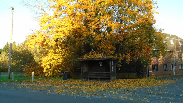
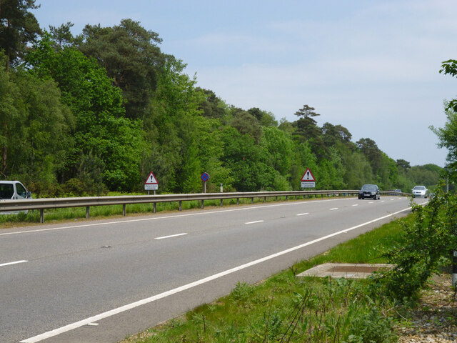
Bagmoor Common is a picturesque area located in Surrey, England. Covering a vast expanse of land, it consists of a combination of downs and moorland, offering visitors a diverse and captivating natural landscape. The common is situated in close proximity to the village of Bagmoor, which adds to its charm and accessibility.

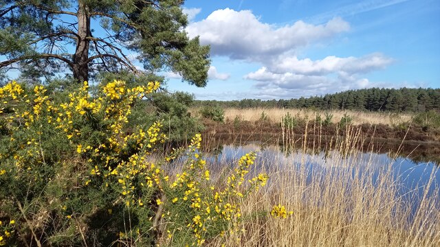
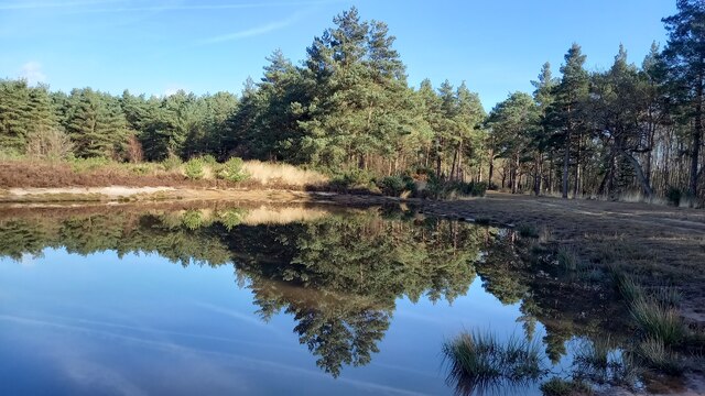
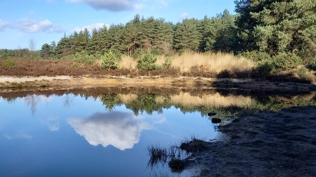
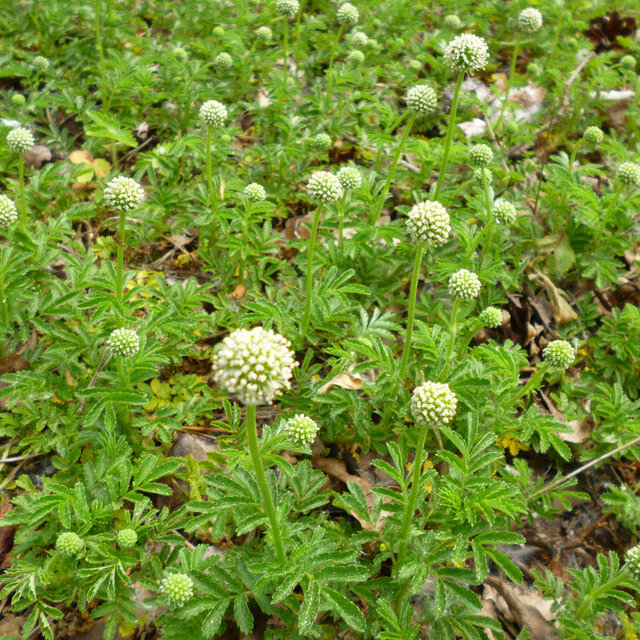
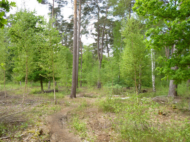
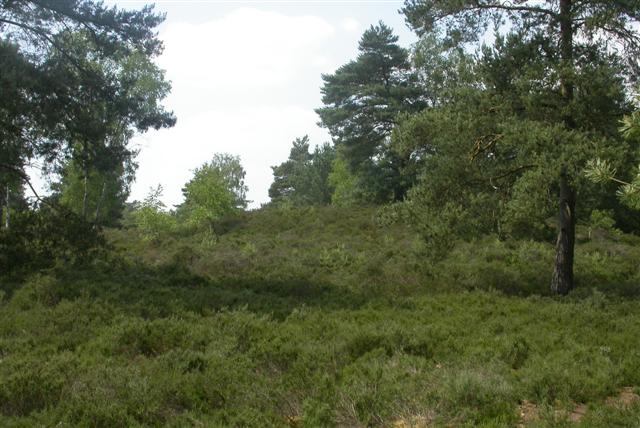
The downs in Bagmoor Common are characterized by their gently rolling hills, covered in lush grass and dotted with wildflowers. These open spaces provide a serene and peaceful atmosphere, making them ideal for leisurely walks and picnics. The moorland, on the other hand, is more rugged and untamed, featuring heather-covered hills, interspersed with pockets of dense woodland.

The common is home to a variety of flora and fauna, making it a haven for nature enthusiasts and wildlife lovers. Visitors can spot a wide range of bird species, including skylarks, kestrels, and buzzards, soaring high above the common. Additionally, various wild animals such as rabbits, foxes, and deer can be spotted foraging amidst the undergrowth.

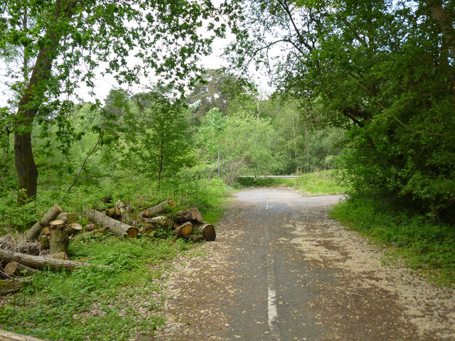
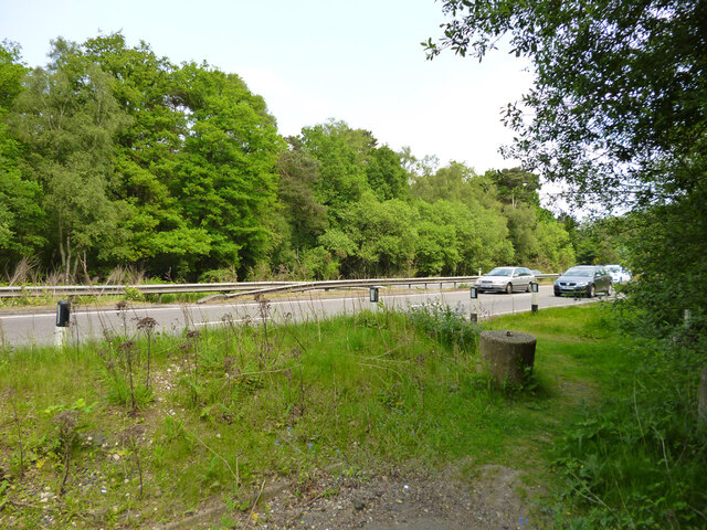
Bagmoor Common also boasts several walking trails and footpaths, allowing visitors to explore its beauty at their own pace. These trails offer stunning views of the surrounding countryside, including the nearby Bagmoor Village and the distant Surrey Hills. The common is also a popular destination for photography, as it provides ample opportunities to capture the natural beauty of the area.

In summary, Bagmoor Common in Surrey is a captivating natural landscape, combining downs and moorland to create a diverse and scenic environment. With its abundance of wildlife, walking trails, and stunning views, it is a must-visit destination for anyone seeking a peaceful and immersive experience in nature.

If you have any feedback on the listing, please let us know in the comments section below.

Bagmoor Common Images

Images are sourced within 2km of 51.172766/-0.67510679 or Grid Reference SU9242. Thanks to Geograph Open Source API. All images are credited.

Barn at Oxenford Grange It was built in 1843 by Augustus Welby Northmore Pugin in Medieval Gothic style of sandstone rubble with ashlar dressings. It has a plain tiled roof, part restored, with ridge cresting and gable end pinnacles. It is rectangular, with pentice roofed aisle extensions to side. There are five bays with gabled, opposing, entrances to centre, offset flanking buttresses and octagonal gable finial. There are rectangular breathers to both and sides, three to either side alternating with buttresses. There are double doors to centre on both sides with stable doors to side. Interior - main roof trusses on corbels with cross braced roof <span class="nowrap"><a title="https://www.britishlistedbuildings.co.uk/101334359" rel="nofollow ugc noopener" href="https://www.britishlistedbuildings.co.uk/101334359">Link</a><img style="margin-left:2px;" alt="External link" title="External link - shift click to open in new window" src="https://s1.geograph.org.uk/img/external.png" width="10" height="10"/></span>
Barn at Oxenford Grange
It was built in 1843 by Augustus Welby Northmore Pugin in Medieval Gothic style of sandstone rubble with ashlar dressings. It has a plain tiled roof, part restored, with ridge cresting and gable end pinnacles. It is rectangular, with pentice roofed aisle extensions to side. There are five bays with gabled, opposing, entrances to centre, offset flanking buttresses and octagonal gable finial. There are rectangular breathers to both and sides, three to either side alternating with buttresses. There are double doors to centre on both sides with stable doors to side. Interior - main roof trusses on corbels with cross braced roof LinkExternal link
Chippie in Portsmouth Road Fish and chip shops are a great British institution. In the 16th century Iberian refugees in London began selling white fish fried in a thin coat of flour. Friday became a particularly busy day as both Jews and Catholics wanted cooked fish that day. A hundred years later, Hugenots brought their fondness for fried potato to the capital. Joseph Malin opened the first chippy in Bethnal Green during the 1860s. Today there are more than 10,000 in England alone.
Chippie in Portsmouth Road
Fish and chip shops are a great British institution. In the 16th century Iberian refugees in London began selling white fish fried in a thin coat of flour. Friday became a particularly busy day as both Jews and Catholics wanted cooked fish that day. A hundred years later, Hugenots brought their fondness for fried potato to the capital. Joseph Malin opened the first chippy in Bethnal Green during the 1860s. Today there are more than 10,000 in England alone.
Bus stop at the junction of Guildford and Portsmouth Roads Bus stops range from a simple sign with the number of the bus and the company operating the service to elaborate structures that have an architectural pedigree all of their own. These days they are often linked via computer to the bus and the depot and display the waiting time in minutes.
Bus stop at the junction of Guildford and Portsmouth Roads
Bus stops range from a simple sign with the number of the bus and the company operating the service to elaborate structures that have an architectural pedigree all of their own. These days they are often linked via computer to the bus and the depot and display the waiting time in minutes.
Elstead Common Nature reserve with blooming gorse beside a heathland pond.
Elstead Common
Nature reserve with blooming gorse beside a heathland pond.
Elstead Common - Pond Nature reserve and heathland - reflective scene on the edge of coniferous woodland.
Elstead Common - Pond
Nature reserve and heathland - reflective scene on the edge of coniferous woodland.
Elstead Common Small pond on heathland in a nature reserve.
Elstead Common
Small pond on heathland in a nature reserve.
Pirri-pirri bur, Acaena novae-zelandiae An alien from New Zealand. The bur stage comes later as the seeds form.  It has clover-like flower heads, but the tiny flowers are not clover-like, nor are the leaves. I have only seen this in similar Surrey locations e.g. <a href="https://www.geograph.org.uk/photo/4971923">SU9167 : Plant in Swinley Forest</a>, although it apparently crops up quite widely.
Pirri-pirri bur, Acaena novae-zelandiae
An alien from New Zealand. The bur stage comes later as the seeds form. It has clover-like flower heads, but the tiny flowers are not clover-like, nor are the leaves. I have only seen this in similar Surrey locations e.g. SU9167 : Plant in Swinley Forest, although it apparently crops up quite widely.
Former Webb Road No longer a road connecting with the A3 beyond, now a bridleway.
Former Webb Road
No longer a road connecting with the A3 beyond, now a bridleway.
End of bridleway 593 and A3 crossing point, Witley Common Bridleway 593 was formerly Webb Road. There is a hazardous crossing point here of the busy dual carriageway to a path parallel with the A3 on the other side.
End of bridleway 593 and A3 crossing point, Witley Common
Bridleway 593 was formerly Webb Road. There is a hazardous crossing point here of the busy dual carriageway to a path parallel with the A3 on the other side.
Witley Common A largely wooded public access common.
Witley Common
A largely wooded public access common.
A3 approaching pedestrian crossing point This is all the protection pedestrians get at the crossing point seen in <a href="https://www.geograph.org.uk/photo/7267969">SU9341 : End of bridleway 593 and A3 crossing point, Witley Common</a>.
A3 approaching pedestrian crossing point
This is all the protection pedestrians get at the crossing point seen in SU9341 : End of bridleway 593 and A3 crossing point, Witley Common.
Milford - war memorial By St. John's church on Church Road.
Milford - war memorial
By St. John's church on Church Road.
St. John's church, Milford
Milford Pharmacy On Portsmouth Road.
Milford Pharmacy
On Portsmouth Road.
St. Joseph's Catholic Church, Milford
Lamp at the Pharmacy A remarkable ornate lamp outside Milford Pharmacy on Portsmouth Road.
Lamp at the Pharmacy
A remarkable ornate lamp outside Milford Pharmacy on Portsmouth Road.
Church and Swings, Milford St John's Church viewed from a nearby park.
Church and Swings, Milford
St John's Church viewed from a nearby park.
Red Brick Housing, Portsmouth Road The nearest house has the tiled upper walls which are quite often seen on older houses. Fancy brickwork on the chimneys of the ones at the end.
Red Brick Housing, Portsmouth Road
The nearest house has the tiled upper walls which are quite often seen on older houses. Fancy brickwork on the chimneys of the ones at the end.
Show me another place!

Bagmoor Common is located at Grid Ref: SU9242 (Lat: 51.172766, Lng: -0.67510679)

Administrative County: Surrey

District: Waverley

Police Authority: Surrey

What 3 Words

///league.onto.dabbling. Near Milford, Surrey

Related Wikis

Elstead Group of Commons

Elstead Group of Commons is a 180-hectare (440-acre) nature reserve east of Elstead in Surrey. It is composed of Royal, Elstead and Ockley Commons, which...

Rodborough Common, Surrey

Rodborough Common is a 62.2-hectare (154-acre) Local Nature Reserve west of Milford in Surrey. It is owned by Surrey County Council and managed by Surrey...

Oxenford Farm

Oxenford Farm is a former abbey farm, a dependency of Waverley Abbey in the civil parish of Witley, Surrey, England, with several listed buildings around...

Milford, Surrey

Milford is a village in the civil parish of Witley south west of Godalming in Surrey, England that was a small village in the early medieval period — it...

Elstead

Elstead is a civil parish in Surrey, England with shops, houses and cottages spanning the north and south sides of the River Wey; development is concentrated...

Witley Camp

Witley Military Camp, often simplified to Camp Witley, was a temporary army camp set up on Witley Common, Surrey, England during both the First and Second...

Witley Common

Witley Common is an area of woodland and heath, close to Witley, Surrey, in the United Kingdom. It is part of a much larger Site of Special Scientific...

Rodborough School

Rodborough School is a coeducational secondary school with academy status, located in Milford, Surrey, England. The school is a feeder school for Godalming...

Nearby Amenities

Located within 500m of 51.172766,-0.67510679
Power: pole
Lat/Long: 51.1742794/-0.6808212
Power: pole
Lat/Long: 51.1740955/-0.6790955
Power: pole
Lat/Long: 51.1739338/-0.6772494
Power: pole
Lat/Long: 51.1738705/-0.6755553
Power: pole
Lat/Long: 51.1736114/-0.6736794
Power: pole
Lat/Long: 51.1734515/-0.6721874
Power: pole
Lat/Long: 51.1733362/-0.6709645
Power: pole
Lat/Long: 51.1733784/-0.66918
Power: tower
Lat/Long: 51.1735894/-0.669278
Power: tower
Lat/Long: 51.1729571/-0.6770457
The data included in this document is from www.openstreetmap.org. The data is made available under ODbL.

Have you been to Bagmoor Common?

Leave your review of Bagmoor Common below (or comments, questions and feedback).