Bagmoor Wood

Wood, Forest in Surrey Waverley

England

Bagmoor Wood

Barn at Oxenford Grange It was built in 1843 by Augustus Welby Northmore Pugin in Medieval Gothic style of sandstone rubble with ashlar dressings. It has a plain tiled roof, part restored, with ridge cresting and gable end pinnacles. It is rectangular, with pentice roofed aisle extensions to side. There are five bays with gabled, opposing, entrances to centre, offset flanking buttresses and octagonal gable finial. There are rectangular breathers to both and sides, three to either side alternating with buttresses. There are double doors to centre on both sides with stable doors to side. Interior - main roof trusses on corbels with cross braced roof <span class="nowrap"><a title="https://www.britishlistedbuildings.co.uk/101334359" rel="nofollow ugc noopener" href="https://www.britishlistedbuildings.co.uk/101334359">Link</a><img style="margin-left:2px;" alt="External link" title="External link - shift click to open in new window" src="https://s1.geograph.org.uk/img/external.png" width="10" height="10"/></span>
Barn at Oxenford Grange Credit: John Baker

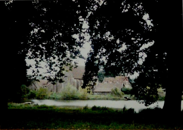
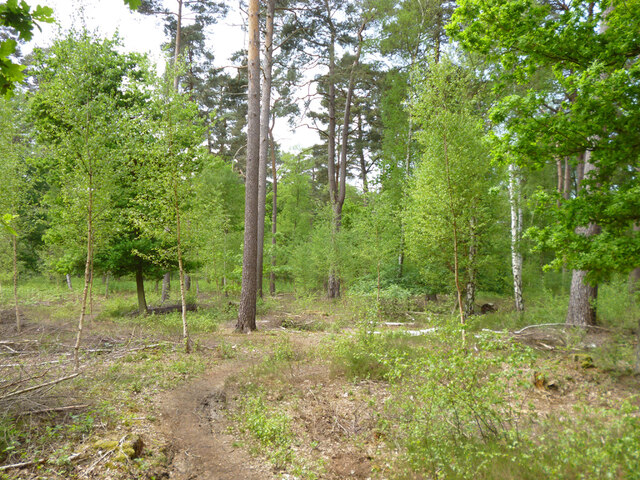
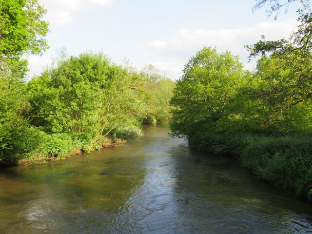
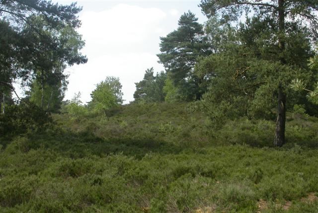
Bagmoor Wood is a picturesque woodland located in Surrey, England. Situated near the village of Bagmoor, it covers an area of approximately 100 acres and is classified as a Site of Special Scientific Interest (SSSI) due to its rich biodiversity.

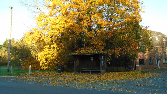
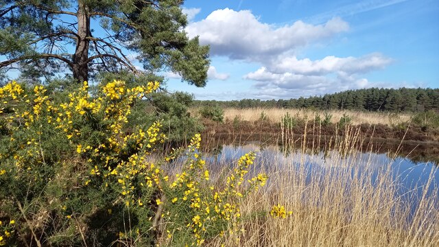
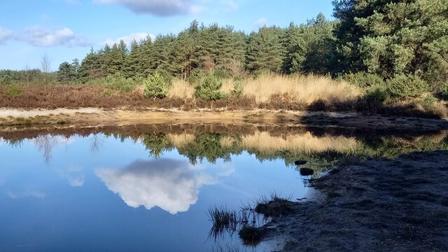
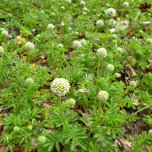
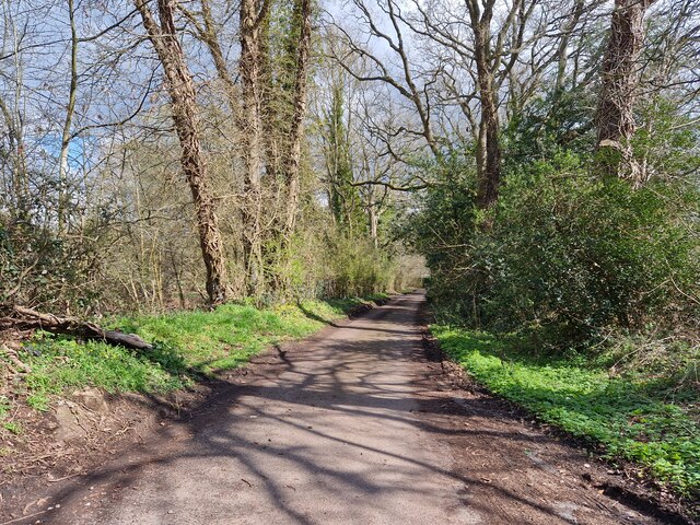
The wood is predominantly composed of native broadleaf trees, including oak, beech, and birch, which create a dense canopy that provides shade and shelter for a wide variety of wildlife. The forest floor is adorned with a carpet of bluebells during the spring, creating a stunning display of color.

Bagmoor Wood is renowned for its diverse bird population, with over 50 different species recorded within its boundaries. Visitors can spot woodpeckers, owls, and various songbirds, making it a popular destination for birdwatching enthusiasts. The wood is also home to a range of mammals, including deer, foxes, and badgers, which can be spotted if one is lucky.

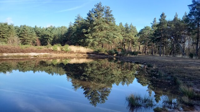
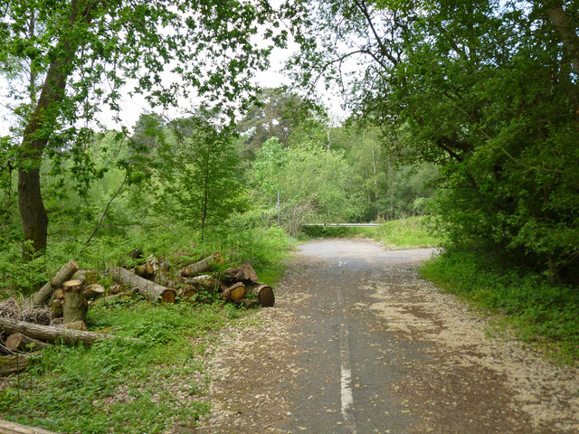
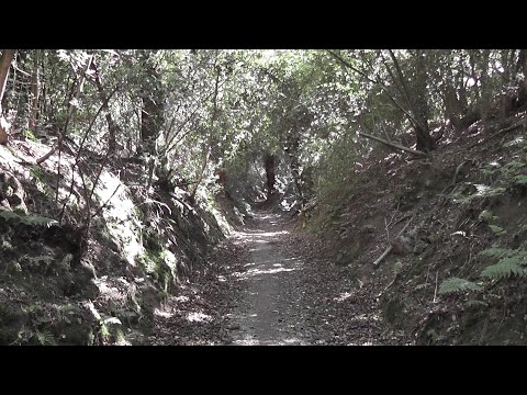
The woodland offers a network of well-maintained footpaths, allowing visitors to explore its natural beauty at their own pace. These paths wind through ancient trees, over babbling brooks, and past tranquil ponds, providing a serene and peaceful atmosphere. The wood is also accessible to wheelchair users, ensuring that everyone can enjoy its natural wonders.

Bagmoor Wood is managed by the local wildlife trust, which works to preserve and enhance its ecological value. The trust organizes guided walks and educational events to raise awareness about the importance of conservation.

Overall, Bagmoor Wood is a haven of tranquility and natural beauty, offering visitors the chance to immerse themselves in the captivating sights and sounds of a truly enchanting woodland environment.

If you have any feedback on the listing, please let us know in the comments section below.

Bagmoor Wood Images

Images are sourced within 2km of 51.175111/-0.67645585 or Grid Reference SU9242. Thanks to Geograph Open Source API. All images are credited.

Barn at Oxenford Grange It was built in 1843 by Augustus Welby Northmore Pugin in Medieval Gothic style of sandstone rubble with ashlar dressings. It has a plain tiled roof, part restored, with ridge cresting and gable end pinnacles. It is rectangular, with pentice roofed aisle extensions to side. There are five bays with gabled, opposing, entrances to centre, offset flanking buttresses and octagonal gable finial. There are rectangular breathers to both and sides, three to either side alternating with buttresses. There are double doors to centre on both sides with stable doors to side. Interior - main roof trusses on corbels with cross braced roof <span class="nowrap"><a title="https://www.britishlistedbuildings.co.uk/101334359" rel="nofollow ugc noopener" href="https://www.britishlistedbuildings.co.uk/101334359">Link</a><img style="margin-left:2px;" alt="External link" title="External link - shift click to open in new window" src="https://s1.geograph.org.uk/img/external.png" width="10" height="10"/></span>
Barn at Oxenford Grange
It was built in 1843 by Augustus Welby Northmore Pugin in Medieval Gothic style of sandstone rubble with ashlar dressings. It has a plain tiled roof, part restored, with ridge cresting and gable end pinnacles. It is rectangular, with pentice roofed aisle extensions to side. There are five bays with gabled, opposing, entrances to centre, offset flanking buttresses and octagonal gable finial. There are rectangular breathers to both and sides, three to either side alternating with buttresses. There are double doors to centre on both sides with stable doors to side. Interior - main roof trusses on corbels with cross braced roof LinkExternal link
Bus stop at the junction of Guildford and Portsmouth Roads Bus stops range from a simple sign with the number of the bus and the company operating the service to elaborate structures that have an architectural pedigree all of their own. These days they are often linked via computer to the bus and the depot and display the waiting time in minutes.
Bus stop at the junction of Guildford and Portsmouth Roads
Bus stops range from a simple sign with the number of the bus and the company operating the service to elaborate structures that have an architectural pedigree all of their own. These days they are often linked via computer to the bus and the depot and display the waiting time in minutes.
Elstead Common Nature reserve with blooming gorse beside a heathland pond.
Elstead Common
Nature reserve with blooming gorse beside a heathland pond.
Elstead Common - Pond Nature reserve and heathland - reflective scene on the edge of coniferous woodland.
Elstead Common - Pond
Nature reserve and heathland - reflective scene on the edge of coniferous woodland.
Elstead Common Small pond on heathland in a nature reserve.
Elstead Common
Small pond on heathland in a nature reserve.
Pirri-pirri bur, Acaena novae-zelandiae An alien from New Zealand. The bur stage comes later as the seeds form.  It has clover-like flower heads, but the tiny flowers are not clover-like, nor are the leaves. I have only seen this in similar Surrey locations e.g. <a href="https://www.geograph.org.uk/photo/4971923">SU9167 : Plant in Swinley Forest</a>, although it apparently crops up quite widely.
Pirri-pirri bur, Acaena novae-zelandiae
An alien from New Zealand. The bur stage comes later as the seeds form. It has clover-like flower heads, but the tiny flowers are not clover-like, nor are the leaves. I have only seen this in similar Surrey locations e.g. SU9167 : Plant in Swinley Forest, although it apparently crops up quite widely.
Former Webb Road No longer a road connecting with the A3 beyond, now a bridleway.
Former Webb Road
No longer a road connecting with the A3 beyond, now a bridleway.
End of bridleway 593 and A3 crossing point, Witley Common Bridleway 593 was formerly Webb Road. There is a hazardous crossing point here of the busy dual carriageway to a path parallel with the A3 on the other side.
End of bridleway 593 and A3 crossing point, Witley Common
Bridleway 593 was formerly Webb Road. There is a hazardous crossing point here of the busy dual carriageway to a path parallel with the A3 on the other side.
Witley Common A largely wooded public access common.
Witley Common
A largely wooded public access common.
A3 approaching pedestrian crossing point This is all the protection pedestrians get at the crossing point seen in <a href="https://www.geograph.org.uk/photo/7267969">SU9341 : End of bridleway 593 and A3 crossing point, Witley Common</a>.
A3 approaching pedestrian crossing point
This is all the protection pedestrians get at the crossing point seen in SU9341 : End of bridleway 593 and A3 crossing point, Witley Common.
St. Joseph's Catholic Church, Milford
Looking from New Road into Ladycross There have been 26,304 photos uploaded this year, of which 123 are mine (0.47 of the total)
Looking from New Road into Ladycross
There have been 26,304 photos uploaded this year, of which 123 are mine (0.47 of the total)
Springfield: early April 2023 (taken from the junction with Bankside Close)
Springfield: early April 2023
(taken from the junction with Bankside Close)
Looking eastwards in Ham Lane
Milford Road, Elstead, near Farnham Milford Road is on the route of the B3001 as it passes through the village of Elstead in Surrey.
Milford Road, Elstead, near Farnham
Milford Road is on the route of the B3001 as it passes through the village of Elstead in Surrey.
Road junction near Elstead, Surrey A road junction near the village of Elstead in Surrey.  The road to the right is the B3001, the road to the left is a minor unclassified road.
Road junction near Elstead, Surrey
A road junction near the village of Elstead in Surrey. The road to the right is the B3001, the road to the left is a minor unclassified road.
Weyburn Lane, Elstead, near Farnham Weyburn Lane forms part of a recent housing development on the site formerly occupied by Weyburn Works.  For an image taken in more-or-less the same place in 2009, see <a href="https://www.geograph.org.uk/photo/1608487">SU9243 : Weyburn Works entrance</a>
Weyburn Lane, Elstead, near Farnham
Weyburn Lane forms part of a recent housing development on the site formerly occupied by Weyburn Works. For an image taken in more-or-less the same place in 2009, see SU9243 : Weyburn Works entrance
River Wey near Elstead, Surrey A view of the River Wey near the village of Elstead in Surrey.
River Wey near Elstead, Surrey
A view of the River Wey near the village of Elstead in Surrey.
Show me another place!

Bagmoor Wood is located at Grid Ref: SU9242 (Lat: 51.175111, Lng: -0.67645585)

Administrative County: Surrey

District: Waverley

Police Authority: Surrey

What 3 Words

///boater.round.timed. Near Milford, Surrey

Related Wikis

Elstead Group of Commons

Elstead Group of Commons is a 180-hectare (440-acre) nature reserve east of Elstead in Surrey. It is composed of Royal, Elstead and Ockley Commons, which...

Oxenford Farm

Oxenford Farm is a former abbey farm, a dependency of Waverley Abbey in the civil parish of Witley, Surrey, England, with several listed buildings around...

Rodborough Common, Surrey

Rodborough Common is a 62.2-hectare (154-acre) Local Nature Reserve west of Milford in Surrey. It is owned by Surrey County Council and managed by Surrey...

Elstead

Elstead is a civil parish in Surrey, England with shops, houses and cottages spanning the north and south sides of the River Wey; development is concentrated...

Milford, Surrey

Milford is a village in the civil parish of Witley south west of Godalming in Surrey, England that was a small village in the early medieval period — it...

Peper Harow

Peper Harow is a rural village and civil parish in southwest Surrey close to the town of Godalming. It was a noted early cricket venue. Its easternmost...

Witley Camp

Witley Military Camp, often simplified to Camp Witley, was a temporary army camp set up on Witley Common, Surrey, England during both the First and Second...

Witley Common

Witley Common is an area of woodland and heath, close to Witley, Surrey, in the United Kingdom. It is part of a much larger Site of Special Scientific...

Related Videos

Scotland Edinburgh streets Waverley Bridge #shorts #scotland #edinburgh #street #trip #rest

Walking on Waverley Bridge in traditional Scottish rainy weather. Scotland Edinburgh Streets of Edinburgh Princess street Trips ...

swcwalks, book1, walk27, Milford to Haslemere. 10/6/22

Another update of a walk last undertaken in 2010. This excellent 11.6 miler, done in decent conditions (though with a moderate ...

WE VISIT MOD HANKLEY NATURE RESERVE area

Today we set off to Hankley Nature reserve which is owned by the MOD We visit the area where graham played as a youngster.

Nearby Amenities

Located within 500m of 51.175111,-0.67645585
Power: pole
Lat/Long: 51.1742794/-0.6808212
Power: pole
Lat/Long: 51.1740955/-0.6790955
Power: pole
Lat/Long: 51.1739338/-0.6772494
Power: pole
Lat/Long: 51.1738705/-0.6755553
Power: pole
Lat/Long: 51.1736114/-0.6736794
Power: pole
Lat/Long: 51.1734515/-0.6721874
Power: pole
Lat/Long: 51.1733362/-0.6709645
Power: pole
Lat/Long: 51.174356/-0.6825859
Power: tower
Lat/Long: 51.1729571/-0.6770457
The data included in this document is from www.openstreetmap.org. The data is made available under ODbL.

Have you been to Bagmoor Wood?

Leave your review of Bagmoor Wood below (or comments, questions and feedback).