Furze Field

Downs, Moorland in Sussex Chichester

England

Furze Field

Seaford College Looking towards the college from Wallace Square.
Seaford College Credit: Chris Thomas-Atkin

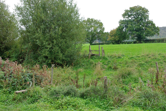
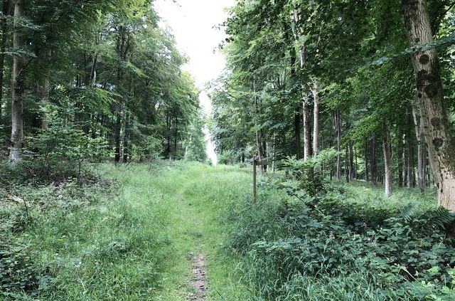
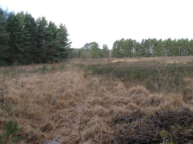
Furze Field, located in Sussex, England, is a picturesque area that showcases the natural beauty of the region's Downs and Moorland landscapes. Spread across a vast expanse, the field is characterized by its rolling hills, lush green meadows, and vibrant wildflowers that add a pop of color to the scenery.

The field gets its name from the abundant growth of furze bushes that carpet the area. These yellow-flowered shrubs not only contribute to the field's aesthetic appeal but also provide habitat for various species of birds and insects. The local fauna is diverse and includes rabbits, hares, and small mammals, which can often be spotted darting between the grassy tufts.

Furze Field is also home to a wide range of plant life. In addition to the furze bushes, visitors can find an assortment of native grasses, mosses, and lichens that thrive in the nutrient-rich soil. The field's location on the Sussex Downs ensures that it is exposed to the elements, resulting in a unique microclimate that supports the growth of heather and gorse.

The field offers visitors a tranquil retreat from the hustle and bustle of everyday life. Its vast open spaces provide ample opportunity for outdoor activities such as walking, picnicking, and birdwatching. The stunning panoramic views of the surrounding countryside, with the rolling hills and distant woodlands, make it a popular spot for photography enthusiasts.

Furze Field is not only a visual delight but also plays a vital role in the local ecosystem, providing a habitat for numerous species and contributing to the overall biodiversity of the area. It is a true gem of Sussex, offering visitors a chance to connect with nature and experience the beauty of the Downs and Moorland landscapes.

If you have any feedback on the listing, please let us know in the comments section below.
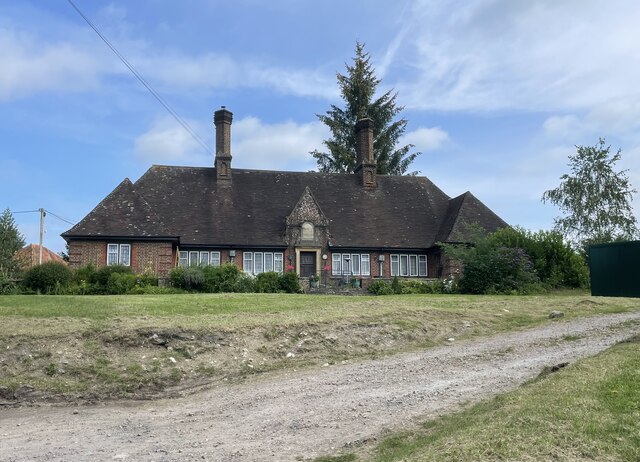
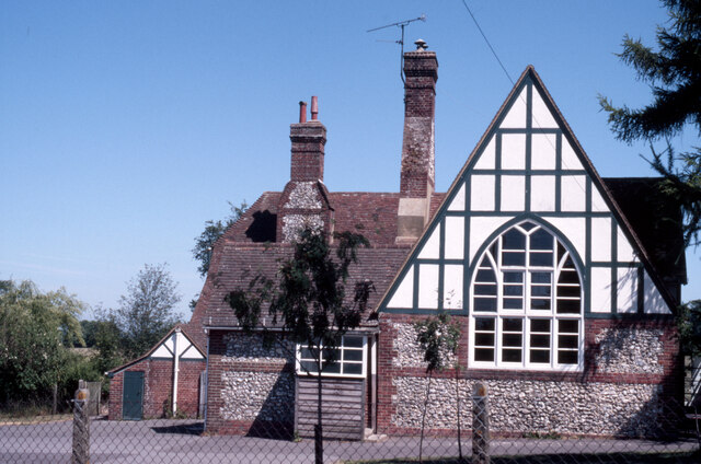
Furze Field Images

Images are sourced within 2km of 50.932623/-0.68191253 or Grid Reference SU9215. Thanks to Geograph Open Source API. All images are credited.

Seaford College Looking towards the college from Wallace Square.
Seaford College
Looking towards the college from Wallace Square.
West Lodge West Lodge at an entrance to Seaford College.
West Lodge
West Lodge at an entrance to Seaford College.
The Parish Church of St Giles The church is a Grade II listed building. See <span class="nowrap"><a title="https://historicengland.org.uk/listing/the-list/list-entry/1276882" rel="nofollow ugc noopener" href="https://historicengland.org.uk/listing/the-list/list-entry/1276882">Link</a><img style="margin-left:2px;" alt="External link" title="External link - shift click to open in new window" src="https://s1.geograph.org.uk/img/external.png" width="10" height="10"/></span>
The Parish Church of St Giles
The church is a Grade II listed building. See LinkExternal link
Homes of Rest The almshouses in Graffham are a Grade II listed building. See <span class="nowrap"><a title="https://historicengland.org.uk/listing/the-list/list-entry/1396449" rel="nofollow ugc noopener" href="https://historicengland.org.uk/listing/the-list/list-entry/1396449">Link</a><img style="margin-left:2px;" alt="External link" title="External link - shift click to open in new window" src="https://s1.geograph.org.uk/img/external.png" width="10" height="10"/></span>
Homes of Rest
The almshouses in Graffham are a Grade II listed building. See LinkExternal link
Graffham School Next to the church, built in 1854 to designs of the  noted architect GE Street.
Graffham School
Next to the church, built in 1854 to designs of the noted architect GE Street.
Oak in field, Graffham
Public footpath 958, Graffham Towards Woodcote, Marsh Farm is visible ahead.
Public footpath 958, Graffham
Towards Woodcote, Marsh Farm is visible ahead.
Dead oak in field, Graffham
Stiles on footpath 958, Graffham From Woodcote towards Graffham.
Stiles on footpath 958, Graffham
From Woodcote towards Graffham.
Horses, Woodcote Farm
Sheep and horses by Dirty Lane, Graffham Dirty Lane is public bridleway 954, Graffham.
Sheep and horses by Dirty Lane, Graffham
Dirty Lane is public bridleway 954, Graffham.
Memorial at the crash site of a Lancaster Bomber A close up of the memorial marking the crash site of an Avro Lancaster which crashed in poor visibility on 13th February 1944, killing all 8 people on board. The plane had taken part the previous evening in special operations in Southern France.

The aircraft was part of the 617 squadron, better known as the Dambuster Squadron, and whilst the aircraft had not been part of the dams raid in May 1943, a member of the crew who lost his life that day had taken part in the dams sortie.

Having taken off from Ford airfield, near Arundel, to return to the squadrons base in Lincolnshire, the plane failed to gain sufficient height to clear the South Downs and crashed in low cloud and fog at the highest point of the Downs in Sussex.

The loss of life is additionally marked by the Four Nations War Memorial in the Church nearby in Upwaltham. This also commemorates the loss of the 7 airmen who died when their American Dakota crashed, almost exactly a year later to the day, on the opposite side of the valley on Sutton Down.

The 15 airmen who lost their lives at Upwaltham represented Four Nations; the UK, the USA, Canada and Australia.
Memorial at the crash site of a Lancaster Bomber
A close up of the memorial marking the crash site of an Avro Lancaster which crashed in poor visibility on 13th February 1944, killing all 8 people on board. The plane had taken part the previous evening in special operations in Southern France. The aircraft was part of the 617 squadron, better known as the Dambuster Squadron, and whilst the aircraft had not been part of the dams raid in May 1943, a member of the crew who lost his life that day had taken part in the dams sortie. Having taken off from Ford airfield, near Arundel, to return to the squadrons base in Lincolnshire, the plane failed to gain sufficient height to clear the South Downs and crashed in low cloud and fog at the highest point of the Downs in Sussex. The loss of life is additionally marked by the Four Nations War Memorial in the Church nearby in Upwaltham. This also commemorates the loss of the 7 airmen who died when their American Dakota crashed, almost exactly a year later to the day, on the opposite side of the valley on Sutton Down. The 15 airmen who lost their lives at Upwaltham represented Four Nations; the UK, the USA, Canada and Australia.
Tumuli beside the South Downs Way Ancient burial mounds close to the National Trail.
Tumuli beside the South Downs Way
Ancient burial mounds close to the National Trail.
Track near Grass Tegleaze Heading northwards in the direction of the South Downs Way.
Track near Grass Tegleaze
Heading northwards in the direction of the South Downs Way.
Path junction at Tegleaze One of the many tracks passing through the woodland at Tegleaze.
Path junction at Tegleaze
One of the many tracks passing through the woodland at Tegleaze.
Joining New Road Approaching the forest track known as New Road.
Joining New Road
Approaching the forest track known as New Road.
Track over North Down Looking south towards Upwaltham.
Track over North Down
Looking south towards Upwaltham.
Old crop Remains of the previous years crop on the slopes of North Down.
Old crop
Remains of the previous years crop on the slopes of North Down.
Show me another place!

Furze Field is located at Grid Ref: SU9215 (Lat: 50.932623, Lng: -0.68191253)

Administrative County: West Sussex

District: Chichester

Police Authority: Sussex

What 3 Words

///windmills.pony.parkway. Near Midhurst, West Sussex

Related Wikis

Graffham

Graffham is a village, Anglican parish and civil parish in West Sussex, England, situated on the northern escarpment of the South Downs within the South...

East Lavington

East Lavington, formerly Woolavington, is a village and civil parish in the District of Chichester in West Sussex, England. It is located six kilometres...

Sussex Downs AONB

Sussex Downs Area of Outstanding Natural Beauty in England was designated in 1966. The designation was revoked in March 2010, together with the neighbouring...

Upwaltham

Upwaltham is a scattered settlement and civil parish in the South Downs, in the District of Chichester of West Sussex, England. It surrounds a parish church...

Heyshott Down

Heyshott Down is a 42.6-hectare (105-acre) biological Site of Special Scientific Interest south of Midhurst in West Sussex. It is a Nature Conservation...

East Dean, West Sussex

East Dean is a village and civil parish in the District of Chichester in West Sussex, England. The village is in a valley in the South Downs, 5+1⁄2 miles...

Duncton

Duncton is a village and civil parish in the District of Chichester in West Sussex, England. The village is in the South Downs 3 miles (5 km) south of...

Lavington Common

Lavington Common is a 31.2-hectare (77-acre) biological Site of Special Scientific Interest south-west of Petworth in West Sussex. It is a National Trust...

Nearby Amenities

Located within 500m of 50.932623,-0.68191253
Graffham Down
Ele: 220
Natural: peak
Lat/Long: 50.9366654/-0.6845091
The data included in this document is from www.openstreetmap.org. The data is made available under ODbL.

Have you been to Furze Field?

Leave your review of Furze Field below (or comments, questions and feedback).