Brantingham Common

Downs, Moorland in Yorkshire

England

Brantingham Common

South Cave Interchange
South Cave Interchange Credit: Neil Theasby

Brantingham Common is a picturesque rural area located in the East Riding of Yorkshire, England. Nestled amidst the stunning landscapes of the Yorkshire Downs and Moorland, this common is a haven for nature enthusiasts and outdoor lovers alike.

Covering an area of approximately 200 hectares, Brantingham Common is characterized by its rolling hills, rugged terrain, and vast expanses of heather and gorse. The common is home to a diverse range of flora and fauna, with notable species including skylarks, curlews, and adders. Visitors can enjoy leisurely walks along the numerous footpaths that crisscross the area, taking in the breathtaking panoramic views of the surrounding countryside.

The common is also renowned for its historical significance. Ancient burial mounds and remnants of Iron Age settlements can be found scattered across the landscape, offering a glimpse into the area's rich heritage. Additionally, the remains of a medieval moated manor house, Brantingham Thorpe, stand as a testament to the area's past.

For those seeking a break from the bustling city life, Brantingham Common offers a tranquil retreat. The absence of major roads and urban developments ensures a serene atmosphere, ideal for relaxation and unwinding. The common is a popular destination for picnicking, birdwatching, and photography, attracting visitors from both near and far.

Overall, Brantingham Common is a hidden gem in Yorkshire, offering a unique blend of natural beauty, historical intrigue, and tranquility. Whether one wishes to explore its diverse ecosystems, delve into its past, or simply revel in its peace and quiet, this common is a must-visit for anyone seeking to connect with nature and experience the charm of the Yorkshire countryside.

If you have any feedback on the listing, please let us know in the comments section below.

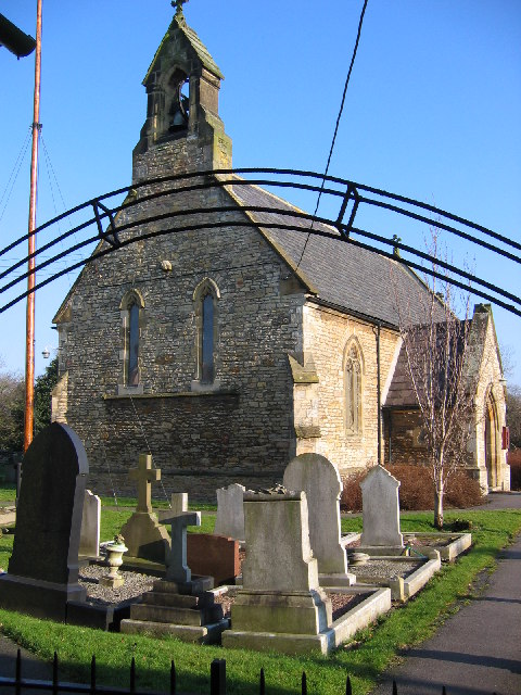
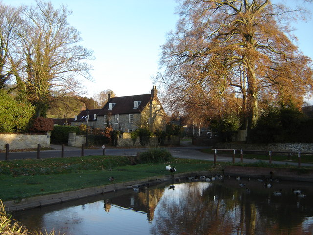
Brantingham Common Images

Images are sourced within 2km of 53.742943/-0.59565305 or Grid Reference SE9228. Thanks to Geograph Open Source API. All images are credited.

South Cave Interchange
View from  Service  Station  to  South  Cave  Interchange  A63
View from Service Station to South Cave Interchange A63
Fuelling  area  at  South  Cave  Service  Station
Fuelling area at South Cave Service Station
Campers  and  Motorhome  sales  Wandahome near South Cave
Campers and Motorhome sales Wandahome
near South Cave
Ellerker Wold Lane Looking along Ellerker Wold Lane from Brantingham Road.
Ellerker Wold Lane
Looking along Ellerker Wold Lane from Brantingham Road.
Fields beside Ellerker Wold Lane Looking across farmland from the junction of Brantingham Road with Ellerker Wold Lane.
Fields beside Ellerker Wold Lane
Looking across farmland from the junction of Brantingham Road with Ellerker Wold Lane.
Along Brantingham Road Looking along Brantingham Road towards the bridge over the A63 from Ellerker Wold Lane. Brantingham Road forms part of National Cycle Network route 65.
Along Brantingham Road
Looking along Brantingham Road towards the bridge over the A63 from Ellerker Wold Lane. Brantingham Road forms part of National Cycle Network route 65.
Markings on a field near Brantingham and the A63: aerial 2021
Old milestone On Saltgrounds Road in Brough just south of the Ferry Inn, this milestone was restored by Elloughton and Brough Parish Council in 1983.   There was an 8.3 mile turnpike between Brough Ferry and Newbald Holmes which was first enacted in 1771 and ended in 1872.  This was part of a route between York and Lincoln which would use the ferry to cross the River Humber.
Old milestone
On Saltgrounds Road in Brough just south of the Ferry Inn, this milestone was restored by Elloughton and Brough Parish Council in 1983. There was an 8.3 mile turnpike between Brough Ferry and Newbald Holmes which was first enacted in 1771 and ended in 1872. This was part of a route between York and Lincoln which would use the ferry to cross the River Humber.
Old Pump at Spout Hill Brantingham Here is the 19th century cast iron pump at the foot of Spout Hill.
Old Pump at Spout Hill Brantingham
Here is the 19th century cast iron pump at the foot of Spout Hill.
St Mary's Church Elloughton Situated in a peaceful corner of Elloughton, St Mary's Church was built in the 13th Century with additions and restoration work done in the 16th and 19th centuries. It is a Grade II listed building. There is a War Memorial plaque inside dedicated to those men of the parish who fell in The Great War 1914-1918.
St Mary's Church Elloughton
Situated in a peaceful corner of Elloughton, St Mary's Church was built in the 13th Century with additions and restoration work done in the 16th and 19th centuries. It is a Grade II listed building. There is a War Memorial plaque inside dedicated to those men of the parish who fell in The Great War 1914-1918.
St Mary's Church Elloughton Church of St Mary the Virgin was built in the 13th Century and is a Grade II listed building. Inside there is a War Memorial plaque dedicated to those local men who fell in The Great War 1914-1918.
St Mary's Church Elloughton
Church of St Mary the Virgin was built in the 13th Century and is a Grade II listed building. Inside there is a War Memorial plaque dedicated to those local men who fell in The Great War 1914-1918.
Gate  to St Mary's Church Elloughton This church of St Mary the Virgin was built in the 13th Century.
Gate to St Mary's Church Elloughton
This church of St Mary the Virgin was built in the 13th Century.
Stained Glass Windows in St Mary's Church Elloughton The church of St Mary the Virgin was built in the 13th Century. Inside are some beautiful stained glass windows. There is also a War Memorial plaque dedicated to the local men who died in WW1
Stained Glass Windows in St Mary's Church Elloughton
The church of St Mary the Virgin was built in the 13th Century. Inside are some beautiful stained glass windows. There is also a War Memorial plaque dedicated to the local men who died in WW1
Some very attractive Houses in Church Street Elloughton Situated just along from St Mary's Church in Elloughton.
Some very attractive Houses in Church Street Elloughton
Situated just along from St Mary's Church in Elloughton.
West of the Roman road Between Brough and South Cave
West of the Roman road
Between Brough and South Cave
Brantingham Road
Brantingham Road
St Mary's Church, Elloughton First constructed in the second half of the thirteenth century and well-maintained in modern times. Like most country churches it has evolved through time.
St Mary's Church, Elloughton
First constructed in the second half of the thirteenth century and well-maintained in modern times. Like most country churches it has evolved through time.
Show me another place!

Brantingham Common is located at Grid Ref: SE9228 (Lat: 53.742943, Lng: -0.59565305)

Division: East Riding

Unitary Authority: East Riding of Yorkshire

Police Authority: Humberside

What 3 Words

///inclines.rentals.originate. Near Ellerker, East Yorkshire

Nearby Locations

Brantingham Common

Related Wikis

Brantingham Roman villa

Brantingham Roman villa is a Roman villa, now a scheduled monument, near Brantingham, East Riding of Yorkshire, England. == Villa == The villa would have...

Ellerker

Ellerker is a village and civil parish in the East Riding of Yorkshire, England. It is situated approximately 10 miles (16 km) west of Hull city centre...

Elloughton

Elloughton is a village in the East Riding of Yorkshire, England. It is situated approximately 12 miles (19 km) to the west of Hull to the south of the...

Brantingham

Brantingham is a village and civil parish in the East Riding of Yorkshire, England, about 2 miles (3 km) north of Brough, 12 miles (19 km) west of Hull...
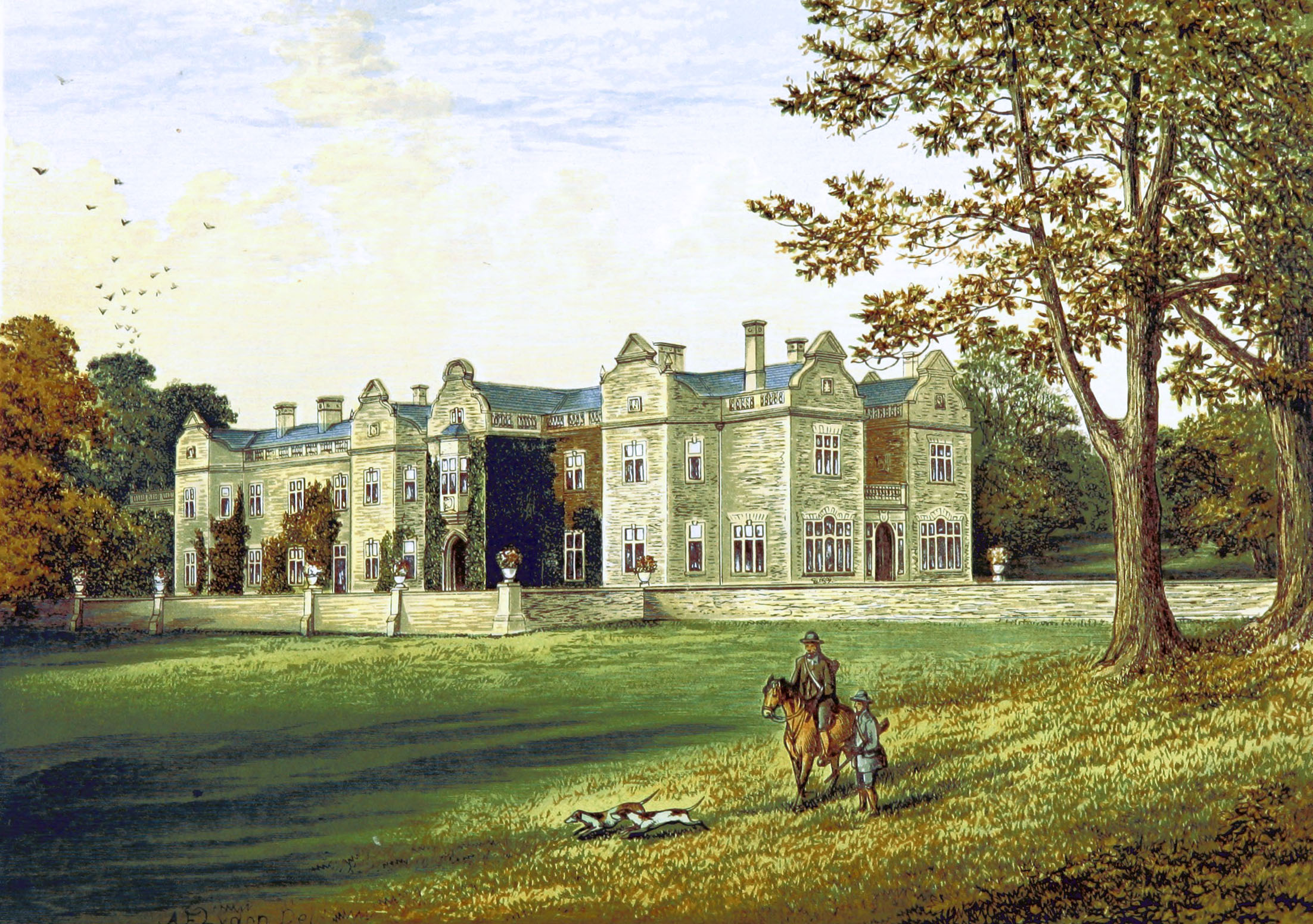
Brantingham Thorpe

Brantingham Thorpe is a Grade II listed country house near Brantingham in the East Riding of Yorkshire, England. It was once owned by the Sykes family...

Petuaria

Petuaria (or Petuaria Parisorum) was originally a Roman fort situated where the town of Brough in the East Riding of Yorkshire now stands. Petuaria means...

Elloughton-cum-Brough

Elloughton-cum-Brough is a civil parish in the East Riding of Yorkshire, England. It is situated 12 miles (19 km) to the west of Hull city centre and covering...

Brough railway station

Brough railway station serves the town of Brough in the East Riding of Yorkshire, England. It is managed by TransPennine Express, and also served by Northern...

Nearby Amenities

Located within 500m of 53.742943,-0.59565305
Power: pole
Lat/Long: 53.7419775/-0.5884861
Power: pole
Lat/Long: 53.7431135/-0.5885194
Power: pole
Lat/Long: 53.743541/-0.6009136
Power: pole
Lat/Long: 53.7435829/-0.5984702
Power: pole
Lat/Long: 53.7436098/-0.5968372
Power: pole
Lat/Long: 53.7439897/-0.5946823
Power: pole
Lat/Long: 53.7442537/-0.5885433
Power: pole
Lat/Long: 53.7448288/-0.5900447
Power: pole
Lat/Long: 53.7449893/-0.5890387
The data included in this document is from www.openstreetmap.org. The data is made available under ODbL.

Have you been to Brantingham Common?

Leave your review of Brantingham Common below (or comments, questions and feedback).