Hazelslack

Settlement in Westmorland South Lakeland

England

Hazelslack

Haverbrack
Haverbrack Credit: Peter McDermott

Hazelslack is a small hamlet located in the county of Cumbria, England, specifically in the historic region of Westmorland. Situated near the southern edge of the Lake District National Park, it lies approximately 9 miles southwest of Kendal and 11 miles northwest of Lancaster. The hamlet is nestled within the picturesque landscape of the Arnside and Silverdale Area of Outstanding Natural Beauty.

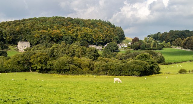
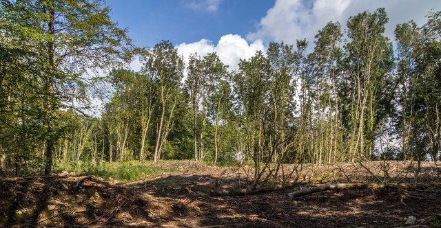
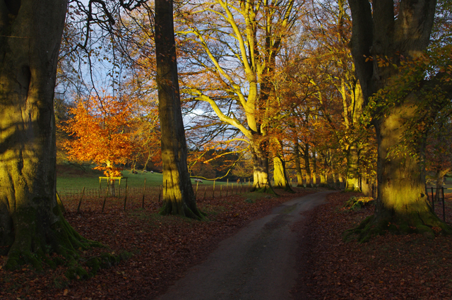
Hazelslack is characterized by its tranquil and rural setting, surrounded by rolling hills, lush meadows, and dense woodlands. The hamlet itself consists of a handful of traditional stone houses and farms, reflecting the area's agricultural heritage. The centerpiece of Hazelslack is Hazelslack Tower, a medieval fortified manor house dating back to the 14th century. This Grade I listed building is known for its distinctive square tower and serves as a reminder of the area's rich history.

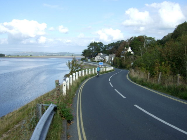
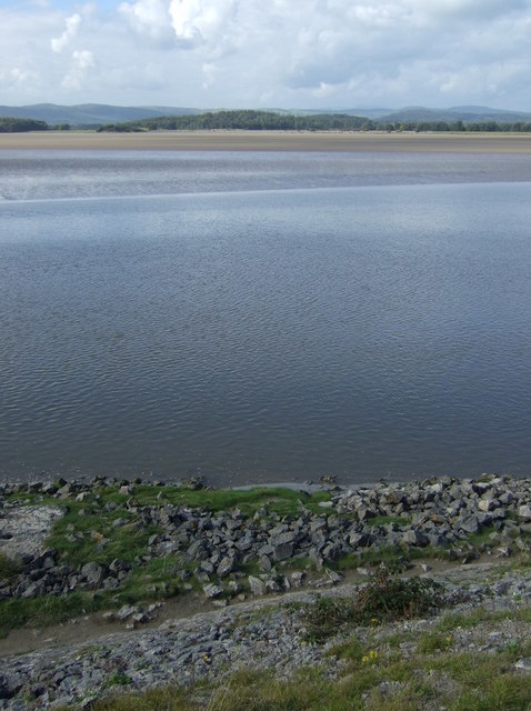
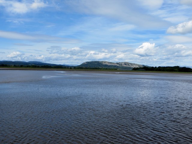
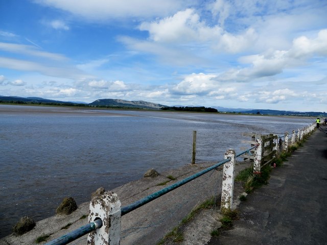
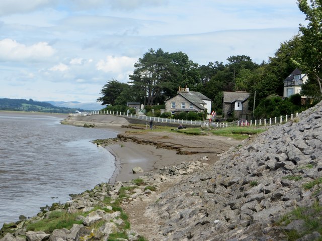
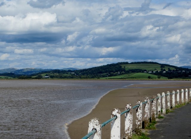
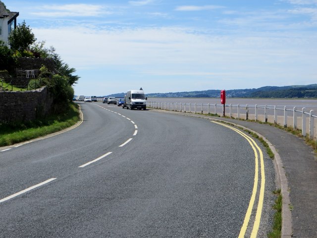
The hamlet is also renowned for its natural beauty and wildlife. It is located near the coast, allowing residents and visitors to enjoy breathtaking views of Morecambe Bay, a designated Site of Special Scientific Interest. The bay is home to a diverse range of bird species, including oystercatchers, curlews, and redshanks, making it a popular spot for birdwatching enthusiasts.

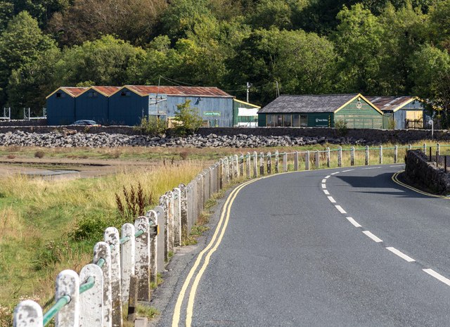
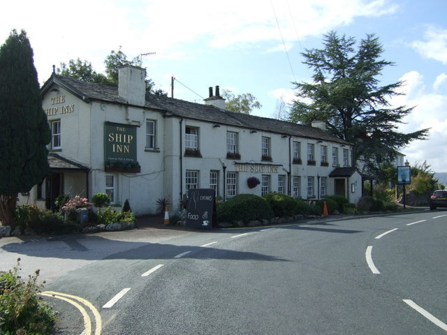
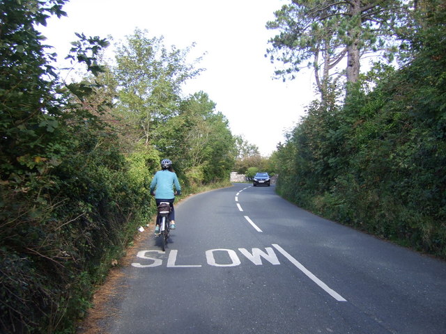
Due to its idyllic location and proximity to the Lake District, Hazelslack is a popular destination for outdoor activities such as hiking, cycling, and nature walks. The nearby Silverdale and Arnside villages offer amenities such as cafes, pubs, and shops, ensuring that visitors have everything they need during their stay.

Overall, Hazelslack, with its stunning natural surroundings and historical charm, provides a peaceful retreat for those seeking a tranquil and picturesque escape in the heart of the English countryside.

If you have any feedback on the listing, please let us know in the comments section below.

Hazelslack Images

Images are sourced within 2km of 54.20247/-2.800966 or Grid Reference SD4778. Thanks to Geograph Open Source API. All images are credited.

Haverbrack
Haverbrack
Wray Cottages Visible after the felling of trees.
Wray Cottages
Visible after the felling of trees.
Storth Builders Merchants in Storth.
Storth
Builders Merchants in Storth.
The Ship Inn, Sandside
Sign for the Ship Inn, Sandside
Cycling on Park Road (B5282) Heading north east.
Cycling on Park Road (B5282)
Heading north east.
Dropping down on the coastal road into Sandside Heading north east.
Dropping down on the coastal road into Sandside
Heading north east.
Kent Channel and Milnthorpe Sands
Limestone outcrop, Haverbrack Bank Like all the hills in the AONB, the bank is composed of carboniferous limestone. Although there are no great pavements or exposures to be seen, it's a pleasant place to wander around on a fine Spring day. Mercifully, the huge Sandside Quarry is not visible from here (screened by the trees on the left). No doubt it will be audible on a working day. Views north over the Kent estuary to the Lakeland fells, Howgills and Dales fells are exceptionally good.
Limestone outcrop, Haverbrack Bank
Like all the hills in the AONB, the bank is composed of carboniferous limestone. Although there are no great pavements or exposures to be seen, it's a pleasant place to wander around on a fine Spring day. Mercifully, the huge Sandside Quarry is not visible from here (screened by the trees on the left). No doubt it will be audible on a working day. Views north over the Kent estuary to the Lakeland fells, Howgills and Dales fells are exceptionally good.
Possible ruined lime kiln, woods west of Haverbrack At first I thought that this hole just west of the footpath might be a natural cave or mine working. A peek inside revealed rough masonry which I took to be the remnants of an old kiln.
Possible ruined lime kiln, woods west of Haverbrack
At first I thought that this hole just west of the footpath might be a natural cave or mine working. A peek inside revealed rough masonry which I took to be the remnants of an old kiln.
Incoming tide at Milnthorpe Sands The tide travels quickly up the funnel created by Morecambe Bay.
Incoming tide at Milnthorpe Sands
The tide travels quickly up the funnel created by Morecambe Bay.
Milnthorpe Sands Tidal waters sweep up the estuary.
Milnthorpe Sands
Tidal waters sweep up the estuary.
At the water's edge Milnthorpe Sands as the tide rushes up the estuary.
At the water's edge
Milnthorpe Sands as the tide rushes up the estuary.
The Kent estuary At Sandside.
The Kent estuary
At Sandside.
Coastal Road at Sandside The B5282, looking south.
Coastal Road at Sandside
The B5282, looking south.
Dallam Park The southern end of the road through the park passes down an avenue of trees. Here, some of the trees are lit by the low late autumn sun.
Dallam Park
The southern end of the road through the park passes down an avenue of trees. Here, some of the trees are lit by the low late autumn sun.
Dallam Park The southern end of the road through the park passes down an avenue of trees. Here, some of the trees are lit by the low late autumn sun.
Dallam Park
The southern end of the road through the park passes down an avenue of trees. Here, some of the trees are lit by the low late autumn sun.
Bracket fungus This is Polyporus squamosus, Shaggy Dryad's Saddle, growing on the dead tree stump on the left in <a href="https://www.geograph.org.uk/photo/5207943">SD4980 : Dallam Park</a>.
Bracket fungus
This is Polyporus squamosus, Shaggy Dryad's Saddle, growing on the dead tree stump on the left in SD4980 : Dallam Park.
Show me another place!

Hazelslack is located at Grid Ref: SD4778 (Lat: 54.20247, Lng: -2.800966)

Administrative County: Cumbria

District: South Lakeland

Police Authority: Cumbria

What 3 Words

///unusually.driving.equipment. Near Arnside, Cumbria

Related Wikis

Hazelslack

Hazelslack is a hamlet in the South Lakeland district, in the English county of Cumbria. It is near the villages of Arnside and Storth. Nearby Hazelslack...

Carr Bank

Carr Bank is a small hamlet near Arnside, Cumbria, England. It is in the civil parish of Beetham in South Lakeland local government district. == References... ==

Storth

Storth is a village near Arnside in Cumbria, England, situated near the border with Lancashire. It is in the historic county of Westmorland. The village...

Slack Head

Slack Head, sometimes written Slackhead, is a hamlet near Beetham, South Lakeland, Cumbria, England. It is in Beetham civil parish. It is a purely residential...

Dog Hole Cave

Dog Hole Cave is an archaeologically significant cave near Storth, Cumbria, England. Other names for the cave include Haverbrack Bank Pot, Haverbrack Dog...

Limestone Link (Cumbria)

The Limestone Link is a waymarked footpath in South Lakeland, Cumbria, England, connecting Arnside and Kirkby Lonsdale, a distance of 13 miles (21 km)...

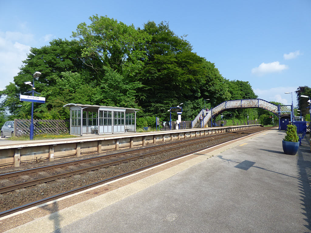
Arnside railway station

Arnside is a railway station on the Furness Line, which runs between Barrow-in-Furness and Lancaster. The station, situated 12+1⁄4 miles (20 km) north...

Beetham

Beetham is a village and civil parish in the South Lakeland district, in Cumbria, England, situated on the border with Lancashire, 6 miles (10 km) north...

Nearby Amenities

Located within 500m of 54.20247,-2.800966
Barrier: stile
Lat/Long: 54.2045978/-2.8017855
Power: pole
Lat/Long: 54.2009177/-2.8077713
Power: pole
Lat/Long: 54.201721/-2.8064597
Power: pole
Lat/Long: 54.2025211/-2.8050596
Power: pole
Lat/Long: 54.2032302/-2.8039733
Power: pole
Lat/Long: 54.2039943/-2.8026617
Power: pole
Lat/Long: 54.2042955/-2.8011435
Power: pole
Lat/Long: 54.2045935/-2.7997729
Power: pole
Lat/Long: 54.2048869/-2.7983192
Power: pole
Lat/Long: 54.2052007/-2.7968949
Barrier: stile
Lat/Long: 54.2023167/-2.8050263
Barrier: stile
Lat/Long: 54.2024067/-2.8049951
Barrier: stile
Lat/Long: 54.2038196/-2.8025895
Information: guidepost
Tourism: information
Lat/Long: 54.2038357/-2.8025856
Information: guidepost
Tourism: information
Lat/Long: 54.2038691/-2.8025096
Information: guidepost
Tourism: information
Lat/Long: 54.202452/-2.8050339
The data included in this document is from www.openstreetmap.org. The data is made available under ODbL.

Have you been to Hazelslack?

Leave your review of Hazelslack below (or comments, questions and feedback).