Wolverton Gardens

Downs, Moorland in Hampshire Winchester

England

Wolverton Gardens

West Meon Trail and Picnic Area The disused railway station platforms are clearly visible. The picnic area and adjacent car park occupy the former goods yards.
West Meon Trail and Picnic Area Credit: Paul Collins

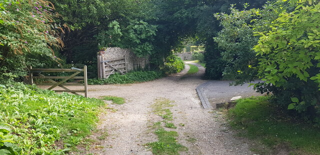
Wolverton Gardens is a picturesque location situated in Hampshire, England. It is renowned for its stunning natural beauty and diverse landscape, featuring a combination of downs and moorland. Spanning over a vast area, Wolverton Gardens offers visitors a unique and immersive experience in the heart of nature.

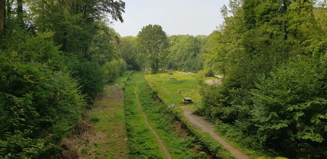
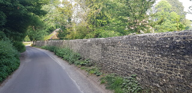
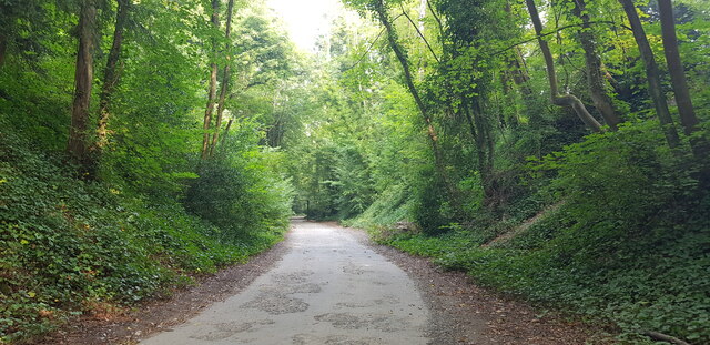
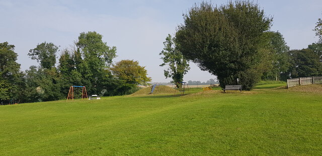
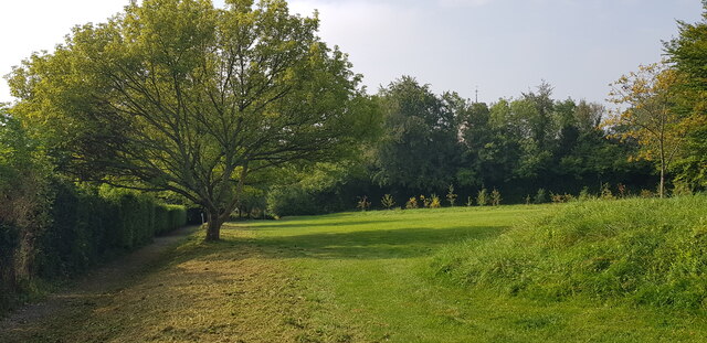
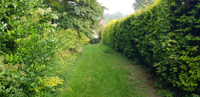
The downs in Wolverton Gardens are characterized by rolling hills and expansive grasslands, providing a sense of tranquility and serenity. The lush greenery is home to a variety of plant species, including wildflowers and herbs, creating a vibrant and colorful environment. Visitors can enjoy leisurely walks or picnics while taking in the breathtaking views of the surrounding countryside.

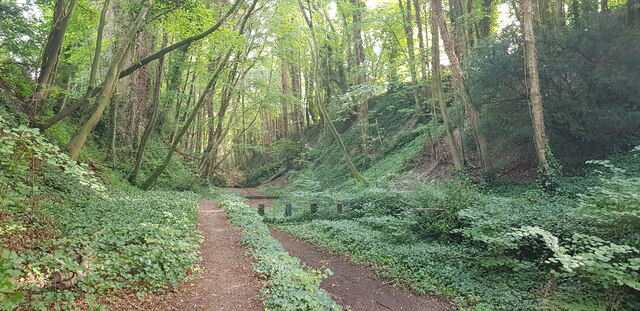
The moorland section of Wolverton Gardens offers a contrasting landscape, with its rugged terrain and heather-covered hills. This area is known for its rich biodiversity, housing a multitude of animal and bird species. It provides a haven for nature enthusiasts and birdwatchers, who can spot rare species such as curlews, lapwings, and skylarks.

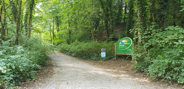
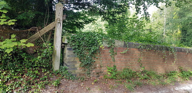
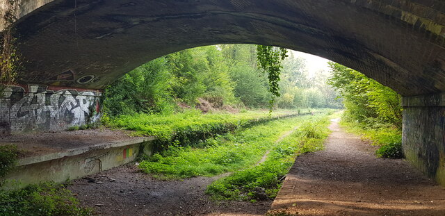
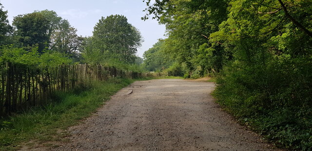
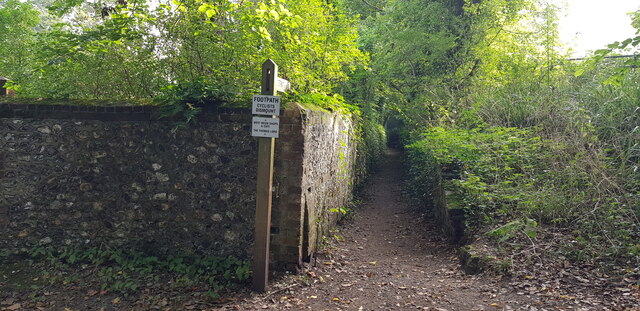
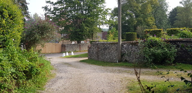
Wolverton Gardens also boasts several well-maintained trails and pathways, making it accessible to all visitors. These paths wind through the gardens, offering opportunities for exploration and discovery. Additionally, the gardens provide educational programs and guided tours, allowing visitors to learn about the flora and fauna that inhabit this unique ecosystem.

Overall, Wolverton Gardens in Hampshire is a natural haven that offers a diverse and captivating landscape. Whether it be the gentle downs or the rugged moorland, this location is a paradise for nature lovers and provides a peaceful retreat for anyone looking to escape the hustle and bustle of modern life.

If you have any feedback on the listing, please let us know in the comments section below.

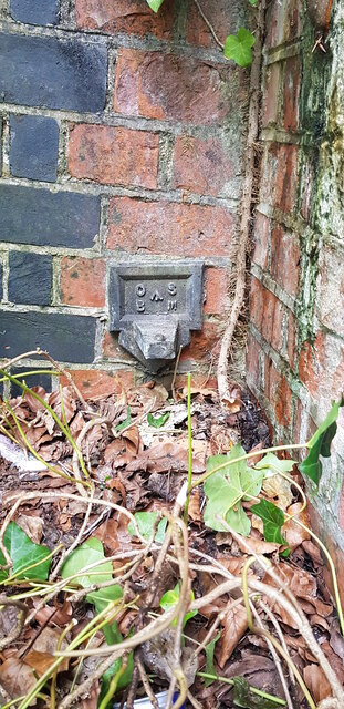
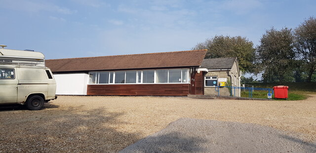
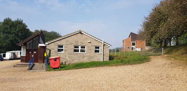
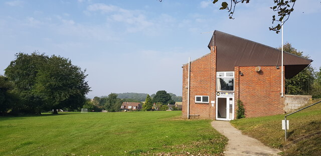
Wolverton Gardens Images

Images are sourced within 2km of 51.013015/-1.0878078 or Grid Reference SU6424. Thanks to Geograph Open Source API. All images are credited.

West Meon Trail and Picnic Area The disused railway station platforms are clearly visible. The picnic area and adjacent car park occupy the former goods yards.
West Meon Trail and Picnic Area
The disused railway station platforms are clearly visible. The picnic area and adjacent car park occupy the former goods yards.
Access to West Meon Trail This entrance leads to a car park and picnic area. It was formerly the access to West Meon Station.
Access to West Meon Trail
This entrance leads to a car park and picnic area. It was formerly the access to West Meon Station.
West Meon Trail This image is captured from the platform of the long-disused West Meon Railway Station.
West Meon Trail
This image is captured from the platform of the long-disused West Meon Railway Station.
Bridge Parapet with Cut Benchmark Here, Station Road crosses the West Meon Trail, formerly a railway.
Bridge Parapet with Cut Benchmark
Here, Station Road crosses the West Meon Trail, formerly a railway.
Flint Wall in Station Road
Underside of Bridge, West Meon Trail Here, Station Road crosses the West Meon Trail, formerly the village railway station.
Underside of Bridge, West Meon Trail
Here, Station Road crosses the West Meon Trail, formerly the village railway station.
Car Park at West Meon Trail The car park is on the site of the former goods yard of West Meon Railway Station. The main station building stood on the left, where the fence is.
Car Park at West Meon Trail
The car park is on the site of the former goods yard of West Meon Railway Station. The main station building stood on the left, where the fence is.
Access Road to West Meon Trail This drive serves the carpark and picnic area of the West Meon Trail. It was built to serve the West Meon railway station and goods yard, now long gone.
Access Road to West Meon Trail
This drive serves the carpark and picnic area of the West Meon Trail. It was built to serve the West Meon railway station and goods yard, now long gone.
Projecting Bracket Bench Mark on Bridge at Former Station A projecting bracket is a rare type of bench mark and a predecessor of the more common 'Flush Bracket'. Bench marks were semi-permanent markers installed by the Ordnance Survey as part of the levelling of Great Britain. This bracket is found on the bridge abutment which carries Station Road over the former West Meon Railway Station platform. This bracket was installed in 1912 and levelled with a height of 321.6620 feet above mean sea level.
Projecting Bracket Bench Mark on Bridge at Former Station
A projecting bracket is a rare type of bench mark and a predecessor of the more common 'Flush Bracket'. Bench marks were semi-permanent markers installed by the Ordnance Survey as part of the levelling of Great Britain. This bracket is found on the bridge abutment which carries Station Road over the former West Meon Railway Station platform. This bracket was installed in 1912 and levelled with a height of 321.6620 feet above mean sea level.
West Meon Village Hall
West Meon Village Hall A sports pavilion can be seen to the right of the hall.
West Meon Village Hall
A sports pavilion can be seen to the right of the hall.
Sports Pavilion at West Meon Recreation Ground
West Meon Recreation Ground
Start of Footpath off Station Road A sign entices us to use the path to visit the pub, café and shops. See also <a href="https://www.geograph.org.uk/photo/620057">SU6423 : Sunken footpath, West Meon</a>.
Start of Footpath off Station Road
A sign entices us to use the path to visit the pub, café and shops. See also SU6423 : Sunken footpath, West Meon.
Love Lane Meets Station Road West Meon House can be glimpsed in the background.
Love Lane Meets Station Road
West Meon House can be glimpsed in the background.
Love Lane, West Meon
Love Lane, West Meon At this point Love Lane makes a zig-zag and has the character of a garden, being neatly mown grass.
Love Lane, West Meon
At this point Love Lane makes a zig-zag and has the character of a garden, being neatly mown grass.
Show me another place!

Wolverton Gardens is located at Grid Ref: SU6424 (Lat: 51.013015, Lng: -1.0878078)

Administrative County: Hampshire

District: Winchester

Police Authority: Hampshire

What 3 Words

///tasters.toward.fuses. Near Swanmore, Hampshire

Related Wikis

West Meon

West Meon is a village and civil parish in Hampshire, England, with a population of 749 people at the 2011 census. == Geography == It is 2+3⁄4 miles (4...

West Meon railway station

West Meon railway station was an intermediate station on the Meon Valley line which ran from Alton to Fareham during the first half of the 20th century...

Chappetts Copse

Chappetts Copse is a 12-hectare (30-acre) nature reserve east of West Meon in Hampshire. It is owned and managed by the Hampshire and Isle of Wight Wildlife...

Westbury House

Westbury House is a country house south of West Meon Road between East Meon and West Meon in Hampshire, England. The house was built in the Palladian style...

Warnford

Warnford is a village and civil parish in the City of Winchester district of Hampshire, England. The parish covers 1283 hectares (3170 acres). The village...
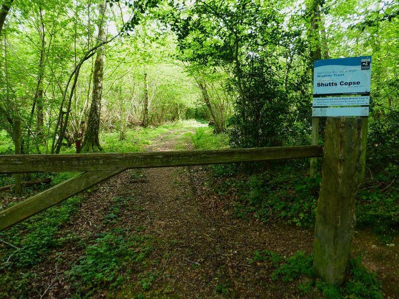
Shutts Copse

Shutts Copse is a 5-hectare (12-acre) nature reserve north of West Meon in Hampshire. It is managed by the Hampshire and Isle of Wight Wildlife Trust...

Peake Wood

Peake Wood is a 17.7-hectare (44-acre) biological Site of Special Scientific Interest west of Petersfield in Hampshire.This is a prime example of a hazel...

Henwood Down

Henwood Down is one of the highest points in the county of Hampshire, England, and in the South Downs, reaching a height of 201 metres (659 ft) above sea...

Nearby Amenities

Located within 500m of 51.013015,-1.0878078
Created By: osmeditor2
Lat/Long: 51.0119417/-1.0821278
Turning Circle
Lat/Long: 51.0136902/-1.088054
Post Box
Brand: Royal Mail
Brand Wikidata: Q638098
Brand Wikipedia: en:Royal Mail
Collection Plate: CP7D
Collection Times: Mo-Fr 09:00; Sa 07:00
Collection Times Checked: 2020-02-06
Old Ref: GU32 160
Operator: Royal Mail
Operator Type: private
Operator Wikidata: Q638098
Post Box Type: lamp
Ref: GU32 160D
Royal Cypher: EIIR
Royal Cypher Wikidata: Q33102113
Source: survey
Lat/Long: 51.0144952/-1.0916485
Barrier: stile
Lat/Long: 51.0125999/-1.0897649
Bus Stop
West Lodge
Bus: yes
Naptan AtcoCode: 1900HA110703
Naptan Bearing: SW
Naptan CommonName: West Lodge
Naptan NaptanCode: hamgawdt
Naptan Street: A32
Naptan Verified: no
Public Transport: platform
Source: naptan_import
Lat/Long: 51.0098286/-1.0904471
Bus Stop
West Lodge
Bus: yes
Naptan AtcoCode: 1900HA110704
Naptan Bearing: NE
Naptan CommonName: West Lodge
Naptan NaptanCode: hamgawjg
Naptan Street: A32
Naptan Verified: no
Public Transport: platform
Source: naptan_import
Lat/Long: 51.0100425/-1.0902006
Bus Stop
Headon View
Bus: yes
Naptan AtcoCode: 1900HA110705
Naptan Bearing: S
Naptan CommonName: Headon View
Naptan Crossing: Opp Headon View
Naptan NaptanCode: hamgdadp
Naptan Street: A32
Naptan Verified: no
Public Transport: platform
Source: naptan_import
Lat/Long: 51.0128374/-1.0865108
Bus Stop
Headon View
Bus: yes
Naptan AtcoCode: 1900HA110706
Naptan Bearing: N
Naptan CommonName: Headon View
Naptan Crossing: Headon View
Naptan NaptanCode: hamgdada
Naptan Street: A32
Naptan Verified: no
Public Transport: platform
Source: naptan_import
Lat/Long: 51.0128654/-1.0866385
Bus Stop
Thomas Lord Ph
Bus: yes
Naptan AtcoCode: 1900HA110707
Naptan Bearing: E
Naptan CommonName: Thomas Lord Ph
Naptan Crossing: Doctors Lane
Naptan NaptanCode: hamgdagw
Naptan Street: High Street
Naptan Verified: no
Public Transport: platform
Shelter: yes
Source: naptan_import
Lat/Long: 51.0121133/-1.0854349
Bus Stop
Thomas Lord Ph
Bus: yes
Naptan AtcoCode: 1900HA110708
Naptan Bearing: W
Naptan CommonName: Thomas Lord Ph
Naptan NaptanCode: hamgdagt
Naptan Street: High Street
Naptan Verified: no
Public Transport: platform
Source: naptan_import
Lat/Long: 51.012038/-1.0854859
Post Box
Brand: Royal Mail
Brand Wikidata: Q638098
Brand Wikipedia: en:Royal Mail
Collection Plate: CP1
Collection Times: Mo-Fr 16:45; Sa 10:00
Collection Times Checked: 2020-02-06
Operator: Royal Mail
Operator Type: private
Operator Wikidata: Q638098
Post Box Type: pillar
Ref: GU32 96
Royal Cypher: EIIR
Royal Cypher Wikidata: Q33102113
Source: survey
Lat/Long: 51.0123365/-1.0872023
Barrier: stile
Lat/Long: 51.0091098/-1.0891944
West Meon War Memorial
Historic: memorial
War Memorial: yes
Wikidata: Q26678090
Lat/Long: 51.0122278/-1.0880164
West Meon
Historic Railway: station
Railway: site
Wikidata: Q7985890
Wikipedia: en:West Meon railway station
Lat/Long: 51.0088499/-1.0854773
Grit Bin
Operator: Hampshire County Council
Lat/Long: 51.0131603/-1.0888603
West Meon
Place: village
Source: survey
Lat/Long: 51.0120264/-1.0871728
Cafe
Cuppacheeno
Addr City: West Meon
Addr Housename: The Village Shop
Addr Postcode: GU32 1LJ
Check Date: 2016-08-23
Contact Facebook: https://www.facebook.com/cuppacheeno/
Cuisine: coffee_shop
Source: survey
Lat/Long: 51.0120937/-1.0860982
Defibrillator
Access: yes
Booth: K6
Covered: booth
Defibrillator Location: inside old red phone box ner Tomas Lod pub, High Street, West Meon
Description: This is an AED.
Disused Amenity: telephone
Emergency: defibrillator
Indoor: no
Man Made: telephone_box
Opening Hours: 24/7
Lat/Long: 51.0121551/-1.0855192
Covered: no
Leisure: picnic_table
Lat/Long: 51.0086954/-1.0860012
Covered: no
Leisure: picnic_table
Lat/Long: 51.0088172/-1.0856951
Drinking Water
Access: yes
Drinking Water: yes
Fee: no
Lat/Long: 51.0129941/-1.0889627
Advertising: board
Lat/Long: 51.0121533/-1.085477
Information: guidepost
Tourism: information
Lat/Long: 51.0123446/-1.0871409
Bench
Lat/Long: 51.0122867/-1.0880054
Man Made: flagpole
Lat/Long: 51.0123041/-1.0879688
Thomas Lord
Cemetery: grave
Description: Grave of Thomas Lord, founder of Lord’s Cricket Ground
Image: https://www.geograph.org.uk/photo/2985119
Inscription: Sacred to the memory of Thomas Lord Esq late of St John’s Wood Road Marylebone who departed this life the 13th January 1832 aged 76 years Founder of Lord’s Cricket Ground 1787
Lat/Long: 51.0125651/-1.0892816
The data included in this document is from www.openstreetmap.org. The data is made available under ODbL.

Have you been to Wolverton Gardens?

Leave your review of Wolverton Gardens below (or comments, questions and feedback).