Kepwick Moor

Downs, Moorland in Yorkshire Hambleton

England

Kepwick Moor

Old Quarries by the Hambleton Drove Road Former shallow limestone quarries on the hilltop by the Hambleton drove road. These are the most northerly of a series of quarries along the hilltop and mark the end of the outcrops of accessible limestone. North of here are mostly coarse sandstones covered with peat and heather.
Old Quarries by the Hambleton Drove Road Credit: Gordon Hatton

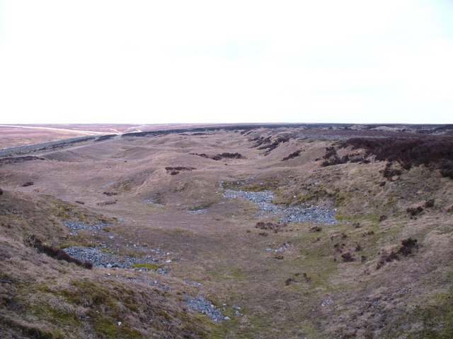
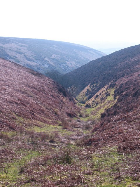
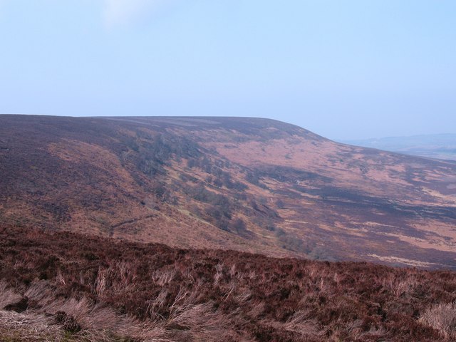
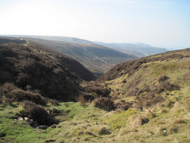
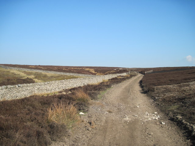
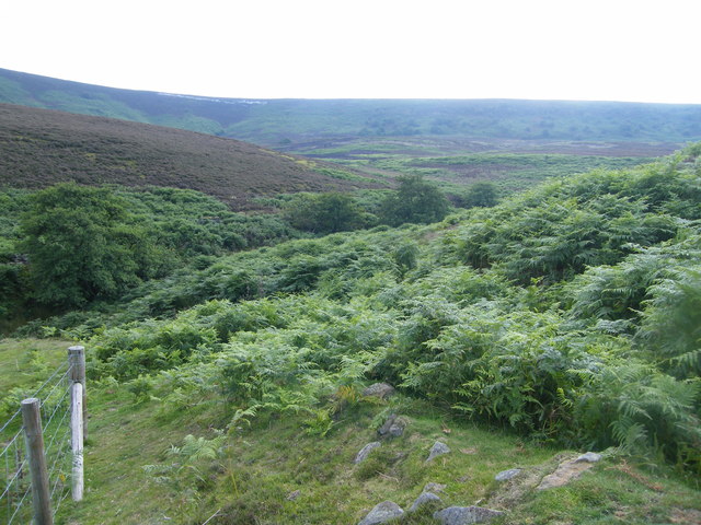
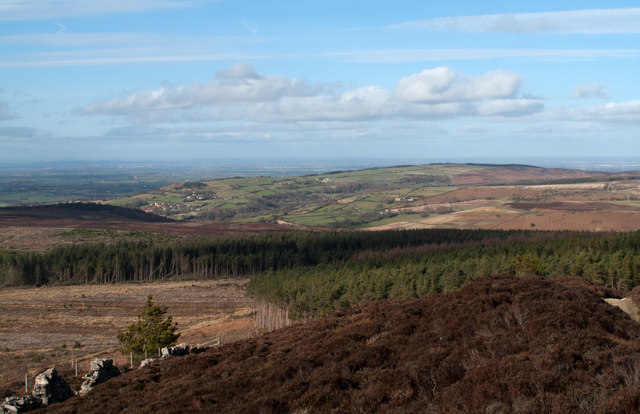
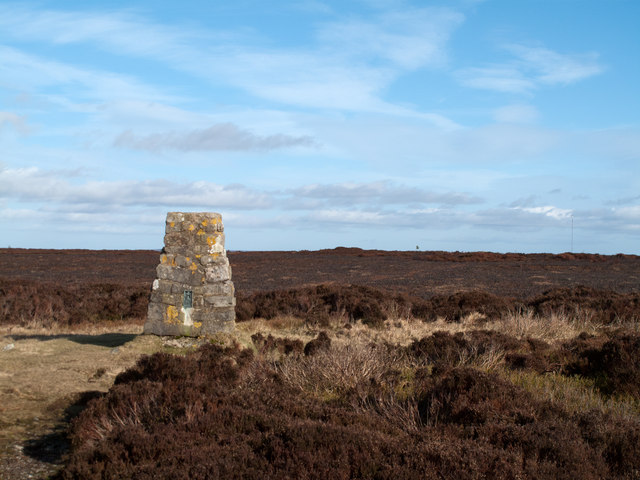
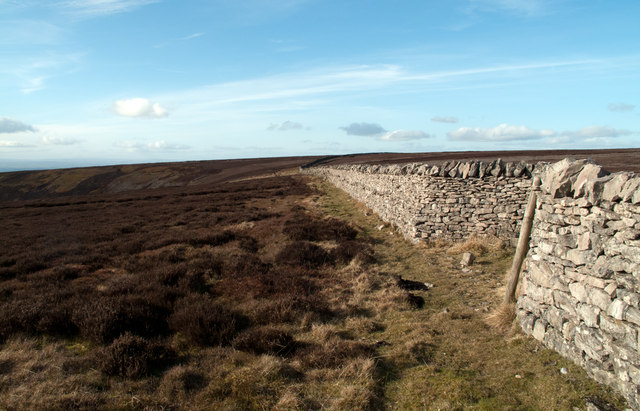
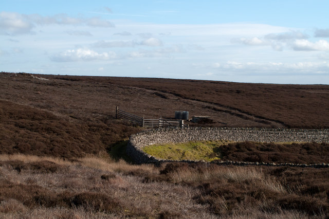
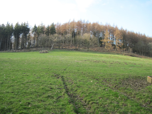
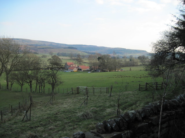
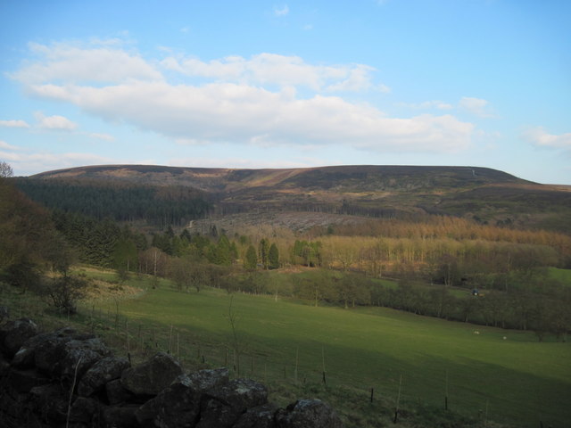
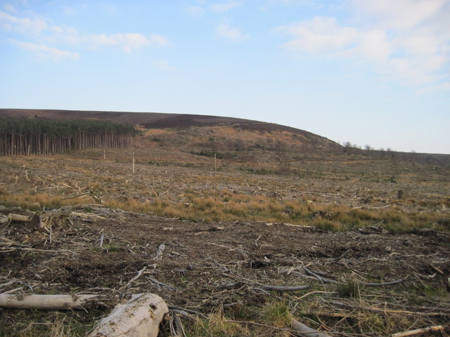
Kepwick Moor, located in the county of Yorkshire, England, is a picturesque expanse of downs and moorland. It covers an area of approximately 10 square kilometers and is situated within the North York Moors National Park. The moor is known for its stunning natural beauty, characterized by rolling hills, open grasslands, and heather-covered landscapes.

Kepwick Moor boasts a diverse range of flora and fauna, making it an important habitat for various species. The heather-covered moorland provides an ideal breeding ground for many bird species, including red grouse, curlews, and lapwings. Visitors to the moor may also spot other wildlife such as hares, deer, and the occasional fox.

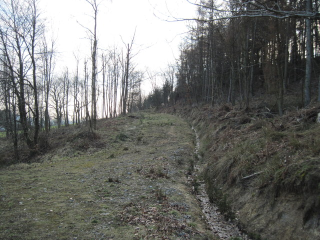
The area is a haven for outdoor enthusiasts, offering numerous opportunities for walking, cycling, and birdwatching. Several well-maintained footpaths crisscross the moor, allowing visitors to explore its beauty at their own pace. One popular route is the Cleveland Way, a long-distance footpath that passes through Kepwick Moor, offering breathtaking views of the surrounding countryside.

Kepwick Moor is also steeped in history, with evidence of human activity dating back thousands of years. Archaeological remains, including prehistoric burial mounds and ancient settlements, can be found scattered across the moor. These remnants provide a glimpse into the lives of those who lived on the moor in centuries past.

Overall, Kepwick Moor is a tranquil and captivating destination, where visitors can immerse themselves in the natural wonders of Yorkshire's downs and moorland, while also exploring its rich historical heritage.

If you have any feedback on the listing, please let us know in the comments section below.
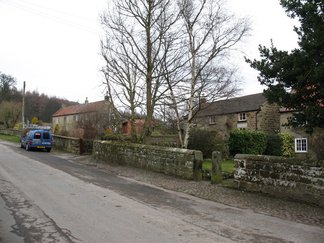
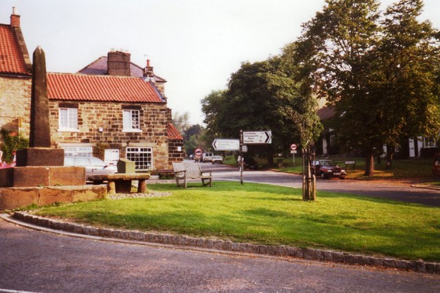
Kepwick Moor Images

Images are sourced within 2km of 54.334529/-1.2640403 or Grid Reference SE4793. Thanks to Geograph Open Source API. All images are credited.

Old Quarries by the Hambleton Drove Road Former shallow limestone quarries on the hilltop by the Hambleton drove road. These are the most northerly of a series of quarries along the hilltop and mark the end of the outcrops of accessible limestone. North of here are mostly coarse sandstones covered with peat and heather.
Old Quarries by the Hambleton Drove Road
Former shallow limestone quarries on the hilltop by the Hambleton drove road. These are the most northerly of a series of quarries along the hilltop and mark the end of the outcrops of accessible limestone. North of here are mostly coarse sandstones covered with peat and heather.
Limekiln House Gill - west The western branch of this steep sided gill which forms the head of Thorodale.
Limekiln House Gill - west
The western branch of this steep sided gill which forms the head of Thorodale.
View from Locker Bank View from the edge of the grouse moor along the eastern slopes of Black Hambleton, the northernmost extension of the Hambleton Hills. Scattered oak and birch woodland in the middle distance is Bawderis Wood.
View from Locker Bank
View from the edge of the grouse moor along the eastern slopes of Black Hambleton, the northernmost extension of the Hambleton Hills. Scattered oak and birch woodland in the middle distance is Bawderis Wood.
White  Gill  Head This dramatic view is often missed by walkers going along the track known as Hambleton Street, which is a few yards above and behind me.It is also part of the long distance footpath, The Cleveland Way.
White Gill Head
This dramatic view is often missed by walkers going along the track known as Hambleton Street, which is a few yards above and behind me.It is also part of the long distance footpath, The Cleveland Way.
Cleveland  Way  toward  White  Gill The track known as Hambleton Street,once a Drove Road,is part of the Cleveland Way.
Cleveland Way toward White Gill
The track known as Hambleton Street,once a Drove Road,is part of the Cleveland Way.
Locker Bank Locker Bank and the Eastern face of Black Hambleton from near Dale Head farm.
Locker Bank
Locker Bank and the Eastern face of Black Hambleton from near Dale Head farm.
Forestry Plantations on Nether Silton Moor An extensive area of coniferous plantation occupies what were once moorland slopes above the villages of Over Silton and Nether Silton on the western fringe of the North Yorks Moors. This view is to the north from beside the Cleveland Way.
Forestry Plantations on Nether Silton Moor
An extensive area of coniferous plantation occupies what were once moorland slopes above the villages of Over Silton and Nether Silton on the western fringe of the North Yorks Moors. This view is to the north from beside the Cleveland Way.
Trig point of Dodd End The trig point at Dodd End stands on heather moorland at the northern end of a plateau of such ground known as Black Hambleton. To the right of the image can be seen the tall mast of the Bilsdale transmitter on quite another piece of moorland.
Trig point of Dodd End
The trig point at Dodd End stands on heather moorland at the northern end of a plateau of such ground known as Black Hambleton. To the right of the image can be seen the tall mast of the Bilsdale transmitter on quite another piece of moorland.
Wall bounding Hambleton Street Here the route of the Cleveland Way follows the old road known as Hambleton Street, which is on the other side of the wall. There's heather moorland to both sides of the wall and road.
Wall bounding Hambleton Street
Here the route of the Cleveland Way follows the old road known as Hambleton Street, which is on the other side of the wall. There's heather moorland to both sides of the wall and road.
White Gill Head White Gill Head is the source of White Gill, a stream draining south-west on Kepwick Moor. Beyond the wall is a gate across the route of the Cleveland Way with posts and rolls of fence wire awaiting installation.
White Gill Head
White Gill Head is the source of White Gill, a stream draining south-west on Kepwick Moor. Beyond the wall is a gate across the route of the Cleveland Way with posts and rolls of fence wire awaiting installation.
Road to Dale Head An access road to a farm now lying in ruins: see <a title="https://www.geograph.org.uk/photo/2819460" href="https://www.geograph.org.uk/photo/2819460">Link</a>. The two prominent hills in the distance are Easterside and Hawnby Hills.
Road to Dale Head
An access road to a farm now lying in ruins: see Link. The two prominent hills in the distance are Easterside and Hawnby Hills.
Knipes  Hill  from  Moor  Lane
Knipes Hill from Moor Lane
Forest  Track  on  Knipes  Hill This is a very large patch of forestry, coming west from the bulk of Hambleton End down to the villages of Over Silton and Nether Silton
Forest Track on Knipes Hill
This is a very large patch of forestry, coming west from the bulk of Hambleton End down to the villages of Over Silton and Nether Silton
Hunter's  Hill  from  Forestry The track through the trees dips to the field wall at this point
Hunter's Hill from Forestry
The track through the trees dips to the field wall at this point
Moorland  Valley Fields down to Sorrow Beck and beyond forestry and the bulk of Black Hambleton
Moorland Valley
Fields down to Sorrow Beck and beyond forestry and the bulk of Black Hambleton
Mother  Gill  Crabtree  Bank  Plantation Water in the bottom but overgrown
Mother Gill Crabtree Bank Plantation
Water in the bottom but overgrown
Forest  track in  Crabtree  Bank  Plantation
Forest track in Crabtree Bank Plantation
Cleared  section  of  Forestry Cleared to the base of Black Hambleton, the trees on the left coming into the photo are almost pointing the way to Hambleton Street the ancient track which is now part of the Cleveland Way as it angles up and around Black Hambleton.
Cleared section of Forestry
Cleared to the base of Black Hambleton, the trees on the left coming into the photo are almost pointing the way to Hambleton Street the ancient track which is now part of the Cleveland Way as it angles up and around Black Hambleton.
Show me another place!

Kepwick Moor is located at Grid Ref: SE4793 (Lat: 54.334529, Lng: -1.2640403)

Division: North Riding

Administrative County: North Yorkshire

District: Hambleton

Police Authority: North Yorkshire

What 3 Words

///protester.arrow.preheated. Near Bilsdale, North Yorkshire

Related Wikis

Nether Silton

Nether Silton is a village and civil parish in the Hambleton District of North Yorkshire, England. It lies 6 miles (9.7 km) east of Northallerton, on...

Kepwick

Kepwick is a village and civil parish in the Hambleton district of North Yorkshire, England, on the North York Moors and near the A19. The population according...

Over Silton Manor

Over Silton Manor is in the middle of the village of Over Silton in North Yorkshire, England. "The village of Over silton, 1994;39" == History == There...

Over Silton

Over Silton is a village and civil parish in the Hambleton district of North Yorkshire, England, about 6 miles (9.7 km) east of Northallerton and on the...

Thimbleby, North Yorkshire

Thimbleby is a small village and civil parish in the Hambleton District of North Yorkshire, England, it is in the North Yorks Moors and close to the village...

Cowesby

Cowesby is a village and civil parish in the Hambleton District of North Yorkshire, England. Part of the village including The Cowesby Hall Estate is within...

Osmotherley, North Yorkshire

Osmotherley is a village and civil parish in the Hambleton hills in North Yorkshire, six miles north-east of Northallerton. The village is at the western...

Osmotherley Friends Meeting House

Osmotherley Friends Meeting House is a Friends Meeting House of the Religious Society of Friends (Quakers), situated in the village of Osmotherley in North...

Nearby Amenities

Located within 500m of 54.334529,-1.2640403
Old Gill Well
Natural: spring
Source: OS-OpenData_StreetView_2016_04
Lat/Long: 54.3325068/-1.2641805
The data included in this document is from www.openstreetmap.org. The data is made available under ODbL.

Have you been to Kepwick Moor?

Leave your review of Kepwick Moor below (or comments, questions and feedback).