Shardlow Moor

Downs, Moorland in Derbyshire South Derbyshire

England

Shardlow Moor

Dark clouds over Moorland House Not generating much energy on the panels at the moment.
Dark clouds over Moorland House Credit: Christine Johnstone

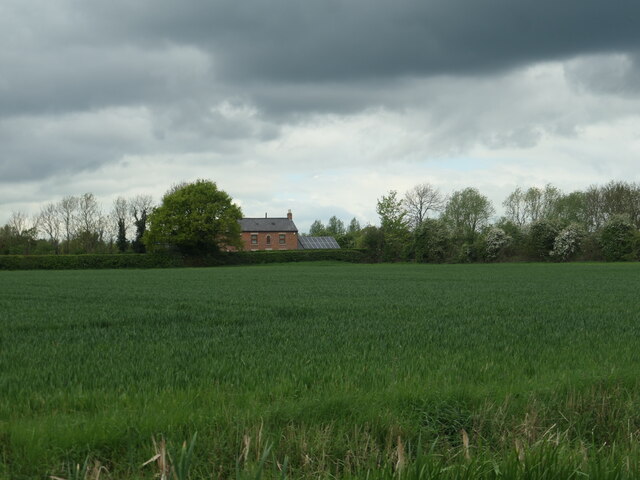
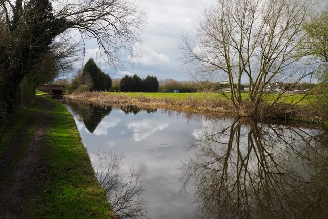
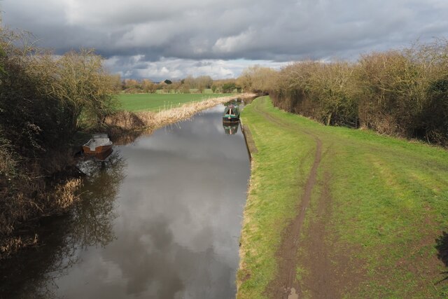
Shardlow Moor is a picturesque area located in Derbyshire, England. It is situated near the village of Shardlow and covers an expansive stretch of land characterized by downs and moorland. The moor is nestled within the beautiful countryside of Derbyshire, known for its rolling hills, green pastures, and tranquil atmosphere.

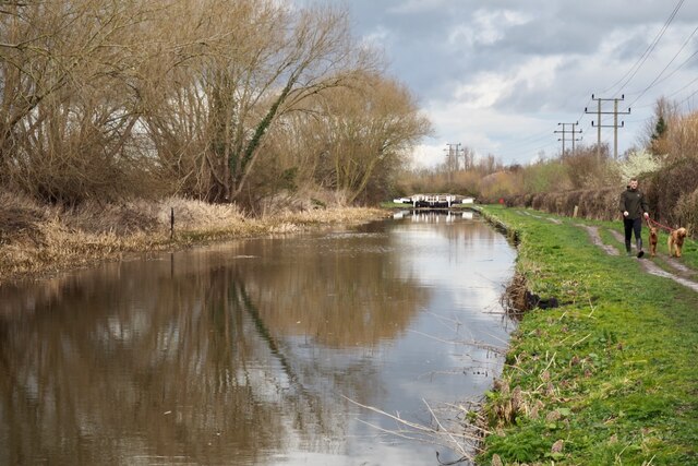
Shardlow Moor boasts a diverse ecosystem, with a variety of plant and animal species thriving in its natural habitat. The moorland is covered in rich heather, gorse, and grasses, creating a stunning landscape that changes colors with the seasons. It is also home to numerous bird species, including lapwings, curlews, and red grouse, making it a popular destination for birdwatchers and nature enthusiasts.

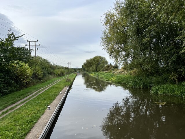
The moor offers a range of activities for visitors to enjoy. Hiking and walking trails crisscross the area, allowing visitors to explore the stunning scenery and take in breathtaking views. The peaceful surroundings make it an ideal location for picnicking or simply unwinding amidst nature.

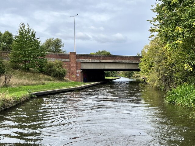
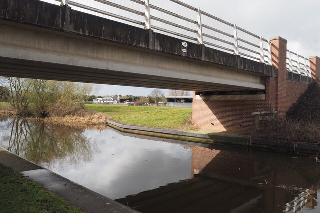
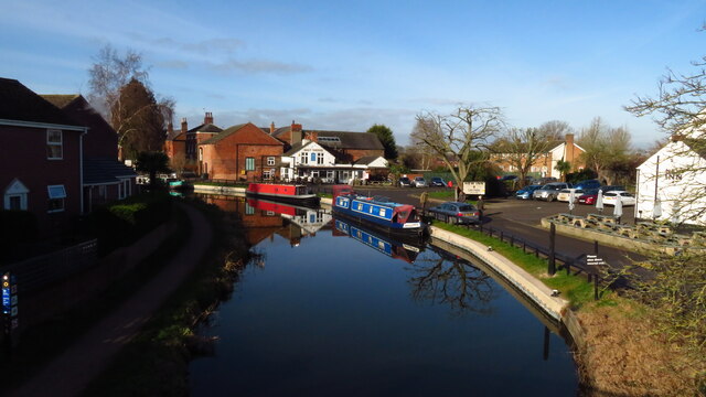
Additionally, Shardlow Moor is a site of historical significance. The area exhibits remnants of its industrial past, with old canal systems and buildings that once played a vital role in the transportation of goods during the Industrial Revolution.

Overall, Shardlow Moor in Derbyshire offers a serene escape from the hustle and bustle of everyday life. Its natural beauty, diverse wildlife, and historical charm make it a must-visit destination for those seeking peace, tranquility, and a connection with nature.

If you have any feedback on the listing, please let us know in the comments section below.

Shardlow Moor Images

Images are sourced within 2km of 52.874072/-1.3666965 or Grid Reference SK4230. Thanks to Geograph Open Source API. All images are credited.

Dark clouds over Moorland House Not generating much energy on the panels at the moment.
Dark clouds over Moorland House
Not generating much energy on the panels at the moment.
Hicken's Bridge The A50 bridge over the Trent and Mersey Canal.
Hicken's Bridge
The A50 bridge over the Trent and Mersey Canal.
The Trent and Mersey Canal Near Shardlow
The Trent and Mersey Canal
Near Shardlow
The Trent and Mersey Canal Looking towards Aston-on-Trent.
The Trent and Mersey Canal
Looking towards Aston-on-Trent.
Weston Road, Aston-on-Trent Aston-on-Trent has a population of about 1,700 (2011 census) making it slightly larger than its neighbour Weston-on-Trent. It is not particularly close to the River Trent, having been established away from the flood plain. In this Sunday lunchtime view traffic cones were in place in connection with the village well-dressing festival which was taking place over the weekend. Wandering around, several of the locals could be heard complaining of a sore head, so it sounds as though a good time was had by all the previous evening.
Weston Road, Aston-on-Trent
Aston-on-Trent has a population of about 1,700 (2011 census) making it slightly larger than its neighbour Weston-on-Trent. It is not particularly close to the River Trent, having been established away from the flood plain. In this Sunday lunchtime view traffic cones were in place in connection with the village well-dressing festival which was taking place over the weekend. Wandering around, several of the locals could be heard complaining of a sore head, so it sounds as though a good time was had by all the previous evening.
Bridge 3A Trent & Mersey Canal (1997) This seems to be an expensive looking bridge for what appears to be just a farm track running across it.

The date is probably the big clue as this is the time that the nearby A50 was finished.  Presumably therefore this was needed to restore access to the farm visible behind destroyed by the new road.
Bridge 3A Trent & Mersey Canal (1997)
This seems to be an expensive looking bridge for what appears to be just a farm track running across it. The date is probably the big clue as this is the time that the nearby A50 was finished. Presumably therefore this was needed to restore access to the farm visible behind destroyed by the new road.
The Trent & Mersey Canal Hicken's Bridge carrying the A50 visible in the distance.
The Trent & Mersey Canal
Hicken's Bridge carrying the A50 visible in the distance.
Canal Milepost Shardlow 1 Mile Preston Brook 91 Miles.

Grade II listed List Entry Number:1088357 <span class="nowrap"><a title="https://historicengland.org.uk/listing/the-list/list-entry/1088357?section=official-list-entry" rel="nofollow ugc noopener" href="https://historicengland.org.uk/listing/the-list/list-entry/1088357?section=official-list-entry">Link</a><img style="margin-left:2px;" alt="External link" title="External link - shift click to open in new window" src="https://s1.geograph.org.uk/img/external.png" width="10" height="10"/></span>

Originally at SK429 298.

See also <a href="https://www.geograph.org.uk/photo/6897993">SK4329 : A canal milepost</a> <a href="https://www.geograph.org.uk/photo/5700633">SK4329 : Shardlow 1 mile</a>.
Canal Milepost
Shardlow 1 Mile Preston Brook 91 Miles. Grade II listed List Entry Number:1088357 LinkExternal link Originally at SK429 298. See also SK4329 : A canal milepost SK4329 : Shardlow 1 mile.
Shardlow Quarry Sand and gravel extraction from the Trent flood plain.
Shardlow Quarry
Sand and gravel extraction from the Trent flood plain.
The Trent and Mesey Canal from Acrelane Bridge The Trent and Mersey Canal is 93·5 miles in length from Derwent Mouth to Preston Brook. The first cut was made by Josiah Wedgwood in July 1766 at Middleport (Stoke-on-Trent). The eastern section between Derwent Mouth and Shugborough (the junction with the Staffordshire and Worcestershire Canal) was already operational by 1770 and the whole canal through to Preston Brook, where it linked with the Bridgewater Canal was open for business by 1777. James Brindley was the engineer until his death in 1772. There are seventy-six locks en route to raise and lower the water level where hills impede the course. There are four tunnels, including the famous Harecastle Tunnel near Stoke-on-Trent.
The Trent and Mesey Canal from Acrelane Bridge
The Trent and Mersey Canal is 93·5 miles in length from Derwent Mouth to Preston Brook. The first cut was made by Josiah Wedgwood in July 1766 at Middleport (Stoke-on-Trent). The eastern section between Derwent Mouth and Shugborough (the junction with the Staffordshire and Worcestershire Canal) was already operational by 1770 and the whole canal through to Preston Brook, where it linked with the Bridgewater Canal was open for business by 1777. James Brindley was the engineer until his death in 1772. There are seventy-six locks en route to raise and lower the water level where hills impede the course. There are four tunnels, including the famous Harecastle Tunnel near Stoke-on-Trent.
Distant view of Aston Lock On the Trent & Mersey Canal east of Aston-on-Trent.
Distant view of Aston Lock
On the Trent & Mersey Canal east of Aston-on-Trent.
The former Lady in Grey Fine Grade II listed building.  Sadly still vacant and decaying See <a href="https://www.geograph.org.uk/photo/5659790">SK4430 : The Lady in Grey</a>.

List Entry Number: 1205393 <span class="nowrap"><a title="https://historicengland.org.uk/listing/the-list/list-entry/1205393" rel="nofollow ugc noopener" href="https://historicengland.org.uk/listing/the-list/list-entry/1205393">Link</a><img style="margin-left:2px;" alt="External link" title="External link - shift click to open in new window" src="https://s1.geograph.org.uk/img/external.png" width="10" height="10"/></span>
The former Lady in Grey
Fine Grade II listed building. Sadly still vacant and decaying See SK4430 : The Lady in Grey. List Entry Number: 1205393 LinkExternal link
The former Lady in Grey Looked to have been closed a year or two when this was taken.  After realising that I have not got a picture of the decaying sign on this visit I planned to return to rectify that omission.  Unfortunately I never did and it is now long gone.  See also <a href="https://www.geograph.org.uk/photo/5659790">SK4430 : The Lady in Grey</a> and <a href="https://www.geograph.org.uk/photo/7019925">SK4430 : The former Lady in Grey</a>.

The building is Grade II listed List Entry Number: 1205393 <span class="nowrap"><a title="https://historicengland.org.uk/listing/the-list/list-entry/1205393" rel="nofollow ugc noopener" href="https://historicengland.org.uk/listing/the-list/list-entry/1205393">Link</a><img style="margin-left:2px;" alt="External link" title="External link - shift click to open in new window" src="https://s1.geograph.org.uk/img/external.png" width="10" height="10"/></span>
The former Lady in Grey
Looked to have been closed a year or two when this was taken. After realising that I have not got a picture of the decaying sign on this visit I planned to return to rectify that omission. Unfortunately I never did and it is now long gone. See also SK4430 : The Lady in Grey and SK4430 : The former Lady in Grey. The building is Grade II listed List Entry Number: 1205393 LinkExternal link
The Malt Shovel
The Malt Shovel
The sign of the Malt Shovel See <a href="https://www.geograph.org.uk/photo/7021550">SK4430 : The Malt Shovel</a>.
The sign of the Malt Shovel
The New Inn
The New Inn
The sign of the New Inn
Trent & Mersey Canal at Shardlow Wharf
Show me another place!

Shardlow Moor is located at Grid Ref: SK4230 (Lat: 52.874072, Lng: -1.3666965)

Administrative County: Derbyshire

District: South Derbyshire

Police Authority: Derbyshire

What 3 Words

///tractor.incur.rich. Near Aston-on-Trent, Derbyshire

Nearby Locations

Aston Moor Shardlow Moor

Related Wikis

Derby South services

The Derby South services are two service stations run by Welcome Break on either side of the A50 road. The services are located in South Derbyshire, near...
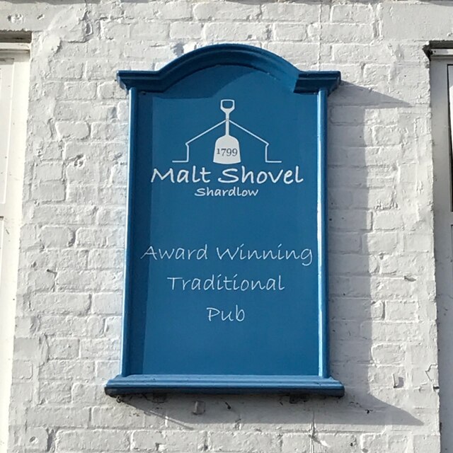
Shardlow

Shardlow is a village in Derbyshire, England about 6 miles (9.7 km) southeast of Derby and 11 miles (18 km) southwest of Nottingham. Part of the civil...

St James' Church, Shardlow

St James’ Church, Shardlow is a Grade II listed parish church in the Church of England in Shardlow, Derbyshire. == History == The foundation stone was...

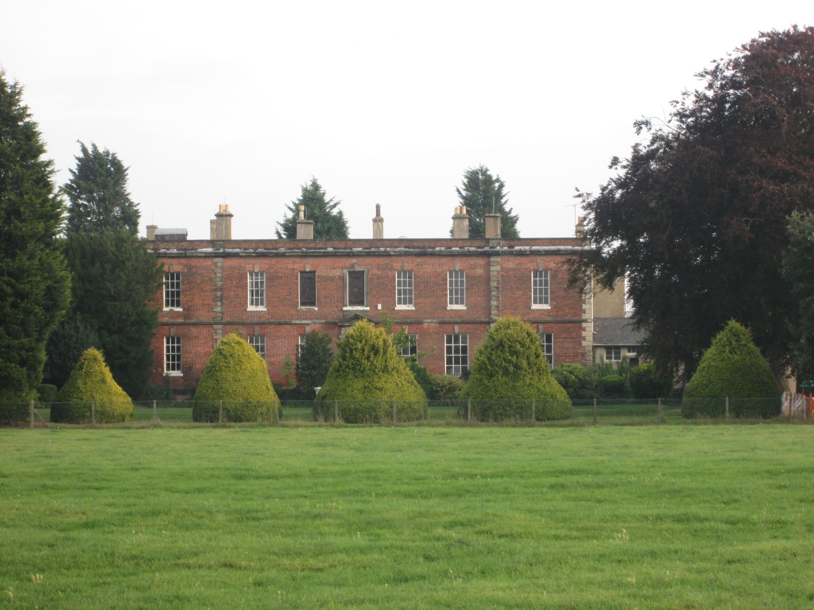
Shardlow Hall, Derbyshire

Shardlow Hall is a 17th-century former country house at Shardlow, Derbyshire now in use as commercial offices. It is a Grade II* listed building which...

Shardlow Hall (school)

Shardlow Hall was a school in Shardlow, a village seven miles south of Derby in the English Midlands. It was founded by B.O.Corbett, who had played football...

Hanson Log Boat

The Hanson Log Boat was a Bronze Age dugout boat found in a gravel pit in Shardlow in Derbyshire. The log boat is now in Derby Museum and Art Gallery....

Shardlow and Great Wilne

Shardlow and Great Wilne is a civil parish in the South Derbyshire district of the English county of Derbyshire. The population of the civil parish taken...

South East Derbyshire Rural District

South East Derbyshire was a rural district in Derbyshire, England from 1894 to 1974. It covered an area to the south-east of Derby. It was formed as Shardlow...

Nearby Amenities

Located within 500m of 52.874072,-1.3666965
Post Box
Brand: Royal Mail
Brand Wikidata: Q638098
Brand Wikipedia: en:Royal Mail
Collection Times: Mo-Fr 17:00; Sa 10:30
Operator: Royal Mail
Operator Wikidata: Q638098
Post Box Design: type_k
Post Box Type: pillar
Ref: DE72 247
Royal Cypher: EIIR
Royal Cypher Wikidata: Q33102113
Source: survey
Lat/Long: 52.871203/-1.3615948
Addr City: Derby
Addr Housenumber: 33A
Addr Postcode: DE72 2GR
Addr Street: London Road
Disused Amenity: post_office
Old Name: Shardlow Post Office
Old Ref Pol Id: 11349
Source: survey
Source Addr: Food Hygiene Open Data
Lat/Long: 52.8712353/-1.3615241
Entrance: main
Lat/Long: 52.8712069/-1.3615529
Bus Stop
Cheal Close
Bus: yes
Public Transport: platform
Shelter: no
Source: survey
Lat/Long: 52.8709445/-1.3634458
Bus Stop
Cheal Close
Bus: yes
Public Transport: platform
Shelter: yes
Source: survey
Lat/Long: 52.8710701/-1.3631374
Bus Stop
Glebe Farm
Both Ways: yes
Bus: yes
Naptan AtcoCode: 100052584
Naptan NaptanCode: dbsjawpd
Public Transport: platform
Shelter: yes
Source: survey
Lat/Long: 52.8748739/-1.372892
Entrance: home
Lat/Long: 52.8706553/-1.3647518
Noexit: yes
Lat/Long: 52.8706796/-1.3644937
Entrance: home
Lat/Long: 52.8707702/-1.3647687
Entrance: home
Lat/Long: 52.8707735/-1.3648408
Advertising: board
Operator: Shardlow & Great Wilne Parish Council
Lat/Long: 52.8709098/-1.3635224
Alphine Aero Ltd
Addr City: Derby
Addr Housename: Manor Farm House
Addr Postcode: DE72 2GR
Addr Street: London Road
Office: company
Source: survey
Source Addr: Companies House Registered Companies
Website: http://www.alphineaero.co.uk/
Lat/Long: 52.8706819/-1.3655917
Mark Blood Building Design
Addr City: Derby
Addr Housename: Manor Farm House
Addr Postcode: DE72 2GR
Addr Street: London Road
Office: architect
Source: survey
Source Addr: Companies House Registered Companies
Website: http://www.markblood.co.uk/
Lat/Long: 52.8706819/-1.3655764
Building: industrial
Source: Bing
Lat/Long: 52.8697972/-1.368289
Addr City: Derby
Addr Housename: The Gables
Addr Housenumber: 37B
Addr Postcode: DE72 2GR
Addr Street: London Road
Building: house
Source: survey
Source Addr Postcode: OS Opendata Codepoint
Source Building: Bing
Lat/Long: 52.8714497/-1.3609949
Defibrillator
Access: yes
Defibrillator Location: Outside Florentine Coffee Shop (former post office) on London Road, Shardlow
Emergency: defibrillator
Indoor: no
Opening Hours: 24/7
Ref GB The Circuit: 07A8733E-2493-4DD5-A0F1-68CEFE1F0815
Source: survey
Lat/Long: 52.8712222/-1.3615063
Power: pole
Lat/Long: 52.877171/-1.3709039
Location Transition: yes
Power: pole
Lat/Long: 52.8761969/-1.3719425
Location Transition: yes
Power: pole
Lat/Long: 52.8762058/-1.3718446
Waste Basket
Colour: black
Material: metal
Operator: South Derbyshire District Council
Waste: trash
Lat/Long: 52.872034/-1.3675349
Waste Basket
Colour: red
Operator: South Derbyshire District Council
Waste: dog_excrement
Lat/Long: 52.870289/-1.3633535
The data included in this document is from www.openstreetmap.org. The data is made available under ODbL.

Have you been to Shardlow Moor?

Leave your review of Shardlow Moor below (or comments, questions and feedback).