Hollington Park

Downs, Moorland in Hampshire Basingstoke and Deane

England

Hollington Park

Highclere Street, Hollington Cross
Highclere Street, Hollington Cross Credit: David Howard

Hollington Park, located in Hampshire, England, is a picturesque area that encompasses both downs and moorland landscapes. Spread over a vast expanse, the park offers visitors a diverse range of natural beauty and outdoor activities.

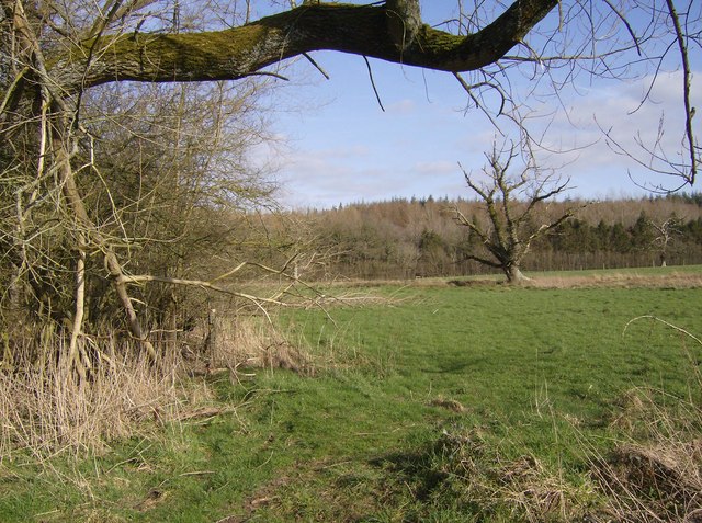
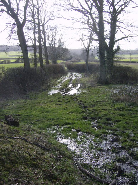
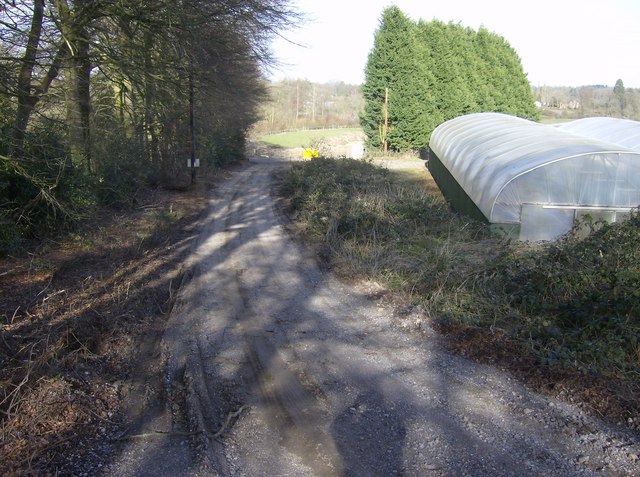
The downs area of Hollington Park is characterized by rolling hills covered in lush, green grass. These hills provide stunning panoramic views of the surrounding countryside, making it a popular spot for hikers, picnickers, and nature enthusiasts. The downs also serve as a habitat for various plant and animal species, including wildflowers, butterflies, and birds.

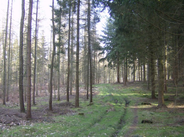
In contrast, the moorland section of Hollington Park offers a different experience altogether. Here, visitors can explore vast expanses of open moorland, characterized by heather, gorse, and bracken. This unique landscape provides a habitat for a variety of wildlife, including birds of prey, deer, and small mammals. The moorland is also home to several walking trails, allowing visitors to immerse themselves in the peaceful and untouched surroundings.

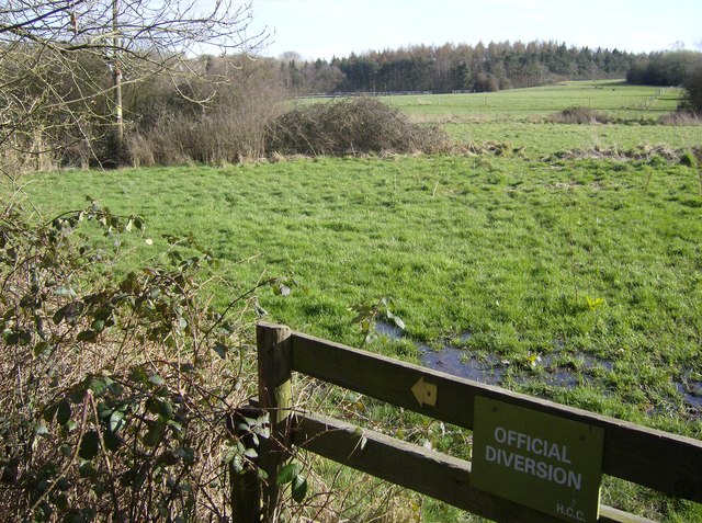
Hollington Park is well-maintained and offers facilities such as parking, picnic areas, and public footpaths for easy access. The park is open to the public year-round, welcoming visitors of all ages to enjoy the tranquil beauty and explore the diverse landscapes. Whether one is seeking a peaceful walk, a family outing, or a chance to connect with nature, Hollington Park in Hampshire provides an idyllic setting for all to enjoy.

If you have any feedback on the listing, please let us know in the comments section below.

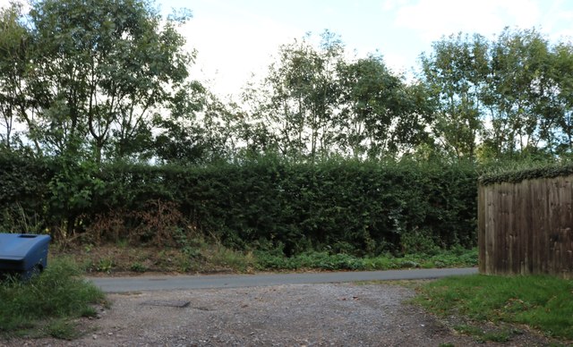
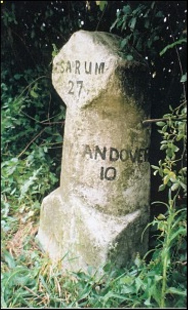
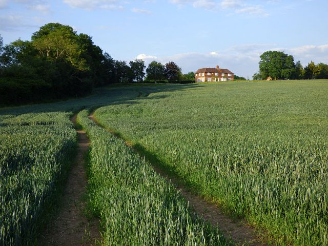
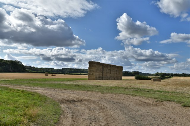
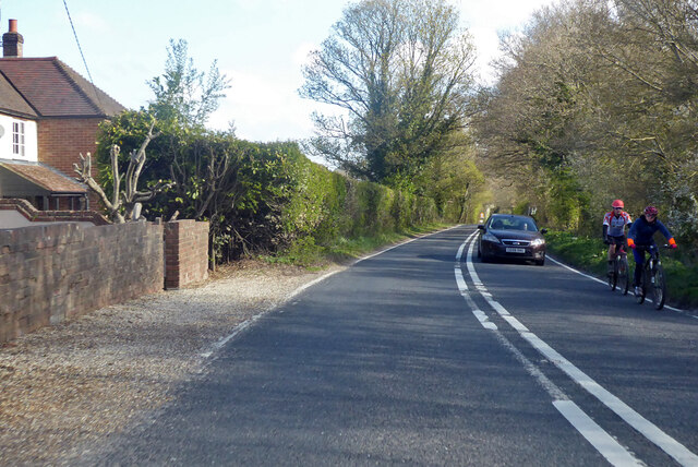
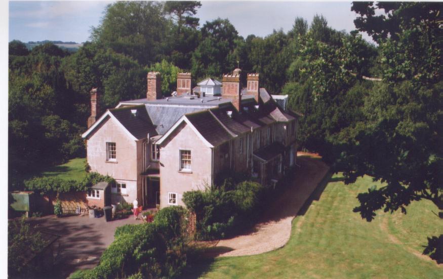
Hollington Park Images

Images are sourced within 2km of 51.344875/-1.3883775 or Grid Reference SU4260. Thanks to Geograph Open Source API. All images are credited.

Highclere Street, Hollington Cross
Old Milestone by the A343, near Highclere Farm, Highclere parish Carved stone post by the A343, in parish of HIGHCLERE (BASINGSTOKE AND DEANE District), near Highclere Farm, South of village, just before bridge, deep in the hedge, on West side of road. Newbury waist, erected by the Andover & Chilton Pond turnpike trust in the 18th century. 

Inscription reads:-
: NEWBURY / 5 : : SARUM / 29 (overpainted 27) / (OXFORD / 31) : : ANDOVER / 11 (overpainted 10) :

Grade II listed.  
List Entry Number: 1419228 <span class="nowrap"><a title="https://historicengland.org.uk/listing/the-list/list-entry/1419228" rel="nofollow ugc noopener" href="https://historicengland.org.uk/listing/the-list/list-entry/1419228">Link</a><img style="margin-left:2px;" alt="External link" title="External link - shift click to open in new window" src="https://s1.geograph.org.uk/img/external.png" width="10" height="10"/></span>

Milestone Society National ID: HA_NEAN05.
Old Milestone by the A343, near Highclere Farm, Highclere parish
Carved stone post by the A343, in parish of HIGHCLERE (BASINGSTOKE AND DEANE District), near Highclere Farm, South of village, just before bridge, deep in the hedge, on West side of road. Newbury waist, erected by the Andover & Chilton Pond turnpike trust in the 18th century. Inscription reads:- : NEWBURY / 5 : : SARUM / 29 (overpainted 27) / (OXFORD / 31) : : ANDOVER / 11 (overpainted 10) : Grade II listed. List Entry Number: 1419228 LinkExternal link Milestone Society National ID: HA_NEAN05.
Farmland, East Woodhay A crop of wheat to the west of Pill Hill.
Farmland, East Woodhay
A crop of wheat to the west of Pill Hill.
Highclere: Harvested agricultural land
A343 towards Newbury
In Highclere Wood Within the Highclere Estate, Highclere Wood is mainly conifers but quite thinly planted.  This area of the wood is called Ivyhouse Copse on 1:25K map, but is bigger than expected for a copse.  There is a footpath through.
In Highclere Wood
Within the Highclere Estate, Highclere Wood is mainly conifers but quite thinly planted. This area of the wood is called Ivyhouse Copse on 1:25K map, but is bigger than expected for a copse. There is a footpath through.
Footpath to Highclere estate As the footpath leaves the A343 there is immediately a diversion round woodland.  The path runs parallel to the southern edge of the wood in a very soggy pasture.  The trees in the background are also part of Highclere Wood within the square.
Footpath to Highclere estate
As the footpath leaves the A343 there is immediately a diversion round woodland. The path runs parallel to the southern edge of the wood in a very soggy pasture. The trees in the background are also part of Highclere Wood within the square.
Footpath to Highclere estate The path stays in pasture just outside woodland to the left.  Ahead Highclere Wood is part of the same continuous section of woodland within the square.
Footpath to Highclere estate
The path stays in pasture just outside woodland to the left. Ahead Highclere Wood is part of the same continuous section of woodland within the square.
Houses in Highclere The first three gables, and six ground floor windows all belong to the same property, For Sale.  The properties have all had their front doors blocked up and the houses "turned round" to face a courtyard behind.  (Note this is not a sales pitch, just what I saw when walking past!)
Houses in Highclere
The first three gables, and six ground floor windows all belong to the same property, For Sale. The properties have all had their front doors blocked up and the houses "turned round" to face a courtyard behind. (Note this is not a sales pitch, just what I saw when walking past!)
Footpath in Highclere estate The footpath, still in pasture following the edge of the wood, crosses a small stream on this footbridge.
Footpath in Highclere estate
The footpath, still in pasture following the edge of the wood, crosses a small stream on this footbridge.
Highclere Wood This section is called Ivyhouse Copse on the 1:25K map, but it is more extensive than that.  There is a stiffish climb up from the open pasture behind, although it looks flat here!
Highclere Wood
This section is called Ivyhouse Copse on the 1:25K map, but it is more extensive than that. There is a stiffish climb up from the open pasture behind, although it looks flat here!
Off Hollington Lane Looking west, this field and woodland pattern is typical of this square.
Off Hollington Lane
Looking west, this field and woodland pattern is typical of this square.
The Natural Garden Well advertised with lots of brown signs approaching it, it all seems a bit unfinished when you arrive, and as the sign says "land restoration" continues.
The Natural Garden
Well advertised with lots of brown signs approaching it, it all seems a bit unfinished when you arrive, and as the sign says "land restoration" continues.
Track to Pill Hill Not marked as a footpath on the map, but plenty of evidence of walkers and horses using it.
Track to Pill Hill
Not marked as a footpath on the map, but plenty of evidence of walkers and horses using it.
Green Lane? Rather brown (muddy) in parts, and blue (wet) in others.
Green Lane?
Rather brown (muddy) in parts, and blue (wet) in others.
The Natural Garden Well advertised (not by me) but at the moment seems to consist of two poly tunnels and a lot of constructional work.
The Natural Garden
Well advertised (not by me) but at the moment seems to consist of two poly tunnels and a lot of constructional work.
An isolated barn Marked on the OS map, so worthy of having its picture taken.  Fascinating hedgerow as well for those interested.
An isolated barn
Marked on the OS map, so worthy of having its picture taken. Fascinating hedgerow as well for those interested.
Sunset, Narington Copse, Highclere, Newbury I arrived here following signs from the A343 to the Natural Garden. The sun was setting and I was able to obtain this image.
Sunset, Narington Copse, Highclere, Newbury
I arrived here following signs from the A343 to the Natural Garden. The sun was setting and I was able to obtain this image.
Show me another place!

Hollington Park is located at Grid Ref: SU4260 (Lat: 51.344875, Lng: -1.3883775)

Administrative County: Hampshire

District: Basingstoke and Deane

Police Authority: Hampshire

What 3 Words

///glitz.briefing.depths. Near Highclere, Hampshire

Related Wikis

Woolton Hill

Woolton Hill is a village in Hampshire, England, in the civil parish of East Woodhay. The village lies approximately 4 miles (6 km) south-west of the centre...

Highclere

Highclere (pronounced ) is a village and civil parish situated in the North Wessex Downs (an Area of Outstanding Natural Beauty) in the Basingstoke and...

Gainsborough Stud

Gainsborough Stud is a stud farm based in Woolton Hill, Hampshire, 3 miles (4.8 km) outside Newbury. It is owned by United Arab Emirates-based international...

Stargroves

Stargroves (also known as Stargrove House) is a manor house and associated estate at East Woodhay in the English county of Hampshire. The house belonged...

East Woodhay

East Woodhay is a village and civil parish in Hampshire, England. The village is approximately 5.5 miles (9 km) south-west of Newbury in Berkshire. At...

Penwood

Penwood is a village in the civil parish of Highclere in the Basingstoke and Deane district of Hampshire, England. Its nearest town is Newbury, which lies...

Bourne House, East Woodhay

Bourne House, East Woodhay, lies at the northwestern tip of the parish of Widehaye in the Evingar hundred, in Hampshire, England. == History == With an...

Highclere Park

Highclere Park is a 69.6-hectare (172-acre) biological Site of Special Scientific Interest east of Highclere in Hampshire. It is the park of Highclere...

Nearby Amenities

Located within 500m of 51.344875,-1.3883775
Post Box
Post Box Type: lamp
Ref: RG20 110
Royal Cypher: EIIR
Royal Cypher Wikidata: Q33102113
Lat/Long: 51.3488668/-1.3914926
Barrier: stile
Lat/Long: 51.3449007/-1.382192
Barrier: stile
Lat/Long: 51.3449354/-1.3822982
The data included in this document is from www.openstreetmap.org. The data is made available under ODbL.

Have you been to Hollington Park?

Leave your review of Hollington Park below (or comments, questions and feedback).