Headon Warren

Downs, Moorland in Hampshire

England

Headon Warren

The Old Battery
The Old Battery Credit: Barry Shimmon

The requested URL returned error: 429 Too Many Requests

If you have any feedback on the listing, please let us know in the comments section below.

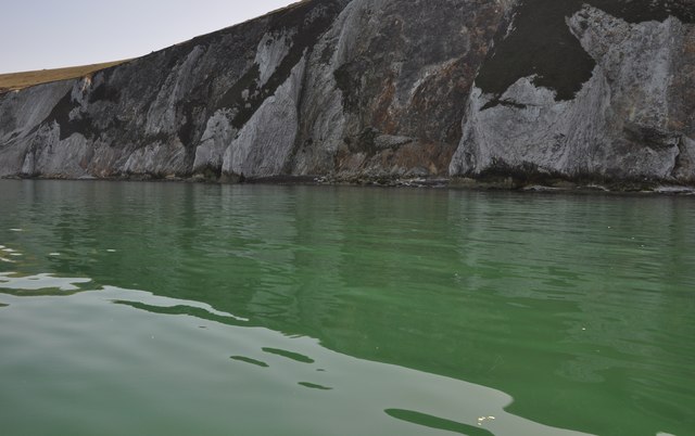
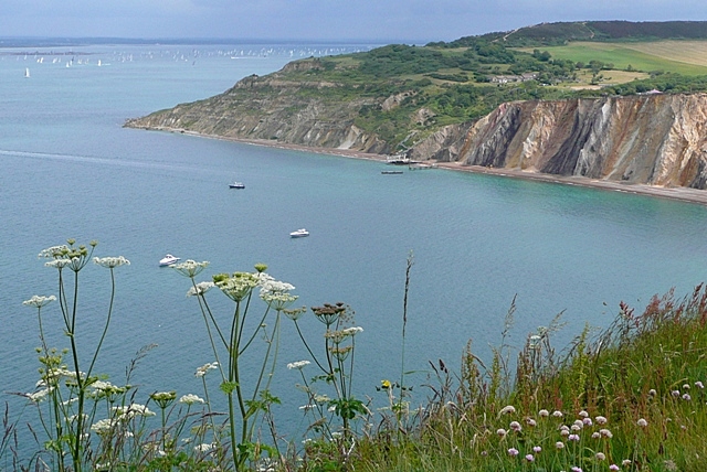
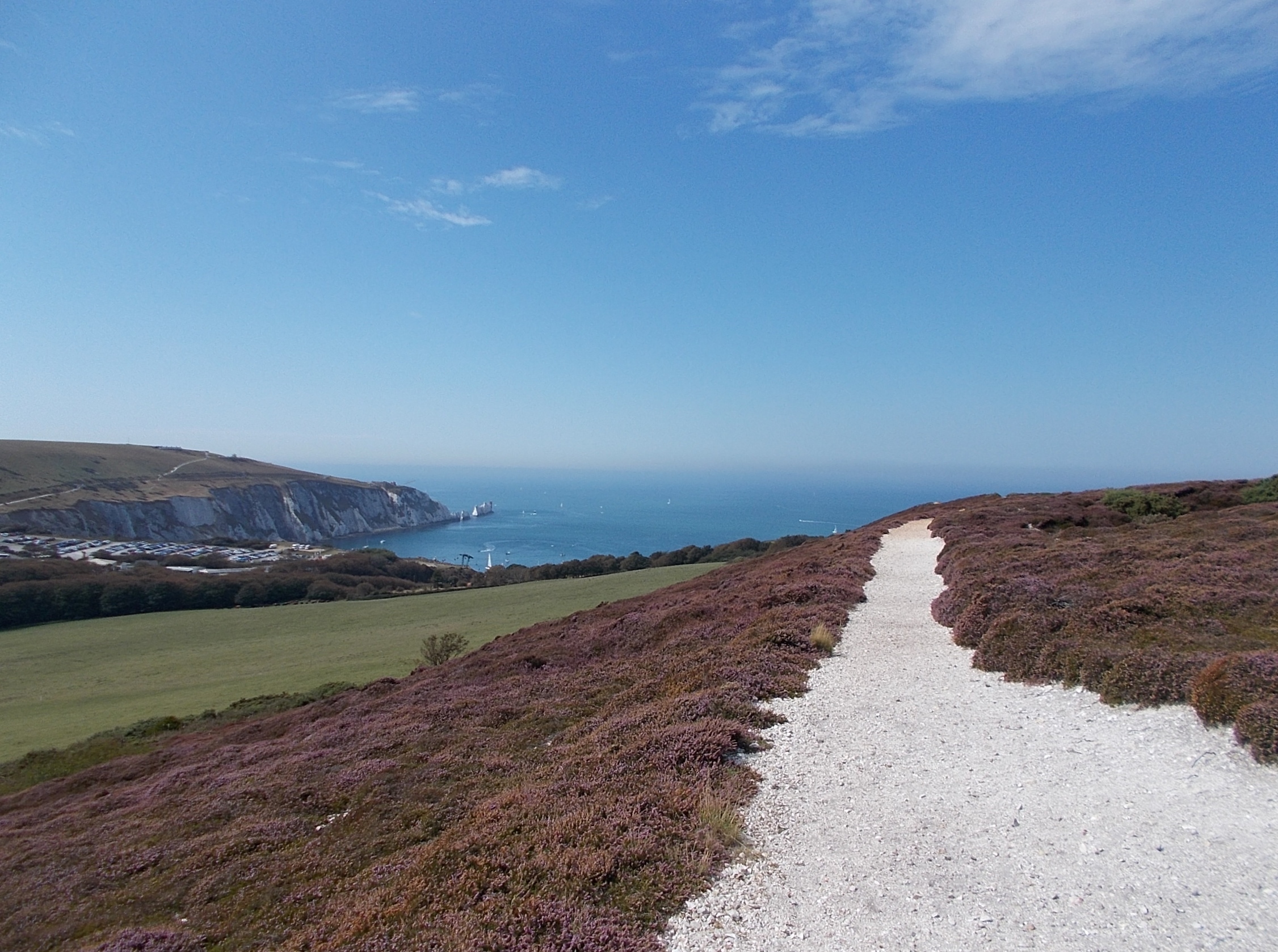
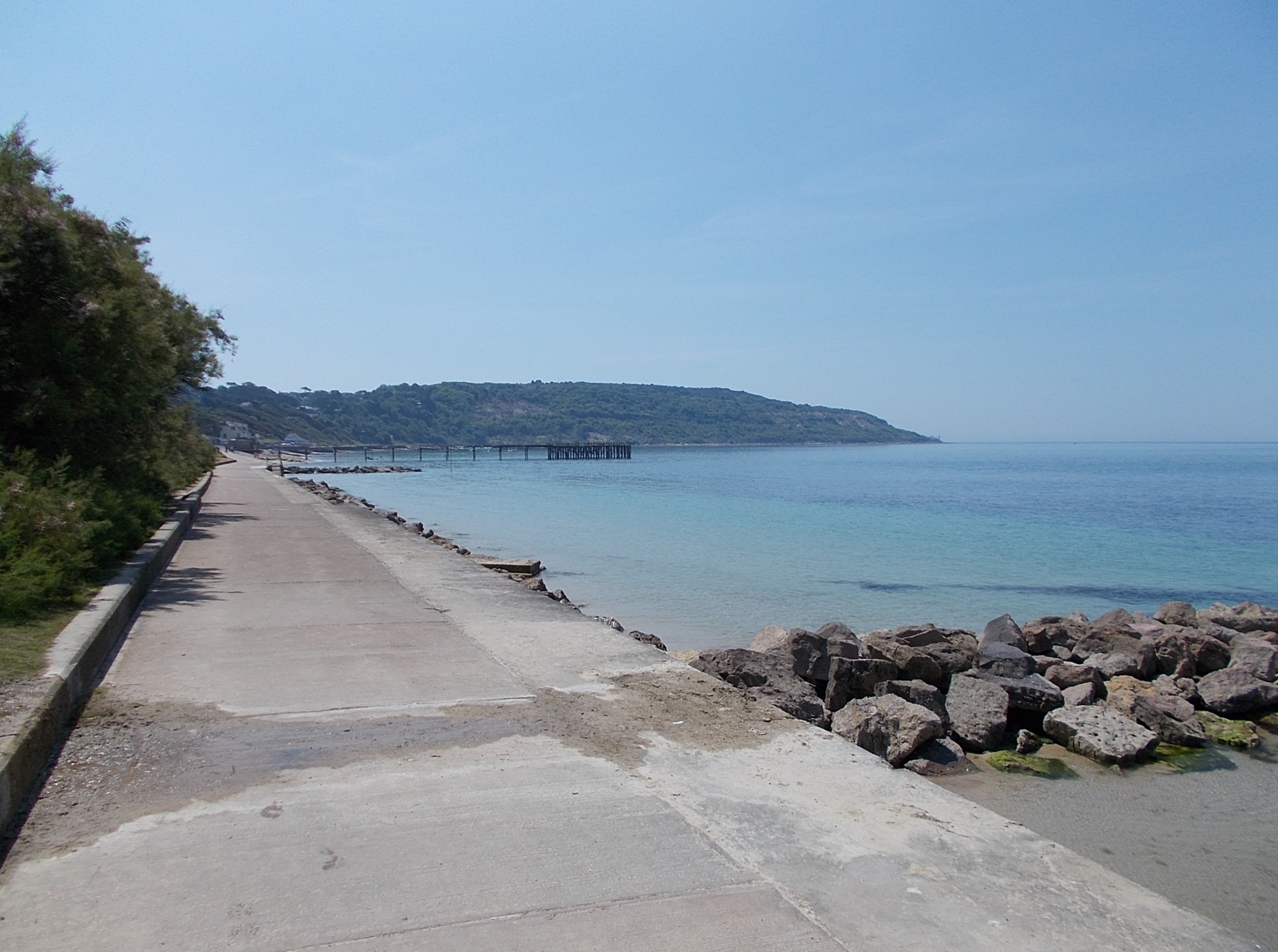
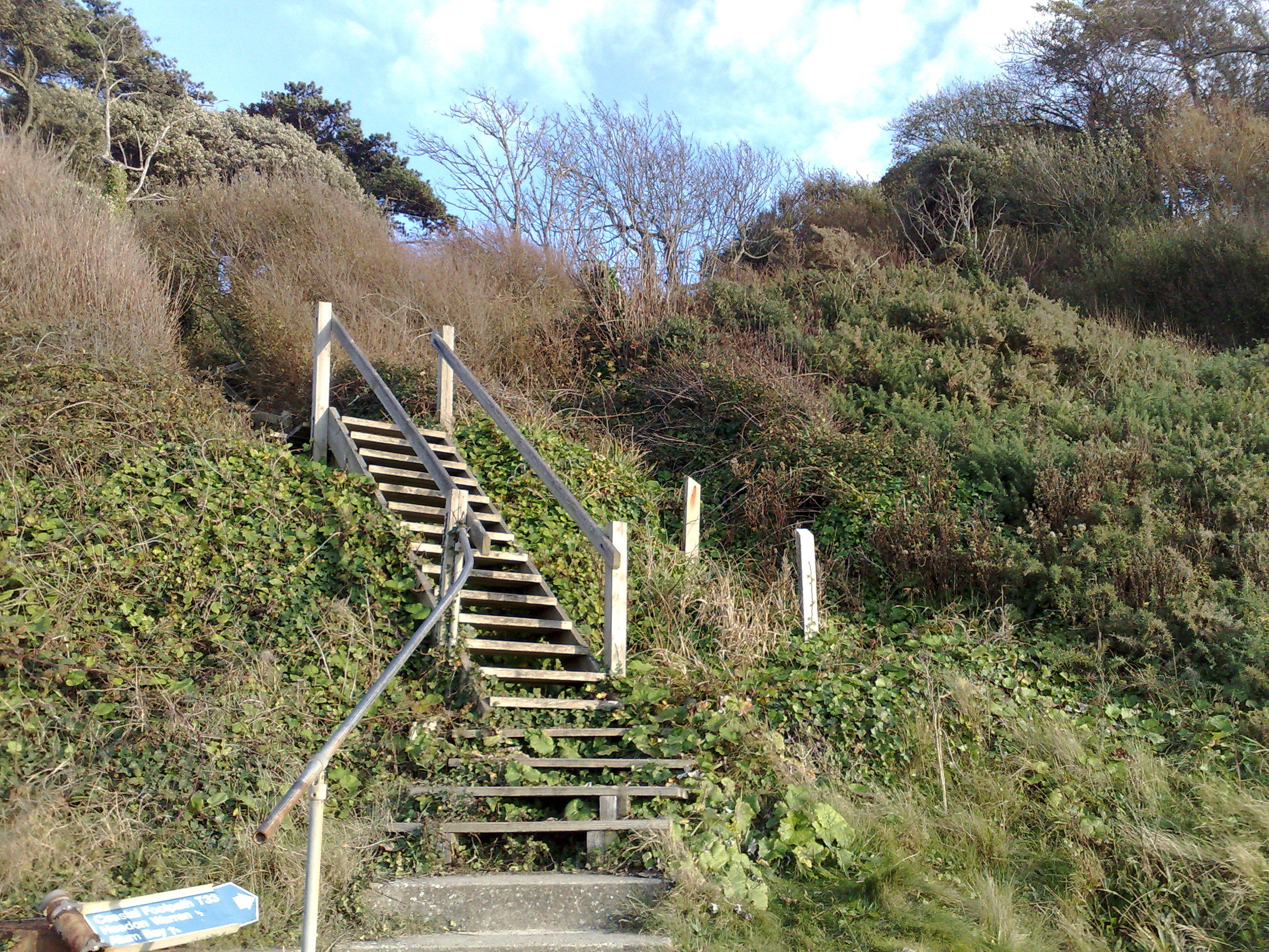
Headon Warren Images

Images are sourced within 2km of 50.672789/-1.5599493 or Grid Reference SZ3185. Thanks to Geograph Open Source API. All images are credited.

The Old Battery
The Old Battery
The Guns One of the two guns at The Old Battery by The Needles
The Guns
One of the two guns at The Old Battery by The Needles
Alum Bay in 1988 As seen from the Old Battery. Hatherwood Point is on the right of the frame.
Alum Bay in 1988
As seen from the Old Battery. Hatherwood Point is on the right of the frame.
South Wight : The Solent Looking towards the gap between Hampshire and the Isle of Wight which leads into the Solent.
South Wight : The Solent
Looking towards the gap between Hampshire and the Isle of Wight which leads into the Solent.
South Wight : The Needles Looking towards the Needles from a boat ride around the bay.
South Wight : The Needles
Looking towards the Needles from a boat ride around the bay.
South Wight : White Cliffs From the boat looking towards the White Cliffs near The Needles.
South Wight : White Cliffs
From the boat looking towards the White Cliffs near The Needles.
South Wight : White Cliffs at Alum Bay Looking towards the white cliffs at Alum Bay from a passing boat.
South Wight : White Cliffs at Alum Bay
Looking towards the white cliffs at Alum Bay from a passing boat.
South Wight : The Needles Tourist Boat A boat which makes regular trips around Alum Chine Bay and up close to the Needles.
South Wight : The Needles Tourist Boat
A boat which makes regular trips around Alum Chine Bay and up close to the Needles.
South Wight : Lower Needles Point Battery The Needles Battery was a military Battery built on the cliff top above the Needles stacks in 1861–63 to guard the West end of the Solent.
South Wight : Lower Needles Point Battery
The Needles Battery was a military Battery built on the cliff top above the Needles stacks in 1861–63 to guard the West end of the Solent.
South Wight : Headland Road A road from the Needles Battery which heads back along the headland.
South Wight : Headland Road
A road from the Needles Battery which heads back along the headland.
South Wight : Cliff Top From the cliff top looking out to sea with the Needles in view.
South Wight : Cliff Top
From the cliff top looking out to sea with the Needles in view.
South Wight : Highdown Test Site The Rocket Development Division was formed in 1956 and the Rocket Test site at Highdown started functioning exactly one year later.
South Wight : Highdown Test Site
The Rocket Development Division was formed in 1956 and the Rocket Test site at Highdown started functioning exactly one year later.
South Wight : Bus Turning Point A place for the Needles Breezer open top bus to turn around and head back down the hill.
South Wight : Bus Turning Point
A place for the Needles Breezer open top bus to turn around and head back down the hill.
South Wight : Lower Needles Point Battery Looking out towards the edge of the headland with the Needles Battery in view.
South Wight : Lower Needles Point Battery
Looking out towards the edge of the headland with the Needles Battery in view.
The Needles Old Battery The Needles headland was the site of a long standing artillery battery, from the 1860s until it was eventually decommissioned in 1954. The site is now owned by the National Trust and the restored battery has been open to the public since 1982.
The Needles Old Battery
The Needles headland was the site of a long standing artillery battery, from the 1860s until it was eventually decommissioned in 1954. The site is now owned by the National Trust and the restored battery has been open to the public since 1982.
Path from the Old Battery The path from Needles Old Battery towards Needles Park at Alum Bay.
Path from the Old Battery
The path from Needles Old Battery towards Needles Park at Alum Bay.
Needles Old Battery - 'the ditch' This is the moat area that is crossed to enter the site and is not ordinarily publicly accessible. In this area there are the very ruinous remains of Robey undertype steam engines and a Campbell gas engine. Power was provided to operate a lift and searchlights among other equipment. The National Trust was kind enough to allow two of us to view this area but I think it is now regarded as no longer safe to visit.
Needles Old Battery - 'the ditch'
This is the moat area that is crossed to enter the site and is not ordinarily publicly accessible. In this area there are the very ruinous remains of Robey undertype steam engines and a Campbell gas engine. Power was provided to operate a lift and searchlights among other equipment. The National Trust was kind enough to allow two of us to view this area but I think it is now regarded as no longer safe to visit.
Needles Old Battery - remains of steam engine In 1990 the remains of this Robey engine were 'preserved' in a plastic tent in the very damp archway where it has resided since c1890 and has been disused since c1900. The duplex cylinders are 7.5" x 12" and the flywheel is 7' 1" diameter. Two of us get in by prior arrangement and pleading a special interest - I am not sure that access would be allowed now as this part of the site is in poor condition.
Needles Old Battery - remains of steam engine
In 1990 the remains of this Robey engine were 'preserved' in a plastic tent in the very damp archway where it has resided since c1890 and has been disused since c1900. The duplex cylinders are 7.5" x 12" and the flywheel is 7' 1" diameter. Two of us get in by prior arrangement and pleading a special interest - I am not sure that access would be allowed now as this part of the site is in poor condition.
Show me another place!

Headon Warren is located at Grid Ref: SZ3185 (Lat: 50.672789, Lng: -1.5599493)

Unitary Authority: Isle of Wight

Police Authority: Hampshire

What 3 Words

///waltzes.someone.mildest. Near Totland, Isle of Wight

Related Wikis

Hatherwood Battery

Hatherwood Battery (map reference SZ308857) is a battery located to the east of Alum Bay on the Isle of Wight. It is one of the many Palmerston Forts built...

Headon Warren and West High Down SSSI

Headon Warren and West High Down is a 276.3-hectare (683-acre) Site of Special Scientific Interest (SSSI) located at the westernmost end of the Isle of...

Totland Bay

Totland Bay is a bay on the west coast of the Isle of Wight, England. It lies one-quarter of an mile (0.4 km) to the west of the village of Totland from...

Widdick Chine

Widdick Chine is a geological feature on the west coast of the Isle of Wight, England. It is west of the village of Totland. It is a steep coastal gully...

Nearby Amenities

Located within 500m of 50.672789,-1.5599493
Headon Warren Barrow
Tourism: attraction
Lat/Long: 50.6717429/-1.5592568
Source: Bing
Lat/Long: 50.6721361/-1.5585275
Source: Bing
Lat/Long: 50.6722104/-1.5582952
Source: Bing
Lat/Long: 50.6723391/-1.557236
Source: Bing
Lat/Long: 50.6739004/-1.5531345
Source: PGS
Lat/Long: 50.6748149/-1.5657783
Source: PGS
Lat/Long: 50.6751398/-1.5651164
Source: PGS
Lat/Long: 50.6751809/-1.5649174
Source: PGS
Lat/Long: 50.6756959/-1.5635229
Source: PGS
Lat/Long: 50.6759887/-1.5618812
Source: PGS
Lat/Long: 50.6762916/-1.560907
Source: PGS
Lat/Long: 50.6763376/-1.5606232
Source: PGS
Lat/Long: 50.6765991/-1.5590286
Source: PGS
Lat/Long: 50.6767604/-1.5567475
Ford: yes
Lat/Long: 50.6741903/-1.5560062
Bench
Lat/Long: 50.6733134/-1.5543302
Information: board
Tourism: information
Lat/Long: 50.6708044/-1.5657073
Hiking: yes
Information: guidepost
Tourism: information
Lat/Long: 50.6709659/-1.5656564
Hiking: yes
Information: guidepost
Tourism: information
Lat/Long: 50.6744217/-1.5535167
Information: board
Tourism: information
Lat/Long: 50.6732624/-1.5543361
Hiking: yes
Information: guidepost
Tourism: information
Lat/Long: 50.6732769/-1.5542462
Hiking: yes
Information: guidepost
Tourism: information
Lat/Long: 50.6723921/-1.55651
Hiking: yes
Information: guidepost
Tourism: information
Lat/Long: 50.672223/-1.5581945
Hiking: yes
Information: guidepost
Tourism: information
Lat/Long: 50.6722527/-1.558692
Information: board
Tourism: information
Lat/Long: 50.6717189/-1.55938
Bench
Lat/Long: 50.6716917/-1.5623921
Hiking: yes
Information: guidepost
Tourism: information
Lat/Long: 50.6717903/-1.5624645
Headon Warren
Place: locality
Lat/Long: 50.6726114/-1.5602088
Seamark Rock Water Level: awash
Seamark Type: rock
Lat/Long: 50.6753855/-1.5648115
Headon Warren WSR
Man Made: reservoir_covered
Operator: Southern Water
Lat/Long: 50.6715541/-1.5571927
Generator Solar Modules: 4
Generator Source: solar
Generator Type: solar_photovoltaic_panel
Power: generator
Lat/Long: 50.6714954/-1.5572134
The data included in this document is from www.openstreetmap.org. The data is made available under ODbL.

Have you been to Headon Warren?

Leave your review of Headon Warren below (or comments, questions and feedback).