Headon Hill

Hill, Mountain in Hampshire

England

Headon Hill

The Old Battery
The Old Battery Credit: Barry Shimmon

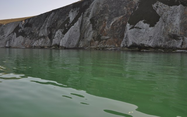
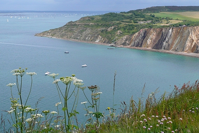
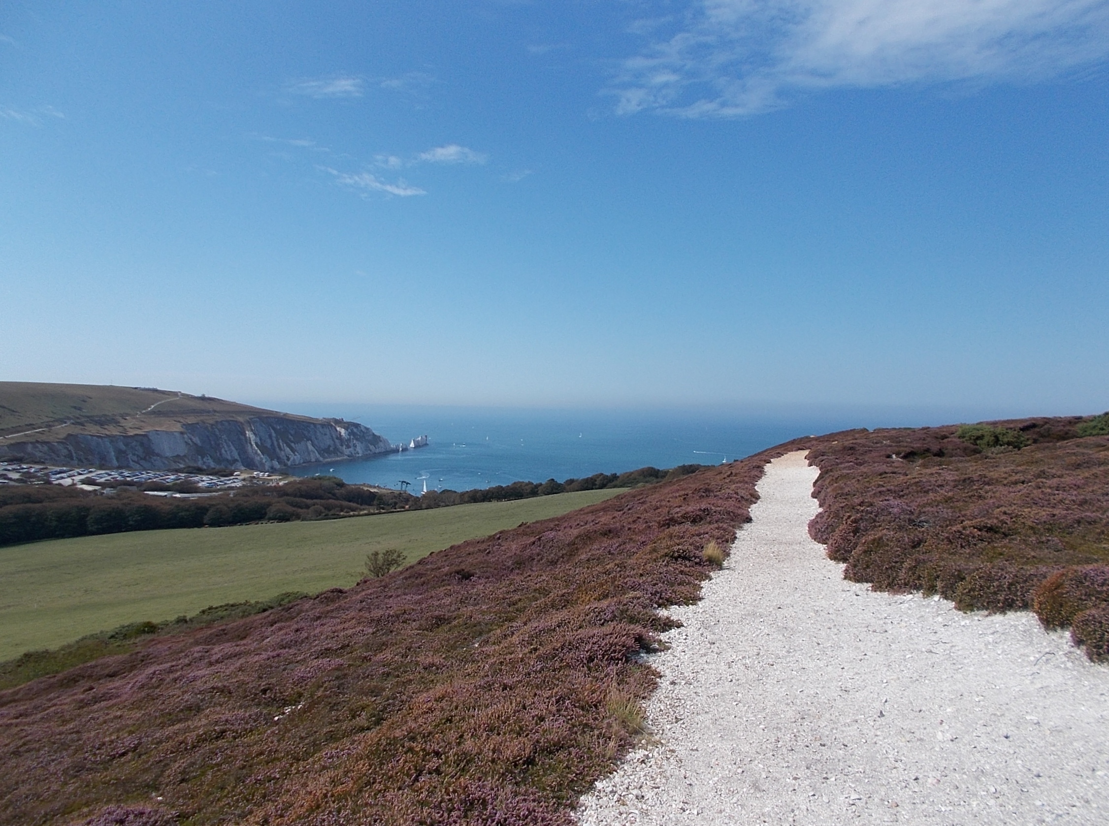
Headon Hill is a prominent landmark located in Hampshire, England. As its name suggests, it is a hill that rises to an elevation of approximately 128 meters (420 feet) above sea level. Situated in the New Forest National Park, it offers breathtaking panoramic views of the surrounding countryside and is a popular destination for hikers, nature enthusiasts, and photographers.

The hill is characterized by its gentle slopes and lush green vegetation, which is predominantly composed of grasses, heather, and scattered trees. It is home to a variety of wildlife, including deer, rabbits, and numerous species of birds. The peacefulness and tranquility of the area make it an ideal spot for birdwatching and wildlife observation.

One of the notable features of Headon Hill is its historical significance. The area has been inhabited for thousands of years, and archaeological evidence suggests that it was a site of human activity during the Neolithic period. It is speculated that the hill may have served as a vantage point or a defensive position in ancient times.

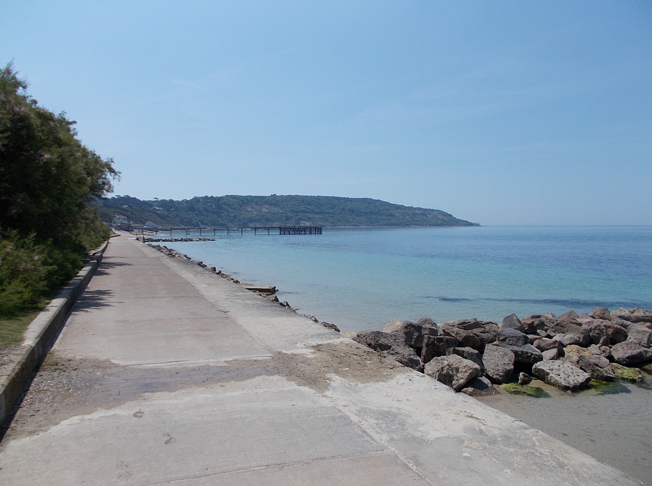
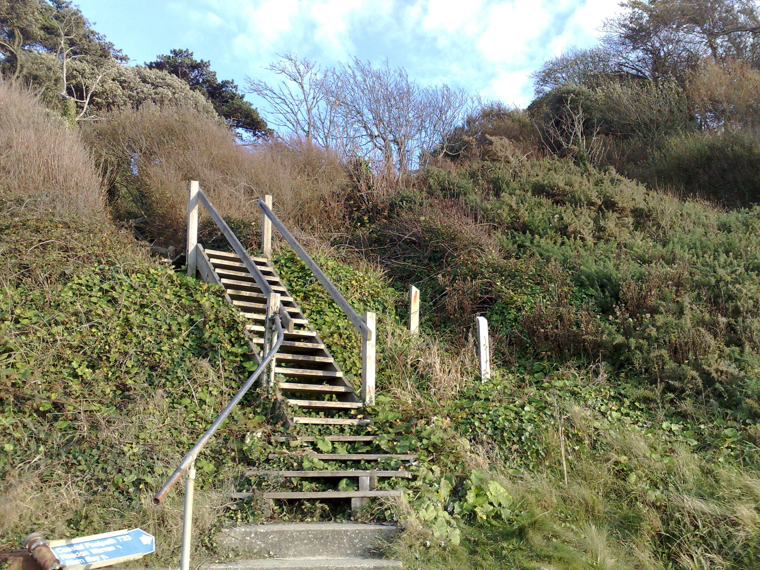
Today, Headon Hill attracts both locals and tourists alike, who come to enjoy its natural beauty and engage in outdoor activities such as hiking, picnicking, and horseback riding. The hill is easily accessible, with several footpaths and trails leading to its summit. Visitors can also explore the nearby villages and attractions, such as the charming town of Lyndhurst and the renowned Beaulieu Motor Museum.

In conclusion, Headon Hill is a picturesque hill in Hampshire, offering stunning views, rich wildlife, and a glimpse into the region's history. It is a beloved destination for those seeking to immerse themselves in nature and experience the beauty of the English countryside.

If you have any feedback on the listing, please let us know in the comments section below.

Headon Hill Images

Images are sourced within 2km of 50.671707/-1.5591953 or Grid Reference SZ3185. Thanks to Geograph Open Source API. All images are credited.

The Old Battery
The Old Battery
Isle of Wight from Mudeford Spit The grass dunes on Mudeford spit frame the tip of the Isle of Wight, including The Needles. A couple of holidaymakers are just visible bottom left.
Isle of Wight from Mudeford Spit
The grass dunes on Mudeford spit frame the tip of the Isle of Wight, including The Needles. A couple of holidaymakers are just visible bottom left.
The Guns One of the two guns at The Old Battery by The Needles
The Guns
One of the two guns at The Old Battery by The Needles
Alum Bay in 1988 As seen from the Old Battery. Hatherwood Point is on the right of the frame.
Alum Bay in 1988
As seen from the Old Battery. Hatherwood Point is on the right of the frame.
South Wight : The Solent Looking towards the gap between Hampshire and the Isle of Wight which leads into the Solent.
South Wight : The Solent
Looking towards the gap between Hampshire and the Isle of Wight which leads into the Solent.
South Wight : The Needles Looking towards the Needles from a boat ride around the bay.
South Wight : The Needles
Looking towards the Needles from a boat ride around the bay.
South Wight : White Cliffs From the boat looking towards the White Cliffs near The Needles.
South Wight : White Cliffs
From the boat looking towards the White Cliffs near The Needles.
South Wight : White Cliffs at Alum Bay Looking towards the white cliffs at Alum Bay from a passing boat.
South Wight : White Cliffs at Alum Bay
Looking towards the white cliffs at Alum Bay from a passing boat.
South Wight : The Needles Tourist Boat A boat which makes regular trips around Alum Chine Bay and up close to the Needles.
South Wight : The Needles Tourist Boat
A boat which makes regular trips around Alum Chine Bay and up close to the Needles.
South Wight : Lower Needles Point Battery The Needles Battery was a military Battery built on the cliff top above the Needles stacks in 1861–63 to guard the West end of the Solent.
South Wight : Lower Needles Point Battery
The Needles Battery was a military Battery built on the cliff top above the Needles stacks in 1861–63 to guard the West end of the Solent.
South Wight : Headland Road A road from the Needles Battery which heads back along the headland.
South Wight : Headland Road
A road from the Needles Battery which heads back along the headland.
South Wight : Cliff Top From the cliff top looking out to sea with the Needles in view.
South Wight : Cliff Top
From the cliff top looking out to sea with the Needles in view.
South Wight : Highdown Test Site The Rocket Development Division was formed in 1956 and the Rocket Test site at Highdown started functioning exactly one year later.
South Wight : Highdown Test Site
The Rocket Development Division was formed in 1956 and the Rocket Test site at Highdown started functioning exactly one year later.
South Wight : Bus Turning Point A place for the Needles Breezer open top bus to turn around and head back down the hill.
South Wight : Bus Turning Point
A place for the Needles Breezer open top bus to turn around and head back down the hill.
South Wight : Lower Needles Point Battery Looking out towards the edge of the headland with the Needles Battery in view.
South Wight : Lower Needles Point Battery
Looking out towards the edge of the headland with the Needles Battery in view.
The Needles Old Battery The Needles headland was the site of a long standing artillery battery, from the 1860s until it was eventually decommissioned in 1954. The site is now owned by the National Trust and the restored battery has been open to the public since 1982.
The Needles Old Battery
The Needles headland was the site of a long standing artillery battery, from the 1860s until it was eventually decommissioned in 1954. The site is now owned by the National Trust and the restored battery has been open to the public since 1982.
Royal Engineers Office, Needles Old Battery The Needles headland was the site of a long standing artillery battery, from the 1860s until it was eventually decommissioned in 1954. The site is now owned by the National Trust and the restored battery has been open to the public since 1982.
Royal Engineers Office, Needles Old Battery
The Needles headland was the site of a long standing artillery battery, from the 1860s until it was eventually decommissioned in 1954. The site is now owned by the National Trust and the restored battery has been open to the public since 1982.
Path from the Old Battery The path from Needles Old Battery towards Needles Park at Alum Bay.
Path from the Old Battery
The path from Needles Old Battery towards Needles Park at Alum Bay.
Show me another place!

Headon Hill is located at Grid Ref: SZ3185 (Lat: 50.671707, Lng: -1.5591953)

Unitary Authority: Isle of Wight

Police Authority: Hampshire

What 3 Words

///radiating.messy.overdrive. Near Totland, Isle of Wight

Related Wikis

Hatherwood Battery

Hatherwood Battery (map reference SZ308857) is a battery located to the east of Alum Bay on the Isle of Wight. It is one of the many Palmerston Forts built...

Headon Warren and West High Down SSSI

Headon Warren and West High Down is a 276.3-hectare (683-acre) Site of Special Scientific Interest (SSSI) located at the westernmost end of the Isle of...

Totland Bay

Totland Bay is a bay on the west coast of the Isle of Wight, England. It lies one-quarter of an mile (0.4 km) to the west of the village of Totland from...

Widdick Chine

Widdick Chine is a geological feature on the west coast of the Isle of Wight, England. It is west of the village of Totland. It is a steep coastal gully...

Nearby Amenities

Located within 500m of 50.671707,-1.5591953
Headon Warren Barrow
Tourism: attraction
Lat/Long: 50.6717429/-1.5592568
Source: Bing
Lat/Long: 50.6721361/-1.5585275
Source: Bing
Lat/Long: 50.6722104/-1.5582952
Source: Bing
Lat/Long: 50.6723391/-1.557236
Source: Bing
Lat/Long: 50.6739004/-1.5531345
Toilets
Access: customers
Operator: Warren Farm
Lat/Long: 50.6672891/-1.5590821
Bus Stop
The Golf House
Bus: yes
Contact Website: https://www.islandbuses.info/stops/230000013170
Naptan AtcoCode: 230000013170
Naptan Bearing: SW
Naptan CommonName: Golf House
Naptan Indicator: towards Alum Bay
Naptan NaptanCode: iowjwgd
Naptan Street: Alum Bay New Road
Public Transport: platform
Shelter: no
Lat/Long: 50.6697421/-1.5544193
Bus Stop
The Golf House
Bus: yes
Contact Website: https://www.islandbuses.info/stops/230000013180
Naptan AtcoCode: 230000013180
Naptan Bearing: NE
Naptan CommonName: Golf House
Naptan Indicator: towards Yarmouth
Naptan NaptanCode: iowjwgj
Naptan Street: Alum Bay New Road
Public Transport: platform
Shelter: no
Lat/Long: 50.6700258/-1.554089
Barrier: kissing_gate
Lat/Long: 50.6689119/-1.5646817
Ford: yes
Lat/Long: 50.6741903/-1.5560062
Bench
Lat/Long: 50.6733134/-1.5543302
Cafe
Warren Farm Tea Rooms
Addr City: Alum Bay
Addr Country: GB
Addr County: Isle of Wight
Addr Housename: Warren Farm
Addr Postcode: PO39 0JB
Addr Street: Alum Bay New Road
Contact Website: https://www.warrenfarmiow.co.uk/farm-shop-tea-gardens
Fhrs Id: 540755
Opening Hours: Sa-Th 12:00-17:30
Shop: farm
Lat/Long: 50.6673415/-1.5587021
Information: board
Tourism: information
Lat/Long: 50.6708044/-1.5657073
Hiking: yes
Information: guidepost
Tourism: information
Lat/Long: 50.6709659/-1.5656564
Hiking: yes
Information: guidepost
Tourism: information
Lat/Long: 50.6684874/-1.5632075
Information: board
Tourism: information
Lat/Long: 50.6732624/-1.5543361
Hiking: yes
Information: guidepost
Tourism: information
Lat/Long: 50.6732769/-1.5542462
Hiking: yes
Information: guidepost
Tourism: information
Lat/Long: 50.6723921/-1.55651
Hiking: yes
Information: guidepost
Tourism: information
Lat/Long: 50.672223/-1.5581945
Hiking: yes
Information: guidepost
Tourism: information
Lat/Long: 50.6722527/-1.558692
Information: board
Tourism: information
Lat/Long: 50.6717189/-1.55938
Bench
Lat/Long: 50.6716917/-1.5623921
Hiking: yes
Information: guidepost
Tourism: information
Lat/Long: 50.6717903/-1.5624645
Headon Warren
Place: locality
Lat/Long: 50.6726114/-1.5602088
Old Coastguard's Cottages
Tourism: apartment
Lat/Long: 50.6692472/-1.5533209
Leisure: picnic_table
Lat/Long: 50.6693008/-1.5532525
Hiking: yes
Information: guidepost
Tourism: information
Lat/Long: 50.6688121/-1.5549906
Hiking: yes
Information: guidepost
Tourism: information
Lat/Long: 50.6683333/-1.5547193
Headon Warren WSR
Man Made: reservoir_covered
Operator: Southern Water
Lat/Long: 50.6715541/-1.5571927
Generator Solar Modules: 4
Generator Source: solar
Generator Type: solar_photovoltaic_panel
Power: generator
Lat/Long: 50.6714954/-1.5572134
Bar
The Wight Horsebox Bar
Contact Website: https://www.warrenfarmiow.co.uk/the-wight-horsebox-bar
Outdoor Seating: only
Lat/Long: 50.6672693/-1.5587617
Access: customers
Leisure: outdoor_seating
Operator: Warren Farm
Lat/Long: 50.667322/-1.5585633
The data included in this document is from www.openstreetmap.org. The data is made available under ODbL.

Have you been to Headon Hill?

Leave your review of Headon Hill below (or comments, questions and feedback).