Low Common

Downs, Moorland in Yorkshire

England

Low Common

View from Snailsden Moor View from Snailsden Moor towards Emley Moor TV mast.
View from Snailsden Moor Credit: Dave Pickersgill

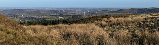
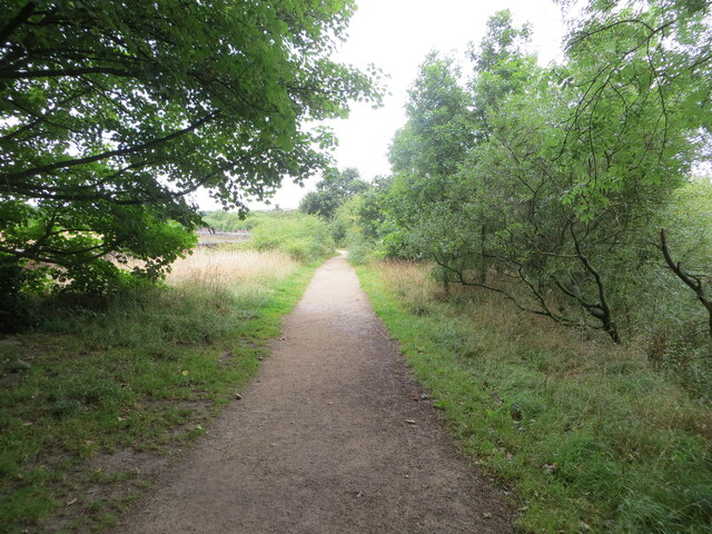
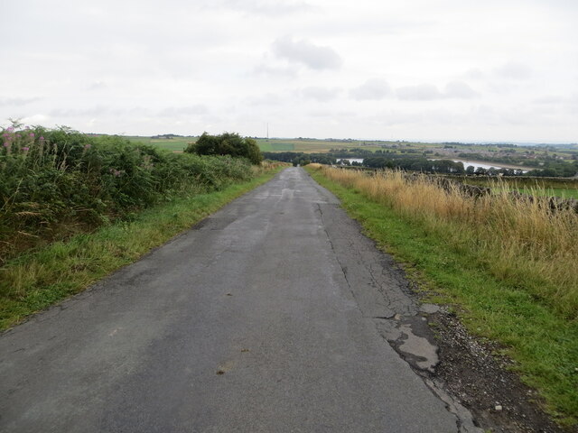
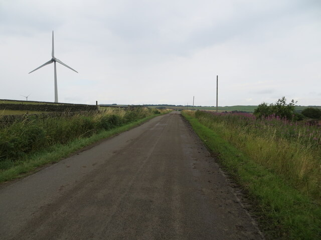
Low Common is a picturesque region located in Yorkshire, England, known for its stunning natural beauty and diverse landscapes. Situated amidst the breathtaking Yorkshire Downs and Moorland, it offers visitors a unique experience in the heart of the countryside.

The region is characterized by its rolling hills, expansive grasslands, and abundant wildlife. The Yorkshire Downs, with their gentle slopes and lush greenery, provide a serene setting for outdoor activities such as hiking, cycling, and horseback riding. The moorland, on the other hand, offers a more rugged terrain, with heather-covered hills and rocky outcrops, attracting nature enthusiasts and bird watchers.

Low Common boasts a rich biodiversity, with numerous species of flora and fauna calling the area home. Visitors can spot various birds, including kestrels, pheasants, and curlews, as well as mammals like hares, deer, and foxes. The region's diverse habitats also support a wide range of plant life, including wildflowers, ferns, and mosses.

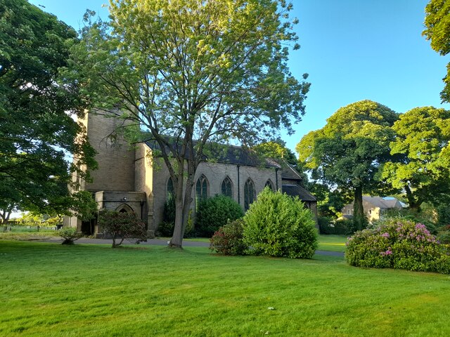
In addition to its natural wonders, Low Common is dotted with charming rural villages and historic landmarks. Traditional stone-built houses, quaint pubs, and friendly locals create a warm and welcoming atmosphere. The area's rich heritage can be explored through visits to ancient churches, historic sites, and museums.

Overall, Low Common, Yorkshire (Downs, Moorland) offers visitors a tranquil escape into nature, with its stunning landscapes, abundant wildlife, and traditional charm. Whether seeking outdoor adventures or a peaceful retreat, this region provides an unforgettable experience for all who venture here.

If you have any feedback on the listing, please let us know in the comments section below.
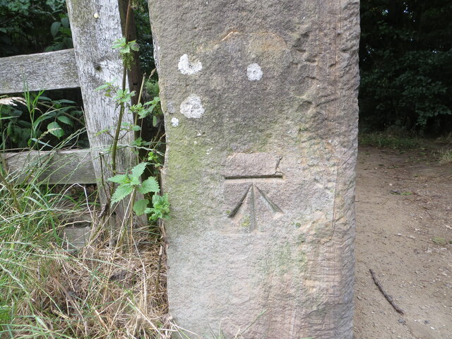
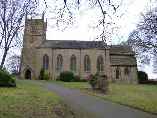
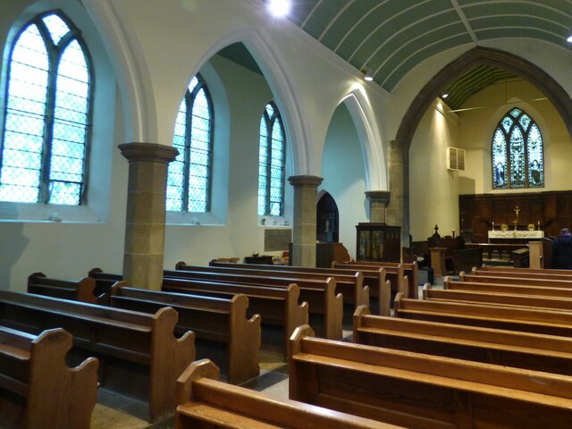
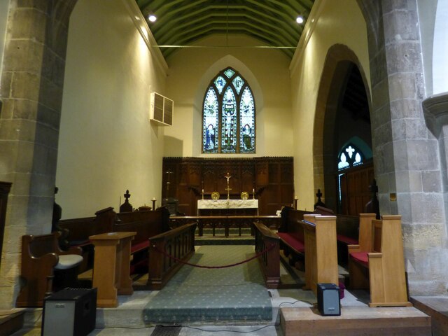
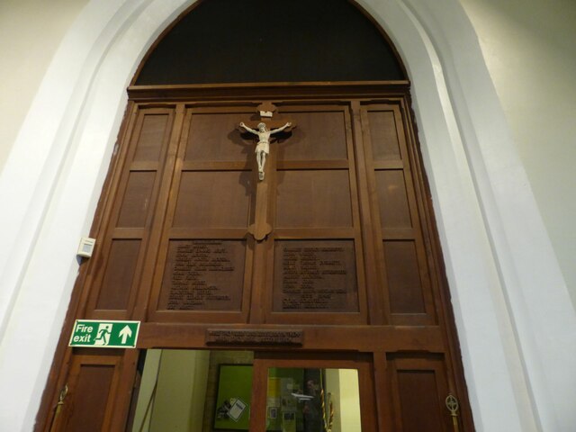
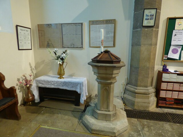
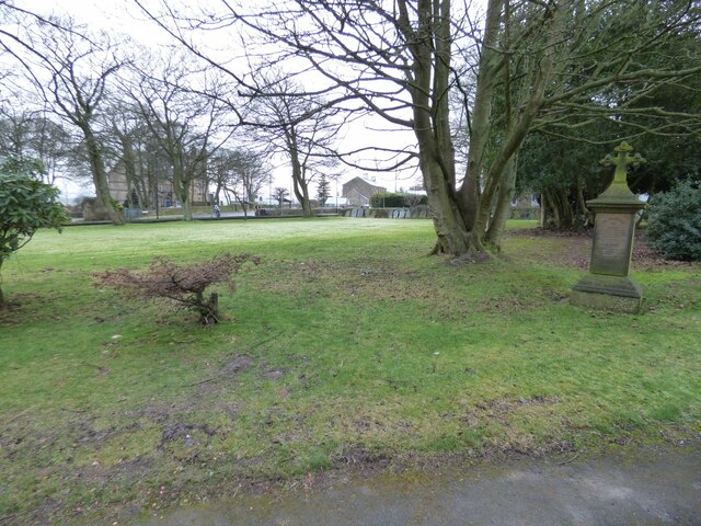
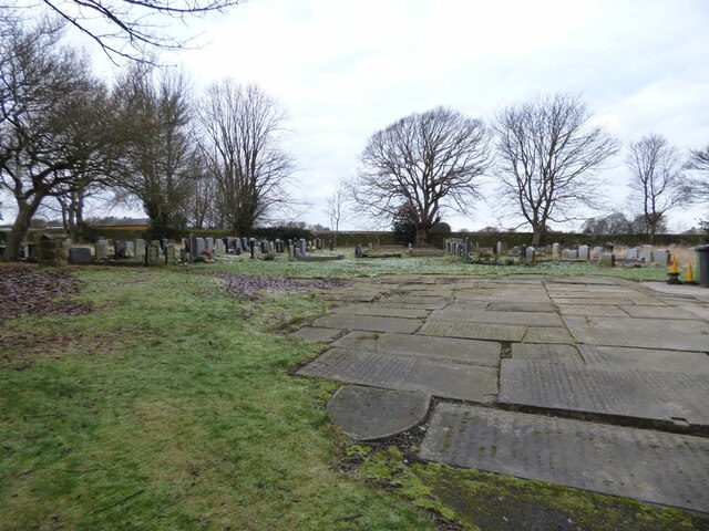
Low Common Images

Images are sourced within 2km of 53.557659/-1.6710733 or Grid Reference SE2106. Thanks to Geograph Open Source API. All images are credited.

View from Snailsden Moor View from Snailsden Moor towards Emley Moor TV mast.
View from Snailsden Moor
View from Snailsden Moor towards Emley Moor TV mast.
Old milestone A view of the 8 miles from Barnsley milestone under the arch of the railway viaduct at Denby Dale.  Trains from Barnsley approach from the left and the station is a short distance to the right across the A636 Wakefield Road.
Old milestone
A view of the 8 miles from Barnsley milestone under the arch of the railway viaduct at Denby Dale. Trains from Barnsley approach from the left and the station is a short distance to the right across the A636 Wakefield Road.
Old milestone This is the last late 19C West Riding CC milestone between Barnsley and Shepley Lane Head.   There would have been two more but they are missing.   Many of the metal attachments had the foundry name on the bevel but the ones on this route haven't so we don't know where they were forged.   On this milestone the four fixing points for the attachment to the backing stone can be seen.  Grade II listed 1135325.
Old milestone
This is the last late 19C West Riding CC milestone between Barnsley and Shepley Lane Head. There would have been two more but they are missing. Many of the metal attachments had the foundry name on the bevel but the ones on this route haven't so we don't know where they were forged. On this milestone the four fixing points for the attachment to the backing stone can be seen. Grade II listed 1135325.
Post Box at Upper Denby HD8 236. Royal Mail list this box as 'Upper Denby'.
Post Box at Upper Denby
HD8 236. Royal Mail list this box as 'Upper Denby'.
Old milestone This West Riding CC milestone is seen when leaving Denby Dale just beyond the railway viaduct and before the junction with the A635 from Barnsley.   Only a few of these flat castings were made, usually where there was no space for the protruding style.  However this one is unique.   It is the only one of the surviving flat castings which is not divided by a central raised line.   This is because Denby Dale and Wakefield are in the same direction.  Another difference is that the foundry name is at the centre top instead of on the left side.   It is Grade II listed 1135309.
Old milestone
This West Riding CC milestone is seen when leaving Denby Dale just beyond the railway viaduct and before the junction with the A635 from Barnsley. Only a few of these flat castings were made, usually where there was no space for the protruding style. However this one is unique. It is the only one of the surviving flat castings which is not divided by a central raised line. This is because Denby Dale and Wakefield are in the same direction. Another difference is that the foundry name is at the centre top instead of on the left side. It is Grade II listed 1135309.
Old milestone This milestone is set into the garden wall of Salt Pie Cottage on the A629 between High Flatts and Birds Edge.  The owners rebuilt the wall to show more of the milestone and on a very sunny day it is surrounded by flowers, possibly of the mallow family.   It is 9 miles to Huddersfield and 3¼ to Penistone on the old tollroad.  Grade II listed 1135304.
Old milestone
This milestone is set into the garden wall of Salt Pie Cottage on the A629 between High Flatts and Birds Edge. The owners rebuilt the wall to show more of the milestone and on a very sunny day it is surrounded by flowers, possibly of the mallow family. It is 9 miles to Huddersfield and 3¼ to Penistone on the old tollroad. Grade II listed 1135304.
Permissive footpath at Ingbirchworth Reservoir Looking north-westward.
Permissive footpath at Ingbirchworth Reservoir
Looking north-westward.
Annat Royd Lane, Ingbirchworth Moor Looking north-eastward, Ingbirchworth Reservoir can be seen in the far distance.
Annat Royd Lane, Ingbirchworth Moor
Looking north-eastward, Ingbirchworth Reservoir can be seen in the far distance.
Spicer House Lane beside a Wind Turbine on Spicer Hill Looking north-westward.
Spicer House Lane beside a Wind Turbine on Spicer Hill
Looking north-westward.
St John the Evangelist Church, Upper Denby A handsome building.
St John the Evangelist Church, Upper Denby
A handsome building.
Ordnance Survey Cut Mark This mark can be found on a gatepost at the footpath entrance to Ingbirchworth Reservoir.
The recorded details give a height of 255.8613 metres above sea level.
For more detail see : <span class="nowrap"><a title="https://www.bench-marks.org.uk/bm52601" rel="nofollow ugc noopener" href="https://www.bench-marks.org.uk/bm52601">Link</a><img style="margin-left:2px;" alt="External link" title="External link - shift click to open in new window" src="https://s1.geograph.org.uk/img/external.png" width="10" height="10"/></span>
Ordnance Survey Cut Mark
This mark can be found on a gatepost at the footpath entrance to Ingbirchworth Reservoir. The recorded details give a height of 255.8613 metres above sea level. For more detail see : LinkExternal link
St John the Evangelist, Denby - south side The church was built in 1842-3, typically for its time with galleries but no chancel. Equally typical of its time was the removal of the galleries and addition of a chancel and porch in 1900. Grade II listed (list entry 1313363).
St John the Evangelist, Denby - south side
The church was built in 1842-3, typically for its time with galleries but no chancel. Equally typical of its time was the removal of the galleries and addition of a chancel and porch in 1900. Grade II listed (list entry 1313363).
St John the Evangelist, Denby - nave The church was built in 1842-3, typically for its time with galleries but no chancel. Equally typical of its time was the removal of the galleries and addition of a chancel and porch in 1900. Grade II listed (list entry 1313363).
St John the Evangelist, Denby - nave
The church was built in 1842-3, typically for its time with galleries but no chancel. Equally typical of its time was the removal of the galleries and addition of a chancel and porch in 1900. Grade II listed (list entry 1313363).
St John the Evangelist, Denby - chancel The church was built in 1842-3, but this narrow chancel was only added in 1900. Grade II listed (list entry 1313363).
St John the Evangelist, Denby - chancel
The church was built in 1842-3, but this narrow chancel was only added in 1900. Grade II listed (list entry 1313363).
St John the Evangelist, Denby - war memorial The war memorial takes the form of wooden panelling between the tower and nave, bearing the names of twenty-four men who died in the First World War, and two in the Second. Beneath the names is written 'While they sleep, Lord Jesus, look on them. When they rise, receive them'.
St John the Evangelist, Denby - war memorial
The war memorial takes the form of wooden panelling between the tower and nave, bearing the names of twenty-four men who died in the First World War, and two in the Second. Beneath the names is written 'While they sleep, Lord Jesus, look on them. When they rise, receive them'.
St John the Evangelist, Denby - font A slender stone font with wooden cover.
St John the Evangelist, Denby - font
A slender stone font with wooden cover.
St John the Evangelist, Denby - front churchyard Nearly all the gravestones have been removed from the area to the front of the church, unlike the rear where they are all still in place.
St John the Evangelist, Denby - front churchyard
Nearly all the gravestones have been removed from the area to the front of the church, unlike the rear where they are all still in place.
St John the Evangelist, Denby - rear churchyard Immediately west of the church building, old gravestones have been laid flat as ledgers. Beyond that, nearly all the gravestones are still in place. The churchyard is now full, with few if any burials having taken place since 1975.
St John the Evangelist, Denby - rear churchyard
Immediately west of the church building, old gravestones have been laid flat as ledgers. Beyond that, nearly all the gravestones are still in place. The churchyard is now full, with few if any burials having taken place since 1975.
Show me another place!

Low Common is located at Grid Ref: SE2106 (Lat: 53.557659, Lng: -1.6710733)

Division: West Riding

Unitary Authority: Kirklees

Police Authority: West Yorkshire

What 3 Words

///gaps.foggy.ripe. Near Denby Dale, West Yorkshire

Related Wikis

Ingbirchworth

Ingbirchworth is a village and former civil parish, now in the parish of Gunthwaite and Ingbirchworth, in the Barnsley district, in the county of South...

Upper Denby

Upper Denby is a small village within the civil parish of Denby Dale, and the borough of Kirklees in West Yorkshire, England. Lying 11 miles (17 km) to...

Gunthwaite and Ingbirchworth

Gunthwaite and Ingbirchworth is a civil parish in the Barnsley district, in the county of South Yorkshire, England. It contains the hamlet of Gunthwaite...

Denby Dale Viaduct

Denby Dale Viaduct is a grade II listed railway viaduct in Denby Dale, West Yorkshire, England. The curving viaduct carries the Penistone line over the...

Nearby Amenities

Located within 500m of 53.557659,-1.6710733
Material: wood
Power: pole
Lat/Long: 53.5541053/-1.6733658
Bus Stop
Falledge Lane Falledge Lane Farm
Bench: no
Bin: no
Bus: yes
Lit: yes
Local Ref: 45020860
Naptan AtcoCode: 450020860
Naptan Bearing: SW
Naptan CommonName: Falledge Lane Falledge Lane Farm
Naptan Crossing: Twixt Huddersfield Road - Greenacre Drive
Naptan Indicator: Stop 45020860
Naptan Landmark: Falledge Farm
Naptan ShortCommonName: Falledge Lane Farm
Naptan Street: Falledge Lane
Naptan Verified: no
Public Transport: platform
Shelter: no
Source: naptan_import
Tactile Paving: no
Lat/Long: 53.5559593/-1.6659225
Bus Stop
Denby Lane New Laithe
Bench: no
Bin: no
Bus: yes
Lit: yes
Local Ref: 45020863
Naptan AtcoCode: 450020863
Naptan Bearing: W
Naptan CommonName: Denby Lane New Laithe
Naptan Crossing: Twixt Greenacre Drive - Penistone Road
Naptan Indicator: Stop 45020863
Naptan PlusbusZoneRef: LEEDS
Naptan ShortCommonName: New Laithe
Naptan Street: Denby Lane
Naptan Verified: no
Public Transport: platform
Shelter: no
Source: naptan_import
Tactile Paving: no
Lat/Long: 53.5604667/-1.6673816
Bus Stop
Falledge Lane Falledge Lane Farm
Bench: no
Bin: no
Bus: yes
Lit: no
Local Ref: 45051032
Naptan AtcoCode: 450051032
Naptan Bearing: NE
Naptan BusStopType: CUS
Naptan CommonName: Falledge Lane Falledge Lane Farm
Naptan Crossing: Fall Edge Farm (Access Road)
Naptan Indicator: Stop 45051032
Naptan ShortCommonName: Fall Edge Farm
Naptan Street: Falledge Lane
Naptan Verified: no
Public Transport: platform
Shelter: no
Source: naptan_import
Tactile Paving: no
Lat/Long: 53.5559955/-1.6660128
Bus Stop
Falledge Lane/Huddersfield Road
Bench: no
Bin: no
Bus: yes
Departures Board: timetable
Lit: no
Local Ref: 45051033
Naptan AtcoCode: 450051033
Naptan Bearing: NE
Naptan BusStopType: CUS
Naptan CommonName: Falledge Lane Penistone Road
Naptan Crossing: Penistone Road
Naptan Indicator: Stop 45051033
Naptan PlusbusZoneRef: ROTHCEN
Naptan ShortCommonName: Penistone Road
Naptan Street: Falledge Lane
Naptan Verified: yes
Operator: Metro
Public Transport: platform
Shelter: no
Source: naptan_import
Tactile Paving: no
Lat/Long: 53.5535803/-1.6691371
Denby Lane New Laithe
Local Ref: 45051035
Naptan AtcoCode: 450051035
Naptan Bearing: E
Naptan BusStopType: CUS
Naptan CommonName: Denby Lane New Laithe
Naptan Crossing: New Lathe
Naptan Indicator: Stop 45051035
Naptan PlusbusZoneRef: LEEDS
Naptan ShortCommonName: New Laithe
Naptan Street: Denby Lane
Naptan Verified: no
Source: naptan_import
Lat/Long: 53.5605745/-1.6673657
Material: wood
Power: pole
Lat/Long: 53.5559951/-1.6660675
Material: wood
Power: pole
Lat/Long: 53.5550518/-1.6696804
Material: wood
Power: pole
Lat/Long: 53.5554629/-1.6681194
Material: wood
Power: pole
Lat/Long: 53.5546501/-1.6712555
Barrier: stile
Material: stone
Note: 3-way stile.
Step Count: 3
Stile: stepover
Lat/Long: 53.5614389/-1.6721021
Ice Cream
Yummy Yorkshire Ice Cream Company
Addr City: Huddersfield
Addr Parentstreet: Penistone Road
Addr Postcode: HD8 8XY
Addr Street: Delph House Farm
Addr Suburb: High Flatts
Email: indulge@yummyyorkshire.co.uk
Opening Hours: Mo-Su 09:00-17:00
Outdoor Seating: yes
Phone: +44 1226 762551
Source: survey
Website: https://www.yummyyorkshire.co.uk
Lat/Long: 53.5556059/-1.6732911
Ingbirchworth
Check Date: 2024-04-18
Direction: -45
Material: stone
Traffic Sign: city_limit
Lat/Long: 53.5538499/-1.6698983
Waste Basket
Colour: black
Material: plastic
Source: survey
Waste: litter
Lat/Long: 53.5535183/-1.6735649
Entrance: yes
Lat/Long: 53.5535261/-1.6735918
Bus Stop
Falledge Lane/Huddersfield Road
Bus: yes
Local Ref: 45020861
Naptan AtcoCode: 450020861
Naptan Bearing: SW
Naptan CommonName: Falledge Lane Penistone Road
Naptan Crossing: Penistone Road
Naptan Indicator: Stop 45020861
Naptan PlusbusZoneRef: ROTHCEN
Naptan ShortCommonName: Penistone Road
Naptan Street: Falledge Lane
Naptan Verified: yes
Operator: Metro
Physically Present: no
Public Transport: platform
Source: naptan_import
Lat/Long: 53.5535225/-1.6690357
Bench
Backrest: no
Disused: yes
Lat/Long: 53.5535682/-1.6692695
Parking
Access: yes
Fee: no
Parking: layby
Surface: concrete
Lat/Long: 53.5576396/-1.6763982
Waste Basket
Colour: black
Material: plastic
Lat/Long: 53.5575748/-1.6762411
Bench
Backrest: no
Covered: booth
Material: metal
Source: survey
Lat/Long: 53.5536695/-1.673669
Bench
Backrest: no
Covered: booth
Material: metal
Source: survey
Lat/Long: 53.553558/-1.6736396
Give Way
Direction: backward
Lit: yes
Source: survey
Lat/Long: 53.5534173/-1.6692937
Access: private
Playground: structure
Playground Theme: ship
Lat/Long: 53.5612177/-1.6679594
Entrance: main
Lat/Long: 53.5540063/-1.6706032
Material: wood
Power: pole
Lat/Long: 53.5563723/-1.6646086
Generator Method: wind_turbine
Generator Source: wind
Power: generator
Lat/Long: 53.5545894/-1.675735
Barrier: stile
Material: stone
Step Count: 4
Stile: stepover
Lat/Long: 53.5553427/-1.6717818
Barrier: stile
Stile: stepover
Lat/Long: 53.5559807/-1.6645378
Barrier: stile
Stile: stepover
Lat/Long: 53.5551153/-1.6649325
Entrance: main
Lat/Long: 53.5555996/-1.6730832
Information: board
Tourism: information
Lat/Long: 53.5607387/-1.6691209
Barrier: stile
Material: stone
Step Count: 2
Stile: stepover
Lat/Long: 53.5617435/-1.6690125
Barrier: stile
Marker: aerial
Material: stone
Step Count: 3
Stile: stepover
Lat/Long: 53.5612456/-1.6740578
Barrier: stile
Material: stone
Step Count: 3
Stile: stepover
Lat/Long: 53.5613388/-1.6739748
Barrier: stile
Step Count: 3
Stile: stepover
Lat/Long: 53.5613809/-1.6729694
Parking
Access: yes
Capacity Disabled: 5
Fee: no
Parking: layby
Lat/Long: 53.5606633/-1.668843
Bus: yes
Public Transport: stop_position
Lat/Long: 53.5535586/-1.669078
Lit: yes
Maxspeed: 40 mph
Ref: S65;S66
Source: survey
Traffic Sign: maxspeed
Traffic Sign Direction: forward
Lat/Long: 53.5536441/-1.6698169
Lit: yes
Maxspeed: 60 mph
Ref: S65;S66
Source: survey
Traffic Sign: maxspeed
Traffic Sign Direction: backward
Lat/Long: 53.5536387/-1.669811
Street Lamp
Lamp Mount: straight_mast
Lamp Type: led
Ref: 355
Source: survey
Support: pole
Support Material: concrete
Lat/Long: 53.5535543/-1.6698189
Street Lamp
Lamp Mount: straight_mast
Lamp Type: led
Ref: 354
Source: survey
Support: pole
Support Material: metal
Lat/Long: 53.553924/-1.6699684
Street Lamp
Lamp Mount: straight_mast
Lamp Type: led
Ref: 353
Source: survey
Support: pole
Support Material: metal
Lat/Long: 53.5540683/-1.6704074
Street Lamp
Lamp Mount: straight_mast
Lamp Type: led
Ref: 352
Source: survey
Support: pole
Support Material: metal
Lat/Long: 53.554259/-1.670642
Street Lamp
Lamp Mount: straight_mast
Lamp Type: led
Ref: 25
Source: survey
Support: pole
Support Material: metal
Lat/Long: 53.5539067/-1.6684696
Street Lamp
Lamp Mount: straight_mast
Lamp Type: led
Ref: 26
Source: survey
Support: pole
Support Material: concrete
Lat/Long: 53.5536934/-1.668959
Street Lamp
Lamp Mount: straight_mast
Lamp Type: led
Ref: 22
Source: survey
Support: pole
Support Material: concrete
Lat/Long: 53.5547186/-1.6675239
Street Lamp
Lamp Mount: straight_mast
Lamp Type: led
Ref: 19
Source: survey
Support: pole
Support Material: metal
Lat/Long: 53.5554734/-1.6664689
Street Lamp
Lamp Mount: straight_mast
Lamp Type: led
Ref: 27
Source: survey
Support: pole
Support Material: metal
Lat/Long: 53.553438/-1.6691676
Street Lamp
Lamp Mount: straight_mast
Lamp Type: led
Ref: 24
Source: survey
Support: pole
Support Material: concrete
Lat/Long: 53.5542021/-1.6682125
Street Lamp
Lamp Mount: straight_mast
Lamp Type: led
Ref: 21
Source: survey
Support: pole
Support Material: concrete
Lat/Long: 53.5549471/-1.6671002
Street Lamp
Lamp Mount: straight_mast
Lamp Type: led
Ref: 17
Source: survey
Support: pole
Support Material: concrete
Lat/Long: 53.5559482/-1.6658986
Street Lamp
Lamp Mount: straight_mast
Lamp Type: led
Ref: 18
Source: survey
Support: pole
Support Material: concrete
Lat/Long: 53.5557853/-1.6662653
Street Lamp
Lamp Mount: straight_mast
Lamp Type: led
Ref: 16
Source: survey
Support: pole
Support Material: concrete
Lat/Long: 53.5563115/-1.6656336
Street Lamp
Lamp Mount: straight_mast
Lamp Type: led
Ref: 15
Source: survey
Support: pole
Support Material: metal
Lat/Long: 53.5565266/-1.6652038
Street Lamp
Lamp Mount: straight_mast
Lamp Type: led
Ref: 13
Source: survey
Support: pole
Support Material: concrete
Lat/Long: 53.557061/-1.6645553
Street Lamp
Lamp Mount: straight_mast
Lamp Type: led
Ref: 14
Source: survey
Support: pole
Support Material: concrete
Lat/Long: 53.5568277/-1.6650113
Street Lamp
Lamp Mount: straight_mast
Lamp Type: led
Ref: 12
Source: survey
Support: pole
Support Material: concrete
Lat/Long: 53.5573692/-1.6643345
Street Lamp
Lamp Mount: straight_mast
Lamp Type: led
Ref: 11
Source: survey
Support: pole
Support Material: metal
Lat/Long: 53.5575704/-1.663909
Entrance: shop
Lat/Long: 53.5556413/-1.6732837
Board Type: nature
Information: board
Tourism: information
Lat/Long: 53.5617457/-1.6701191
Barrier: stile
Material: stone
Note: Iron crossbar stepover.
Stile: squeezer
Lat/Long: 53.5550583/-1.6671747
The data included in this document is from www.openstreetmap.org. The data is made available under ODbL.

Have you been to Low Common?

Leave your review of Low Common below (or comments, questions and feedback).