Summer Ford Hill

Hill, Mountain in Yorkshire

England

Summer Ford Hill

Post Box at Upper Denby HD8 236. Royal Mail list this box as 'Upper Denby'.
Post Box at Upper Denby Credit: David Bremner

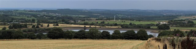
Summer Ford Hill is a prominent geographical feature located in the county of Yorkshire, England. Rising to an elevation of approximately 430 meters (1,411 feet), it is classified as a hill rather than a mountain. Situated in the southern part of the North York Moors National Park, the hill offers breathtaking panoramic views of the surrounding countryside.

Covered in lush green vegetation, Summer Ford Hill is a haven for nature enthusiasts and hikers alike. The hill is home to a diverse range of flora and fauna, including heather, bilberry, and various species of birds and mammals. During the summer months, the hill's slopes are adorned with vibrant wildflowers, creating a picturesque landscape.

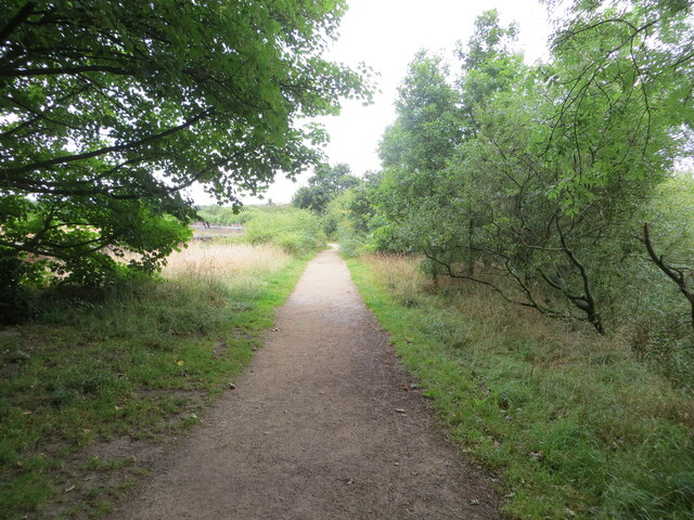
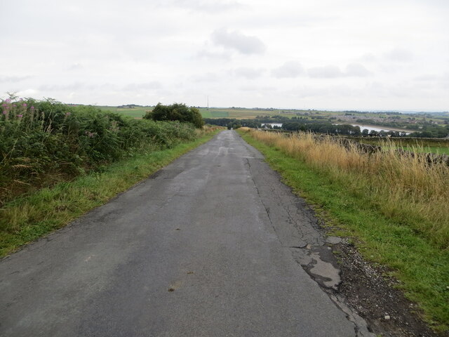
The summit of Summer Ford Hill is easily accessible via a network of well-maintained footpaths, making it a popular destination for outdoor activities such as walking, hiking, and mountain biking. As visitors ascend the hill, they are treated to stunning vistas of the nearby valleys, meandering rivers, and rolling hills, all contributing to the area's natural beauty.

Nearby, the charming village of Summer Ford provides amenities for those exploring the area, including accommodations, eateries, and local shops. The village is a gateway to various attractions in the North York Moors National Park, such as historic landmarks, ancient ruins, and other natural wonders.

Overall, Summer Ford Hill in Yorkshire, with its breathtaking views and diverse wildlife, offers visitors a chance to immerse themselves in the unspoiled beauty of the British countryside.

If you have any feedback on the listing, please let us know in the comments section below.

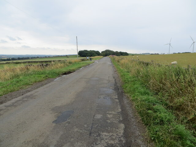
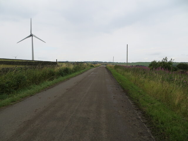
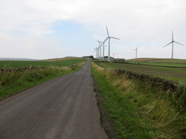
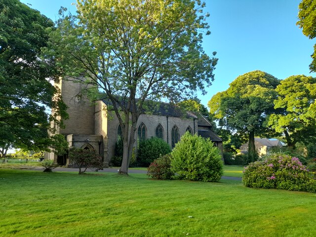
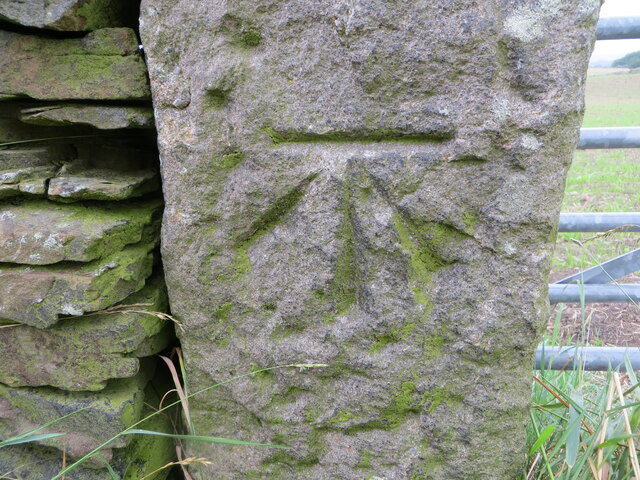
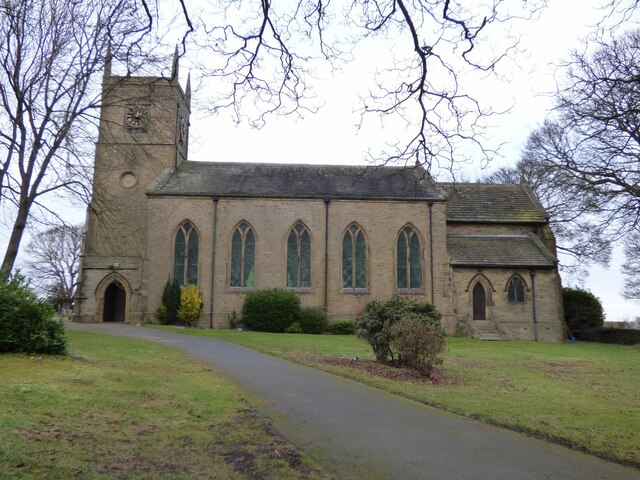
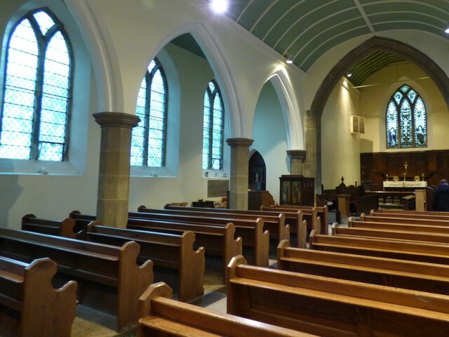
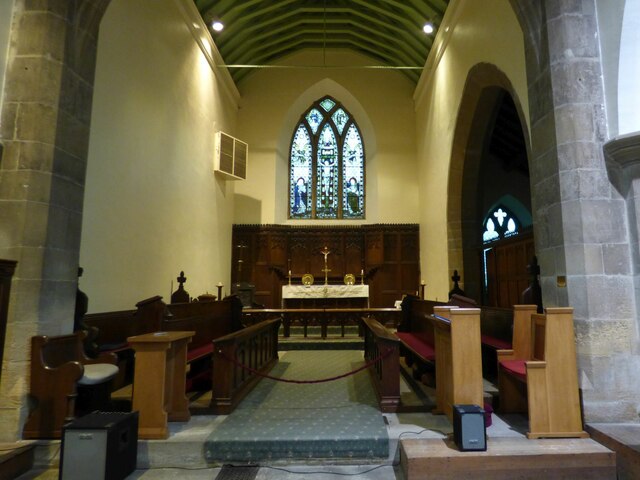
Summer Ford Hill Images

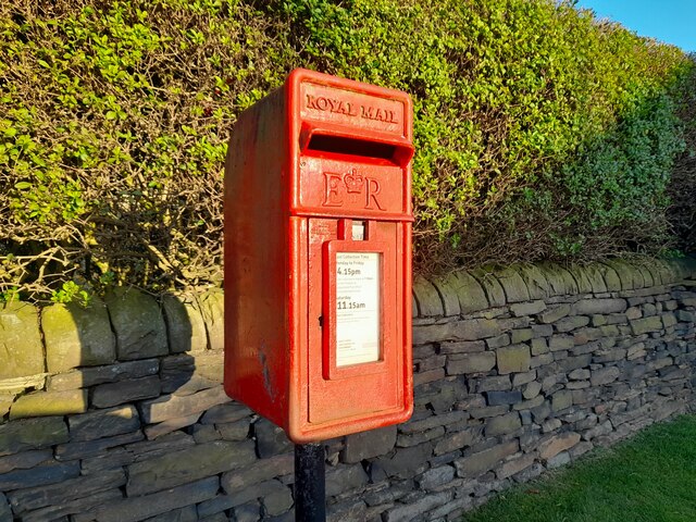
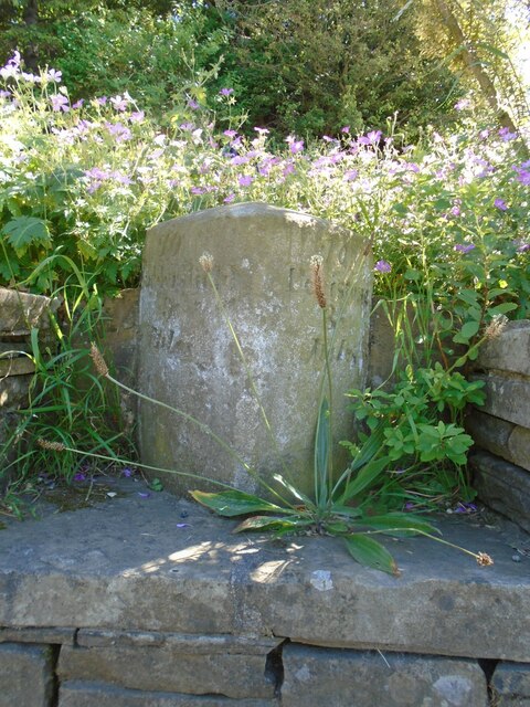
Images are sourced within 2km of 53.553076/-1.6780973 or Grid Reference SE2106. Thanks to Geograph Open Source API. All images are credited.

Post Box at Upper Denby HD8 236. Royal Mail list this box as 'Upper Denby'.
Post Box at Upper Denby
HD8 236. Royal Mail list this box as 'Upper Denby'.
Old milestone This milestone is set into the garden wall of Salt Pie Cottage on the A629 between High Flatts and Birds Edge.  The owners rebuilt the wall to show more of the milestone and on a very sunny day it is surrounded by flowers, possibly of the mallow family.   It is 9 miles to Huddersfield and 3¼ to Penistone on the old tollroad.  Grade II listed 1135304.
Old milestone
This milestone is set into the garden wall of Salt Pie Cottage on the A629 between High Flatts and Birds Edge. The owners rebuilt the wall to show more of the milestone and on a very sunny day it is surrounded by flowers, possibly of the mallow family. It is 9 miles to Huddersfield and 3¼ to Penistone on the old tollroad. Grade II listed 1135304.
Permissive footpath at Ingbirchworth Reservoir Looking north-westward.
Permissive footpath at Ingbirchworth Reservoir
Looking north-westward.
Annat Royd Lane, Ingbirchworth Moor Looking north-eastward, Ingbirchworth Reservoir can be seen in the far distance.
Annat Royd Lane, Ingbirchworth Moor
Looking north-eastward, Ingbirchworth Reservoir can be seen in the far distance.
Spicer House Lane near Annat Royd Farm Looking south-eastward.
Spicer House Lane near Annat Royd Farm
Looking south-eastward.
Spicer House Lane beside a Wind Turbine on Spicer Hill Looking north-westward.
Spicer House Lane beside a Wind Turbine on Spicer Hill
Looking north-westward.
Whitley Road and Wind Turbines on Spicer Hill Looking north-westward.
Whitley Road and Wind Turbines on Spicer Hill
Looking north-westward.
St John the Evangelist Church, Upper Denby A handsome building.
St John the Evangelist Church, Upper Denby
A handsome building.
Royd Moor Reservoir
Royd Moor Reservoir
Royd Moor wind farm
Royd Moor wind farm
Ordnance Survey Cut Mark This mark can be found on a gatepost at the footpath entrance to Ingbirchworth Reservoir.
The recorded details give a height of 255.8613 metres above sea level.
For more detail see : <span class="nowrap"><a title="https://www.bench-marks.org.uk/bm52601" rel="nofollow ugc noopener" href="https://www.bench-marks.org.uk/bm52601">Link</a><img style="margin-left:2px;" alt="External link" title="External link - shift click to open in new window" src="https://s1.geograph.org.uk/img/external.png" width="10" height="10"/></span>
Ordnance Survey Cut Mark
This mark can be found on a gatepost at the footpath entrance to Ingbirchworth Reservoir. The recorded details give a height of 255.8613 metres above sea level. For more detail see : LinkExternal link
Ordnance Survey Cut Mark This mark can be found on a gatepost beside Spicer House Land, Royd Moor.
The recorded detail s give a height of 322.7649 metres above sea level.
For more detail see : <span class="nowrap"><a title="https://www.bench-marks.org.uk/bm91191" rel="nofollow ugc noopener" href="https://www.bench-marks.org.uk/bm91191">Link</a><img style="margin-left:2px;" alt="External link" title="External link - shift click to open in new window" src="https://s1.geograph.org.uk/img/external.png" width="10" height="10"/></span>
Ordnance Survey Cut Mark
This mark can be found on a gatepost beside Spicer House Land, Royd Moor. The recorded detail s give a height of 322.7649 metres above sea level. For more detail see : LinkExternal link
Ordnance Survey Cut Mark This mark can be found on a gatepost beside Whitley Road, Spicer Hill.
The recorded details give a height of 329.5163 metres above sea level.
For more detail see : <span class="nowrap"><a title="https://www.bench-marks.org.uk/bm91229" rel="nofollow ugc noopener" href="https://www.bench-marks.org.uk/bm91229">Link</a><img style="margin-left:2px;" alt="External link" title="External link - shift click to open in new window" src="https://s1.geograph.org.uk/img/external.png" width="10" height="10"/></span>
Ordnance Survey Cut Mark
This mark can be found on a gatepost beside Whitley Road, Spicer Hill. The recorded details give a height of 329.5163 metres above sea level. For more detail see : LinkExternal link
St John the Evangelist, Denby - south side The church was built in 1842-3, typically for its time with galleries but no chancel. Equally typical of its time was the removal of the galleries and addition of a chancel and porch in 1900. Grade II listed (list entry 1313363).
St John the Evangelist, Denby - south side
The church was built in 1842-3, typically for its time with galleries but no chancel. Equally typical of its time was the removal of the galleries and addition of a chancel and porch in 1900. Grade II listed (list entry 1313363).
St John the Evangelist, Denby - nave The church was built in 1842-3, typically for its time with galleries but no chancel. Equally typical of its time was the removal of the galleries and addition of a chancel and porch in 1900. Grade II listed (list entry 1313363).
St John the Evangelist, Denby - nave
The church was built in 1842-3, typically for its time with galleries but no chancel. Equally typical of its time was the removal of the galleries and addition of a chancel and porch in 1900. Grade II listed (list entry 1313363).
St John the Evangelist, Denby - chancel The church was built in 1842-3, but this narrow chancel was only added in 1900. Grade II listed (list entry 1313363).
St John the Evangelist, Denby - chancel
The church was built in 1842-3, but this narrow chancel was only added in 1900. Grade II listed (list entry 1313363).
St John the Evangelist, Denby - war memorial The war memorial takes the form of wooden panelling between the tower and nave, bearing the names of twenty-four men who died in the First World War, and two in the Second. Beneath the names is written 'While they sleep, Lord Jesus, look on them. When they rise, receive them'.
St John the Evangelist, Denby - war memorial
The war memorial takes the form of wooden panelling between the tower and nave, bearing the names of twenty-four men who died in the First World War, and two in the Second. Beneath the names is written 'While they sleep, Lord Jesus, look on them. When they rise, receive them'.
St John the Evangelist, Denby - font A slender stone font with wooden cover.
St John the Evangelist, Denby - font
A slender stone font with wooden cover.
Show me another place!

Summer Ford Hill is located at Grid Ref: SE2106 (Lat: 53.553076, Lng: -1.6780973)

Division: West Riding

Unitary Authority: Barnsley

Police Authority: South Yorkshire

What 3 Words

///helped.expectant.query. Near Denby Dale, West Yorkshire

Related Wikis

Ingbirchworth

Ingbirchworth is a village and former civil parish, now in the parish of Gunthwaite and Ingbirchworth, in the Barnsley district, in the county of South...

Gunthwaite and Ingbirchworth

Gunthwaite and Ingbirchworth is a civil parish in the Barnsley district, in the county of South Yorkshire, England. It contains the hamlet of Gunthwaite...

Upper Denby

Upper Denby is a small village within the civil parish of Denby Dale, and the borough of Kirklees in West Yorkshire, England. Lying 11 miles (17 km) to...
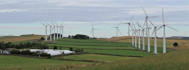
Royd Moor Wind Farm

The Royd Moor Wind Farm is located at Penistone, Barnsley, South Yorkshire, England, and consists of thirteen 450 kW turbines. The site is located approximately...

Nearby Amenities

Located within 500m of 53.553076,-1.6780973
Material: wood
Power: pole
Lat/Long: 53.5541053/-1.6733658
Bus Stop
Wellthorne Lane/The Fountain PH
Bus: yes
Naptan AtcoCode: 370055942
Naptan Bearing: N
Naptan CommonName: Wellthorne Lane/The Fountain Ph
Naptan Indicator: 55942
Naptan Landmark: The Fountain Ph
Naptan PlusbusZoneRef: ROTHCEN
Naptan Street: Wellthorne Lane
Naptan Verified: yes
Physically Present: no
Public Transport: platform
Source: naptan_import
Lat/Long: 53.5523138/-1.6707064
Power: pole
Lat/Long: 53.5536735/-1.6825899
Power: pole
Lat/Long: 53.5536636/-1.6848005
Material: wood
Power: pole
Lat/Long: 53.5537086/-1.6749027
Power: pole
Lat/Long: 53.5536911/-1.6787758
Power: pole
Lat/Long: 53.5536831/-1.680015
Material: wood
Power: pole
Lat/Long: 53.5546501/-1.6712555
Power: pole
Lat/Long: 53.553699/-1.6773381
Board Type: history
Check Date: 2023-08-30
Information: board
Operator: Gunthwaite & Ingbirchworth Parish Council
Source: survey
Tourism: information
Lat/Long: 53.5521742/-1.6741652
Turning Circle
Summer Ford Croft
Access: private
Turning Circle: y-head
Lat/Long: 53.5513042/-1.6722804
Noexit: yes
Lat/Long: 53.5527855/-1.6737098
Ice Cream
Yummy Yorkshire Ice Cream Company
Addr City: Huddersfield
Addr Parentstreet: Penistone Road
Addr Postcode: HD8 8XY
Addr Street: Delph House Farm
Addr Suburb: High Flatts
Email: indulge@yummyyorkshire.co.uk
Opening Hours: Mo-Su 09:00-17:00
Outdoor Seating: yes
Phone: +44 1226 762551
Source: survey
Website: https://www.yummyyorkshire.co.uk
Lat/Long: 53.5556059/-1.6732911
Bench
Backrest: no
Material: wood
Source: survey
Lat/Long: 53.553176/-1.6746248
Bench
Backrest: no
Material: wood
Source: survey
Lat/Long: 53.5530342/-1.6745872
Bench
Backrest: no
Material: wood
Source: survey
Lat/Long: 53.5529043/-1.6745698
Waste Basket
Colour: black
Material: plastic
Source: survey
Waste: litter
Lat/Long: 53.5535183/-1.6735649
Entrance: yes
Lat/Long: 53.5535261/-1.6735918
Bench
Backrest: no
Lat/Long: 53.5521999/-1.6741644
Flow Control: sluice_gate
Man Made: tower
Tower Construction: stone
Tower Type: monitoring
Waterway: flow_control
Lat/Long: 53.5501445/-1.6747327
Content: water
Man Made: storage_tank
Lat/Long: 53.5498407/-1.6735217
Barrier: stile
Foot: yes
Material: stone
Stile: squeezer
Wheelchair: yes
Lat/Long: 53.5506092/-1.6829402
Turning Circle
Turning Circle: knuckle
Lat/Long: 53.5521522/-1.674017
Shelter
Bench: yes
Shelter Type: weather_shelter
Lat/Long: 53.55215/-1.675778
Bench: yes
Covered: no
Leisure: picnic_table
Material: wood
Lat/Long: 53.5526026/-1.6779695
Board Type: wildlife
Check Date: 2023-10-04
Information: board
Tourism: information
Lat/Long: 53.5521176/-1.6769717
Bench
Backrest: yes
Lat/Long: 53.5521314/-1.6827829
Waste Basket
Check Date: 2023-12-26
Lat/Long: 53.5521649/-1.682705
Bench
Backrest: yes
Material: wood
Lat/Long: 53.5520616/-1.6781856
Bench
Backrest: no
Lat/Long: 53.5521202/-1.6741433
Waste Basket
Colour: black
Material: metal
Ref: 1383
Waste: dog_excrement;litter
Lat/Long: 53.5521934/-1.6742507
Bench
Backrest: no
Covered: booth
Material: metal
Source: survey
Lat/Long: 53.5536695/-1.673669
Bench
Backrest: no
Covered: booth
Material: metal
Source: survey
Lat/Long: 53.553558/-1.6736396
Bench
Backrest: yes
Material: wood
Lat/Long: 53.5520709/-1.6770531
Bench: yes
Covered: no
Leisure: picnic_table
Material: wood
Lat/Long: 53.552648/-1.6773567
Bench
Backrest: yes
Material: wood
Lat/Long: 53.55277/-1.6776695
Bench
Backrest: yes
Material: wood
Lat/Long: 53.5527609/-1.6772429
Description: 15 panels
Generator Method: photovoltaic
Generator Output Electricity: yes
Generator Source: solar
Generator Type: solar_photovoltaic_panel
Note: roof household
Power: generator
Lat/Long: 53.5526186/-1.6724345
Summer Ford Bridge
Historic: bridge
Note: Submerged by reservoir - visible in extreme drought
Lat/Long: 53.5517375/-1.6800406
Tourism: viewpoint
Lat/Long: 53.5525876/-1.6781407
Barrier: stile
Material: stone
Stile: squeezer
Lat/Long: 53.5521692/-1.6741691
Waste Basket
Colour: black
Material: metal
Source: survey
Survey Date: 2022-01-05
Waste: litter
Lat/Long: 53.5495545/-1.6807896
Generator Method: wind_turbine
Generator Source: wind
Power: generator
Lat/Long: 53.5545894/-1.675735
Parking
Access: yes
Capacity: 4
Fee: no
Parking: surface
Surface: asphalt
Lat/Long: 53.5521509/-1.673628
Parking
Access: yes
Capacity: 2
Fee: no
Parking: surface
Surface: asphalt
Lat/Long: 53.5521819/-1.6727594
Noexit: yes
Lat/Long: 53.5515803/-1.6740402
Entrance: yes
Lat/Long: 53.5523872/-1.6729325
Entrance: main
Lat/Long: 53.5522948/-1.6729199
Cafe
The Fountain Kiosk
Addr City: Sheffield
Addr Postcode: S36 7GJ
Addr Street: Wellthorne Lane
Addr Suburb: Ingbirchworth
Check Date: 2024-01-06
Nohousenumber: yes
Opening Hours: We-Su 09:30-11:30
Outdoor Seating: yes
Source: survey
Takeaway: only
Lat/Long: 53.5524502/-1.672983
Building: container
Operator: Gunthwaite & Ingbirchworth Parish Council
Source: survey
Lat/Long: 53.5521875/-1.6745256
Barrier: stile
Material: stone
Step Count: 4
Stile: stepover
Lat/Long: 53.5553427/-1.6717818
Post Office
Ingbirchworth Mobile Post Office
Brand: Post Office
Brand Wikidata: Q1783168
Brand Wikipedia: en:Post Office Ltd
Contact Website: https://www.postoffice.co.uk/branch-finder/7063407/ingbirchworth-stop
Opening Hours: Th 09:25-10:25
Operator: Kirkburton Post Office
Lat/Long: 53.5524529/-1.672418
Entrance: main
Lat/Long: 53.5555996/-1.6730832
Parking
Capacity: 10
Parking: street_side
Lat/Long: 53.5486736/-1.679313
Bench
Backrest: yes
Lat/Long: 53.5523134/-1.6779508
Man Made: utility_pole
Material: wood
Operator: BT
Utility: telecom
Lat/Long: 53.552168/-1.6726584
Man Made: utility_pole
Material: wood
Operator: BT
Utility: telecom
Lat/Long: 53.5521909/-1.6718193
Man Made: utility_pole
Material: wood
Operator: BT
Utility: telecom
Lat/Long: 53.5522049/-1.6713305
Man Made: utility_pole
Material: wood
Operator: BT
Utility: telecom
Lat/Long: 53.5522305/-1.670748
Description: 14 panels
Generator Method: photovoltaic
Generator Output Electricity: yes
Generator Source: solar
Generator Type: solar_photovoltaic_panel
Note: roof household
Power: generator
Lat/Long: 53.5514654/-1.6740689
Bus: yes
Public Transport: stop_position
Lat/Long: 53.5522801/-1.6706989
Colour: green
Man Made: street_cabinet
Operator: Openreach
Operator Wikidata: Q7096543
Ref: 24
Street Cabinet: telecom
Utility: telecom
Lat/Long: 53.5522031/-1.6714392
Charging Station
Access: customers
Brand: EV Open
Capacity: 2
Fee: yes
Operator: VendElectric
Source: http://pberry.me.uk/osm/node/10739630769.jpeg
Survey Date: 2023-03-16
Lat/Long: 53.5524273/-1.6727604
Description: 15 panels
Generator Method: photovoltaic
Generator Output Electricity: yes
Generator Source: solar
Generator Type: solar_photovoltaic_panel
Note: roof household
Power: generator
Lat/Long: 53.5523096/-1.6738451
Grit Bin
Access: yes
Colour: yellow
Material: plastic
Source: survey
Lat/Long: 53.552548/-1.6714787
Barrier: bollard
Bollard: fixed
Material: metal
Source: survey
Lat/Long: 53.5522377/-1.6737828
Barrier: bollard
Bollard: fixed
Material: metal
Source: survey
Lat/Long: 53.5522361/-1.6738739
Barrier: bollard
Bollard: fixed
Material: metal
Source: survey
Lat/Long: 53.5522369/-1.6738283
Barrier: bollard
Bollard: fixed
Material: metal
Source: survey
Lat/Long: 53.5522436/-1.6736379
Street Lamp
Lamp Type: led
Ref: 7
Support: pole
Lat/Long: 53.5522045/-1.6716428
Street Lamp
Lamp Type: led
Ref: 9
Support: pole
Lat/Long: 53.5521697/-1.6727314
Street Lamp
Lamp Type: led
Ref: 11
Support: pole
Lat/Long: 53.5521339/-1.6737989
Street Lamp
Lamp Type: led
Ref: 10
Support: pole
Lat/Long: 53.5522387/-1.6731942
Street Lamp
Lamp Type: led
Ref: 8
Support: pole
Lat/Long: 53.552273/-1.6721395
Street Lamp
Lamp Type: led
Ref: 6
Support: pole
Lat/Long: 53.5523074/-1.6711273
Street Lamp
Lamp Mount: straight_mast
Lamp Type: led
Source: survey
Support: pole
Support Material: metal
Lat/Long: 53.5524306/-1.6733809
Street Lamp
Lamp Mount: straight_mast
Lamp Type: led
Source: survey
Support: pole
Support Material: metal
Lat/Long: 53.5523334/-1.6734979
Street Lamp
Lamp Mount: straight_mast
Lamp Type: led
Source: survey
Support: pole
Support Material: metal
Lat/Long: 53.5525543/-1.6735909
Man Made: flagpole
Lat/Long: 53.5521782/-1.6713621
Bench
Backrest: yes
Material: wood
Lat/Long: 53.5529098/-1.6744308
Entrance: shop
Lat/Long: 53.5556413/-1.6732837
Street Lamp
Lamp Type: led
Ref: 14
Support: pole
Lat/Long: 53.5518984/-1.6711701
Street Lamp
Lamp Type: led
Ref: 1
Support: pole
Lat/Long: 53.5521209/-1.6711413
Street Lamp
Lamp Type: led
Ref: 11
Support: pole
Lat/Long: 53.5513982/-1.6715743
Street Lamp
Lamp Type: led
Ref: 13
Support: pole
Lat/Long: 53.5519151/-1.6715499
Street Lamp
Lamp Type: led
Ref: 12
Support: pole
Lat/Long: 53.5516114/-1.6715916
The data included in this document is from www.openstreetmap.org. The data is made available under ODbL.

Have you been to Summer Ford Hill?

Leave your review of Summer Ford Hill below (or comments, questions and feedback).