Batsford Park

Downs, Moorland in Gloucestershire Cotswold

England

Batsford Park

Country road near Batsford Country road from Moreton-in-Marsh to Batsford.
Country road near Batsford Credit: Philip Halling

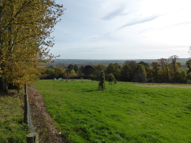
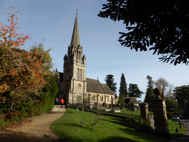
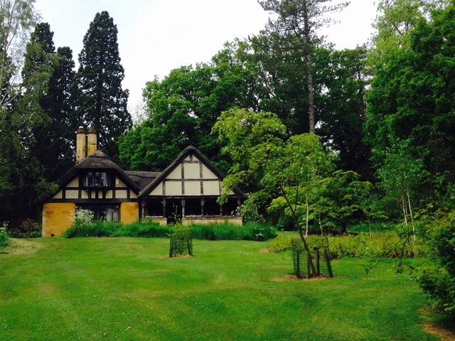
Batsford Park is a picturesque estate located in Gloucestershire, England. Nestled in the heart of the Cotswolds, this stunning park covers an area of approximately 1,800 acres and offers a diverse landscape of downs and moorland.

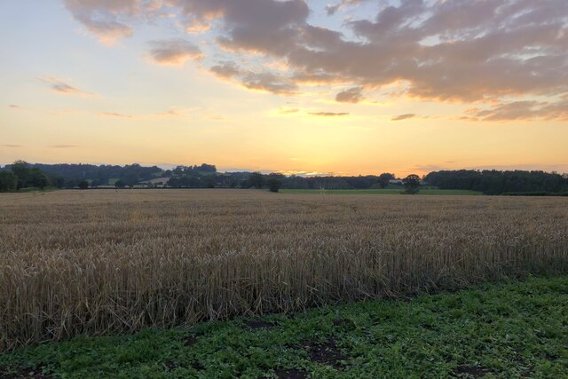
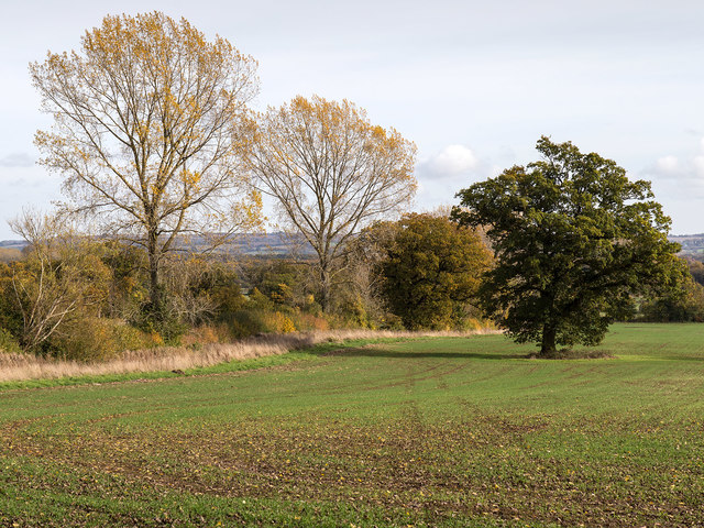
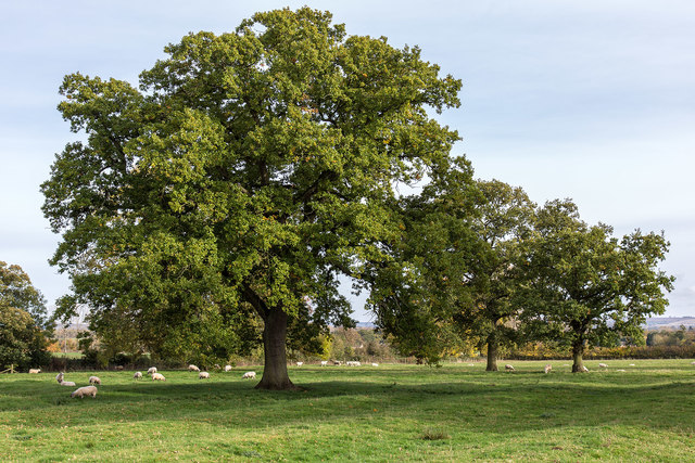
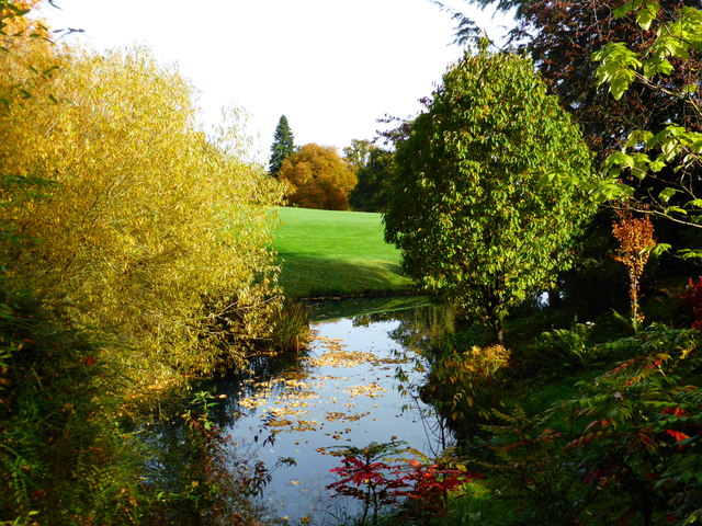
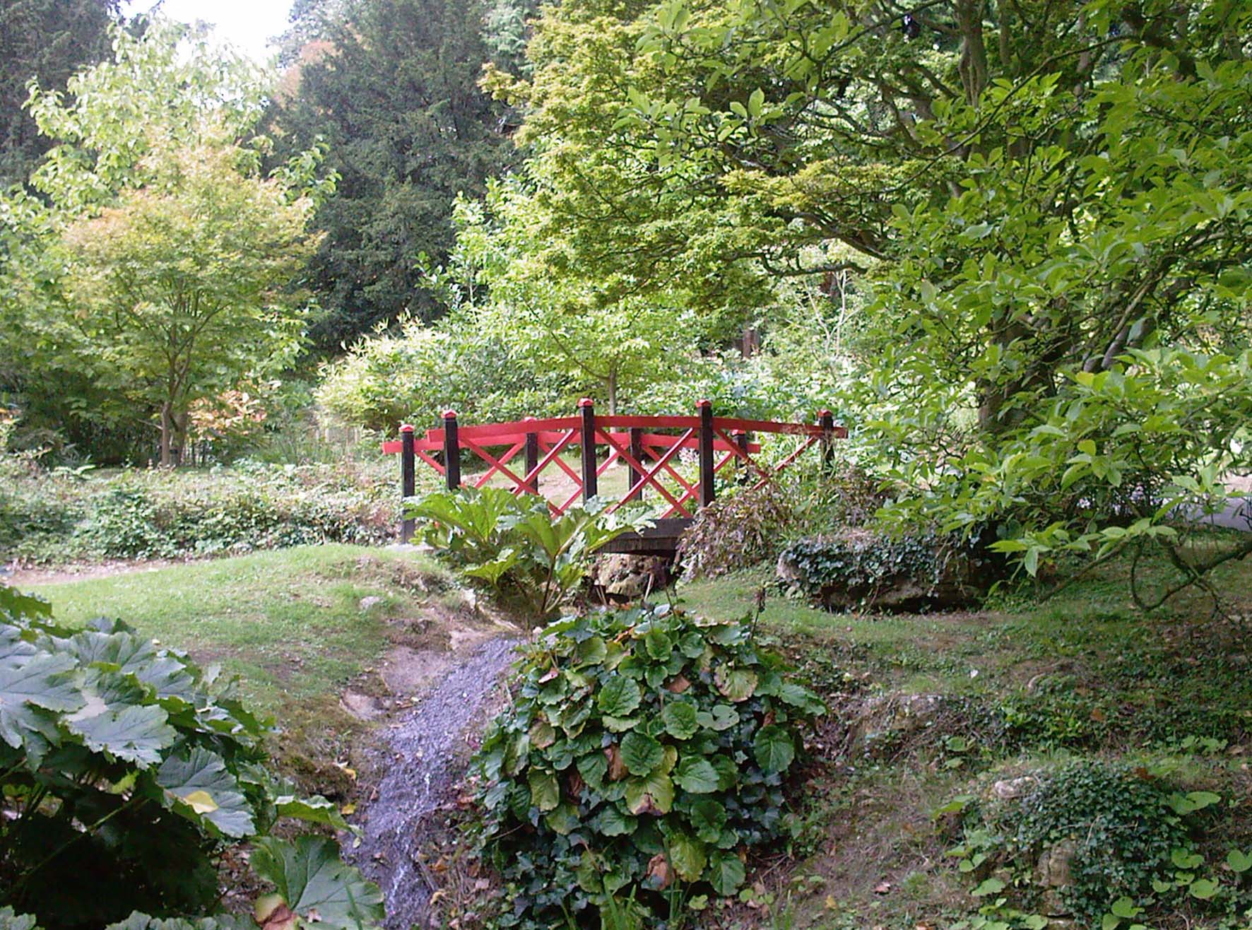
The park boasts magnificent views of the surrounding countryside, with rolling hills and lush green meadows stretching as far as the eye can see. Visitors to Batsford Park are treated to a tranquil and serene environment, perfect for those seeking a break from the hustle and bustle of city life.

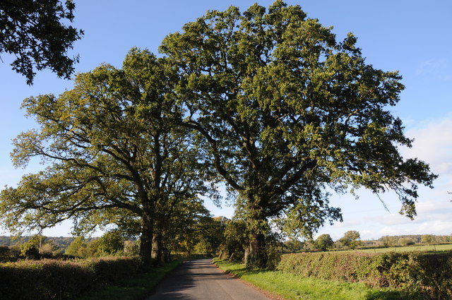
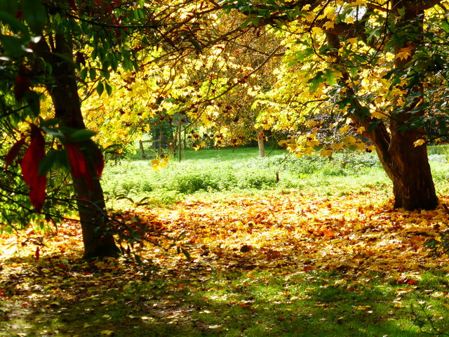
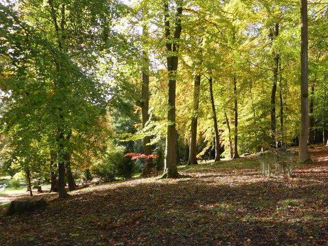
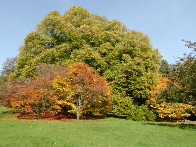
The park is home to a rich variety of flora and fauna, making it a haven for nature enthusiasts. It is particularly renowned for its collection of trees, including rare and exotic species. Batsford Park's arboretum showcases over 2,850 different trees and shrubs, making it one of the largest private collections in the country.

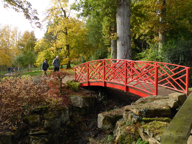
Aside from its natural beauty, the park also offers a range of recreational activities. There are numerous walking trails and paths that allow visitors to explore the estate at their own pace. The park also features a café, where visitors can enjoy a hot meal or a refreshing drink while taking in the breathtaking views.

Batsford Park is open to the public throughout the year, with various events and activities organized seasonally. Whether one is looking for a peaceful retreat or an opportunity to immerse themselves in nature, Batsford Park is a must-visit destination in Gloucestershire.

If you have any feedback on the listing, please let us know in the comments section below.

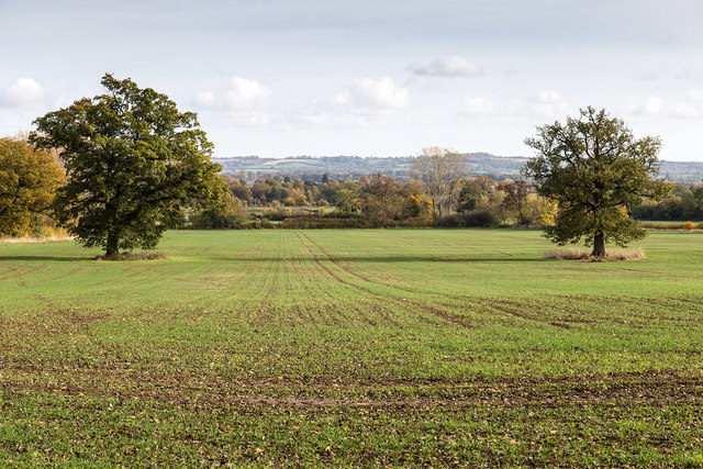
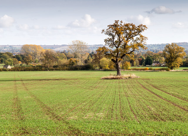
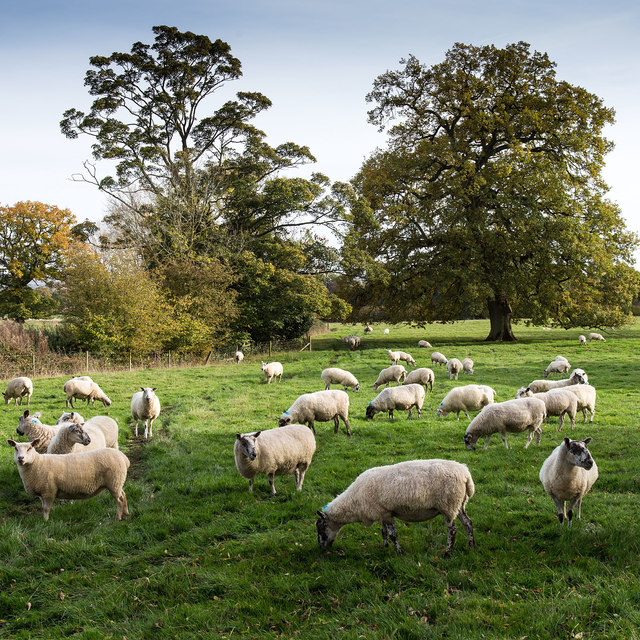
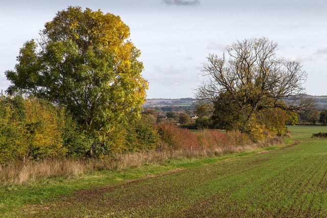
Batsford Park Images

Images are sourced within 2km of 52.001847/-1.7351748 or Grid Reference SP1833. Thanks to Geograph Open Source API. All images are credited.

Country road near Batsford Country road from Moreton-in-Marsh to Batsford.
Country road near Batsford
Country road from Moreton-in-Marsh to Batsford.
Field of wheat at sunset
St. Mary's Church, Batsford The south side of the church from the edge of the churchyard.
Anglican parish church. Rebuilt by W.F. Poulton and Woodman of
Reading 1861-2. Ashlar limestone.<span class="nowrap"><a title="http://www.britishlistedbuildings.co.uk/en-128641-church-of-st-mary-batsford-gloucestershi#.Viz3Syspknk" rel="nofollow ugc noopener" href="http://www.britishlistedbuildings.co.uk/en-128641-church-of-st-mary-batsford-gloucestershi#.Viz3Syspknk">Link</a><img style="margin-left:2px;" alt="External link" title="External link - shift click to open in new window" src="https://s1.geograph.org.uk/img/external.png" width="10" height="10"/></span>
St. Mary's Church, Batsford
The south side of the church from the edge of the churchyard. Anglican parish church. Rebuilt by W.F. Poulton and Woodman of Reading 1861-2. Ashlar limestone.LinkExternal link
Autumn Fields View ESE from the footpath to Bourton-on-the-Hill.
Autumn Fields
View ESE from the footpath to Bourton-on-the-Hill.
Autumn Fields View ESE from the footpath to Bourton-on-the-Hill.
Autumn Fields
View ESE from the footpath to Bourton-on-the-Hill.
Autumn Fields View ESE from the footpath to Bourton-on-the-Hill.
Autumn Fields
View ESE from the footpath to Bourton-on-the-Hill.
Sheep by the footpath View ESE from the footpath to Bourton-on-the-Hill.
Sheep by the footpath
View ESE from the footpath to Bourton-on-the-Hill.
Autumn Hedgerow View ESE from the footpath to Bourton-on-the-Hill.
Autumn Hedgerow
View ESE from the footpath to Bourton-on-the-Hill.
Autumn Fields View ESE from the footpath to Bourton-on-the-Hill.
Autumn Fields
View ESE from the footpath to Bourton-on-the-Hill.
Batsford Arboretum - viewpoint Looking over the boundary fence at one of the corners of the arboretum.
Batsford Arboretum - viewpoint
Looking over the boundary fence at one of the corners of the arboretum.
Batsford Church from the Arboretum It is possible to enter the arboretum from this end but a notice warns that people doing so without a ticket risk prosecution as the pay booth is at the other end.
Batsford Church from the Arboretum
It is possible to enter the arboretum from this end but a notice warns that people doing so without a ticket risk prosecution as the pay booth is at the other end.
Autumn colours - Batsford Arboretum
Batsford Arboretum The positions and view direction are approximations. A lovely sunny sunday morning in autumn.
Batsford Arboretum
The positions and view direction are approximations. A lovely sunny sunday morning in autumn.
Batsford Arboretum - autumnal The camera can be adjusted to make these colours even more vibrant but this au natural effect in the sunshine is quite vivid enough for my liking.
Batsford Arboretum - autumnal
The camera can be adjusted to make these colours even more vibrant but this au natural effect in the sunshine is quite vivid enough for my liking.
Cold Well Lake - Batsford Arboretum The autumn colours are really vibrant here. In the lake was an Island with three young boys who had got there with the aid of a boat and were fishing. The lake is private like the Hall but there is a view to be had from the arboretum.
Cold Well Lake - Batsford Arboretum
The autumn colours are really vibrant here. In the lake was an Island with three young boys who had got there with the aid of a boat and were fishing. The lake is private like the Hall but there is a view to be had from the arboretum.
Batsford Arboretum - red bridge This rather oriental looking bridge crosses the stream just above Sister's Pool.
Batsford Arboretum - red bridge
This rather oriental looking bridge crosses the stream just above Sister's Pool.
Batsford arboretum Batsford arboretum, Cotswolds
Batsford arboretum
Batsford arboretum, Cotswolds
Falcon ready to fly
Falcon ready to fly
Show me another place!

Batsford Park is located at Grid Ref: SP1833 (Lat: 52.001847, Lng: -1.7351748)

Administrative County: Gloucestershire

District: Cotswold

Police Authority: Gloucestershire

What 3 Words

///bride.conducted.outgrown. Near Blockley, Gloucestershire

Related Wikis

Nearby Amenities

Located within 500m of 52.001847,-1.7351748
Shop: gift
Lat/Long: 51.9989826/-1.7356561
Cafe
Garden Terrace
Opening Hours: Mo-Su 09:30-17:00
Lat/Long: 51.9988488/-1.7355461
Toilets
Fee: no
Wheelchair: yes
Lat/Long: 51.9989917/-1.7357674
Barrier: swing_gate
Bicycle: yes
Foot: yes
Horse: yes
Motorcar: yes
Motorcycle: yes
Lat/Long: 51.9982015/-1.7357352
Covered: no
Leisure: picnic_table
Lat/Long: 51.9984075/-1.7354563
Covered: no
Leisure: picnic_table
Lat/Long: 51.9983782/-1.7355596
Cotswold Falconry Centre
Board Type: notice
Information: board
Tourism: information
Lat/Long: 51.9985937/-1.7341246
Bicycle Parking
Capacity: 4
Lat/Long: 51.9986024/-1.7360678
Leisure: playground
Lat/Long: 51.9988472/-1.7352927
Hermits cave
Natural: cave_entrance
Lat/Long: 52.0004371/-1.7405657
Tourism: viewpoint
Lat/Long: 51.9995077/-1.7401428
Waterway: waterfall
Lat/Long: 51.9997917/-1.7376016
Waterway: waterfall
Lat/Long: 51.9998799/-1.7377417
Post Box
Brand: Royal Mail
Brand Wikidata: Q638098
Brand Wikipedia: en:Royal Mail
Operator: Royal Mail
Operator Wikidata: Q638098
Post Box Type: wall
Ref: GL56 134
Royal Cypher: EVIIR
Royal Cypher Wikidata: Q33102324
Lat/Long: 52.0027269/-1.7295152
Bench
Backrest: yes
Source: bing
Lat/Long: 51.9995944/-1.7401421
Charging Station
Capacity: 2
Source: survey
Lat/Long: 51.9985136/-1.7369972
Charging Station
Capacity: 2
Source: survey
Lat/Long: 51.9985384/-1.736957
Charging Station
Capacity: 2
Source: survey
Lat/Long: 51.9985631/-1.7369087
Batsford
Power: pole
Transformer: distribution
Voltage Primary: 11000
Lat/Long: 52.0027067/-1.7301904
Batsford Estate Yard
Location Transition: yes
Power: pole
Transformer: distribution
Voltage Primary: 11000
Lat/Long: 52.0041862/-1.7295823
Power: pole
Lat/Long: 52.0046155/-1.730279
Power: pole
Lat/Long: 52.005122/-1.7311111
Power: pole
Lat/Long: 52.0053416/-1.7319976
Power: pole
Lat/Long: 52.005583/-1.7329846
Power: pole
Lat/Long: 52.0058154/-1.733914
Power: pole
Lat/Long: 52.0061147/-1.7351338
Power: pole
Lat/Long: 52.0061754/-1.7368135
Oak Avenue
Power: pole
Transformer: distribution
Voltage Primary: 11000
Lat/Long: 51.998862/-1.7376758
Keepers Barn
Power: pole
Transformer: distribution
Voltage Primary: 11000
Lat/Long: 52.0021065/-1.7374485
Power: pole
Lat/Long: 52.0016932/-1.738461
Power: pole
Lat/Long: 52.0012263/-1.7395594
Power: pole
Lat/Long: 52.0007962/-1.7407355
Power: pole
Lat/Long: 52.0004779/-1.7416066
Traffic Calming: bump
Lat/Long: 52.0008012/-1.7333071
Waste Basket
Waste: dog_excrement;trash
Lat/Long: 52.0024638/-1.7309771
Traffic Calming: bump
Lat/Long: 52.0026033/-1.7306485
Waterway: waterfall
Lat/Long: 51.9998523/-1.7320504
Man Made: utility_pole
Lat/Long: 51.9973807/-1.7355048
Man Made: utility_pole
Lat/Long: 51.997822/-1.7362598
Man Made: utility_pole
Lat/Long: 51.9975466/-1.7358552
The data included in this document is from www.openstreetmap.org. The data is made available under ODbL.

Have you been to Batsford Park?

Leave your review of Batsford Park below (or comments, questions and feedback).