Nought Moor

Downs, Moorland in Yorkshire Harrogate

England

Nought Moor

Riverside path
Riverside path Credit: don cload

Nought Moor, located in the county of Yorkshire, England, is a picturesque area that encompasses both downs and moorland landscapes. Spanning an expansive area, it is nestled within the Yorkshire Dales National Park, renowned for its natural beauty and rich wildlife.

The downs of Nought Moor are characterized by gently rolling hills, covered in lush green grasses and dotted with vibrant wildflowers during the summer months. This landscape provides breathtaking panoramic views of the surrounding countryside, making it a popular destination for hikers, nature enthusiasts, and photographers.

Moving towards the moorland section of Nought Moor, the scenery transitions into a wilder, more rugged terrain. Here, heather and bracken dominate the landscape, creating a striking purple and green tapestry that stretches as far as the eye can see. The moorland is interspersed with patches of woodland, adding to the diversity of the area and providing a habitat for various bird species, including grouse and curlews.

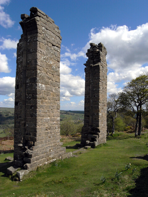
Nought Moor is also home to several historic sites, including ancient stone circles and burial mounds, which stand as a testament to the area's rich history. Visitors can explore these archaeological wonders and gain insight into the lives of the people who once inhabited this land.

With its stunning natural landscapes, diverse wildlife, and historical significance, Nought Moor offers a captivating experience for all who venture into its bounds. Whether one seeks tranquility, adventure, or a deeper understanding of the region's past, this Yorkshire gem is sure to leave a lasting impression.

If you have any feedback on the listing, please let us know in the comments section below.
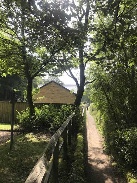
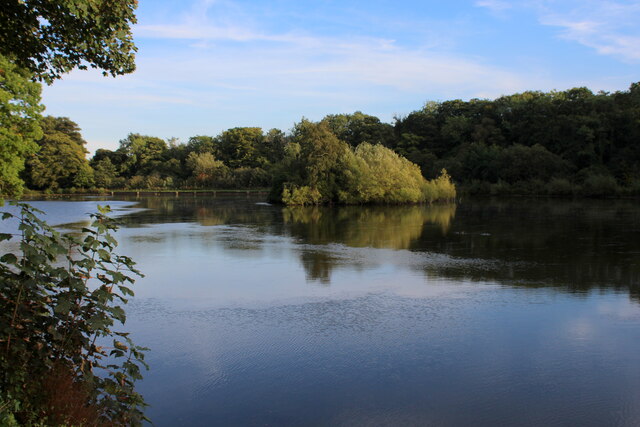
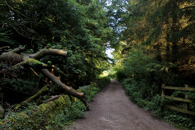
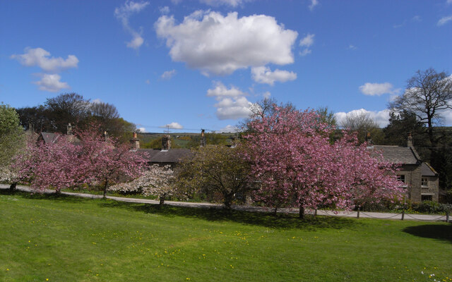
Nought Moor Images

Images are sourced within 2km of 54.068626/-1.7677339 or Grid Reference SE1563. Thanks to Geograph Open Source API. All images are credited.

Riverside path
Riverside path
Glasshouses Mill Dam Created out of the River Nidd in the 1850's, to supply water to the Glasshouses Flax Mill - just downstream from here.
The mill has now been converted into living accommodation, while the artificial lake is the preserve of water fowl and the odd angler.
Glasshouses Mill Dam
Created out of the River Nidd in the 1850's, to supply water to the Glasshouses Flax Mill - just downstream from here. The mill has now been converted into living accommodation, while the artificial lake is the preserve of water fowl and the odd angler.
Footpath heading towards Glasshouses Follows the River Nidd from Pateley Bridge - at this point sandwiched between a redundant mill race and a fish farm.
Footpath heading towards Glasshouses
Follows the River Nidd from Pateley Bridge - at this point sandwiched between a redundant mill race and a fish farm.
The Village Green, Bewerley
Yorke's Folly
Yorke's Folly
Pateley Bridge features [2] The River Nidd looking upstream from the bridge carrying the B6265 road.
Pateley Bridge is a small market town, the market charter being granted in 1320. Located on the banks of the River Nidd, the town is some 11 miles northwest of Harrogate, some 10 miles southwest of Ripon and is within the Nidderdale Area of Outstanding Natural Beauty. The town is popular with tourists exploring the Yorkshire Dales.
Pateley Bridge features [2]
The River Nidd looking upstream from the bridge carrying the B6265 road. Pateley Bridge is a small market town, the market charter being granted in 1320. Located on the banks of the River Nidd, the town is some 11 miles northwest of Harrogate, some 10 miles southwest of Ripon and is within the Nidderdale Area of Outstanding Natural Beauty. The town is popular with tourists exploring the Yorkshire Dales.
War memorial Located in public gardens alongside the River Nidd, Pateley Bridge's war memorial is a rough-hewn stone of remembrance. Erected in 1922 there are four attached bronze plaques bearing names and inscription in raised lettering.
Pateley Bridge is a small market town, the market charter being granted in 1320. Located on the banks of the River Nidd, the town is some 11 miles northwest of Harrogate, some 10 miles southwest of Ripon and is within the Nidderdale Area of Outstanding Natural Beauty. The town is popular with tourists exploring the Yorkshire Dales.
War memorial
Located in public gardens alongside the River Nidd, Pateley Bridge's war memorial is a rough-hewn stone of remembrance. Erected in 1922 there are four attached bronze plaques bearing names and inscription in raised lettering. Pateley Bridge is a small market town, the market charter being granted in 1320. Located on the banks of the River Nidd, the town is some 11 miles northwest of Harrogate, some 10 miles southwest of Ripon and is within the Nidderdale Area of Outstanding Natural Beauty. The town is popular with tourists exploring the Yorkshire Dales.
Pateley Bridge, old School The OS Flush Bracket 0369/S is fixed to the south-east facing wall of the old Pateley Bridge school.
Pateley Bridge, old School
The OS Flush Bracket 0369/S is fixed to the south-east facing wall of the old Pateley Bridge school.
Pateley Bridge, old school The OS Flush Bracket 0369/S is fixed to the south-east facing gable end wall of the old Pateley Bridge school.
Pateley Bridge, old school
The OS Flush Bracket 0369/S is fixed to the south-east facing gable end wall of the old Pateley Bridge school.
Pateley Bridge, old school There is a benchmark cut into the south-east facing gable end of the old school in Pateley Bridge.
Pateley Bridge, old school
There is a benchmark cut into the south-east facing gable end of the old school in Pateley Bridge.
Bewerley, bridge There is a benchmark cut into the western parapet of the bridge on the lowest course of stone.
Bewerley, bridge
There is a benchmark cut into the western parapet of the bridge on the lowest course of stone.
Bewerley, bridge There is a benchmark cut into the western parapet of the bridge on the lowest course of stone.
Bewerley, bridge
There is a benchmark cut into the western parapet of the bridge on the lowest course of stone.
Bewerley, The Mount There is a benchmark cut into the right hand gatepost of The Mount. This is on the south side of the B6265.
Bewerley, The Mount
There is a benchmark cut into the right hand gatepost of The Mount. This is on the south side of the B6265.
Bewerley, The Mount There is a benchmark cut into the right hand gatepost of The Mount. This is on the south side of the B6265.
Bewerley, The Mount
There is a benchmark cut into the right hand gatepost of The Mount. This is on the south side of the B6265.
Pateley Bridge, old brewery The benchmark is cut into the 2nd course of stone and at the extreme left of the building.
Pateley Bridge, old brewery
The benchmark is cut into the 2nd course of stone and at the extreme left of the building.
Pateley Bridge, old brewery The benchmark is cut into the 2nd course of stone and at the extreme left of the building, and close to the For Sale sign.
Pateley Bridge, old brewery
The benchmark is cut into the 2nd course of stone and at the extreme left of the building, and close to the For Sale sign.
Pateley Bridge, bridge over R Nidd The benchmark is cut into the western parapet of the bridge over the River Nidd.
Pateley Bridge, bridge over R Nidd
The benchmark is cut into the western parapet of the bridge over the River Nidd.
Pateley Bridge, bridge over R Nidd There is a benchmark cut into the western parapet of the bridge over the River Nidd.
Pateley Bridge, bridge over R Nidd
There is a benchmark cut into the western parapet of the bridge over the River Nidd.
Show me another place!

Nought Moor is located at Grid Ref: SE1563 (Lat: 54.068626, Lng: -1.7677339)

Division: West Riding

Administrative County: North Yorkshire

District: Harrogate

Police Authority: North Yorkshire

What 3 Words

///cattle.physics.scribbled. Near Pateley Bridge, North Yorkshire

Related Wikis

Bewerley

Bewerley is a village and civil parish in the Harrogate district of North Yorkshire, England, about twelve miles west of Ripon. The parish includes the...

Pateley Bridge

Pateley Bridge (known locally as Pateley) is a market town in Nidderdale in the county and district of North Yorkshire, England. Historically part of the...

Pateley Bridge railway station

Pateley Bridge railway station is a disused railway station in North Yorkshire, England. The station was the terminating station on the North Eastern Railway...

Pateley Playhouse

The Pateley Playhouse is a small amateur-run theatre in the town of Pateley Bridge in Nidderdale, North Yorkshire, England. The building was initially...

Nidderdale AONB

The Nidderdale AONB is an Area of Outstanding Natural Beauty in North Yorkshire, England, bordering the Yorkshire Dales National Park to the east and south...

Nidderdale

Nidderdale, historically also known as Netherdale, is one of the Yorkshire Dales (although outside the Yorkshire Dales National Park) in North Yorkshire...

Pateley Bridge railway station (Nidd Valley Light Railway)

Pateley Bridge railway station (NVLR) was a railway station serving the southern terminus of the Nidd Valley Light Railway, in Pateley Bridge, North Yorkshire...

Nidderdale Museum

Nidderdale Museum is a local and social history museum in the market town of Pateley Bridge in Nidderdale, one of the Yorkshire Dales, in North Yorkshire...

Nearby Amenities

Located within 500m of 54.068626,-1.7677339
Source: OS Yorkshire sheet 135, publ. 1854
Waterway: weir
Lat/Long: 54.070529/-1.7691019
Information: board
Source: survey
Tourism: information
Lat/Long: 54.0692183/-1.7632734
Barrier: stile
Lat/Long: 54.0673096/-1.7674119
Historic: boundary_stone
Source: NLS-OS-1st_Series
Lat/Long: 54.0672684/-1.7658994
Historic: boundary_stone
Source: OS Yorkshire sheet 135, publ. 1854
Lat/Long: 54.0673625/-1.7691315
Barrier: stile
Lat/Long: 54.0702397/-1.7720552
Historic: boundary_stone
Source: NLS-OS-1st_Series
Lat/Long: 54.0673597/-1.761022
Keld Spring
Natural: spring
Source: OS Yorkshire sheet 135, publ. 1854
Lat/Long: 54.068976/-1.7673102
Nought Moor
Place: locality
Source: NLS-OS-1st_Series
Lat/Long: 54.0684879/-1.7658994
Historic: boundary_stone
Source: NLS-OS-1st_Series
Lat/Long: 54.0672988/-1.7633893
The data included in this document is from www.openstreetmap.org. The data is made available under ODbL.

Have you been to Nought Moor?

Leave your review of Nought Moor below (or comments, questions and feedback).