Wilton Moor

Downs, Moorland in Yorkshire Richmondshire

England

Wilton Moor

Track over Witton Moor Much of Witton Moor is now open access land, with this track being the best approach.
Track over Witton Moor Credit: Gordon Hatton

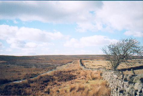
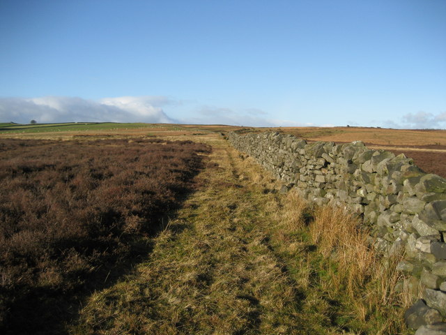
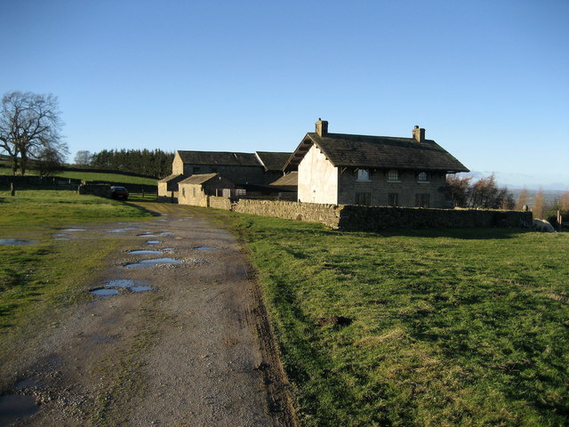
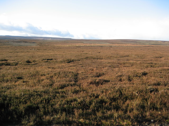
Wilton Moor is a picturesque region located in the county of Yorkshire, England. Situated amidst the stunning landscape of the Yorkshire Downs, this area is renowned for its rugged moorland and natural beauty. Spanning over vast expanses, Wilton Moor offers visitors a unique and tranquil experience.

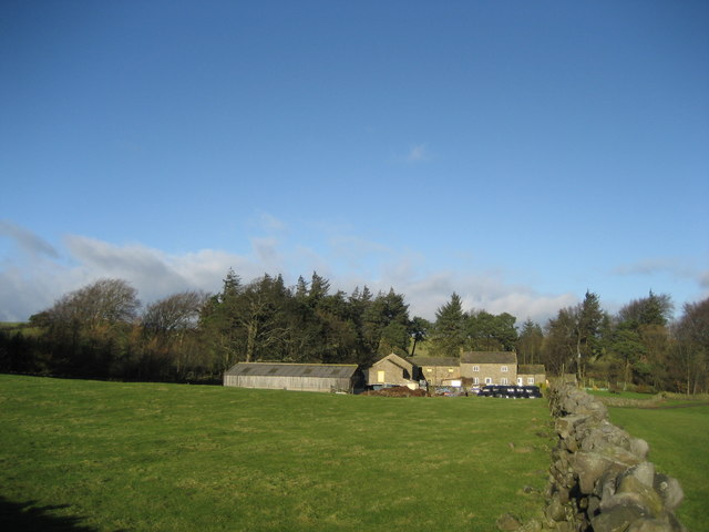
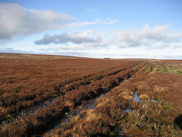
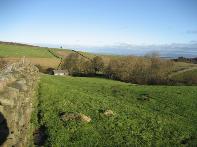
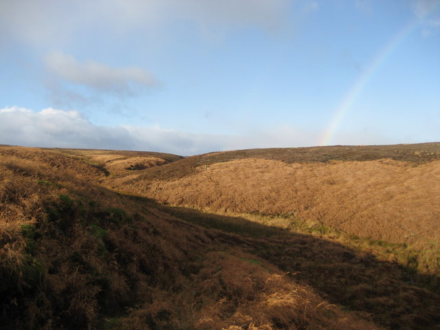
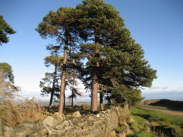
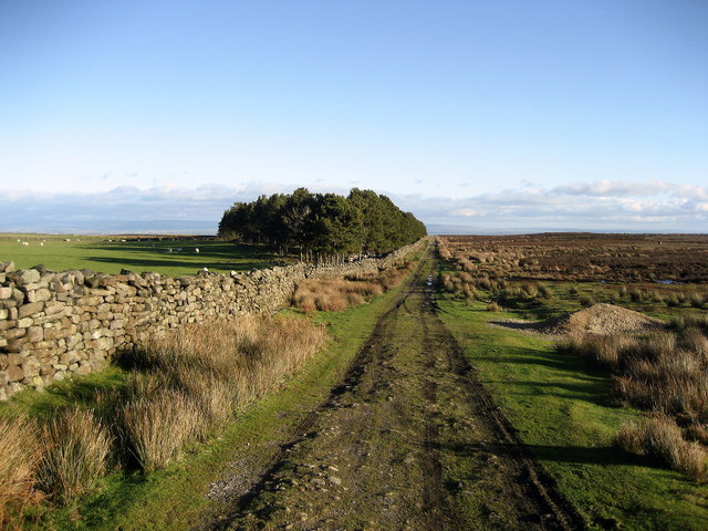
The moorland of Wilton is characterized by its rolling hills, heather-covered landscapes, and scattered patches of woodland. It is home to a diverse range of flora and fauna, making it an ideal destination for nature enthusiasts and wildlife lovers. The moorland is particularly known for its rich birdlife, with species such as curlew, lapwing, and red grouse frequently spotted in the area.

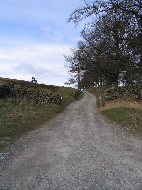
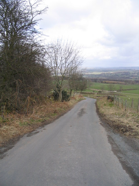
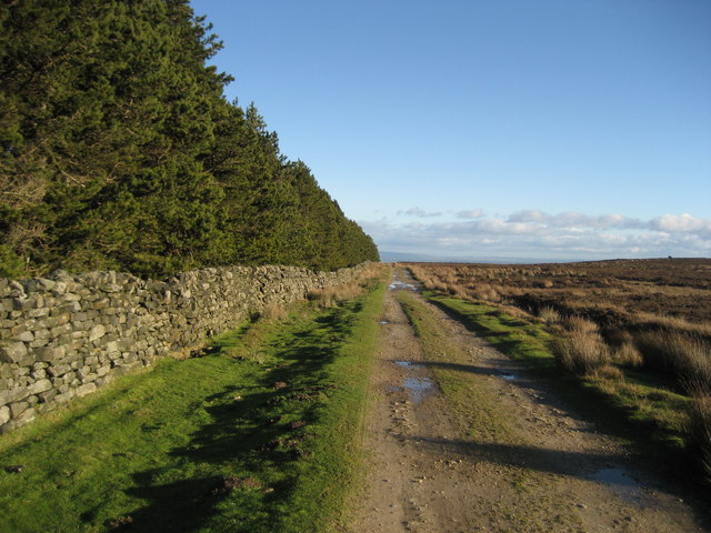
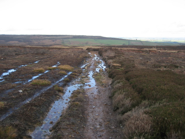
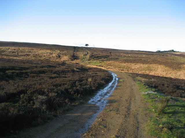
Scenic walking trails crisscross the moor, providing visitors with the opportunity to explore the breathtaking surroundings. These paths lead to several points of interest, including ancient stone circles and prehistoric burial sites that offer insights into the region's historical significance.

Wilton Moor also holds cultural importance, with its connection to the Brontë sisters, who drew inspiration from the wild beauty of the Yorkshire landscape. The moorland has been immortalized in literature, particularly in Emily Brontë's renowned novel, "Wuthering Heights."

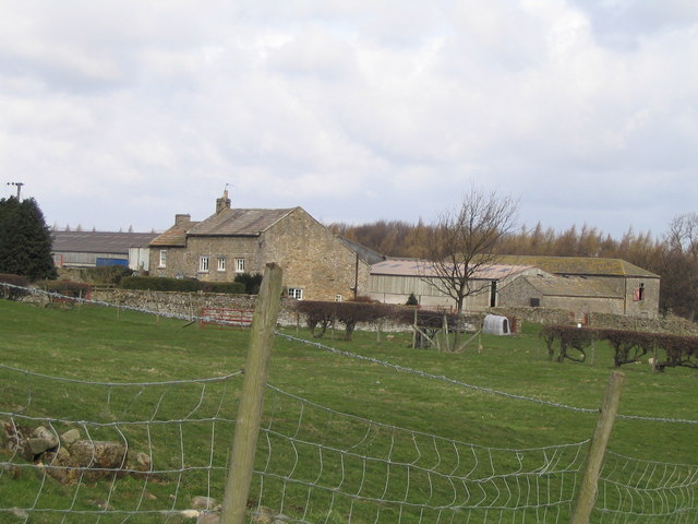
With its unspoiled natural beauty and serene atmosphere, Wilton Moor offers a welcome respite from the bustling city life. Whether it's a leisurely walk, a bird-watching adventure, or simply a moment of quiet contemplation, visitors to Wilton Moor are guaranteed an unforgettable experience in the heart of Yorkshire.

If you have any feedback on the listing, please let us know in the comments section below.
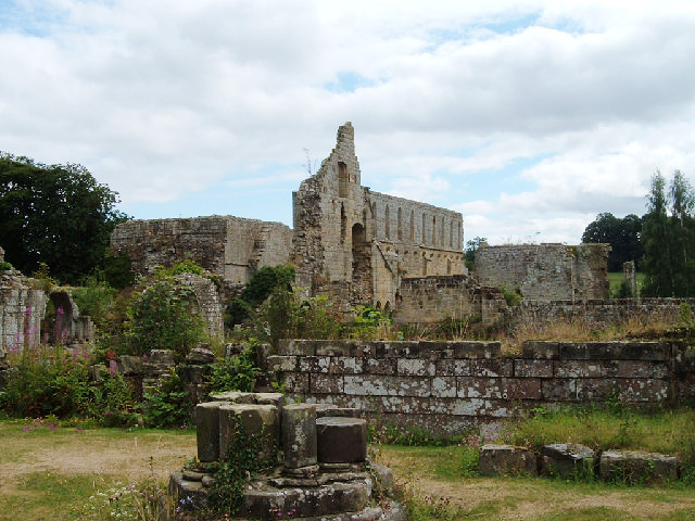
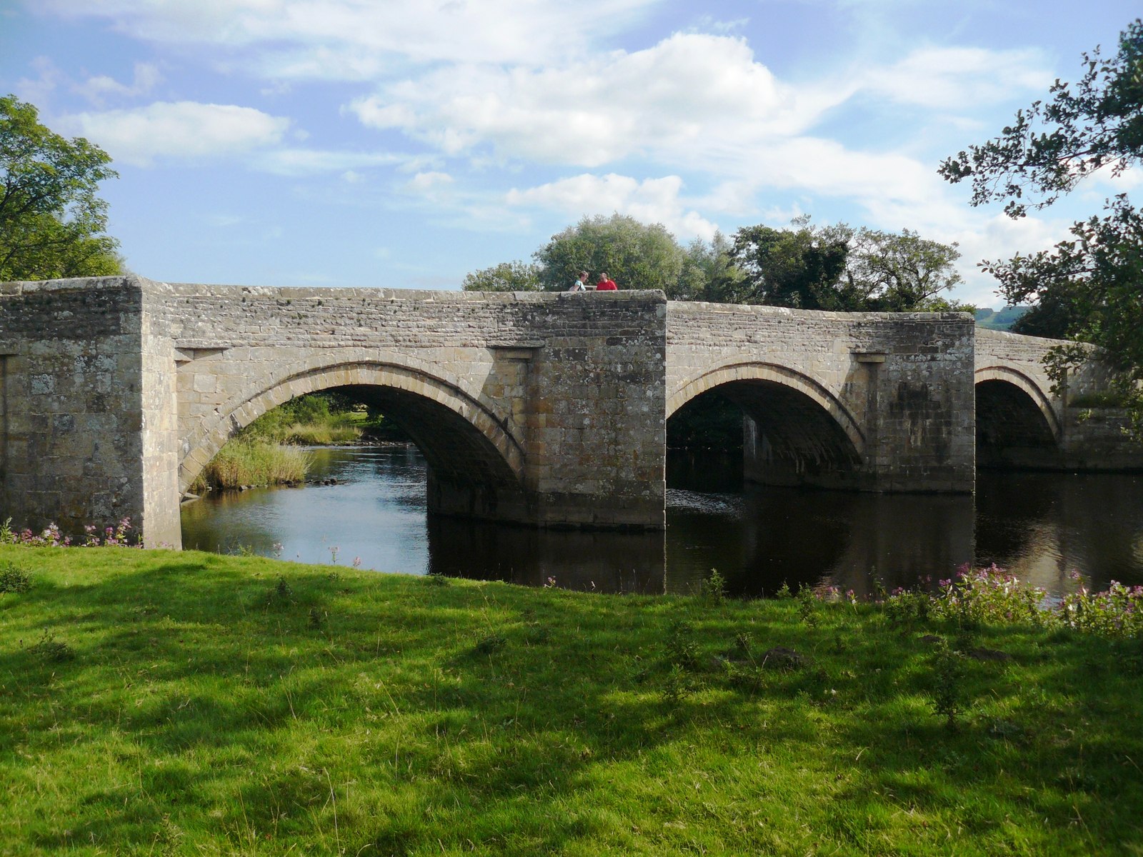
Wilton Moor Images

Images are sourced within 2km of 54.246494/-1.7664147 or Grid Reference SE1583. Thanks to Geograph Open Source API. All images are credited.

Track over Witton Moor Much of Witton Moor is now open access land, with this track being the best approach.
Track over Witton Moor
Much of Witton Moor is now open access land, with this track being the best approach.
Track to Witton Moor
Road between Ellingstring and Jervaulx Looking downhill just before High Newstead
Road between Ellingstring and Jervaulx
Looking downhill just before High Newstead
Low Newstead Farm
Low Newstead Farm
Wall over Tranmire Bog Dry stone enclosure wall heading north west over the rough ground of Tranmire Bog towards Witton Moor
Wall over Tranmire Bog
Dry stone enclosure wall heading north west over the rough ground of Tranmire Bog towards Witton Moor
Tranmire Isolated farmstead surrounded by enclosed pastures, which are themselves surrounded by moorland - like an island
Tranmire
Isolated farmstead surrounded by enclosed pastures, which are themselves surrounded by moorland - like an island
Track over Agra Moor Part of the way that leads from Colsterdale to East Witton in Wensleydale - at this point on windswept Agra Moor
Track over Agra Moor
Part of the way that leads from Colsterdale to East Witton in Wensleydale - at this point on windswept Agra Moor
Track beside East Belt Plantation Shows this substantial track running east between the plantation and Witton Moor
Track beside East Belt Plantation
Shows this substantial track running east between the plantation and Witton Moor
Grey Yaud Plantation This is the south eastern corner of a large block of plantation that seem to be a popular feature of this locality
Grey Yaud Plantation
This is the south eastern corner of a large block of plantation that seem to be a popular feature of this locality
Field south of Sowden Beck Farm The farm itself is concealed tightly in the valley of the beck, and only one of the outer buildings is visible from this part of the field
Field south of Sowden Beck Farm
The farm itself is concealed tightly in the valley of the beck, and only one of the outer buildings is visible from this part of the field
Watercourse below Tranmire Hill Following this gill upstream to its source on Agra Moor - the rainbow is a bonus, but not a geograph (wrong square).
Watercourse below Tranmire Hill
Following this gill upstream to its source on Agra Moor - the rainbow is a bonus, but not a geograph (wrong square).
Track across Witton Moor Not marked on your map, but it is there. Part of a track that runs from Colsterdale over Agra and Witton Moor, and then down to East Witton in Wensleydale
Track across Witton Moor
Not marked on your map, but it is there. Part of a track that runs from Colsterdale over Agra and Witton Moor, and then down to East Witton in Wensleydale
The Green, Ellingstring A pleasant green area at the western end of the village
The Green, Ellingstring
A pleasant green area at the western end of the village
Moor Cote Located above a series of plantations, this farm looked deserted and even abandoned. The main house has a curious outsized roof giving it almost an alpine quality
Moor Cote
Located above a series of plantations, this farm looked deserted and even abandoned. The main house has a curious outsized roof giving it almost an alpine quality
Scots Pine near Milestone Bank Lovely specimens of these noble trees on the edge of Witton Moor
Scots Pine near Milestone Bank
Lovely specimens of these noble trees on the edge of Witton Moor
Track beside Witton Moor This track follows the northern boundary of Witton Moor, at this point approaching East Belt Plantation
Track beside Witton Moor
This track follows the northern boundary of Witton Moor, at this point approaching East Belt Plantation
Track approaching Tom Claypham Beck This track is crossing the north western corner of Witton Moor, executing a little dip to cross the approaching watercourse
Track approaching Tom Claypham Beck
This track is crossing the north western corner of Witton Moor, executing a little dip to cross the approaching watercourse
Agra Moor Wide open and windswept moorland landscape
Agra Moor
Wide open and windswept moorland landscape
Show me another place!

Wilton Moor is located at Grid Ref: SE1583 (Lat: 54.246494, Lng: -1.7664147)

Division: North Riding

Administrative County: North Yorkshire

District: Richmondshire

Police Authority: North Yorkshire

What 3 Words

///reinforce.archive.commuted. Near Masham, North Yorkshire

Related Wikis

Ellingstring

Ellingstring is a village and civil parish in Wensleydale in North Yorkshire, England, about 5 miles (8 km) south-east of Leyburn, and 3.5 miles (5.6 km...

Gollinglith Foot

Gollinglith Foot (GOWN-li FOOT), historically also spelt Gownley Foot, is a hamlet in the civil parish of Healey in the Harrogate district of North Yorkshire...

East Witton

East Witton is a village and civil parish in Wensleydale in North Yorkshire, England. It lies south of Leyburn, in the Richmondshire district. Richard...

Jervaulx Abbey

Jervaulx Abbey in East Witton in North Yorkshire, 14 mi (23 km) north-west of the city of Ripon, was one of the great Cistercian abbeys of Yorkshire, England...

Colsterdale

Colsterdale is the valley of the River Burn, a tributary of the River Ure, in the Yorkshire Dales in North Yorkshire, England. It gives its name to a hamlet...

River Cover

The River Cover is a river in the Yorkshire Dales in North Yorkshire, England. The Yorkshire Dales Rivers Trust has a remit to conserve the ecological...

Ulshaw Bridge

Ulshaw Bridge is a hamlet on the River Ure, near to Middleham, in North Yorkshire, England. The hamlet derives its name partly from the Medieval stone...

Healey, North Yorkshire

Healey is a small village and civil parish in the Harrogate district of North Yorkshire, England. It is situated in the valley of the River Burn, to the...

Have you been to Wilton Moor?

Leave your review of Wilton Moor below (or comments, questions and feedback).