Brown Hill

Hill, Mountain in Yorkshire Harrogate

England

Brown Hill

The Village Green, Bewerley
The Village Green, Bewerley Credit: habiloid

Brown Hill is a prominent geographical feature located in the county of Yorkshire, England. Rising to an elevation of approximately 400 meters, it is classified as a hill rather than a mountain due to its height falling slightly below the generally accepted threshold of 600 meters. Situated in the southern part of Yorkshire, Brown Hill is part of the wider Pennines range, renowned for its picturesque landscapes and diverse flora and fauna.

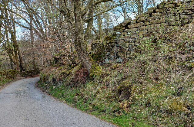
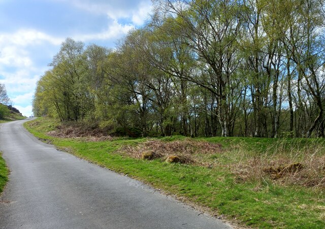
The hill's name, Brown Hill, is derived from the distinct brownish color of the vegetation covering its slopes, particularly during the autumn season. Its terrain is characterized by rolling hills and steep inclines, providing captivating views of the surrounding countryside and nearby towns. Brown Hill is accessible via a network of well-maintained footpaths, making it a popular destination for hikers, nature enthusiasts, and locals seeking a tranquil escape.

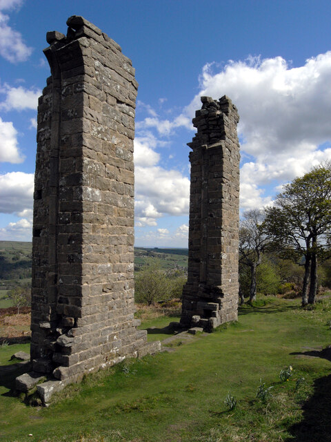
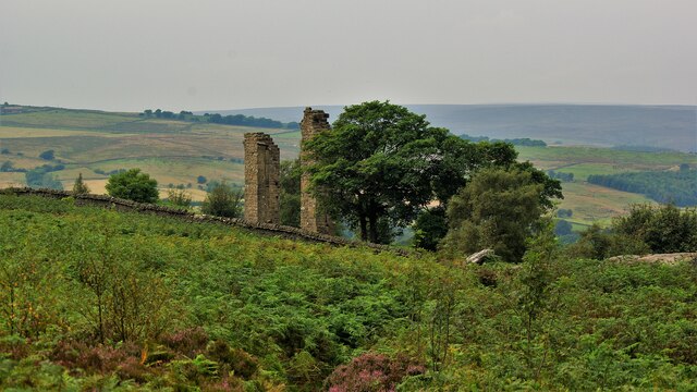
The hill's proximity to various historic settlements and archaeological sites adds to its significance. It is located near the village of Brownhill, which shares its name, and is within reach of several other charming Yorkshire towns. The area surrounding Brown Hill is rich in heritage, with traces of Roman and medieval settlements found nearby.

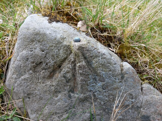
Nature enthusiasts visiting Brown Hill can expect a diverse range of wildlife, including various bird species, small mammals, and indigenous plant life. The hill's open heathland and woodland areas provide habitats for a multitude of species, making it an important site for conservation efforts.

In conclusion, Brown Hill is a notable feature in the Yorkshire landscape, offering stunning views, historical significance, and a haven for biodiversity.

If you have any feedback on the listing, please let us know in the comments section below.
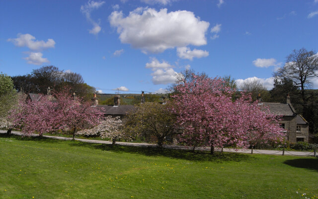
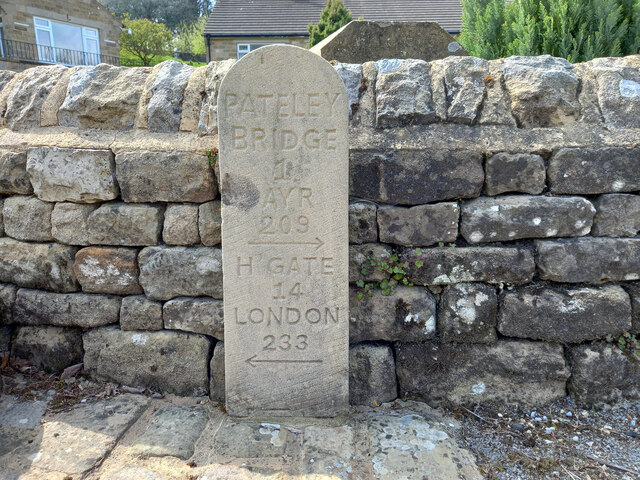
Brown Hill Images

Images are sourced within 2km of 54.062998/-1.7669861 or Grid Reference SE1563. Thanks to Geograph Open Source API. All images are credited.

The Village Green, Bewerley
Yorke's Folly
Yorke's Folly
Modern Waymarker, Bewerley On the West side of an unclassified road, installed since July 2011.

Inscription: Pateley / Bridge / 1 / Ayr / 209 / ⇨ / H Gate / 14 / London / 233 / ⇦

Milestone Society National ID: YN_HGPB15N
Modern Waymarker, Bewerley
On the West side of an unclassified road, installed since July 2011. Inscription: Pateley / Bridge / 1 / Ayr / 209 / ⇨ / H Gate / 14 / London / 233 / ⇦ Milestone Society National ID: YN_HGPB15N
Yorke's Folly A Georgian eye-catcher on Guyscliffe (Guise Cliff) for Mr Yorke from his home in Bewerley
Yorke's Folly
A Georgian eye-catcher on Guyscliffe (Guise Cliff) for Mr Yorke from his home in Bewerley
Bewerley, Bridgehouse Gate wall The benchmark is cut into the roadside wall on the north side of the lane.
Bewerley, Bridgehouse Gate wall
The benchmark is cut into the roadside wall on the north side of the lane.
Bewerley, Bridgehouse  Gate There is a benchmark cut into the roadside wall on the north side of the lane.
Bewerley, Bridgehouse Gate
There is a benchmark cut into the roadside wall on the north side of the lane.
Bewerley, Peat Lane gatepost The benchmark is cut into a gatepost to the property Croft Cottage on the south side of the lane.
Bewerley, Peat Lane gatepost
The benchmark is cut into a gatepost to the property Croft Cottage on the south side of the lane.
Bewerley, Croft Cottage There is a benchmark cut into the left hand stone gatepost to the property Croft Cottage which is on the south side of Peat Lane.
Bewerley, Croft Cottage
There is a benchmark cut into the left hand stone gatepost to the property Croft Cottage which is on the south side of Peat Lane.
Bewerley, Peat Lane The benchmark is cut into a boulder on the north side of the lane.
Bewerley, Peat Lane
The benchmark is cut into a boulder on the north side of the lane.
Bewerley, Peat Lane The small boulder which can be seen at the edge of the left hand side of the road, just in the shadows, has a benchmark cut into its surface.
Bewerley, Peat Lane
The small boulder which can be seen at the edge of the left hand side of the road, just in the shadows, has a benchmark cut into its surface.
Bewerley, Peat Lane There is a benchmark cut into a house on the north side of the lane.
Bewerley, Peat Lane
There is a benchmark cut into a house on the north side of the lane.
Bewerley, Peat Lane There is a benchmark cut into the right hand side of the gable end of this house on the north side of the lane.
Bewerley, Peat Lane
There is a benchmark cut into the right hand side of the gable end of this house on the north side of the lane.
Bewerley, Peat Lane According to the OS benchmark database there is a boulder with a benchmark on the south side of the lane. Many of the boulders are coated in moss which makes searching difficult. Nothing was found on the largest boulders.
Bewerley, Peat Lane
According to the OS benchmark database there is a boulder with a benchmark on the south side of the lane. Many of the boulders are coated in moss which makes searching difficult. Nothing was found on the largest boulders.
Bewerley, Peat Lane According to the OS benchmark database there is a cutmark at ground level on a culvert. Today, after new road surfaces and improvements there is no obvious culvert or any running water. A few roadside large stones were uncovered but no mark was found.
Bewerley, Peat Lane
According to the OS benchmark database there is a cutmark at ground level on a culvert. Today, after new road surfaces and improvements there is no obvious culvert or any running water. A few roadside large stones were uncovered but no mark was found.
Bewerley, Low Moor The boulder with the rivet is on the north side of Peat Lane.
Bewerley, Low Moor
The boulder with the rivet is on the north side of Peat Lane.
Bewerley, Low Moor The boulder with the rivet is on the north side of Peat Lane, and it is very prominent.
Bewerley, Low Moor
The boulder with the rivet is on the north side of Peat Lane, and it is very prominent.
Bewerley, Peat Lane The boulder with the rivet is on the north-west side of the lane.
Bewerley, Peat Lane
The boulder with the rivet is on the north-west side of the lane.
Bewerley, Peat Lane There is a boulder with a benchmark/rivet on the north-west side of the lane.
Bewerley, Peat Lane
There is a boulder with a benchmark/rivet on the north-west side of the lane.
Show me another place!

Brown Hill is located at Grid Ref: SE1563 (Lat: 54.062998, Lng: -1.7669861)

Division: West Riding

Administrative County: North Yorkshire

District: Harrogate

Police Authority: North Yorkshire

What 3 Words

///shoulders.pouting.fuss. Near Pateley Bridge, North Yorkshire

Related Wikis

Bewerley

Bewerley is a village and civil parish in the Harrogate district of North Yorkshire, England, about twelve miles west of Ripon. The parish includes the...

Pateley Bridge

Pateley Bridge (known locally as Pateley) is a market town in Nidderdale in the county and district of North Yorkshire, England. Historically part of the...

Pateley Bridge railway station

Pateley Bridge railway station is a disused railway station in North Yorkshire, England. The station was the terminating station on the North Eastern Railway...

Pateley Playhouse

The Pateley Playhouse is a small amateur-run theatre in the town of Pateley Bridge in Nidderdale, North Yorkshire, England. The building was initially...

Nearby Amenities

Located within 500m of 54.062998,-1.7669861
Barrier: stile
Lat/Long: 54.0673096/-1.7674119
Historic: boundary_stone
Source: NLS-OS-1st_Series
Lat/Long: 54.0672684/-1.7658994
Hunting Stand
Lat/Long: 54.0586541/-1.7651491
Hunting Stand
Lat/Long: 54.0587431/-1.7659173
Hunting Stand
Lat/Long: 54.0588226/-1.7665384
Hunting Stand
Lat/Long: 54.0589145/-1.7672156
Hunting Stand
Lat/Long: 54.0589981/-1.7678997
Hunting Stand
Lat/Long: 54.059105/-1.7686025
Hunting Stand
Lat/Long: 54.0592023/-1.7693124
Hunting Stand
Lat/Long: 54.0592941/-1.7699989
Hunting Stand
Lat/Long: 54.0593873/-1.770704
Hunting Stand
Lat/Long: 54.0594887/-1.7713952
Brown Hill
Natural: peak
Source: NLS-OS-1st_Series
Lat/Long: 54.0628723/-1.7665645
Cat Loup Dub
Alt Name: Wsah Dub
Place: locality
Source: OS Yorkshire sheet 135, publ. 1854
Lat/Long: 54.0638666/-1.7729804
The data included in this document is from www.openstreetmap.org. The data is made available under ODbL.

Have you been to Brown Hill?

Leave your review of Brown Hill below (or comments, questions and feedback).