Binn Moor

Downs, Moorland in Yorkshire

England

Binn Moor

Butterley Reservoir
Butterley Reservoir Credit: Dave Pickersgill

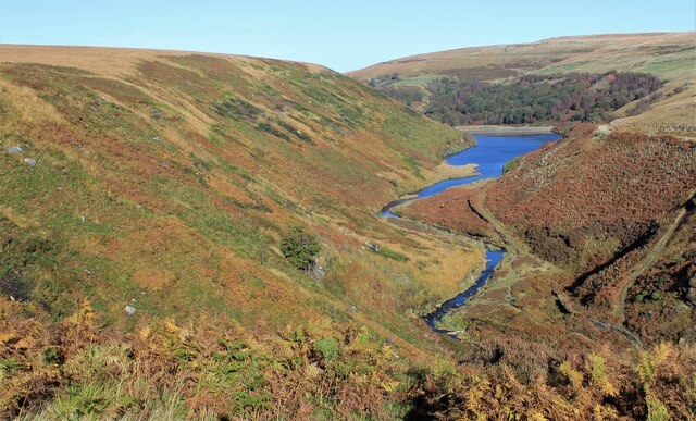
Binn Moor is a vast expanse of moorland located in Yorkshire, England. Situated in the heart of the Yorkshire Dales National Park, it offers visitors a truly unique and breathtaking landscape. The moorland is characterized by its rolling hills, heather-covered slopes, and expansive views that stretch for miles.

Covering an area of approximately 10 square miles, Binn Moor is a haven for wildlife enthusiasts and outdoor adventurers alike. The moorland is home to a variety of plant and animal species, including curlews, lapwings, and grouse. Rare species, such as the black grouse, can also be found here, making it a popular destination for birdwatchers.

The moorland is crisscrossed by a network of footpaths and trails, making it easily accessible for hikers and walkers. The rugged terrain offers a challenging but rewarding experience for those looking to explore the area. Visitors can embark on long hikes, taking in the stunning vistas and immersing themselves in the tranquil surroundings.

Binn Moor is also home to several archaeological sites, including ancient burial mounds and stone circles that provide a glimpse into the area's rich history. These remnants of the past add an extra layer of intrigue to the already captivating landscape.

Overall, Binn Moor is a must-visit destination for nature lovers and outdoor enthusiasts. Its unspoiled beauty and diverse wildlife make it a true gem within the Yorkshire Dales National Park. Whether you're seeking a peaceful retreat or an adventure-filled hike, Binn Moor offers something for everyone.

If you have any feedback on the listing, please let us know in the comments section below.

Binn Moor Images

Images are sourced within 2km of 53.58908/-1.9137323 or Grid Reference SE0510. Thanks to Geograph Open Source API. All images are credited.

Butterley Reservoir
Butterley Reservoir
Blakeley Reservoir
Blakeley Reservoir
Track, Bridleway and Footpath at Wessenden Lodge Looking south-westward.
Track, Bridleway and Footpath at Wessenden Lodge
Looking south-westward.
Track and footpath signage in the Wassenden Valley Looking northward. The Kirklees Way continues ahead towards Marsden whilst the Pennine Way turns westward towards Black Moss
Track and footpath signage in the Wassenden Valley
Looking northward. The Kirklees Way continues ahead towards Marsden whilst the Pennine Way turns westward towards Black Moss
The Pennine Way near Great Hey Cote Hill
The Pennine Way near Wessenden Reservoir
The Pennine Way near Hey Green
The Pennine Way above Wessenden Reservoir
The Pennine Way near Blakely Clough
Waterfall at Wessenden
Wessenden Brook
Wessenden Brook
Blakeley Reservoir View from the path along Deer Hill Reservoir conduit
Blakeley Reservoir
View from the path along Deer Hill Reservoir conduit
Waterfall from Wessenden Reservoir overflow The spillway on the reservoir ends abruptly in this waterfall down to Wessenden Brook
Waterfall from Wessenden Reservoir overflow
The spillway on the reservoir ends abruptly in this waterfall down to Wessenden Brook
Waterfalls in Great Hey Sike Clough View from a contour path following a water pipe line that feeds Deer Hill Reservoir conduit
Waterfalls in Great Hey Sike Clough
View from a contour path following a water pipe line that feeds Deer Hill Reservoir conduit
Pennine Way maintenance What appears to be another stream on the edge of Blakely Clough is a line of bagged stone for the Pennine Way
Pennine Way maintenance
What appears to be another stream on the edge of Blakely Clough is a line of bagged stone for the Pennine Way
Nobo on the PW Northbound on The Pennine Way
Nobo on the PW
Northbound on The Pennine Way
Show me another place!

Binn Moor is located at Grid Ref: SE0510 (Lat: 53.58908, Lng: -1.9137323)

Division: West Riding

Unitary Authority: Kirklees

Police Authority: West Yorkshire

What 3 Words

///called.barstool.spoons. Near Marsden, West Yorkshire

Related Wikis

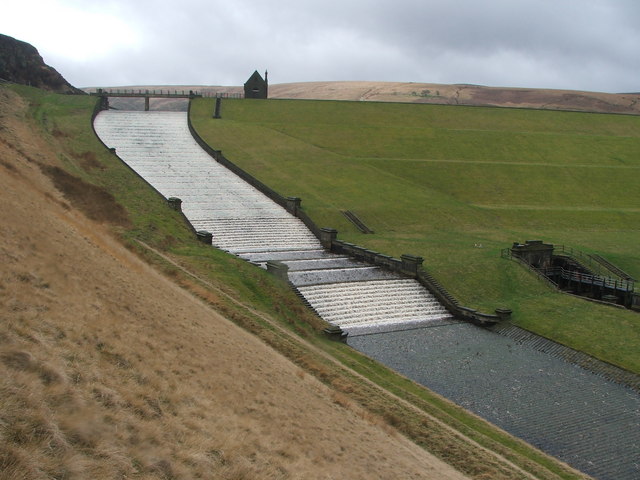
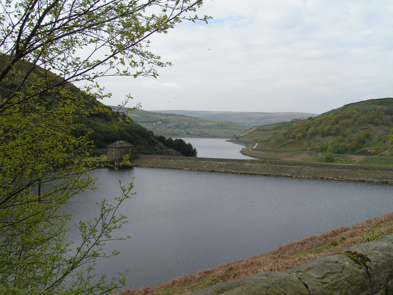
Butterley Reservoir, West Yorkshire

Butterley Reservoir is a reservoir located near Marsden, West Yorkshire, near the Peak District National Park boundary. It was completed in 1906. The reservoir...

Wessenden Valley

The Wessenden Valley is a moorland valley in the Dark Peak, immediately south of Marsden in West Yorkshire, England. The name Wessenden derives from Old...
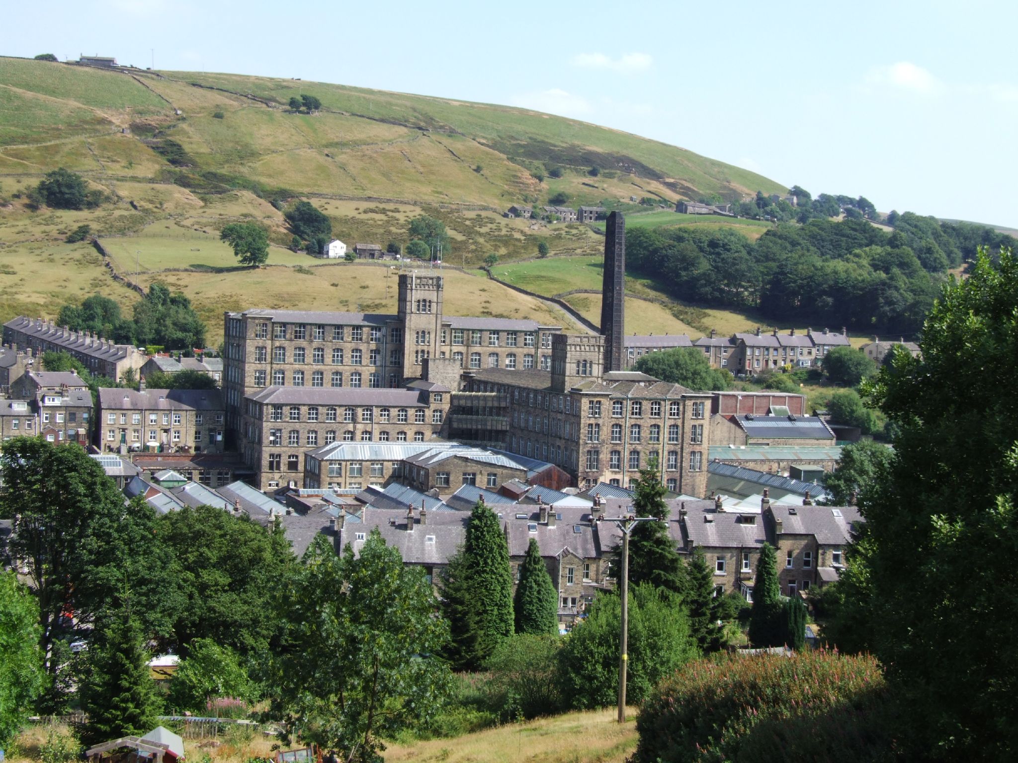
Bank Bottom Mill

Bank Bottom Mill, later known as Marsden Mill, was from 1824 an important centre for the production of woollen cloth in Marsden, West Yorkshire, England...

Marsden, West Yorkshire

Marsden is a large village in the Colne Valley, in the metropolitan borough of Kirklees, West Yorkshire, England. It is in the South Pennines close to...

Nearby Amenities

Located within 500m of 53.58908,-1.9137323
Turning Circle
Lat/Long: 53.5886981/-1.9193553
Ford: yes
Lat/Long: 53.585209/-1.9158915
Barrier: stile
Material: wood
Stile: stepover
Lat/Long: 53.5864709/-1.9169024
Barrier: stile
Material: wood
Stile: stepover
Lat/Long: 53.5859846/-1.9164048
Waterway: waterfall
Lat/Long: 53.5882919/-1.9140865
Note: Most water heads underground here - unclear where it remerges. Water in the valley looks less.
Lat/Long: 53.5882688/-1.9142632
Barrier: stile
Dog Gate: yes
Material: wood
Stile: stepover
Lat/Long: 53.5888008/-1.9195238
Marsden Moor Heritage Trail
Information: guidepost
Tourism: information
Lat/Long: 53.5858069/-1.9151267
Disused Barrier: gate
Material: wood
Lat/Long: 53.5873899/-1.9172838
The data included in this document is from www.openstreetmap.org. The data is made available under ODbL.

Have you been to Binn Moor?

Leave your review of Binn Moor below (or comments, questions and feedback).