Lydiard Plain

Downs, Moorland in Wiltshire

England

Lydiard Plain

Transmitter at Frith Copse Situated at the north end of the wood, off Flaxlands Lane.
Transmitter at Frith Copse Credit: Rick Crowley

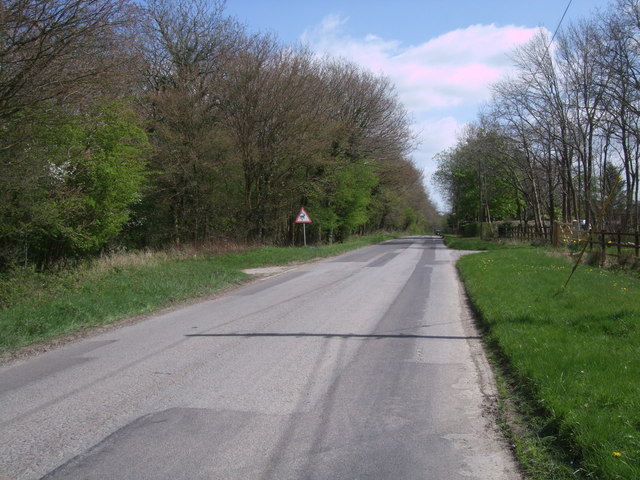
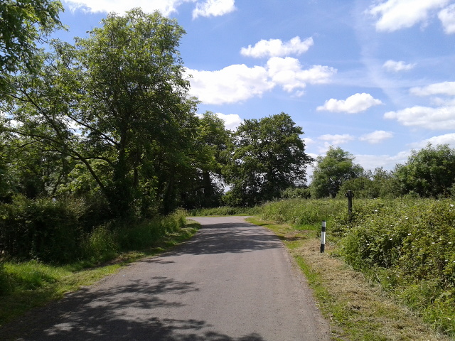
Lydiard Plain is a stunning natural landscape located in Wiltshire, England. Situated within the larger Lydiard Park, the plain is known for its picturesque downs and moorland. Covering an area of approximately 260 acres, Lydiard Plain offers a diverse range of flora and fauna, making it a popular destination for nature enthusiasts.

The downs of Lydiard Plain are characterized by their rolling hills, covered in a patchwork of grasses and wildflowers. These open spaces provide breathtaking panoramic views of the surrounding countryside. The moorland, on the other hand, consists of heathland and scrub, creating a unique habitat for a variety of wildlife.

Visitors to Lydiard Plain can enjoy leisurely walks and hikes along the numerous trails that crisscross the area. These paths lead through vibrant meadows, peaceful woodlands, and alongside tranquil ponds. There are also designated picnic areas, allowing visitors to relax and take in the beauty of the surroundings.

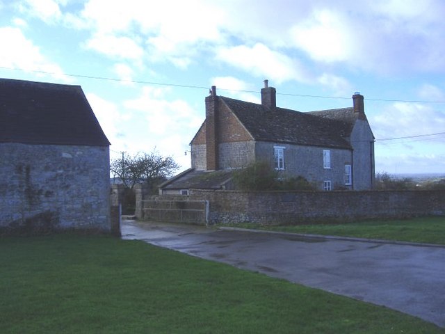
The plain is home to a rich diversity of wildlife, including rabbits, foxes, and various bird species. Nature lovers may also spot rare species such as the silver-studded blue butterfly or the Dartford warbler. Additionally, Lydiard Plain hosts a number of archaeological sites, with evidence of human activity dating back thousands of years.

Overall, Lydiard Plain offers a peaceful and unspoiled natural environment, providing a haven for both wildlife and visitors seeking to escape the hustle and bustle of everyday life.

If you have any feedback on the listing, please let us know in the comments section below.

Lydiard Plain Images

Images are sourced within 2km of 51.574116/-1.9176167 or Grid Reference SU0586. Thanks to Geograph Open Source API. All images are credited.

Transmitter at Frith Copse Situated at the north end of the wood, off Flaxlands Lane.
Transmitter at Frith Copse
Situated at the north end of the wood, off Flaxlands Lane.
Old Milestone, B4042, Callow Hill Damaged between July 2018 and Apr 2021. The image of it intact from earlier is <a href="https://www.geograph.org.uk/photo/6114779">SU0484 : Old Milestone by the B4042, Malmesbury Road, Callow Hill</a>.
Swindon half-round stone by the B4042, in parish of Wootton Bassett (North Wiltshire District), Malmesbury Road, Callow Hill, West of Highgate Farm, on wide verge, beside the damaged Golden Jubilee Parish Marker.
Erected by the Malmesbury Third Division Turnpike Trust.

Inscription once read: (To / Malmesbury / 8 Miles) // (To / Swindon / 7 Miles)

Grade II listed Number: 1184315 <span class="nowrap"><a title="https://historicengland.org.uk/listing/the-list/list-entry/1184315" rel="nofollow ugc noopener" href="https://historicengland.org.uk/listing/the-list/list-entry/1184315">Link</a><img style="margin-left:2px;" alt="External link" title="External link - shift click to open in new window" src="https://s1.geograph.org.uk/img/external.png" width="10" height="10"/></span>

Milestone Society National ID: WI_SNMY08
Old Milestone, B4042, Callow Hill
Damaged between July 2018 and Apr 2021. The image of it intact from earlier is SU0484 : Old Milestone by the B4042, Malmesbury Road, Callow Hill. Swindon half-round stone by the B4042, in parish of Wootton Bassett (North Wiltshire District), Malmesbury Road, Callow Hill, West of Highgate Farm, on wide verge, beside the damaged Golden Jubilee Parish Marker. Erected by the Malmesbury Third Division Turnpike Trust. Inscription once read: (To / Malmesbury / 8 Miles) // (To / Swindon / 7 Miles) Grade II listed Number: 1184315 LinkExternal link Milestone Society National ID: WI_SNMY08
Woodland on a cutting, M4
Farm entrance
Farm entrance
On the B4696 looking towards the junction with the B4042
Summer greenery, looking west
M4, westbound The M4 is 190 miles long and runs from London to South Wales. Major centres close to the motorway include Reading, Swindon, Bristol, Newport, Cardiff and Swansea. The motorway was constructed between 1961 and 1996. The M4 originally crossed the first Severn Road Bridge. It has now been diverted to use the Second Severn Crossing and the motorway over the older bridge has been renumbered as M48.
Wikipedia: <span class="nowrap"><a title="http://en.wikipedia.org/wiki/M4_motorway" rel="nofollow ugc noopener" href="http://en.wikipedia.org/wiki/M4_motorway">Link</a><img style="margin-left:2px;" alt="External link" title="External link - shift click to open in new window" src="https://s1.geograph.org.uk/img/external.png" width="10" height="10"/></span>
M4, westbound
The M4 is 190 miles long and runs from London to South Wales. Major centres close to the motorway include Reading, Swindon, Bristol, Newport, Cardiff and Swansea. The motorway was constructed between 1961 and 1996. The M4 originally crossed the first Severn Road Bridge. It has now been diverted to use the Second Severn Crossing and the motorway over the older bridge has been renumbered as M48. Wikipedia: LinkExternal link
Lane to Flaxlands, and Morris's Copse, near Hook Looking down the lane towards Flaxlands, with Morris's Copse on the left.
Lane to Flaxlands, and Morris's Copse, near Hook
Looking down the lane towards Flaxlands, with Morris's Copse on the left.
On the ramparts of Ringsbury Camp, near Dogridge, Purton Ringsbury Camp is a multivallate Iron Age hillfort. The area occupied by the hillfort is almost coterminous with a small area of sandstone overlying the edge of the limestone escarpment here. This sandstone, formerly known as Rhaxella Chert, is now named the Ringsbury Spiculate Member after its location. The location for the hillfort was perhaps carefully chosen for certain qualities inherent in this rock.
On the ramparts of Ringsbury Camp, near Dogridge, Purton
Ringsbury Camp is a multivallate Iron Age hillfort. The area occupied by the hillfort is almost coterminous with a small area of sandstone overlying the edge of the limestone escarpment here. This sandstone, formerly known as Rhaxella Chert, is now named the Ringsbury Spiculate Member after its location. The location for the hillfort was perhaps carefully chosen for certain qualities inherent in this rock.
Brockhurst Meadow Nature Reserve, near Purton A wildlife-rich meadow. The ancient ridge-and-furrow can clearly be seen running from left to right across the picture.
Brockhurst Meadow Nature Reserve, near Purton
A wildlife-rich meadow. The ancient ridge-and-furrow can clearly be seen running from left to right across the picture.
The Firs, Wood Lane, Braydon The Firs (on the left of the picture) is a pocket of woodland in the heart of what was once the Royal Forest of Braydon. It is a Wiltshire Wildlife Trust reserve, with a circular woodland walk within it.<span class="nowrap"><a title="http://www.wiltshirewildlife.org/Reserves/thefirs.htm" rel="nofollow ugc noopener" href="http://www.wiltshirewildlife.org/Reserves/thefirs.htm">Link</a><img style="margin-left:2px;" alt="External link" title="External link - shift click to open in new window" src="https://s1.geograph.org.uk/img/external.png" width="10" height="10"/></span>
The Firs, Wood Lane, Braydon
The Firs (on the left of the picture) is a pocket of woodland in the heart of what was once the Royal Forest of Braydon. It is a Wiltshire Wildlife Trust reserve, with a circular woodland walk within it.LinkExternal link
Four Oaks Park, Lydiard Plain Four Oaks Park is a residential site for travellers and gypsies. At present it still seems to be in the process of construction.
Four Oaks Park, Lydiard Plain
Four Oaks Park is a residential site for travellers and gypsies. At present it still seems to be in the process of construction.
Bridleway, Webb's Wood, looking towards Four Oaks Park The bridleway emerges from Webb's Wood at this point; Four Oaks Park travellers' residential site can be seen in the distance, see <a href="https://www.geograph.org.uk/photo/3938593">SU0586 : Four Oaks Park, Lydiard Plain</a>.
Bridleway, Webb's Wood, looking towards Four Oaks Park
The bridleway emerges from Webb's Wood at this point; Four Oaks Park travellers' residential site can be seen in the distance, see SU0586 : Four Oaks Park, Lydiard Plain.
Echo Lodge Meadows nature reserve, Wood Lane Echo Lodge Meadows is a Wiltshire Wildlife Trust nature reserve, situated between Wood Lane and the edge of Webb's Wood. <span class="nowrap"><a title="http://www.wiltshirewildlife.org/Reserves/echolodgemeadows" rel="nofollow ugc noopener" href="http://www.wiltshirewildlife.org/Reserves/echolodgemeadows">Link</a><img style="margin-left:2px;" alt="External link" title="External link - shift click to open in new window" src="https://s1.geograph.org.uk/img/external.png" width="10" height="10"/></span>
Echo Lodge Meadows nature reserve, Wood Lane
Echo Lodge Meadows is a Wiltshire Wildlife Trust nature reserve, situated between Wood Lane and the edge of Webb's Wood. LinkExternal link
Common Farm, near Purton Common Farm, seen here in the distance from the track from Battlelake Farm to Brockhurst Wood.
Common Farm, near Purton
Common Farm, seen here in the distance from the track from Battlelake Farm to Brockhurst Wood.
Country lane near Greenacres Farm Minor road approaching junction with B4696. Greenacres farm is on the right, strips of grazing land on the left.
Country lane near Greenacres Farm
Minor road approaching junction with B4696. Greenacres farm is on the right, strips of grazing land on the left.
Lane heading west near Flaxlands
Green Hill Green Hill on a very wet day in January. The photograph is taken from the entrance to a property that has just been built or is undergoing renovation, hence the new fence, churned up mud, and traffic cone.
Green Hill
Green Hill on a very wet day in January. The photograph is taken from the entrance to a property that has just been built or is undergoing renovation, hence the new fence, churned up mud, and traffic cone.
Show me another place!

Lydiard Plain is located at Grid Ref: SU0586 (Lat: 51.574116, Lng: -1.9176167)

Unitary Authority: Wiltshire

Police Authority: Wiltshire

What 3 Words

///door.universally.shuttered. Near Purton, Wiltshire

Related Wikis

Cricklade and Wootton Bassett Rural District

Cricklade and Wootton Bassett Rural District was a rural district in the county of Wiltshire, England. It lay to the west and southwest of the town and...

Restrop Farm and Brockhurst Wood

Restrop Farm and Brockhurst Wood (grid reference SU073866) is a 56.5 hectare biological Site of Special Scientific Interest in Wiltshire, England, about...

Ringsbury Camp

Ringsbury Camp is an Iron Age hill fort, thought to date from approximately the year 50BC, in the civil parish of Purton in Wiltshire, England. The site...

Ballard's Ash

Ballard's Ash is a hamlet in north Wiltshire, England. It lies in Lydiard Tregoze parish, just beyond the northern outskirts of Royal Wootton Bassett,...

Nearby Amenities

Located within 500m of 51.574116,-1.9176167
Power: tower
Lat/Long: 51.5752058/-1.924017
Power: tower
Lat/Long: 51.5724849/-1.9232338
Lydiard Plain
Place: hamlet
Lat/Long: 51.5723909/-1.9194163
The data included in this document is from www.openstreetmap.org. The data is made available under ODbL.

Have you been to Lydiard Plain?

Leave your review of Lydiard Plain below (or comments, questions and feedback).