Arkleside Moor

Downs, Moorland in Yorkshire Richmondshire

England

Arkleside Moor

Snowed heather tussocks on Great Haw The view east from Great Haw over moorland with the undulating ground of the North Yorks Moors in the distance. The stream groove to the right in the image will be of a tributary of Steel House Gill.
Snowed heather tussocks on Great Haw Credit: Trevor Littlewood

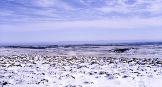
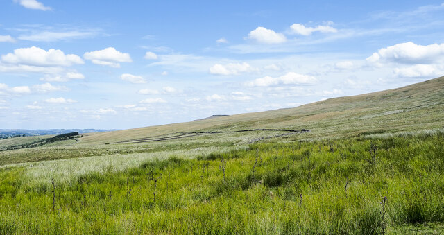
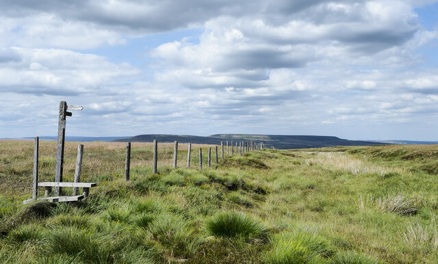
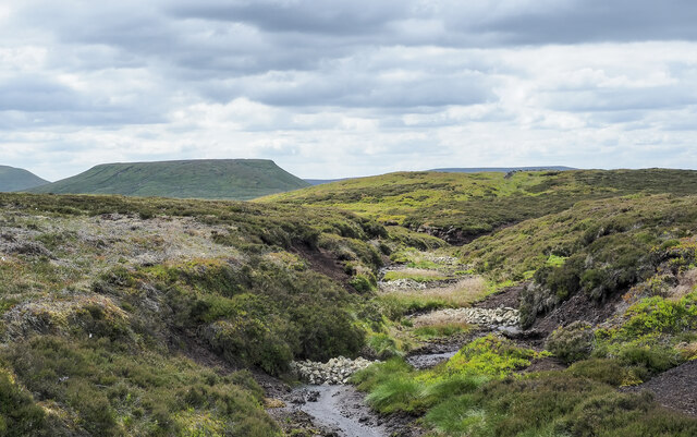
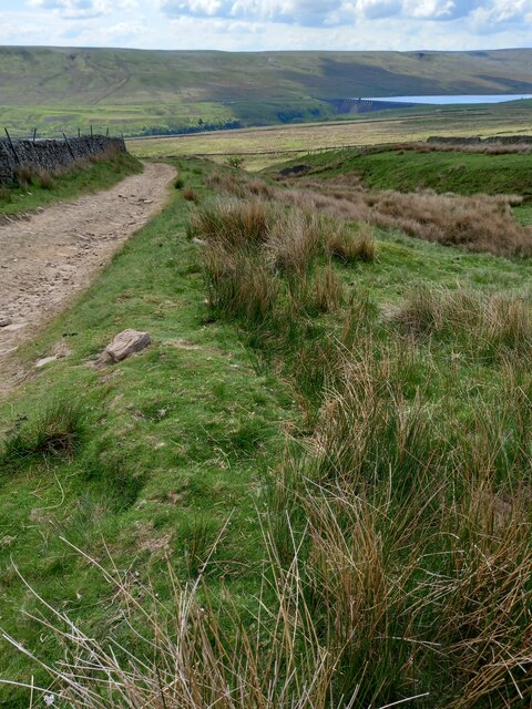
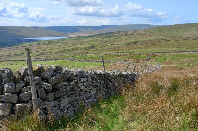
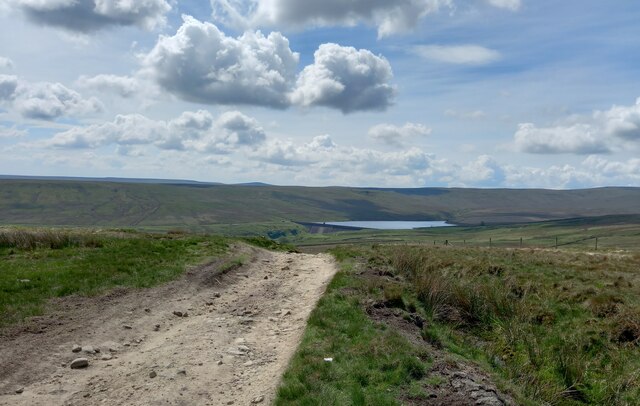
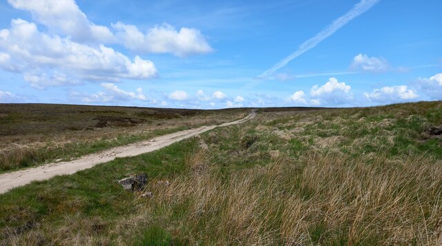
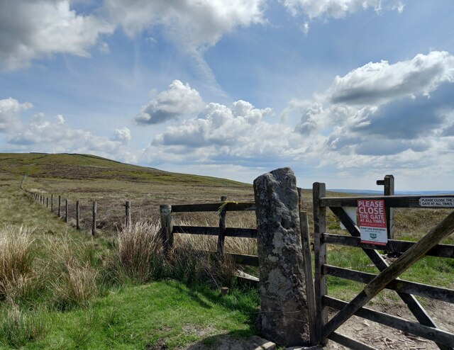
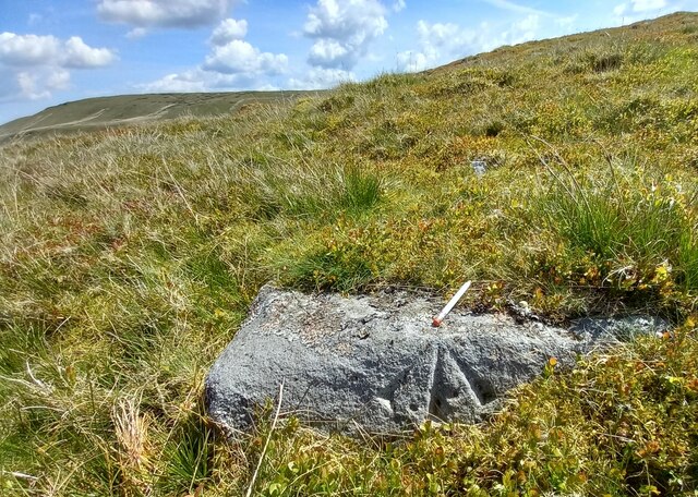
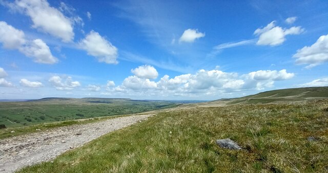
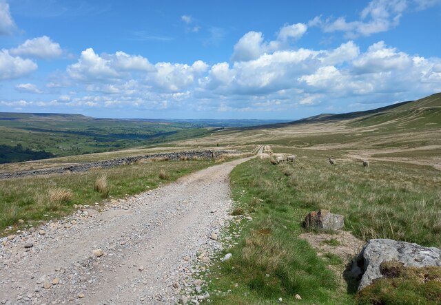
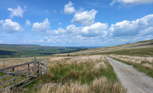
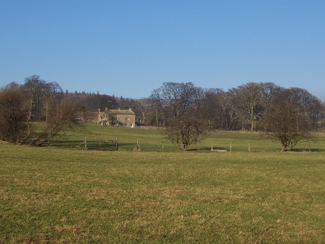
Arkleside Moor is a picturesque expanse of moorland located in Yorkshire, England. Situated in the Yorkshire Dales National Park, it covers an area of approximately 5 square kilometers. The moorland is characterized by its rolling hills, heather-covered landscapes, and stunning panoramic views.

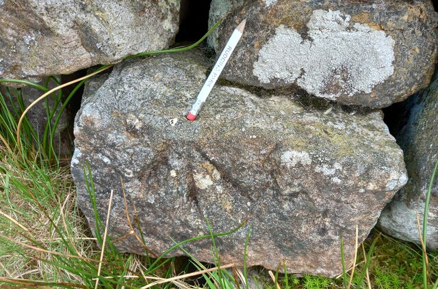
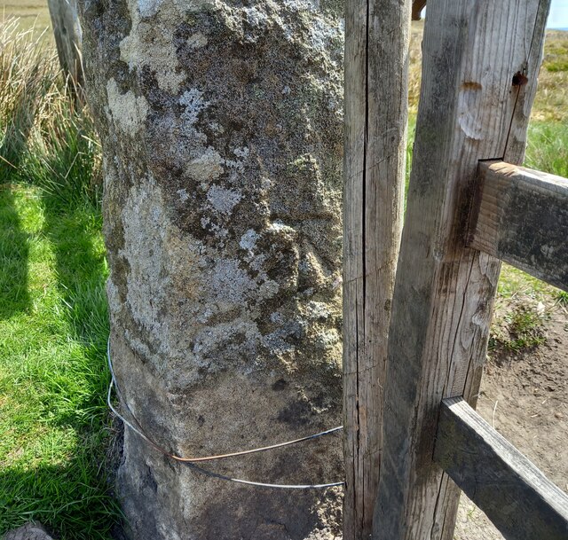
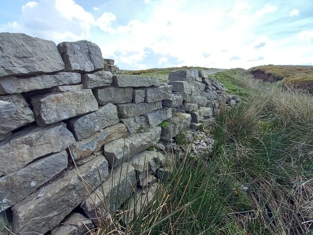
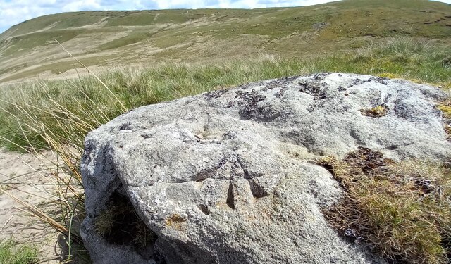
The terrain of Arkleside Moor is predominantly composed of acidic peat soil, which supports the growth of heather, grasses, and moss. The moorland is dotted with numerous natural features, such as small streams, rocky outcrops, and peat bogs. These elements contribute to the unique biodiversity of the area, providing habitats for a variety of plant and animal species.

One of the most notable features of Arkleside Moor is its abundant wildlife. Visitors may catch a glimpse of rare bird species, including merlins, curlews, and golden plovers, which are well-adapted to the moorland environment. The area is also home to a diverse range of insects, including dragonflies, butterflies, and beetles.

The moorland offers numerous opportunities for outdoor activities and exploration. Hiking and walking trails crisscross the area, allowing visitors to discover its hidden gems. The expansive views from the higher points of the moor are particularly awe-inspiring, offering vistas of the surrounding countryside and distant hills.

Arkleside Moor is a place of tranquility and natural beauty, its unspoiled landscapes attracting nature enthusiasts, photographers, and those seeking a peaceful retreat. Its remote location and undisturbed surroundings make it an ideal destination for those looking to escape the hustle and bustle of everyday life and immerse themselves in the tranquility of nature.

If you have any feedback on the listing, please let us know in the comments section below.

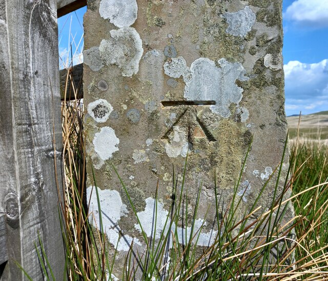
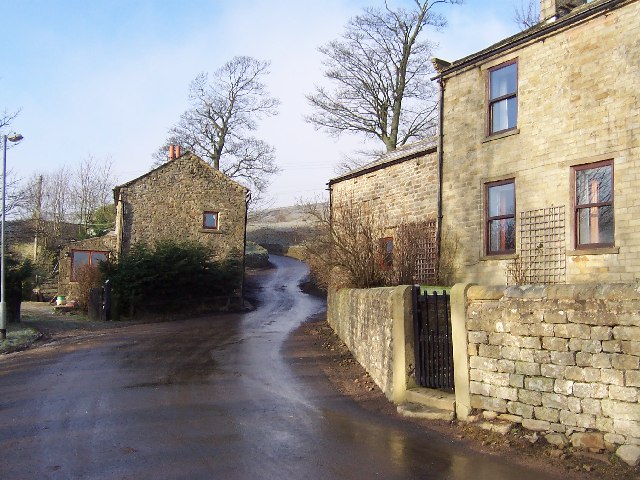
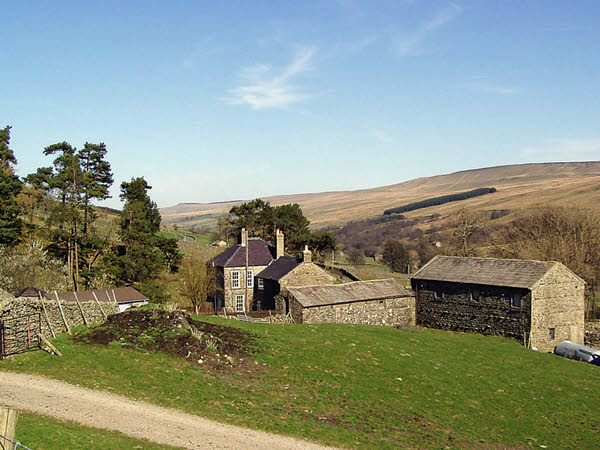
Arkleside Moor Images

Images are sourced within 2km of 54.209912/-1.9126164 or Grid Reference SE0579. Thanks to Geograph Open Source API. All images are credited.

Snowed heather tussocks on Great Haw The view east from Great Haw over moorland with the undulating ground of the North Yorks Moors in the distance. The stream groove to the right in the image will be of a tributary of Steel House Gill.
Snowed heather tussocks on Great Haw
The view east from Great Haw over moorland with the undulating ground of the North Yorks Moors in the distance. The stream groove to the right in the image will be of a tributary of Steel House Gill.
Moorland with Arkleside Pasture Arkleside Pasture is an area of enclosed, marginal farmland on the south side of Coverdale above the small settlement of Arkleside; it lies beyond the rough vegetation in the foreground and the groove of Arkleside Gill which can just be discerned in the image.
Moorland with Arkleside Pasture
Arkleside Pasture is an area of enclosed, marginal farmland on the south side of Coverdale above the small settlement of Arkleside; it lies beyond the rough vegetation in the foreground and the groove of Arkleside Gill which can just be discerned in the image.
Fence with stile and footpath indicator The fence descends from the ridge between Little Whernside and Dead Man's Hill going down beside Harkera Gill. The route of the public footpath indicated by the finger post follows a similar route.
Pen Hill is the flat-topped feature in the distance.
Fence with stile and footpath indicator
The fence descends from the ridge between Little Whernside and Dead Man's Hill going down beside Harkera Gill. The route of the public footpath indicated by the finger post follows a similar route. Pen Hill is the flat-topped feature in the distance.
Erosion prevention measure on Dead Man's Hill The piles of stones in the peaty gully restrict the flow of water and will retain loosened peat so limiting further erosion. The immediate gully doesn't appear to have been eroded badly but near the centre of the image, beyond the stones, this branch enters a larger and more badly affected channel which should now be defended.
The flat-topped hill in the distance is Little Whernside.
Erosion prevention measure on Dead Man's Hill
The piles of stones in the peaty gully restrict the flow of water and will retain loosened peat so limiting further erosion. The immediate gully doesn't appear to have been eroded badly but near the centre of the image, beyond the stones, this branch enters a larger and more badly affected channel which should now be defended. The flat-topped hill in the distance is Little Whernside.
Track leading from Scar House to Horsehouse, and Angram Reservoir in distance According to the 1910 map there was a benchmark at this location on the west side of the track. The cutmark is likely to be on a boulder, rock or stone. Nothing was found.
Track leading from Scar House to Horsehouse, and Angram Reservoir in distance
According to the 1910 map there was a benchmark at this location on the west side of the track. The cutmark is likely to be on a boulder, rock or stone. Nothing was found.
Benchmark cut into drystone wall, Nidderdale The pivot benchmark is cut into the drystone wall on the north side of the track which leads from Scar House Reservoir to Horsehouse. Wider view <a href="https://www.geograph.org.uk/photo/7556212">SE0477 : Across the moorland to Angram Reservoir</a>
Benchmark cut into drystone wall, Nidderdale
The pivot benchmark is cut into the drystone wall on the north side of the track which leads from Scar House Reservoir to Horsehouse. Wider view SE0477 : Across the moorland to Angram Reservoir
Across the moorland to Angram Reservoir There is a pivot benchmark cut into the drystone wall on the north side of the track which leads from Scar House Reservoir to Horsehouse. In the distance is Angram Reservoir. Closer view <a href="https://www.geograph.org.uk/photo/7556211">SE0477 : Benchmark cut into drystone wall, Nidderdale</a>
Across the moorland to Angram Reservoir
There is a pivot benchmark cut into the drystone wall on the north side of the track which leads from Scar House Reservoir to Horsehouse. In the distance is Angram Reservoir. Closer view SE0477 : Benchmark cut into drystone wall, Nidderdale
Track leading from Scar House to Horsehouse According to the 1910 map there was a benchmark at this location, and likely cut into a boulder or stone alongside the track. Nothing was found.
Track leading from Scar House to Horsehouse
According to the 1910 map there was a benchmark at this location, and likely cut into a boulder or stone alongside the track. Nothing was found.
Track leading from Scar House to Horsehouse, Nidderdale According to the 1910 map there was a benchmark cut at this location. No suitable features were found for a benchmark.
Track leading from Scar House to Horsehouse, Nidderdale
According to the 1910 map there was a benchmark cut at this location. No suitable features were found for a benchmark.
Benchmark cut into gatepost, Nidderdale The benchmark is cut into a stone gatepost on the track which leads from Scar House reservoir to Horsehouse in Coverdale. Wider view <a href="https://www.geograph.org.uk/photo/7557643">SE0478 : Boundary fence on moorland below Little Whernside</a>
Benchmark cut into gatepost, Nidderdale
The benchmark is cut into a stone gatepost on the track which leads from Scar House reservoir to Horsehouse in Coverdale. Wider view SE0478 : Boundary fence on moorland below Little Whernside
Boundary fence on moorland below Little Whernside There is a benchmark cut into the stone gatepost on the track which leads from Scar House reservoir to Horsehouse in Coverdale. Closer view <a href="https://www.geograph.org.uk/photo/7557642">SE0478 : Benchmark cut into gatepost, Nidderdale</a>
Boundary fence on moorland below Little Whernside
There is a benchmark cut into the stone gatepost on the track which leads from Scar House reservoir to Horsehouse in Coverdale. Closer view SE0478 : Benchmark cut into gatepost, Nidderdale
West parapet of bridge near Little Whernside According to the OS benchmark database there is a benchmark cut into the west face of the bridge, and on the north side of the stream. The bridge has gone through several repairs and refits, and nothing was found.
West parapet of bridge near Little Whernside
According to the OS benchmark database there is a benchmark cut into the west face of the bridge, and on the north side of the stream. The bridge has gone through several repairs and refits, and nothing was found.
Pivot benchmark cut into boulder on moorland, Nidderdale The pivot benchmark is cut into a large boulder on the east side of the track which leads from Scar House reservoir to Horsehouse in Coverdale. Wider view <a href="https://www.geograph.org.uk/photo/7557646">SE0478 : Views to Coverdale</a>
Pivot benchmark cut into boulder on moorland, Nidderdale
The pivot benchmark is cut into a large boulder on the east side of the track which leads from Scar House reservoir to Horsehouse in Coverdale. Wider view SE0478 : Views to Coverdale
Views to Coverdale There is a pivot benchmark cut into the large boulder on the east side of the track which leads from Scar House reservoir to Horsehouse in Coverdale. Closer view <a href="https://www.geograph.org.uk/photo/7557645">SE0478 : Pivot benchmark cut into boulder on moorland, Nidderdale</a>
Views to Coverdale
There is a pivot benchmark cut into the large boulder on the east side of the track which leads from Scar House reservoir to Horsehouse in Coverdale. Closer view SE0478 : Pivot benchmark cut into boulder on moorland, Nidderdale
Benchmark cut into boulder, Nidderdale The pivot benchmark is cut into a large boulder on the east side of the track which leads from Scar House reservoir to Horsehouse in Coverdale. Wider view <a href="https://www.geograph.org.uk/photo/7557650">SE0479 : Views to Coverdale</a>
Benchmark cut into boulder, Nidderdale
The pivot benchmark is cut into a large boulder on the east side of the track which leads from Scar House reservoir to Horsehouse in Coverdale. Wider view SE0479 : Views to Coverdale
Views to Coverdale There is a pivot benchmark cut into the large boulder on the east side of the track which leads from Scar House reservoir to Horsehouse in Coverdale. Closer view <a href="https://www.geograph.org.uk/photo/7557648">SE0479 : Benchmark cut into boulder, Nidderdale</a>
Views to Coverdale
There is a pivot benchmark cut into the large boulder on the east side of the track which leads from Scar House reservoir to Horsehouse in Coverdale. Closer view SE0479 : Benchmark cut into boulder, Nidderdale
Benchmark cut into gatepost, Nidderdale The benchmark is cut into a stone gatepost on the west side of the track which leads from Scar House reservoir to Horsehouse in Coverdale. Wider view <a href="https://www.geograph.org.uk/photo/7557652">SE0479 : Views to Coverdale</a>
Benchmark cut into gatepost, Nidderdale
The benchmark is cut into a stone gatepost on the west side of the track which leads from Scar House reservoir to Horsehouse in Coverdale. Wider view SE0479 : Views to Coverdale
Views to Coverdale There is a benchmark cut into the stone gatepost on the west side of the track which leads from Scar House reservoir to Horsehouse in Coverdale. Closer view <a href="https://www.geograph.org.uk/photo/7557651">SE0479 : Benchmark cut into gatepost, Nidderdale</a>
Views to Coverdale
There is a benchmark cut into the stone gatepost on the west side of the track which leads from Scar House reservoir to Horsehouse in Coverdale. Closer view SE0479 : Benchmark cut into gatepost, Nidderdale
Show me another place!

Arkleside Moor is located at Grid Ref: SE0579 (Lat: 54.209912, Lng: -1.9126164)

Division: North Riding

Administrative County: North Yorkshire

District: Richmondshire

Police Authority: North Yorkshire

What 3 Words

///cone.stay.sharpened. Near Leyburn, North Yorkshire

Nearby Locations

Arkleside Moor

Related Wikis

Horsehouse

Horsehouse is a village in Coverdale in the Yorkshire Dales, North Yorkshire, England. It is listed as a hamlet in many texts, but the presence of the...

Nidd Aqueduct

The Nidd Aqueduct is an aqueduct or man-made watercourse in North Yorkshire, England. It feeds water from Angram and Scar House reservoirs in upper Nidderdale...

Scar House Reservoir

Scar House Reservoir is the second of the three reservoirs in Upper Nidderdale, North Yorkshire, England, the others are Angram Reservoir and Gouthwaite...

Braidley

Braidley is a hamlet in Coverdale in the Yorkshire Dales, England. It lies in the civil parish of Carlton Highdale in the Richmondshire district of North...

Carlton Highdale

Carlton Highdale is a civil parish in Coverdale, North Yorkshire, England. According to the 2001 census it had a population of 95. The parish covers the...

Little Whernside

Little Whernside is a hill in the Yorkshire Dales, North Yorkshire, England, 2.82 miles (4.54 km) north east of Great Whernside. It is on the boundary...

Woodale

Woodale is a hamlet in Coverdale in the Yorkshire Dales in England. It lies in the civil parish of Carlton Highdale in the Richmondshire district of North...

Gammersgill

Gammersgill is a hamlet in Coverdale in the Yorkshire Dales, North Yorkshire, England. It is about 7 miles (11 km) south-west of Leyburn. The toponym is...

Have you been to Arkleside Moor?

Leave your review of Arkleside Moor below (or comments, questions and feedback).