Butterley Reservoir

Lake, Pool, Pond, Freshwater Marsh in Yorkshire

England

Butterley Reservoir

Butterley Reservoir
Butterley Reservoir Credit: Dave Pickersgill

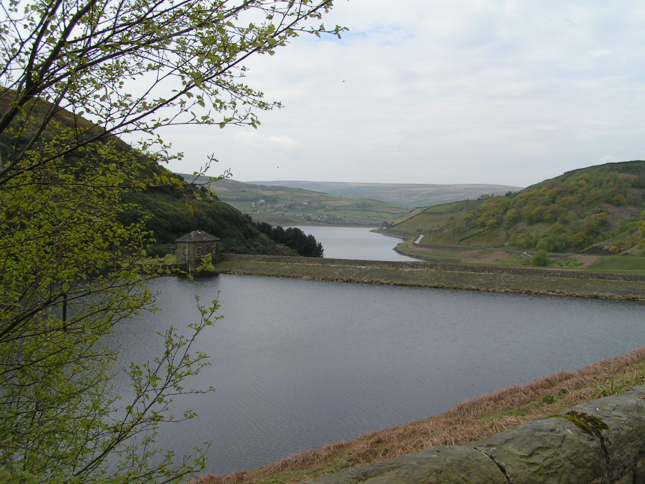
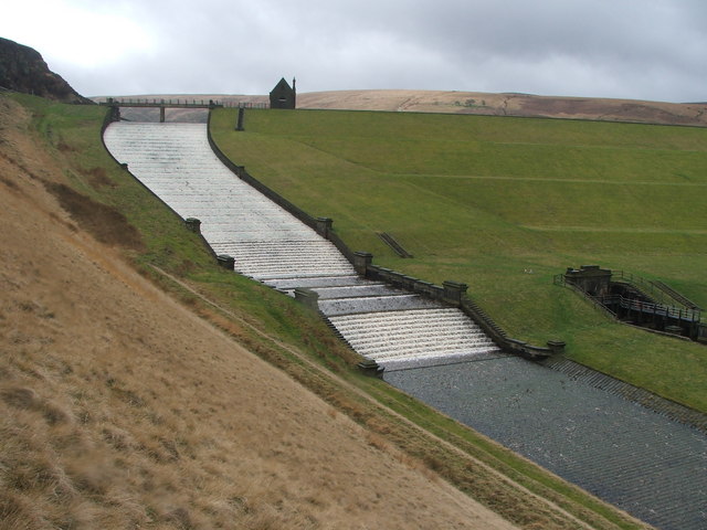
Butterley Reservoir is a man-made freshwater lake located in the county of Yorkshire, England. It is situated in the beautiful valley of the River Dearne, near the village of Marsden. The reservoir was constructed in the early 19th century to meet the growing water demands of the industrial revolution.

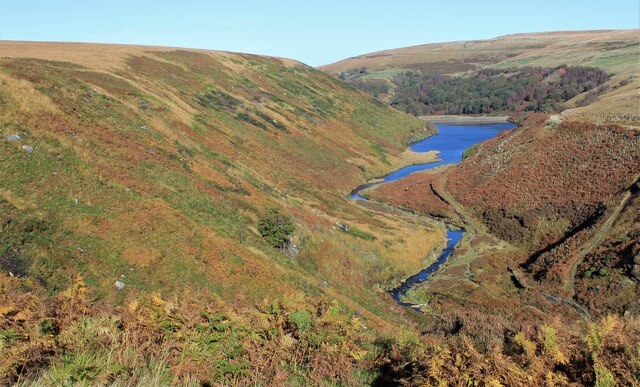
Covering an area of approximately 35 hectares, Butterley Reservoir is an important water source for the surrounding area. It is fed by several small streams and springs, ensuring a constant supply of fresh water. The lake is surrounded by picturesque countryside, offering stunning views and attracting visitors from near and far.

The reservoir is primarily used for fishing and is home to a variety of fish species, including trout, perch, and pike. Anglers can be seen casting their lines from the banks or from small boats, enjoying the peacefulness and serenity of the area. Fishing permits can be obtained from the local authorities.

Butterley Reservoir also serves as a habitat for numerous bird species, making it a popular spot for birdwatchers. The reed beds and wetlands around the lake provide nesting sites for waterfowl, including ducks, swans, and herons. Visitors can often spot these graceful creatures gliding across the water or wading in the shallows.

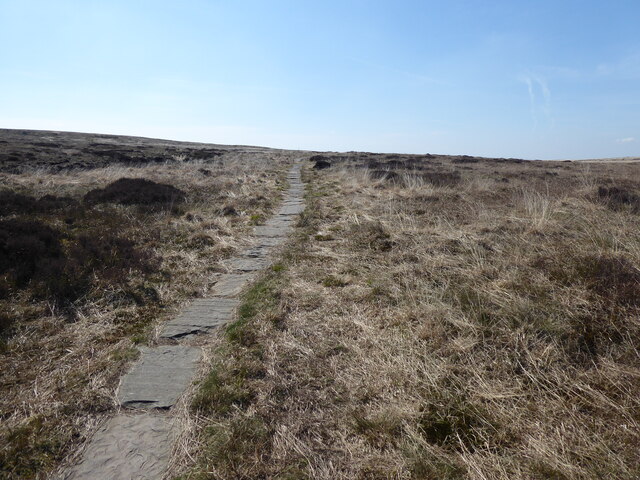
For those seeking outdoor activities, the reservoir offers opportunities for walking and cycling along its shores. There are designated paths and trails, allowing visitors to explore the surrounding countryside and enjoy the natural beauty of the area.

Overall, Butterley Reservoir is a peaceful and picturesque water body in Yorkshire, providing a haven for wildlife and a recreational space for locals and tourists alike.

If you have any feedback on the listing, please let us know in the comments section below.

Butterley Reservoir Images

Images are sourced within 2km of 53.587892/-1.9255932 or Grid Reference SE0510. Thanks to Geograph Open Source API. All images are credited.

Butterley Reservoir
Butterley Reservoir
Blakeley Reservoir
Blakeley Reservoir
Track, Bridleway and Footpath at Wessenden Lodge Looking south-westward.
Track, Bridleway and Footpath at Wessenden Lodge
Looking south-westward.
Track and footpath signage in the Wassenden Valley Looking northward. The Kirklees Way continues ahead towards Marsden whilst the Pennine Way turns westward towards Black Moss
Track and footpath signage in the Wassenden Valley
Looking northward. The Kirklees Way continues ahead towards Marsden whilst the Pennine Way turns westward towards Black Moss
The Pennine Way near Wessenden Reservoir
The Pennine Way near Hey Green
The Pennine Way above Wessenden Reservoir
The Pennine Way near Blakely Clough
The Pennine Way near Swellands reservoir
Waterfall at Wessenden
Wessenden Brook
Wessenden Brook
Blakeley Reservoir View from the path along Deer Hill Reservoir conduit
Blakeley Reservoir
View from the path along Deer Hill Reservoir conduit
Waterfall from Wessenden Reservoir overflow The spillway on the reservoir ends abruptly in this waterfall down to Wessenden Brook
Waterfall from Wessenden Reservoir overflow
The spillway on the reservoir ends abruptly in this waterfall down to Wessenden Brook
Waterfalls in Great Hey Sike Clough View from a contour path following a water pipe line that feeds Deer Hill Reservoir conduit
Waterfalls in Great Hey Sike Clough
View from a contour path following a water pipe line that feeds Deer Hill Reservoir conduit
Pennine Way maintenance What appears to be another stream on the edge of Blakely Clough is a line of bagged stone for the Pennine Way
Pennine Way maintenance
What appears to be another stream on the edge of Blakely Clough is a line of bagged stone for the Pennine Way
Nobo on the PW Northbound on The Pennine Way
Nobo on the PW
Northbound on The Pennine Way
Show me another place!

Butterley Reservoir is located at Grid Ref: SE0510 (Lat: 53.587892, Lng: -1.9255932)

Division: West Riding

Unitary Authority: Kirklees

Police Authority: West Yorkshire

What 3 Words

///factoring.yell.cabinet. Near Marsden, West Yorkshire

Related Wikis

Wessenden Valley

The Wessenden Valley is a moorland valley in the Dark Peak, immediately south of Marsden in West Yorkshire, England. The name Wessenden derives from Old...

Butterley Reservoir, West Yorkshire

Butterley Reservoir is a reservoir located near Marsden, West Yorkshire, near the Peak District National Park boundary. It was completed in 1906. The reservoir...
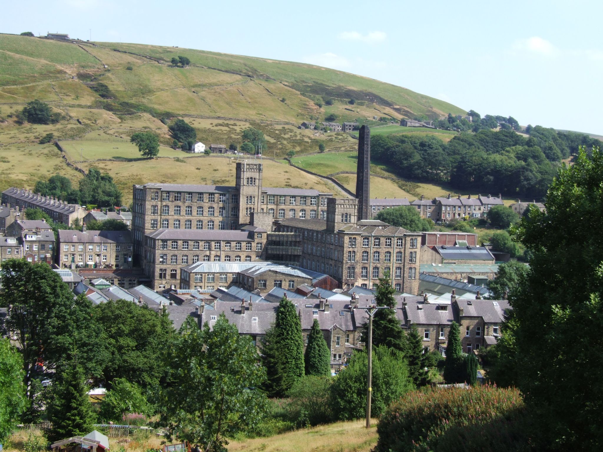
Bank Bottom Mill

Bank Bottom Mill, later known as Marsden Mill, was from 1824 an important centre for the production of woollen cloth in Marsden, West Yorkshire, England...

Marsden, West Yorkshire

Marsden is a large village in the Colne Valley, in the metropolitan borough of Kirklees, West Yorkshire, England. It is in the South Pennines close to...

Nearby Amenities

Located within 500m of 53.587892,-1.9255932
Turning Circle
Lat/Long: 53.5886981/-1.9193553
Fixme: pos
Note: Was the position fixed or just an improved guess? If fixed, remove fixme tag (and this note!)
Lat/Long: 53.5917076/-1.9287913
Barrier: stile
Material: wood
Lat/Long: 53.5865864/-1.9215138
Still Life
Artist Name: Joss Smith
Artwork Type: sculpture
Material: stone
Start Date: 1993
Tourism: artwork
Lat/Long: 53.5862904/-1.920597
Mounting Block
Inscription: Pennine Bridleway Dark Peak Link 2008
Lat/Long: 53.5917191/-1.9286097
Mounting Block
Lat/Long: 53.5917787/-1.927981
Bench
Lat/Long: 53.5918595/-1.9279696
Information: board
Tourism: information
Lat/Long: 53.5918946/-1.9280446
Information: board
Tourism: information
Lat/Long: 53.5918285/-1.9280514
Barrier: stile
Material: wood
Stile: ladder
Lat/Long: 53.5863116/-1.9210558
Barrier: stile
Dog Gate: yes
Material: wood
Stile: stepover
Lat/Long: 53.5888008/-1.9195238
Ford: yes
Lat/Long: 53.5860133/-1.9256367
Ford: yes
Lat/Long: 53.5876681/-1.928369
The data included in this document is from www.openstreetmap.org. The data is made available under ODbL.

Have you been to Butterley Reservoir?

Leave your review of Butterley Reservoir below (or comments, questions and feedback).