West Collierlaw Moss

Downs, Moorland in Durham

England

West Collierlaw Moss

Parkhead, Stanhope Moor The old Parkhead station was once the highest standard gauge railway station in Britain; although it was only served by passenger trains for a very short time. <span class="nowrap"><a title="http://www.subbrit.org.uk/sb-sites/stations/p/parkhead/index.shtml" rel="nofollow ugc noopener" href="http://www.subbrit.org.uk/sb-sites/stations/p/parkhead/index.shtml">Link</a><img style="margin-left:2px;" alt="External link" title="External link - shift click to open in new window" src="https://s1.geograph.org.uk/img/external.png" width="10" height="10"/></span>
The old railway is now a component of the C2C cycle route and the old Station House has now been lovingly restored and operates as a B and B and cafe which is open 24/365 and is a magnet for the large number of cyclists who travel this way. <span class="nowrap"><a title="http://www.parkheadstation.co.uk/" rel="nofollow ugc noopener" href="http://www.parkheadstation.co.uk/">Link</a><img style="margin-left:2px;" alt="External link" title="External link - shift click to open in new window" src="https://s1.geograph.org.uk/img/external.png" width="10" height="10"/></span>
Parkhead, Stanhope Moor Credit: Oliver Dixon

West Collierlaw Moss is a region located in Durham, England, specifically within the Downs and Moorland area. Situated in the northeast part of England, Durham is known for its picturesque landscapes and rich history. West Collierlaw Moss is one of the many natural areas within this region that attracts visitors and locals alike.

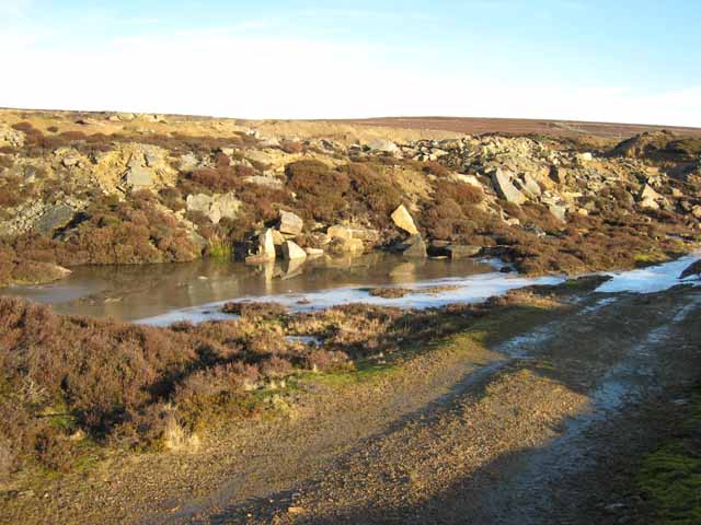
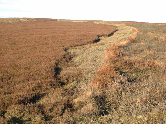
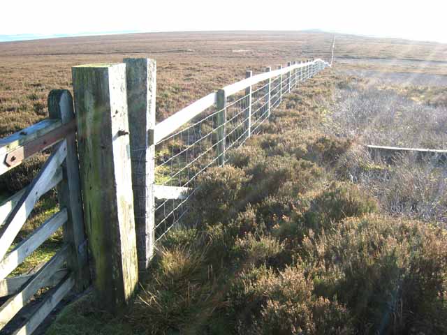
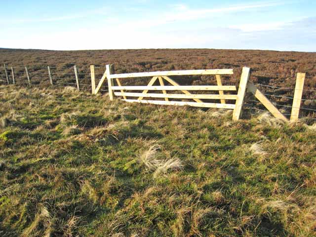
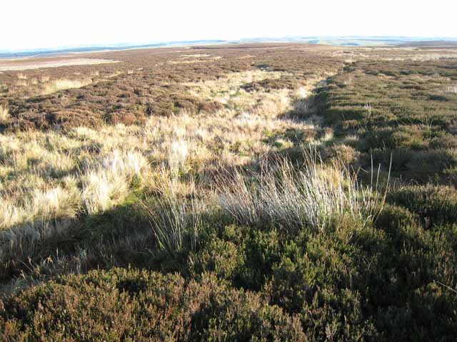
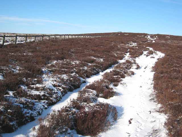
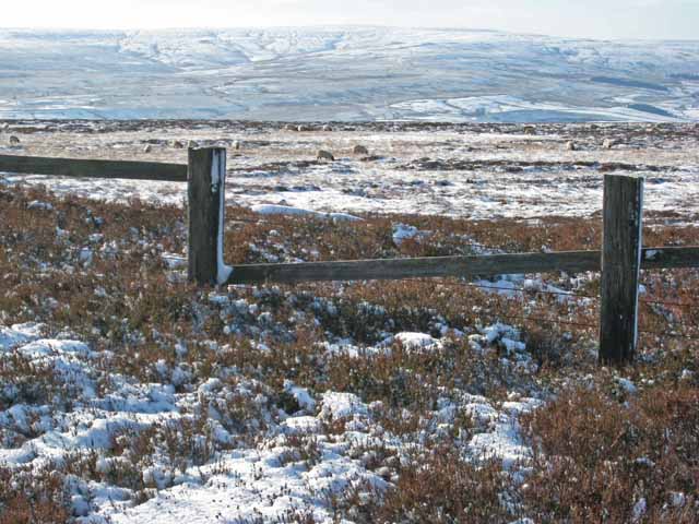
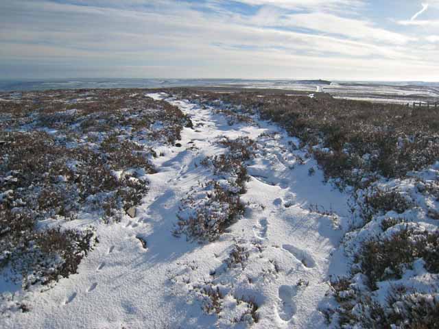
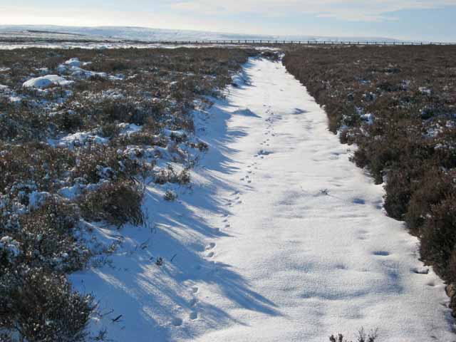
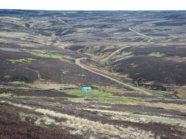
Covering a vast expanse, West Collierlaw Moss features a diverse range of ecosystems and habitats. The area is characterized by its expansive moorlands, lush grasslands, and scattered trees. This diversity in vegetation creates an ideal environment for numerous species of flora and fauna to thrive.

Wildlife enthusiasts flock to West Collierlaw Moss to observe the variety of bird species that inhabit the area. The marshlands provide a perfect breeding ground for waterfowl and wading birds, including the elegant curlew and the graceful lapwing. Moreover, the moorlands are home to birds of prey, such as kestrels and merlins, which can often be spotted soaring through the skies.

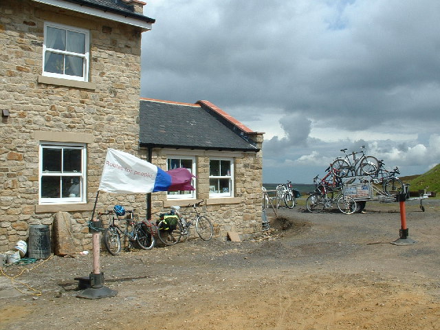
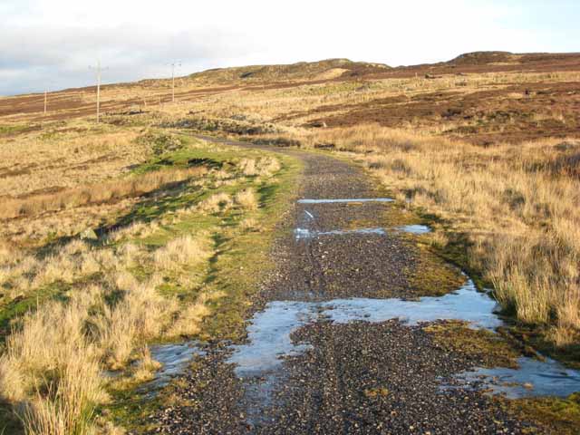
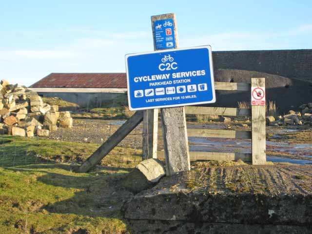
Aside from its natural beauty, West Collierlaw Moss offers visitors various recreational activities. The expansive open spaces make it an ideal location for hiking, walking, and picnicking. Additionally, the area is intersected by several walking trails, allowing visitors to explore and appreciate the unique landscapes at their own pace.

West Collierlaw Moss, located in Durham's Downs and Moorland area, offers a serene and enchanting escape for nature lovers and outdoor enthusiasts. With its diverse habitats and abundant wildlife, it provides a welcoming environment for both relaxation and exploration.

If you have any feedback on the listing, please let us know in the comments section below.

West Collierlaw Moss Images

Images are sourced within 2km of 54.771957/-1.9826988 or Grid Reference NZ0141. Thanks to Geograph Open Source API. All images are credited.

Parkhead, Stanhope Moor The old Parkhead station was once the highest standard gauge railway station in Britain; although it was only served by passenger trains for a very short time. <span class="nowrap"><a title="http://www.subbrit.org.uk/sb-sites/stations/p/parkhead/index.shtml" rel="nofollow ugc noopener" href="http://www.subbrit.org.uk/sb-sites/stations/p/parkhead/index.shtml">Link</a><img style="margin-left:2px;" alt="External link" title="External link - shift click to open in new window" src="https://s1.geograph.org.uk/img/external.png" width="10" height="10"/></span>
The old railway is now a component of the C2C cycle route and the old Station House has now been lovingly restored and operates as a B and B and cafe which is open 24/365 and is a magnet for the large number of cyclists who travel this way. <span class="nowrap"><a title="http://www.parkheadstation.co.uk/" rel="nofollow ugc noopener" href="http://www.parkheadstation.co.uk/">Link</a><img style="margin-left:2px;" alt="External link" title="External link - shift click to open in new window" src="https://s1.geograph.org.uk/img/external.png" width="10" height="10"/></span>
Parkhead, Stanhope Moor
The old Parkhead station was once the highest standard gauge railway station in Britain; although it was only served by passenger trains for a very short time. LinkExternal link The old railway is now a component of the C2C cycle route and the old Station House has now been lovingly restored and operates as a B and B and cafe which is open 24/365 and is a magnet for the large number of cyclists who travel this way. LinkExternal link
Millstone Quarry, Crawleyside Judging from the freshness of the cut faces of stone, this quarry has not been abandoned for very long.
Millstone Quarry, Crawleyside
Judging from the freshness of the cut faces of stone, this quarry has not been abandoned for very long.
Millstone Quarry, Crawleyside Like many abandoned quarries, this one seems to have been used as a bit of a dump.
Millstone Quarry, Crawleyside
Like many abandoned quarries, this one seems to have been used as a bit of a dump.
Disused railway approaching Park Head This length of disused railway runs from the top of the Crawleyside Incline to Park Head Station and formed part of the once extensive network of railways in upper Weardale which served the lead and iron ore mining industries. <span class="nowrap"><a title="http://www.durham.gov.uk/miner/projects.nsf/581cd74a9c6aa8b080256d48003758cb/bb96ba295948449580256e8a004f0ba8?OpenDocument" rel="nofollow ugc noopener" href="http://www.durham.gov.uk/miner/projects.nsf/581cd74a9c6aa8b080256d48003758cb/bb96ba295948449580256e8a004f0ba8?OpenDocument">Link</a><img style="margin-left:2px;" alt="External link" title="External link - shift click to open in new window" src="https://s1.geograph.org.uk/img/external.png" width="10" height="10"/></span> This railway is now used as a path for cyclists and walkers avoiding the steep B6278 road up from Stanhope.
Disused railway approaching Park Head
This length of disused railway runs from the top of the Crawleyside Incline to Park Head Station and formed part of the once extensive network of railways in upper Weardale which served the lead and iron ore mining industries. LinkExternal link This railway is now used as a path for cyclists and walkers avoiding the steep B6278 road up from Stanhope.
Grouse moor management, Crawleyside This illustrates the process of maintaining heather moorland for grouse shooting. To the right a zone of burnt heather; to the left a zone which was burnt previously and is now occupied by shoots of tender young heather on which red grouse love to feed.
Grouse moor management, Crawleyside
This illustrates the process of maintaining heather moorland for grouse shooting. To the right a zone of burnt heather; to the left a zone which was burnt previously and is now occupied by shoots of tender young heather on which red grouse love to feed.
Sign at Parkhead Station The old Parkhead station was once the highest standard gauge railway station in Britain; although it was only served by passenger trains for a very short time. <span class="nowrap"><a title="http://www.subbrit.org.uk/sb-sites/stations/p/parkhead/index.shtml" rel="nofollow ugc noopener" href="http://www.subbrit.org.uk/sb-sites/stations/p/parkhead/index.shtml">Link</a><img style="margin-left:2px;" alt="External link" title="External link - shift click to open in new window" src="https://s1.geograph.org.uk/img/external.png" width="10" height="10"/></span> The old railway is now a component of the C2C cycle route and the old Station House has now been lovingly restored and operates as a B and B and cafe which is open 24/365 and is a magnet for the large number of cyclists who travel this way. <span class="nowrap"><a title="http://www.parkheadstation.co.uk/" rel="nofollow ugc noopener" href="http://www.parkheadstation.co.uk/">Link</a><img style="margin-left:2px;" alt="External link" title="External link - shift click to open in new window" src="https://s1.geograph.org.uk/img/external.png" width="10" height="10"/></span>
Sign at Parkhead Station
The old Parkhead station was once the highest standard gauge railway station in Britain; although it was only served by passenger trains for a very short time. LinkExternal link The old railway is now a component of the C2C cycle route and the old Station House has now been lovingly restored and operates as a B and B and cafe which is open 24/365 and is a magnet for the large number of cyclists who travel this way. LinkExternal link
Radio mast on Collier Law, Crawleyside This mast is no longer here (17/11/2013). Just a rectangular cleared patch, not even any concrete foundations visible!
Radio mast on Collier Law, Crawleyside
This mast is no longer here (17/11/2013). Just a rectangular cleared patch, not even any concrete foundations visible!
Mast on Collier Law This small mast, seen from the access road, is presumably some part of the main installation on the summit of Collier Law.
Mast on Collier Law
This small mast, seen from the access road, is presumably some part of the main installation on the summit of Collier Law.
Fence on Collier Law There are some very stout fences partitioning up the grouse moors above Weardale.
Fence on Collier Law
There are some very stout fences partitioning up the grouse moors above Weardale.
Gate and fence, Collier Law, Crawleyside One of the fences partitioning up the grouse moors above Weardale.
Gate and fence, Collier Law, Crawleyside
One of the fences partitioning up the grouse moors above Weardale.
Wolsingham Park Moor Near Collier Law
Wolsingham Park Moor
Near Collier Law
Shooting butts on Wolsingham Park Moor The moors on either side of Weardale are much given over to grouse shooting.
Shooting butts on Wolsingham Park Moor
The moors on either side of Weardale are much given over to grouse shooting.
The track up the Red Brae On the footpath from Frosterley to Collier Law, looking towards Collier Law <a href="https://www.geograph.org.uk/gridref/NZ0141">NZ0141</a> (the tip of the telecommunications mast can just be seen on the skyline) .
The track up the Red Brae
On the footpath from Frosterley to Collier Law, looking towards Collier Law NZ0141 (the tip of the telecommunications mast can just be seen on the skyline) .
Snowy moorland on the Red Brae Seen from the footpath from Frosterley to Collier Law. A number of sheep can be seen grazing in the snow-bound heather. In the distance are the moors on the far side of Weardale (Stanhope hidden in the valley in between).
Snowy moorland on the Red Brae
Seen from the footpath from Frosterley to Collier Law. A number of sheep can be seen grazing in the snow-bound heather. In the distance are the moors on the far side of Weardale (Stanhope hidden in the valley in between).
Footprints in the snow, Red Brae On the footpath from Frosterley to Collier Law, looking back towards Frosterley. The cairn which can just be seen on the horizon is on Fatherley Hill <a href="https://www.geograph.org.uk/gridref/NZ0239">NZ0239</a>.
Footprints in the snow, Red Brae
On the footpath from Frosterley to Collier Law, looking back towards Frosterley. The cairn which can just be seen on the horizon is on Fatherley Hill NZ0239.
Footprints in the snow, near Fatherley Hill Probably hare tracks (information from Russel Wills). The summit of Fatherley Hill <a href="https://www.geograph.org.uk/gridref/NZ0239">NZ0239</a> can be seen to the left in the middle distance.
Footprints in the snow, near Fatherley Hill
Probably hare tracks (information from Russel Wills). The summit of Fatherley Hill NZ0239 can be seen to the left in the middle distance.
Wolsingham Park Moor and the valley of the Black Burn The road is to provide access for the guns up to the grouse moors for which Weardale is renowned.
Wolsingham Park Moor and the valley of the Black Burn
The road is to provide access for the guns up to the grouse moors for which Weardale is renowned.
Horse and cart at Park Head One of various artworks and industrial artefacts surrounding Park Head B and B and tearooms.
Horse and cart at Park Head
One of various artworks and industrial artefacts surrounding Park Head B and B and tearooms.
Show me another place!

West Collierlaw Moss is located at Grid Ref: NZ0141 (Lat: 54.771957, Lng: -1.9826988)

Unitary Authority: County Durham

Police Authority: Durham

What 3 Words

///sticky.capillary.interlude. Near Stanhope, Co. Durham

Related Wikis

Weardale Rural District

Weardale was a rural district in County Durham, England from 1894 to 1974. It was formed under the Local Government Act 1894 as a successor to the Weardale...

Blanchland railway station

Blanchland railway station served the village of Blanchland, Northumberland, England, from 1845 to 1965 on the Stanhope and Tyne Railway. == History... ==

Crawley Edge Cairns

The Crawley Edge Cairns are a series of forty-two Bronze Age round barrows, cairns and clearance cairns located in a field in Crawleyside, near Stanhope...

Crawleyside

Crawleyside is a village in the civil parish of Stanhope, in County Durham, England. It is situated to the north of Stanhope, in Weardale. In the 2001...

Nearby Amenities

Located within 500m of 54.771957,-1.9826988
Collier Law
Natural: peak
Source: npe
Wikidata: Q24651786
Lat/Long: 54.7710438/-1.9763746
Power: pole
Transformer: distribution
Lat/Long: 54.7710651/-1.9783735
Razed Man Made: mast
Lat/Long: 54.7709323/-1.9769772
Collier Law
Image: https://www.geograph.org.uk/photo/5835118
Man Made: survey_point
Ref: PP023
Tpuk Ref: TP2353
Website: https://trigpointing.uk/trig/2353
Lat/Long: 54.7710382/-1.9763371
Power: pole
Lat/Long: 54.7704966/-1.9842594
Power: pole
Lat/Long: 54.7705927/-1.9832641
Power: pole
Lat/Long: 54.7709756/-1.9793001
Power: pole
Lat/Long: 54.7708815/-1.980274
Power: pole
Lat/Long: 54.7707797/-1.981328
Power: pole
Lat/Long: 54.7706912/-1.9822441
Power: pole
Lat/Long: 54.7704039/-1.9852192
Power: pole
Lat/Long: 54.7703091/-1.9862006
Power: pole
Lat/Long: 54.7702069/-1.9872589
Power: pole
Lat/Long: 54.7701037/-1.9883275
Power: pole
Lat/Long: 54.7700008/-1.9893921
Image: https://www.geograph.org.uk/photo/6942325
Man Made: cairn
Lat/Long: 54.7707129/-1.9752713
The data included in this document is from www.openstreetmap.org. The data is made available under ODbL.

Have you been to West Collierlaw Moss?

Leave your review of West Collierlaw Moss below (or comments, questions and feedback).