Old Park
Downs, Moorland in Gloucestershire Cotswold
England
Old Park

Old Park is a picturesque area located in Gloucestershire, England, known for its stunning Downs and Moorland landscape. Situated in the south-western region of the county, it covers a vast area of approximately 2,500 acres. The area is renowned for its natural beauty and diverse ecosystems, attracting nature enthusiasts and outdoor adventurers alike.
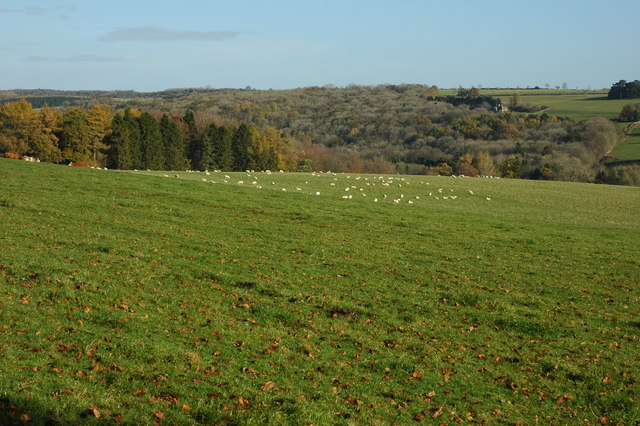
The Downs of Old Park offer panoramic views of the surrounding countryside, with rolling hills and lush green meadows stretching as far as the eye can see. These open grasslands provide an ideal habitat for a variety of wildlife, including rabbits, foxes, and various species of birds. The peace and tranquility of the area make it a perfect spot for leisurely walks and picnics, allowing visitors to immerse themselves in the serene surroundings.
In addition to the Downs, Old Park is also home to expansive Moorland, characterized by its heather-covered hills and rocky outcrops. This unique landscape provides a haven for rare plant species and is a designated Site of Special Scientific Interest (SSSI). Visitors can observe the vibrant colors of blooming heather and the rugged beauty of the terrain while enjoying the peace and solitude that the Moorland offers.
Old Park is a haven for outdoor activities, attracting hikers, cyclists, and horse riders. Numerous trails crisscross the area, allowing visitors to explore the natural wonders and discover hidden gems. The close proximity to nearby villages and towns provides opportunities for visitors to enjoy local amenities, such as quaint pubs and charming shops.
In conclusion, Old Park, Gloucestershire, with its stunning Downs and Moorland, offers a peaceful retreat for those seeking to immerse themselves in the beauty of nature. Its diverse ecosystems, breathtaking views, and range of outdoor activities make it a must-visit destination for nature lovers and adventure seekers alike.
If you have any feedback on the listing, please let us know in the comments section below.
Old Park Images
Images are sourced within 2km of 51.781894/-1.9836741 or Grid Reference SP0109. Thanks to Geograph Open Source API. All images are credited.


Old Park is located at Grid Ref: SP0109 (Lat: 51.781894, Lng: -1.9836741)
Administrative County: Gloucestershire
District: Cotswold
Police Authority: Gloucestershire
What 3 Words
///goals.picnic.ritual. Near Stratton, Gloucestershire
Nearby Locations
Related Wikis
Rendcomb
Rendcomb is a village in the Cotswold local authority area of the English county of Gloucestershire. It is about five miles north of Cirencester in the...
Rendcomb College
Rendcomb College is a public school (English private boarding and day school) for pupils aged 3–18, located in the village of Rendcomb five miles north...
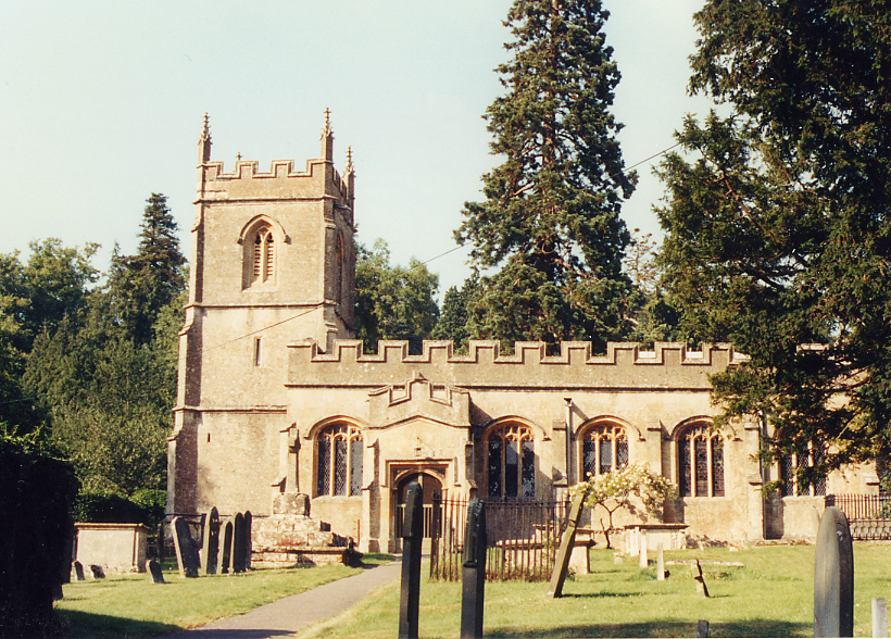
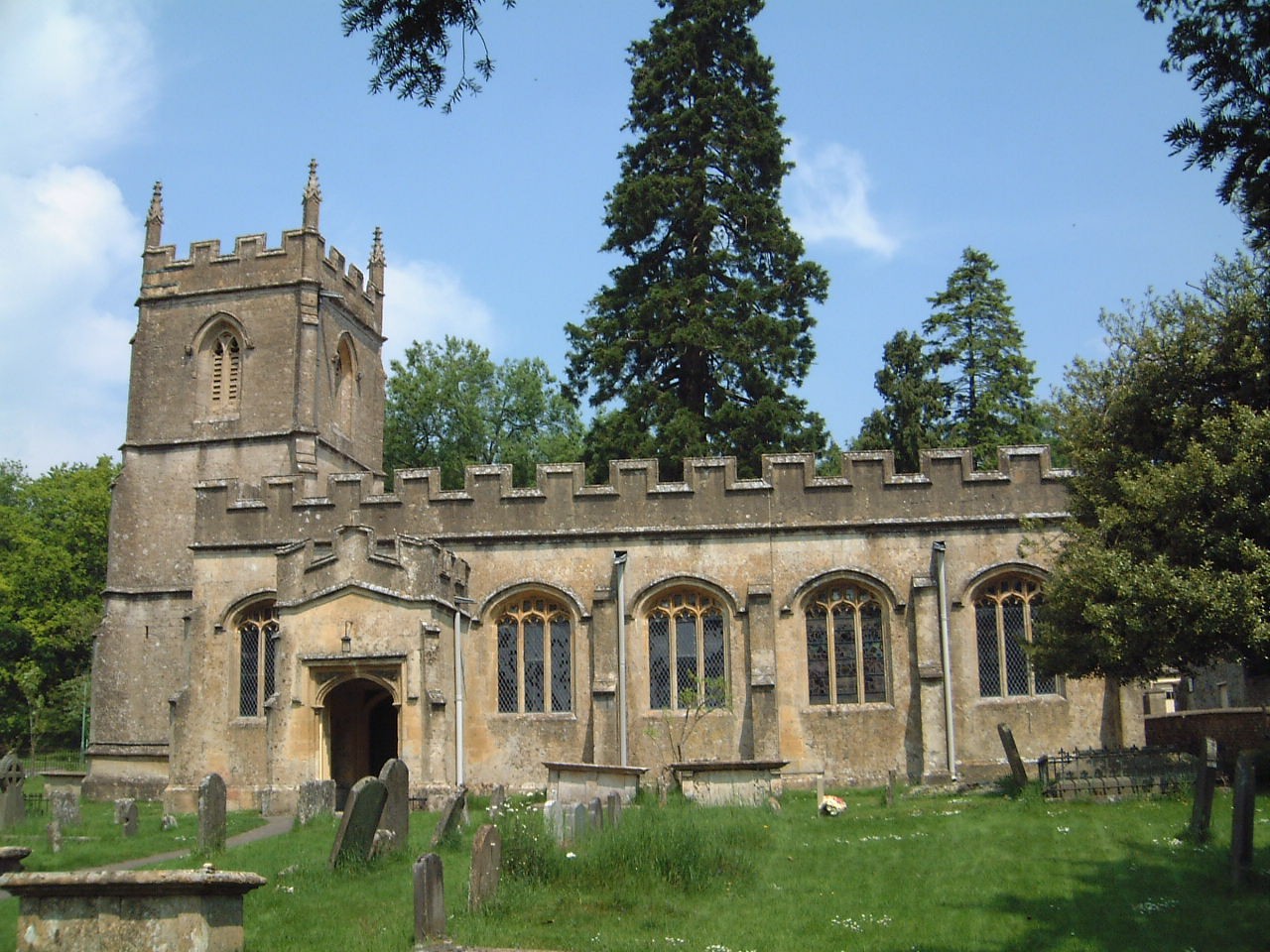
Church of St Peter, Rendcomb
The Anglican Church of St Peter within the grounds of Rendcomb College at Rendcomb in the Cotswold District of Gloucestershire, England was rebuilt in...

Woodmancote, Cirencester
Woodmancote is a Cotswolds village near Cirencester, Gloucestershire, England. The village lies just off the A435. The village is 0.2 square miles (52...
Nearby Amenities
Located within 500m of 51.781894,-1.9836741Have you been to Old Park?
Leave your review of Old Park below (or comments, questions and feedback).