Vicar's Allotment

Downs, Moorland in Yorkshire Craven

England

Vicar's Allotment

Shades of green below High Bradley A lovely late spring view of Airedale (if it weren't for the ugly sheds of the Snaygill Industrial Estate in the distance).
Shades of green below High Bradley Credit: Stephen Craven

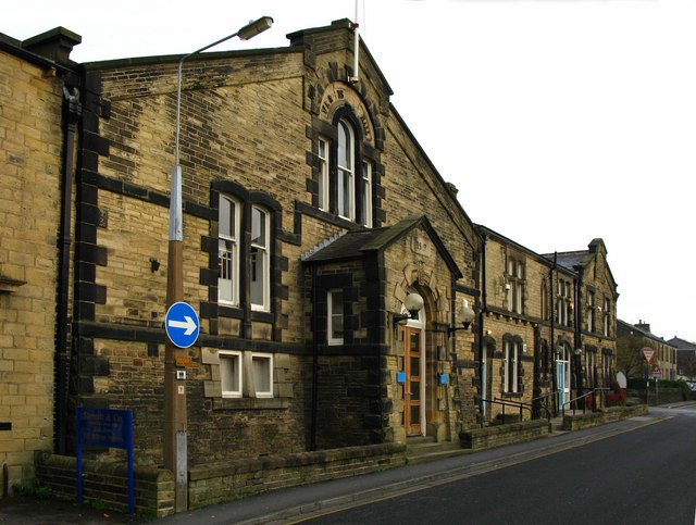
Vicar's Allotment is a picturesque piece of land located in the heart of Yorkshire, England. Situated amidst the breathtaking beauty of the Yorkshire Downs and Moorland, this allotment offers a tranquil escape from the hustle and bustle of city life.

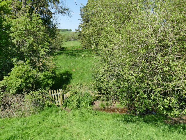
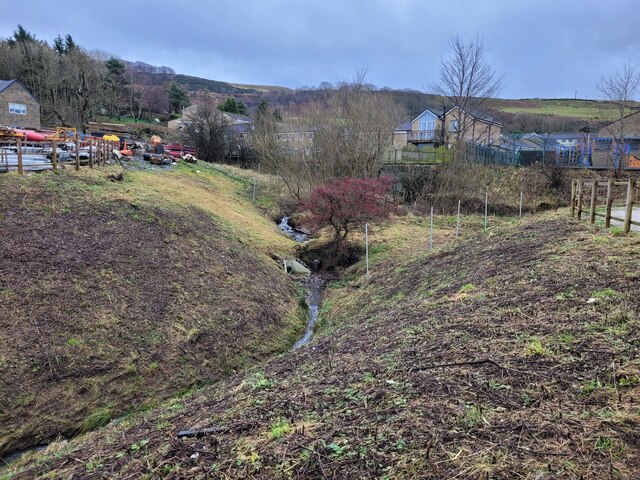
Covering an area of approximately 10 acres, Vicar's Allotment is a haven for nature enthusiasts and gardening enthusiasts alike. The site is adorned with a diverse range of flora and fauna, including vibrant wildflowers, ancient oak trees, and various species of birds and butterflies. The lush greenery and rolling hills provide a stunning backdrop for visitors to immerse themselves in the natural beauty of the region.

The allotment is meticulously maintained by a dedicated team of volunteers who work tirelessly to ensure its upkeep and preservation. The site features well-maintained walking trails, allowing visitors to explore the area at their own pace and admire the captivating landscapes.

In addition to its natural beauty, Vicar's Allotment also serves as a community hub, hosting regular events and workshops on gardening, conservation, and wildlife education. These activities aim to foster a sense of community spirit and promote environmental awareness among visitors of all ages.

Whether you are a nature lover, a gardening enthusiast, or simply seeking a peaceful retreat, Vicar's Allotment is a must-visit destination in Yorkshire. Its idyllic setting, diverse wildlife, and community-focused initiatives make it an exceptional place to reconnect with nature and appreciate the wonders of the Yorkshire Downs and Moorland.

If you have any feedback on the listing, please let us know in the comments section below.

Vicar's Allotment Images

Images are sourced within 2km of 53.953204/-1.9828058 or Grid Reference SE0150. Thanks to Geograph Open Source API. All images are credited.

Shades of green below High Bradley A lovely late spring view of Airedale (if it weren't for the ugly sheds of the Snaygill Industrial Estate in the distance).
Shades of green below High Bradley
A lovely late spring view of Airedale (if it weren't for the ugly sheds of the Snaygill Industrial Estate in the distance).
Gate on a footpath at Gill Bottom The beck among these trees is the parish boundary between Bradleys Both and Skipton.
Gate on a footpath at Gill Bottom
The beck among these trees is the parish boundary between Bradleys Both and Skipton.
Following footpath between High Bradley and Snaygill Not very visible on the ground, but the map indicates a right of way passing the edge of this field between High Bradley and Snaygill, on the south side of Skipton.
Following footpath between High Bradley and Snaygill
Not very visible on the ground, but the map indicates a right of way passing the edge of this field between High Bradley and Snaygill, on the south side of Skipton.
Tree perched above rocks The location is above Low Snaygill on the Leeds to Liverpool Canal, just south of Skipton. The buildings above are at Cawder Hall Farm.
Tree perched above rocks
The location is above Low Snaygill on the Leeds to Liverpool Canal, just south of Skipton. The buildings above are at Cawder Hall Farm.
Old Boundary Marker opposite Ellenber Farm on the A65 Skipton Road Parish Boundary Marker against a drystone wall over Skibeden Beck, on the north side of the A65 Skipton Road opposite Ellenber Farm. Inscribed SKIPTON / LOCAL BOARD and ESHD / DRAUGHTON; vertical lettering separated by a vertical groove. On the boundary of Skipton and Draughton parishes. Skipton Local Board refers to the Local Board of Health. ESHD stands for East Stainclife Highway District, which dates the stone between 1862 and 1894. Grade II Listed details <span class="nowrap"><a title="https://historicengland.org.uk/listing/the-list/list-entry/1157571" rel="nofollow ugc noopener" href="https://historicengland.org.uk/listing/the-list/list-entry/1157571">Link</a><img style="margin-left:2px;" alt="External link" title="External link - shift click to open in new window" src="https://s1.geograph.org.uk/img/external.png" width="10" height="10"/></span>.

Milestone Society National ID: YW_SKIDRA01pb
Old Boundary Marker opposite Ellenber Farm on the A65 Skipton Road
Parish Boundary Marker against a drystone wall over Skibeden Beck, on the north side of the A65 Skipton Road opposite Ellenber Farm. Inscribed SKIPTON / LOCAL BOARD and ESHD / DRAUGHTON; vertical lettering separated by a vertical groove. On the boundary of Skipton and Draughton parishes. Skipton Local Board refers to the Local Board of Health. ESHD stands for East Stainclife Highway District, which dates the stone between 1862 and 1894. Grade II Listed details LinkExternal link. Milestone Society National ID: YW_SKIDRA01pb
Skipton Moor Lane beside Back Plantation Section of the old turnpike road between Addingham and Skipton, now downgraded to a bridleway
Skipton Moor Lane beside Back Plantation
Section of the old turnpike road between Addingham and Skipton, now downgraded to a bridleway
Footpath heading north towards Back Plantation Faint path, obliterated by a dusting of snow hading towards Skipton Moor Road and Back Plantation
Footpath heading north towards Back Plantation
Faint path, obliterated by a dusting of snow hading towards Skipton Moor Road and Back Plantation
Jenny Beck trickles through the Alders The Alders is a new housing development to the east of Skipton, taking away farmland  and natural drainage areas from above the town. 
Jenny Beck flowing down off Skipton Moor looked quite placid today, but I have on good authority it can often be a raging torrent, which can break its banks and flow down Short Bank Road. 
But I suppose it is better to build new housing on a hillside rather than on the floodplain where the River Aire frequently causes issues.
Jenny Beck trickles through the Alders
The Alders is a new housing development to the east of Skipton, taking away farmland and natural drainage areas from above the town. Jenny Beck flowing down off Skipton Moor looked quite placid today, but I have on good authority it can often be a raging torrent, which can break its banks and flow down Short Bank Road. But I suppose it is better to build new housing on a hillside rather than on the floodplain where the River Aire frequently causes issues.
Looking South down field wall near Middlebrough House
Skipton to Addingham turnpike The traditional view was that this is on the route of the Roman road from Ilkley (Olicana) to Ribchester via Skipton. However, modern research using LIDAR suggests that the Roman route was lower down to the north.

Further details can be found at <span class="nowrap"><a title="http://roadsofromanbritain.org/gazetteer/yorkshire/rr72a.html" rel="nofollow ugc noopener" href="http://roadsofromanbritain.org/gazetteer/yorkshire/rr72a.html">Link</a><img style="margin-left:2px;" alt="External link" title="External link - shift click to open in new window" src="https://s1.geograph.org.uk/img/external.png" width="10" height="10"/></span>
Skipton to Addingham turnpike
The traditional view was that this is on the route of the Roman road from Ilkley (Olicana) to Ribchester via Skipton. However, modern research using LIDAR suggests that the Roman route was lower down to the north. Further details can be found at LinkExternal link
Skipton to Addingham Turnpike A small plantation on the steep slope down from Skipton Moor to the old road.

The traditional view was that this is on the route of the Roman road from Ilkley (Olicana) to Ribchester via Skipton. However, modern research using LIDAR suggests that the Roman route was lower down to the north.

Further details can be found at <span class="nowrap"><a title="http://roadsofromanbritain.org/gazetteer/yorkshire/rr72a.html" rel="nofollow ugc noopener" href="http://roadsofromanbritain.org/gazetteer/yorkshire/rr72a.html">Link</a><img style="margin-left:2px;" alt="External link" title="External link - shift click to open in new window" src="https://s1.geograph.org.uk/img/external.png" width="10" height="10"/></span>
Skipton to Addingham Turnpike
A small plantation on the steep slope down from Skipton Moor to the old road. The traditional view was that this is on the route of the Roman road from Ilkley (Olicana) to Ribchester via Skipton. However, modern research using LIDAR suggests that the Roman route was lower down to the north. Further details can be found at LinkExternal link
A6131 from Skipton Bypass This is the old Skipton to Harrogate and the North East road and is now very quiet following the opening of the Skipton bypass several years ago
A6131 from Skipton Bypass
This is the old Skipton to Harrogate and the North East road and is now very quiet following the opening of the Skipton bypass several years ago
Skipton Road, Embsay The railway bridge carries the line from Skipton (Right) to Swinden Limestone quarry (Left) and is used by several trains each day.  Just short of Swinden Quarry at Cracoe there is a manual level crossing.
Skipton Road, Embsay
The railway bridge carries the line from Skipton (Right) to Swinden Limestone quarry (Left) and is used by several trains each day. Just short of Swinden Quarry at Cracoe there is a manual level crossing.
Bridleway to Skipton Moor Looking ENE through the woods above Jenny Gill. The bridleway starts at the top of Shortbank Road.
Bridleway to Skipton Moor
Looking ENE through the woods above Jenny Gill. The bridleway starts at the top of Shortbank Road.
Moorland below Vicar's Allotment, Skipton Moor. Looking west along the wall above Jenny Gill. Skipton in the distance about 160m lower.
Moorland below Vicar's Allotment, Skipton Moor.
Looking west along the wall above Jenny Gill. Skipton in the distance about 160m lower.
Clouds in valley outside Skipton
High Edge. Just on the edge of Skipton Moor access land.  Looking W.
High Edge.
Just on the edge of Skipton Moor access land. Looking W.
Sunken bath. Probably placed here originally as a source of water for livestock.  I doubt that sheep would know how to use the taps though.  Near High Edge.
Sunken bath.
Probably placed here originally as a source of water for livestock. I doubt that sheep would know how to use the taps though. Near High Edge.
Show me another place!

Vicar's Allotment is located at Grid Ref: SE0150 (Lat: 53.953204, Lng: -1.9828058)

Division: West Riding

Administrative County: North Yorkshire

District: Craven

Police Authority: North Yorkshire

What 3 Words

///widely.pots.sprain. Near Low Bradley, North Yorkshire

Related Wikis

Skipton Rural District

Skipton was a rural district in the West Riding of Yorkshire from 1894 to 1974. It was named after Skipton, which constituted an urban district on its...

Otley Road drill hall, Skipton

The Otley Road drill hall, sometimes known as Wellington House, is a former military installation in Skipton, North Yorkshire, England. == History == The...

Old Corn Mill

The Old Corn Mill is a historic building in Bradley, North Yorkshire, a village in England. A watermill was first recorded in Bradley in 1314, although...

Plaza Cinema, Skipton

The Plaza Cinema is a traditional cinema located in Skipton, North Yorkshire, England. It is the sole survivor of four cinemas that once existed in the...

Nearby Amenities

Located within 500m of 53.953204,-1.9828058
Vicar's Allotment
Natural: moor
Source: NPE
Lat/Long: 53.9526355/-1.9818921
Skipton Pits
Natural: wetland
Source: OS 1:25k
Lat/Long: 53.9495544/-1.9826645
Barrier: stile
Lat/Long: 53.9569522/-1.9840762
Barrier: stile
Stile: ladder
Lat/Long: 53.952846/-1.9902746
Skipton Moor
Man Made: survey_point
Natural: peak
Source: NLS-OS-1st_Series
Lat/Long: 53.9543359/-1.9800221
Pembroke Stone
Natural: rock
Source: OS 168, publ. 1854
Lat/Long: 53.9491203/-1.9845599
The data included in this document is from www.openstreetmap.org. The data is made available under ODbL.

Have you been to Vicar's Allotment?

Leave your review of Vicar's Allotment below (or comments, questions and feedback).