Edge End Moor

Downs, Moorland in Yorkshire

England

Edge End Moor

Chinook Helicopter passing close to Stoodley Pike Monument A close encounter!
Chinook Helicopter passing close to Stoodley Pike Monument Credit: Colin Park

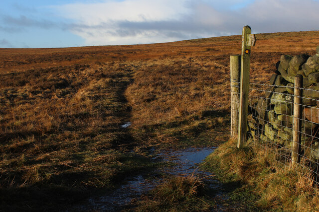
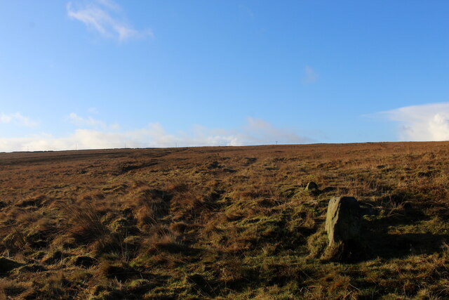
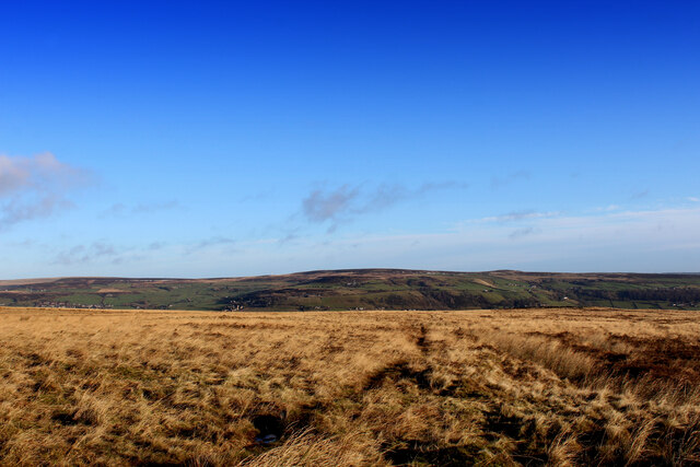
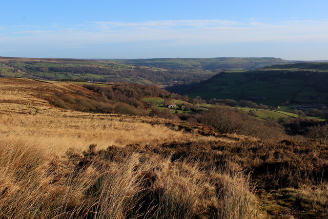
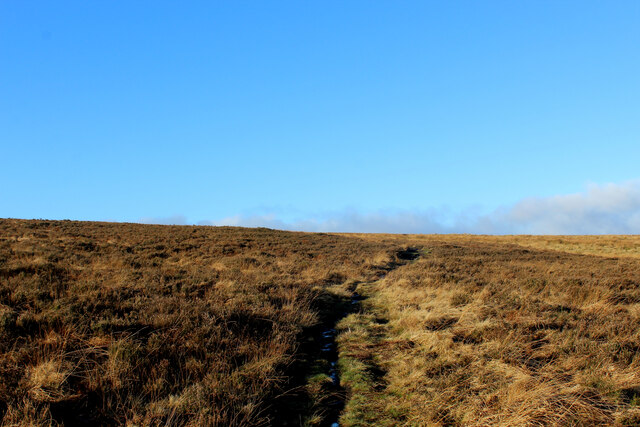
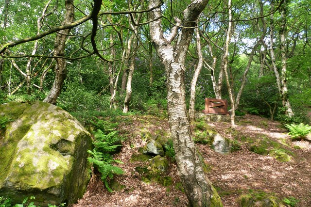
Edge End Moor is a picturesque moorland located in Yorkshire, England. Situated in the heart of the Yorkshire Dales National Park, it covers an area of approximately 3.5 square miles. The moorland is characterized by its rolling hills, heather-covered landscapes, and vast open spaces.

The terrain of Edge End Moor is primarily composed of peat, which gives the moor its distinctive brownish color. The moorland is dotted with numerous streams and small tarns, adding to its natural beauty. It is home to a variety of wildlife, including birds such as curlews, lapwings, and golden plovers, making it a popular spot for birdwatching enthusiasts.

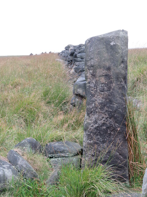
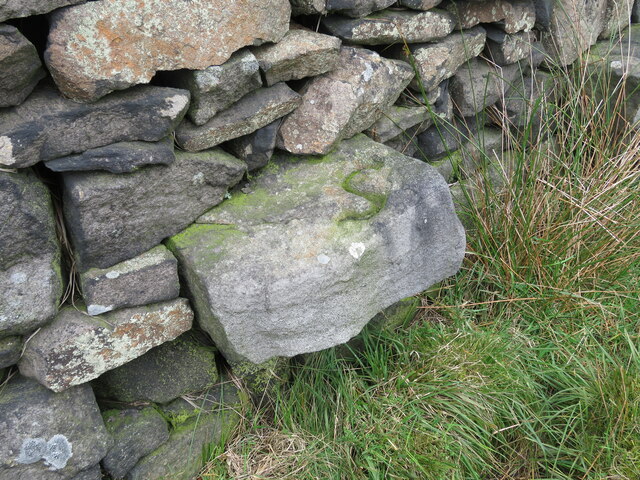
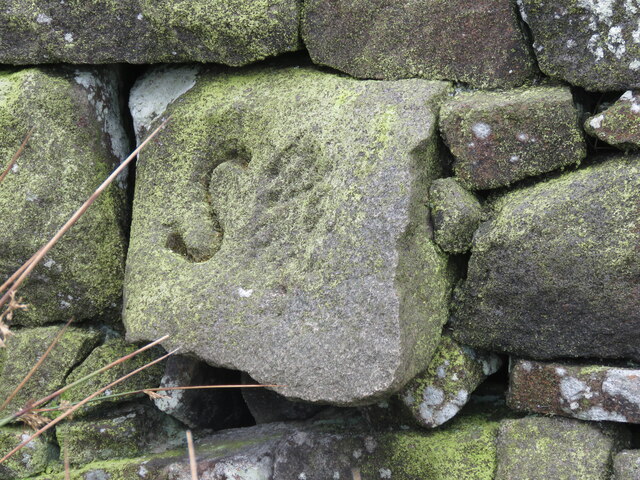
One of the striking features of Edge End Moor is the presence of ancient stone structures known as cairns and standing stones. These remnants from the Bronze Age are believed to have served as markers or burial sites. They provide a glimpse into the area's rich history and cultural heritage.

The moorland offers several walking and hiking trails, allowing visitors to explore its stunning vistas and serene atmosphere. One popular route is the Pennine Way, which crosses through Edge End Moor, providing breathtaking views of the surrounding countryside.

Edge End Moor is a place of tranquility and natural beauty, offering visitors a chance to escape the hustle and bustle of city life. Its untouched landscapes and unique archaeological sites make it a perfect destination for nature lovers, history enthusiasts, and those seeking a peaceful retreat in the heart of Yorkshire.

If you have any feedback on the listing, please let us know in the comments section below.

Edge End Moor Images

Images are sourced within 2km of 53.727029/-2.036383 or Grid Reference SD9725. Thanks to Geograph Open Source API. All images are credited.

Chinook Helicopter passing close to Stoodley Pike Monument A close encounter!
Chinook Helicopter passing close to Stoodley Pike Monument
A close encounter!
Pennine Way at Doe Stones & view towards Edge End Moor
Seat at eastern end of Horsehold Wood & view over Calderside A seat with a view.
Seat at eastern end of Horsehold Wood & view over Calderside
A seat with a view.
View towards Hebden Bridge from eastern end of Horsehold Wood
Striding onto Erringden Moor Plenty of footpaths to choose from, when walking on this stretch of moorland
Striding onto Erringden Moor
Plenty of footpaths to choose from, when walking on this stretch of moorland
Old Boundary Stone on Erringden Moor There are plenty of these stones forming a line across the moor
Old Boundary Stone on Erringden Moor
There are plenty of these stones forming a line across the moor
Footpath on Erringden Moor Narrow but distinct footpath crossing Erringden Moor
Footpath on Erringden Moor
Narrow but distinct footpath crossing Erringden Moor
On the Edge of Erringden Moor Great view of Cragg Vale and Calderdale from here.
On the Edge of Erringden Moor
Great view of Cragg Vale and Calderdale from here.
On Erringden Moor One of many footpaths that can be found on this stretch of moorland
On Erringden Moor
One of many footpaths that can be found on this stretch of moorland
View towards Stoodley Pike Monument from Dick's Lane
Hebden Bridge viewed from hills to the south west
Old Boundary Marker in Stoodley Glen, Calderdale Township Boundary Marker above Stoodley Glen and south of Stoodley Lane. Formerly on the boundary of Langfield and Sowerby townships in Halifax parish. It marked the boundary of the Sowerby Ramble, a narrow strip of land along the Calder valley and up Stoodley Glen between Erringden and Stansfield townships and Erringden and Langfield township. Sowerby Ramble was part of Sowerby township but in 1850 it became part of Erringden township, later parish. In 1897 Langfield and Stansfield became part of Todmorden parish and in 1937 this part of Erringden parish also became part of Todmorden parish. 

Milestone Society National ID: YW_LANSOW02pb
Old Boundary Marker in Stoodley Glen, Calderdale
Township Boundary Marker above Stoodley Glen and south of Stoodley Lane. Formerly on the boundary of Langfield and Sowerby townships in Halifax parish. It marked the boundary of the Sowerby Ramble, a narrow strip of land along the Calder valley and up Stoodley Glen between Erringden and Stansfield townships and Erringden and Langfield township. Sowerby Ramble was part of Sowerby township but in 1850 it became part of Erringden township, later parish. In 1897 Langfield and Stansfield became part of Todmorden parish and in 1937 this part of Erringden parish also became part of Todmorden parish. Milestone Society National ID: YW_LANSOW02pb
Old Boundary Marker between Higher Moor and Sunderland Pasture in Hebden Royd parish Township Boundary Marker beside a track between Higher Moor and Sunderland Pasture. On the former boundary of the Sowerby Ramble between Erringden and Sowerby townships in Halifax parish but now entirely in Hebden Royd parish. Inscribed E for Erringden on its face and S for Sowerby on top.

Milestone Society National ID: YW_HEBR01pb
Old Boundary Marker between Higher Moor and Sunderland Pasture in Hebden Royd parish
Township Boundary Marker beside a track between Higher Moor and Sunderland Pasture. On the former boundary of the Sowerby Ramble between Erringden and Sowerby townships in Halifax parish but now entirely in Hebden Royd parish. Inscribed E for Erringden on its face and S for Sowerby on top. Milestone Society National ID: YW_HEBR01pb
Old Boundary Marker on Palace House Road, Hebden Bridge Township Boundary Marker on Palace House Road, Hebden Bridge, inscribed in the east parapet of the bridge over the Calder Valley Railway. Formerly on the boundary of Erringden and Sowerby townships in Halifax parish. It marked the boundary of the Sowerby Ramble, a narrow strip of land along the Calder valley and up Stoodley Glen between Erringden and Stansfield townships and Erringden and Langfield townships. Sowerby Ramble was part of Sowerby township but in 1850 it became part of Erringden township, later parish. This marker is now entirely in Hebden Royd parish. Inscribed with a reversed S for Sowerby.

Milestone Society National ID: YW_HEBR04pb
Old Boundary Marker on Palace House Road, Hebden Bridge
Township Boundary Marker on Palace House Road, Hebden Bridge, inscribed in the east parapet of the bridge over the Calder Valley Railway. Formerly on the boundary of Erringden and Sowerby townships in Halifax parish. It marked the boundary of the Sowerby Ramble, a narrow strip of land along the Calder valley and up Stoodley Glen between Erringden and Stansfield townships and Erringden and Langfield townships. Sowerby Ramble was part of Sowerby township but in 1850 it became part of Erringden township, later parish. This marker is now entirely in Hebden Royd parish. Inscribed with a reversed S for Sowerby. Milestone Society National ID: YW_HEBR04pb
Old Boundary Marker between Higher Moor and Sunderland Pasture in Hebden Royd parish Township Boundary Marker built into a wall adjacent to a stile between Higher Moor and Sunderland Pasture. On the former boundary of the Sowerby Ramble between Erringden and Sowerby townships in Halifax parish but now entirely in Hebden Royd parish. Inscribed S for Sowerby township.

Milestone Society National ID: YW_HEBR02pb
Old Boundary Marker between Higher Moor and Sunderland Pasture in Hebden Royd parish
Township Boundary Marker built into a wall adjacent to a stile between Higher Moor and Sunderland Pasture. On the former boundary of the Sowerby Ramble between Erringden and Sowerby townships in Halifax parish but now entirely in Hebden Royd parish. Inscribed S for Sowerby township. Milestone Society National ID: YW_HEBR02pb
Old Boundary Marker between Higher Moor and Sunderland Pasture in Hebden Royd parish Township Boundary Marker built into a wall adjacent to a stile between Higher Moor and Sunderland Pasture. On the former boundary of the Sowerby Ramble between Erringden and Sowerby townships in Halifax parish but now entirely in Hebden Royd parish. Inscribed S for Sowerby township.

Milestone Society National ID: YW_HEBR03pb
Old Boundary Marker between Higher Moor and Sunderland Pasture in Hebden Royd parish
Township Boundary Marker built into a wall adjacent to a stile between Higher Moor and Sunderland Pasture. On the former boundary of the Sowerby Ramble between Erringden and Sowerby townships in Halifax parish but now entirely in Hebden Royd parish. Inscribed S for Sowerby township. Milestone Society National ID: YW_HEBR03pb
Old Boundary Marker in Stoodley Glen, Calderdale Parish Boundary Marker in Stoodley Glen below Height Wood. Formerly on the boundary of Langfield and Sowerby townships in Halifax parish. It marked the boundary of the Sowerby Ramble, a narrow strip of land along the Calder valley and up Stoodley Glen between Erringden and Stansfield townships and Erringden and Langfield township. Sowerby Ramble was part of Sowerby township but in 1850 it became part of Erringden township, later parish. In 1897 Langfield and Stansfield became part of Todmorden parish and in 1937 this part of Erringden parish also became part of Todmorden parish..

Milestone Society National ID: YW_SOWERR01pb
Old Boundary Marker in Stoodley Glen, Calderdale
Parish Boundary Marker in Stoodley Glen below Height Wood. Formerly on the boundary of Langfield and Sowerby townships in Halifax parish. It marked the boundary of the Sowerby Ramble, a narrow strip of land along the Calder valley and up Stoodley Glen between Erringden and Stansfield townships and Erringden and Langfield township. Sowerby Ramble was part of Sowerby township but in 1850 it became part of Erringden township, later parish. In 1897 Langfield and Stansfield became part of Todmorden parish and in 1937 this part of Erringden parish also became part of Todmorden parish.. Milestone Society National ID: YW_SOWERR01pb
Rawtonstall Wood The wood with a view to the memorial to Jeffery Stinson, an architect
Rawtonstall Wood
The wood with a view to the memorial to Jeffery Stinson, an architect
Show me another place!

Edge End Moor is located at Grid Ref: SD9725 (Lat: 53.727029, Lng: -2.036383)

Division: West Riding

Unitary Authority: Calderdale

Police Authority: West Yorkshire

What 3 Words

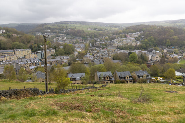
///walks.yachting.rushed. Near Hebden Bridge, West Yorkshire

Related Wikis

Eastwood (L&Y) railway station

Eastwood Railway Station served the village of Eastwood in the civil parish of Todmorden, West Yorkshire, England. The station opened with the line on...

Eastwood, West Yorkshire

Eastwood is a place within the civil parish of Todmorden and Metropolitan Borough of Calderdale, in West Yorkshire, England. It lies 8 miles (12.9 km)...

Stoodley Pike

Stoodley Pike is a 1,300-foot (400 m) hill in the south Pennines in West Yorkshire in northern England. It is noted for the 121-foot (37 m) Stoodley Pike...

Erringden

Erringden is a civil parish in the Metropolitan Borough of Calderdale in West Yorkshire, England. Previously it was a township within the chapelry of Heptonstall...

Nearby Amenities

Located within 500m of 53.727029,-2.036383
Barrier: stile
Steps: 1
Stile: stepover
Lat/Long: 53.724431/-2.0320155
Barrier: stile
Material: wood
Stile: stepover
Lat/Long: 53.7237098/-2.0379711
Lodge Hill
Natural: peak
Lat/Long: 53.7250758/-2.0383934
Barrier: stile
Foot: yes
Material: stone
Stile: stepover
Lat/Long: 53.7272522/-2.0303058
Barrier: entrance
Lat/Long: 53.7234743/-2.0323795
Power: pole
Lat/Long: 53.728317/-2.0296919
Power: pole
Lat/Long: 53.727111/-2.0298663
Power: pole
Lat/Long: 53.7259589/-2.0300111
Power: pole
Lat/Long: 53.7248115/-2.0302042
Power: pole
Lat/Long: 53.724145/-2.0315641
Line Management: branch
Power: pole
Lat/Long: 53.723188/-2.0336482
The data included in this document is from www.openstreetmap.org. The data is made available under ODbL.

Have you been to Edge End Moor?

Leave your review of Edge End Moor below (or comments, questions and feedback).