Height Rough

Downs, Moorland in Yorkshire

England

Height Rough
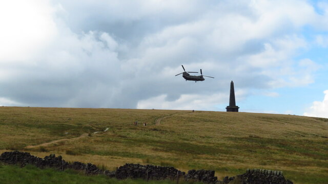
Chinook Helicopter passing close to Stoodley Pike Monument A close encounter!
Chinook Helicopter passing close to Stoodley Pike Monument Credit: Colin Park

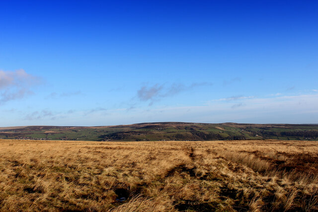
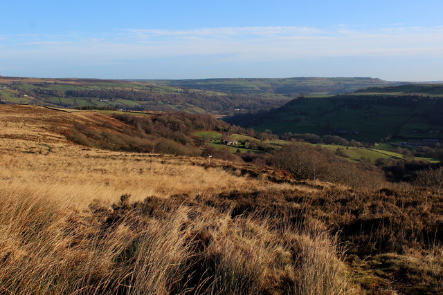
Height Rough is a picturesque area located in the county of Yorkshire, England. It is renowned for its diverse landscape, encompassing both downs and moorland. The region is known for its undulating terrain, characterized by rolling hills and valleys, providing stunning panoramic views.

The downs in Height Rough are characterized by their wide, open spaces and gentle slopes. These areas are covered in lush green grass and are often used for grazing livestock. The downs offer a tranquil and serene environment, perfect for leisurely walks and outdoor activities.

The moorland in Height Rough is a stark contrast to the downs, featuring rugged and wild landscapes. The moorland is characterized by its heather-covered hills, peat bogs, and rocky outcrops. This unique habitat supports a variety of flora and fauna, including rare bird species such as the red grouse and curlew.

The area is also home to several walking and hiking trails, providing opportunities for outdoor enthusiasts to explore the natural beauty of Height Rough. The trails offer a chance to experience the diverse landscapes, from the peaceful downs to the rugged moorland. Along the way, visitors may come across ancient stone formations, remnants of the region's rich history.

Height Rough is a haven for nature lovers and those seeking a peaceful escape from the bustling city life. Whether it's admiring the sweeping views from the downs or venturing into the wild moorland, this Yorkshire gem offers a unique and unforgettable experience.

If you have any feedback on the listing, please let us know in the comments section below.

Height Rough Images

Images are sourced within 2km of 53.721563/-2.0379088 or Grid Reference SD9725. Thanks to Geograph Open Source API. All images are credited.
Chinook Helicopter passing close to Stoodley Pike Monument A close encounter!
Chinook Helicopter passing close to Stoodley Pike Monument
A close encounter!
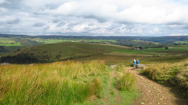
Pennine Way at Doe Stones & view towards Edge End Moor
Striding onto Erringden Moor Plenty of footpaths to choose from, when walking on this stretch of moorland
Striding onto Erringden Moor
Plenty of footpaths to choose from, when walking on this stretch of moorland
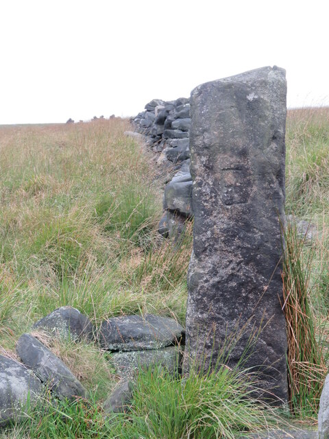
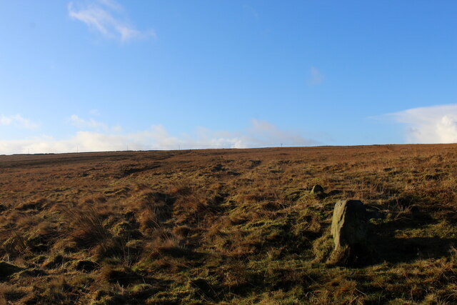
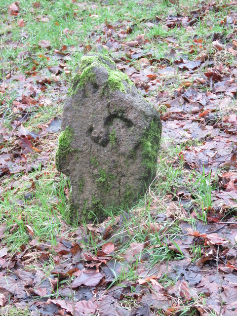
Old Boundary Stone on Erringden Moor There are plenty of these stones forming a line across the moor
Old Boundary Stone on Erringden Moor
There are plenty of these stones forming a line across the moor
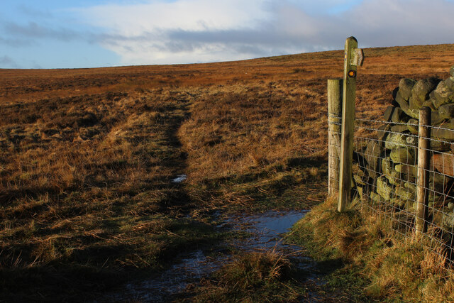
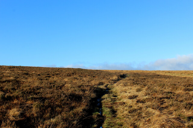
Footpath on Erringden Moor Narrow but distinct footpath crossing Erringden Moor
Footpath on Erringden Moor
Narrow but distinct footpath crossing Erringden Moor
On the Edge of Erringden Moor Great view of Cragg Vale and Calderdale from here.
On the Edge of Erringden Moor
Great view of Cragg Vale and Calderdale from here.
On Erringden Moor One of many footpaths that can be found on this stretch of moorland
On Erringden Moor
One of many footpaths that can be found on this stretch of moorland
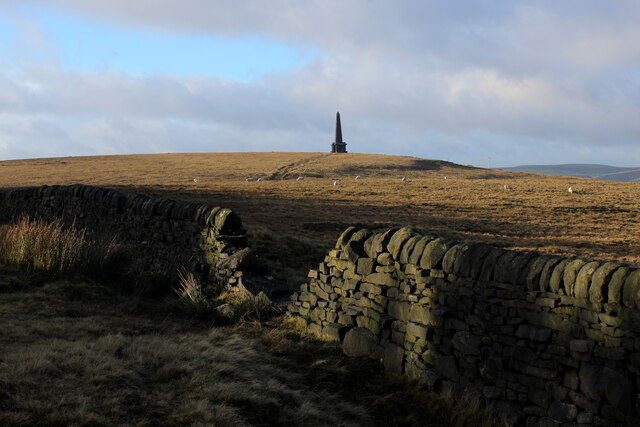
View towards Stoodley Pike Monument from Dick's Lane
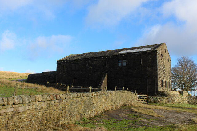
Large Outbuilding beside Pasture House The outbuilding is larger than the farmhouse itself, which is concealed from view behind this bulky edifice.
The complex is located beside Withens Clough Reservoir, and seems to be the only sign of habitation in the vicinity.
The outbuilding appears to be a converted barn in need of some repair.
Passed by on the Calderdale Way long distance footpath.
Large Outbuilding beside Pasture House
The outbuilding is larger than the farmhouse itself, which is concealed from view behind this bulky edifice. The complex is located beside Withens Clough Reservoir, and seems to be the only sign of habitation in the vicinity. The outbuilding appears to be a converted barn in need of some repair. Passed by on the Calderdale Way long distance footpath.
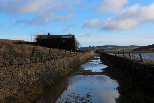
Flooded New Withens Road Approaching Pasture House on the Calderdale Way long distance footpath beside Withens Clough Reservoir
Flooded New Withens Road
Approaching Pasture House on the Calderdale Way long distance footpath beside Withens Clough Reservoir
Old Boundary Marker in Stoodley Glen, Calderdale Township Boundary Marker above Stoodley Glen and south of Stoodley Lane. Formerly on the boundary of Langfield and Sowerby townships in Halifax parish. It marked the boundary of the Sowerby Ramble, a narrow strip of land along the Calder valley and up Stoodley Glen between Erringden and Stansfield townships and Erringden and Langfield township. Sowerby Ramble was part of Sowerby township but in 1850 it became part of Erringden township, later parish. In 1897 Langfield and Stansfield became part of Todmorden parish and in 1937 this part of Erringden parish also became part of Todmorden parish. 

Milestone Society National ID: YW_LANSOW02pb
Old Boundary Marker in Stoodley Glen, Calderdale
Township Boundary Marker above Stoodley Glen and south of Stoodley Lane. Formerly on the boundary of Langfield and Sowerby townships in Halifax parish. It marked the boundary of the Sowerby Ramble, a narrow strip of land along the Calder valley and up Stoodley Glen between Erringden and Stansfield townships and Erringden and Langfield township. Sowerby Ramble was part of Sowerby township but in 1850 it became part of Erringden township, later parish. In 1897 Langfield and Stansfield became part of Todmorden parish and in 1937 this part of Erringden parish also became part of Todmorden parish. Milestone Society National ID: YW_LANSOW02pb
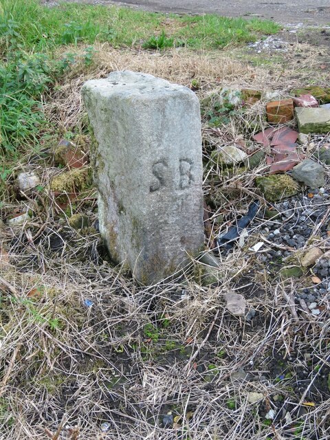
Old Boundary Marker between Higher Moor and Sunderland Pasture in Hebden Royd parish Township Boundary Marker beside a track between Higher Moor and Sunderland Pasture. On the former boundary of the Sowerby Ramble between Erringden and Sowerby townships in Halifax parish but now entirely in Hebden Royd parish. Inscribed E for Erringden on its face and S for Sowerby on top.

Milestone Society National ID: YW_HEBR01pb
Old Boundary Marker between Higher Moor and Sunderland Pasture in Hebden Royd parish
Township Boundary Marker beside a track between Higher Moor and Sunderland Pasture. On the former boundary of the Sowerby Ramble between Erringden and Sowerby townships in Halifax parish but now entirely in Hebden Royd parish. Inscribed E for Erringden on its face and S for Sowerby on top. Milestone Society National ID: YW_HEBR01pb
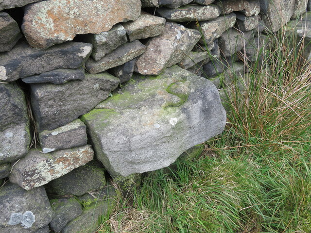
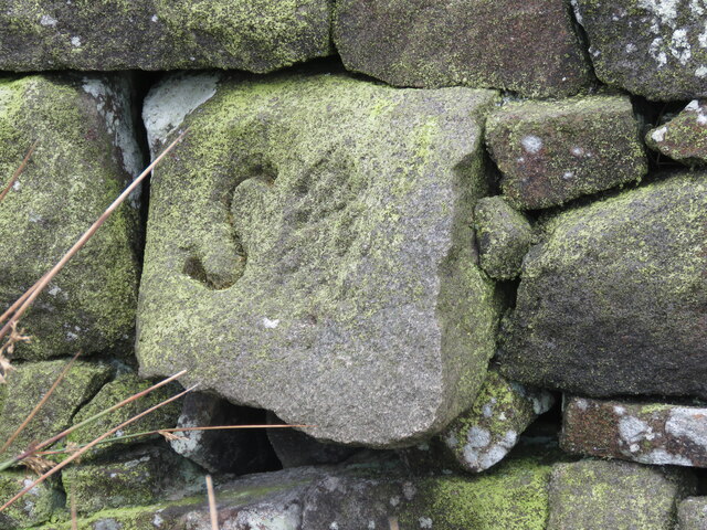
Old Boundary Marker between Higher Moor and Sunderland Pasture in Hebden Royd parish Township Boundary Marker built into a wall adjacent to a stile between Higher Moor and Sunderland Pasture. On the former boundary of the Sowerby Ramble between Erringden and Sowerby townships in Halifax parish but now entirely in Hebden Royd parish. Inscribed S for Sowerby township.

Milestone Society National ID: YW_HEBR02pb
Old Boundary Marker between Higher Moor and Sunderland Pasture in Hebden Royd parish
Township Boundary Marker built into a wall adjacent to a stile between Higher Moor and Sunderland Pasture. On the former boundary of the Sowerby Ramble between Erringden and Sowerby townships in Halifax parish but now entirely in Hebden Royd parish. Inscribed S for Sowerby township. Milestone Society National ID: YW_HEBR02pb
Old Boundary Marker between Higher Moor and Sunderland Pasture in Hebden Royd parish Township Boundary Marker built into a wall adjacent to a stile between Higher Moor and Sunderland Pasture. On the former boundary of the Sowerby Ramble between Erringden and Sowerby townships in Halifax parish but now entirely in Hebden Royd parish. Inscribed S for Sowerby township.

Milestone Society National ID: YW_HEBR03pb
Old Boundary Marker between Higher Moor and Sunderland Pasture in Hebden Royd parish
Township Boundary Marker built into a wall adjacent to a stile between Higher Moor and Sunderland Pasture. On the former boundary of the Sowerby Ramble between Erringden and Sowerby townships in Halifax parish but now entirely in Hebden Royd parish. Inscribed S for Sowerby township. Milestone Society National ID: YW_HEBR03pb
Old Boundary Marker in Stoodley Glen, Calderdale Parish Boundary Marker in Stoodley Glen below Height Wood. Formerly on the boundary of Langfield and Sowerby townships in Halifax parish. It marked the boundary of the Sowerby Ramble, a narrow strip of land along the Calder valley and up Stoodley Glen between Erringden and Stansfield townships and Erringden and Langfield township. Sowerby Ramble was part of Sowerby township but in 1850 it became part of Erringden township, later parish. In 1897 Langfield and Stansfield became part of Todmorden parish and in 1937 this part of Erringden parish also became part of Todmorden parish..

Milestone Society National ID: YW_SOWERR01pb
Old Boundary Marker in Stoodley Glen, Calderdale
Parish Boundary Marker in Stoodley Glen below Height Wood. Formerly on the boundary of Langfield and Sowerby townships in Halifax parish. It marked the boundary of the Sowerby Ramble, a narrow strip of land along the Calder valley and up Stoodley Glen between Erringden and Stansfield townships and Erringden and Langfield township. Sowerby Ramble was part of Sowerby township but in 1850 it became part of Erringden township, later parish. In 1897 Langfield and Stansfield became part of Todmorden parish and in 1937 this part of Erringden parish also became part of Todmorden parish.. Milestone Society National ID: YW_SOWERR01pb
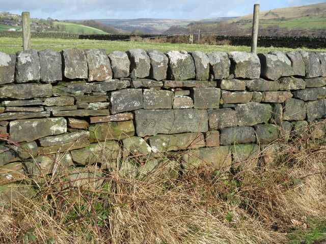
Old Boundary Marker on Baulk Head Lane, Todmorden Estate Boundary Marker set in a stone wall on Baulk Head Lane, a green lane. In the former Stansfield township and parish, absorbed into Todmorden parish in 1897. Not on any township or parish boundary so is thought to mark an estate boundary.

Milestone Society National ID: YW_TOD11em
Old Boundary Marker on Baulk Head Lane, Todmorden
Estate Boundary Marker set in a stone wall on Baulk Head Lane, a green lane. In the former Stansfield township and parish, absorbed into Todmorden parish in 1897. Not on any township or parish boundary so is thought to mark an estate boundary. Milestone Society National ID: YW_TOD11em
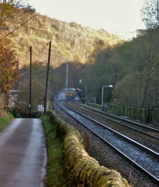
Oakville Road and Railway View towards Hebden Bridge where road and rail are hardly separated. A rail track cleaning train is going over Whiteley Arches
Oakville Road and Railway
View towards Hebden Bridge where road and rail are hardly separated. A rail track cleaning train is going over Whiteley Arches
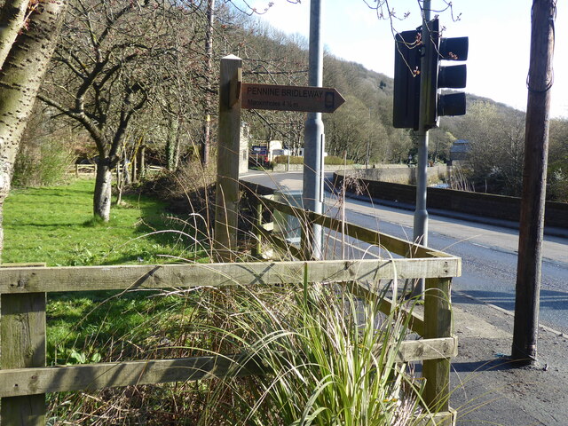
The Pennine Way and Bridleway crossing the A646
Show me another place!

Height Rough is located at Grid Ref: SD9725 (Lat: 53.721563, Lng: -2.0379088)

Division: West Riding

Unitary Authority: Calderdale

Police Authority: West Yorkshire

What 3 Words

///forces.hikes.voucher. Near Hebden Bridge, West Yorkshire

Related Wikis

Stoodley Pike

Stoodley Pike is a 1,300-foot (400 m) hill in the south Pennines in West Yorkshire in northern England. It is noted for the 121-foot (37 m) Stoodley Pike...

Eastwood, West Yorkshire

Eastwood is a place within the civil parish of Todmorden and Metropolitan Borough of Calderdale, in West Yorkshire, England. It lies 8 miles (12.9 km)...

Eastwood (L&Y) railway station

Eastwood Railway Station served the village of Eastwood in the civil parish of Todmorden, West Yorkshire, England. The station opened with the line on...

Upper Calder Valley

The Upper Calder Valley lies in West Yorkshire, in northern England, and covers the towns of Todmorden, Hebden Bridge, Mytholmroyd, Luddendenfoot, and...

Nearby Amenities

Located within 500m of 53.721563,-2.0379088
Barrier: stile
Steps: 2
Stile: stepover
Lat/Long: 53.7197782/-2.0317974
Barrier: stile
Steps: 2
Stile: stepover
Lat/Long: 53.7213385/-2.0342296
Barrier: stile
Material: wood
Stile: stepover
Lat/Long: 53.7196097/-2.0386443
Barrier: stile
Material: wood
Stile: stepover
Lat/Long: 53.7237098/-2.0379711
Barrier: cattle_grid
Lat/Long: 53.7210577/-2.0428507
Power: pole
Lat/Long: 53.7185426/-2.0432996
Power: pole
Lat/Long: 53.7193078/-2.0418703
Lodge Hill
Natural: peak
Lat/Long: 53.7250758/-2.0383934
Barrier: entrance
Lat/Long: 53.7234743/-2.0323795
Barrier: stile
Material: wood
Stile: stepover
Lat/Long: 53.7217389/-2.0417968
Barrier: stile
Material: wood
Stile: stepover
Lat/Long: 53.7212604/-2.0411097
Power: pole
Lat/Long: 53.7221549/-2.0312771
Power: pole
Lat/Long: 53.7225119/-2.0322481
Power: pole
Lat/Long: 53.7228754/-2.0332432
Line Management: branch
Power: pole
Lat/Long: 53.723188/-2.0336482
Power: pole
Lat/Long: 53.7224366/-2.035291
Power: pole
Lat/Long: 53.7217803/-2.0366898
Power: pole
Lat/Long: 53.7210915/-2.038157
Power: pole
Lat/Long: 53.720117/-2.0402572
The data included in this document is from www.openstreetmap.org. The data is made available under ODbL.

Have you been to Height Rough?

Leave your review of Height Rough below (or comments, questions and feedback).