Broad Moss

Downs, Moorland in Cheshire

England

Broad Moss

Saltersford Hall Farm On Hooleyhey Lane.
Saltersford Hall Farm Credit: Trevor Harris

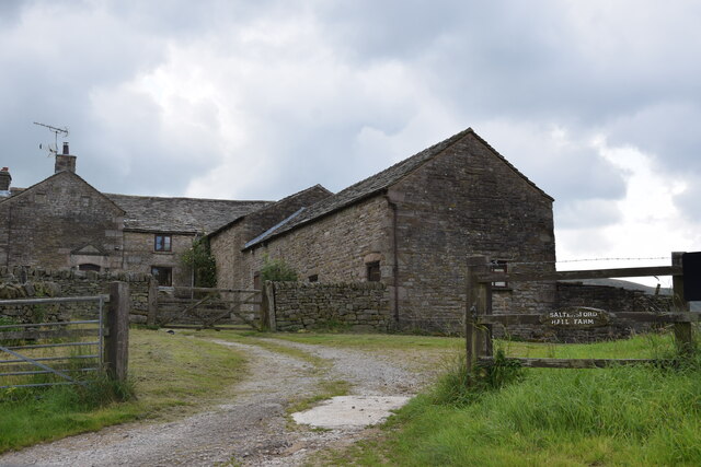
Broad Moss is a picturesque area located in the county of Cheshire, England. Situated between the Downs and Moorland, it offers a diverse landscape that attracts nature enthusiasts and outdoor lovers alike. Covering an expansive area of approximately 500 acres, Broad Moss is renowned for its stunning natural beauty and unique ecosystem.

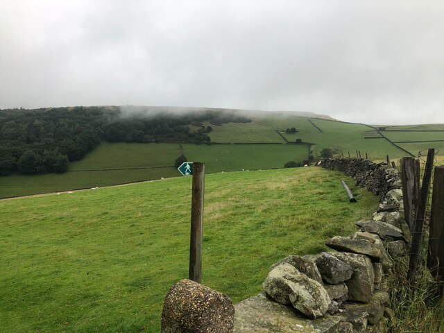
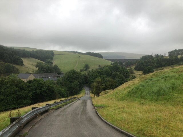
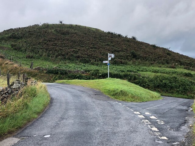
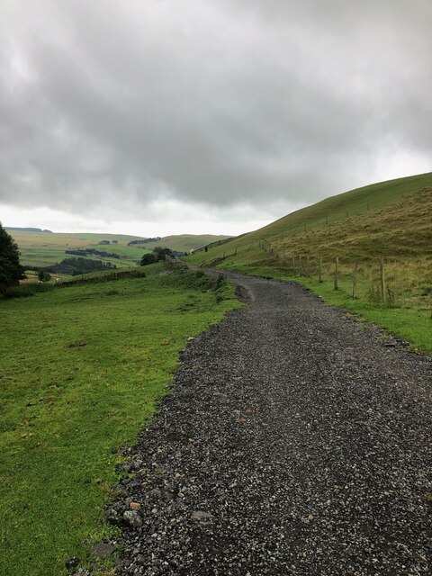
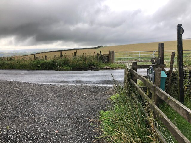
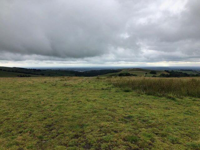
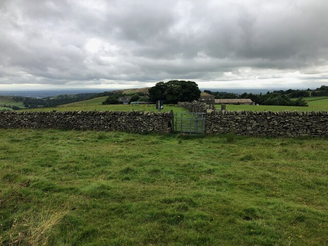
The Downs in Broad Moss are characterized by rolling hills and gentle slopes, covered in lush green grass and scattered with wildflowers during the spring and summer months. The terrain provides ample opportunities for hiking and walking, with well-marked trails that offer breathtaking views of the surrounding countryside.

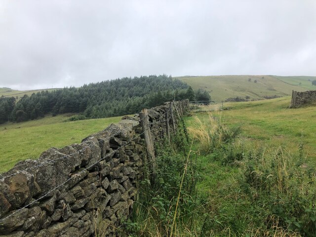
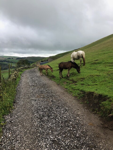
On the other hand, the Moorland in Broad Moss boasts a more rugged and untamed landscape. Here, visitors can explore vast expanses of heather and gorse, interspersed with rocky outcrops and small streams. The Moorland is home to a variety of wildlife, including grouse, foxes, and birds of prey, making it a popular spot for birdwatching and wildlife photography.

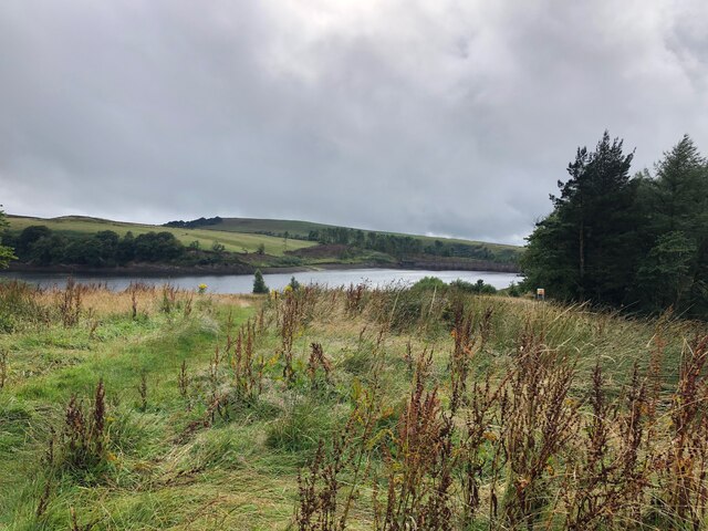
Broad Moss also features several ponds and small lakes, providing habitats for various aquatic species and attracting migratory birds throughout the year. These bodies of water are also popular for fishing and boating activities.

Overall, Broad Moss in Cheshire offers a diverse range of natural landscapes, from gentle Downs to wild Moorland. With its stunning scenery and abundant wildlife, it is a must-visit destination for nature lovers seeking a tranquil and immersive outdoor experience.

If you have any feedback on the listing, please let us know in the comments section below.

Broad Moss Images

Images are sourced within 2km of 53.291783/-2.0377797 or Grid Reference SJ9777. Thanks to Geograph Open Source API. All images are credited.

Saltersford Hall Farm On Hooleyhey Lane.
Saltersford Hall Farm
On Hooleyhey Lane.
View across the Dean Valley towards Waggonshaw Brow
Lamaload Road and Water Treatment Works Lamaload Dam visible in background
Lamaload Road and Water Treatment Works
Lamaload Dam visible in background
Footpath and drystone wall North of Lamaload Reservoir
View of Lamaload Reservoir from Lower Hooleyhey
Junction of Hooleyhey Lane and Ewrin Lane
Memorial Stone The stone marks the site where the body of John Turner was found in a snowdrift in 1755, This stone is described in the novel "Thursbitch" by Alan Garner <span class="nowrap"><a title="https://en.wikipedia.org/wiki/Thursbitch" rel="nofollow ugc noopener" href="https://en.wikipedia.org/wiki/Thursbitch">Link</a><img style="margin-left:2px;" alt="External link" title="External link - shift click to open in new window" src="https://s1.geograph.org.uk/img/external.png" width="10" height="10"/></span>
Memorial Stone
The stone marks the site where the body of John Turner was found in a snowdrift in 1755, This stone is described in the novel "Thursbitch" by Alan Garner LinkExternal link
Driveway leading to Waggonshaw Farm This is also a public footpath. Waggonshaw Brow is the high ground on the right of the picture
Driveway leading to Waggonshaw Farm
This is also a public footpath. Waggonshaw Brow is the high ground on the right of the picture
Junction of driveway leading from Waggonshaw Farm with Ewrin Lane
Horses on track leading to Waggonshaw Farm
Footpath descending from Waggonshaw Brow The marker post for the path is in the centre of this photograph. The Cheshire Plain is visible in the far distance where the dish of the Radio Telescope at Jodrell Bank can be picked out.
Footpath descending from Waggonshaw Brow
The marker post for the path is in the centre of this photograph. The Cheshire Plain is visible in the far distance where the dish of the Radio Telescope at Jodrell Bank can be picked out.
Footpath approaching Common Barn Farm Common Barn is working farm that also offers B&B accommodation
Footpath approaching Common Barn Farm
Common Barn is working farm that also offers B&B accommodation
Peak & Northern Footpaths Society, Sign No 437, East of Common Barn Farm This signpost is dedicated to Geoffrey Kidgell  1935-2011 "He Loved the Hills"
Peak & Northern Footpaths Society, Sign No 437, East of Common Barn Farm
This signpost is dedicated to Geoffrey Kidgell 1935-2011 "He Loved the Hills"
Courtyard at Common Barn Farm The footpath runs right through the courtyard at Common Barn Farm. The farm is a working farm which also offers B&B accommodation to visitors seeking to "get away from it all" which they certainly can here, considering its relatively remote location. The courtyard appears to be an area where guests can relax outside, with chairs and a picnic table being present. Also present is an unusually located Peak and Northern Footpaths Society sign (No 436) which is dedicated to Brian Morrison (1934-2018).
Courtyard at Common Barn Farm
The footpath runs right through the courtyard at Common Barn Farm. The farm is a working farm which also offers B&B accommodation to visitors seeking to "get away from it all" which they certainly can here, considering its relatively remote location. The courtyard appears to be an area where guests can relax outside, with chairs and a picnic table being present. Also present is an unusually located Peak and Northern Footpaths Society sign (No 436) which is dedicated to Brian Morrison (1934-2018).
Lane descending hill, East of Rainow
View down to Ginclough The collection of houses in the centre of the picture is the hamlet of Ginclough. The prominent hill in the background is Big Low.
View down to Ginclough
The collection of houses in the centre of the picture is the hamlet of Ginclough. The prominent hill in the background is Big Low.
Upland pastures off Bakestonedale Road A collection of photographs (just one from each contributor) taken on New Year's Day 2023 by Geographers from all over Great Britain, Ireland and the Isle of Man.

View all the photos on a map here: <a title="https://www.geograph.org.uk/search.php?i=172163615" href="https://www.geograph.org.uk/search.php?i=172163615">Link</a>
Upland pastures off Bakestonedale Road
A collection of photographs (just one from each contributor) taken on New Year's Day 2023 by Geographers from all over Great Britain, Ireland and the Isle of Man. View all the photos on a map here: Link
Looking down the valley of Gnathole Brook, west of Charles Head
Show me another place!

Broad Moss is located at Grid Ref: SJ9777 (Lat: 53.291783, Lng: -2.0377797)

Unitary Authority: Cheshire East

Police Authority: Cheshire

What 3 Words

///both.promotion.activism. Near Pott Shrigley, Cheshire

Nearby Locations

Broad Moss

Related Wikis

Jenkin Chapel

Jenkin Chapel, stands in an isolated position on the western slopes of the Pennines, 4.3 miles (7 km) northeast of Macclesfield, Cheshire, England. It...
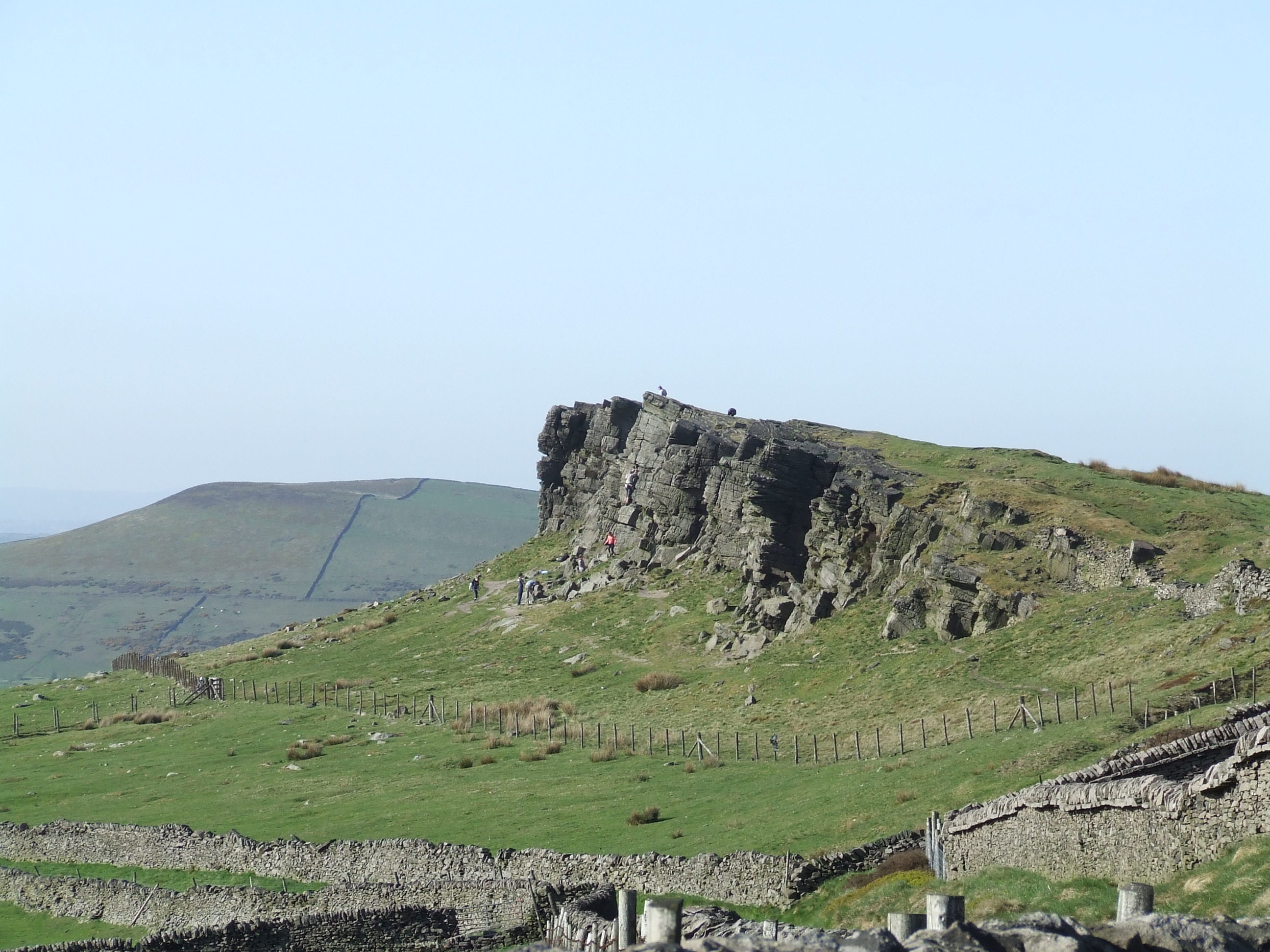
Windgather Rocks

The Windgather Rocks (416 metres/1,365 ft a.s.l.) is a gritstone crag on the Derbyshire–Cheshire border in England. It is in the Peak District National...

Lamaload Reservoir

Lamaload Reservoir is a reservoir near Rainow, Cheshire, England (SJ972750). It lies in the South West Peak within the Peak District National Park, to...

Cats Tor

Cats Tor is a Peak District hill on the border between Cheshire and Derbyshire, between the towns of Macclesfield and Buxton. The summit is 518 metres...
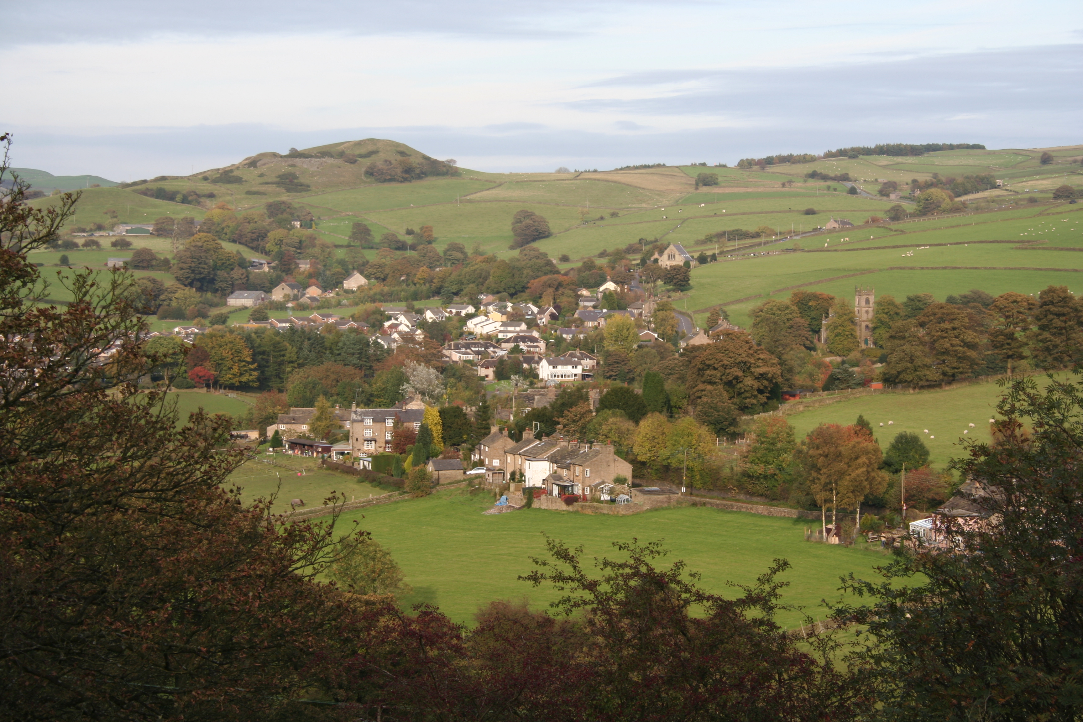
Rainow

Rainow is a village and civil parish in Cheshire, England, in the valley of the River Dean and next to the B5470 road between Macclesfield and Kettleshulme...

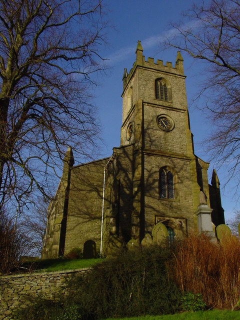
Holy Trinity Church, Rainow

Holy Trinity Church is in the village of Rainow, Cheshire, England. It is an active Anglican parish church in the deanery of Macclesfield, the archdeaconry...

Kettleshulme

Kettleshulme (Old Norse Ketil's island or Ketil's watermeadow) is a village and former civil parish, now in the parish of Kettleshulme and Lyme Handley...

Ingersley Hall

Ingersley Hall, later Savio House, stands to the east of the town of Bollington, Cheshire, England. The house was built in about 1775 for John Gaskell...

Related Videos

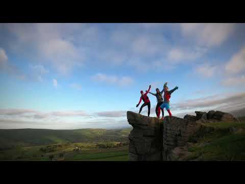
Walking at Windgather Rocks Derbyshire ~ Drone Footage @angie iCam_life

A rugged landscape that as its name describes is incredibly windy . Managed to get the Drone to fly but it wobbled a bit in places.

#fishandchips in #derbyshire

fishandchips in #derbyshire #foodblogger #chips #fastfood #takeaway #travel #chipshop #batteredfish #foodvlogger.

High Peak Sunrise Run with Virginie and Serin

7am start rewarded with a spectacular sunrise!

Nearby Amenities

Located within 500m of 53.291783,-2.0377797
Barrier: stile
Foot: yes
Material: wood
Stile: stepover
Lat/Long: 53.294473/-2.0348761
Barrier: stile
Foot: yes
Material: wood
Stile: stepover
Lat/Long: 53.2949205/-2.03464
The data included in this document is from www.openstreetmap.org. The data is made available under ODbL.

Have you been to Broad Moss?

Leave your review of Broad Moss below (or comments, questions and feedback).