The Park
Downs, Moorland in Northumberland
England
The Park
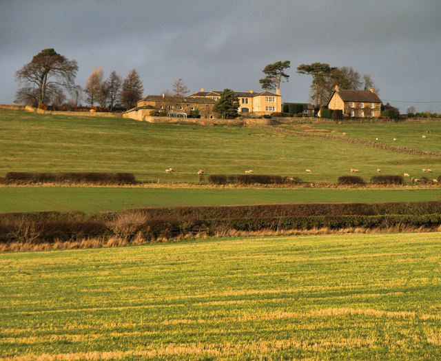
The Park, located in the county of Northumberland, England, is a picturesque area encompassing downs and moorland, offering visitors a diverse and captivating natural landscape. Covering an extensive area, it is a haven for outdoor enthusiasts and nature lovers alike.
The downs in The Park are characterized by their gently rolling hills and expansive grasslands. They provide ample space for leisure activities such as picnicking, kite flying, and taking leisurely walks while enjoying breathtaking panoramic views. The downs are also home to a wide variety of wildflowers, creating a vibrant and colorful spectacle during the spring and summer months.
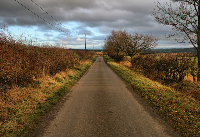
Adjacent to the downs, the moorland in The Park offers a stark contrast with its rugged and untamed beauty. Visitors can explore the vast expanse of heather-covered hills, which provide a habitat for several bird species, including grouse and curlews. The moorland is also crisscrossed with walking trails and bridleways, allowing hikers and horse riders to immerse themselves in the tranquil surroundings.
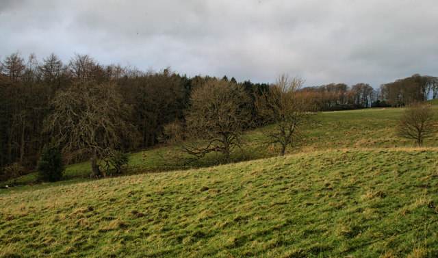
The Park is a designated Area of Outstanding Natural Beauty, which speaks to the exceptional quality and significance of its natural features. Its diverse ecosystem supports a wide range of wildlife, including deer, foxes, and various bird species. Visitors to The Park can experience the tranquility and splendor of the Northumberland countryside, making it an ideal destination for those seeking solace and a connection with nature.
If you have any feedback on the listing, please let us know in the comments section below.
The Park Images
Images are sourced within 2km of 54.986182/-2.0488036 or Grid Reference NY9665. Thanks to Geograph Open Source API. All images are credited.

![Corbridge Roman Site [1] The museum, seen from the car park. Details from English Heritage at: <span class="nowrap"><a title="http://www.english-heritage.org.uk/daysout/properties/corbridge-roman-town-hadrians-wall/" rel="nofollow ugc noopener" href="http://www.english-heritage.org.uk/daysout/properties/corbridge-roman-town-hadrians-wall/">Link</a><img style="margin-left:2px;" alt="External link" title="External link - shift click to open in new window" src="https://s1.geograph.org.uk/img/external.png" width="10" height="10"/></span>](https://s0.geograph.org.uk/geophotos/02/47/21/2472188_97a83f26.jpg)
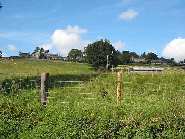
![Corbridge Roman Site [2] The remains of the town. Details from English Heritage at: <span class="nowrap"><a title="http://www.english-heritage.org.uk/daysout/properties/corbridge-roman-town-hadrians-wall/" rel="nofollow ugc noopener" href="http://www.english-heritage.org.uk/daysout/properties/corbridge-roman-town-hadrians-wall/">Link</a><img style="margin-left:2px;" alt="External link" title="External link - shift click to open in new window" src="https://s1.geograph.org.uk/img/external.png" width="10" height="10"/></span>](https://s3.geograph.org.uk/geophotos/02/47/22/2472291_784bae3c.jpg)


The Park is located at Grid Ref: NY9665 (Lat: 54.986182, Lng: -2.0488036)
Unitary Authority: Northumberland
Police Authority: Northumbria
What 3 Words
///teachers.underway.shallower. Near Corbridge, Northumberland
Nearby Locations
Related Wikis

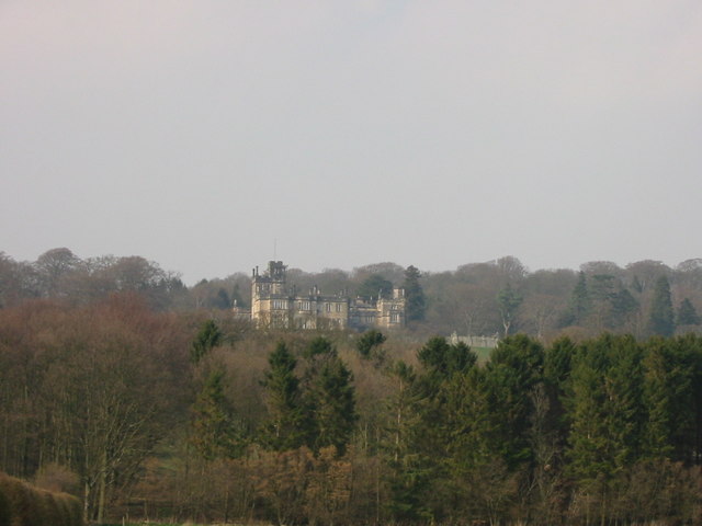
Sandhoe Hall
Sandhoe Hall, also once known as Sandhoe House, is a 19th-century country house situated at Sandhoe, Northumberland. It is a Grade II listed building.The...

Sandhoe
Sandhoe is a hamlet and civil parish in Northumberland, England. It lies about 3 kilometres (2 mi) northwest of Corbridge and 3 kilometres south of Hadrian...
Beaufront Castle
Beaufront Castle is a privately owned 19th-century country house near Hexham, Northumberland, England. It is a Grade I listed building.A pele tower was...

Coria (Corbridge)
Coria was a fort and town 2.5 miles (4.0 km) south of Hadrian's Wall, in the Roman province of Britannia at a point where a big Roman north–south road...

Devil's Water
Devil's Water is a narrow, powerful river in Northumberland, England fed by many streams. A right-bank firmly north-flowing tributary of the Tyne, it ends...
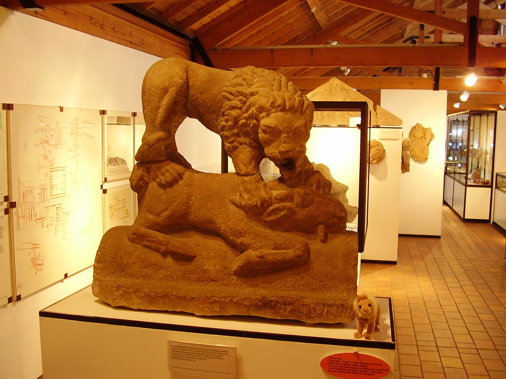
Corbridge Lion
The Corbridge Lion, Northumberland, England, is an ancient Roman free-standing sandstone sculpture of a male lion standing on a prone animal (possibly...
Anick
Anick ( AY-nik) is a village and former civil parish, now in the parish of Sandhoe, in Northumberland, England, situated to the north of Hexham. In 1881...

Corbridge Vicar's Pele
Corbridge Vicar's Pele is a pele tower in the village of Corbridge, Northumberland, England. It was a three-storey defensive pele tower, with one room...
Have you been to The Park?
Leave your review of The Park below (or comments, questions and feedback).