Arkengarthdale Moor

Downs, Moorland in Yorkshire Richmondshire

England

Arkengarthdale Moor

Heading down Arkengarthdale The road down the dale at the point where it drops steeply down to Punchard Gill Bridge.  Hard to believe that this was once a turnpike road, with Punchard Gate House some 400m behind the camera as a toll house. Two hundred years ago there was sufficient traffic to and from both coal and lead mines to make this road a worthwhile investment.
Heading down Arkengarthdale Credit: Gordon Hatton

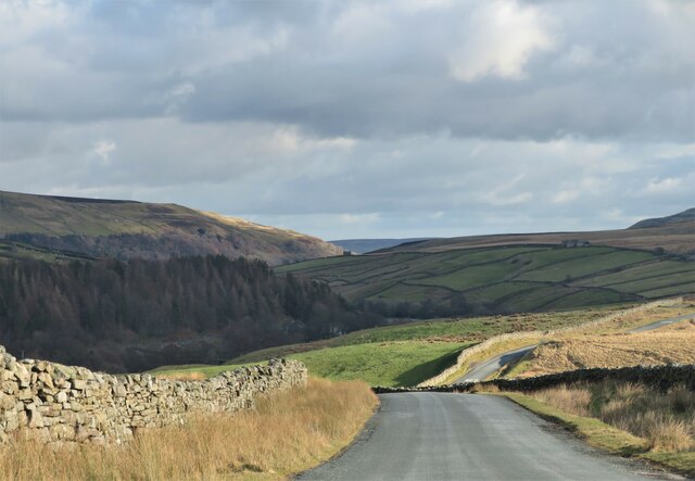
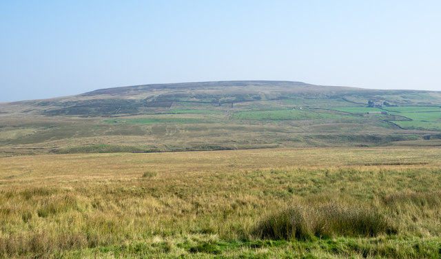
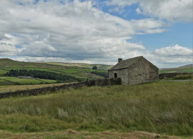
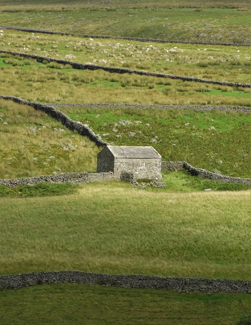
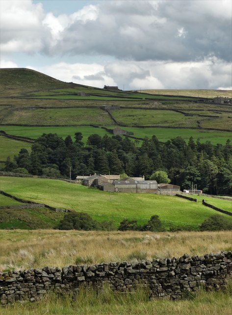
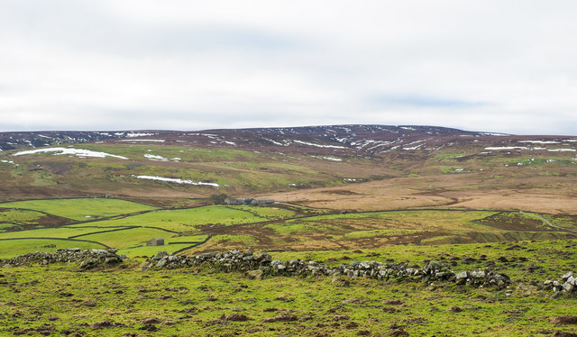
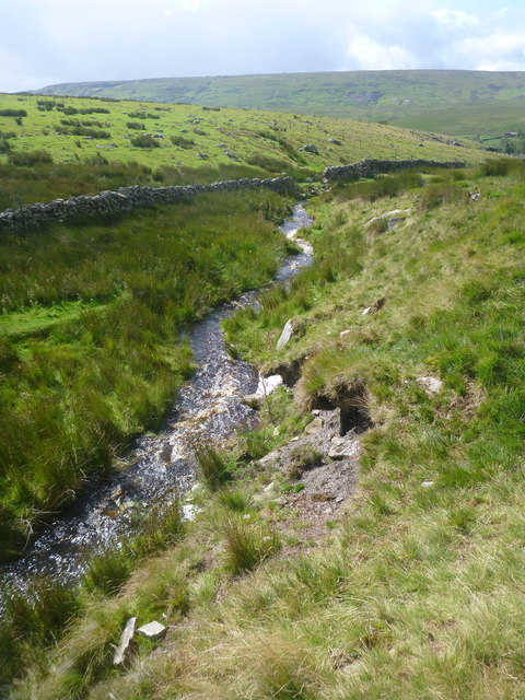
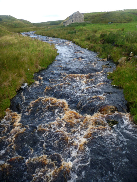
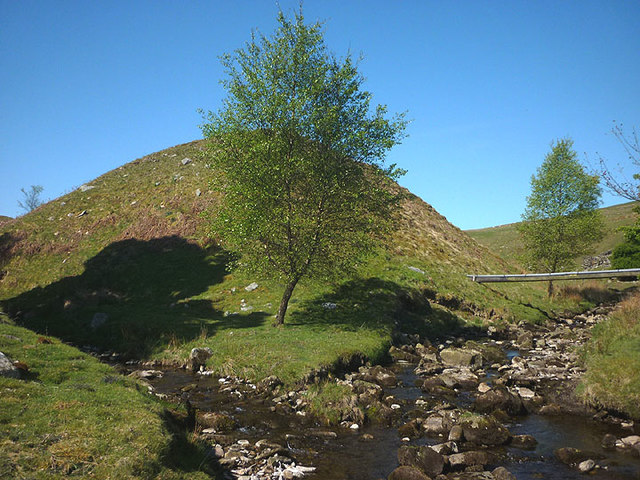
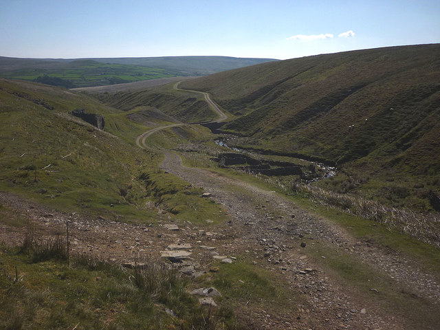
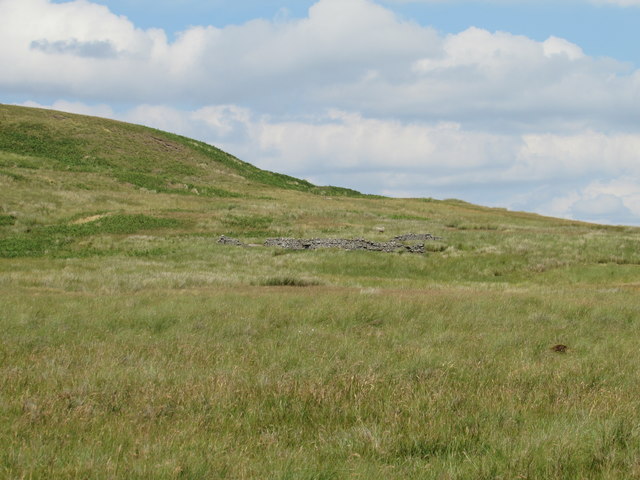
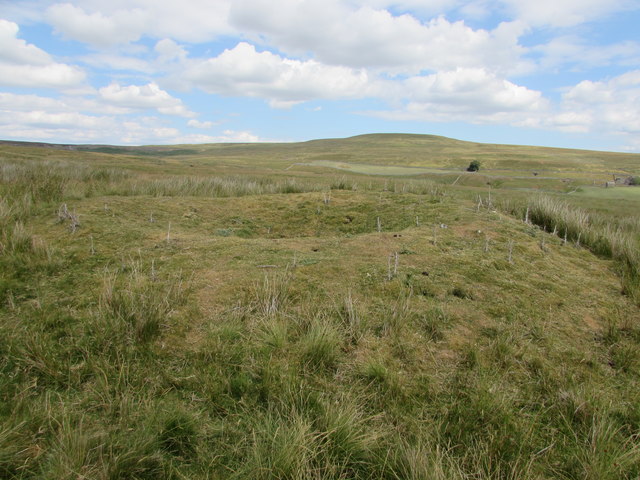
Arkengarthdale Moor is a vast and picturesque landscape located in the heart of Yorkshire, England. Stretching over 15 square kilometers, this moorland is a part of the larger Yorkshire Dales National Park and offers breathtaking views of rolling hills, heather-covered moors, and deep valleys.

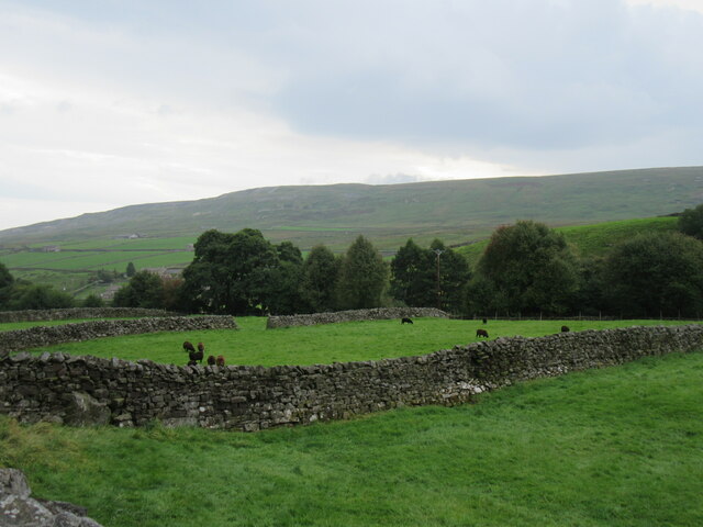
Situated in the northern region of Yorkshire, Arkengarthdale Moor is renowned for its rugged beauty and unspoiled natural surroundings. The moorland is characterized by its diverse flora and fauna, making it a haven for nature enthusiasts and wildlife lovers. Visitors can expect to encounter an array of native bird species, such as curlews, lapwings, and red grouse, as well as sightings of hares, foxes, and deer.

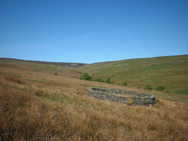
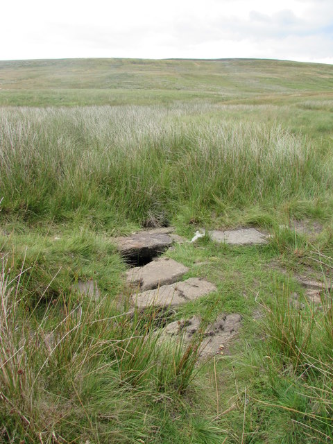
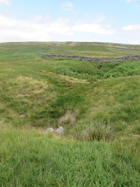
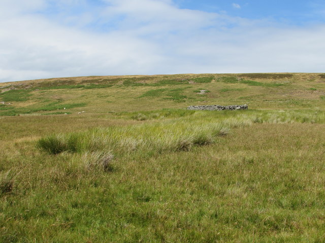
The landscape of Arkengarthdale Moor is dotted with ancient stone walls and scattered ruins, serving as reminders of its rich historical past. The area was once a thriving lead mining district, and remnants of the mining industry can still be seen today. The moorland is also home to several archaeological sites, including Bronze Age burial mounds and stone circles, adding to its historical significance.

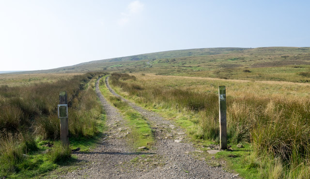
For outdoor enthusiasts, Arkengarthdale Moor offers an array of activities. Hiking and walking trails crisscross the moorland, providing opportunities for exploration and discovery. The moors also attract cyclists and horse riders, who can enjoy the stunning vistas while traversing the network of bridleways.

In summary, Arkengarthdale Moor is a captivating destination in Yorkshire, offering a harmonious blend of natural beauty, historical heritage, and outdoor activities. Whether one seeks solitude in the vast moorland or wishes to immerse themselves in the rich history of the region, this Yorkshire gem is sure to leave a lasting impression.

If you have any feedback on the listing, please let us know in the comments section below.

Arkengarthdale Moor Images

Images are sourced within 2km of 54.450203/-2.0524325 or Grid Reference NY9606. Thanks to Geograph Open Source API. All images are credited.

Heading down Arkengarthdale The road down the dale at the point where it drops steeply down to Punchard Gill Bridge.  Hard to believe that this was once a turnpike road, with Punchard Gate House some 400m behind the camera as a toll house. Two hundred years ago there was sufficient traffic to and from both coal and lead mines to make this road a worthwhile investment.
Heading down Arkengarthdale
The road down the dale at the point where it drops steeply down to Punchard Gill Bridge. Hard to believe that this was once a turnpike road, with Punchard Gate House some 400m behind the camera as a toll house. Two hundred years ago there was sufficient traffic to and from both coal and lead mines to make this road a worthwhile investment.
Near Whaw Looking south down Arkengarthdale.
Near Whaw
Looking south down Arkengarthdale.
Estate road rising towards Leading Stead Leading Stead is an ill-defined upland location named on OS maps as part of Arkengarthdale Moor - another of them! The estate road climbs only a short way up the slope which is on the south side of Arkengarthdale.
Estate road rising towards Leading Stead
Leading Stead is an ill-defined upland location named on OS maps as part of Arkengarthdale Moor - another of them! The estate road climbs only a short way up the slope which is on the south side of Arkengarthdale.
Moorland in Arkengarthdale Grassy moorland on the north side of the valley road as seen from a location named on OS maps as White Hill. The distant feature is Cleasby Hill.
Moorland in Arkengarthdale
Grassy moorland on the north side of the valley road as seen from a location named on OS maps as White Hill. The distant feature is Cleasby Hill.
Roadside barn at Punchard Gate
Field barn in Arkengarthsale
A view of Low Faggergill Farm
Ruined wall crossing rough grazing The enclosed area of rough grazing is on the north side of Arkengarthdale. The view beyond is across the valley to a moorland high point at West Moor which rises to finally to Water Crag.
Ruined wall crossing rough grazing
The enclosed area of rough grazing is on the north side of Arkengarthdale. The view beyond is across the valley to a moorland high point at West Moor which rises to finally to Water Crag.
Stream flowing off Gale Head Moor The stream flows alongside the wall separating Faggergill intake (far side, improved pasture) and Faggergill Moor (this side, rough moorland) which in this section is also below an intake wall, as a ridge by the name of Peat Moor Rigg. Seen from below, at Gales, it is also called Gale Head Moor. One has to take one's best guess as to which names apply exactly where, as that sort of detail is not delineated by the OS mapping - it's unlikely that the surveyors did more than ask a few people what the moor was called and just tried to apply the answers to what seemed the relevant bits.
Stream flowing off Gale Head Moor
The stream flows alongside the wall separating Faggergill intake (far side, improved pasture) and Faggergill Moor (this side, rough moorland) which in this section is also below an intake wall, as a ridge by the name of Peat Moor Rigg. Seen from below, at Gales, it is also called Gale Head Moor. One has to take one's best guess as to which names apply exactly where, as that sort of detail is not delineated by the OS mapping - it's unlikely that the surveyors did more than ask a few people what the moor was called and just tried to apply the answers to what seemed the relevant bits.
Arkle Beck from Dale Head New Bridge Dale Head is connected to the Arkengarthdale road by a track which the public right of way (a footpath) only partially follows. The routes certainly coincide over the bridge, from where we found ourselves peering both upstream (as seen here) and downstream to see if this would be too high up the dale to put on to Arkle Beck for a paddling trip. It's a difficult judgement to make in August when even recent damp weather has not raised the beck to anything like the sort of wet winter levels one would need. I suspect that Whaw bridge would be a more sensible option.
Arkle Beck from Dale Head New Bridge
Dale Head is connected to the Arkengarthdale road by a track which the public right of way (a footpath) only partially follows. The routes certainly coincide over the bridge, from where we found ourselves peering both upstream (as seen here) and downstream to see if this would be too high up the dale to put on to Arkle Beck for a paddling trip. It's a difficult judgement to make in August when even recent damp weather has not raised the beck to anything like the sort of wet winter levels one would need. I suspect that Whaw bridge would be a more sensible option.
Sheepfold, Great Punchard Gill Looking towards the new tree plantings by the confluence with Little Punchard Gill.
Sheepfold, Great Punchard Gill
Looking towards the new tree plantings by the confluence with Little Punchard Gill.
Confluence of Great and Little Punchard Gills A scatter of trees has been planted around this pleasant spot.
Confluence of Great and Little Punchard Gills
A scatter of trees has been planted around this pleasant spot.
Shooters track, Great Punchard Gill
Stone Flagged Bridge over Near Crook Sike One of 3 flagged bridges over minor streams on this moorland.
Stone Flagged Bridge over Near Crook Sike
One of 3 flagged bridges over minor streams on this moorland.
Shake Holes on Seavy Hill
Sheep Fold below Baxton Knab
Ruined sheep fold below Baxton Knab
Unmarked Mine Shaft on Gale Head Moor Although no longer marked on 1:25k maps, a run of "old Lead mines" are marked around this vicinity on the 6" to a mile 1854 OS map. In the distance is the unremarkable lump of Hoove.
Unmarked Mine Shaft on Gale Head Moor
Although no longer marked on 1:25k maps, a run of "old Lead mines" are marked around this vicinity on the 6" to a mile 1854 OS map. In the distance is the unremarkable lump of Hoove.
Show me another place!

Arkengarthdale Moor is located at Grid Ref: NY9606 (Lat: 54.450203, Lng: -2.0524325)

Division: North Riding

Administrative County: North Yorkshire

District: Richmondshire

Police Authority: North Yorkshire

What 3 Words

///segmented.arise.test. Near Bowes, Co. Durham

Related Wikis

Arkengarthdale

Arkengarthdale is a dale, or valley, on the east side of the Pennines in North Yorkshire, England. Running roughly north-west to south-east, it is the...

Whaw

Whaw is a hamlet in Arkengarthdale in North Yorkshire, England. It is one of few settlements in the dale and is one of the smallest. Its name derives from...

Arkle Beck Meadows, Whaw

Arkle Beck Meadows, Whaw (grid reference NY984041) is a 8.4 hectares (21 acres) biological Site of Special Scientific Interest (SSSI) at Whaw in Arkengarthdale...

Arkengarthdale Gunnerside and Reeth Moors

Arkengarthdale Gunnerside and Reeth Moors (grid reference NY935070 and SD970990) is a 7,634.72 hectares (18,865.8 acres) biological Site of Special Scientific...

Walney to Wear and Whitby Cycle Route

The Walney to Wear and Whitby Cycle Route (or W2W) is the name of a cross-country cycle route in Northern England. It runs from Walney Island in Cumbria...

National Cycle Route 70

National Cycle Network (NCN) Route 70 is a Sustrans National Route that runs from Walney Island in Cumbria to Sunderland. The route is fully open and signed...

Eskeleth

Eskeleth is a hamlet in Arkengarthdale in North Yorkshire, England. It is in the Yorkshire Dales National Park. Eskeleth sits 4 miles (6.4 km) from the...

Hoove

Hoove is a hill in the northern Yorkshire Dales in North Yorkshire, England, near the town of Barnard Castle in County Durham. Its elevation is 554 metres...

Nearby Amenities

Located within 500m of 54.450203,-2.0524325
Park Head
Place: farm
Lat/Long: 54.4487115/-2.0499312
The data included in this document is from www.openstreetmap.org. The data is made available under ODbL.

Have you been to Arkengarthdale Moor?

Leave your review of Arkengarthdale Moor below (or comments, questions and feedback).