Flasby Fell

Downs, Moorland in Yorkshire Craven

England

Flasby Fell

Path by Hetton Beck This path leads eventually to Flasby.
Path by Hetton Beck Credit: Bill Boaden

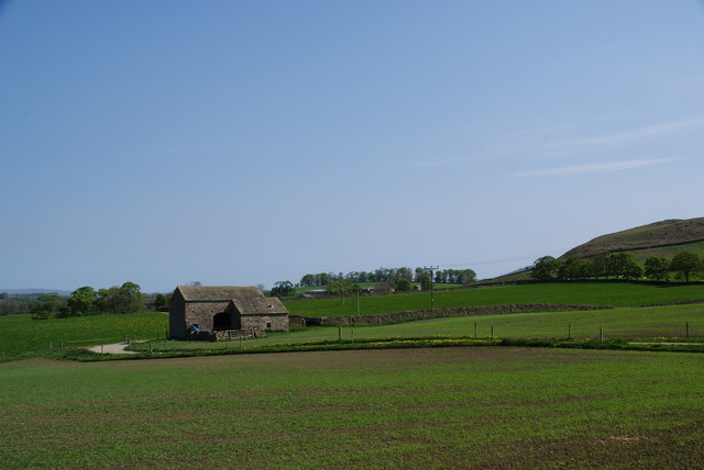
Flasby Fell is a picturesque area located in the county of Yorkshire, England. Situated between the towns of Skipton and Settle, it is a prominent feature of the Yorkshire Dales National Park. This region is known for its stunning natural landscapes, and Flasby Fell is no exception.

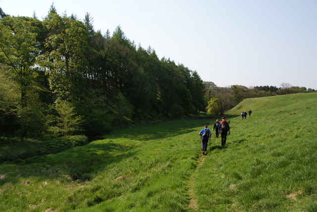
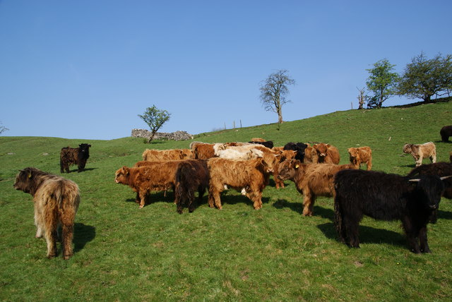
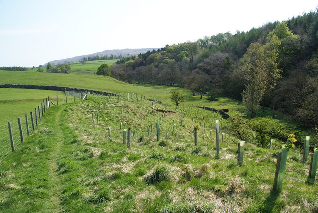
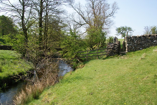
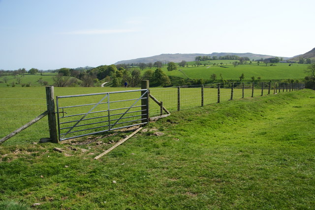
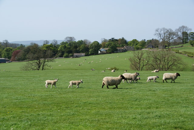
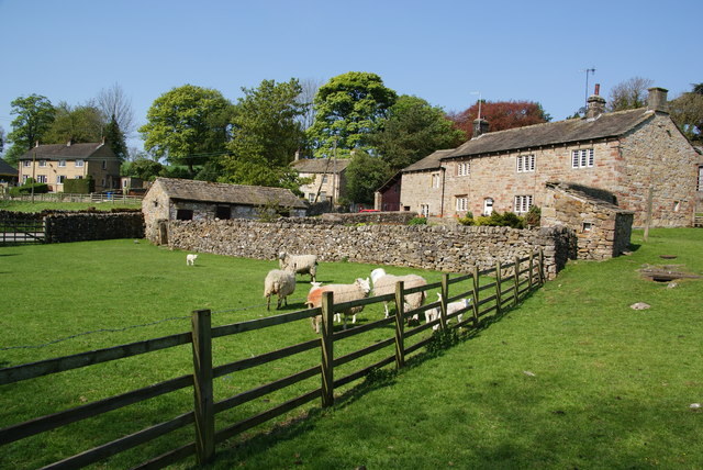
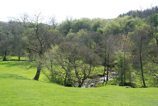
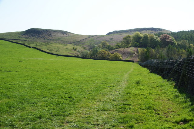
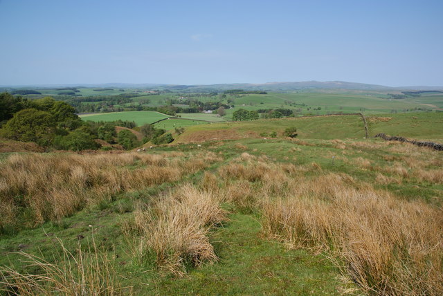
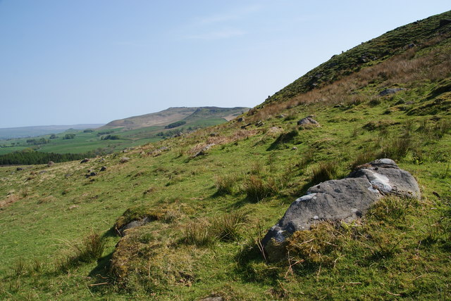
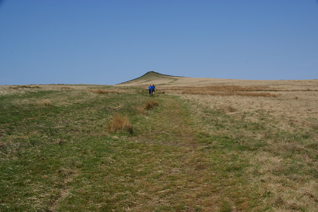
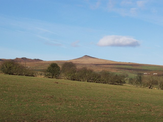
Covering an area of approximately 3 square kilometers, Flasby Fell is characterized by its rolling hills, expansive moorland, and breathtaking views. The terrain is predominantly covered in heather and grasses, providing a vibrant display of colors throughout the year. The fell is also home to several species of wildlife, including birds of prey such as kestrels and buzzards, as well as sheep and other grazing animals.

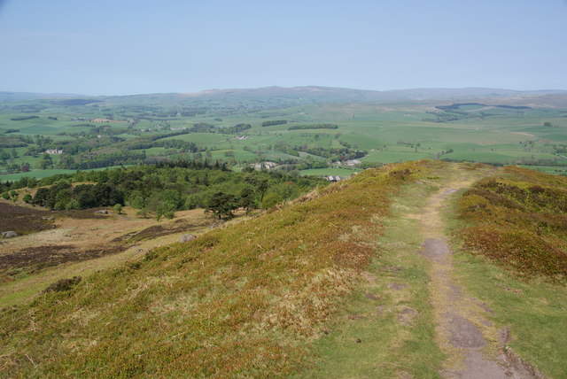
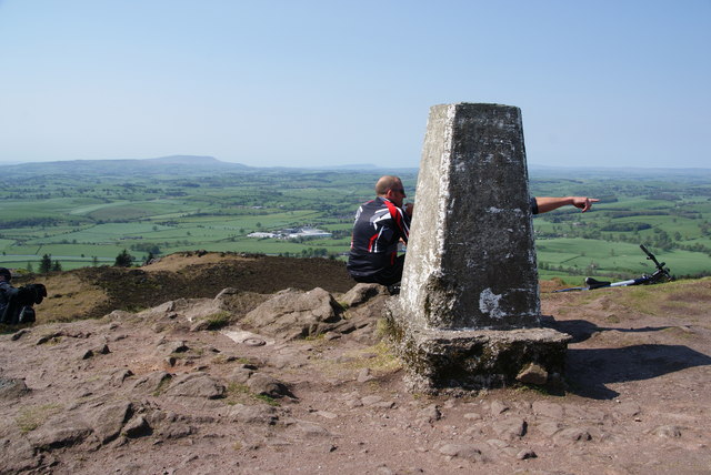
Flasby Fell offers a variety of walking and hiking routes, allowing visitors to explore its diverse landscapes. The paths are well-maintained, making it accessible for both experienced hikers and those seeking a leisurely stroll. From the summit, visitors can enjoy panoramic views of the surrounding countryside, including the nearby Yorkshire Dales and the Ribble Valley.

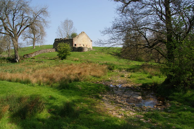
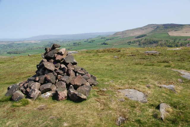
The area surrounding Flasby Fell is rich in history and heritage. There are several ancient monuments and sites of interest in the vicinity, such as the Flasby Stone Circle, which dates back to the Bronze Age. These archaeological remains add an extra layer of intrigue to the natural beauty of the fell.

Overall, Flasby Fell is a captivating destination for nature lovers and outdoor enthusiasts. Its stunning landscapes, diverse wildlife, and historical significance make it a must-visit location in Yorkshire.

If you have any feedback on the listing, please let us know in the comments section below.

Flasby Fell Images

Images are sourced within 2km of 54.002435/-2.0579372 or Grid Reference SD9656. Thanks to Geograph Open Source API. All images are credited.

Path by Hetton Beck This path leads eventually to Flasby.
Path by Hetton Beck
This path leads eventually to Flasby.
Young cattle near Mill Laithe These are by the footpath between Hetton and Flasby.
Young cattle near Mill Laithe
These are by the footpath between Hetton and Flasby.
New plantation above Flasby Beck The new trees will form mixed but mostly broad-leaved woodland.
New plantation above Flasby Beck
The new trees will form mixed but mostly broad-leaved woodland.
Narrow stile by Flasby Beck In the trees you can just see the bridge carrying the access track to Flasby Moor Side Farm.
Narrow stile by Flasby Beck
In the trees you can just see the bridge carrying the access track to Flasby Moor Side Farm.
Gate between fields above Flasby Flasby is out of sight in the dip ahead. We had inadvertently wandered away from the path which is nearer to Flasby Beck.
Gate between fields above Flasby
Flasby is out of sight in the dip ahead. We had inadvertently wandered away from the path which is nearer to Flasby Beck.
Sheep near Flasby Flasby is in the trees ahead.
Sheep near Flasby
Flasby is in the trees ahead.
Holme Laithe
Holme Laithe
Flasby As seen from the footpath alongside Flasby Beck.
Flasby
As seen from the footpath alongside Flasby Beck.
Flasby Beck Viewed from the side of Holme Laithe.
Flasby Beck
Viewed from the side of Holme Laithe.
Oldfield Laithe On the western lower slopes of Flasby Fell.
Oldfield Laithe
On the western lower slopes of Flasby Fell.
Path heading for Flasby Fell The access land begins at the next wall. On the map, the path strikes further left to the gap in the wall, but most current usage keeps by the wall till later.
Path heading for Flasby Fell
The access land begins at the next wall. On the map, the path strikes further left to the gap in the wall, but most current usage keeps by the wall till later.
The lower slopes of Flasby Fell A small beck runs down here, with the potential for making the ground boggy. In the distance are the Bowland hills.
The lower slopes of Flasby Fell
A small beck runs down here, with the potential for making the ground boggy. In the distance are the Bowland hills.
The northern side of Rough Haw Beyond is Rylstone Fell.
The northern side of Rough Haw
Beyond is Rylstone Fell.
Cairn at the top of Rough Haw Rylstone Fell is behind.
Cairn at the top of Rough Haw
Rylstone Fell is behind.
The gap between Rough Haw and Sharp Haw Looking from Rough Haw towards Sharp Haw.
The gap between Rough Haw and Sharp Haw
Looking from Rough Haw towards Sharp Haw.
The north end of Sharp Haw hilltop This is taken from the trig point.
The north end of Sharp Haw hilltop
This is taken from the trig point.
Trig point on Sharp Haw It wasn't possible to view this without people. In the distance is Pendle, and to the right of it Longridge Fell.
Trig point on Sharp Haw
It wasn't possible to view this without people. In the distance is Pendle, and to the right of it Longridge Fell.
Skyrakes A large expanse of smoothly contoured open moorland.
Skyrakes
A large expanse of smoothly contoured open moorland.
Show me another place!

Flasby Fell is located at Grid Ref: SD9656 (Lat: 54.002435, Lng: -2.0579372)

Division: West Riding

Administrative County: North Yorkshire

District: Craven

Police Authority: North Yorkshire

What 3 Words

///herring.reply.mandolin. Near Gargrave, North Yorkshire

Related Wikis

Sharp Haw

Sharp Haw is a hill on the southern edge of the Yorkshire Dales, located just within the National Park. Being the last outpost of the hills before the...

Cracoe

Cracoe is a small village and civil parish in the Craven district of North Yorkshire, England. It is situated near to Rylstone and about 6 miles south...

Flasby

Flasby is a hamlet in the Yorkshire Dales in North Yorkshire, England. It is one of the two settlements, with Winterburn, in the civil parish of Flasby...

Hetton, North Yorkshire

Hetton is a small Dales village in the civil parish of Hetton-cum-Bordley, in the North Yorkshire district of North Yorkshire, England, situated 5.75 miles...

Rylstone

Rylstone is a village and civil parish in the Craven district of North Yorkshire, England. It is situated very near to Cracoe and about 6 miles south west...

St Peter's Church, Rylstone

St Peter's Church is in the village of Rylstone, North Yorkshire, England. It is an active Anglican parish church in the deanery of Skipton, the archdeaconry...

Rylstone railway station

Rylstone railway station was a railway station that served the small village of Rylstone in North Yorkshire, England. It was built by the Yorkshire Dales...

Eshton

Eshton is a small village and civil parish in the Craven district of North Yorkshire, England. At the 2011 Census the population was less than 100 and...

Nearby Amenities

Located within 500m of 54.002435,-2.0579372
Rough Haw
Ele: 305
Natural: peak
Source: OS 1:25k
Source Ele: OS 150,publ 1853
Lat/Long: 53.9988811/-2.0572805
Flasby Fell
Natural: fell
Source: NPE
Lat/Long: 54.0017281/-2.0595467
Natural: spring
Source: OS 1:25k
Lat/Long: 54.0026705/-2.0571125
Natural: peak
Source: aerial_imagery
Lat/Long: 54.002961/-2.061207
Ele: 923 ft
Fixme: position interpolated
Man Made: survey_point
Source: OS 150,publ 1853
Lat/Long: 54.0067656/-2.0589378
Natural: spring
Source: OS-OpenData_StreetView_2016_04
Lat/Long: 54.0000664/-2.0530877
The data included in this document is from www.openstreetmap.org. The data is made available under ODbL.

Have you been to Flasby Fell?

Leave your review of Flasby Fell below (or comments, questions and feedback).