Biddulph Park

Downs, Moorland in Staffordshire Staffordshire Moorlands

England

Biddulph Park

Wolf Lowe Farm
Wolf Lowe Farm Credit: Eirian Evans

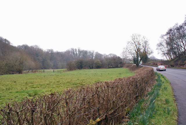
Biddulph Park is a picturesque and expansive public park located in the county of Staffordshire, England. Spanning over 50 acres, it offers a range of natural landscapes including downs and moorland, making it a popular destination for nature enthusiasts and outdoor recreation.

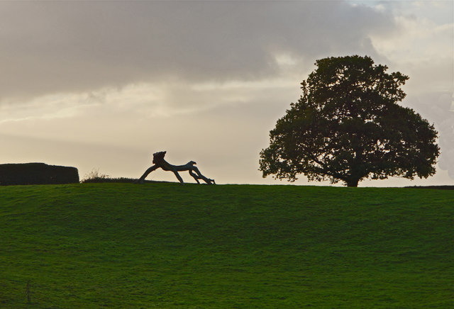
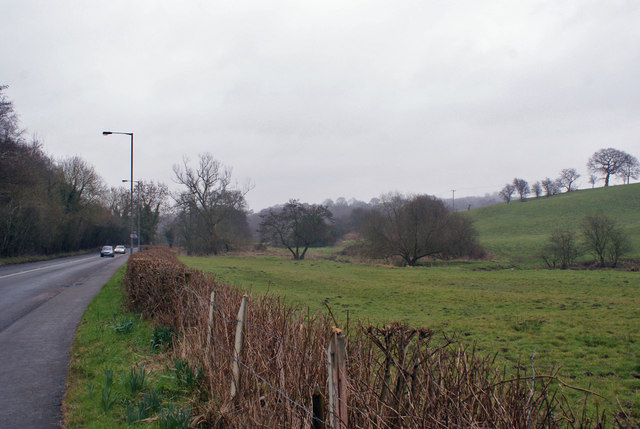
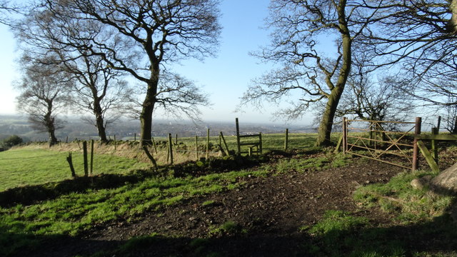
The park features rolling hills covered in lush green grass, providing visitors with ample space for leisurely walks, picnics, and sports activities. It is adorned with a variety of trees, including oak, beech, and birch, which contribute to the park's vibrant and diverse ecosystem. These trees also provide shade during the summer months, creating a pleasant environment for relaxation.

Biddulph Park is known for its outstanding views, with the downs offering panoramic vistas of the surrounding countryside. The moorland area, on the other hand, showcases a rugged and wild landscape, characterized by heather, gorse, and bracken. This section of the park attracts birdwatchers, as it is home to various species of birds, including kestrels, skylarks, and lapwings.

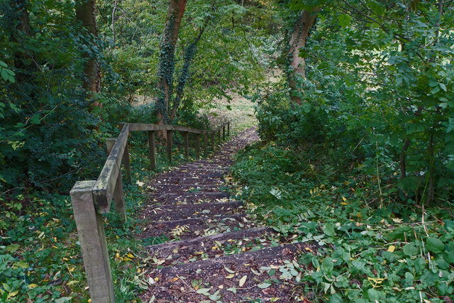
In addition to its natural beauty, Biddulph Park boasts several amenities for visitors. These include well-maintained footpaths, cycling routes, and a children's play area. The park also features a café where visitors can enjoy refreshments and take in the stunning views.

Overall, Biddulph Park offers a serene and idyllic setting for individuals and families seeking to connect with nature and enjoy outdoor activities. Its diverse landscapes and beautiful surroundings make it a must-visit destination in Staffordshire.

If you have any feedback on the listing, please let us know in the comments section below.

Biddulph Park Images

Images are sourced within 2km of 53.144647/-2.1492244 or Grid Reference SJ9060. Thanks to Geograph Open Source API. All images are credited.

Wolf Lowe Farm
Wolf Lowe Farm
Beyond repair? Dilapidated barns at Cloud Park Farm.
Beyond repair?
Dilapidated barns at Cloud Park Farm.
BIG drainage Septic tank awaiting installation.
BIG drainage
Septic tank awaiting installation.
How many walkers ... can you fit in a 'phone box?
How many walkers ...
can you fit in a 'phone box?
Mobile Phone? No! Mobile Library, Timbersbrook. (Ignore the O/S Map: you will never make a call from here.)
Mobile Phone?
No! Mobile Library, Timbersbrook. (Ignore the O/S Map: you will never make a call from here.)
The Beast of Timbersbrook!
A lot of steps Timbersbrook Country Park
A lot of steps
Timbersbrook Country Park
View over a hedge Looking north towards Whitemoor, over the valley of Biddulph Brook, from the side of the A527.
View over a hedge
Looking north towards Whitemoor, over the valley of Biddulph Brook, from the side of the A527.
Valley of Biddulph Brook Here, the brook flows through grazing land, approximately parallel to the A527 road.
Valley of Biddulph Brook
Here, the brook flows through grazing land, approximately parallel to the A527 road.
The green, Timbersbrook Just a small triangle in the crossroads, but large enough to accommodate a seat, a fingerpost, telephone kiosk and postbox. The fingerpost is a traditional Cheshire County Council cast iron design, but the shield carries the letters BDC rather than the normal CCC. This almost certainly represents Buglawton (Urban) District Council.
The K6 telephone kiosk has like many others been converted into a book exchange.
The green, Timbersbrook
Just a small triangle in the crossroads, but large enough to accommodate a seat, a fingerpost, telephone kiosk and postbox. The fingerpost is a traditional Cheshire County Council cast iron design, but the shield carries the letters BDC rather than the normal CCC. This almost certainly represents Buglawton (Urban) District Council. The K6 telephone kiosk has like many others been converted into a book exchange.
Crossroads at Timbersbrook See <a title="https://www.geograph.org.uk/photo/5076292" href="https://www.geograph.org.uk/photo/5076292">Link</a> for a close up of the fingerpost.
Crossroads at Timbersbrook
See Link for a close up of the fingerpost.
Timbersbrook Primitive Methodist Chapel Now converted to residential use. The house nameplate indicates that the chapel was built in 1882, although the inscription in the gable is now illegible.
Timbersbrook Primitive Methodist Chapel
Now converted to residential use. The house nameplate indicates that the chapel was built in 1882, although the inscription in the gable is now illegible.
Stile at Rainow Hill, Timbersbrook
Old Milestone by Overton Road, Biddulph Park Carved stone post by the UC road, in parish of BIDDULPH (STAFFORDSHIRE MOORLANDS District), Overton Road, Biddulph Park, on grass in front of drystone wall, on West side of road. Newcastle triangle stone, erected by the Tunstall & Bosley turnpike trust in the 19th century. 

Inscription reads:-
: TO / Macclesfield / 9 Miles : : TO / Newcastle / 11 / Miles : 

Grade II listed. List Entry Number: 1392588
<span class="nowrap"><a title="https://historicengland.org.uk/listing/the-list/list-entry/1392588" rel="nofollow ugc noopener" href="https://historicengland.org.uk/listing/the-list/list-entry/1392588">Link</a><img style="margin-left:2px;" alt="External link" title="External link - shift click to open in new window" src="https://s1.geograph.org.uk/img/external.png" width="10" height="10"/></span>

Milestone Society National ID: ST_MFNC09.
Old Milestone by Overton Road, Biddulph Park
Carved stone post by the UC road, in parish of BIDDULPH (STAFFORDSHIRE MOORLANDS District), Overton Road, Biddulph Park, on grass in front of drystone wall, on West side of road. Newcastle triangle stone, erected by the Tunstall & Bosley turnpike trust in the 19th century. Inscription reads:- : TO / Macclesfield / 9 Miles : : TO / Newcastle / 11 / Miles : Grade II listed. List Entry Number: 1392588 LinkExternal link Milestone Society National ID: ST_MFNC09.
Old Milestone by the A527, Whitemoor, BiddulphParish Carved stone post by the A527, in parish of BIDDULPH (STAFFORDSHIRE MOORLANDS District), Whitemoor near County Boundary, in low wall, on West side of road. Newcastle triangle stone, erected by the New Biddulph turnpike trust in the 19th century. Defaced.

Inscription reads:- : TO / Congleton / 1 Mile : : TO / Newcastle / 11 / Miles :   

Milestone Society National ID: ST_NCCO11.
Old Milestone by the A527, Whitemoor, BiddulphParish
Carved stone post by the A527, in parish of BIDDULPH (STAFFORDSHIRE MOORLANDS District), Whitemoor near County Boundary, in low wall, on West side of road. Newcastle triangle stone, erected by the New Biddulph turnpike trust in the 19th century. Defaced. Inscription reads:- : TO / Congleton / 1 Mile : : TO / Newcastle / 11 / Miles : Milestone Society National ID: ST_NCCO11.
Old Wayside Cross by Overton Road, Biddulph parish Shepherd's Cross, old head and shaft, by the wayside, in parish of Biddulph (Staffordshire Moorlands District), Overton Road, near Biddulph Grange Garden.

Grade II listed.
List Entry Number: 1190201 <span class="nowrap"><a title="https://historicengland.org.uk/listing/the-list/list-entry/1190201" rel="nofollow ugc noopener" href="https://historicengland.org.uk/listing/the-list/list-entry/1190201">Link</a><img style="margin-left:2px;" alt="External link" title="External link - shift click to open in new window" src="https://s1.geograph.org.uk/img/external.png" width="10" height="10"/></span>
Scheduled Monument.
List Entry Number: 1014689 <span class="nowrap"><a title="https://historicengland.org.uk/listing/the-list/list-entry/1014689" rel="nofollow ugc noopener" href="https://historicengland.org.uk/listing/the-list/list-entry/1014689">Link</a><img style="margin-left:2px;" alt="External link" title="External link - shift click to open in new window" src="https://s1.geograph.org.uk/img/external.png" width="10" height="10"/></span>

To be surveyed

Milestone Society National ID: STMO_BID01
Old Wayside Cross by Overton Road, Biddulph parish
Shepherd's Cross, old head and shaft, by the wayside, in parish of Biddulph (Staffordshire Moorlands District), Overton Road, near Biddulph Grange Garden. Grade II listed. List Entry Number: 1190201 LinkExternal link Scheduled Monument. List Entry Number: 1014689 LinkExternal link To be surveyed Milestone Society National ID: STMO_BID01
Direction Sign – Signpost Located at Timbersbrook, on a grass triangle at the junction of Under Rainow Road, Weathercocok Lane and Tunstall Road in Congleton parish. 4 arms and pawn finial. See also <a title="https://www.geograph.org.uk/photo/5076292" href="https://www.geograph.org.uk/photo/5076292">Link</a>.

Milestone Society National ID: CH_SJ8962
Direction Sign – Signpost
Located at Timbersbrook, on a grass triangle at the junction of Under Rainow Road, Weathercocok Lane and Tunstall Road in Congleton parish. 4 arms and pawn finial. See also Link. Milestone Society National ID: CH_SJ8962
Animal Statue There were a few others dotted around the farm, Not what you expect to see by a busy road.
Animal Statue
There were a few others dotted around the farm, Not what you expect to see by a busy road.
Show me another place!

Biddulph Park is located at Grid Ref: SJ9060 (Lat: 53.144647, Lng: -2.1492244)

Administrative County: Staffordshire

District: Staffordshire Moorlands

Police Authority: Staffordshire

What 3 Words

///crowned.acquaint.guessing. Near Biddulph, Staffordshire

Nearby Locations

Newtown Biddulph Park

Related Wikis

The Bridestones

The Bridestones is a chambered cairn, near Congleton, Cheshire, England, that was constructed in the Neolithic period about 3500–2400 BC. It was described...

Biddulph Grange Country Park

Biddulph Grange Country Park is a country park in Biddulph, UK. It was originally part of Biddulph Grange. == Contents == The 73 acres (0.30 km2) park...
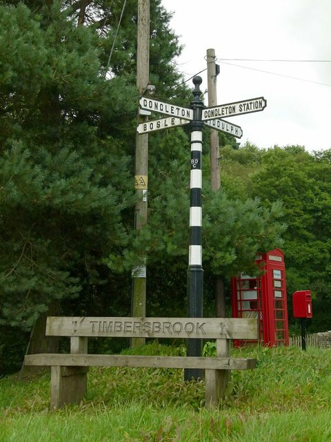
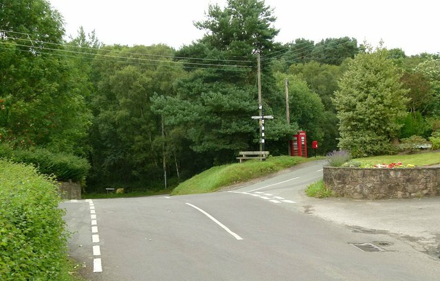
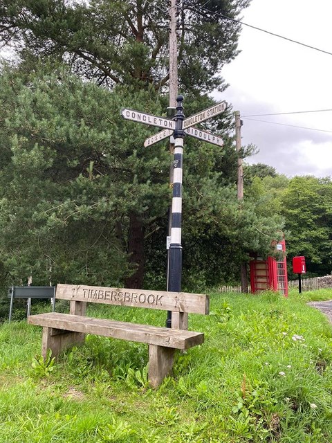
Timbersbrook

Timbersbrook is a small village in the town parish of Congleton, Cheshire, England. == References ==

Biddulph Grange

Biddulph Grange is a National Trust landscaped garden, in Biddulph near Stoke-on-Trent, Staffordshire, England. It is separate from Biddulph Grange Country...

Gritstone Trail

The Gritstone Trail, or Cheshire Gritstone Trail, is a 35-mile (56 km) long-distance footpath in England which follows the most westerly hills of the Peak...

Biddulph Moor

Biddulph Moor is a village located on the hill which bears the same name. It is in Biddulph parish and is a part of the Staffordshire Moorlands district...

The Cloud (hill)

The Cloud or Bosley Cloud is a prominent hill on the border between Cheshire and Staffordshire a couple of miles west of the Peak District National Park...

Biddulph

Biddulph is a town in Staffordshire, England, 8.5 miles (14 km) north of Stoke-on-Trent and 4.5 miles (7 km) south-east of Congleton, Cheshire. == Origin... ==

Nearby Amenities

Located within 500m of 53.144647,-2.1492244
Post Box
Ref: ST8 404
Lat/Long: 53.1434913/-2.1432776
Bus Stop
Biddulph Park Road
Naptan AtcoCode: 3800C812100
Naptan Bearing: N
Naptan CommonName: Biddulph Park Road
Naptan Indicator: Opp
Naptan Landmark: Biddulph Park Rd
Naptan Street: Overton Rd
Naptan Verified: no
Source: naptan_import
Lat/Long: 53.1422524/-2.1545232
Bus Stop
Patchetts Corner
Naptan AtcoCode: 3800C820300
Naptan Bearing: W
Naptan CommonName: Patchetts Corner
Naptan Indicator: Adj
Naptan Landmark: Patchetts Corner
Naptan Street: Biddulph Common Rd
Naptan Verified: no
Source: naptan_import
Lat/Long: 53.1436152/-2.1430012
Bus Stop
Patchetts Corner
Naptan AtcoCode: 3800C820301
Naptan Bearing: E
Naptan CommonName: Patchetts Corner
Naptan Indicator: Adj
Naptan Landmark: Patchetts Corner
Naptan Street: Biddulph Common Rd
Naptan Verified: no
Source: naptan_import
Lat/Long: 53.1435708/-2.1425077
Ele: 286.3563232
Lat/Long: 53.143582/-2.1432013
Barrier: stile
Ele: 289.7208252
Steps: 1
Stile: stepover
Lat/Long: 53.1422691/-2.1430712
Barrier: stile
Steps: 1
Stile: wall
Lat/Long: 53.1436394/-2.1553595
Barrier: stile
Steps: 1
Stile: wall
Lat/Long: 53.1431234/-2.1555763
Barrier: stile
Steps: 2
Stile: wall
Lat/Long: 53.1445214/-2.1554073
Barrier: stile
Steps: 3
Stile: wall
Lat/Long: 53.1459082/-2.1558288
Barrier: stile
Steps: 1
Stile: wall
Lat/Long: 53.1455294/-2.1554371
Telephone
Booth: K6
Covered: booth
Fixme: does this phone box have a defibrillator in it?
Man Made: telephone_box
Lat/Long: 53.1435043/-2.1426918
The data included in this document is from www.openstreetmap.org. The data is made available under ODbL.

Have you been to Biddulph Park?

Leave your review of Biddulph Park below (or comments, questions and feedback).