Newtown

Settlement in Staffordshire Staffordshire Moorlands

England

Newtown

Wolf Lowe Farm
Wolf Lowe Farm Credit: Eirian Evans

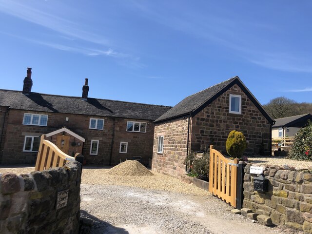
Newtown is a small rural village located in the county of Staffordshire, England. Situated in the heart of the country, it is surrounded by picturesque countryside and rolling hills, offering a peaceful and idyllic setting for its residents and visitors.

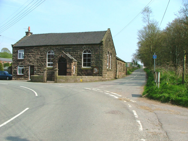
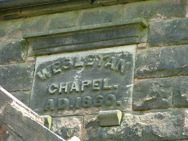
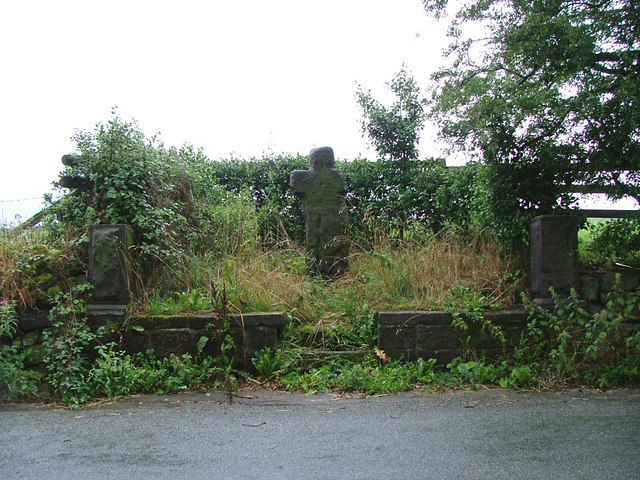
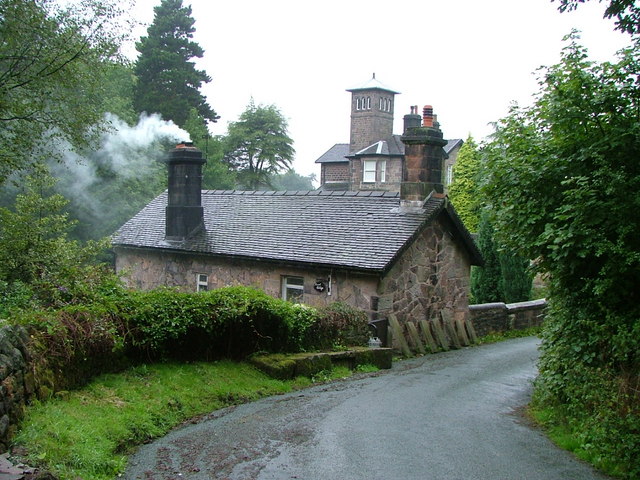
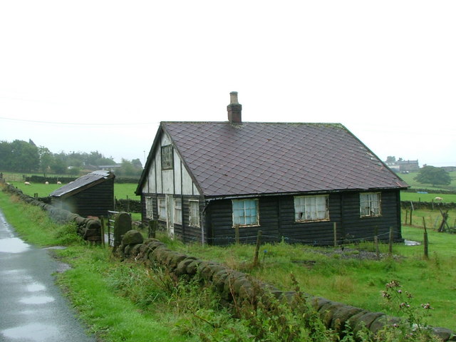
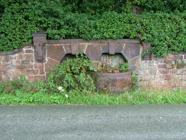
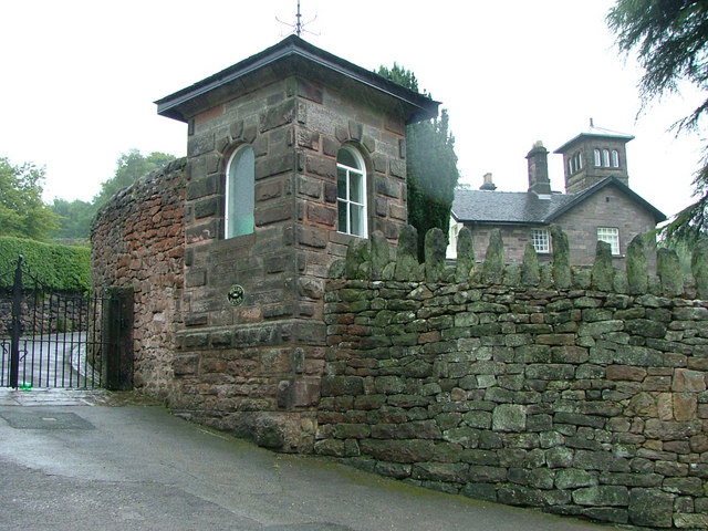
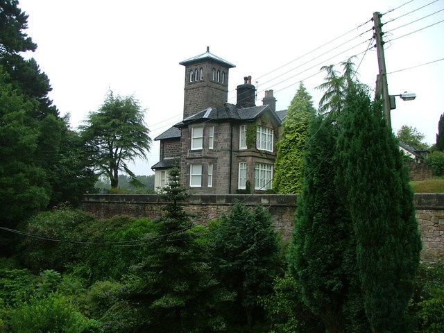
The village has a rich history dating back centuries, evident in its well-preserved architecture and traditional buildings. Newtown boasts a charming mix of period cottages, old farmhouses, and historic landmarks, creating a quintessentially English atmosphere.

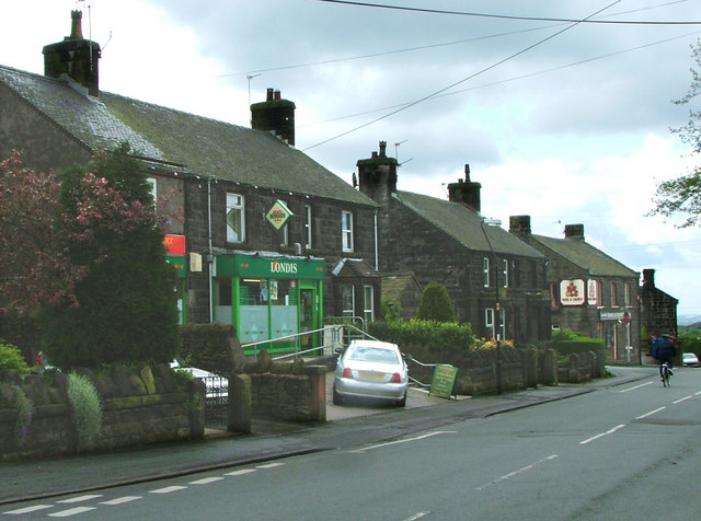
Despite its small size, Newtown is not lacking in amenities. The village has a primary school, a post office, a community center, and a local pub, providing essential services and a strong sense of community. Additionally, it benefits from excellent transport connections, with easy access to nearby towns and cities through a network of well-maintained roads.

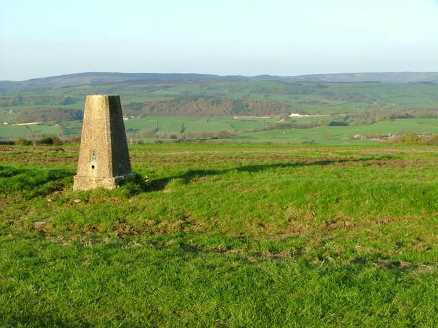
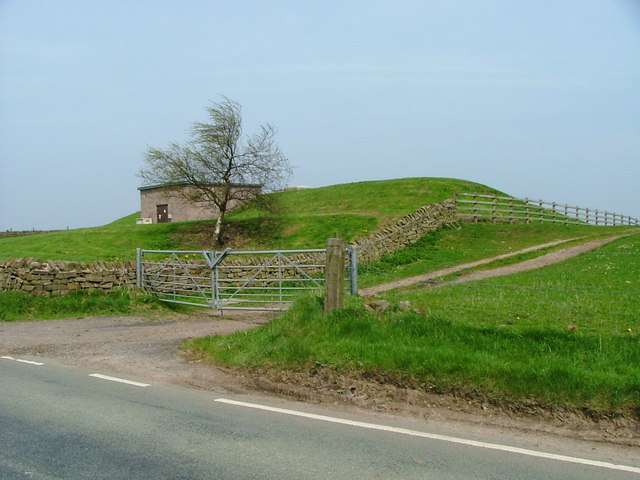
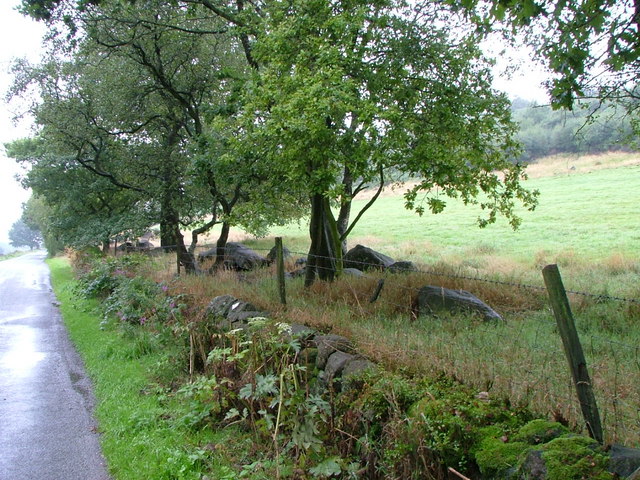
Nature enthusiasts will find Newtown particularly appealing, as the village is surrounded by stunning natural beauty. There are ample opportunities for outdoor activities such as hiking, cycling, and horse riding, with several walking trails and bridleways crisscrossing the area.

Newtown's residents enjoy a peaceful and close-knit community, where neighbors know each other and social events are regularly organized. The village also hosts seasonal festivals and fairs, attracting visitors from the surrounding areas.

In conclusion, Newtown, Staffordshire offers a tranquil and picturesque setting, steeped in history and natural beauty. It provides a perfect escape from the hustle and bustle of city life, making it an appealing place to live or visit for those seeking a peaceful and charming rural experience.

If you have any feedback on the listing, please let us know in the comments section below.

Newtown Images

Images are sourced within 2km of 53.140834/-2.138548 or Grid Reference SJ9060. Thanks to Geograph Open Source API. All images are credited.

Wolf Lowe Farm
Wolf Lowe Farm
Old Milestone by Overton Road, Biddulph Park Carved stone post by the UC road, in parish of BIDDULPH (STAFFORDSHIRE MOORLANDS District), Overton Road, Biddulph Park, on grass in front of drystone wall, on West side of road. Newcastle triangle stone, erected by the Tunstall & Bosley turnpike trust in the 19th century. 

Inscription reads:-
: TO / Macclesfield / 9 Miles : : TO / Newcastle / 11 / Miles : 

Grade II listed. List Entry Number: 1392588
<span class="nowrap"><a title="https://historicengland.org.uk/listing/the-list/list-entry/1392588" rel="nofollow ugc noopener" href="https://historicengland.org.uk/listing/the-list/list-entry/1392588">Link</a><img style="margin-left:2px;" alt="External link" title="External link - shift click to open in new window" src="https://s1.geograph.org.uk/img/external.png" width="10" height="10"/></span>

Milestone Society National ID: ST_MFNC09.
Old Milestone by Overton Road, Biddulph Park
Carved stone post by the UC road, in parish of BIDDULPH (STAFFORDSHIRE MOORLANDS District), Overton Road, Biddulph Park, on grass in front of drystone wall, on West side of road. Newcastle triangle stone, erected by the Tunstall & Bosley turnpike trust in the 19th century. Inscription reads:- : TO / Macclesfield / 9 Miles : : TO / Newcastle / 11 / Miles : Grade II listed. List Entry Number: 1392588 LinkExternal link Milestone Society National ID: ST_MFNC09.
Old Wayside Cross by Overton Road, Biddulph parish Shepherd's Cross, old head and shaft, by the wayside, in parish of Biddulph (Staffordshire Moorlands District), Overton Road, near Biddulph Grange Garden.

Grade II listed.
List Entry Number: 1190201 <span class="nowrap"><a title="https://historicengland.org.uk/listing/the-list/list-entry/1190201" rel="nofollow ugc noopener" href="https://historicengland.org.uk/listing/the-list/list-entry/1190201">Link</a><img style="margin-left:2px;" alt="External link" title="External link - shift click to open in new window" src="https://s1.geograph.org.uk/img/external.png" width="10" height="10"/></span>
Scheduled Monument.
List Entry Number: 1014689 <span class="nowrap"><a title="https://historicengland.org.uk/listing/the-list/list-entry/1014689" rel="nofollow ugc noopener" href="https://historicengland.org.uk/listing/the-list/list-entry/1014689">Link</a><img style="margin-left:2px;" alt="External link" title="External link - shift click to open in new window" src="https://s1.geograph.org.uk/img/external.png" width="10" height="10"/></span>

To be surveyed

Milestone Society National ID: STMO_BID01
Old Wayside Cross by Overton Road, Biddulph parish
Shepherd's Cross, old head and shaft, by the wayside, in parish of Biddulph (Staffordshire Moorlands District), Overton Road, near Biddulph Grange Garden. Grade II listed. List Entry Number: 1190201 LinkExternal link Scheduled Monument. List Entry Number: 1014689 LinkExternal link To be surveyed Milestone Society National ID: STMO_BID01
Bridestone Burial Chamber, Timbersbrook This Burial Chamber near Timbersbrook lies close to a minor road about four miles east of Congleton.
Bridestone Burial Chamber, Timbersbrook
This Burial Chamber near Timbersbrook lies close to a minor road about four miles east of Congleton.
Trig Point overlooking Horton Valley The woodland in the distance is surrounding Rudyard Reservoir (SJ9459)
Trig Point overlooking Horton Valley
The woodland in the distance is surrounding Rudyard Reservoir (SJ9459)
Biddulph Park Methodist Chapel Established in 1860. The left hand part of the building is a private dwelling, not surprisingly called Chapel Cottage.
Biddulph Park Methodist Chapel
Established in 1860. The left hand part of the building is a private dwelling, not surprisingly called Chapel Cottage.
Date stone of Biddulph Park Chapel
Reservoir This enclosed reservoir serves Biddulph Moor
Reservoir
This enclosed reservoir serves Biddulph Moor
Shepherd's Cross Possibly a Christianised standing stone (menhir) or 14th century wayside cross.
Shepherd's Cross
Possibly a Christianised standing stone (menhir) or 14th century wayside cross.
Hurst Cottage Built on a slope by a narrow bridge by a sharp bend with a brook running alongside. Not the most obvious place to build but a beautiful situation
Hurst Cottage
Built on a slope by a narrow bridge by a sharp bend with a brook running alongside. Not the most obvious place to build but a beautiful situation
Overton Hall A barn here (possibly the one on the right) is currently (August 2006) for sale at £565,000. It's enough to make the cows pig-sick.
Overton Hall
A barn here (possibly the one on the right) is currently (August 2006) for sale at £565,000. It's enough to make the cows pig-sick.
Derelict I hope this isn't inhabited as many of the windows are smashed, but surely something could be done with it.
Derelict
I hope this isn't inhabited as many of the windows are smashed, but surely something could be done with it.
Bridleway Not used a lot, I presume.
Bridleway
Not used a lot, I presume.
Long Edge This is the site of a disused quarry, hence the number of boulders lying around.
Long Edge
This is the site of a disused quarry, hence the number of boulders lying around.
The Fox is no more. This pleasant new house used to be the Fox Inn, known as the Fox and Paw in 1749. It still appears on the OS maps as an inn.
The Fox is no more.
This pleasant new house used to be the Fox Inn, known as the Fox and Paw in 1749. It still appears on the OS maps as an inn.
A pair of dry troughs Directly opposite the Shepherd's Cross - there is a large raised enclosure behind these which may have contained a well to feed these.
A pair of dry troughs
Directly opposite the Shepherd's Cross - there is a large raised enclosure behind these which may have contained a well to feed these.
Spring House A small gatehouse at the entrance to this fantastic towered house.
Spring House
A small gatehouse at the entrance to this fantastic towered house.
Spring House pictured across the gardens of Hurst Cottage
Spring House
pictured across the gardens of Hurst Cottage
Show me another place!

Newtown is located at Grid Ref: SJ9060 (Lat: 53.140834, Lng: -2.138548)

Administrative County: Staffordshire

District: Staffordshire Moorlands

Police Authority: Staffordshire

What 3 Words

///range.dive.beanbag. Near Biddulph, Staffordshire

Nearby Locations

Biddulph Park Newtown

Related Wikis

Biddulph Grange Country Park

Biddulph Grange Country Park is a country park in Biddulph, UK. It was originally part of Biddulph Grange. == Contents == The 73 acres (0.30 km2) park...

The Bridestones

The Bridestones is a chambered cairn, near Congleton, Cheshire, England, that was constructed in the Neolithic period about 3500–2400 BC. It was described...

Biddulph Grange

Biddulph Grange is a National Trust landscaped garden, in Biddulph near Stoke-on-Trent, Staffordshire, England. It is separate from Biddulph Grange Country...

Biddulph Moor

Biddulph Moor is a village located on the hill which bears the same name. It is in Biddulph parish and is a part of the Staffordshire Moorlands district...

Nearby Amenities

Located within 500m of 53.140834,-2.138548
Post Box
Ref: ST8 404
Lat/Long: 53.1434913/-2.1432776
Bus Stop
Patchetts Corner
Naptan AtcoCode: 3800C820300
Naptan Bearing: W
Naptan CommonName: Patchetts Corner
Naptan Indicator: Adj
Naptan Landmark: Patchetts Corner
Naptan Street: Biddulph Common Rd
Naptan Verified: no
Source: naptan_import
Lat/Long: 53.1436152/-2.1430012
Bus Stop
Patchetts Corner
Naptan AtcoCode: 3800C820301
Naptan Bearing: E
Naptan CommonName: Patchetts Corner
Naptan Indicator: Adj
Naptan Landmark: Patchetts Corner
Naptan Street: Biddulph Common Rd
Naptan Verified: no
Source: naptan_import
Lat/Long: 53.1435708/-2.1425077
Ele: 262.3234863
Lat/Long: 53.1384003/-2.1440948
Ele: 254.8732910
Lat/Long: 53.137862/-2.1441731
Barrier: stile
Ele: 293.3256836
Steps: 1
Stile: stepover
Lat/Long: 53.1407034/-2.1432338
Ele: 279.3867188
Lat/Long: 53.1393896/-2.1431941
Ele: 278.1850586
Lat/Long: 53.1393687/-2.1432273
Ele: 260.8814697
Lat/Long: 53.1382335/-2.144472
Ele: 286.3563232
Lat/Long: 53.143582/-2.1432013
Barrier: stile
Ele: 289.7208252
Steps: 1
Stile: stepover
Lat/Long: 53.1422691/-2.1430712
Ele: 271.9366455
Lat/Long: 53.1368599/-2.1412357
Turning Circle
Lat/Long: 53.1385885/-2.1348972
Telephone
Booth: K6
Covered: booth
Fixme: does this phone box have a defibrillator in it?
Man Made: telephone_box
Lat/Long: 53.1435043/-2.1426918
The data included in this document is from www.openstreetmap.org. The data is made available under ODbL.

Have you been to Newtown?

Leave your review of Newtown below (or comments, questions and feedback).