Bainsford

Settlement in Stirlingshire

Scotland

Bainsford

Rosebank Distillery Partial demolition of the old distillery taking place. A new complex is beginning to take shape to form a new Distillery incorporating Visitor Experience, Cafe, retail, associated landscaping and car park.
Rosebank Distillery Credit: Eirian Evans

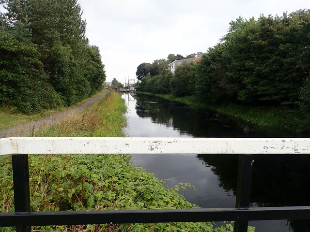
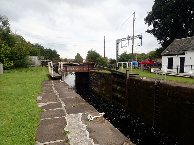
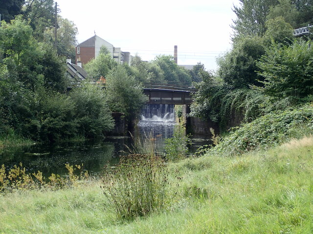
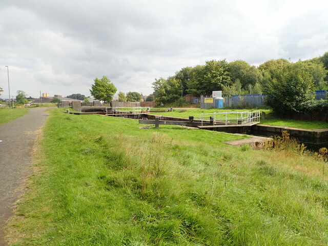
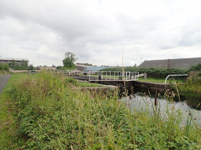
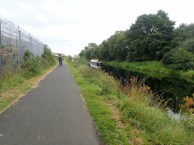
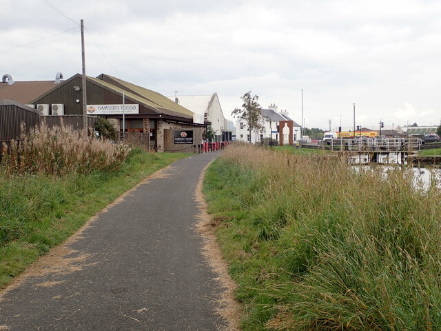
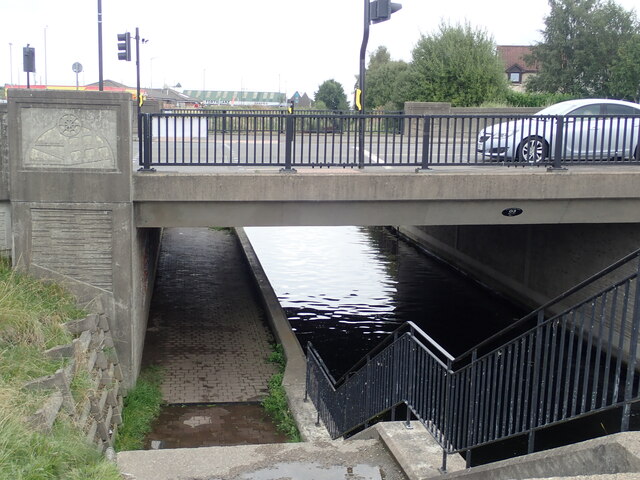
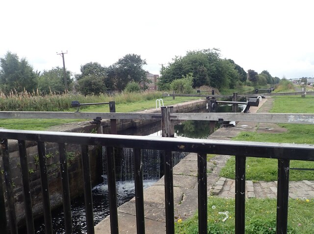
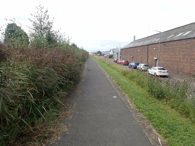
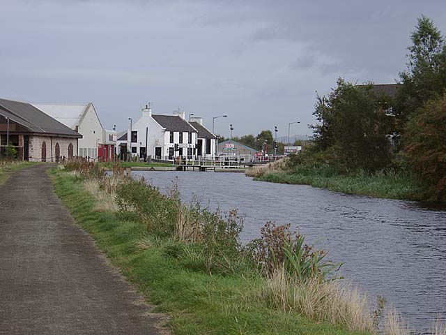
Bainsford is a small village located in the county of Stirlingshire, Scotland. Situated on the southern outskirts of Falkirk, it is part of the Falkirk Council area. Bainsford is nestled between the River Carron and the Forth and Clyde Canal, offering picturesque views and easy access to waterways.

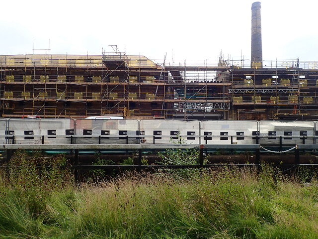
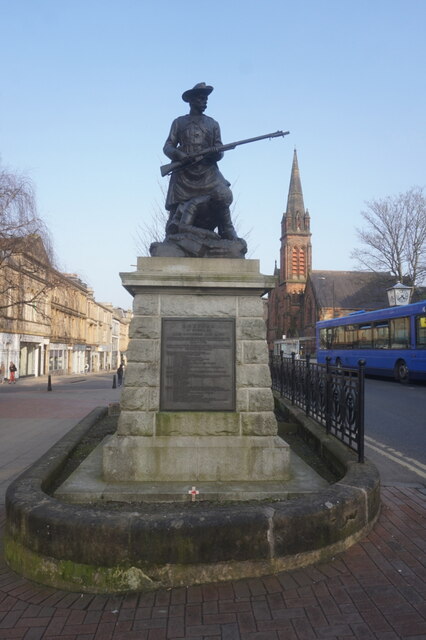
The village is known for its rich industrial history, particularly in the iron and steel industries. In the 19th and early 20th centuries, Bainsford was home to several ironworks and foundries, which played a significant role in the area's economy. Today, some remnants of this industrial past can still be seen, adding character to the village.

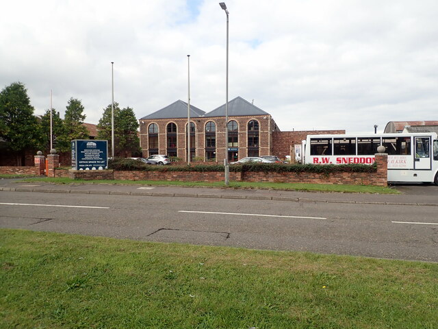
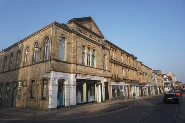
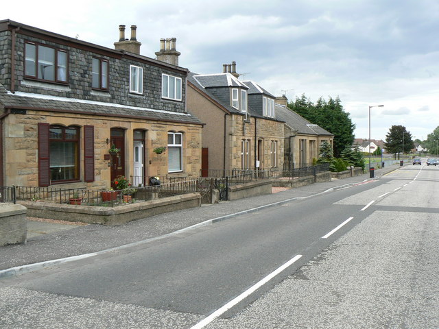
Bainsford has a close-knit community and offers a range of amenities to its residents. There are a few local shops and businesses, including a post office and convenience stores, providing everyday essentials. The village also boasts a primary school, ensuring that educational needs are catered for within the community.

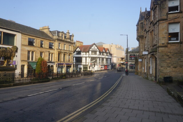
For recreational activities, Bainsford benefits from its proximity to Falkirk, where residents can access a wider range of amenities and leisure facilities. The Falkirk Wheel, a unique rotating boat lift, is a notable attraction nearby. Additionally, the area offers plenty of opportunities for outdoor enthusiasts, with scenic walking paths and cycling routes along the canal and river.

Overall, Bainsford presents a charming blend of history, community, and natural beauty, making it an appealing place to live or visit in Stirlingshire.

If you have any feedback on the listing, please let us know in the comments section below.

Bainsford Images

Images are sourced within 2km of 56.016068/-3.784377 or Grid Reference NS8881. Thanks to Geograph Open Source API. All images are credited.

Rosebank Distillery Partial demolition of the old distillery taking place. A new complex is beginning to take shape to form a new Distillery incorporating Visitor Experience, Cafe, retail, associated landscaping and car park.
Rosebank Distillery
Partial demolition of the old distillery taking place. A new complex is beginning to take shape to form a new Distillery incorporating Visitor Experience, Cafe, retail, associated landscaping and car park.
Looking down the Forth and Clyde Canal from Lock No.10
Camelon Railway Lock, No. 9 The railway bridge carries the Edinburgh to Dundee railway line.
Camelon Railway Lock, No. 9
The railway bridge carries the Edinburgh to Dundee railway line.
Camelon Railway Lock, No. 9 Taken from the towpath on the north side of the Clyde & Forth Canal
Camelon Railway Lock, No. 9
Taken from the towpath on the north side of the Clyde & Forth Canal
Merers Lock Lock No.8 on the Forth and Clyde Canal. Merchiston Road crosses the canal east of the lock
Merers Lock
Lock No.8 on the Forth and Clyde Canal. Merchiston Road crosses the canal east of the lock
Merchiston Lock This is lock No.7 on the Forth and Clyde Canal
Merchiston Lock
This is lock No.7 on the Forth and Clyde Canal
Towpath beside the Forth and Clyde Canal The barbed wire topped fence on the left surrounds an industrial area.
Towpath beside the Forth and Clyde Canal
The barbed wire topped fence on the left surrounds an industrial area.
Forth and Clyde Canal towpath Near canal lock no.5, Bainsford Lock. The B905 crosses the canal on the east side of the lock.
Forth and Clyde Canal towpath
Near canal lock no.5, Bainsford Lock. The B905 crosses the canal on the east side of the lock.
Towpath underpassing Grahams Road bridge
Offices to let on Bankside
Bankside Industrial Estate
Abbotshaugh Lock Lock No.4 on the Forth and Clyde Canal
Abbotshaugh Lock
Lock No.4 on the Forth and Clyde Canal
Canal towpath near the Bankside Industrial Estate The canal is obscured by overgrown hedge
Canal towpath near the Bankside Industrial Estate
The canal is obscured by overgrown hedge
Boer War Memorial, Newmarket Street, Falkirk
Newmarket Street, Falkirk
Upper Newmarket Street, Falkirk
The Carron Works Public House A Wetherspoons pub on Bank Street, Falkirk.
The Carron Works Public House
A Wetherspoons pub on Bank Street, Falkirk.
The Carron Works Public House
Show me another place!

Bainsford is located at Grid Ref: NS8881 (Lat: 56.016068, Lng: -3.784377)

Unitary Authority: Falkirk

Police Authority: Forth Valley

What 3 Words

///deny.method.prompting. Near Carron, Falkirk

Nearby Locations

Bainsford Mungal

Related Wikis

Bainsford

Bainsford is a small village within the Falkirk council area of Scotland. The village is situated in the Forth Valley, 1 mile (1.6 km) north of the town...

Merchiston Park

Merchiston Park () was a football ground in Bainsford, near Falkirk, which was the home of East Stirlingshire F.C. between c. 1882 and 1920. It was near...

Carron, Falkirk

Carron (Scottish Gaelic: Carrann) is a village in the Falkirk council area of Scotland. It is in the Forth Valley, about 2 miles (3.2 km) north of Falkirk...

Abbotshaugh Community Woodland

The historic site of Abbotshaugh Community Woodland, located on the south bank of the River Carron, has witnessed many changes over the past 500 years...

St Mungo's High School

St Mungo's High School is a mixed, Roman Catholic, secondary school in Falkirk, Scotland. As the only Catholic secondary school in Falkirk, St Mungo's...

Firs Park

Firs Park was a football stadium in Falkirk, Scotland, which was the home of East Stirlingshire F.C. between 1921 and 2008. It was located on Firs Street...
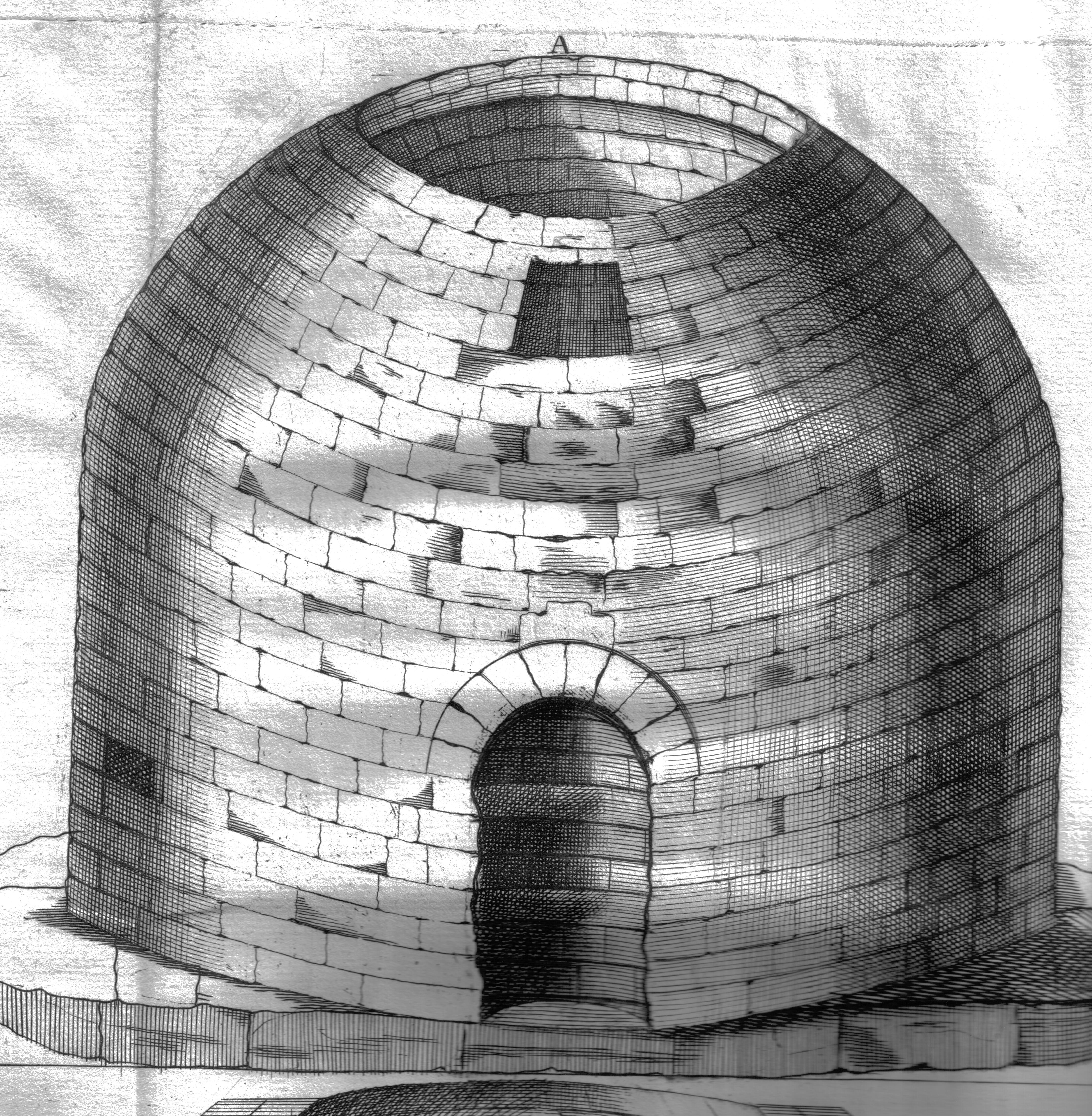
Arthur's O'on

Arthur's O'on (Scots: Oven) was a stone building thought to be Roman temple that, until 1743, stood on rising ground above the north bank of the River...

Carronshore

Carronshore is a village in the Falkirk council area of Scotland. The village lies in the Forth Valley, 1.7 miles (2.7 km) north of the town of Falkirk...

Nearby Amenities

Located within 500m of 56.016068,-3.784377
Bainsford
Place: suburb
Population: 3202
Source: npe
Wikidata: Q4848570
Wikipedia: en:Bainsford
Lat/Long: 56.0142017/-3.7895968
Traffic Signals
Lat/Long: 56.013791/-3.7894566
Mini Roundabout
Direction: clockwise
Lat/Long: 56.0156119/-3.7855512
Mini Roundabout
Direction: clockwise
Lat/Long: 56.0194867/-3.7830226
Crossing
Crossing: traffic_signals
Lat/Long: 56.0136517/-3.7835912
Noexit: yes
Lat/Long: 56.0116065/-3.7839882
Noexit: yes
Lat/Long: 56.0174156/-3.7787611
Access: private
Barrier: lift_gate
Bicycle: no
Foot: no
Motorcar: yes
Motorcycle: yes
Source: survey
Lat/Long: 56.0153073/-3.7817551
Turning Circle
Lat/Long: 56.0199672/-3.7881324
Bench
Backrest: yes
Lat/Long: 56.0180926/-3.7882234
Waste Basket
Lat/Long: 56.0202689/-3.7826989
Recycling
Recycling Cans: yes
Recycling Glass: yes
Recycling Type: container
Lat/Long: 56.0162518/-3.7834247
Entrance: main
Lat/Long: 56.0163102/-3.7825802
Barrier: lift_gate
Bicycle: yes
Foot: yes
Motorcar: yes
Motorcycle: yes
Lat/Long: 56.0158647/-3.7830663
Power: transformer
Lat/Long: 56.0142225/-3.7866023
Waste Basket
Lat/Long: 56.0182074/-3.7896657
Booth: K6
Covered: booth
Disused Amenity: telephone
Man Made: telephone_box
Operator: Bainsford War Memorial Association
Tourism: artwork
Lat/Long: 56.018333/-3.788869
Recycling
Recycling Cans: yes
Recycling Glass: yes
Recycling Scrap Metal: yes
Recycling Type: container
Lat/Long: 56.0185472/-3.7880891
Waste Basket
Lat/Long: 56.0185651/-3.7880742
Barrier: cycle_barrier
Bicycle: yes
Foot: yes
Lat/Long: 56.0146185/-3.7790514
Waste Basket
Lat/Long: 56.0178518/-3.7787952
Barrier: cycle_barrier
Bicycle: yes
Foot: yes
Lat/Long: 56.0178518/-3.7788405
Lidl
Addr Country: GB
Addr Housename: The Carron Centre
Addr Postcode: FK2 7TA
Addr Street: Ronades Road
Brand: Lidl
Brand Wikidata: Q151954
Brand Wikipedia: en:Lidl
Fhrs Id: 549262
Shop: supermarket
Website: https://www.lidl.co.uk/s/en-GB/store-finder/falkirk/carron/the-carron-centre-ronades-road/
Lat/Long: 56.0170147/-3.7922439
Community Centre
The Sub (Excellence in Childcare Centre)
Addr City: Falkirk
Addr Housename: Dawson Centre
Addr Postcode: FK2 7RG
Addr Street: David's Loan
Digital Access: computer
Email: dawsoncldlets@falkirk.gov.uk
Internet Access: wlan
Phone: +44 1324 501470
Service Times: Only open for bookings, contact Centre for more information.
Website: https://www.falkirk.gov.uk/places/community-centres/the-sub.aspx
Wheelchair: yes
Lat/Long: 56.0177464/-3.7815981
Community Centre
Keep Inspiring Change
Addr City: Falkirk
Addr Housename: Dawson Centre
Addr Postcode: FK2 7RG
Addr Street: David's Loan
Phone: +44 1324 501470
Lat/Long: 56.0175095/-3.7813352
Addr City: Falkirk
Addr Housename: Dawson Centre
Addr Postcode: FK2 7RG
Addr Street: David's Loan
Lat/Long: 56.0176605/-3.7814971
Addr City: Falkirk
Addr Postcode: FK2 7RG
Addr Street: David's Loan
Lat/Long: 56.0175941/-3.7814391
Addr City: Falkirk
Addr Postcode: FK2 7RG
Addr Street: David's Loan
Lat/Long: 56.0176405/-3.781307
Advice Service
Advice Outreach Service - Abbotsford House
Addr City: Falkirk
Addr Postcode: FK2 7YZ
Addr Street: David's Loan
Government: services
Office: government
Opening Hours: Th 09:00-12:00
Phone: +44 1324 504950
Type: services
Lat/Long: 56.0164885/-3.7823875
Bicycle Parking
Lat/Long: 56.0163554/-3.7824267
Bicycle Repair Station
Service Bicycle Pump: yes
Lat/Long: 56.0163706/-3.7823891
Bicycle Parking
Lat/Long: 56.017584/-3.7815823
Social Facility
Community Surplus Foodshare
Addr City: Falkirk
Addr Postcode: FK2 7RG
Addr Street: David's Loan
Description: Food available - no referral needed, bring your own bag
Opening Hours: Sa,Su 13:00-16:00
Social Facility: food_bank
Lat/Long: 56.0176673/-3.7815959
Sky High Trampolining
Addr City: Falkirk
Addr Housename: Castlelaurie Industrial Estate
Addr Postcode: FK2 7XF
Leisure: sports_centre
Sport: trampoline
Lat/Long: 56.0120038/-3.7818335
Post Box
Collection Times: Mo-Fr 09:00; Sa 07:00
Operator: Royal Mail
Post Box Design: type_b
Post Box Type: pillar
Ref: FK2 37D
Royal Cypher: GVIR
Royal Cypher Wikidata: Q33102169
Lat/Long: 56.0168078/-3.7915519
Post Box
Collection Times: Mo-Fr 16:30; Sa 11:30
Operator: Royal Mail
Post Box Design: type_b
Post Box Type: pillar
Ref: FK2 215
Royal Cypher: scottish_crown
Lat/Long: 56.0194186/-3.7794819
Post Box
Collection Times: Mo-Fr 09:00; Sa 07:00
Operator: Royal Mail
Post Box Design: type_b
Post Box Type: pillar
Ref: FK2 183D
Royal Cypher: GVIR
Royal Cypher Wikidata: Q33102169
Lat/Long: 56.0183369/-3.7888455
Post Box
Collection Times: Mo-Fr 09:00; Sa 07:00
Operator: Royal Mail
Post Box Design: type_b
Post Box Type: pillar
Ref: FK2 168D
Royal Cypher: GR
Royal Cypher Wikidata: Q33102273
Lat/Long: 56.0153913/-3.7859481
Post Box
Collection Times: Mo-Fr 09:00; Sa 07:00
Operator: Royal Mail
Post Box Type: pillar
Ref: FK2 10D
Royal Cypher: GR
Royal Cypher Wikidata: Q33102273
Lat/Long: 56.0140753/-3.7895168
Clinic
AD Injury Clinic
Phone: +44 1324 626462
Lat/Long: 56.0140581/-3.7894028
Woodside Garden Store
Shop: garden_centre
Lat/Long: 56.0141192/-3.7894725
For Eyes
Shop: optician
Lat/Long: 56.0141649/-3.7895007
Generator Method: photovoltaic
Generator Output Electricity: yes
Generator Source: solar
Generator Type: solar_photovoltaic_panel
Power: generator
Lat/Long: 56.0137822/-3.7908254
Generator Method: photovoltaic
Generator Output Electricity: yes
Generator Source: solar
Generator Type: solar_photovoltaic_panel
Power: generator
Lat/Long: 56.01375/-3.7907919
Fast Food
Meat In The Middle
Addr City: Falkirk
Addr Housenumber: 117
Addr Postcode: FK2 7NT
Addr Street: Main Street
Addr Suburb: Bainsford
Opening Hours: Mo-Su 10:00-22:00
Phone: +44 1324 631151
Website: http://www.meatinthemiddle.uk/
Lat/Long: 56.0136422/-3.7890601
Rumpers
Shop: hairdresser
Lat/Long: 56.0136745/-3.7890936
Crossing
Crossing: traffic_signals
Crossing Island: no
Tactile Paving: yes
Lat/Long: 56.0136394/-3.7892596
Crossing
Crossing: traffic_signals
Crossing Island: no
Tactile Paving: yes
Lat/Long: 56.0139019/-3.7892295
Crossing
Crossing: traffic_signals
Crossing Island: no
Tactile Paving: yes
Lat/Long: 56.013939/-3.789563
Crossing
Crossing: traffic_signals
Crossing Island: no
Tactile Paving: yes
Lat/Long: 56.0137101/-3.7895863
Bainsford Laundry
Shop: laundry
Lat/Long: 56.0135658/-3.7894262
Brand: Premier
Brand Wikidata: Q7240340
Brand Wikipedia: en:Premier Stores
Shop: convenience
Lat/Long: 56.0135043/-3.7893055
Atm
Lat/Long: 56.0135485/-3.789343
Man Made: monitoring_station
Monitoring Air Quality: yes
Lat/Long: 56.0135741/-3.7890104
Bus Stop
Bus: yes
Public Transport: platform
Lat/Long: 56.0132788/-3.788645
Crossing
Crossing: zebra
Crossing Island: no
Tactile Paving: yes
Lat/Long: 56.0126478/-3.7879988
William Hill
Brand: William Hill
Brand Wikidata: Q4053147
Brand Wikipedia: en:William Hill (bookmaker)
Shop: bookmaker
Lat/Long: 56.0132748/-3.7885583
Pub
Carronade Arms
Lat/Long: 56.0131828/-3.7885318
Coral
Brand: Coral
Brand Wikidata: Q54621344
Brand Wikipedia: en:Coral (bookmaker)
Shop: bookmaker
Lat/Long: 56.0126981/-3.787916
Pub
Blue Bell Inn
Lat/Long: 56.0128366/-3.7880841
Shop: hairdresser
Lat/Long: 56.0129765/-3.7882713
Fast Food
ABC Chinese
Lat/Long: 56.0129132/-3.7881873
Shelter
Shelter Type: public_transport
Lat/Long: 56.0183884/-3.7887441
Traffic Calming: choker
Lat/Long: 56.0182959/-3.7893455
Traffic Calming: choker
Lat/Long: 56.0185106/-3.7883657
Give Way
Direction: backward
Lat/Long: 56.018634/-3.7880877
Give Way
Direction: backward
Lat/Long: 56.018562/-3.7880173
The data included in this document is from www.openstreetmap.org. The data is made available under ODbL.

Have you been to Bainsford?

Leave your review of Bainsford below (or comments, questions and feedback).