Bainshole

Settlement in Aberdeenshire

Scotland

Bainshole

Almost the top Hill of Foundland summit view
Almost the top Credit: Ralph Greig

Bainshole is a small village located in Aberdeenshire, Scotland. Situated about 15 miles west of Aberdeen, it lies in the heart of the picturesque countryside, surrounded by rolling hills and lush green landscapes. The village is part of the parish of Banchory-Devenick and is home to a close-knit community.

With a population of around 200 residents, Bainshole offers a peaceful and tranquil atmosphere. The village consists of a cluster of traditional stone houses, many of which date back several centuries, giving it a charming and rustic feel. The residents take great pride in maintaining the character and heritage of the area, ensuring that the village retains its unique identity.

Despite its small size, Bainshole is well-connected to neighboring towns and cities, making it an attractive location for those seeking a quiet lifestyle with easy access to urban amenities. The nearby city of Aberdeen provides a range of services, including shopping centers, schools, and healthcare facilities.

Nature enthusiasts and outdoor lovers are particularly drawn to Bainshole due to its proximity to the stunning rural landscapes of Aberdeenshire. The area offers numerous opportunities for outdoor activities such as hiking, cycling, and fishing. Additionally, several historic sites and landmarks can be found in the vicinity, providing a glimpse into the region's rich history.

Overall, Bainshole is a hidden gem within Aberdeenshire, offering a peaceful retreat for those seeking a slower pace of life while still being within reach of modern conveniences.

If you have any feedback on the listing, please let us know in the comments section below.
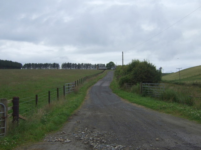
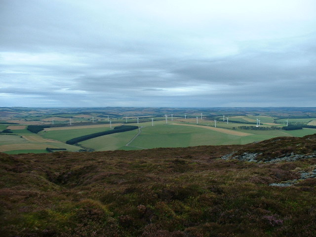
Bainshole Images

Images are sourced within 2km of 57.403625/-2.6673179 or Grid Reference NJ6035. Thanks to Geograph Open Source API. All images are credited.

Almost the top Hill of Foundland summit view
Almost the top
Hill of Foundland summit view
Masts of Foudland
Masts of Foudland
Hill of Foudland The snow has picked out the spoil heaps left on the Hill of Foudland by the slate quarriers of days gone by.
Hill of Foudland
The snow has picked out the spoil heaps left on the Hill of Foudland by the slate quarriers of days gone by.
Summit area, Hill of Foudland The highest point of the hill is probably within this picture. The far tump is a vegetated ruin, so does not count. It is always hard spotting the top on quarried hills. There is a triangulation pillar to the left.
Summit area, Hill of Foudland
The highest point of the hill is probably within this picture. The far tump is a vegetated ruin, so does not count. It is always hard spotting the top on quarried hills. There is a triangulation pillar to the left.
Triangulation pillar, Hill of Foudland There is probably higher ground to the north, but this is as good a summit candidate as any on this flat topped moorland hill.
Flush bracket number is S6906.
Triangulation pillar, Hill of Foudland
There is probably higher ground to the north, but this is as good a summit candidate as any on this flat topped moorland hill. Flush bracket number is S6906.
Road, Hill of Foudland The road serves the communication masts on the hill. The view includes Tillymorgan Hill, which has also been quarried for slate and the A96's notorious Glens of Foudland section, infamous for snow drifts. No danger today, the temperature was 11°C.
Road, Hill of Foudland
The road serves the communication masts on the hill. The view includes Tillymorgan Hill, which has also been quarried for slate and the A96's notorious Glens of Foudland section, infamous for snow drifts. No danger today, the temperature was 11°C.
Masts, Hill of Foudland Buildings beneath the telecom masts on Foudland Hill.
Masts, Hill of Foudland
Buildings beneath the telecom masts on Foudland Hill.
Woodland on Hill of Foudland A conifer plantation finds it hard going near the exposed ridge.
Woodland on Hill of Foudland
A conifer plantation finds it hard going near the exposed ridge.
Minor road near Bog Farm
Minor road to Clinkstone
Track to Wedderburn North from the A96.
Track to Wedderburn
North from the A96.
A96 heading east  Towards Aberdeen.
A96 heading east
Towards Aberdeen.
Glens of Foudland
Glens of Foudland
Grazing, Braehead North of the A96.
Grazing, Braehead
North of the A96.
Sheep grazing, Braehead
Braehead
Braehead
A bend in the A96  Heading east towards Aberdeen.
A bend in the A96
Heading east towards Aberdeen.
Show me another place!

Bainshole is located at Grid Ref: NJ6035 (Lat: 57.403625, Lng: -2.6673179)

Unitary Authority: Aberdeenshire

Police Authority: North East

What 3 Words

///forced.attends.boast. Near Insch, Aberdeenshire

Nearby Locations

Bainshole

Related Wikis

Bainshole

Bainshole is a farm in Aberdeenshire, Scotland. == References ==

Brideswell, Aberdeenshire

Brideswell (Scottish Gaelic: Tobar Bhrìde) is a village in Aberdeenshire, Scotland. It is named in honour of Brigid of Ireland.

Ythanwells

Ythanwells () is a village in the Marr area of Aberdeenshire, Scotland, lying 10.6 kilometres (6.6 mi) east of Huntly. The village is sometimes known...

Battle of Slioch

The Battle of Slioch was a minor skirmish in the First War of Scottish Independence. Although the encounter was inconclusive, the domestic enemies of the...

Nearby Amenities

Located within 500m of 57.403625,-2.6673179
Power: pole
Lat/Long: 57.4024059/-2.659885
Material: wood
Power: pole
Lat/Long: 57.4024015/-2.6609927
Material: wood
Power: pole
Lat/Long: 57.4024593/-2.6622292
Power: pole
Lat/Long: 57.4058766/-2.6679343
Power: pole
Lat/Long: 57.405316/-2.6676875
Power: pole
Lat/Long: 57.4047742/-2.6674166
Material: wood
Power: pole
Lat/Long: 57.4043241/-2.666848
Material: wood
Power: pole
Lat/Long: 57.4038689/-2.666219
Material: wood
Power: pole
Lat/Long: 57.4033906/-2.6652789
Material: wood
Power: pole
Lat/Long: 57.4029542/-2.6644072
Material: wood
Power: pole
Lat/Long: 57.4025186/-2.6635127
Material: wood
Power: pole
Lat/Long: 57.4025482/-2.6641122
Power: pole
Lat/Long: 57.4029687/-2.6655243
Material: wood
Power: pole
Lat/Long: 57.4033762/-2.6668252
Material: wood
Power: pole
Lat/Long: 57.4037613/-2.6680899
Material: wood
Power: pole
Lat/Long: 57.4041919/-2.6695383
Material: wood
Power: pole
Lat/Long: 57.4046268/-2.6709411
Material: wood
Power: pole
Lat/Long: 57.4050429/-2.6723117
Material: wood
Power: pole
Lat/Long: 57.4054605/-2.6736823
Power: pole
Lat/Long: 57.4020909/-2.6626235
Power: pole
Lat/Long: 57.401666/-2.6612073
Power: pole
Lat/Long: 57.3993822/-2.6696195
Power: pole
Lat/Long: 57.3995814/-2.6697833
Power: pole
Lat/Long: 57.4000407/-2.6702262
Power: pole
Lat/Long: 57.4007088/-2.6707953
Power: pole
Lat/Long: 57.401415/-2.6712625
Power: pole
Lat/Long: 57.4022179/-2.6646596
Power: pole
Lat/Long: 57.4020544/-2.6659947
Power: pole
Lat/Long: 57.4018982/-2.6672812
Power: pole
Lat/Long: 57.4017359/-2.6686164
Power: pole
Lat/Long: 57.4015737/-2.669945
Power: pole
Lat/Long: 57.4012504/-2.6725888
Power: pole
Lat/Long: 57.4008209/-2.6731822
Power: pole
Lat/Long: 57.4074689/-2.668331
Power: pole
Lat/Long: 57.406937/-2.6681968
Power: pole
Lat/Long: 57.4064288/-2.6680702
Material: wood
Power: pole
Lat/Long: 57.4029268/-2.6609386
Material: wood
Power: pole
Lat/Long: 57.4037285/-2.6604688
Power: pole
Lat/Long: 57.4040559/-2.6602713
Whinbrae
Place: isolated_dwelling
Lat/Long: 57.401074/-2.674114
Wedderburn
Place: isolated_dwelling
Lat/Long: 57.4059984/-2.668814
Braehead
Place: hamlet
Lat/Long: 57.403964/-2.660703
The data included in this document is from www.openstreetmap.org. The data is made available under ODbL.

Have you been to Bainshole?

Leave your review of Bainshole below (or comments, questions and feedback).