Bainbridge

Settlement in Yorkshire Richmondshire

England

Bainbridge

Benchmark on barn off north side of A684 beside road to Abattoir Ordnance Survey cut mark benchmark levelled at  230.698m above Newlyn Datum in 1971. See <span class="nowrap"><a title="www.bench-marks.org.uk/bm27814" rel="nofollow ugc noopener" href="http://www.bench-marks.org.uk/bm27814">Link</a><img style="margin-left:2px;" alt="External link" title="External link - shift click to open in new window" src="https://s1.geograph.org.uk/img/external.png" width="10" height="10"/></span>
Benchmark on barn off north side of A684 beside road to Abattoir Credit: Roger Templeman

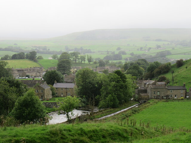
Bainbridge is a small village located in the heart of the Yorkshire Dales National Park in North Yorkshire, England. Situated in the valley of the River Bain, it is known for its tranquil and picturesque surroundings. The village, with a population of around 400 residents, has a rich history dating back to Roman times.

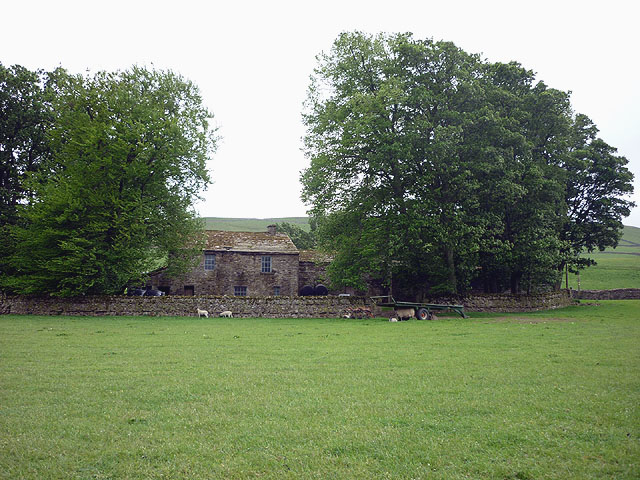
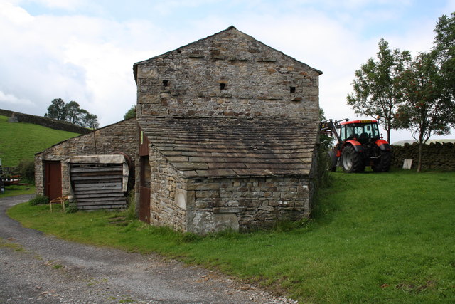
Bainbridge offers visitors a charming rural experience, with its stone-built houses, traditional cottages, and beautifully maintained gardens. It boasts a sense of timelessness, with its narrow streets and historic architecture that have remained relatively untouched for centuries. The village has a close-knit community, and its residents take great pride in preserving its traditional character.

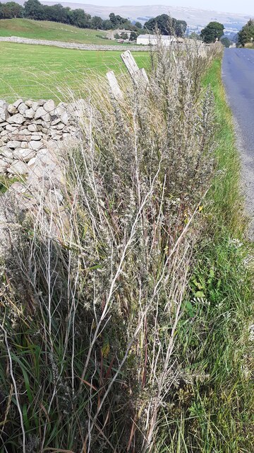
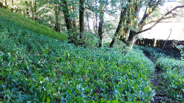
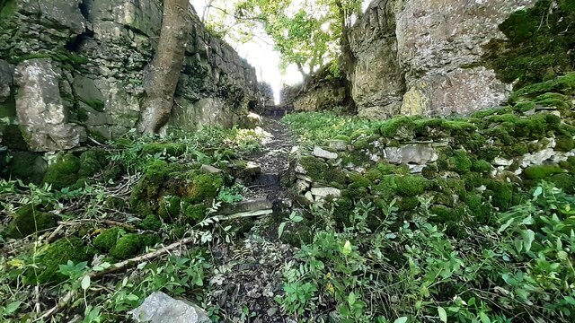
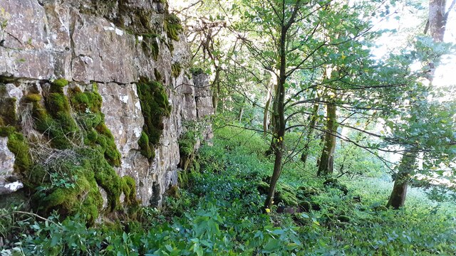
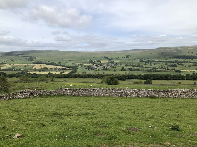
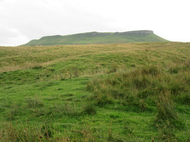
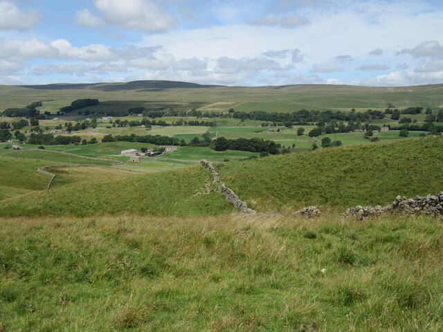
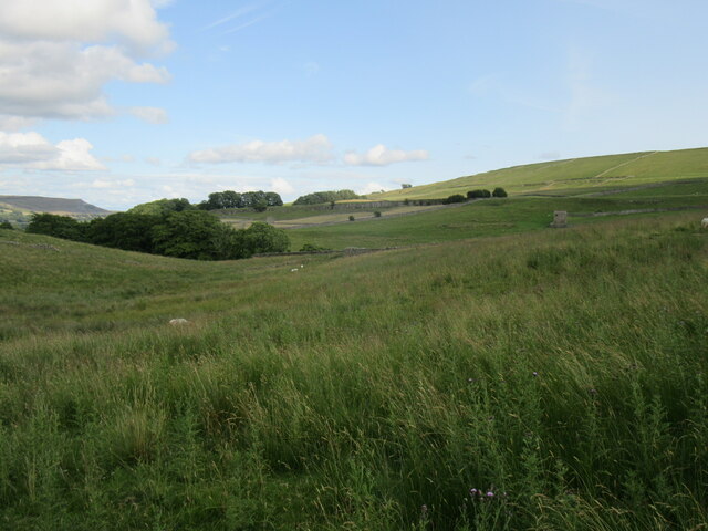
Nature enthusiasts are drawn to Bainbridge for its stunning landscapes and abundant wildlife. The River Bain, which flows through the village, provides a peaceful setting for fishing and riverside walks. The surrounding countryside offers ample opportunities for hiking and exploring the Dales, with its rolling hills, limestone crags, and picturesque valleys.

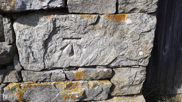
The village is also home to several notable attractions. The Bainbridge Roman Fort, a significant archaeological site, showcases remains of a Roman fort and bathhouse, providing insight into the area's Roman history. The nearby Semerwater, a natural lake formed by glacial activity, offers a tranquil spot for boating, picnicking, and birdwatching.

In terms of amenities, Bainbridge has a village store, a post office, a tearoom, and a traditional pub, where locals and visitors can relax and enjoy a hearty meal. The village's annual agricultural show, held in August, attracts crowds from the surrounding areas, showcasing the best of rural life and farming.

Overall, Bainbridge offers a peaceful escape in the heart of the Yorkshire Dales, with its idyllic landscapes, rich history, and welcoming community.

If you have any feedback on the listing, please let us know in the comments section below.

Bainbridge Images

Images are sourced within 2km of 54.308723/-2.102773 or Grid Reference SD9390. Thanks to Geograph Open Source API. All images are credited.

Benchmark on barn off north side of A684 beside road to Abattoir Ordnance Survey cut mark benchmark levelled at  230.698m above Newlyn Datum in 1971. See <span class="nowrap"><a title="www.bench-marks.org.uk/bm27814" rel="nofollow ugc noopener" href="http://www.bench-marks.org.uk/bm27814">Link</a><img style="margin-left:2px;" alt="External link" title="External link - shift click to open in new window" src="https://s1.geograph.org.uk/img/external.png" width="10" height="10"/></span>
Benchmark on barn off north side of A684 beside road to Abattoir
Ordnance Survey cut mark benchmark levelled at 230.698m above Newlyn Datum in 1971. See LinkExternal link
Stone barn off north side of A684 beside road to abattoir There is an Ordnance Survey benchmark <a href="https://www.geograph.org.uk/photo/6958852">SD9189 : Benchmark on barn off north side of A684 beside road to Abattoir</a> on a stone on the front of the barn on the left hand side of its door
Stone barn off north side of A684 beside road to abattoir
There is an Ordnance Survey benchmark SD9189 : Benchmark on barn off north side of A684 beside road to Abattoir on a stone on the front of the barn on the left hand side of its door
Junction of dry stone walls on NW side of A684 at Butter Hill Ordnance Survey records indicate that a benchmark was levelled at 228.910m above Newlyn Datum in 1971 on a bolt set in a concrete block buried at the wall junction
Junction of dry stone walls on NW side of A684 at Butter Hill
Ordnance Survey records indicate that a benchmark was levelled at 228.910m above Newlyn Datum in 1971 on a bolt set in a concrete block buried at the wall junction
Footpath through wood below Brough Scar
Footpath passing through gap in Brough Scar
Looking west along Brough Scar
Wensleydale View of Wensleydale from lower slopes of Addlebrough. The treeline in the middle distance is Worton Scar, and the small town of Askrigg can be seen in the centre of the image.
Wensleydale
View of Wensleydale from lower slopes of Addlebrough. The treeline in the middle distance is Worton Scar, and the small town of Askrigg can be seen in the centre of the image.
The north side of Addlebrough Looking up at the north side of Addlebrough.
The north side of Addlebrough
Looking up at the north side of Addlebrough.
Above Greensley Bank Greensley Bank is the farm ahead.
Above Greensley Bank
Greensley Bank is the farm ahead.
Bainbridge High Pasture Looking NW from Cam High Road.
Bainbridge High Pasture
Looking NW from Cam High Road.
Near Bainbridge Looking east from Cam High Road.
Near Bainbridge
Looking east from Cam High Road.
Field barn above the River Bain The little River Bain is hidden in the fold of the hills, whilst the barn, although typical of Dales barns, is slightly unusual in that it sits in the middle of a field rather than at a junction of two or three.
Field barn above the River Bain
The little River Bain is hidden in the fold of the hills, whilst the barn, although typical of Dales barns, is slightly unusual in that it sits in the middle of a field rather than at a junction of two or three.
Bainbridge Looking north to Bainbridge.
Bainbridge
Looking north to Bainbridge.
Bracken Hill The view from Bracken Hill.
Bracken Hill
The view from Bracken Hill.
Scar Top The house does not seem to be occupied - slates are sliding off the roof.
Scar Top
The house does not seem to be occupied - slates are sliding off the roof.
Barn on Cam High Road near Bainbridge There is an OS benchmark <a href="https://www.geograph.org.uk/photo/2708746">SD9389 : Benchmark on barn on Cam High Road</a> on the barn.
Barn on Cam High Road near Bainbridge
There is an OS benchmark SD9389 : Benchmark on barn on Cam High Road on the barn.
Barn beside Blean Lane There is an OS benchmark <a href="https://www.geograph.org.uk/photo/2720637">SD9388 : Benchmark on barn on Blean Lane</a> on the corner of the barn.
Barn beside Blean Lane
There is an OS benchmark SD9388 : Benchmark on barn on Blean Lane on the corner of the barn.
Benchmark on gatepost above Greensley Bank Ordnance Survey cut mark benchmark described on the Bench Mark Database at <span class="nowrap"><a title="http://www.bench-marks.org.uk/bm39034" rel="nofollow ugc noopener" href="http://www.bench-marks.org.uk/bm39034">Link</a><img style="margin-left:2px;" alt="External link" title="External link - shift click to open in new window" src="https://s1.geograph.org.uk/img/external.png" width="10" height="10"/></span>
Benchmark on gatepost above Greensley Bank
Ordnance Survey cut mark benchmark described on the Bench Mark Database at LinkExternal link
Show me another place!

Bainbridge is located at Grid Ref: SD9390 (Lat: 54.308723, Lng: -2.102773)

Division: North Riding

Administrative County: North Yorkshire

District: Richmondshire

Police Authority: North Yorkshire

What 3 Words

///horn.groom.sharpness. Near Leyburn, North Yorkshire

Related Wikis

Bainbridge, North Yorkshire

Bainbridge is a village and civil parish in North Yorkshire, England. The population of the civil parish at the 2011 census was 480. The village is situated...

River Bain Hydro

The River Bain Hydro is a hydroelectric generator on the River Bain in the village of Bainbridge, North Yorkshire, England. Its screw turbine powers most...

River Bain, North Yorkshire

The River Bain is a river in North Yorkshire, England. As a tributary of the River Ure, it is one of the shortest, named rivers in England. The river...

Fors Abbey

Fors Abbey was an abbey in Low Abbotside, Askrigg, North Yorkshire, England.It was built in 1145 for the Savigniac order and converted to the Cistercian...

Virosidum

Virosidum was a Roman fort and settlement situated near to the modern town of Bainbridge, North Yorkshire, England. The site is a Scheduled monument....

Askrigg railway station

Askrigg railway station is a disused railway station in North Yorkshire, England and served the village of Askrigg. It was part of the Wensleydale Railway...

St Oswald's Church, Askrigg

St Oswald's Church is a Grade I listed parish church in the Church of England in Askrigg, North Yorkshire. == History == The church dates largely from...

Cringley House

Cringley House (also known as Skeldale House) is an historic building in the English village of Askrigg, North Yorkshire. Standing on the south side of...

Nearby Amenities

Located within 500m of 54.308723,-2.102773
Bainbridge
Place: village
Wikidata: Q2331884
Wikipedia: en:Bainbridge, North Yorkshire
Lat/Long: 54.3075892/-2.1029831
Maxspeed: 30
Traffic Sign: maxspeed
Lat/Long: 54.3083967/-2.1045883
Barrier: stile
Foot: yes
Lat/Long: 54.3063668/-2.1066325
Barrier: stile
Foot: yes
Lat/Long: 54.3064425/-2.1091167
Bus Stop
Bainbridge Green
Bench: yes
Bin: yes
Bus: yes
Departures Board: timetable
Naptan AtcoCode: 3200YNB00979
Naptan NaptanCode: 32000979
Public Transport: platform
Shelter: yes
Lat/Long: 54.3081327/-2.1032344
Post Box
Post Box Type: wall
Royal Cypher: EIIR
Royal Cypher Wikidata: Q33102113
Lat/Long: 54.3067108/-2.1024443
Place Of Worship
Friends Meeting House
Denomination: quaker
Religion: christian
Wikidata: Q26588667
Lat/Long: 54.3092657/-2.1022542
Noexit: yes
Lat/Long: 54.306463/-2.1054308
Noexit: yes
Lat/Long: 54.3065683/-2.1054877
National Park Authority
Office: government
Lat/Long: 54.3061037/-2.105953
Noexit: yes
Lat/Long: 54.3059211/-2.1033862
Noexit: yes
Lat/Long: 54.3061102/-2.1021418
Barrier: stile
Material: stone
Source: survey;gps
Stile: squeezer
Lat/Long: 54.3123521/-2.1039567
Barrier: kissing_gate
Source: survey;gps
Lat/Long: 54.3122233/-2.1064666
Barrier: stile
Material: stone
Source: survey;gps
Stile: squeezer
Lat/Long: 54.3123247/-2.1037991
Barrier: kissing_gate
Source: survey;gps
Lat/Long: 54.3125793/-2.1051524
Give Way
Lat/Long: 54.3084912/-2.1029639
Telephone
Booth: KX100
Covered: booth
Lat/Long: 54.3079976/-2.1036494
Barrier: cattle_grid
Lat/Long: 54.3112534/-2.1031897
Give Way
Lat/Long: 54.3086944/-2.1028512
Entrance: yes
Lat/Long: 54.3079821/-2.1025705
Entrance: yes
Lat/Long: 54.3079335/-2.1025656
Bus Stop
Bainbridge Green
Bench: no
Bus: yes
Departures Board: timetable
Lit: yes
Public Transport: platform
Shelter: no
Lat/Long: 54.3080922/-2.1030944
Street Lamp
Lat/Long: 54.3081034/-2.1030886
Waste Basket
Lat/Long: 54.3081162/-2.1032256
Parking
Lat/Long: 54.3079096/-2.102692
Noexit: yes
Lat/Long: 54.3061705/-2.1019505
Noexit: yes
Lat/Long: 54.3058983/-2.1020698
Bench
Backrest: yes
Material: wood
Lat/Long: 54.3056876/-2.1002047
Power: pole
Lat/Long: 54.3048399/-2.1005572
Power: pole
Lat/Long: 54.3050206/-2.1020016
Power: pole
Lat/Long: 54.3051709/-2.1034232
Power: pole
Lat/Long: 54.3053493/-2.1048394
Power: pole
Lat/Long: 54.3054588/-2.1057165
Power: pole
Lat/Long: 54.3127854/-2.1002582
Power: pole
Lat/Long: 54.3125757/-2.1018541
Power: pole
Lat/Long: 54.3124325/-2.1029511
Power: pole
Lat/Long: 54.3123058/-2.1039543
Power: pole
Lat/Long: 54.311859/-2.1052712
Power: pole
Lat/Long: 54.31141/-2.1065614
Power: pole
Lat/Long: 54.3116478/-2.1080084
Power: pole
Lat/Long: 54.3052976/-2.1070737
Barrier: stile
Lat/Long: 54.305949/-2.0969649
Give Way
Lat/Long: 54.3083654/-2.1038501
Barrier: stile
Lat/Long: 54.3052368/-2.1000461
Give Way
Lat/Long: 54.3084339/-2.1038302
Give Way
Lat/Long: 54.3080687/-2.103659
Give Way
Lat/Long: 54.3078316/-2.1033792
Give Way
Lat/Long: 54.3077286/-2.103415
Give Way
Lat/Long: 54.3065599/-2.1025418
Give Way
Lat/Long: 54.3065081/-2.10263
Give Way
Lat/Long: 54.3095392/-2.1025406
Give Way
Lat/Long: 54.3098373/-2.1026325
Power: pole
Lat/Long: 54.3059518/-2.1004137
Power: pole
Lat/Long: 54.3083336/-2.1057983
Power: pole
Lat/Long: 54.3073289/-2.1071944
Power: pole
Lat/Long: 54.3075558/-2.1092007
Power: pole
Lat/Long: 54.3075996/-2.1080379
Power: pole
Lat/Long: 54.30644/-2.1077214
Power: pole
Lat/Long: 54.3068125/-2.107826
Power: pole
Lat/Long: 54.3072569/-2.1021424
Power: pole
Lat/Long: 54.3048676/-2.1005438
Power: pole
Lat/Long: 54.3054291/-2.1004674
Power: pole
Lat/Long: 54.3079384/-2.1024019
Power: pole
Lat/Long: 54.3075707/-2.1020915
Power: pole
Lat/Long: 54.3076364/-2.1015175
Noexit: yes
Lat/Long: 54.3086434/-2.1023604
Crossing
Lat/Long: 54.3087127/-2.1028981
Noexit: yes
Lat/Long: 54.3088762/-2.1029866
Noexit: yes
Lat/Long: 54.3091938/-2.1028083
Noexit: yes
Lat/Long: 54.3095311/-2.102072
Noexit: yes
Lat/Long: 54.3097994/-2.1022752
Noexit: yes
Lat/Long: 54.3098632/-2.1023282
Noexit: yes
Lat/Long: 54.3101585/-2.1025836
Noexit: yes
Lat/Long: 54.310236/-2.102422
Noexit: yes
Lat/Long: 54.3104285/-2.1025468
Noexit: yes
Lat/Long: 54.3105732/-2.1027875
Power: pole
Lat/Long: 54.3071079/-2.1015222
Power: pole
Lat/Long: 54.3069048/-2.1014652
Power: pole
Lat/Long: 54.3065214/-2.1010414
Power: pole
Lat/Long: 54.3061513/-2.1006484
Give Way
Lat/Long: 54.3065038/-2.1036825
Barrier: stile
Lat/Long: 54.3058517/-2.1003016
Barrier: stile
Lat/Long: 54.306336/-2.1010279
Power: pole
Lat/Long: 54.3063499/-2.1009644
Street Lamp
Lat/Long: 54.3085491/-2.1028142
Street Lamp
Lat/Long: 54.3084562/-2.1039004
Power: pole
Lat/Long: 54.3053907/-2.0997164
Power: pole
Lat/Long: 54.3050046/-2.1000879
Barrier: stile
Lat/Long: 54.3051211/-2.0998922
Give Way
Lat/Long: 54.3052706/-2.0997264
Crossing
Lat/Long: 54.3062111/-2.1056443
Barrier: kerb
Kerb: lowered
Tactile Paving: yes
Lat/Long: 54.3062306/-2.1056264
Barrier: kerb
Kerb: lowered
Tactile Paving: yes
Lat/Long: 54.3061915/-2.1056623
Crossing
Lat/Long: 54.3063423/-2.1061779
Barrier: kerb
Kerb: lowered
Tactile Paving: yes
Lat/Long: 54.306314/-2.106185
Barrier: kerb
Kerb: lowered
Tactile Paving: yes
Lat/Long: 54.3063706/-2.1061709
Entrance: main
Lat/Long: 54.3061632/-2.1062278
Give Way
Lat/Long: 54.3061889/-2.104809
Give Way
Lat/Long: 54.3061339/-2.1042145
Noexit: yes
Lat/Long: 54.3065589/-2.1059765
Noexit: yes
Lat/Long: 54.3064878/-2.1062196
Noexit: yes
Lat/Long: 54.3065861/-2.1062029
Noexit: yes
Lat/Long: 54.3063463/-2.1035364
Noexit: yes
Lat/Long: 54.3066154/-2.1045442
Noexit: yes
Lat/Long: 54.3066372/-2.1049604
Give Way
Lat/Long: 54.3062112/-2.1042473
Noexit: yes
Lat/Long: 54.3063139/-2.1048079
Noexit: yes
Lat/Long: 54.3069864/-2.1051924
Noexit: yes
Lat/Long: 54.3070263/-2.1048804
Power: pole
Lat/Long: 54.3120418/-2.1032253
Power: pole
Lat/Long: 54.3123667/-2.1034585
Bench
Backrest: yes
Material: wood
Lat/Long: 54.3077175/-2.1026021
Bench
Backrest: yes
Direction: 95
Material: wood
Lat/Long: 54.3070209/-2.1034199
Historic: stocks
Wikidata: Q26451528
Lat/Long: 54.3070887/-2.1031342
Bench
Backrest: yes
Direction: 120
Material: stone
Lat/Long: 54.3083336/-2.1032592
Bench
Backrest: yes
Direction: 120
Material: wood
Lat/Long: 54.3080949/-2.1035404
Bainbridge Green
Bus: yes
Public Transport: stop_position
Lat/Long: 54.3080956/-2.1031462
Bainbridge Green
Bus: yes
Public Transport: stop_position
Lat/Long: 54.3081282/-2.1031238
The data included in this document is from www.openstreetmap.org. The data is made available under ODbL.

Have you been to Bainbridge?

Leave your review of Bainbridge below (or comments, questions and feedback).