Brough Hill

Hill, Mountain in Yorkshire Richmondshire

England

Brough Hill

Junction of dry stone walls on NW side of A684 at Butter Hill Ordnance Survey records indicate that a benchmark was levelled at 228.910m above Newlyn Datum in 1971 on a bolt set in a concrete block buried at the wall junction
Junction of dry stone walls on NW side of A684 at Butter Hill Credit: Roger Templeman

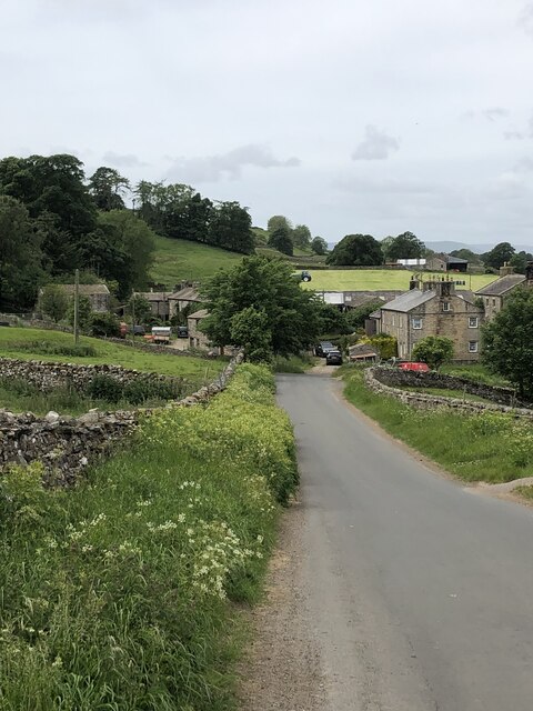
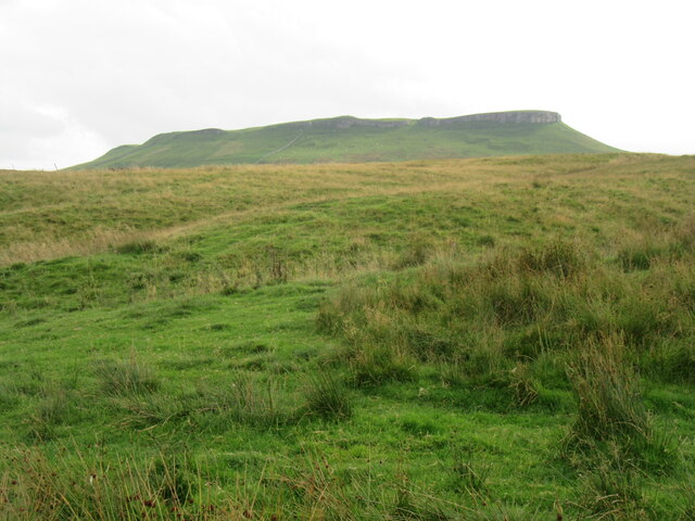
Brough Hill, located in Yorkshire, England, is a picturesque hill that offers breathtaking views and holds historical significance. Situated near the village of Brough, in the Eden district, this hill is a popular destination for nature enthusiasts and history buffs alike.

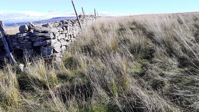
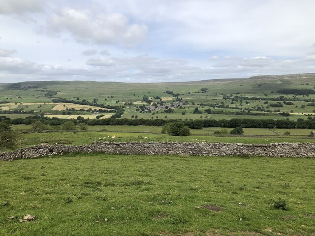
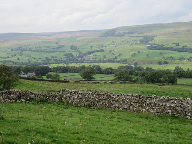
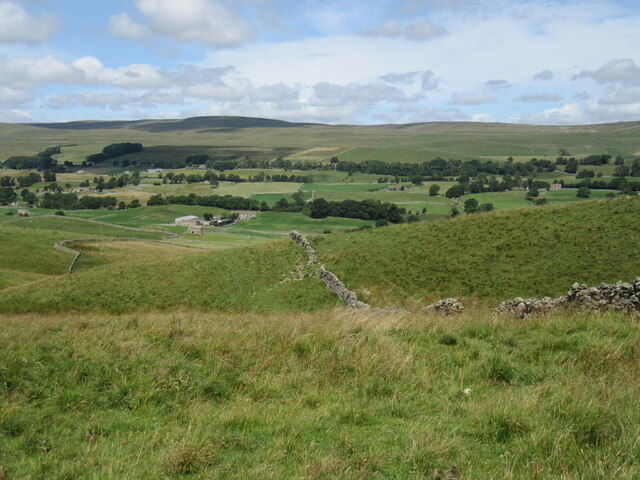
At an elevation of approximately 354 meters (1,161 feet), Brough Hill is not classified as a mountain but rather a hill. Nevertheless, its prominent position in the landscape provides visitors with stunning panoramic views of the surrounding countryside, including the nearby River Eden and the picturesque town of Kirkby Stephen.

The hill is known for its rich historical heritage, dating back to Roman times. The remains of a Roman fort, known as Verterae, can be found on the hill, reflecting its strategic importance as a defensive position. The fort was likely built during the 1st century AD and served as a key outpost along the Roman road that connected York to Carlisle.

Today, visitors can explore the ruins of the fort and imagine the Roman soldiers who once stood guard on this hilltop. The site also offers interpretive panels that provide historical context and information.

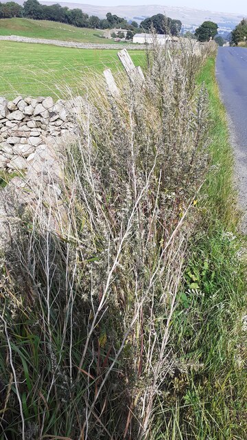
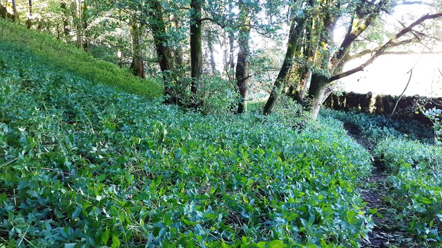
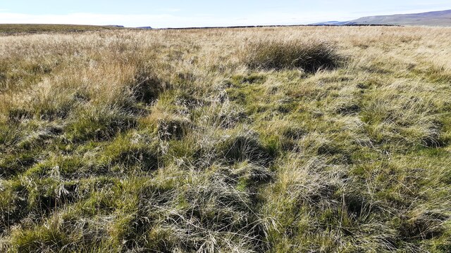
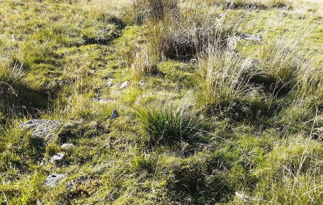
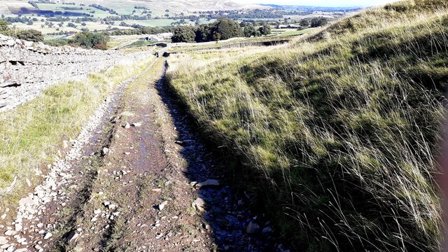
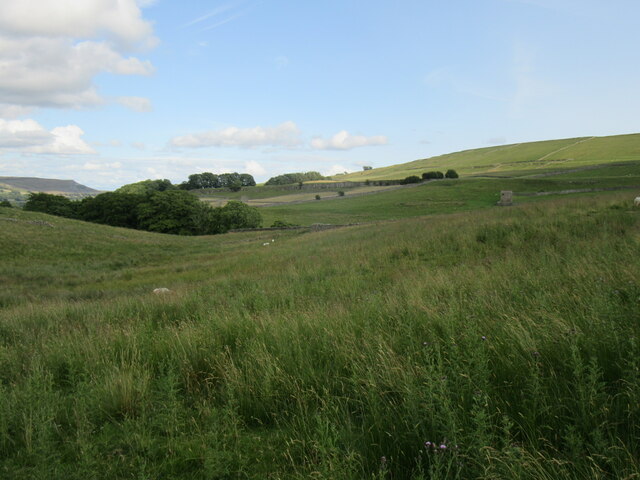
Aside from its historical significance, Brough Hill is also a great place for outdoor activities such as hiking and picnicking. Several walking routes traverse the hill, allowing visitors to enjoy the stunning vistas and the tranquil beauty of the surrounding landscape.

In conclusion, Brough Hill in Yorkshire is a captivating hill that combines natural beauty with historical intrigue. Whether one seeks to admire the panoramic views, delve into the area's Roman past, or simply enjoy a peaceful walk, Brough Hill offers a memorable experience for all who visit.

If you have any feedback on the listing, please let us know in the comments section below.
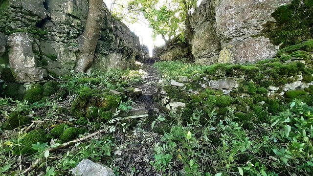
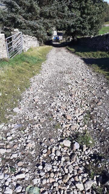
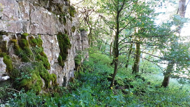
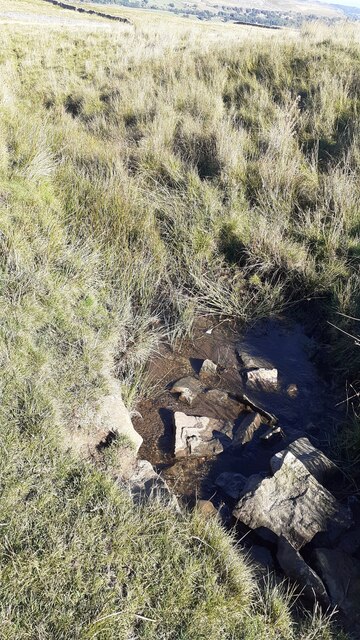
Brough Hill Images

Images are sourced within 2km of 54.306839/-2.0987541 or Grid Reference SD9390. Thanks to Geograph Open Source API. All images are credited.

Junction of dry stone walls on NW side of A684 at Butter Hill Ordnance Survey records indicate that a benchmark was levelled at 228.910m above Newlyn Datum in 1971 on a bolt set in a concrete block buried at the wall junction
Junction of dry stone walls on NW side of A684 at Butter Hill
Ordnance Survey records indicate that a benchmark was levelled at 228.910m above Newlyn Datum in 1971 on a bolt set in a concrete block buried at the wall junction
Footpath through wood below Brough Scar
Corner of dry stone wall on Thornton Rust Moor
Open moorland on Worton Pasture
Footpath passing through gap in Brough Scar
Bridleway approaching Cubeck from SW
Looking west along Brough Scar
A stream on Worton Pasture
Remains of a building on Worton Pasture?
Bridleway from Worton Pasture towards Cubeck
Wensleydale View of Wensleydale from lower slopes of Addlebrough. The treeline in the middle distance is Worton Scar, and the small town of Askrigg can be seen in the centre of the image.
Wensleydale
View of Wensleydale from lower slopes of Addlebrough. The treeline in the middle distance is Worton Scar, and the small town of Askrigg can be seen in the centre of the image.
Semer Water Semer Water viewed from Carpley Green Road.
Semer Water
Semer Water viewed from Carpley Green Road.
The north side of Addlebrough Looking up at the north side of Addlebrough.
The north side of Addlebrough
Looking up at the north side of Addlebrough.
Near Cubeck Looking across Wensleydale near Cubeck.
Near Cubeck
Looking across Wensleydale near Cubeck.
Above Greensley Bank Greensley Bank is the farm ahead.
Above Greensley Bank
Greensley Bank is the farm ahead.
Near Bainbridge Looking east from Cam High Road.
Near Bainbridge
Looking east from Cam High Road.
Field barn above the River Bain The little River Bain is hidden in the fold of the hills, whilst the barn, although typical of Dales barns, is slightly unusual in that it sits in the middle of a field rather than at a junction of two or three.
Field barn above the River Bain
The little River Bain is hidden in the fold of the hills, whilst the barn, although typical of Dales barns, is slightly unusual in that it sits in the middle of a field rather than at a junction of two or three.
Show me another place!

Brough Hill is located at Grid Ref: SD9390 (Lat: 54.306839, Lng: -2.0987541)

Division: North Riding

Administrative County: North Yorkshire

District: Richmondshire

Police Authority: North Yorkshire

What 3 Words

///chaos.fields.raft. Near Leyburn, North Yorkshire

Related Wikis

Virosidum

Virosidum was a Roman fort and settlement situated near to the modern town of Bainbridge, North Yorkshire, England. The site is a Scheduled monument....

River Bain Hydro

The River Bain Hydro is a hydroelectric generator on the River Bain in the village of Bainbridge, North Yorkshire, England. Its screw turbine powers most...

Bainbridge, North Yorkshire

Bainbridge is a village and civil parish in North Yorkshire, England. The population of the civil parish at the 2011 census was 480. The village is situated...

River Bain, North Yorkshire

The River Bain is a river in North Yorkshire, England. As a tributary of the River Ure, it is one of the shortest, named rivers in England. The river...

Fors Abbey

Fors Abbey was an abbey in Low Abbotside, Askrigg, North Yorkshire, England.It was built in 1145 for the Savigniac order and converted to the Cistercian...

Askrigg railway station

Askrigg railway station is a disused railway station in North Yorkshire, England and served the village of Askrigg. It was part of the Wensleydale Railway...

St Oswald's Church, Askrigg

St Oswald's Church is a Grade I listed parish church in the Church of England in Askrigg, North Yorkshire. == History == The church dates largely from...

Cringley House

Cringley House (also known as Skeldale House) is an historic building in the English village of Askrigg, North Yorkshire. Standing on the south side of...

Nearby Amenities

Located within 500m of 54.306839,-2.0987541
Bainbridge
Place: village
Wikidata: Q2331884
Wikipedia: en:Bainbridge, North Yorkshire
Lat/Long: 54.3075892/-2.1029831
Maxspeed: 30
Traffic Sign: maxspeed
Lat/Long: 54.3083967/-2.1045883
Bus Stop
Bainbridge Green
Bench: yes
Bin: yes
Bus: yes
Departures Board: timetable
Naptan AtcoCode: 3200YNB00979
Naptan NaptanCode: 32000979
Public Transport: platform
Shelter: yes
Lat/Long: 54.3081327/-2.1032344
Post Box
Post Box Type: wall
Royal Cypher: EIIR
Royal Cypher Wikidata: Q33102113
Lat/Long: 54.3067108/-2.1024443
Place Of Worship
Friends Meeting House
Denomination: quaker
Religion: christian
Wikidata: Q26588667
Lat/Long: 54.3092657/-2.1022542
Noexit: yes
Lat/Long: 54.306463/-2.1054308
Noexit: yes
Lat/Long: 54.3065683/-2.1054877
National Park Authority
Office: government
Lat/Long: 54.3061037/-2.105953
Noexit: yes
Lat/Long: 54.3059211/-2.1033862
Noexit: yes
Lat/Long: 54.3061102/-2.1021418
Give Way
Lat/Long: 54.3084912/-2.1029639
Telephone
Booth: KX100
Covered: booth
Lat/Long: 54.3079976/-2.1036494
Give Way
Lat/Long: 54.3086944/-2.1028512
Entrance: yes
Lat/Long: 54.3079821/-2.1025705
Entrance: yes
Lat/Long: 54.3079335/-2.1025656
Bus Stop
Bainbridge Green
Bench: no
Bus: yes
Departures Board: timetable
Lit: yes
Public Transport: platform
Shelter: no
Lat/Long: 54.3080922/-2.1030944
Street Lamp
Lat/Long: 54.3081034/-2.1030886
Waste Basket
Lat/Long: 54.3081162/-2.1032256
Parking
Lat/Long: 54.3079096/-2.102692
Noexit: yes
Lat/Long: 54.3061705/-2.1019505
Noexit: yes
Lat/Long: 54.3058983/-2.1020698
Barrier: stile
Lat/Long: 54.3029876/-2.10255
Bench
Backrest: yes
Material: wood
Lat/Long: 54.3056876/-2.1002047
Noexit: yes
Lat/Long: 54.30505/-2.0963738
Noexit: yes
Lat/Long: 54.3050227/-2.0966808
Power: pole
Lat/Long: 54.3048125/-2.0930001
Power: pole
Lat/Long: 54.3047718/-2.0945504
Power: pole
Lat/Long: 54.3047264/-2.0960391
Power: pole
Lat/Long: 54.3046982/-2.0975679
Power: pole
Lat/Long: 54.3046388/-2.0990565
Power: pole
Lat/Long: 54.3048399/-2.1005572
Power: pole
Lat/Long: 54.3050206/-2.1020016
Power: pole
Lat/Long: 54.3051709/-2.1034232
Power: pole
Lat/Long: 54.3053493/-2.1048394
Power: pole
Lat/Long: 54.3054588/-2.1057165
Barrier: stile
Lat/Long: 54.305949/-2.0969649
Give Way
Lat/Long: 54.3083654/-2.1038501
Barrier: stile
Lat/Long: 54.3044842/-2.0987983
Barrier: stile
Lat/Long: 54.3052368/-2.1000461
Give Way
Lat/Long: 54.3084339/-2.1038302
Give Way
Lat/Long: 54.3080687/-2.103659
Give Way
Lat/Long: 54.3078316/-2.1033792
Give Way
Lat/Long: 54.3077286/-2.103415
Give Way
Lat/Long: 54.3065599/-2.1025418
Give Way
Lat/Long: 54.3065081/-2.10263
Give Way
Lat/Long: 54.3095392/-2.1025406
Give Way
Lat/Long: 54.3098373/-2.1026325
Power: pole
Lat/Long: 54.3059518/-2.1004137
Power: pole
Lat/Long: 54.3083336/-2.1057983
Power: pole
Lat/Long: 54.3072569/-2.1021424
Power: pole
Lat/Long: 54.3048676/-2.1005438
Power: pole
Lat/Long: 54.3054291/-2.1004674
Power: pole
Lat/Long: 54.3079384/-2.1024019
Power: pole
Lat/Long: 54.3075707/-2.1020915
Power: pole
Lat/Long: 54.3076364/-2.1015175
Noexit: yes
Lat/Long: 54.3086434/-2.1023604
Crossing
Lat/Long: 54.3087127/-2.1028981
Noexit: yes
Lat/Long: 54.3088762/-2.1029866
Noexit: yes
Lat/Long: 54.3091938/-2.1028083
Noexit: yes
Lat/Long: 54.3095311/-2.102072
Noexit: yes
Lat/Long: 54.3097994/-2.1022752
Noexit: yes
Lat/Long: 54.3098632/-2.1023282
Noexit: yes
Lat/Long: 54.3101585/-2.1025836
Noexit: yes
Lat/Long: 54.310236/-2.102422
Noexit: yes
Lat/Long: 54.3104285/-2.1025468
Noexit: yes
Lat/Long: 54.3105732/-2.1027875
Power: pole
Lat/Long: 54.3071079/-2.1015222
Power: pole
Lat/Long: 54.3069048/-2.1014652
Power: pole
Lat/Long: 54.3065214/-2.1010414
Power: pole
Lat/Long: 54.3061513/-2.1006484
Give Way
Lat/Long: 54.3065038/-2.1036825
Barrier: stile
Lat/Long: 54.3058517/-2.1003016
Barrier: stile
Lat/Long: 54.3054159/-2.0943112
Barrier: stile
Lat/Long: 54.3051139/-2.0951402
Power: pole
Lat/Long: 54.3049148/-2.0967578
Power: pole
Lat/Long: 54.3047477/-2.0952917
Power: pole
Lat/Long: 54.3047669/-2.0960302
Power: pole
Lat/Long: 54.3050827/-2.0959288
Power: pole
Lat/Long: 54.3051195/-2.0967962
Barrier: stile
Lat/Long: 54.306336/-2.1010279
Power: pole
Lat/Long: 54.3063499/-2.1009644
Street Lamp
Lat/Long: 54.3085491/-2.1028142
Street Lamp
Lat/Long: 54.3084562/-2.1039004
Power: pole
Lat/Long: 54.3053907/-2.0997164
Power: pole
Lat/Long: 54.3050046/-2.1000879
Barrier: stile
Lat/Long: 54.3051211/-2.0998922
Give Way
Lat/Long: 54.3052706/-2.0997264
Noexit: yes
Lat/Long: 54.3050649/-2.0972774
Give Way
Lat/Long: 54.3051453/-2.0965901
Noexit: yes
Lat/Long: 54.3050133/-2.0958141
Crossing
Lat/Long: 54.3062111/-2.1056443
Barrier: kerb
Kerb: lowered
Tactile Paving: yes
Lat/Long: 54.3062306/-2.1056264
Barrier: kerb
Kerb: lowered
Tactile Paving: yes
Lat/Long: 54.3061915/-2.1056623
Crossing
Lat/Long: 54.3063423/-2.1061779
Barrier: kerb
Kerb: lowered
Tactile Paving: yes
Lat/Long: 54.306314/-2.106185
Barrier: kerb
Kerb: lowered
Tactile Paving: yes
Lat/Long: 54.3063706/-2.1061709
Entrance: main
Lat/Long: 54.3061632/-2.1062278
Give Way
Lat/Long: 54.3061889/-2.104809
Give Way
Lat/Long: 54.3061339/-2.1042145
Noexit: yes
Lat/Long: 54.3065589/-2.1059765
Noexit: yes
Lat/Long: 54.3064878/-2.1062196
Noexit: yes
Lat/Long: 54.3065861/-2.1062029
Noexit: yes
Lat/Long: 54.3063463/-2.1035364
Noexit: yes
Lat/Long: 54.3066154/-2.1045442
Noexit: yes
Lat/Long: 54.3066372/-2.1049604
Give Way
Lat/Long: 54.3062112/-2.1042473
Noexit: yes
Lat/Long: 54.3063139/-2.1048079
Noexit: yes
Lat/Long: 54.3069864/-2.1051924
Noexit: yes
Lat/Long: 54.3070263/-2.1048804
Bench
Backrest: yes
Material: wood
Lat/Long: 54.3077175/-2.1026021
Bench
Backrest: yes
Direction: 95
Material: wood
Lat/Long: 54.3070209/-2.1034199
Historic: stocks
Wikidata: Q26451528
Lat/Long: 54.3070887/-2.1031342
Bench
Backrest: yes
Direction: 120
Material: stone
Lat/Long: 54.3083336/-2.1032592
Bench
Backrest: yes
Direction: 120
Material: wood
Lat/Long: 54.3080949/-2.1035404
Bainbridge Green
Bus: yes
Public Transport: stop_position
Lat/Long: 54.3080956/-2.1031462
Bainbridge Green
Bus: yes
Public Transport: stop_position
Lat/Long: 54.3081282/-2.1031238
Power: pole
Lat/Long: 54.3048203/-2.094553
Power: pole
Lat/Long: 54.3053181/-2.0919257
The data included in this document is from www.openstreetmap.org. The data is made available under ODbL.

Have you been to Brough Hill?

Leave your review of Brough Hill below (or comments, questions and feedback).