Lenny Wood

Wood, Forest in Yorkshire Richmondshire

England

Lenny Wood

Footpath through wood below Brough Scar
Footpath through wood below Brough Scar Credit: Roger Templeman

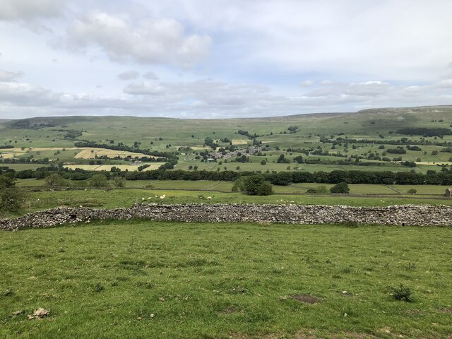
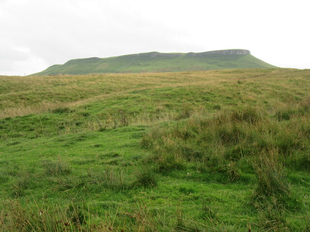
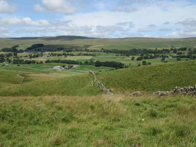
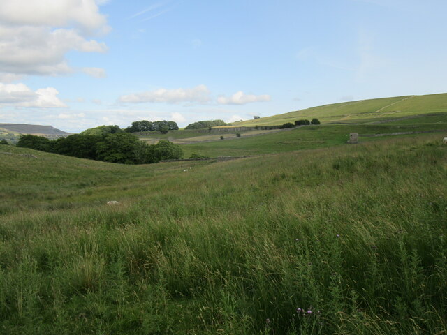
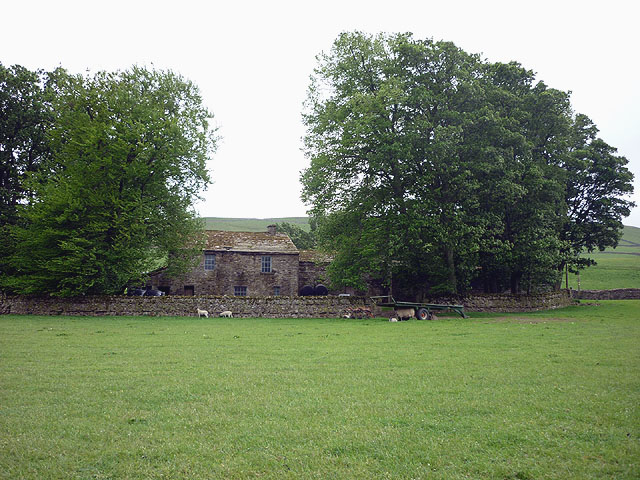
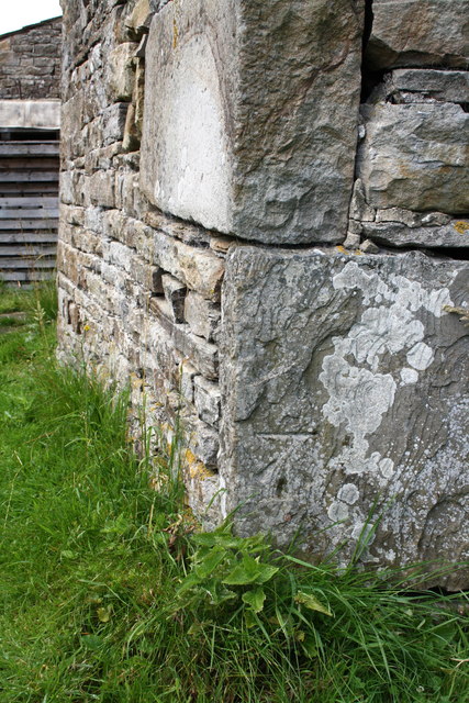
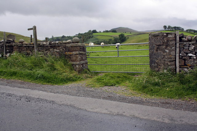
Lenny Wood is a picturesque forest located in Yorkshire, England. Covering an area of approximately 100 acres, it is known for its dense woodland and rich biodiversity. The forest is named after Lenny, a popular local character known for his love of nature and dedication to conservation.

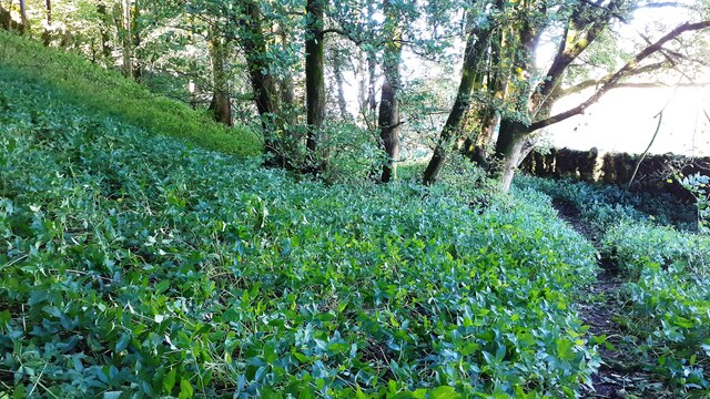
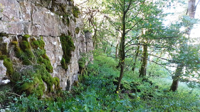
Lenny Wood is home to a variety of tree species, including oak, beech, and birch, which create a vibrant and ever-changing landscape throughout the year. The forest floor is adorned with a diverse range of flora, including bluebells, wild garlic, and ferns, adding to the enchanting atmosphere.

The forest provides a haven for numerous wildlife species, attracting birdwatchers and nature enthusiasts from near and far. Visitors may spot various bird species such as woodpeckers, tits, and finches, as well as mammals like deer, foxes, and squirrels. Lenny Wood is also home to a thriving population of butterflies and insects, making it a paradise for insect enthusiasts and photographers.

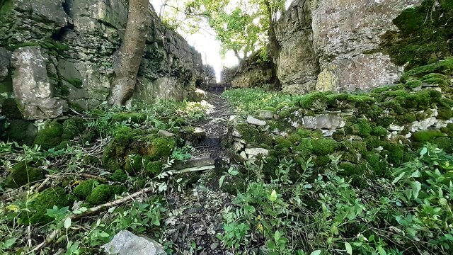
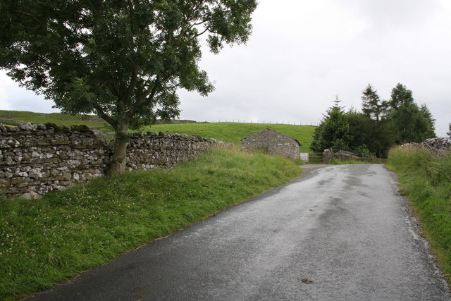
The forest offers several well-maintained walking trails, allowing visitors to explore its beauty at their own pace. These paths wind through the ancient woodland, offering glimpses of hidden ponds and streams along the way. Lenny Wood is also a popular spot for picnics and family outings, with designated areas providing ample space for relaxation and enjoyment.

Overall, Lenny Wood is a tranquil retreat that offers an immersive experience in nature. Its lush vegetation, abundant wildlife, and peaceful ambiance make it a must-visit destination for anyone seeking solace and connection with the natural world.

If you have any feedback on the listing, please let us know in the comments section below.
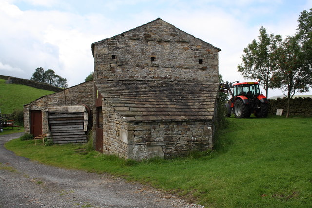
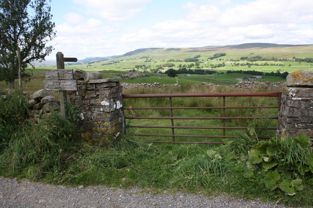
Lenny Wood Images

Images are sourced within 2km of 54.312702/-2.0954173 or Grid Reference SD9390. Thanks to Geograph Open Source API. All images are credited.

Footpath through wood below Brough Scar
Footpath passing through gap in Brough Scar
Looking west along Brough Scar
Wensleydale View of Wensleydale from lower slopes of Addlebrough. The treeline in the middle distance is Worton Scar, and the small town of Askrigg can be seen in the centre of the image.
Wensleydale
View of Wensleydale from lower slopes of Addlebrough. The treeline in the middle distance is Worton Scar, and the small town of Askrigg can be seen in the centre of the image.
The north side of Addlebrough Looking up at the north side of Addlebrough.
The north side of Addlebrough
Looking up at the north side of Addlebrough.
Above Greensley Bank Greensley Bank is the farm ahead.
Above Greensley Bank
Greensley Bank is the farm ahead.
Near Bainbridge Looking east from Cam High Road.
Near Bainbridge
Looking east from Cam High Road.
Bainbridge Looking north to Bainbridge.
Bainbridge
Looking north to Bainbridge.
Bracken Hill The view from Bracken Hill.
Bracken Hill
The view from Bracken Hill.
Scar Top The house does not seem to be occupied - slates are sliding off the roof.
Scar Top
The house does not seem to be occupied - slates are sliding off the roof.
Barn on Cam High Road near Bainbridge There is an OS benchmark <a href="https://www.geograph.org.uk/photo/2708746">SD9389 : Benchmark on barn on Cam High Road</a> on the barn.
Barn on Cam High Road near Bainbridge
There is an OS benchmark SD9389 : Benchmark on barn on Cam High Road on the barn.
Benchmark on gatepost above Greensley Bank Ordnance Survey cut mark benchmark described on the Bench Mark Database at <span class="nowrap"><a title="http://www.bench-marks.org.uk/bm39034" rel="nofollow ugc noopener" href="http://www.bench-marks.org.uk/bm39034">Link</a><img style="margin-left:2px;" alt="External link" title="External link - shift click to open in new window" src="https://s1.geograph.org.uk/img/external.png" width="10" height="10"/></span>
Benchmark on gatepost above Greensley Bank
Ordnance Survey cut mark benchmark described on the Bench Mark Database at LinkExternal link
Gateway across path to Greensley Bank The signs read:
Please keep dogs
under close control
preferably on a lead
and:
Meadowland
Winter food for stock
Please walk in single file.

On the left hand gatepost is an OS benchmark <a href="https://www.geograph.org.uk/photo/2697335">SD9289 : Benchmark on gatepost above Greensley Bank</a>
Gateway across path to Greensley Bank
The signs read: Please keep dogs under close control preferably on a lead and: Meadowland Winter food for stock Please walk in single file. On the left hand gatepost is an OS benchmark SD9289 : Benchmark on gatepost above Greensley Bank
Benchmark on barn on Cam High Road Ordnance Survey cut mark described on the Bench Mark Database at <span class="nowrap"><a title="http://www.bench-marks.org.uk/bm39074" rel="nofollow ugc noopener" href="http://www.bench-marks.org.uk/bm39074">Link</a><img style="margin-left:2px;" alt="External link" title="External link - shift click to open in new window" src="https://s1.geograph.org.uk/img/external.png" width="10" height="10"/></span>
Benchmark on barn on Cam High Road
Ordnance Survey cut mark described on the Bench Mark Database at LinkExternal link
Benchmark on stone of Carpley Green Road Ordnance Survey pivot benchmark described on the Bench Mark Database at <span class="nowrap"><a title="http://www.bench-marks.org.uk/bm39075" rel="nofollow ugc noopener" href="http://www.bench-marks.org.uk/bm39075">Link</a><img style="margin-left:2px;" alt="External link" title="External link - shift click to open in new window" src="https://s1.geograph.org.uk/img/external.png" width="10" height="10"/></span>
Benchmark on stone of Carpley Green Road
Ordnance Survey pivot benchmark described on the Bench Mark Database at LinkExternal link
Carpley Green Road south from Bainbridge There is an OS benchmark <a href="https://www.geograph.org.uk/photo/2719675">SD9389 : Benchmark on stone of Carpley Green Road</a> on the wall on the left side of the road
Carpley Green Road south from Bainbridge
There is an OS benchmark SD9389 : Benchmark on stone of Carpley Green Road on the wall on the left side of the road
Benchmark on gateway on Carpley Green Road Ordnance Survey cut mark benchmark described on the Bench Mark Database at <span class="nowrap"><a title="http://www.bench-marks.org.uk/bm39076" rel="nofollow ugc noopener" href="http://www.bench-marks.org.uk/bm39076">Link</a><img style="margin-left:2px;" alt="External link" title="External link - shift click to open in new window" src="https://s1.geograph.org.uk/img/external.png" width="10" height="10"/></span>
Benchmark on gateway on Carpley Green Road
Ordnance Survey cut mark benchmark described on the Bench Mark Database at LinkExternal link
Gateway to field from Carpley Green Road There is an OS benchmark <a href="https://www.geograph.org.uk/photo/2719755">SD9389 : Benchmark on gateway on Carpley Green Road</a> on the inside face of the wall end at the left hand side of the gateway.
Gateway to field from Carpley Green Road
There is an OS benchmark SD9389 : Benchmark on gateway on Carpley Green Road on the inside face of the wall end at the left hand side of the gateway.
Show me another place!

Lenny Wood is located at Grid Ref: SD9390 (Lat: 54.312702, Lng: -2.0954173)

Division: North Riding

Administrative County: North Yorkshire

District: Richmondshire

Police Authority: North Yorkshire

What 3 Words

///oatmeal.image.important. Near Leyburn, North Yorkshire

Related Wikis

River Bain, North Yorkshire

The River Bain is a river in North Yorkshire, England. As a tributary of the River Ure, it is one of the shortest, named rivers in England. The river...

Askrigg railway station

Askrigg railway station is a disused railway station in North Yorkshire, England and served the village of Askrigg. It was part of the Wensleydale Railway...

Fors Abbey

Fors Abbey was an abbey in Low Abbotside, Askrigg, North Yorkshire, England.It was built in 1145 for the Savigniac order and converted to the Cistercian...

Bainbridge, North Yorkshire

Bainbridge is a village and civil parish in North Yorkshire, England. The population of the civil parish at the 2011 census was 480. The village is situated...

Virosidum

Virosidum was a Roman fort and settlement situated near to the modern town of Bainbridge, North Yorkshire, England. The site is a Scheduled monument....

St Oswald's Church, Askrigg

St Oswald's Church is a Grade I listed parish church in the Church of England in Askrigg, North Yorkshire. == History == The church dates largely from...

River Bain Hydro

The River Bain Hydro is a hydroelectric generator on the River Bain in the village of Bainbridge, North Yorkshire, England. Its screw turbine powers most...

Cringley House

Cringley House (also known as Skeldale House) is an historic building in the English village of Askrigg, North Yorkshire. Standing on the south side of...

Nearby Amenities

Located within 500m of 54.312702,-2.0954173
Askrigg
Historic Railway: station
Railway: site
Wikidata: Q4807246
Lat/Long: 54.3129381/-2.088224
Post Box
Lat/Long: 54.3143894/-2.1017324
Source: OS_OpenData_Streetview
Waterway: weir
Lat/Long: 54.3136237/-2.1014629
Barrier: stile
Material: stone
Source: survey;gps
Stile: squeezer
Lat/Long: 54.3138675/-2.1007932
Barrier: stile
Material: stone
Source: survey;gps
Stile: squeezer
Lat/Long: 54.3143481/-2.0996364
Barrier: stile
Material: stone
Source: survey;gps
Stile: squeezer
Lat/Long: 54.3143816/-2.0985115
Barrier: stile
Material: stone
Source: survey;gps
Stile: stepover
Lat/Long: 54.314784/-2.0969684
Barrier: stile
Material: stone
Source: survey;gps
Stile: squeezer
Lat/Long: 54.3150388/-2.0953601
Barrier: stile
Material: stone
Source: survey;gps
Stile: squeezer
Lat/Long: 54.3152269/-2.0937564
Barrier: stile
Material: stone
Source: survey;gps
Stile: squeezer
Lat/Long: 54.3155236/-2.0924345
Barrier: stile
Material: stone
Source: survey;gps
Stile: squeezer
Lat/Long: 54.3158873/-2.0903966
Power: pole
Transformer: distribution
Lat/Long: 54.3126993/-2.0890412
Power: pole
Lat/Long: 54.3126649/-2.0890412
Power: pole
Lat/Long: 54.3127556/-2.0905808
Power: pole
Lat/Long: 54.3128167/-2.0919943
Power: pole
Lat/Long: 54.3128808/-2.0930296
Power: pole
Lat/Long: 54.3128996/-2.0933542
Power: pole
Lat/Long: 54.3129825/-2.0947731
Power: pole
Lat/Long: 54.3130858/-2.096377
Power: pole
Lat/Long: 54.3131421/-2.0975974
Power: pole
Lat/Long: 54.3129669/-2.0989117
Power: pole
Lat/Long: 54.3127854/-2.1002582
Power: pole
Lat/Long: 54.3125757/-2.1018541
Power: pole
Lat/Long: 54.3124325/-2.1029511
Power: pole
Transformer: distribution
Lat/Long: 54.3130326/-2.0879924
Power: pole
Lat/Long: 54.3146011/-2.1023396
Power: pole
Lat/Long: 54.3146223/-2.1017334
Power: pole
Lat/Long: 54.3146058/-2.1003755
Power: pole
Lat/Long: 54.3133502/-2.0993757
Power: pole
Lat/Long: 54.3154934/-2.1014437
Power: pole
Lat/Long: 54.3150643/-2.1012573
Power: pole
Lat/Long: 54.3146363/-2.1010816
Power: pole
Lat/Long: 54.3144799/-2.1010266
Power: pole
Lat/Long: 54.3142518/-2.1009381
Power: pole
Lat/Long: 54.3140121/-2.1009824
Power: pole
Lat/Long: 54.3138407/-2.100804
Power: pole
Lat/Long: 54.3139608/-2.1001147
Power: pole
Lat/Long: 54.3140922/-2.099365
Power: pole
Lat/Long: 54.3142569/-2.0984691
Power: pole
Lat/Long: 54.3138149/-2.0933327
The data included in this document is from www.openstreetmap.org. The data is made available under ODbL.

Have you been to Lenny Wood?

Leave your review of Lenny Wood below (or comments, questions and feedback).