Capnut Pasture

Downs, Moorland in Yorkshire Craven

England

Capnut Pasture

Passing Far Gearstones The B6255 climbs up the moor from Ribblehead before descending into Widdale.
Passing Far Gearstones Credit: Mary and Angus Hogg

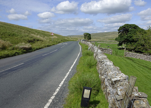
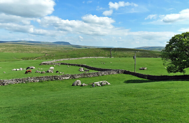
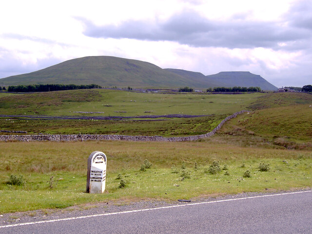
Capnut Pasture is a picturesque area located in Yorkshire, England, nestled within the stunning landscape of the Yorkshire Downs and Moorland. Spanning over a vast expanse, this region is known for its breathtaking beauty, diverse wildlife, and rich cultural heritage.

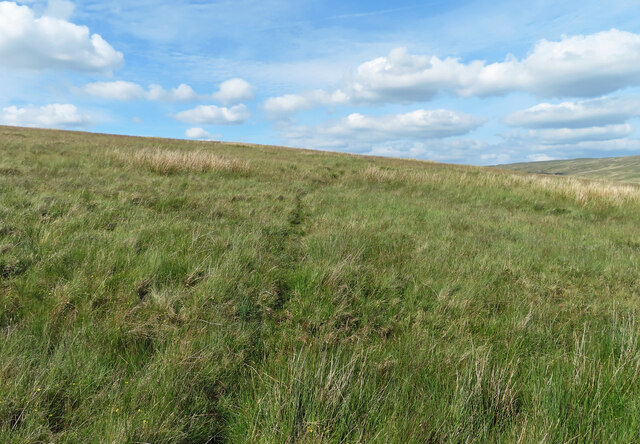
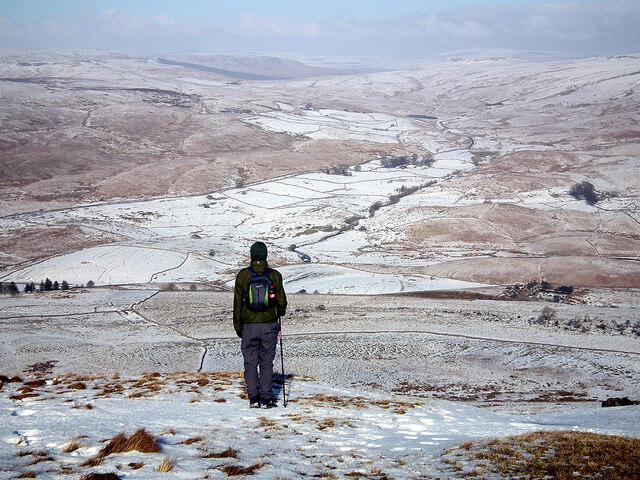
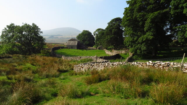
The rolling hills of the Yorkshire Downs dominate the landscape, providing a dramatic backdrop for Capnut Pasture. These hills are covered in lush green grass and dotted with vibrant wildflowers during the warmer months, creating a postcard-perfect scene. The region is also home to a variety of wildlife, including deer, hares, and numerous bird species, making it a haven for nature lovers and wildlife enthusiasts.

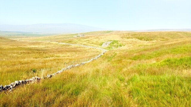
Capnut Pasture is characterized by its unique blend of open grassland and heather-clad moorland. The heather, which blooms in shades of purple and pink during late summer, creates a stunning contrast against the verdant landscape. This area is also rich in archaeological remains, with ancient stone circles and burial mounds scattered throughout, serving as a testament to the area's long history.

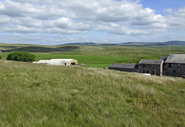
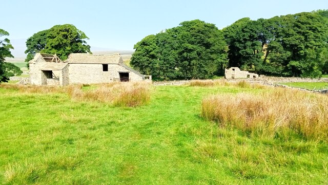
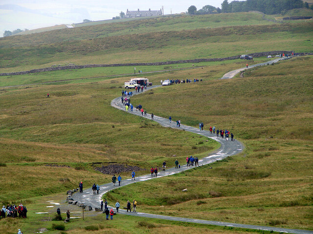
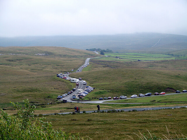
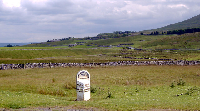
Hikers and outdoor enthusiasts are drawn to Capnut Pasture for its extensive network of walking trails, offering panoramic views of the surrounding countryside. The picturesque village of Capnut, nestled within the pasture, provides a charming base for visitors, with its quaint cottages and traditional pubs serving up hearty local fare.

In conclusion, Capnut Pasture in Yorkshire, with its idyllic blend of rolling hills, heather-clad moorland, and rich cultural heritage, is a haven for nature lovers and a must-visit destination for those seeking a quintessential English countryside experience.

If you have any feedback on the listing, please let us know in the comments section below.

Capnut Pasture Images

Images are sourced within 2km of 54.211312/-2.3375206 or Grid Reference SD7879. Thanks to Geograph Open Source API. All images are credited.
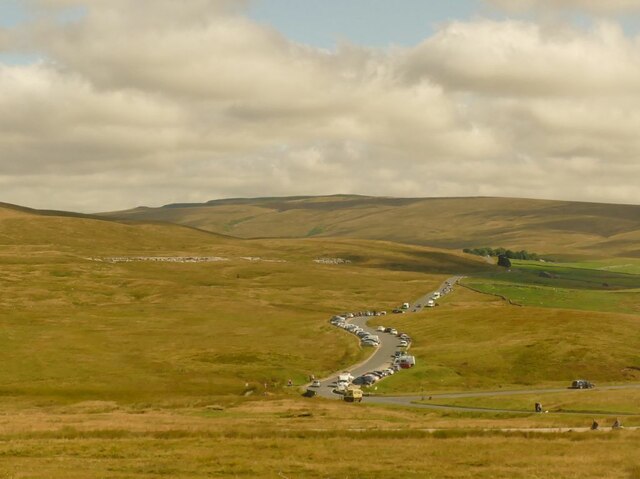
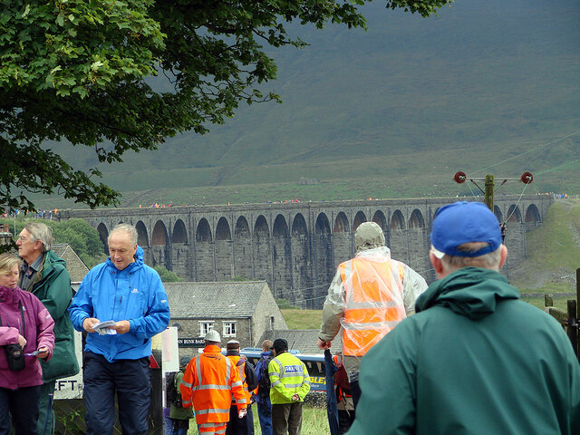
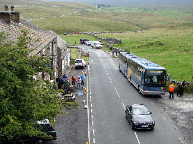
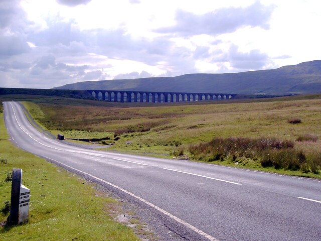
Passing Far Gearstones The B6255 climbs up the moor from Ribblehead before descending into Widdale.
Passing Far Gearstones
The B6255 climbs up the moor from Ribblehead before descending into Widdale.
At Far Gearstones Fields near the farm buildings, marked out by traditional dry-stone walls.
At Far Gearstones
Fields near the farm buildings, marked out by traditional dry-stone walls.
On Green Slack Hill A sort of a path on the moor near Gearstones.
On Green Slack Hill
A sort of a path on the moor near Gearstones.
From Green Slack Hill This view taken from the edge of the hill shows Far Gearstones on the left and Gearstones Lodge on the right.
From Green Slack Hill
This view taken from the edge of the hill shows Far Gearstones on the left and Gearstones Lodge on the right.
Old milestone The 13 mile section of the route from Burton in Lonsdale to the old West Riding/North Riding boundary was, prior to 1974, in the West Riding but is now  North Yorkshire.   The previous photograph of this stone at the entrance to Far Gearstones Farm <a href="https://www.geograph.org.uk/photo/6044877">SD7880 : Old Milestone by the B6255, Blea Moor Road, Ingleton Parish</a> was actually taken in April 2015 not as stated.   It has been painted since then but rust is once again showing through.   Grade II listed 1132231.
Old milestone
The 13 mile section of the route from Burton in Lonsdale to the old West Riding/North Riding boundary was, prior to 1974, in the West Riding but is now North Yorkshire. The previous photograph of this stone at the entrance to Far Gearstones Farm SD7880 : Old Milestone by the B6255, Blea Moor Road, Ingleton Parish was actually taken in April 2015 not as stated. It has been painted since then but rust is once again showing through. Grade II listed 1132231.
A view over the upper Ribble valley from Park Fell With the cottages at Gauber visible on the right.
A view over the upper Ribble valley from Park Fell
With the cottages at Gauber visible on the right.
Cars parked at Gearstones This road junction at Ribblehead is popular with both visitors to the famous viaduct, and longer distance walkers.
Cars parked at Gearstones
This road junction at Ribblehead is popular with both visitors to the famous viaduct, and longer distance walkers.
Thorns Old farm, now abandoned.
Thorns
Old farm, now abandoned.
Ribble Way Looking back in the direction of Whernside with a crumbling old lime kiln in the near distance on Thorns Moss.
Ribble Way
Looking back in the direction of Whernside with a crumbling old lime kiln in the near distance on Thorns Moss.
Viaduct walkers An official event allowing people to walk across Ribblehead Viaduct. Here people are awaiting their turn to do the walk. Walkers are seen across the viaduct. This was the last day of repairs to the viaduct and no trains were running.
Viaduct walkers
An official event allowing people to walk across Ribblehead Viaduct. Here people are awaiting their turn to do the walk. Walkers are seen across the viaduct. This was the last day of repairs to the viaduct and no trains were running.
Ribblehead viaduct walkers The Settle & Carlisle Railway was closed for repairs to the viaduct. On the last day of the closure, people were permitted to walk across the viaduct. Here, some are seen returning to Ribblehead, viewed from the viaduct.
Ribblehead viaduct walkers
The Settle & Carlisle Railway was closed for repairs to the viaduct. On the last day of the closure, people were permitted to walk across the viaduct. Here, some are seen returning to Ribblehead, viewed from the viaduct.
A busy day at Ribblehead On a day when the viaduct was open to walkers.
A busy day at Ribblehead
On a day when the viaduct was open to walkers.
Buses at Ribblehead Transporting walkers for the walking on the Ribblehead viaduct event.
Buses at Ribblehead
Transporting walkers for the walking on the Ribblehead viaduct event.
Abandoned farmstead at Cove Hole near Ribblehead
Ribblehead [2] Although not the most pleasant of weather, the area around the Ribblehead Viaduct was crowded.
Ribblehead [2]
Although not the most pleasant of weather, the area around the Ribblehead Viaduct was crowded.
Milestone on Blea Moor Road (B6255), Ribblehead A close-up of the milestone can be seen in <a href="https://www.geograph.org.uk/photo/7041937">SD7679 : Milestone on Blea Moor Road (B6255), Ribblehead</a>.
Milestone on Blea Moor Road (B6255), Ribblehead
A close-up of the milestone can be seen in SD7679 : Milestone on Blea Moor Road (B6255), Ribblehead.
Blea Moor Road (B6255) approaching the Ribblehead Viaduct A close-up of the milestone can be seen in <a href="https://www.geograph.org.uk/photo/7041937">SD7679 : Milestone on Blea Moor Road (B6255), Ribblehead</a>.
Blea Moor Road (B6255) approaching the Ribblehead Viaduct
A close-up of the milestone can be seen in SD7679 : Milestone on Blea Moor Road (B6255), Ribblehead.
Looking towards Ingleborough from Blea Moor Road (B6255), Ribblehead A close-up of the milestone can be seen in <a href="https://www.geograph.org.uk/photo/7041937">SD7679 : Milestone on Blea Moor Road (B6255), Ribblehead</a>.
Looking towards Ingleborough from Blea Moor Road (B6255), Ribblehead
A close-up of the milestone can be seen in SD7679 : Milestone on Blea Moor Road (B6255), Ribblehead.
Show me another place!

Capnut Pasture is located at Grid Ref: SD7879 (Lat: 54.211312, Lng: -2.3375206)

Division: West Riding

Administrative County: North Yorkshire

District: Craven

Police Authority: North Yorkshire

What 3 Words

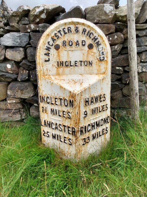
///pushed.planting.decompose. Near Ingleton, North Yorkshire

Related Wikis

Ribblehead

Ribblehead is the area of moorland at the head of the River Ribble in the area known as Ribblesdale, in the Yorkshire Dales National Park, England. Ribblehead...

Ribblehead Quarry

Ribblehead Quarry is a former limestone quarry next to Ribblehead railway station in the Yorkshire Dales National Park, North Yorkshire, England. It had...

Ribblehead railway station

Ribblehead is a railway station on the Settle and Carlisle Line, which runs between Carlisle and Leeds via Settle. The station, situated 52 miles 17 chains...

Ribblehead Viaduct

The Ribblehead Viaduct or Batty Moss Viaduct carries the Settle–Carlisle railway across Batty Moss in the Ribble Valley at Ribblehead, in North Yorkshire...

Ling Gill

Ling Gill is a gill (or narrow valley) in the Yorkshire Dales in North Yorkshire, England. Cam Beck, a tributary of the River Ribble, flows through the...

High Birkwith

High Birkwith is a hamlet in the Craven district of North Yorkshire, England. It is located north of the village of Horton in Ribblesdale and in the same...

Blea Moor Tunnel

Blea Moor Tunnel is a 2,629 yards (1.494 mi)(2,404 m) railway tunnel located between Ribblehead Viaduct and Dent railway station in England. It is the...

Selside, North Yorkshire

Selside is a small village in Ribblesdale in North Yorkshire, England. It lies 2 miles (3 km) north west of Horton in Ribblesdale. Selside was mentioned...

Nearby Amenities

Located within 500m of 54.211312,-2.3375206
Gearstones
Place: hamlet
Lat/Long: 54.2151307/-2.3393722
Barrier: stile
Material: wood
Source: survey;bing
Stile: stepover
Lat/Long: 54.2148661/-2.3389047
Barrier: stile
Material: stone
Source: survey;gps
Stile: stepover
Lat/Long: 54.2138485/-2.3367974
Barrier: stile
Lat/Long: 54.2135838/-2.3402596
High Flat Hill
Natural: peak
Source: OS 1:25k
Lat/Long: 54.2090688/-2.3405564
Barrier: stile
Material: wood
Source: survey;gps
Stile: ladder
Lat/Long: 54.2097149/-2.3356264
Barrier: stile
Source: survey;gps
Stile: ladder
Lat/Long: 54.2138207/-2.3365946
Natural: sinkhole
Source: EsriWorldImageryClarity
Lat/Long: 54.2102786/-2.344852
Natural: sinkhole
Source: EsriWorldImageryClarity
Lat/Long: 54.2103602/-2.3445087
Natural: sinkhole
Source: EsriWorldImageryClarity
Lat/Long: 54.2104293/-2.3445516
Natural: sinkhole
Source: EsriWorldImageryClarity
Lat/Long: 54.212041/-2.338297
Natural: sinkhole
Source: EsriWorldImageryClarity
Lat/Long: 54.2134141/-2.3331766
Natural: sinkhole
Source: EsriWorldImageryClarity
Lat/Long: 54.2134329/-2.3327368
Natural: sinkhole
Source: EsriWorldImageryClarity
Lat/Long: 54.2102162/-2.3403569
Natural: sinkhole
Source: EsriWorldImageryClarity
Lat/Long: 54.2115767/-2.3382755
Natural: sinkhole
Source: EsriWorldImageryClarity
Lat/Long: 54.213213/-2.3339604
Natural: sinkhole
Source: EsriWorldImageryClarity
Lat/Long: 54.2121847/-2.3423927
Natural: sinkhole
Source: EsriWorldImageryClarity
Lat/Long: 54.2120661/-2.343243
Natural: sinkhole
Source: EsriWorldImageryClarity
Lat/Long: 54.2113258/-2.338018
Natural: sinkhole
Source: EsriWorldImageryClarity
Lat/Long: 54.2129495/-2.3340033
Natural: sinkhole
Source: EsriWorldImageryClarity
Lat/Long: 54.2112379/-2.3423096
Natural: sinkhole
Source: EsriWorldImageryClarity
Lat/Long: 54.2103542/-2.3413118
Natural: sinkhole
Source: EsriWorldImageryClarity
Lat/Long: 54.2102974/-2.3415907
Natural: sinkhole
Source: EsriWorldImageryClarity
Lat/Long: 54.2116646/-2.3383721
Natural: sinkhole
Source: EsriWorldImageryClarity
Lat/Long: 54.2118277/-2.3385545
Natural: sinkhole
Source: EsriWorldImageryClarity
Lat/Long: 54.2100279/-2.3398097
Natural: sinkhole
Source: EsriWorldImageryClarity
Lat/Long: 54.210059/-2.339563
Natural: sinkhole
Source: EsriWorldImageryClarity
Lat/Long: 54.2100969/-2.341934
Natural: sinkhole
Source: EsriWorldImageryClarity
Lat/Long: 54.2122983/-2.3386296
Natural: sinkhole
Source: EsriWorldImageryClarity
Lat/Long: 54.2134956/-2.3338955
Natural: sinkhole
Source: EsriWorldImageryClarity
Lat/Long: 54.2099577/-2.3428326
Natural: sinkhole
Source: EsriWorldImageryClarity
Lat/Long: 54.2131007/-2.3336171
Natural: sinkhole
Source: EsriWorldImageryClarity
Lat/Long: 54.2134078/-2.3330693
Natural: sinkhole
Source: EsriWorldImageryClarity
Lat/Long: 54.2122412/-2.345032
Natural: sinkhole
Source: EsriWorldImageryClarity
Lat/Long: 54.2097243/-2.3422982
Natural: sinkhole
Source: EsriWorldImageryClarity
Lat/Long: 54.2135518/-2.3340247
Natural: sinkhole
Source: EsriWorldImageryClarity
Lat/Long: 54.2134204/-2.333477
Natural: sinkhole
Source: EsriWorldImageryClarity
Lat/Long: 54.2112445/-2.3419662
Natural: sinkhole
Source: EsriWorldImageryClarity
Lat/Long: 54.2114575/-2.3422345
Natural: sinkhole
Source: EsriWorldImageryClarity
Lat/Long: 54.2108119/-2.3426958
Natural: sinkhole
Source: EsriWorldImageryClarity
Lat/Long: 54.2135769/-2.3336385
Natural: sinkhole
Source: EsriWorldImageryClarity
Lat/Long: 54.21374/-2.3329519
Natural: sinkhole
Source: EsriWorldImageryClarity
Lat/Long: 54.2135643/-2.3333596
Natural: sinkhole
Source: EsriWorldImageryClarity
Lat/Long: 54.2111379/-2.3424276
Natural: sinkhole
Source: EsriWorldImageryClarity
Lat/Long: 54.2132886/-2.3336165
Natural: sinkhole
Source: EsriWorldImageryClarity
Lat/Long: 54.210843/-2.342449
Natural: sinkhole
Source: EsriWorldImageryClarity
Lat/Long: 54.2106488/-2.3426636
Natural: sinkhole
Source: EsriWorldImageryClarity
Lat/Long: 54.2134329/-2.3329299
Natural: sinkhole
Source: EsriWorldImageryClarity
Lat/Long: 54.210235/-2.3417517
Natural: sinkhole
Source: EsriWorldImageryClarity
Lat/Long: 54.2132632/-2.3330806
Natural: sinkhole
Source: EsriWorldImageryClarity
Lat/Long: 54.2120852/-2.3429855
Power: pole
Lat/Long: 54.2154886/-2.3373477
Power: pole
Lat/Long: 54.2149931/-2.3381761
Power: pole
Lat/Long: 54.2144449/-2.3390817
Power: pole
Lat/Long: 54.2139186/-2.3399497
Power: pole
Lat/Long: 54.2133659/-2.340878
Power: pole
Lat/Long: 54.2128043/-2.3418081
Power: pole
Lat/Long: 54.2122021/-2.3427664
Power: pole
Lat/Long: 54.2115668/-2.3438359
Power: pole
Lat/Long: 54.2110779/-2.3450145
Power: pole
Lat/Long: 54.2150042/-2.3387052
Power: pole
Lat/Long: 54.2150185/-2.3393435
Natural: stone
Lat/Long: 54.2100189/-2.3425977
Natural: stone
Lat/Long: 54.2099942/-2.3424285
Natural: stone
Lat/Long: 54.2099313/-2.3424271
Natural: stone
Lat/Long: 54.2099623/-2.3422981
Natural: stone
Lat/Long: 54.2099938/-2.3422336
Natural: stone
Lat/Long: 54.2101254/-2.3422322
Natural: stone
Lat/Long: 54.2100642/-2.3421347
Natural: stone
Lat/Long: 54.2100772/-2.3420494
Natural: stone
Lat/Long: 54.2096691/-2.3428372
Natural: stone
Lat/Long: 54.2096438/-2.3428133
Natural: stone
Lat/Long: 54.2096491/-2.3429698
Natural: stone
Lat/Long: 54.2096281/-2.3431188
Natural: stone
Lat/Long: 54.2096525/-2.343089
Natural: stone
Lat/Long: 54.2096691/-2.3430845
Natural: stone
Lat/Long: 54.2096377/-2.3423767
Natural: stone
Lat/Long: 54.2098556/-2.3426748
Natural: stone
Lat/Long: 54.2098347/-2.3425958
Natural: stone
Lat/Long: 54.2098704/-2.3427165
Natural: stone
Lat/Long: 54.2098556/-2.3427195
Natural: stone
Lat/Long: 54.2098643/-2.3427463
Natural: stone
Lat/Long: 54.2098652/-2.342785
Natural: stone
Lat/Long: 54.2098469/-2.342782
Natural: stone
Lat/Long: 54.2098469/-2.3427522
Natural: stone
Lat/Long: 54.2098329/-2.3427612
Natural: stone
Lat/Long: 54.2098016/-2.342864
Natural: stone
Lat/Long: 54.2097571/-2.3429713
Natural: stone
Lat/Long: 54.2098225/-2.3429847
Natural: stone
Lat/Long: 54.2105864/-2.3417163
Natural: stone
Lat/Long: 54.2105849/-2.3413861
Natural: stone
Lat/Long: 54.2103148/-2.3417911
Natural: stone
Lat/Long: 54.2102363/-2.3418943
Natural: stone
Lat/Long: 54.2102665/-2.3419434
Natural: stone
Lat/Long: 54.2103827/-2.3425729
Natural: stone
Lat/Long: 54.2104808/-2.3425806
Barrier: entrance
Lat/Long: 54.2086006/-2.3405604
Natural: stone
Lat/Long: 54.2091607/-2.3436404
Natural: stone
Lat/Long: 54.2090521/-2.3438081
Natural: stone
Lat/Long: 54.2089434/-2.3437745
Natural: stone
Lat/Long: 54.20904/-2.3436094
Natural: stone
Lat/Long: 54.2090219/-2.343323
Natural: stone
Lat/Long: 54.2091864/-2.3432843
Natural: stone
Lat/Long: 54.2091366/-2.3434856
Natural: stone
Lat/Long: 54.2092422/-2.3434546
Ford: yes
Lat/Long: 54.2141232/-2.3354889
The data included in this document is from www.openstreetmap.org. The data is made available under ODbL.

Have you been to Capnut Pasture?

Leave your review of Capnut Pasture below (or comments, questions and feedback).