Middle Hill

Hill, Mountain in Yorkshire Craven

England

Middle Hill

The Pennine Way near New Head Hill
The Pennine Way near New Head Hill Credit: Dave Kelly

Middle Hill is a prominent geographic feature located in Yorkshire, England. Situated within the picturesque landscape of the North York Moors National Park, it stands as a testament to the region's natural beauty. With an elevation of approximately 343 meters (1,125 feet), Middle Hill is classified as a hill rather than a mountain.

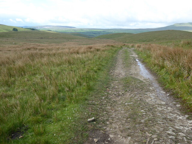
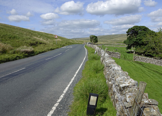
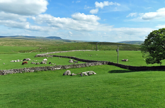
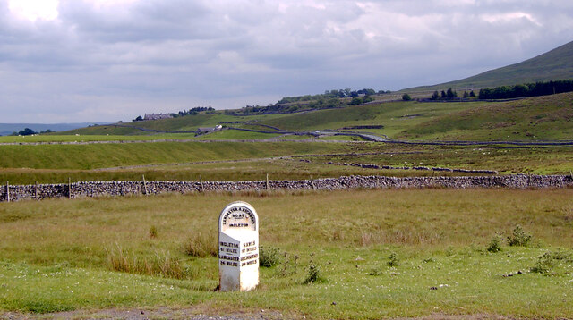
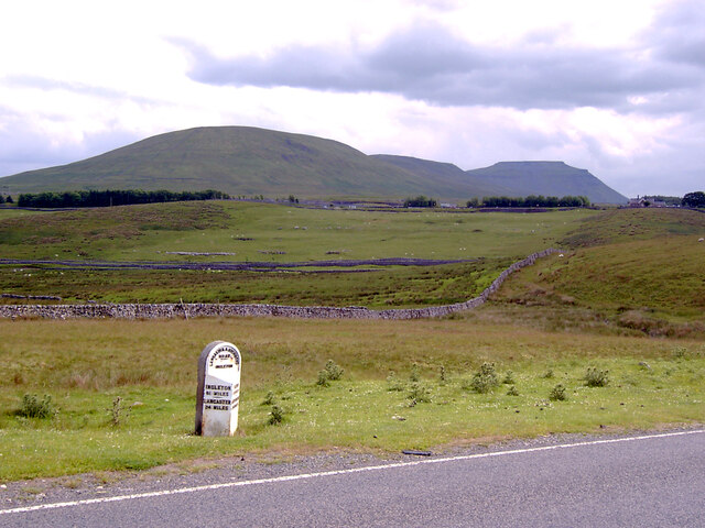
The hill's location provides visitors with breathtaking panoramic views of the surrounding countryside. On clear days, one can see the rolling hills, expansive valleys, and charming villages that dot the Yorkshire landscape. The hill's summit is accessible via well-maintained footpaths, making it a popular destination for hikers and nature enthusiasts.

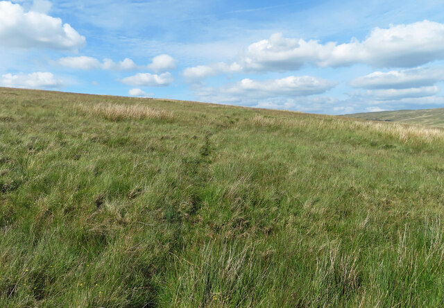
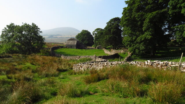
Middle Hill is also home to a diverse range of flora and fauna. The lower slopes are covered in lush vegetation, including heather, grasses, and wildflowers, while the upper reaches are characterized by stony outcrops and scattered shrubs. The hill provides a habitat for various bird species, such as curlews, lapwings, and skylarks, as well as small mammals like rabbits and hares.

For those seeking outdoor activities, Middle Hill offers ample opportunities for exploration and adventure. Its location within the North York Moors National Park means that there are numerous walking and cycling trails in the vicinity, allowing visitors to immerse themselves in the area's natural splendor. Additionally, the hill is a popular spot for paragliding and hang gliding, attracting thrill-seekers from far and wide.

In conclusion, Middle Hill is a captivating destination in Yorkshire, offering stunning views, diverse wildlife, and outdoor recreational opportunities. Whether visitors seek peaceful walks amidst nature or adrenaline-fueled adventures, Middle Hill has something to offer for all.

If you have any feedback on the listing, please let us know in the comments section below.

Middle Hill Images

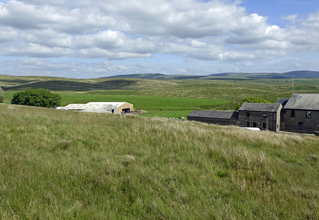
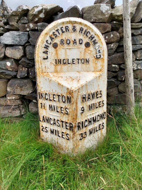
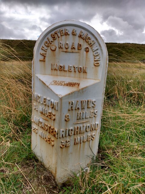
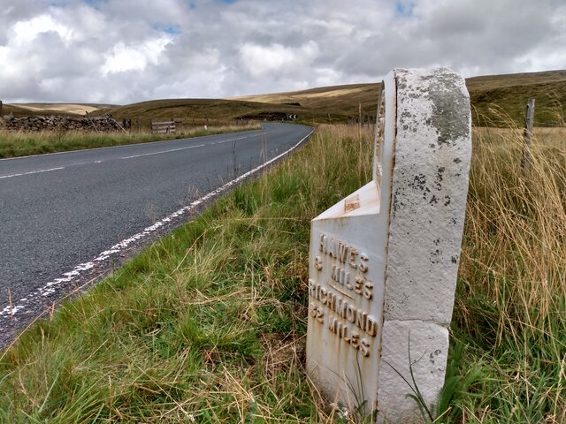
Images are sourced within 2km of 54.213609/-2.3326938 or Grid Reference SD7879. Thanks to Geograph Open Source API. All images are credited.
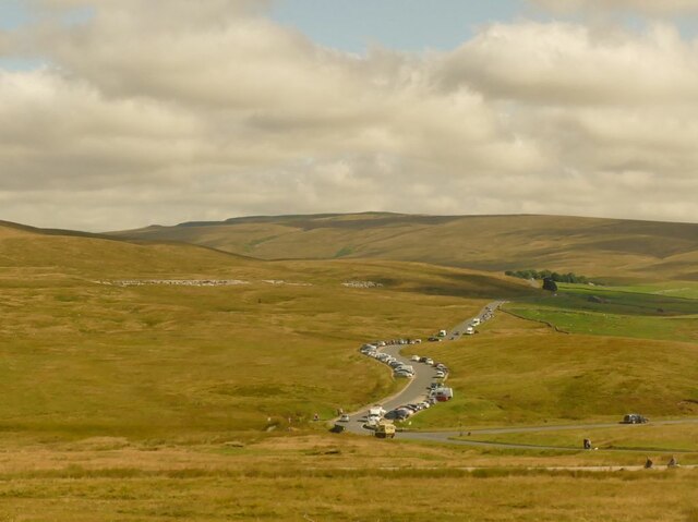
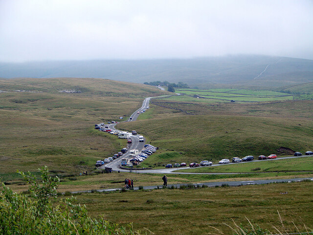
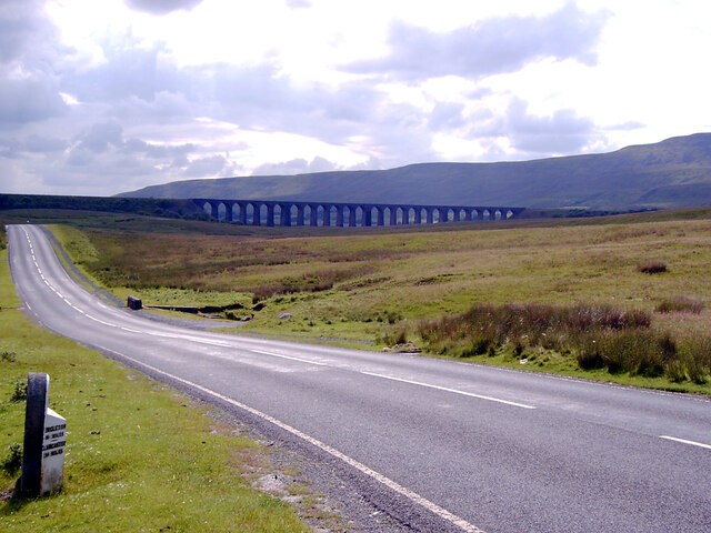
The Pennine Way near New Head Hill
Passing Far Gearstones The B6255 climbs up the moor from Ribblehead before descending into Widdale.
Passing Far Gearstones
The B6255 climbs up the moor from Ribblehead before descending into Widdale.
At Far Gearstones Fields near the farm buildings, marked out by traditional dry-stone walls.
At Far Gearstones
Fields near the farm buildings, marked out by traditional dry-stone walls.
On Green Slack Hill A sort of a path on the moor near Gearstones.
On Green Slack Hill
A sort of a path on the moor near Gearstones.
From Green Slack Hill This view taken from the edge of the hill shows Far Gearstones on the left and Gearstones Lodge on the right.
From Green Slack Hill
This view taken from the edge of the hill shows Far Gearstones on the left and Gearstones Lodge on the right.
Old milestone The 13 mile section of the route from Burton in Lonsdale to the old West Riding/North Riding boundary was, prior to 1974, in the West Riding but is now  North Yorkshire.   The previous photograph of this stone at the entrance to Far Gearstones Farm <a href="https://www.geograph.org.uk/photo/6044877">SD7880 : Old Milestone by the B6255, Blea Moor Road, Ingleton Parish</a> was actually taken in April 2015 not as stated.   It has been painted since then but rust is once again showing through.   Grade II listed 1132231.
Old milestone
The 13 mile section of the route from Burton in Lonsdale to the old West Riding/North Riding boundary was, prior to 1974, in the West Riding but is now North Yorkshire. The previous photograph of this stone at the entrance to Far Gearstones Farm SD7880 : Old Milestone by the B6255, Blea Moor Road, Ingleton Parish was actually taken in April 2015 not as stated. It has been painted since then but rust is once again showing through. Grade II listed 1132231.
Old milestone This milestone has been painted since <a href="https://www.geograph.org.uk/photo/6102622">SD7981 : Old Milestone by the B6255 on Gayle Moor</a> was taken but the legends have not been picked out in black.   On the bevel can be seen the rectangle with the maker's name, William Towler, Globe Foundry, Leeds.   On the 1893 contract the metal castings were to be painted blue with white lettering.   It is not known when black letters on white became the norm.   When old paint is stripped off prior to repainting patches of blue can sometimes be seen.   Grade II listed 1289368.
Old milestone
This milestone has been painted since SD7981 : Old Milestone by the B6255 on Gayle Moor was taken but the legends have not been picked out in black. On the bevel can be seen the rectangle with the maker's name, William Towler, Globe Foundry, Leeds. On the 1893 contract the metal castings were to be painted blue with white lettering. It is not known when black letters on white became the norm. When old paint is stripped off prior to repainting patches of blue can sometimes be seen. Grade II listed 1289368.
Old milestone Looking towards Hawes, it can be seen that the backing stone is cracked.   But it is securely held by 4 bolts, 2 in the top part and 2 at the base although they are hidden in the soil at this milestone.   The backing stones were not painted when they were set up but over the years some have been painted white, some black and some grey.   The stones were to be got from a quarry in Kirkstall (Leeds) or be of similar quality.
Old milestone
Looking towards Hawes, it can be seen that the backing stone is cracked. But it is securely held by 4 bolts, 2 in the top part and 2 at the base although they are hidden in the soil at this milestone. The backing stones were not painted when they were set up but over the years some have been painted white, some black and some grey. The stones were to be got from a quarry in Kirkstall (Leeds) or be of similar quality.
Gayle Beck Lodge The ruined remains of Gayle Beck Lodge, a month later the chimney and gable end totally collapsed.
Gayle Beck Lodge
The ruined remains of Gayle Beck Lodge, a month later the chimney and gable end totally collapsed.
Cars parked at Gearstones This road junction at Ribblehead is popular with both visitors to the famous viaduct, and longer distance walkers.
Cars parked at Gearstones
This road junction at Ribblehead is popular with both visitors to the famous viaduct, and longer distance walkers.
Thorns Old farm, now abandoned.
Thorns
Old farm, now abandoned.
Ribble Way Looking back in the direction of Whernside with a crumbling old lime kiln in the near distance on Thorns Moss.
Ribble Way
Looking back in the direction of Whernside with a crumbling old lime kiln in the near distance on Thorns Moss.
A busy day at Ribblehead On a day when the viaduct was open to walkers.
A busy day at Ribblehead
On a day when the viaduct was open to walkers.
Abandoned farmstead at Cove Hole near Ribblehead
Ribblehead [2] Although not the most pleasant of weather, the area around the Ribblehead Viaduct was crowded.
Ribblehead [2]
Although not the most pleasant of weather, the area around the Ribblehead Viaduct was crowded.
Milestone on Blea Moor Road (B6255), Ribblehead A close-up of the milestone can be seen in <a href="https://www.geograph.org.uk/photo/7041937">SD7679 : Milestone on Blea Moor Road (B6255), Ribblehead</a>.
Milestone on Blea Moor Road (B6255), Ribblehead
A close-up of the milestone can be seen in SD7679 : Milestone on Blea Moor Road (B6255), Ribblehead.
Blea Moor Road (B6255) approaching the Ribblehead Viaduct A close-up of the milestone can be seen in <a href="https://www.geograph.org.uk/photo/7041937">SD7679 : Milestone on Blea Moor Road (B6255), Ribblehead</a>.
Blea Moor Road (B6255) approaching the Ribblehead Viaduct
A close-up of the milestone can be seen in SD7679 : Milestone on Blea Moor Road (B6255), Ribblehead.
Looking towards Ingleborough from Blea Moor Road (B6255), Ribblehead A close-up of the milestone can be seen in <a href="https://www.geograph.org.uk/photo/7041937">SD7679 : Milestone on Blea Moor Road (B6255), Ribblehead</a>.
Looking towards Ingleborough from Blea Moor Road (B6255), Ribblehead
A close-up of the milestone can be seen in SD7679 : Milestone on Blea Moor Road (B6255), Ribblehead.
Show me another place!

Middle Hill is located at Grid Ref: SD7879 (Lat: 54.213609, Lng: -2.3326938)

Division: West Riding

Administrative County: North Yorkshire

District: Craven

Police Authority: North Yorkshire

What 3 Words

///frame.incurs.gravitate. Near Ingleton, North Yorkshire

Related Wikis

Nearby Amenities

Located within 500m of 54.213609,-2.3326938
Gearstones
Place: hamlet
Lat/Long: 54.2151307/-2.3393722
Milestone
Lat/Long: 54.2174042/-2.3337554
Barrier: stile
Material: wood
Source: survey;bing
Stile: stepover
Lat/Long: 54.2148661/-2.3389047
Barrier: stile
Material: stone
Source: survey;gps
Stile: stepover
Lat/Long: 54.2138485/-2.3367974
Barrier: stile
Lat/Long: 54.2135838/-2.3402596
Barrier: stile
Lat/Long: 54.2179457/-2.3308726
Building: yes
Lat/Long: 54.2171354/-2.3354251
Middle Hill
Natural: peak
Source: OS 1:25k
Lat/Long: 54.2125598/-2.3300443
Barrier: stile
Material: wood
Source: survey;gps
Stile: ladder
Lat/Long: 54.2097149/-2.3356264
Barrier: stile
Source: survey;gps
Stile: ladder
Lat/Long: 54.2138207/-2.3365946
Barrier: cattle_grid
Lat/Long: 54.2172367/-2.3338499
Barrier: cattle_grid
Lat/Long: 54.2173145/-2.3336424
Natural: sinkhole
Source: EsriWorldImageryClarity
Lat/Long: 54.212041/-2.338297
Natural: sinkhole
Source: EsriWorldImageryClarity
Lat/Long: 54.2134141/-2.3331766
Natural: sinkhole
Source: EsriWorldImageryClarity
Lat/Long: 54.2134329/-2.3327368
Natural: sinkhole
Source: EsriWorldImageryClarity
Lat/Long: 54.2115767/-2.3382755
Natural: sinkhole
Source: EsriWorldImageryClarity
Lat/Long: 54.213213/-2.3339604
Natural: sinkhole
Source: EsriWorldImageryClarity
Lat/Long: 54.2113258/-2.338018
Natural: sinkhole
Source: EsriWorldImageryClarity
Lat/Long: 54.2129495/-2.3340033
Natural: sinkhole
Source: EsriWorldImageryClarity
Lat/Long: 54.2116646/-2.3383721
Natural: sinkhole
Source: EsriWorldImageryClarity
Lat/Long: 54.2118277/-2.3385545
Natural: sinkhole
Source: EsriWorldImageryClarity
Lat/Long: 54.2122983/-2.3386296
Natural: sinkhole
Source: EsriWorldImageryClarity
Lat/Long: 54.2134956/-2.3338955
Natural: sinkhole
Source: EsriWorldImageryClarity
Lat/Long: 54.2131007/-2.3336171
Natural: sinkhole
Source: EsriWorldImageryClarity
Lat/Long: 54.2134078/-2.3330693
Natural: sinkhole
Source: EsriWorldImageryClarity
Lat/Long: 54.2135518/-2.3340247
Natural: sinkhole
Source: EsriWorldImageryClarity
Lat/Long: 54.2134204/-2.333477
Natural: sinkhole
Source: EsriWorldImageryClarity
Lat/Long: 54.2135769/-2.3336385
Natural: sinkhole
Source: EsriWorldImageryClarity
Lat/Long: 54.21374/-2.3329519
Natural: sinkhole
Source: EsriWorldImageryClarity
Lat/Long: 54.2135643/-2.3333596
Natural: sinkhole
Source: EsriWorldImageryClarity
Lat/Long: 54.2132886/-2.3336165
Natural: sinkhole
Source: EsriWorldImageryClarity
Lat/Long: 54.2134329/-2.3329299
Natural: sinkhole
Source: EsriWorldImageryClarity
Lat/Long: 54.2132632/-2.3330806
Information: guidepost
Tourism: information
Lat/Long: 54.2179339/-2.3309123
Power: pole
Lat/Long: 54.2154886/-2.3373477
Power: pole
Lat/Long: 54.2149931/-2.3381761
Power: pole
Lat/Long: 54.2144449/-2.3390817
Power: pole
Lat/Long: 54.2139186/-2.3399497
Power: pole
Lat/Long: 54.2150042/-2.3387052
Power: pole
Lat/Long: 54.2150185/-2.3393435
Ford: yes
Lat/Long: 54.2141232/-2.3354889
Power: pole
Lat/Long: 54.2165704/-2.3352869
Power: pole
Lat/Long: 54.2171093/-2.3353218
Power: pole
Lat/Long: 54.2177472/-2.3349308
The data included in this document is from www.openstreetmap.org. The data is made available under ODbL.

Have you been to Middle Hill?

Leave your review of Middle Hill below (or comments, questions and feedback).