Broad Reyn Hill

Hill, Mountain in Yorkshire Craven

England

Broad Reyn Hill

The Pennine Way near Fair Bottom Hill
The Pennine Way near Fair Bottom Hill Credit: Dave Kelly

Broad Reyn Hill, located in Yorkshire, England, is a prominent hill/mountain that stands tall and proud in the picturesque landscape of the region. Rising to an elevation of approximately 500 meters (1,640 feet), it dominates the surrounding countryside, offering breathtaking views and a sense of tranquility.

Covered in lush greenery, Broad Reyn Hill boasts a diverse range of flora and fauna, making it an ideal spot for nature enthusiasts and hikers. The hill is known for its rolling slopes, which are dotted with patches of heather and wildflowers, creating a vibrant and colorful scenery during the warmer months.

Broad Reyn Hill is a popular destination for outdoor activities such as hiking, walking, and mountain biking. Several well-marked trails wind their way up the hill, catering to both experienced adventurers and casual walkers. As visitors ascend the hill, they are treated to stunning panoramic views of the surrounding Yorkshire Dales, with its patchwork of fields, meandering rivers, and quaint villages.

The hill's summit offers an excellent vantage point, granting visitors a 360-degree view of the surrounding landscape. On clear days, one can see as far as the North York Moors National Park and even catch a glimpse of the distant coastline.

Overall, Broad Reyn Hill is a captivating natural landmark that showcases the rugged beauty of Yorkshire. With its stunning vistas, abundant wildlife, and well-maintained trails, it is a must-visit destination for anyone seeking to immerse themselves in the splendor of the English countryside.

If you have any feedback on the listing, please let us know in the comments section below.

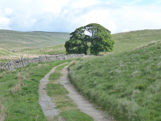
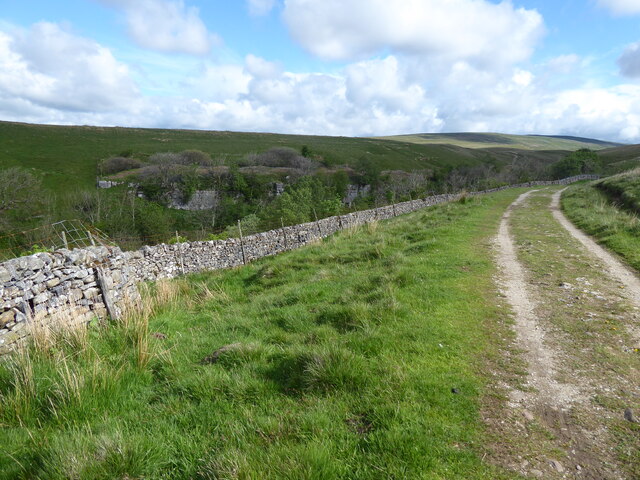
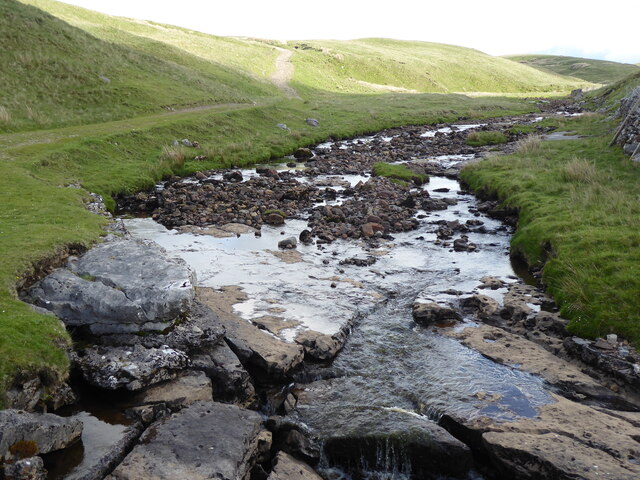
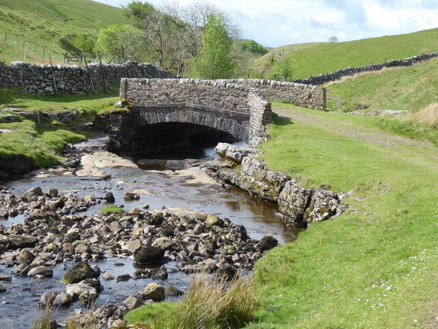
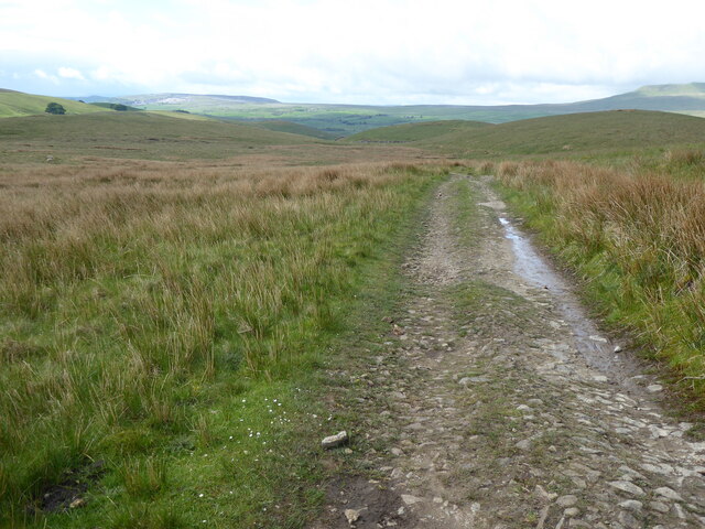
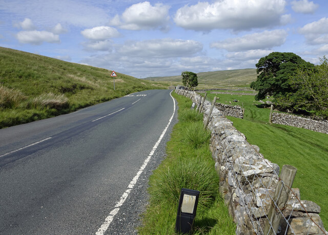
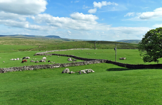
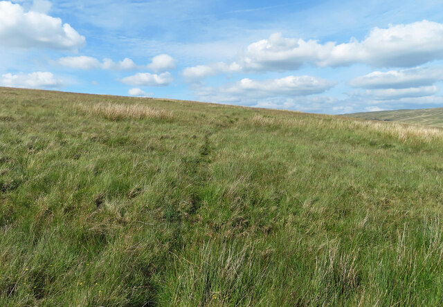
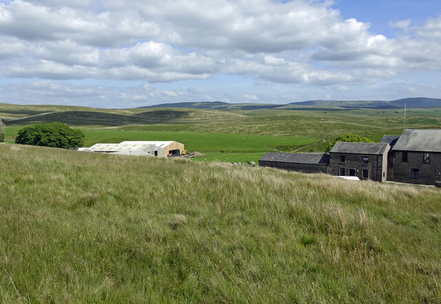
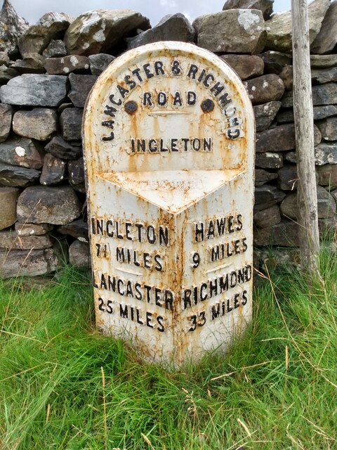
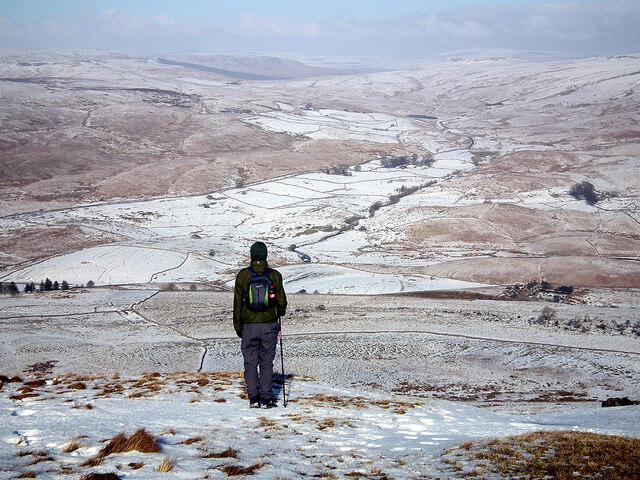
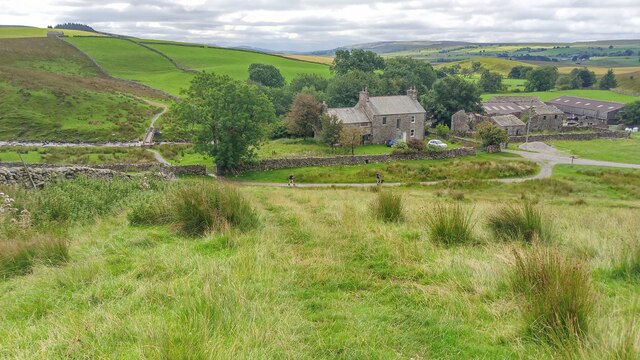
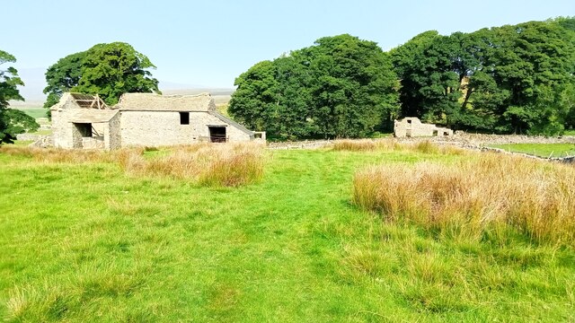
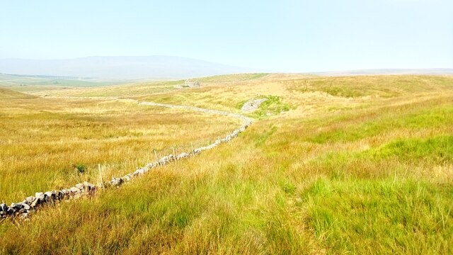
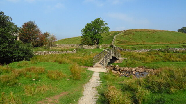
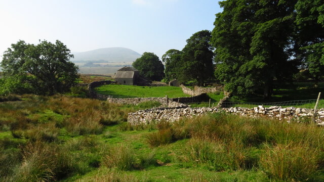
Broad Reyn Hill Images

Images are sourced within 2km of 54.210922/-2.3258951 or Grid Reference SD7879. Thanks to Geograph Open Source API. All images are credited.

The Pennine Way near Fair Bottom Hill
The Pennine Way near Ling Gill
The Pennine Way from Ling Gill Bridge
The Pennine Way at Ling Gill Bridge
The Pennine Way near New Head Hill
Passing Far Gearstones The B6255 climbs up the moor from Ribblehead before descending into Widdale.
Passing Far Gearstones
The B6255 climbs up the moor from Ribblehead before descending into Widdale.
At Far Gearstones Fields near the farm buildings, marked out by traditional dry-stone walls.
At Far Gearstones
Fields near the farm buildings, marked out by traditional dry-stone walls.
On Green Slack Hill A sort of a path on the moor near Gearstones.
On Green Slack Hill
A sort of a path on the moor near Gearstones.
From Green Slack Hill This view taken from the edge of the hill shows Far Gearstones on the left and Gearstones Lodge on the right.
From Green Slack Hill
This view taken from the edge of the hill shows Far Gearstones on the left and Gearstones Lodge on the right.
Old milestone The 13 mile section of the route from Burton in Lonsdale to the old West Riding/North Riding boundary was, prior to 1974, in the West Riding but is now  North Yorkshire.   The previous photograph of this stone at the entrance to Far Gearstones Farm <a href="https://www.geograph.org.uk/photo/6044877">SD7880 : Old Milestone by the B6255, Blea Moor Road, Ingleton Parish</a> was actually taken in April 2015 not as stated.   It has been painted since then but rust is once again showing through.   Grade II listed 1132231.
Old milestone
The 13 mile section of the route from Burton in Lonsdale to the old West Riding/North Riding boundary was, prior to 1974, in the West Riding but is now North Yorkshire. The previous photograph of this stone at the entrance to Far Gearstones Farm SD7880 : Old Milestone by the B6255, Blea Moor Road, Ingleton Parish was actually taken in April 2015 not as stated. It has been painted since then but rust is once again showing through. Grade II listed 1132231.
Ford on Sike Moor This ford is found above High Birkwith on Sike Moor.
Ford on Sike Moor
This ford is found above High Birkwith on Sike Moor.
Gayle Beck Lodge The ruined remains of Gayle Beck Lodge, a month later the chimney and gable end totally collapsed.
Gayle Beck Lodge
The ruined remains of Gayle Beck Lodge, a month later the chimney and gable end totally collapsed.
A view over the upper Ribble valley from Park Fell With the cottages at Gauber visible on the right.
A view over the upper Ribble valley from Park Fell
With the cottages at Gauber visible on the right.
Nether Lodge Ribblesdale Farm.
Nether Lodge
Ribblesdale Farm.
Thorns Old farm, now abandoned.
Thorns
Old farm, now abandoned.
Ribble Way Looking back in the direction of Whernside with a crumbling old lime kiln in the near distance on Thorns Moss.
Ribble Way
Looking back in the direction of Whernside with a crumbling old lime kiln in the near distance on Thorns Moss.
Footbridge over Cam Beck, Nether Lodge near Selside
Abandoned farmstead at Cove Hole near Ribblehead
Show me another place!

Broad Reyn Hill is located at Grid Ref: SD7879 (Lat: 54.210922, Lng: -2.3258951)

Division: West Riding

Administrative County: North Yorkshire

District: Craven

Police Authority: North Yorkshire

Also known as: Allen Hill

What 3 Words

///kinder.halt.blink. Near Ingleton, North Yorkshire

Related Wikis

Nearby Amenities

Located within 500m of 54.210922,-2.3258951
Middle Hill
Natural: peak
Source: OS 1:25k
Lat/Long: 54.2125598/-2.3300443
Broad Reyn Hill
Alt Name: Allen Hill
Natural: peak
Source: OS 1:25k
Lat/Long: 54.2113049/-2.3248945
Tile Hill
Natural: peak
Source: OS 1:25k
Lat/Long: 54.2066116/-2.3246799
The data included in this document is from www.openstreetmap.org. The data is made available under ODbL.

Have you been to Broad Reyn Hill?

Leave your review of Broad Reyn Hill below (or comments, questions and feedback).