Whitchester Moor

Downs, Moorland in Northumberland

England

Whitchester Moor

Pit Cottages With their own shelterbelt.
Beside the High Carriteth Burn.
Sheep look on!
Pit Cottages Credit: Russel Wills

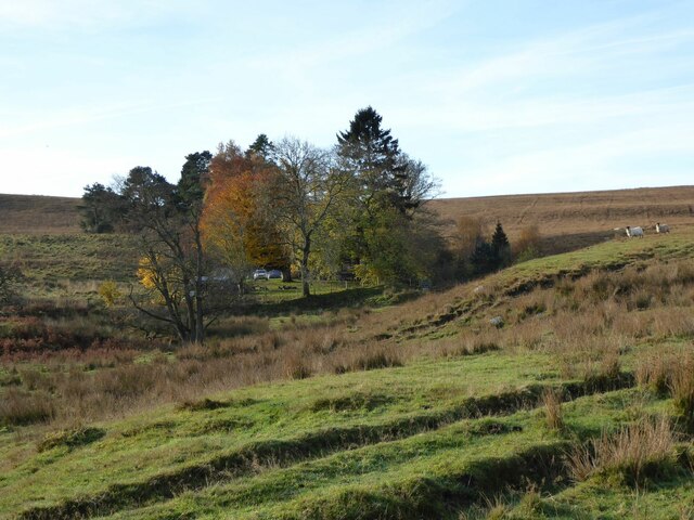
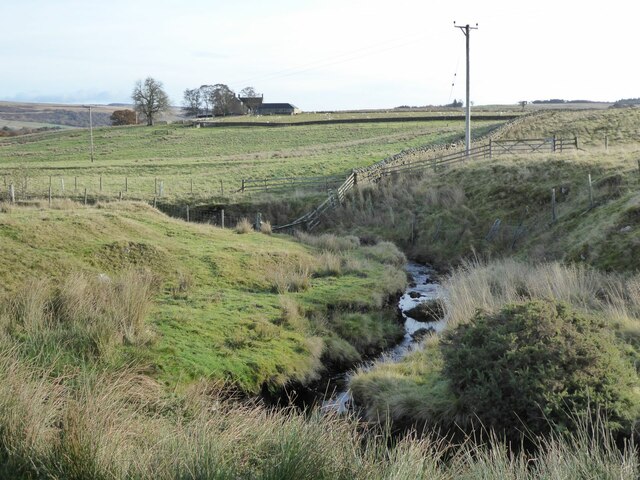
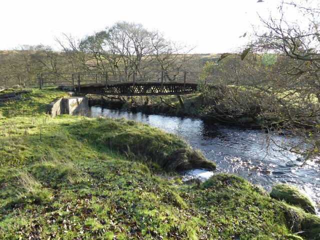
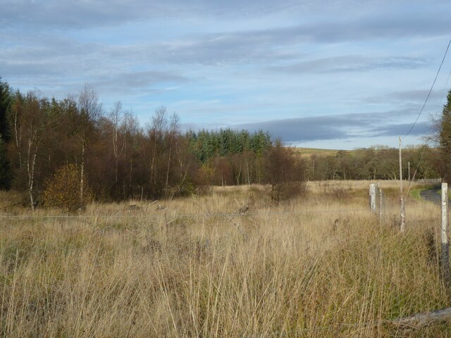
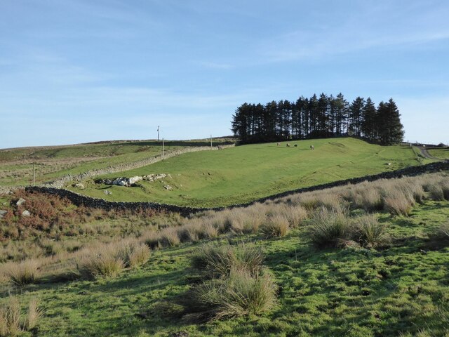
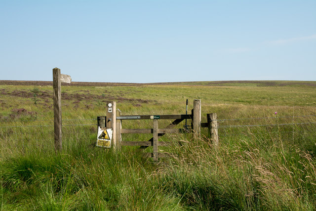
Whitchester Moor, located in the county of Northumberland, is a picturesque expanse of downs and moorland that spans across a vast area. Nestled within the northern region of England, this natural wonder offers visitors a unique blend of rugged beauty and tranquil landscapes.

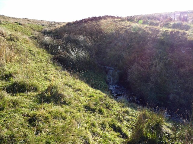
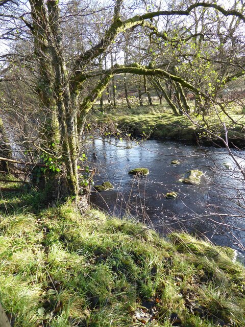
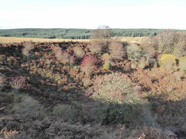
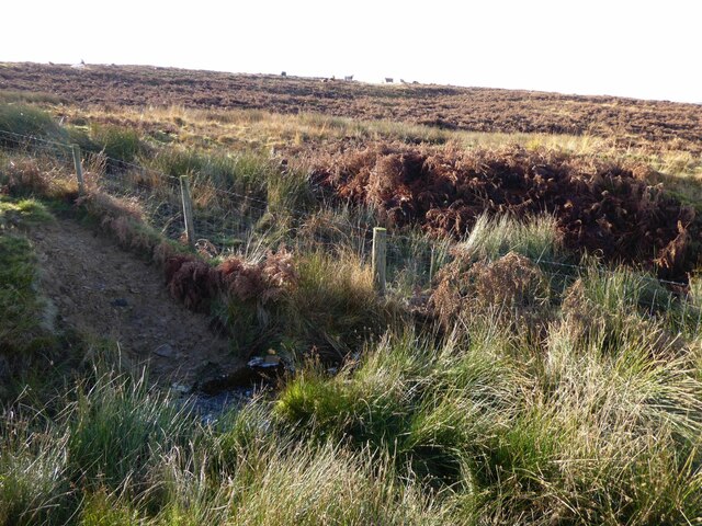
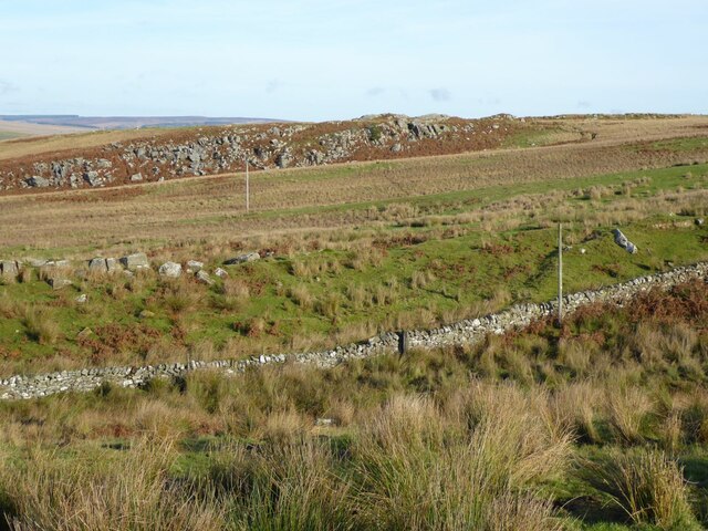
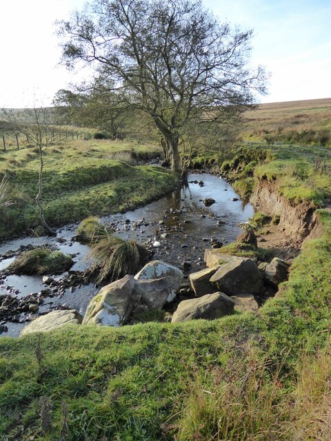
The moorland of Whitchester Moor is characterized by its rolling hills and heather-covered terrain. This wild and untamed landscape is home to a diverse range of flora and fauna, making it an ideal destination for nature enthusiasts. The moorland is particularly renowned for its stunning display of purple heather during the summer months, creating a breathtaking sight for visitors.

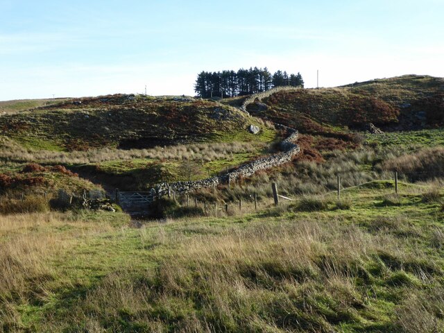
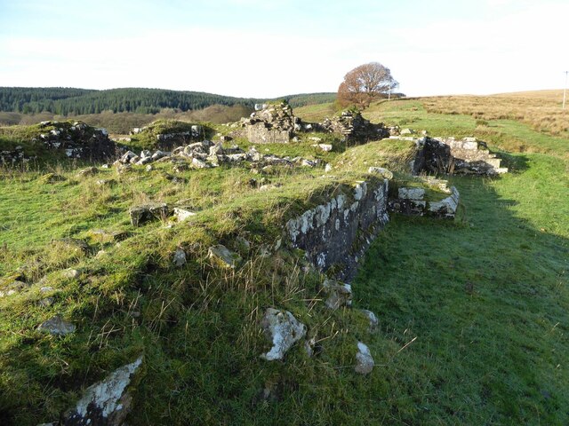
In addition to its natural beauty, Whitchester Moor also holds historical significance. Ancient burial mounds and standing stones can be found scattered across the landscape, serving as a reminder of the area's rich past. These archaeological treasures provide a fascinating glimpse into the lives of the people who once inhabited this area.

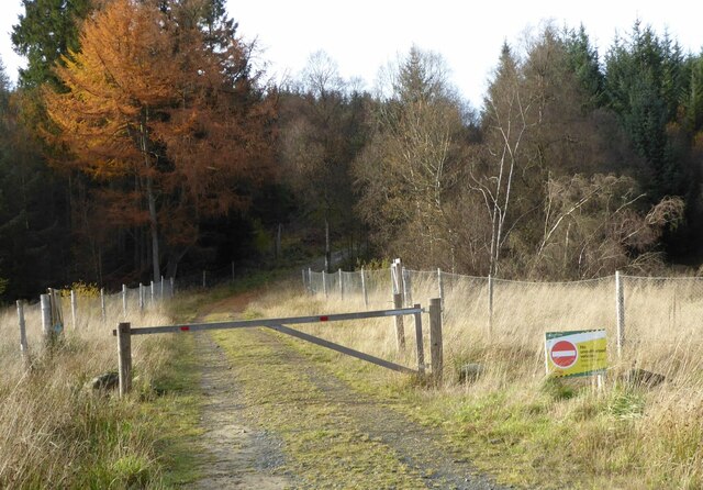
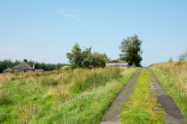
Outdoor activities such as hiking, birdwatching, and photography are popular pastimes for visitors to Whitchester Moor. The expansive trails that crisscross the moorland offer opportunities to explore its diverse habitats and encounter a wide variety of wildlife. Common sightings include red grouse, curlews, and skylarks, among other bird species.

Whitchester Moor is also a designated Site of Special Scientific Interest, ensuring the preservation of its unique ecosystems and rare species. Visitors are encouraged to respect the natural environment and adhere to designated paths and guidelines to protect the delicate balance of this remarkable moorland.

Overall, Whitchester Moor in Northumberland provides a captivating blend of natural beauty, historical significance, and recreational opportunities, making it a must-visit destination for those seeking to immerse themselves in the splendor of the British countryside.

If you have any feedback on the listing, please let us know in the comments section below.

Whitchester Moor Images

Images are sourced within 2km of 55.137872/-2.3453311 or Grid Reference NY7882. Thanks to Geograph Open Source API. All images are credited.

Pit Cottages With their own shelterbelt.
Beside the High Carriteth Burn.
Sheep look on!
Pit Cottages
With their own shelterbelt. Beside the High Carriteth Burn. Sheep look on!
High Carriteth Burn With High Carriteth farm in the background.
High Carriteth Burn
With High Carriteth farm in the background.
Stream near Whitchester farm Flowing off Whitchester Moor.
Stream near Whitchester farm
Flowing off Whitchester Moor.
Chirdon Burn Between Cadger Ford and Dally Castle.
Chirdon Burn
Between Cadger Ford and Dally Castle.
Substantial bridge over Chirdon Burn At Cadger Ford.  The ford has been superseded!
Carries the track to Whitchester and New Chirdon.
Substantial bridge over Chirdon Burn
At Cadger Ford. The ford has been superseded! Carries the track to Whitchester and New Chirdon.
Looking into Andrew's Cleugh A cleugh is Scots for a narrow gorge or chasm with high rocky sides.
This one seemed a haven for wildlife with birds enjoying the berries.
Bower wood on the horizon.
Looking into Andrew's Cleugh
A cleugh is Scots for a narrow gorge or chasm with high rocky sides. This one seemed a haven for wildlife with birds enjoying the berries. Bower wood on the horizon.
A wiggly wall Approaching Whitchester.
A wiggly wall
Approaching Whitchester.
Forest track Leading into Bower forest.
Forest track
Leading into Bower forest.
Rough ground beside the road After clear felling.
Rough ground beside the road
After clear felling.
Cattle on Whitchester Moor With a stream running beside the fence.
Cattle on Whitchester Moor
With a stream running beside the fence.
Snabdaugh Crags Viewed from the track to Whitchester.
Snabdaugh Crags
Viewed from the track to Whitchester.
Whitchester hiding behind its shelter belt With crags intruding into the improved pasture.
Whitchester hiding behind its shelter belt
With crags intruding into the improved pasture.
Dally Castle (remains of) Dally, although never a 'proper' castle, has become woven into local legends and folklore.
The ruins you see today are the remains of what was originally the home of David Lindsey, a Scottish nobleman. Around 700 years ago Lindsey chose this isolated spot to build himself a hall-house.  A hall-house was a defensible building - the earliest type of mediaeval stronghold (apart from the great castles) to survive in Northumberland.
Dally Castle (remains of)
Dally, although never a 'proper' castle, has become woven into local legends and folklore. The ruins you see today are the remains of what was originally the home of David Lindsey, a Scottish nobleman. Around 700 years ago Lindsey chose this isolated spot to build himself a hall-house. A hall-house was a defensible building - the earliest type of mediaeval stronghold (apart from the great castles) to survive in Northumberland.
Matthew Bridge The bridge has seen much better days!!
You would have to be desperate to use it.
Close to Dally Castle.
Matthew Bridge
The bridge has seen much better days!! You would have to be desperate to use it. Close to Dally Castle.
Erosion beside the High Carriteth Burn The large boulders may have been placed to prevent more erosion.
Erosion beside the High Carriteth Burn
The large boulders may have been placed to prevent more erosion.
Carriteth Bridge Over the High Carriteth Burn. 
The burn flows from Berry Hill past an area of disused workings.
Carriteth Bridge
Over the High Carriteth Burn. The burn flows from Berry Hill past an area of disused workings.
Route of bridleway heading on to  Shitlington Common The gate by which the bridleway leaves the minor road to Watson's Walls.
Route of bridleway heading on to Shitlington Common
The gate by which the bridleway leaves the minor road to Watson's Walls.
Watson's Walls with minor road Watson's Walls is the house at the left side of the image. The already poorly surface and grass-grown  minor road passing deteriorates beyond this location and become a bridleway.
Watson's Walls with minor road
Watson's Walls is the house at the left side of the image. The already poorly surface and grass-grown minor road passing deteriorates beyond this location and become a bridleway.
Show me another place!

Whitchester Moor is located at Grid Ref: NY7882 (Lat: 55.137872, Lng: -2.3453311)

Unitary Authority: Northumberland

Police Authority: Northumbria

What 3 Words

///milder.riverside.larger. Near Bellingham, Northumberland

Related Wikis

Dally Castle

Dally Castle is a ruined 13th-century stone motte-and-bailey fortress in Northumberland, and one of the first hall houses in Northumberland. It lies 5...

Tarset railway station

Tarset railway station served the civil parish of Tarset, Northumberland, England from 1862 to 1958 on the Border Counties Railway. == History == The station...

Greystead

Greystead is a village and civil parish in Northumberland, England west of Bellingham. The population as of the 2011 census was less than 100. It shares...

Tarset Castle

Tarset Castle is a ruin near Tarset in Northumberland. == History == A licence to crenellate was granted to John Comyn in 1267, and the castle was built...

Tarset

Tarset is a civil parish in Northumberland, England, created in 1955 from parts of Bellingham, Tarset West and Thorneyburn parishes. It is 4 miles (6 km...

Hesleyside Hall

Hesleyside Hall is a privately owned 18th-century country house and the ancestral home of the Border reiver Charlton family about 2 miles (3 km) west of...

Charlton (Northumberland) railway station

Charlton railway station served the village of Charlton, Northumberland, England from 1861 to 1862 on the Border Counties Railway. == History == The station...

Charlton, Northumberland

Charlton is a village in Northumberland, England. It is about 1.5 miles (2.4 km) to the northwest of Bellingham, on the River North Tyne. == Governance... ==

Nearby Amenities

Located within 500m of 55.137872,-2.3453311
Limestone Rigg
Place: locality
Lat/Long: 55.1352052/-2.3470639
Whitchester Moor
Place: locality
Lat/Long: 55.1363441/-2.3486419
The data included in this document is from www.openstreetmap.org. The data is made available under ODbL.

Have you been to Whitchester Moor?

Leave your review of Whitchester Moor below (or comments, questions and feedback).