Hollybed Common

Downs, Moorland in Worcestershire Malvern Hills

England

Hollybed Common

Hollybush Hill from the A438
Hollybush Hill from the A438 Credit: Peter Whatley

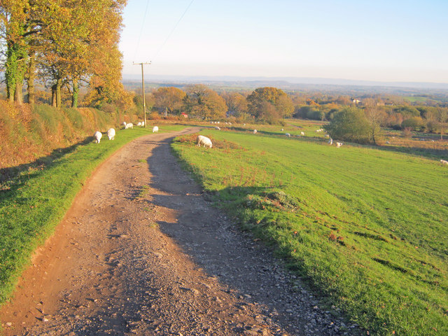
Hollybed Common is a picturesque area located in Worcestershire, England. It is known for its diverse landscape, encompassing both downs and moorland. Covering an area of approximately 50 hectares, the common offers a tranquil escape from the bustling city life.

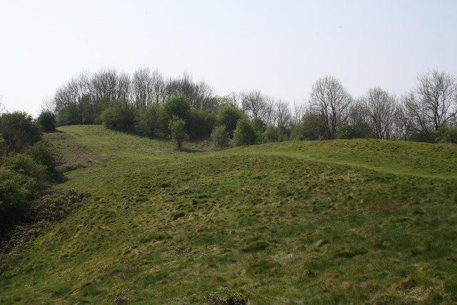
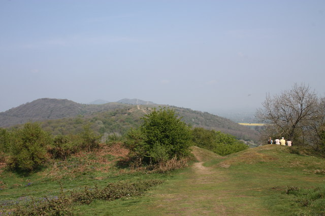
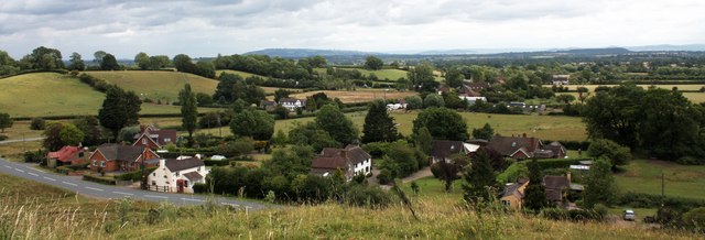
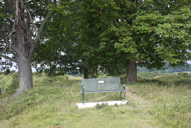
The downs of Hollybed Common are characterized by their gently rolling hills, covered in short grasses and scattered wildflowers. The open space allows for breathtaking views of the surrounding countryside and is a popular spot for picnics and leisurely walks. The downs are home to a variety of bird species, including skylarks and meadow pipits, making it a haven for birdwatchers.

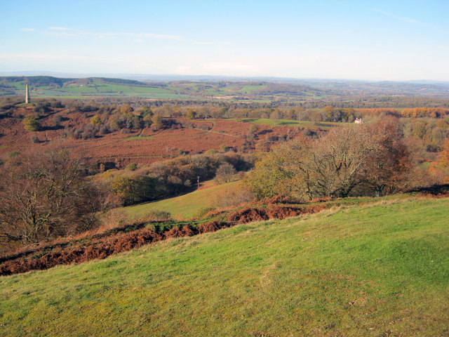
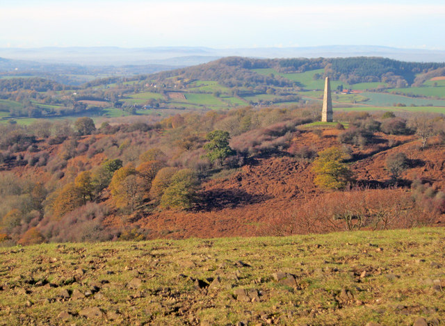
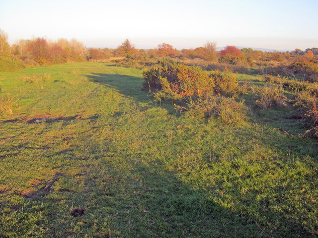
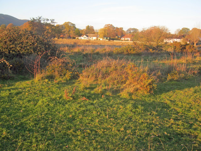
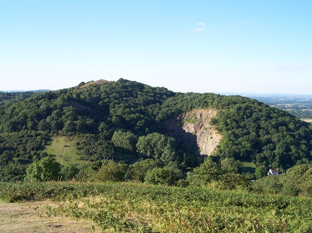
The moorland section of Hollybed Common presents a stark contrast to the downs. Here, visitors will find expansive stretches of heather and gorse, creating a vibrant purple and yellow tapestry. The moorland is also home to a diverse range of plants and wildlife, including bilberries, adders, and the rare green hairstreak butterfly.

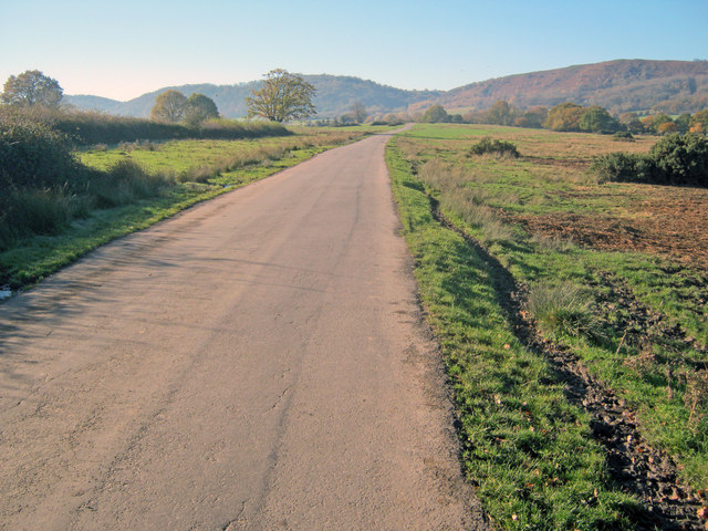
The common is crisscrossed by a network of footpaths, allowing visitors to explore the area at their own pace. These paths lead through woodlands, across streams, and up to panoramic viewpoints, providing ample opportunities to immerse oneself in the natural beauty of the Worcestershire countryside.

Hollybed Common is managed by the Worcestershire Wildlife Trust, ensuring the preservation of its unique ecosystem. Whether it's for a peaceful walk, birdwatching, or simply enjoying the beauty of nature, Hollybed Common offers a rewarding experience for all who visit.

If you have any feedback on the listing, please let us know in the comments section below.

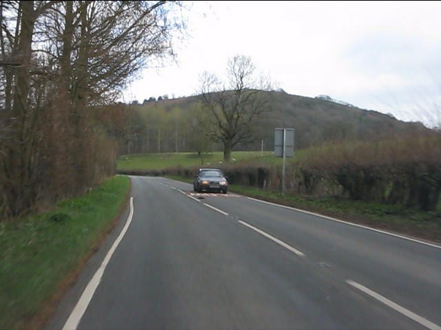
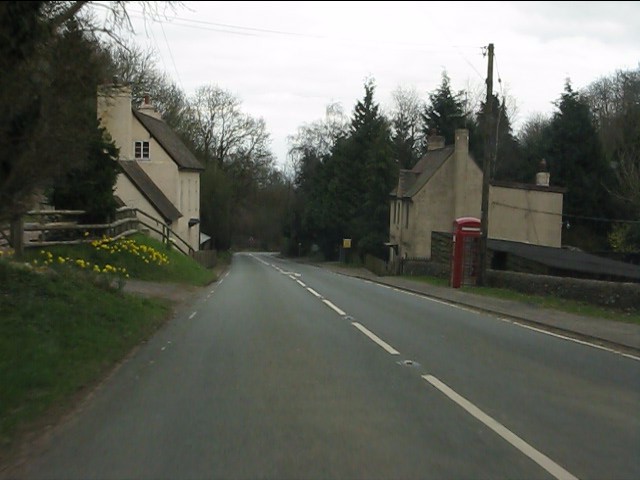
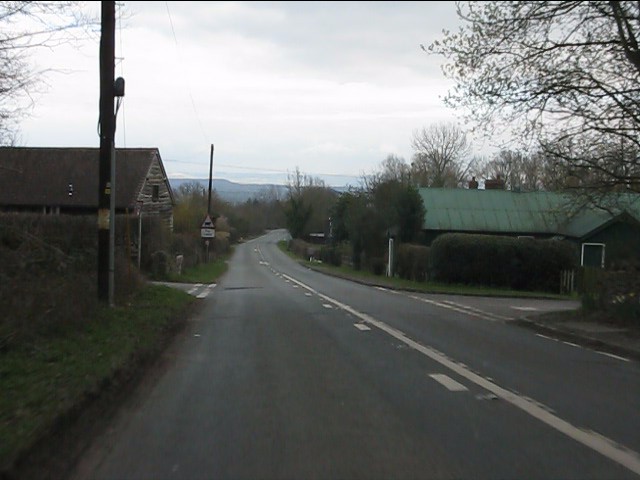
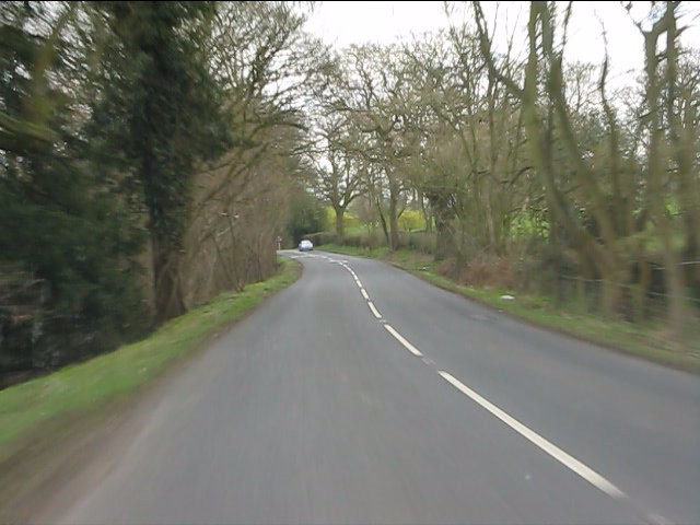
Hollybed Common Images

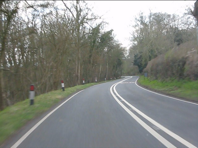
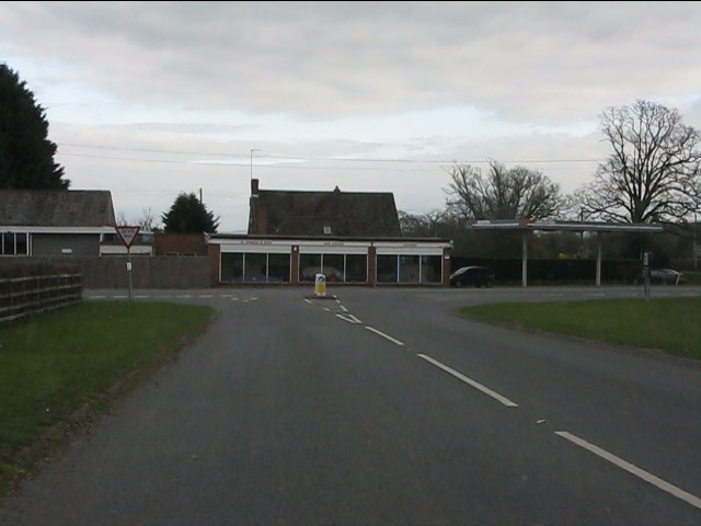
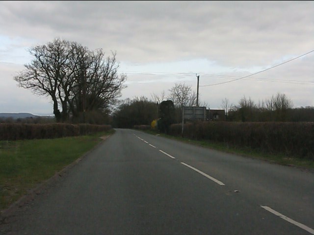
Images are sourced within 2km of 52.035186/-2.3280655 or Grid Reference SO7737. Thanks to Geograph Open Source API. All images are credited.

Hollybush Hill from the A438
A438 at Hollybush
A438 at Hollybush
Hollybush crossroads, A438
A438 near Coombegreen Common
A438 descends toward Rye Cross
A438 approaching Rye Cross The building houses G.Windle & Sons.  A filling station was also once operated here, but is now disused, though the canopy remains.
A438 approaching Rye Cross
The building houses G.Windle & Sons. A filling station was also once operated here, but is now disused, though the canopy remains.
A438 heading east from Rye Cross
Hollybush Hill It can be quite hard to imagine that 2000 years ago this quiet spot was part of a busy town - the Midsummer Hill iron-age hill-fort. 
Excavations in the late 1960s by Stan Stanford showed the area full of small building plots. 
Each plot had been reused time and time again over the centuries suggesting continuous occupation. 
The buildings used four posts arranged in a square - not at all like the round huts usually depicted for this era.
Evidence for similar square buildings have been found in other so called "hill-forts" in Herefordshire and the Welsh Marches
Hollybush Hill
It can be quite hard to imagine that 2000 years ago this quiet spot was part of a busy town - the Midsummer Hill iron-age hill-fort. Excavations in the late 1960s by Stan Stanford showed the area full of small building plots. Each plot had been reused time and time again over the centuries suggesting continuous occupation. The buildings used four posts arranged in a square - not at all like the round huts usually depicted for this era. Evidence for similar square buildings have been found in other so called "hill-forts" in Herefordshire and the Welsh Marches
North gate of Midsummer Hill iron-age  hill-fort Looking north along the Malvern Hills.
Another hill-fort occupies Herefordshire Beacon on the left.
Straight ahead are three overlapping peaks of Pinnacle Hill (north and south) and Black Hill.
In the far distance one can just make out Worcestershire Beacon in the haze.
North gate of Midsummer Hill iron-age hill-fort
Looking north along the Malvern Hills. Another hill-fort occupies Herefordshire Beacon on the left. Straight ahead are three overlapping peaks of Pinnacle Hill (north and south) and Black Hill. In the far distance one can just make out Worcestershire Beacon in the haze.
The shelter on Midsummer Hill The shelter was built by the owners of Eastnor Castle and the hill.
In 1923 the hill was given to the National Trust in memory of Captain Reginald Somers Cocks, MC who died in the first world war.
The shelter on Midsummer Hill
The shelter was built by the owners of Eastnor Castle and the hill. In 1923 the hill was given to the National Trust in memory of Captain Reginald Somers Cocks, MC who died in the first world war.
Lane across Castlemorton Common Long straight lane heading towards Hollybush. Popular route for weekend picnics as it is possible to park on many of the green spaces.
Lane across Castlemorton Common
Long straight lane heading towards Hollybush. Popular route for weekend picnics as it is possible to park on many of the green spaces.
Hillfort ditch on Midsummer Hill Looking north-west from Midsummer Hill with the Somers Obelisk on the left and Peacock Villa on the right. A commanding view across the countryside as autumn takes a grip. The ditch just below runs around the complete top of Midsummer Hill and Hollybush Hill to enclose a large area. Less well-known than its neighbour the Hereford Beacon, but may well have been just as important in the Iron Age.
Hillfort ditch on Midsummer Hill
Looking north-west from Midsummer Hill with the Somers Obelisk on the left and Peacock Villa on the right. A commanding view across the countryside as autumn takes a grip. The ditch just below runs around the complete top of Midsummer Hill and Hollybush Hill to enclose a large area. Less well-known than its neighbour the Hereford Beacon, but may well have been just as important in the Iron Age.
The obelisk from Midsummer Hill From Midsummer Hill looking west across Eastnor Park to Frith Hill above Ledbury.
The obelisk from Midsummer Hill
From Midsummer Hill looking west across Eastnor Park to Frith Hill above Ledbury.
Track across Castlemorton Common Heading east towards Bowling Green.
Track across Castlemorton Common
Heading east towards Bowling Green.
Scrubland at Castlemorton Common View east with Bredon Hill just visible on the horizon. The evening sun highlights the mixture of rough grazing, gorse and scrub in this more inaccessible part of the common.
Scrubland at Castlemorton Common
View east with Bredon Hill just visible on the horizon. The evening sun highlights the mixture of rough grazing, gorse and scrub in this more inaccessible part of the common.
West side of Castlemorton Common Looking north to the cottages on Hancock's Lane lit up by the evening sun.
West side of Castlemorton Common
Looking north to the cottages on Hancock's Lane lit up by the evening sun.
Coombegreen The view from Wendy Woodward's seat atop the hillock on Coombegreen Common.
Looking out to the houses on the B4208 and those on Birts Street.
<a href="https://www.geograph.org.uk/photo/2511815">SO7736 : Wendy Woodward's seat, Coombegreen Common</a>
Coombegreen
The view from Wendy Woodward's seat atop the hillock on Coombegreen Common. Looking out to the houses on the B4208 and those on Birts Street. SO7736 : Wendy Woodward's seat, Coombegreen Common
Wendy Woodward's seat, Coombegreen Common The seat is at the front of the hill overlooking the Severn Plain.
Behind are several commemorative trees including one dating back to 1937 for the King's Coronation.
<a href="https://www.geograph.org.uk/photo/2511845">SO7736 : Plaque on Wendy Woodward's seat, Coombe Green</a>
<a href="https://www.geograph.org.uk/photo/2511865">SO7736 : Wendy Woodward's seat, Coombe Green Common</a>
<a href="https://www.geograph.org.uk/photo/2511797">SO7736 : Coombegreen</a>
Wendy Woodward's seat, Coombegreen Common
The seat is at the front of the hill overlooking the Severn Plain. Behind are several commemorative trees including one dating back to 1937 for the King's Coronation. SO7736 : Plaque on Wendy Woodward's seat, Coombe Green SO7736 : Wendy Woodward's seat, Coombe Green Common SO7736 : Coombegreen
Show me another place!

Hollybed Common is located at Grid Ref: SO7737 (Lat: 52.035186, Lng: -2.3280655)

Administrative County: Worcestershire

District: Malvern Hills

Police Authority: West Mercia

What 3 Words

///canal.gadget.beaters. Near Ledbury, Herefordshire

Related Wikis

Hollybed Farm Meadows

Hollybed Farm Meadows is nature reserve of the Worcestershire Wildlife Trust, about 1 mile (1.6 km) west of the village of Castlemorton, in Worcestershire...

Hollybush, Worcestershire

Hollybush is a small village in Worcestershire at the southern end of the Malvern Hills and close to the borders of both Gloucestershire and Herefordshire...

Birts Street

Birts Street is a village in Worcestershire, England.

Midsummer Hill

Midsummer Hill is situated in the range of Malvern Hills that runs approximately 13 kilometres (8 mi) north-south along the Herefordshire-Worcestershire...

Hollybush Hill

Hollybush Hill is situated in the range of Malvern Hills that runs approximately 13 kilometres (8 mi) north–south along the Herefordshire–Worcestershire...

Castlemorton Common Festival

The Castlemorton Common Festival was a week-long free festival and rave held in the Malvern Hills near Malvern, Worcestershire, England between 22 and...

Rye Cross

Rye Cross is a hamlet in south-west Worcestershire 1 mile west of Castlemorton, 0.5 miles east of Berrow and 1 mile south of Hollybush, near the borders...

Swinyard Hill

Swinyard Hill is a hill in the Malvern Range, a line of hills that runs approximately 13 kilometres (8 mi) north-south along the Herefordshire-Worcestershire...

Nearby Amenities

Located within 500m of 52.035186,-2.3280655
Barrier: stile
Lat/Long: 52.0379064/-2.3228858
Milton Cottage
Power: pole
Transformer: distribution
Voltage Primary: 11000
Lat/Long: 52.0385946/-2.3241422
Hollybeds Castlemorton
Power: pole
Transformer: distribution
Voltage Primary: 11000
Lat/Long: 52.0350204/-2.321471
Coombe Green
Power: pole
Transformer: distribution
Voltage Primary: 11000
Lat/Long: 52.0308336/-2.326768
Man Made: milk_churn_stand
Wikimedia Commons: File:Milk churns on stand, Hollybed Street - geograph.org.uk - 833701.jpg
Lat/Long: 52.0347504/-2.3209922
The data included in this document is from www.openstreetmap.org. The data is made available under ODbL.

Have you been to Hollybed Common?

Leave your review of Hollybed Common below (or comments, questions and feedback).