Angerholme Wold

Downs, Moorland in Westmorland Eden

England

Angerholme Wold

Section of Ais Gill with flat bed near White Kirk
Section of Ais Gill with flat bed near White Kirk Credit: Roger Templeman

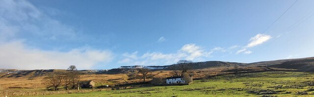
Angerholme Wold is a geographical region located in Westmorland, a county in the northwestern part of England. It is characterized by its diverse landscape, encompassing both downs and moorland areas.

The downs of Angerholme Wold offer sprawling grasslands, gently rolling hills, and fertile soil. These downs are known for their suitability for agriculture and grazing, making them a vital part of the local economy. The lush greenery of the downs provides a picturesque backdrop to the surrounding countryside.

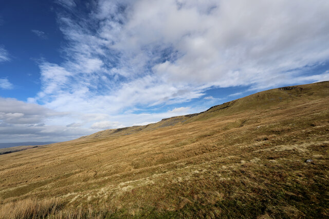
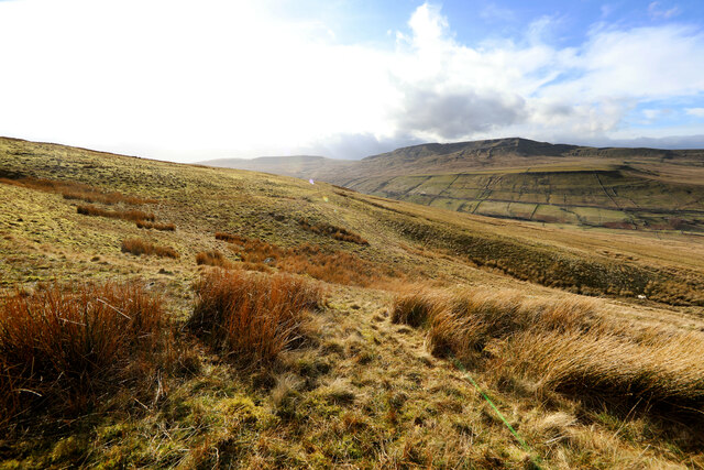
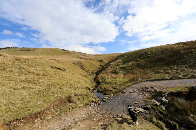
In contrast, the moorland areas of Angerholme Wold boast vast expanses of heather, bracken, and peat bogs. This rugged terrain creates a unique and wild environment, home to various species of flora and fauna. The moorlands are often visited by nature enthusiasts and hikers, offering breathtaking panoramic views of the surrounding valleys and hills.

Angerholme Wold is also known for its rich cultural heritage and historical significance. The region is dotted with ancient stone circles and burial mounds, providing evidence of early human settlements in the area. It has been a site of interest for archaeologists and historians, offering valuable insights into the past.

Overall, Angerholme Wold in Westmorland is a diverse and captivating region, combining the beauty of downs with the untamed wilderness of moorland. Its natural landscapes, agricultural importance, and historical significance make it a fascinating destination for both locals and visitors alike.

If you have any feedback on the listing, please let us know in the comments section below.

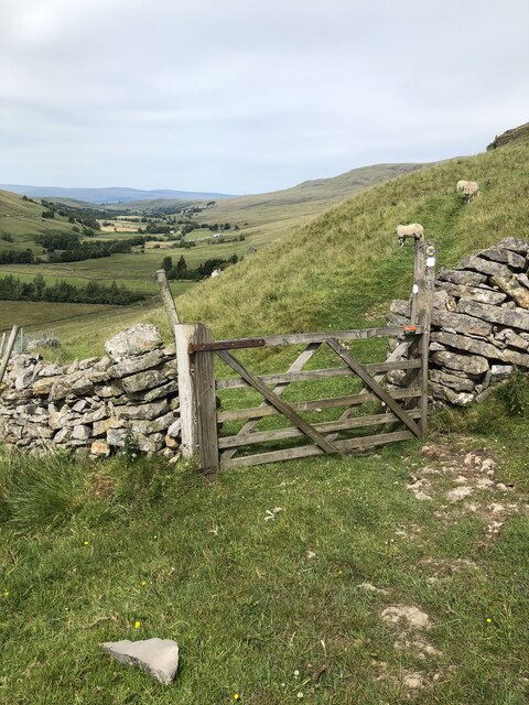
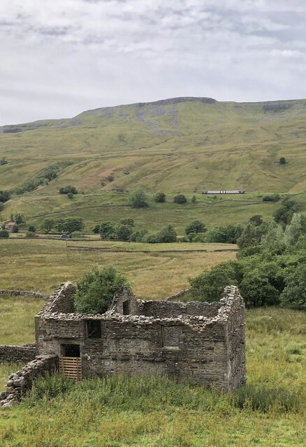
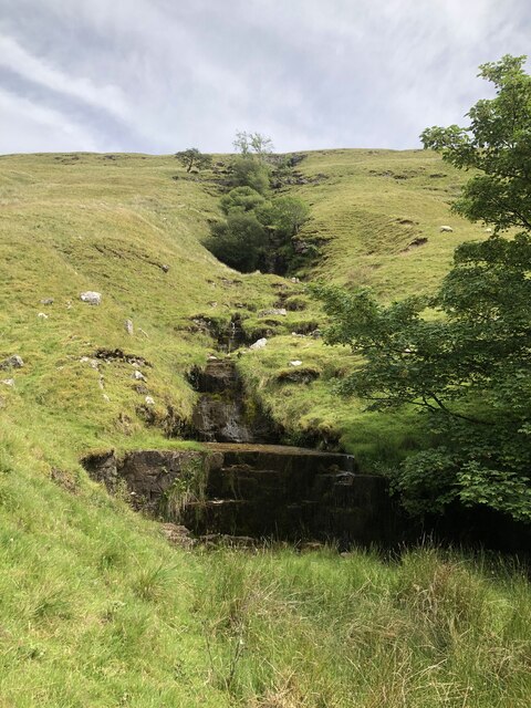
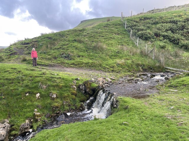
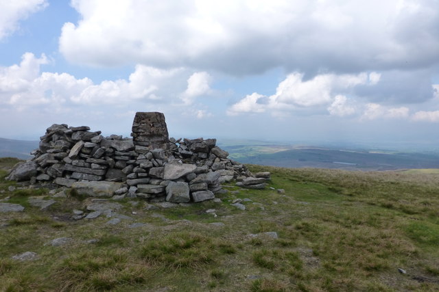
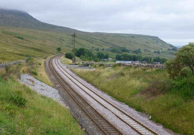
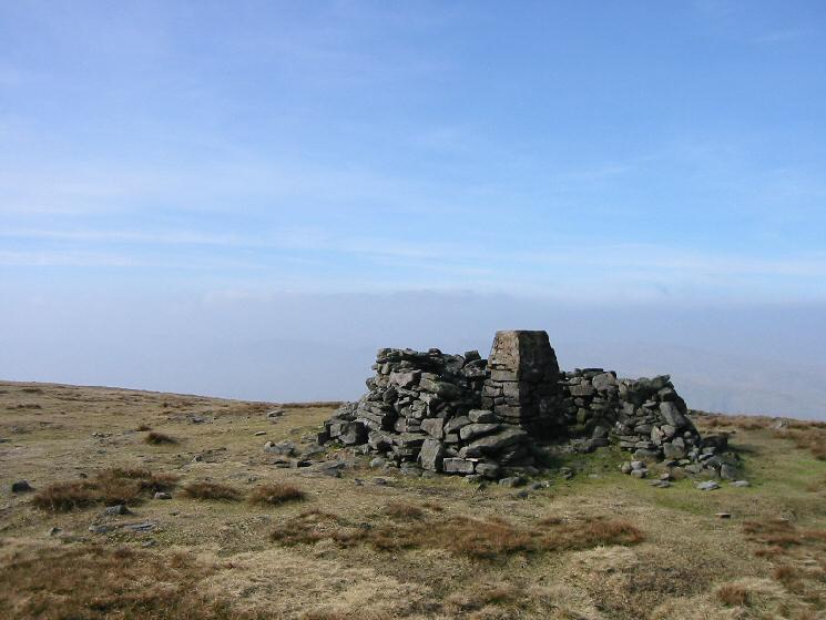
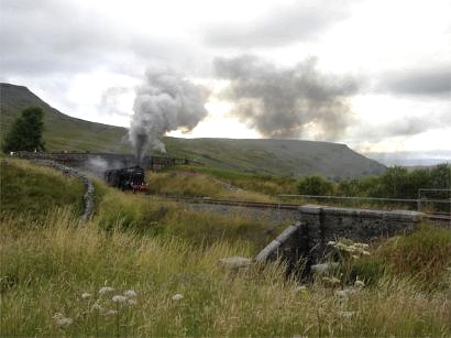
Angerholme Wold Images

Images are sourced within 2km of 54.386532/-2.3516769 or Grid Reference SD7799. Thanks to Geograph Open Source API. All images are credited.

Section of Ais Gill with flat bed near White Kirk
Telecoms Tower near Cotegill Railway Bridge
Aisgill Farm
Aisgill Farm
Rose Cottage at Angrholme
Little Ing Farm
Little Ing Farm
Moorland below Mallerstang Edge From where Old Road, a Byway open to all traffic, crosses Elm Gill, an ascent of 180m of a pathless section of the moor leads upwards to the southern end of Mallerstang Edge. This is looking towards the edge from near the start of the climb.
Moorland below Mallerstang Edge
From where Old Road, a Byway open to all traffic, crosses Elm Gill, an ascent of 180m of a pathless section of the moor leads upwards to the southern end of Mallerstang Edge. This is looking towards the edge from near the start of the climb.
Below Rowantree Cove looking across to Wild Boar Fell Partway up the pathless climb from the easy Old Road (a Byway open to all traffic) to the southern end of Mallerstang Edge, views start to open up across the Eden Valley towards Wild Boar Fell and Swarth Fell.
Below Rowantree Cove looking across to Wild Boar Fell
Partway up the pathless climb from the easy Old Road (a Byway open to all traffic) to the southern end of Mallerstang Edge, views start to open up across the Eden Valley towards Wild Boar Fell and Swarth Fell.
Old Road crosses Elm Gill Old Road runs from the Thrang right round to the junction of Cotterdale with Wensleydale, a distance of over 11.5 kilometres, with often fine views, but doesn't seem to be anywhere near as popular with off-road drivers and trail bikes as some of the BOATs in the dales. The point where it crosses Elm Gill was the spot where we had chosen (well, the dog didn't actually get a vote) to leave the track to ascend to the southern end of Mallerstang Edge. There don't seem to be any actual paths up the CROW Access Land, so the choice is a little arbitrary, but our route reached the beginnings of a faint path on the ridge in three quarters of a kilometre with 180m of ascent.
Old Road crosses Elm Gill
Old Road runs from the Thrang right round to the junction of Cotterdale with Wensleydale, a distance of over 11.5 kilometres, with often fine views, but doesn't seem to be anywhere near as popular with off-road drivers and trail bikes as some of the BOATs in the dales. The point where it crosses Elm Gill was the spot where we had chosen (well, the dog didn't actually get a vote) to leave the track to ascend to the southern end of Mallerstang Edge. There don't seem to be any actual paths up the CROW Access Land, so the choice is a little arbitrary, but our route reached the beginnings of a faint path on the ridge in three quarters of a kilometre with 180m of ascent.
Arches of Aisgill Viaduct The viaduct is on the Settle to Carlisle line. The view is from the B6259 at Aisgill Farm across the property at Beckside Barn.
Aisgill is known for being the location of a crash in 1913 which killed 16 people, it happened just to the south of the viaduct - left in the image.
Arches of Aisgill Viaduct
The viaduct is on the Settle to Carlisle line. The view is from the B6259 at Aisgill Farm across the property at Beckside Barn. Aisgill is known for being the location of a crash in 1913 which killed 16 people, it happened just to the south of the viaduct - left in the image.
Tree growing out of old kiln on Slade Edge
Gate on bridleway below Hanging Lund Scar
Ruined building at Hanging Lund Ruined farm building at Hanging Lund. A Northern Rail DMU is passing below Wild Boar Fell on the Settle - Carlisle line in the background.
Ruined building at Hanging Lund
Ruined farm building at Hanging Lund. A Northern Rail DMU is passing below Wild Boar Fell on the Settle - Carlisle line in the background.
Unnamed stream at Hanging Lund An unnamed stream creating a series of stepped waterfalls as it tumbles down Hanging Lund Scar.
Unnamed stream at Hanging Lund
An unnamed stream creating a series of stepped waterfalls as it tumbles down Hanging Lund Scar.
View along Mallerstang over Aisgill Farm Just visible, the smoke from 46100 Royal Scot heading a charter train from Carlisle to Crewe.
View along Mallerstang over Aisgill Farm
Just visible, the smoke from 46100 Royal Scot heading a charter train from Carlisle to Crewe.
Southbound steam charter passing Wild Boar Fell The locomotive is 46100 Royal Scot
Southbound steam charter passing Wild Boar Fell
The locomotive is 46100 Royal Scot
Ford Above Hazelgill This Pennine Bridleway ford is found beside the Settle to Carlisle Railway above Hazelgill.
Ford Above Hazelgill
This Pennine Bridleway ford is found beside the Settle to Carlisle Railway above Hazelgill.
Wild Boar Fell
Wild Boar Fell
The Settle - Carlisle Railway looking north With Aisgill Farm right of centre.
Taken from the bridge where the B6259 crosses the railway near Ais Gill summit.
Ais Gill summit is the highest point on the Settle to Carlisle Railway, at 356 m (1,169 ft) above sea level. It is on the B6259 road, at the head of the Mallerstang Valley, just before the boundary between Cumbria and North Yorkshire.
The Settle - Carlisle Railway looking north
With Aisgill Farm right of centre. Taken from the bridge where the B6259 crosses the railway near Ais Gill summit. Ais Gill summit is the highest point on the Settle to Carlisle Railway, at 356 m (1,169 ft) above sea level. It is on the B6259 road, at the head of the Mallerstang Valley, just before the boundary between Cumbria and North Yorkshire.
Show me another place!

Angerholme Wold is located at Grid Ref: SD7799 (Lat: 54.386532, Lng: -2.3516769)

Administrative County: Cumbria

District: Eden

Police Authority: Cumbria

What 3 Words

///joked.talents.denote. Near Kirkby Stephen, Cumbria

Nearby Locations

Angerholme Wold White Hill

Related Wikis

Related Videos

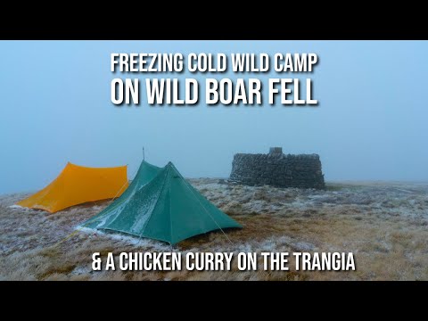
Freezing Cold Wild Camp on Wild Boar Fell & a Chicken Curry on the Trangia

Joined by my friend Ciaran, we headed for a wild camp on Wild Boar Fell in the Yorkshire Dales. The forecast predicted a cold ...

Wild Boar Fell

Another addition to the walking logs. This time a dander up on to Wild Boar Fell in the Howgills/Dales border. It was a great walk ...

Strong winds on Wild Boar Fell

Wet and windy conditions on the summit of Wild Boar Fell in the Yorkshire Dales National Park near Kirkby Stephen in England.

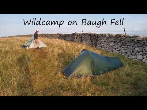
Baugh Fell Wildcamp.

A walk over wild Boar Fell and Swarth Fell with a final ascent of Baugh Fell to camp near the summit. Saturday was very warm, but ...

Nearby Amenities

Located within 500m of 54.386532,-2.3516769
Angerholme Wold
Place: locality
Source: OS OpenData StreetView
Lat/Long: 54.3862693/-2.3509456
High Bank
Place: locality
Lat/Long: 54.3877506/-2.3540375
Natural: sinkhole
Lat/Long: 54.3831207/-2.3527617
Natural: sinkhole
Lat/Long: 54.3838014/-2.3529512
Natural: sinkhole
Lat/Long: 54.384175/-2.3531004
Natural: sinkhole
Lat/Long: 54.3824749/-2.3525328
Natural: sinkhole
Lat/Long: 54.3844193/-2.353405
Natural: sinkhole
Lat/Long: 54.3850918/-2.3536111
Natural: sinkhole
Lat/Long: 54.3854988/-2.3536706
Natural: sinkhole
Lat/Long: 54.3857408/-2.3537246
Natural: sinkhole
Lat/Long: 54.3862071/-2.3540497
Natural: sinkhole
Lat/Long: 54.3863345/-2.3540956
Natural: sinkhole
Lat/Long: 54.3892509/-2.3572628
Natural: sinkhole
Lat/Long: 54.389226/-2.3574759
Natural: sinkhole
Lat/Long: 54.3890358/-2.3568414
Natural: sinkhole
Lat/Long: 54.3889958/-2.356678
Natural: sinkhole
Lat/Long: 54.388869/-2.3564886
Natural: sinkhole
Lat/Long: 54.3822683/-2.3524645
Natural: sinkhole
Lat/Long: 54.3824533/-2.352294
Natural: sinkhole
Lat/Long: 54.3830582/-2.3528993
Natural: sinkhole
Lat/Long: 54.3833398/-2.3530077
Natural: sinkhole
Lat/Long: 54.3834539/-2.3529993
Natural: sinkhole
Lat/Long: 54.3836408/-2.352991
Natural: sinkhole
Lat/Long: 54.3838957/-2.3522866
Natural: sinkhole
Lat/Long: 54.3837185/-2.3523074
Natural: sinkhole
Lat/Long: 54.3848098/-2.3533146
Natural: sinkhole
Lat/Long: 54.3846046/-2.3532084
Natural: sinkhole
Lat/Long: 54.3846327/-2.3536719
Natural: sinkhole
Lat/Long: 54.3841744/-2.3524938
Natural: sinkhole
Lat/Long: 54.384613/-2.3526483
Natural: sinkhole
Lat/Long: 54.384897/-2.3529477
Natural: sinkhole
Lat/Long: 54.3870194/-2.3546883
Natural: sinkhole
Lat/Long: 54.3871238/-2.35473
Natural: sinkhole
Lat/Long: 54.3872985/-2.3549217
Natural: sinkhole
Lat/Long: 54.3874514/-2.3548676
Natural: sinkhole
Lat/Long: 54.3876626/-2.3551427
Natural: sinkhole
Lat/Long: 54.3880461/-2.3555053
Natural: sinkhole
Lat/Long: 54.3882135/-2.3555261
Natural: sinkhole
Lat/Long: 54.3882742/-2.3556553
Natural: sinkhole
Lat/Long: 54.3884951/-2.3558637
Natural: sinkhole
Lat/Long: 54.388563/-2.3559596
Natural: sinkhole
Lat/Long: 54.3886577/-2.3559429
Natural: sinkhole
Lat/Long: 54.3888494/-2.3562639
Natural: sinkhole
Lat/Long: 54.38883/-2.3562055
Natural: sinkhole
Lat/Long: 54.3856105/-2.3534946
The data included in this document is from www.openstreetmap.org. The data is made available under ODbL.

Have you been to Angerholme Wold?

Leave your review of Angerholme Wold below (or comments, questions and feedback).