White Hill

Hill, Mountain in Westmorland Eden

England

White Hill

Rose Cottage at Angrholme
Rose Cottage at Angrholme Credit: Anthony Parkes

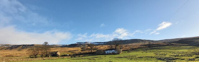
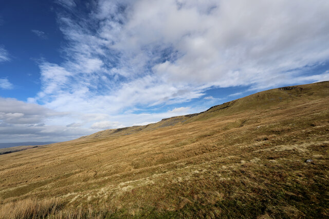
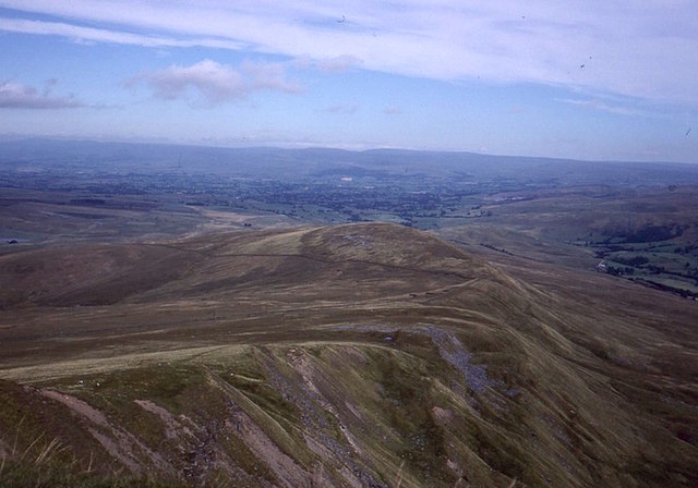
White Hill is a prominent hill located in the county of Westmorland, England. Situated in the Lake District National Park, it forms part of the majestic Eastern Fells, offering breathtaking panoramic views of the surrounding landscape. Rising to an elevation of approximately 1,243 feet (379 meters), it is regarded as a relatively modest mountain in comparison to its neighboring peaks.

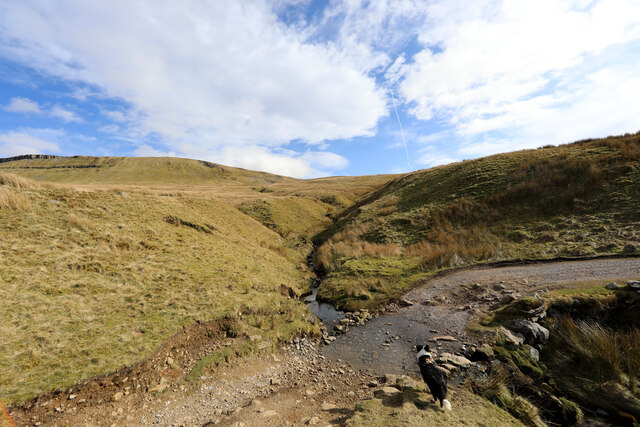
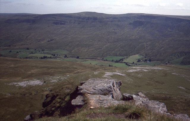
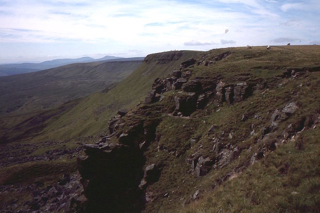
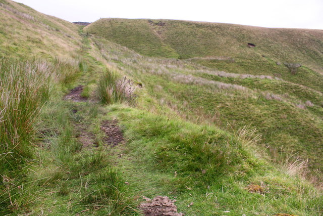
The hill is characterized by its distinctive white limestone, which gives it its name and lends a unique charm to the area. White Hill is accessible via various walking routes, with the most popular starting from the picturesque village of Patterdale. The ascent is moderately challenging, with steep sections and rocky terrain, but the effort is rewarded with stunning vistas of Ullswater Lake, Helvellyn, and the surrounding fells.

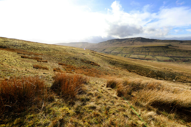
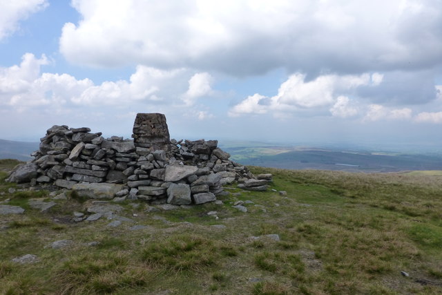
The summit of White Hill provides an ideal vantage point for taking in the beauty of the Lake District. On clear days, it is possible to see as far as the Scottish mountains in the north and the Pennines in the east. The hill is also home to a wide range of flora and fauna, including heather, bilberry, and red deer, making it a haven for nature enthusiasts and photographers.

White Hill offers a tranquil and remote experience, away from the busier tourist hotspots of the Lake District. It is a place to immerse oneself in the natural beauty of the region and enjoy a peaceful hike in a stunning setting. Whether you are an avid mountaineer or simply seeking a peaceful retreat, White Hill is a must-visit destination in Westmorland.

If you have any feedback on the listing, please let us know in the comments section below.
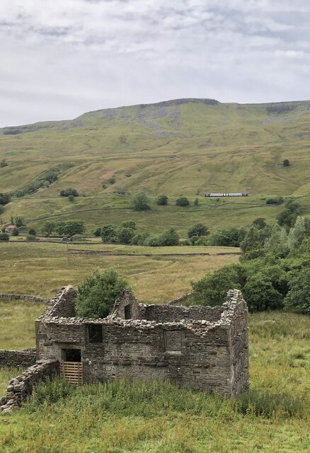
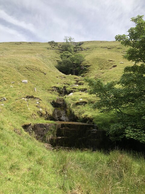
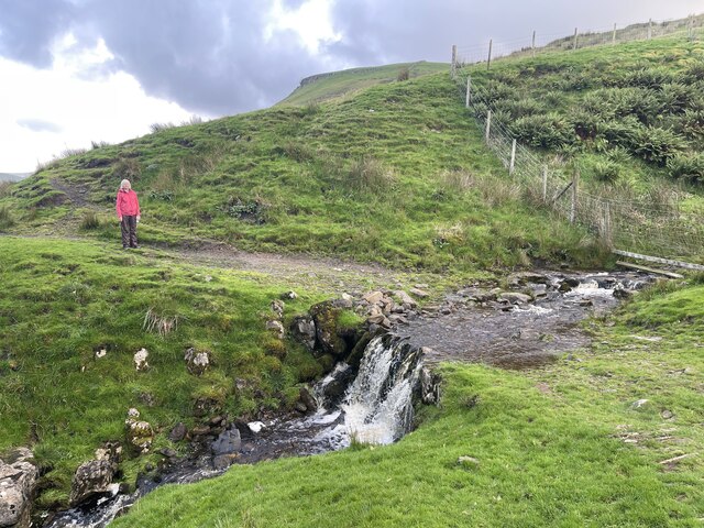
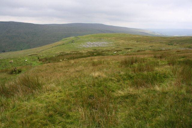
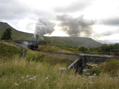
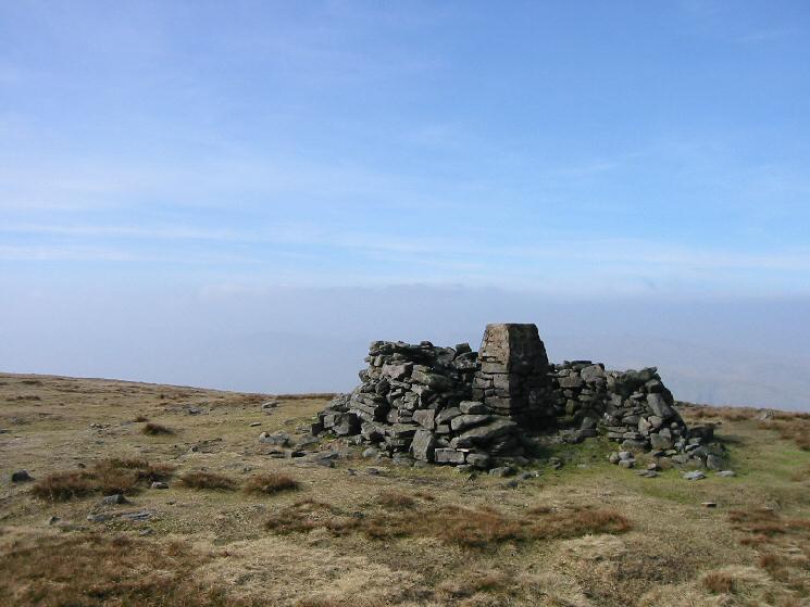
White Hill Images

Images are sourced within 2km of 54.394487/-2.3512367 or Grid Reference SD7799. Thanks to Geograph Open Source API. All images are credited.

Rose Cottage at Angrholme
Little Ing Farm
Little Ing Farm
Moorland below Mallerstang Edge From where Old Road, a Byway open to all traffic, crosses Elm Gill, an ascent of 180m of a pathless section of the moor leads upwards to the southern end of Mallerstang Edge. This is looking towards the edge from near the start of the climb.
Moorland below Mallerstang Edge
From where Old Road, a Byway open to all traffic, crosses Elm Gill, an ascent of 180m of a pathless section of the moor leads upwards to the southern end of Mallerstang Edge. This is looking towards the edge from near the start of the climb.
Below Rowantree Cove looking across to Wild Boar Fell Partway up the pathless climb from the easy Old Road (a Byway open to all traffic) to the southern end of Mallerstang Edge, views start to open up across the Eden Valley towards Wild Boar Fell and Swarth Fell.
Below Rowantree Cove looking across to Wild Boar Fell
Partway up the pathless climb from the easy Old Road (a Byway open to all traffic) to the southern end of Mallerstang Edge, views start to open up across the Eden Valley towards Wild Boar Fell and Swarth Fell.
Old Road crosses Elm Gill Old Road runs from the Thrang right round to the junction of Cotterdale with Wensleydale, a distance of over 11.5 kilometres, with often fine views, but doesn't seem to be anywhere near as popular with off-road drivers and trail bikes as some of the BOATs in the dales. The point where it crosses Elm Gill was the spot where we had chosen (well, the dog didn't actually get a vote) to leave the track to ascend to the southern end of Mallerstang Edge. There don't seem to be any actual paths up the CROW Access Land, so the choice is a little arbitrary, but our route reached the beginnings of a faint path on the ridge in three quarters of a kilometre with 180m of ascent.
Old Road crosses Elm Gill
Old Road runs from the Thrang right round to the junction of Cotterdale with Wensleydale, a distance of over 11.5 kilometres, with often fine views, but doesn't seem to be anywhere near as popular with off-road drivers and trail bikes as some of the BOATs in the dales. The point where it crosses Elm Gill was the spot where we had chosen (well, the dog didn't actually get a vote) to leave the track to ascend to the southern end of Mallerstang Edge. There don't seem to be any actual paths up the CROW Access Land, so the choice is a little arbitrary, but our route reached the beginnings of a faint path on the ridge in three quarters of a kilometre with 180m of ascent.
Ruined building at Hanging Lund Ruined farm building at Hanging Lund. A Northern Rail DMU is passing below Wild Boar Fell on the Settle - Carlisle line in the background.
Ruined building at Hanging Lund
Ruined farm building at Hanging Lund. A Northern Rail DMU is passing below Wild Boar Fell on the Settle - Carlisle line in the background.
Unnamed stream at Hanging Lund An unnamed stream creating a series of stepped waterfalls as it tumbles down Hanging Lund Scar.
Unnamed stream at Hanging Lund
An unnamed stream creating a series of stepped waterfalls as it tumbles down Hanging Lund Scar.
Ford Above Hazelgill This Pennine Bridleway ford is found beside the Settle to Carlisle Railway above Hazelgill.
Ford Above Hazelgill
This Pennine Bridleway ford is found beside the Settle to Carlisle Railway above Hazelgill.
Wild Boar Fell
Wild Boar Fell
Valley of River Eden The farm in the distance, on the right, is Cooper Hill
Valley of River Eden
The farm in the distance, on the right, is Cooper Hill
Valley of River Eden and Hanging Lund Scar The scar is crossed by several stream valleys and there are several shake holes.  Hanging Lund Farm is on the left in <a href="https://www.geograph.org.uk/gridref/SD7898">SD7898</a>
Valley of River Eden and Hanging Lund Scar
The scar is crossed by several stream valleys and there are several shake holes. Hanging Lund Farm is on the left in SD7898
Scriddles Scriddles is the mapped name for the screes on the north ridge of Wild Boar Fell.  View north from the Nab towards the North Pennines.
Scriddles
Scriddles is the mapped name for the screes on the north ridge of Wild Boar Fell. View north from the Nab towards the North Pennines.
View off The Nab Looking over Mallerstang from Wild Boar Fell.  The limestone plinth of the hill shows well from here.
View off The Nab
Looking over Mallerstang from Wild Boar Fell. The limestone plinth of the hill shows well from here.
Yoadcomb Scar Broken crags on the east side of Wild Boar Fell.  Ingleborough and Whernside are in the background along with some curricks on Wild Boar Fell.


A currick is a stone man, common in the North Pennines.  Could be considered a “local” word, it’s not used in Scotland, but perhaps its  that there are only some localities with lots of hills and flat stones so that they can be built.  The usual story is that they are Scotsman deterrents, looking like alert men watching over the cattle.  However I have not seen them so much in Southern Scotland which of course also suffered cattle raids, but the geology is not so favourable. They are almost always in visible places, on edges.  Personally I think they were built for fun.  

The best Scottish examples were on Geal Charn above the Pass of Drumochter but some idiot demolished them in the 1990s.
Yoadcomb Scar
Broken crags on the east side of Wild Boar Fell. Ingleborough and Whernside are in the background along with some curricks on Wild Boar Fell. A currick is a stone man, common in the North Pennines. Could be considered a “local” word, it’s not used in Scotland, but perhaps its that there are only some localities with lots of hills and flat stones so that they can be built. The usual story is that they are Scotsman deterrents, looking like alert men watching over the cattle. However I have not seen them so much in Southern Scotland which of course also suffered cattle raids, but the geology is not so favourable. They are almost always in visible places, on edges. Personally I think they were built for fun. The best Scottish examples were on Geal Charn above the Pass of Drumochter but some idiot demolished them in the 1990s.
Little Ing Farm The view of the farmstead from the roadside on a very wet and overcast day. The slopes of Hangingstone Scar overlook the scene.
Little Ing Farm
The view of the farmstead from the roadside on a very wet and overcast day. The slopes of Hangingstone Scar overlook the scene.
Ford on track crossing Hazel Gill
Ascending the Pennine Bridleway at High Dolpinsty
View from Pennine Bridleway towards Little Wold limestone pavement
Show me another place!

White Hill is located at Grid Ref: SD7799 (Lat: 54.394487, Lng: -2.3512367)

Administrative County: Cumbria

District: Eden

Police Authority: Cumbria

What 3 Words

///beast.bookshop.worked. Near Kirkby Stephen, Cumbria

Nearby Locations

White Hill Angerholme Wold

Related Wikis

1995 Ais Gill rail accident

The 1995 Ais Gill rail accident occurred near Aisgill, Cumbria, UK, at about 18:55 on 31 January 1995, when a class 156 Super-Sprinter was derailed by...

Mallerstang

Mallerstang is a civil parish in the extreme east of Cumbria, and, geographically, a dale at the head of the upper Eden Valley. Originally part of Westmorland...

Wild Boar Fell

Wild Boar Fell is a mountain in the Yorkshire Dales National Park, on the eastern edge of Cumbria, England. At 2,323 feet (708 m), it is either the 4th...

Outhgill

Outhgill is a hamlet in Mallerstang, Cumbria, England. It lies about 5 miles (8 km) south of Kirkby Stephen. It is the main hamlet in the dale of Mallerstang...

Nearby Amenities

Located within 500m of 54.394487,-2.3512367
White Hill
Natural: peak
Source: OS OpenData StreetView
Lat/Long: 54.3943711/-2.350171
Mires
Place: locality
Source: OS_OpenData_StreetView
Lat/Long: 54.396639/-2.3534357
Grey Stones
Place: locality
Source: OS_OpenData_StreetView
Lat/Long: 54.398063/-2.352792
Little Wold
Place: locality
Source: OS_OpenData_StreetView
Lat/Long: 54.3932535/-2.3581779
Ford: yes
Lat/Long: 54.3928535/-2.3441798
Lordburn Close
Place: locality
Lat/Long: 54.3921035/-2.3527655
The data included in this document is from www.openstreetmap.org. The data is made available under ODbL.

Have you been to White Hill?

Leave your review of White Hill below (or comments, questions and feedback).