Bull Flat

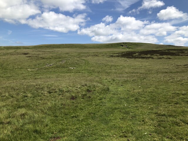
Downs, Moorland in Westmorland Eden

England

Bull Flat

Towngate, Smardale Seen from the railway bridge, Holme Farm is nearest the camera with the grade II* listed Smardale hall <a href="https://www.geograph.org.uk/photo/1997661">NY7308 : Smardale Hall</a> beyond. In the foreground is a railway quarter-mile post.
Towngate, Smardale Credit: Stephen Craven

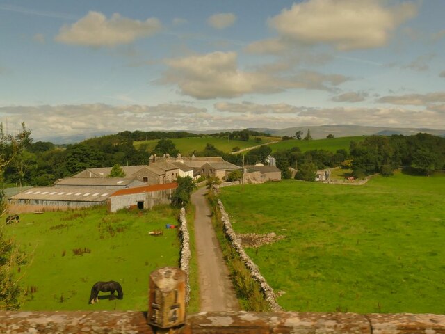
Bull Flat is a small locality located in Westmorland, a historic county in the northwest of England. Situated in the scenic region known as the Downs, Bull Flat is nestled amidst picturesque moorland. This area is renowned for its natural beauty, vast open spaces, and undulating landscapes.

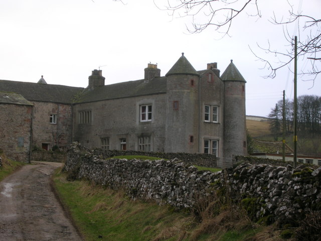
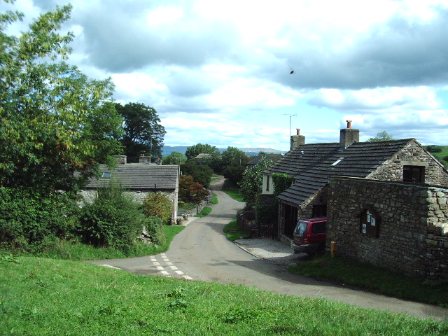
The village of Bull Flat is characterized by its rural charm and tranquil ambiance. It is a closely-knit community with a population of around 100 residents. The village is predominantly residential, with a scattering of traditional cottages and farmhouses dotting the landscape. These buildings reflect the area's rich agricultural heritage and provide a glimpse into the region's past.

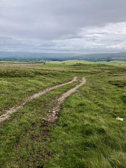
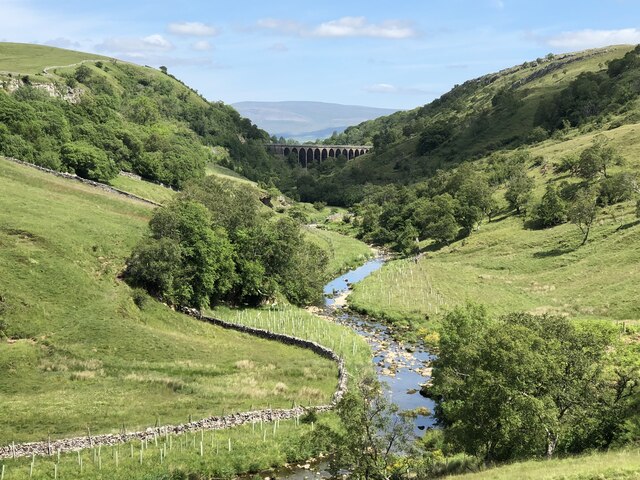
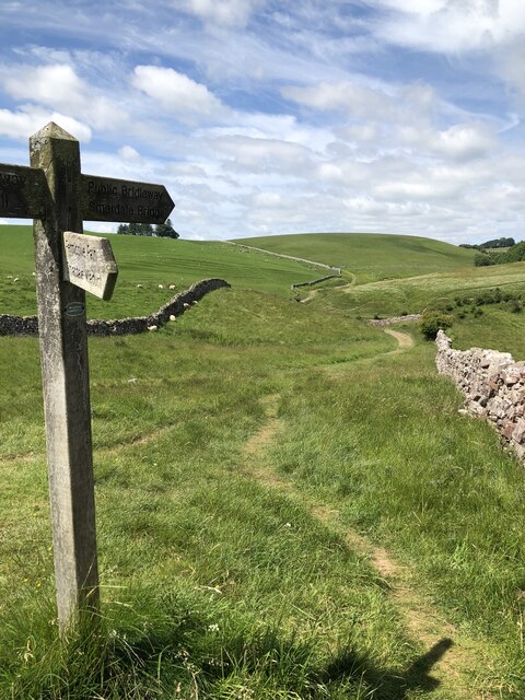
Surrounded by rolling hills and expansive meadows, Bull Flat offers residents and visitors ample opportunities for outdoor activities and exploration. The Downs are famous for their scenic walking trails and cycling routes, attracting nature enthusiasts and adventure seekers alike. The Moorland, with its heather-covered hills and peat bogs, presents a unique and breathtaking landscape that is ideal for hiking and birdwatching.

Despite its remote location, Bull Flat benefits from its proximity to the nearby market town of Westmorland. Here, residents find necessary amenities such as shops, schools, and healthcare facilities. The village also enjoys good transport links, making it easily accessible to neighboring towns and cities.

In summary, Bull Flat is a charming rural village nestled in the heart of the Westmorland Downs. Its idyllic setting, surrounded by moorland, provides a haven for those seeking tranquility and a connection with nature. With its rich agricultural history and proximity to essential amenities, Bull Flat offers a unique and desirable lifestyle for its residents.

If you have any feedback on the listing, please let us know in the comments section below.

Bull Flat Images

Images are sourced within 2km of 54.465541/-2.4235082 or Grid Reference NY7207. Thanks to Geograph Open Source API. All images are credited.

Towngate, Smardale Seen from the railway bridge, Holme Farm is nearest the camera with the grade II* listed Smardale hall <a href="https://www.geograph.org.uk/photo/1997661">NY7308 : Smardale Hall</a> beyond. In the foreground is a railway quarter-mile post.
Towngate, Smardale
Seen from the railway bridge, Holme Farm is nearest the camera with the grade II* listed Smardale hall NY7308 : Smardale Hall beyond. In the foreground is a railway quarter-mile post.
Chapel Well Barn, Smardale Situated close to the Scandal Beck (marked by the lines of trees, right). See also <a href="https://www.geograph.org.uk/photo/6275067">NY7308 : View over Scandal Beck from Smardale Viaduct</a>.
Chapel Well Barn, Smardale
Situated close to the Scandal Beck (marked by the lines of trees, right). See also NY7308 : View over Scandal Beck from Smardale Viaduct.
Track on Limekiln Hill
Long Plantation The name that appears on the 1862 6" O.S. map. with a wood symbol — see Maps.nls.uk. (2022). View map: Westmorland XXX (includes: Kirkby Stephen; Mallerstang; Nateby; Ravenstonedale; ...) - Ordnance Survey Six-inch England and Wales, 1842-1952. [online] Available at: <span class="nowrap"><a title="https://maps.nls.uk/view/102347880#zoom=6&lat=9304&lon=2399&layers=BT" rel="nofollow ugc noopener" href="https://maps.nls.uk/view/102347880#zoom=6&lat=9304&lon=2399&layers=BT">Link</a><img style="margin-left:2px;" alt="External link" title="External link - shift click to open in new window" src="https://s1.geograph.org.uk/img/external.png" width="10" height="10"/></span> [Accessed 26 Jun. 2022].
Long Plantation
The name that appears on the 1862 6" O.S. map. with a wood symbol — see Maps.nls.uk. (2022). View map: Westmorland XXX (includes: Kirkby Stephen; Mallerstang; Nateby; Ravenstonedale; ...) - Ordnance Survey Six-inch England and Wales, 1842-1952. [online] Available at: LinkExternal link [Accessed 26 Jun. 2022].
Scandal Beck entering Smardale Gill Scandal Beck is forced north to join the River Eden through the narrow Smardale Gill. The beck is crossed by the disused Smardalegill viaduct, which now carries a permissive footpath. The viaduct was designed by Sir Thomas Bouch for the South Durham & Lancashire Union Railway, opening in 1861 and closing in 1962.
Scandal Beck entering Smardale Gill
Scandal Beck is forced north to join the River Eden through the narrow Smardale Gill. The beck is crossed by the disused Smardalegill viaduct, which now carries a permissive footpath. The viaduct was designed by Sir Thomas Bouch for the South Durham & Lancashire Union Railway, opening in 1861 and closing in 1962.
Coast to Coast route east of Smardale Bridge Devised by Alfred Wainwright and first published in his 1973 book, this popular route remains an unofficial long distance path without its own dedicated waymarks for much of its length.
Coast to Coast route east of Smardale Bridge
Devised by Alfred Wainwright and first published in his 1973 book, this popular route remains an unofficial long distance path without its own dedicated waymarks for much of its length.
Bridleway crossing Smardale Fell
Remains of old bridge over disused railway This disused line is part of the Smardale Nature Reserve and this section is signposted as a path to Waitby.
The railway line once connected Tebay to Darlington.
Remains of old bridge over disused railway
This disused line is part of the Smardale Nature Reserve and this section is signposted as a path to Waitby. The railway line once connected Tebay to Darlington.
Smardale Gill Viaduct The viaduct is the man made highlight of the Smardale Nature Reserve.
Smardale Gill Viaduct
The viaduct is the man made highlight of the Smardale Nature Reserve.
Smardale Gill Viaduct The viaduct is the man made highlight of the Smardale Nature Reserve.
Smardale Gill Viaduct
The viaduct is the man made highlight of the Smardale Nature Reserve.
Scandal Beck and Smardale Gill
Smardalegill and Scandal Beck seen from the viaduct
Path through Smardale Nature Reserve The 6km long linear nature reserve is reclaimed from the former South Durham & Lancashire Union Railway trackbed and surrounds. The railway was designed by Sir Thomas Bouch, primarily for moving materials associated with iron & steel production in Barrow-In-Furness and Teesside. The railway closed in 1962.
Path through Smardale Nature Reserve
The 6km long linear nature reserve is reclaimed from the former South Durham & Lancashire Union Railway trackbed and surrounds. The railway was designed by Sir Thomas Bouch, primarily for moving materials associated with iron & steel production in Barrow-In-Furness and Teesside. The railway closed in 1962.
Ford across Scandal Beck
Makeshift farm buildings near Crosby Garrett
Site of Crosby Garrett railway station Site of former station serving the hamlet of Crosby Garrett, closed in 1952.
Site of Crosby Garrett railway station
Site of former station serving the hamlet of Crosby Garrett, closed in 1952.
Track across Crosby Garrett Fell
Gate across track on Crosby Garrett Fell
Show me another place!

Bull Flat is located at Grid Ref: NY7207 (Lat: 54.465541, Lng: -2.4235082)

Administrative County: Cumbria

District: Eden

Police Authority: Cumbria

What 3 Words

///taxpayers.original.scuba. Near Kirkby Stephen, Cumbria

Related Wikis

Smardale

Smardale is a small village and former civil parish, now in the parish of Waitby, in the Eden district, in Cumbria, England. In 1891 the parish had a population...

Smardale railway station

Smardale railway station was a minor station on the South Durham & Lancashire Union Railway between Tebay and Kirkby Stephen East. It served the villages...

Crosby Garrett

Crosby Garrett is a hamlet and civil parish in the Eden District of Cumbria, England. It was formerly in the county of Westmorland. In the 2011 census...

Crosby Garrett Helmet

The Crosby Garrett Helmet is a copper alloy Roman cavalry helmet dating from the late 2nd or early 3rd century AD. It was found by an unnamed metal detectorist...

St Andrew's Church, Crosby Garrett

St Andrew's Church is in the village of Crosby Garrett, Cumbria, England. It is an active Anglican parish church in the deanery of Appleby, the archdeaconry...

Crosby Garrett railway station

Crosby Garrett was a railway station which served the village of Crosby Garrett in Cumbria, England. It was situated on the Settle-Carlisle Line 38+1⁄4...

Waitby

Waitby is a small village and civil parish in the Eden district of Cumbria, England. The parish contains two small villages, Waitby and Smardale, plus...

Little Asby

Little Asby is a small village in Cumbria, England. Historically part of Westmorland, its name is said to be derived from the Norse words askr, meaning...

Nearby Amenities

Located within 500m of 54.465541,-2.4235082
Power: pole
Lat/Long: 54.4679146/-2.4187946
Power: pole
Lat/Long: 54.4673145/-2.4199668
Power: pole
Lat/Long: 54.4667065/-2.4211952
Power: pole
Lat/Long: 54.4660955/-2.4223647
Power: pole
Lat/Long: 54.4654672/-2.4236172
Power: pole
Lat/Long: 54.4648655/-2.424776
Power: pole
Lat/Long: 54.4643058/-2.4258623
Power: pole
Lat/Long: 54.4636885/-2.4270639
Power: pole
Lat/Long: 54.4632021/-2.4280107
Power: pole
Lat/Long: 54.4626284/-2.4291185
The data included in this document is from www.openstreetmap.org. The data is made available under ODbL.

Have you been to Bull Flat?

Leave your review of Bull Flat below (or comments, questions and feedback).