Mells Park

Downs, Moorland in Somerset Mendip

England

Mells Park

Cottages in Selwood Street
Cottages in Selwood Street Credit: Vieve Forward

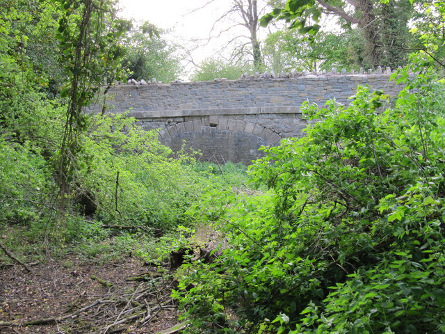
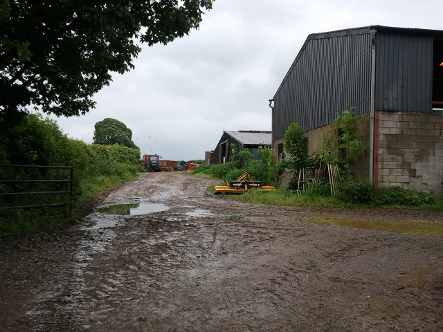
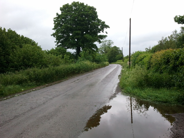
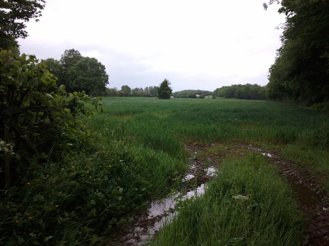
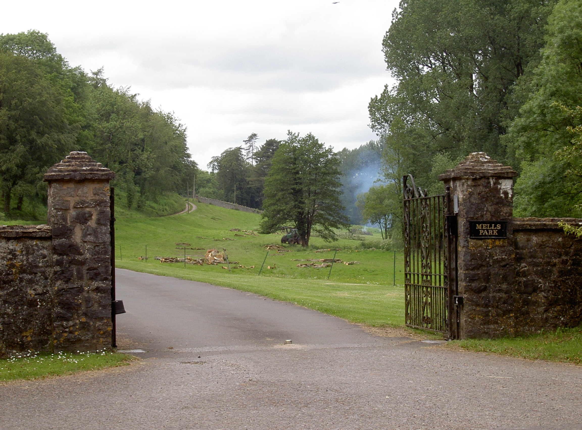
Mells Park is a picturesque estate located in Somerset, England. Situated on the edge of the Mendip Hills, the park encompasses a diverse landscape comprising downs and moorland. Spanning over 500 acres, it offers visitors a unique blend of natural beauty, historical significance, and recreational opportunities.

The park boasts rolling hills covered in lush grasslands and heather, providing a stunning backdrop for nature enthusiasts and photographers alike. The moorland areas are home to an array of wildlife, including birds, rabbits, and deer, making it an ideal spot for wildlife observation and birdwatching.

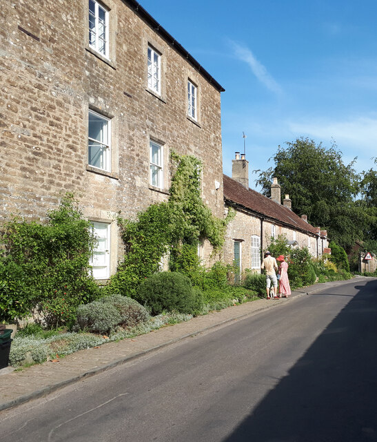
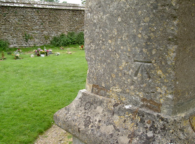
Steeped in history, Mells Park features several historical landmarks that add to its charm. The centerpiece is Mells Manor, a Grade I listed building that dates back to the 16th century. The manor is known for its beautiful architecture, including a striking courtyard and delightful gardens. The park also houses the St. Andrew's Church, a medieval church that showcases remarkable stained glass windows and an ancient churchyard.

Visitors can enjoy leisurely walks or hikes along the park's well-maintained trails, offering breathtaking views of the surrounding countryside. The park also offers picnic areas, where families and friends can relax and enjoy the serenity of the landscape.

Mells Park is a popular destination for both locals and tourists, offering a serene escape from the bustling city life. Whether you're looking to immerse yourself in nature, explore historical sites, or simply unwind amidst tranquil surroundings, Mells Park is a must-visit destination in Somerset.

If you have any feedback on the listing, please let us know in the comments section below.
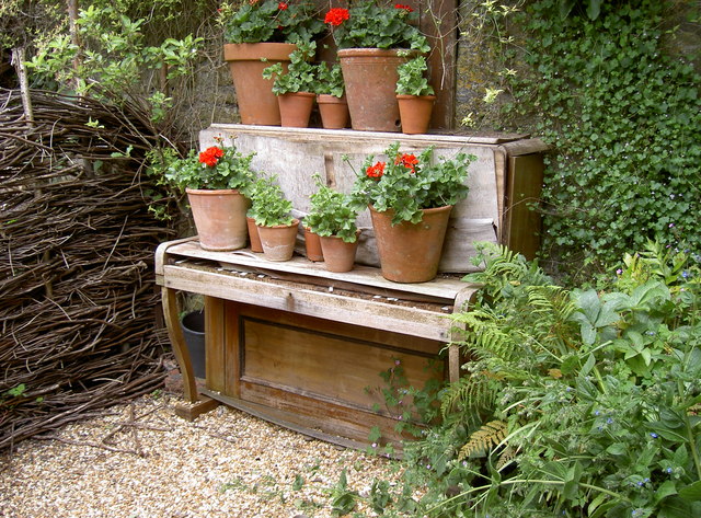
Mells Park Images

Images are sourced within 2km of 51.23407/-2.41112 or Grid Reference ST7148. Thanks to Geograph Open Source API. All images are credited.

Cottages in Selwood Street
Former canal bridge near Vobster Infilled arch of a bridge over the course of the abandoned Dorset and Somerset Canal.
Former canal bridge near Vobster
Infilled arch of a bridge over the course of the abandoned Dorset and Somerset Canal.
Lockup, Gay Street, Mells Built in the 17C.
Lockup, Gay Street, Mells
Built in the 17C.
Road at Park Corner
Road at Park Corner
Gate on Limekiln Lane onto guarded property
Finger Farm yard
Finger Farm yard
Road to Mells at Finger Farm
A wet field entrance
Houses in Mells
Houses in Mells
Mells church benchmark A cutmark, as listed in the Benchmark Database: <span class="nowrap"><a title="http://www.bench-marks.org.uk/bm44827" rel="nofollow ugc noopener" href="http://www.bench-marks.org.uk/bm44827">Link</a><img style="margin-left:2px;" alt="External link" title="External link - shift click to open in new window" src="https://s1.geograph.org.uk/img/external.png" width="10" height="10"/></span> , on the base of the tower of St Andrew's church. See <a href="https://www.geograph.org.uk/photo/4022338">ST7249 : St Andrew's tower</a> for a wider view.
Mells church benchmark
A cutmark, as listed in the Benchmark Database: LinkExternal link , on the base of the tower of St Andrew's church. See ST7249 : St Andrew's tower for a wider view.
St Andrew's tower The base of the church tower, with a benchmark on its base. See <a href="https://www.geograph.org.uk/photo/4022335">ST7249 : Mells church benchmark</a>.
St Andrew's tower
The base of the church tower, with a benchmark on its base. See ST7249 : Mells church benchmark.
Mells pumping station Located by the Mells Stream in Top Lane, this is station 14108. It was built by Frome R.D.C. in 1958.
Mells pumping station
Located by the Mells Stream in Top Lane, this is station 14108. It was built by Frome R.D.C. in 1958.
Bridge over Woodlands End The Mells Stream relaxes here for a short while before carrying on towards Great Elm and then Frome.
Bridge over Woodlands End
The Mells Stream relaxes here for a short while before carrying on towards Great Elm and then Frome.
Mells war memorial This fine memorial was designed by Lutyens and Gill in about 1920 and features a central Tuscan column. It also has a thought-provoking inscription:

'We died in a strange land, facing the dark cloud of war,
and this stone is raised to us in the home of our delight.'

See <a href="https://www.geograph.org.uk/photo/4048219">ST7249 : St Michael atop the column</a> for a closer look at the figure on the column.
Mells war memorial
This fine memorial was designed by Lutyens and Gill in about 1920 and features a central Tuscan column. It also has a thought-provoking inscription: 'We died in a strange land, facing the dark cloud of war, and this stone is raised to us in the home of our delight.' See ST7249 : St Michael atop the column for a closer look at the figure on the column.
St Michael atop the column The figure looking down on the Mells war memorial is said to be that of St Michael, and is based on the one in Henry VII’s chapel in Westminster Abbey.
St Michael atop the column
The figure looking down on the Mells war memorial is said to be that of St Michael, and is based on the one in Henry VII’s chapel in Westminster Abbey.
Many a good tune Perhaps a little of Tchaikovsky's Nutcracker would be appropriate? Scene in a commercial garden in Mells.
Many a good tune
Perhaps a little of Tchaikovsky's Nutcracker would be appropriate? Scene in a commercial garden in Mells.
Branching out A dead creeping specimen on a short wall of St Andrew's church graveyard, forming a rather evocative tree outline.
Branching out
A dead creeping specimen on a short wall of St Andrew's church graveyard, forming a rather evocative tree outline.
A quick trim Mells recreation ground, receiving a mid-summer crop. Or at least the areas that actually have grass at the moment.
A quick trim
Mells recreation ground, receiving a mid-summer crop. Or at least the areas that actually have grass at the moment.
Show me another place!

Mells Park is located at Grid Ref: ST7148 (Lat: 51.23407, Lng: -2.41112)

Administrative County: Somerset

District: Mendip

Police Authority: Avon and Somerset

What 3 Words

///polygraph.button.practical. Near Frome, Somerset

Related Wikis

Mells Park

Mells Park is a country estate of 140 hectares (350 acres) near Mells, Somerset, England. It originated as a 17th-century deer park, probably created by...
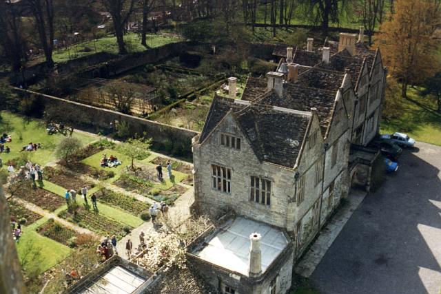
Mells Manor

Mells Manor at Mells, Somerset, England, was built in the 16th century for Edward Horner, altered in the 17th century, partially demolished around 1780...

Mells, Somerset

Mells is a village and civil parish in Somerset, England, near the town of Frome. == Vobster == The parish includes the village of Vobster, which had a...

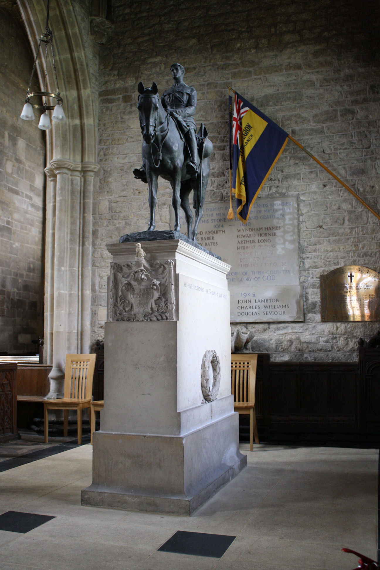
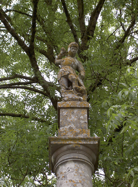
Equestrian statue of Edward Horner

The equestrian statue of Edward Horner stands inside St Andrew's Church in the village of Mells in Somerset, south-western England. It was designed by...

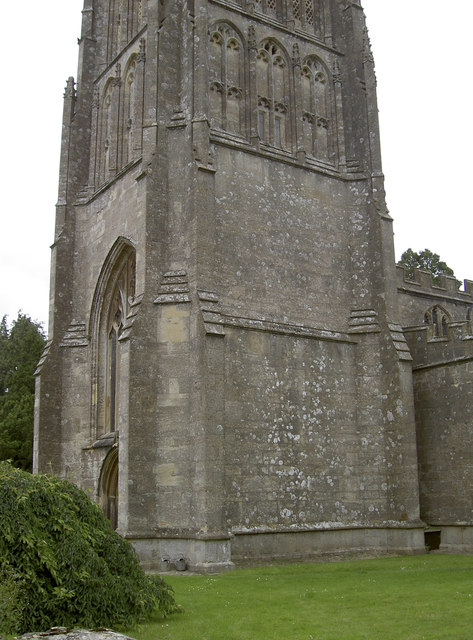
St Andrew's Church, Mells

St Andrew's Church is a Church of England parish church located in the village of Mells in the English county of Somerset. The church is a grade I listed...
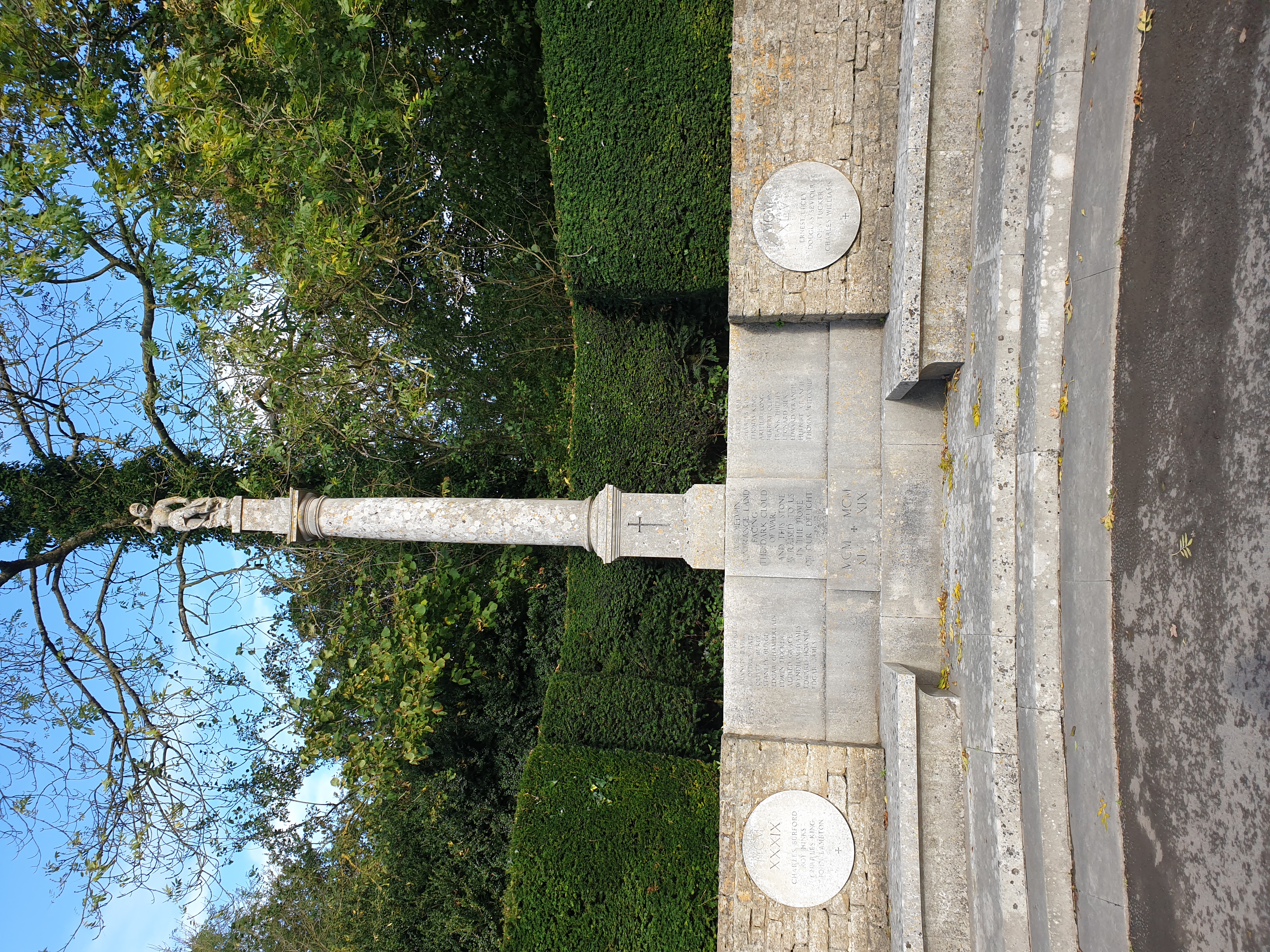
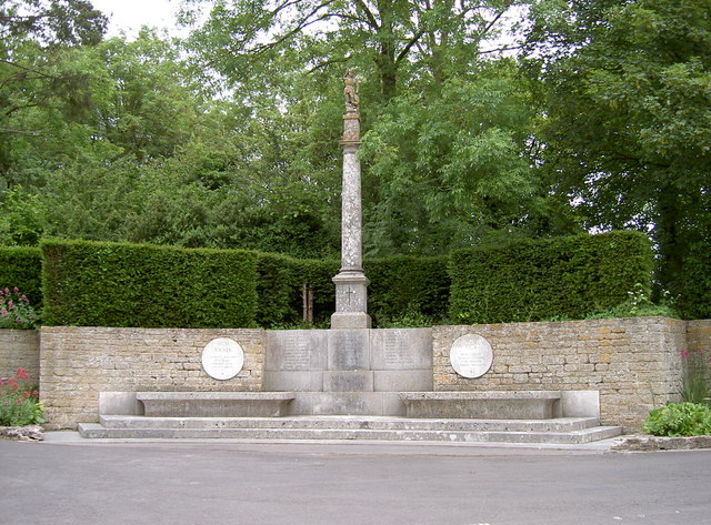
Mells War Memorial

Mells War Memorial is a First World War memorial by Sir Edwin Lutyens in the village of Mells in the Mendip Hills of Somerset, south-western England. Unveiled...
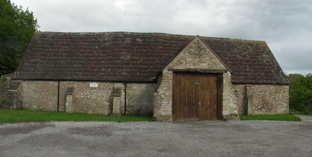
Mells Village Hall

Mells Village Hall in Mells, Somerset, England was built in the 14th century as a tithe barn and now serves as the village hall. It is a Grade II* listed...

Whatley Quarry

Whatley Quarry, grid reference ST731479 is a limestone quarry owned by Hanson plc, near the village of Whatley on the Mendip Hills, Somerset, England....

Nearby Amenities

Located within 500m of 51.23407,-2.41112
Cobby Wood
Place: locality
Lat/Long: 51.2327045/-2.408024
The data included in this document is from www.openstreetmap.org. The data is made available under ODbL.

Have you been to Mells Park?

Leave your review of Mells Park below (or comments, questions and feedback).